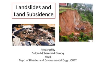
Landslides and
Land Subsidence
Prepared by
Sultan Mohammad Farooq
Head
Dept. of Disaster and Environmental Engg. ,CUET.
Landslides
A landslide is the movement of
rock, debris or earth down a slope.
It results from the failure of the
materials which make up the hill
slope and are driven by the force of
gravity. Landslides are known also
as landslips, slumps or slope
failure.
• When, shear stress exceeds
shear strength of the material,
downward movement of rock
materials or debris or soil start
along the slope. Such
movement is called landslide.
• They can occur along a slope
where the internal resistance
of the rocks are reduced or
they loose their holding
capacity.
Terminologies
In geology, a wide variety of terms have been
used to describe any detached mass of soil,
rock, or debris that moves down a slope mainly
by gravitational forces. The most frequently used
terms are:
 Mass movement
 Slope movement
 Landslide
 Mass wasting
 Slope failure
Factors Affecting
Shear Stress and Landslides
The factors contributing to an increase of the
shear stress are
• Removal of lateral and underlying support (erosion,
previous slides, road cuts and quarries)
• Increase of load (weight of rain/snow, fills, vegetation)
• Increase of lateral pressures (hydraulic pressure, roots,
crystallization, swelling of clay)
• Transitory stresses (earthquakes, vibrations of trucks,
machinery, blasting)
• Regional tilting (geological movements).
Factors related to the decrease of the
material strength are
• Decrease of material strength (weathering, change in
state of consistency)
• Changes in inter-granular forces (pore water pressure,
solution)
• Changes in structure (decrease strength in failure plane,
fracturing due to unloading)
Hills which will not slide easily
 Rocky hills will not slide.
 Sometimes hills have inclined layers of stiff clay, sand &
soft rocks. If the inclination is away from the cut surface,
sliding will be difficult.
 Hills with milder slopes (<30°) are safe against sliding.
Factor affecting Landslide
Natural Factors Anthropogenic Factors
I. Gravity
II. Geological factors
III. Heavy and prolonged
rainfall
IV. Earthquakes
V. Forest fire
VI. Volcanoes
VII. Waves
I. Inappropriate drainage
system
II. Cutting and deep
excavations on slopes for
buildings, roads, canals &
mining
III. Change in slope use
pattern, deforestation,
agricultural practices on
steep slopes
Many factors contribute to slides including geology,
gravity, weather, groundwater, wave action and human
action. Typically, a landslide occurs when several of
these factors converge
Landslide Classification
Classification of Earth Movements
Earth Flow Landslides Subsidence
Solifluction
Creep
Rapid flows
Rock slides
Rock falls
Debris slide or
slump
Collapse
Plastic flow
All movement of land masses are referred as landslides, but
differ in many respects, therefore all types of landslides are
categorized as Earth Movements. These are categorized as
Earth Movements
Landslide Classification
Following factors have been used to classify landslides.
 Material (rock and soil type, their structure as well as
geotechnical properties);
 Water (wet, dry, saturated);
 Climate (tropical, temperate, cold, arid etc.);
 Geomorphic attributes (slope forms, weathering,
topographic profile);
 Landslide morphology (size, depth, length, height);
 Type of movement (fall, slide, flow etc.);
 Triggering mechanism (rainfall, earthquake, human
activities etc.).
 Speed of movement (slow, high etc.);
Landslide Classification
There are many classification schemes for
landslides proposed by different authors like
 Sharpe (1938),
 Campbell (1951),
 Hutchison (1968, 1969, and 1977),
 Crozier (1973),
 Varnes (1978),
 Wieczorek (1984) and
 Cruden and Varnes (1996).
Landslide Classification system of Sharpe (1938)
Landslide classification system by D. J. Varnes (1978)
Different Types of Landslide
Two major types of landslides are
1. Rotational landslide: The surface of
rupture is curved concavely upward
(spoon shaped), and the slide
movement is more or less rotational
i.e. a slump.
2. Translational landslide: The mass of
soil and rock moves out or down and
outward with little rotational
movement or backward tilting. Here
material of landslide may range from
loose, unconsolidated soils to
extensive slabs of rock and may
progress over great distances.
Lateral Spreads
Often occur on very gentle
slopes and result in nearly
horizontal movement of
earth materials. Lateral
spreads are usually caused
by liquefaction, where
saturated sediments are
transformed from a solid
into a liquefied state, usually
triggered by an earthquake.
Topple
Toppling failures are
distinguished by the forward
rotation of a unit or units
about some pivotal point,
below or low in the unit,
under the actions of gravity
and forces exerted by
adjacent units or by fluids in
cracks.
Solifluction
The gradual
movement of wet soil
or other material
down a slope,
especially where
frozen subsoil acts
as a barrier to the
percolation of water.
Creep
Creep is extremely slow
downward movement of dry
surfacial matter.
Movement of the soil occurs
in regions which are
subjected to freeze-thaw
conditions. The freeze lifts the
particles of soil and rocks and
when there is a thaw, the
particles are set back down,
but not in the same place as
before.
Rapid flow
Rapid flow is similar to the
creep, but differ in terms of
speed and depth. It is faster.
Creep is involved upto
shallow depth (app. 1-2 m),
whereas the rapid flow is
involved to greater depth
(app. upto 5 m or more)
Classification of flow
Slump
A slump is a form of mass wasting that occurs when a
coherent mass of loosely consolidated materials or rock
layers moves a short distance down a slope.
Movement is characterized by sliding along a concave-
upward or planar surface.
Rock slides
Rockslides and other types
of slides involve the
displacement of material along
one or more discrete shearing
surfaces.
The sliding can extend
downward and outward along
a broadly planar surface (a
translational slide), or it can be
rotational along a concave-
upward set of shear surfaces
(a slump).
Rock falls
A rock fall is a fragment
of rock (a block)
detached by sliding,
toppling, or falling,
that falls along a vertical
or sub-vertical cliff,
proceeds down slope by
bouncing and flying
along ballistic trajectories
or by rolling on talus or
debris slopes,” (Varnes,
1978).
Causes of Landslide
General potential causes of landslide
Geological causes
• Weak material
• Sensitive material
• Weathered material
• Sheared material
• Jointed or fissured material
• Adversely oriented mass discontinuity (bedding, schistocity, etc)
• Adversely oriented structural discontinuity (fault, unconformity etc)
• Contrast in permeability
• Contrast in stiffness (stiff, dense material over plastic material)
General potential causes of landslide
Morphological causes
• Tectonic or volcanic uplift
• Glacial rebound
• Wave erosion of slope toe
• Fluvial erosion of slope toe
• Glacial erosion of slope toe
• Erosion of lateral margins
• Subterranean erosion (solution, piping)
• Deposition of load on the slope or its crest
• Vegetation removal
General potential causes of landslide
Physical causes
• Intense rainfall
• Prolonged exceptional precipitation
• Rapid snow melt
• Rapid drawdown of floods and tides
• Thawing
• Freeze-and-thaw weathering
• Earthquake
• Volcanic eruption
• Shrink and swell weathering
General potential causes of landslide
Human causes
• Excavation of the slope or its toe
• Deposition of load on the slope or its crest
• Drawdown (of reservoirs)
• Deforestation
• Irrigation
• Mining
• Artificial vibration
• Water leakage from utilities
Triggering of landslides
 Landslide triggering mechanism means event
that makes landslide happens.
 An external impetus such as intense rainfall,
earthquake, volcanic eruption, storm waves and
rapid stream erosion, human activities are main
triggering mechanism
Landslide triggers after road construction
Features of Landslide
and Risk Analysis
Various Features of Landslide
Definition of
Landslide
Features
Landslide Velocity Scale
Zones of Landslide
Plan and profile of a Landslide
Specific risk of a Building and on Persons in a building
Affects of Landslide
 Landslide cause property damage, injury, death and adversely
affect a variety of resources. For example, water supplies,
fisheries, sewage disposal systems, forests, dams, and
roadways can be affected for years after a slide event.
 The negative economic effects of landslide include the cost to
repair structures, loss of property value, disruption of
transportation routes, medical costs in the event of injury and
indirect costs such as lost timber and lost fish stocks.
 Water availability, quantity and quality can be affected by
landslides. Geotechnical studies and engineering projects to
assess the stabilize potentially dangerous sites can be costly.
 Large, infrequent landslides contribute less to personal and
property losses than the smaller, more frequent slides and
debris torrents in populated areas.
Landslide Scenario
Physiography of Bangladesh Hills, Land use and
Vulnerabilities
About 82% land of
Bangladesh can be
identified as recent plains
and 18% as terrace and
hilly area.
Pleistocene terrace has
covered 10% and eastern
and north-eastern tertiary
hill are of only 8% of the
country.
Physiographically, hilly regions can be divided
into the following three sub-regions:
1. Chittagong and Chittagong Hill Tract
2. Hill Ranges of Northeastern Sylhet
3. Hill along the narrow northern strip of Sylhet
and Mymensingh
Landslide Trends in Chittagong
Year Location Consequence
1990 Occurred on May 30, Rangamati district
Affected the link road embankment at Jhagar
beel area.
1997
Occurred in July,
Charaipada of Bandarban
Affected total 90,000-sq m area.
1999
Occurred on August 11, Bandarban
Seven fatalities reported. Affected Lama
Thana and Aziznagar Union.
11 August landslide was followed again
on 15 August at village Chittaputi,
Bandarban
At least 50 houses completely vanished
under the solid earth and 300 houses were
partly damaged. About of cultivated land, of
household garden, and unmetalled road
crushed.
Occurred on August 11 at Gopaipur
under Kotwali Thana
Ten Fatalities reported. Crushed two
thatched house killing the inmates.
2000 Occurred on June 24 at campus and
other parts of
At least Thirteen people died and Twenty
injured.
Year Location Consequence
2003 Occurred on June Cox's Bazar Six casualties reported.
Occurred on July 30 due to magnitude 5.9
Earthquake
Six causalities reported.
2006 Occurred in September at village Rajarkol,
Cox’s Bazar
Killed Two children and injured Six.
2007 Occurred in June at Mati Jharna colony of
Lalkhan Bazar,
Killed 128 people, injured 100
2008 Occurred on July 3, at Teknaf and Ukhia
subdistricts of Cox's Bazar
14 people died.
Occurred on July 4 at Cox's Bazar
Two people in one family were buried alive
under mud.
Occurred on July 14 at Himchhari, Cox’s Bazar Killed 2 persons under mudslide.
Occurred on August 11 at Cox’s bazar Killed 3 family members.
Occurred on August 18 at Matijharna of and
Cox's Bazar
Killed at least 14 people, a dozen injured and
10 others feared trapped at Matijharna
2009 1st August at Lama Upazilla, Bandarban Killed 10 people and destroyed 50 houses.
2010 Occurred on 16th June at Cox-Bazar 52 peoples were killed.
Causes of these landslides in Chittagong
 Hill Cutting: Hills of Chittagong is being cut for building
construction, develop resedential/ housing area, clay and
sand mining and developing road network.
 Sandy hill; about 95% of hill soil is sand of which 8.44% is
coarse sand (dia. > 600 microns) & 86.8% is fine sand
(75<dia<600 microns); the remaining 4.76% is silt & clay (dia
<75 microns).
 Deforestation: Khulshi, Batali hill and hills near Foy’s lake are
massively affected by deforestation in Chittagong city.
 Rainfall: The average yearly rainfall of Chittagong is
approximately 3000mm. More rainfall increases the probability
of landslide.
Landslide Vulnerability in Chittagong
Although tertiary hills of
Chittagong are prone to
landslides due to its
formation and structure
but it can be reduced by
stopping hill cutting and
deforestation etc. Risk is
higher where settlement
exists on the foothills
and poor people live
within the areas.
Sustainable Management Options
• Landslide vulnerability assessment and zoning
• Strict compliance of zoning and other legal and
policy instruments
• Re-location of the foothill slums
• Proper compliance of existing legal provisions
• Real time monitoring and early warning
• Enhancement of public awareness
• Establishment of the emergency response and
recovery team and facilities
Land Subsidence
Land Subsidence
• Land subsidence is
defined as the lowering of
the land surface.
• Many different factors can
cause the land surface to
subside.
• Subsidence can occur
rapidly due to a sinkhole or
under ground mine
collapse, or during a major
earthquake.
How does Land Subsidence occur?
 Land subsidence in an environmental hazard
which is caused by overdraft of ground water
or oil extraction and results in gradual setting
or sudden sinking of the earth’s surface owing
to subsurface movement of the materials of
the earth.
 Decline of water table or piezometric surface
results in vertical compression of the sub-
surface materials. Along with vertical
compression, lateral compression may also
take place due to initiation or acceleration of
lateral flow of groundwater. This lateral
movement also results in subsidence of the
land surface.
Principal causes of Land Subsidence are
1. Aquifer system compaction (extraction of oil, gas, water
beneath the surface)
2. Drainage of organic soils
3. Underground mining
4. Hydro compaction
5. Natural compaction (natural settlement)
6. Sinkholes
7. Thawing permafrost
Three distinct process accounts for most of
water related subsidence
—Compaction of aquifer systems
—Drainage & subsequent oxidation of organic
soils
—Dissolution & collapse of susceptible rocks
Different types of land subsidence
Classification of land subsidence rate
Landslide
rate
(mm/year)
Class
>20 Very high
15-20 high
10-15 Medium
5-10 low
0-5 very low
Dominico’s eqon. (1972)
C = mv. ∆σ. Z. H
Where,
C = amount of land subsidence
(m)
mv = coeff. of volume decrease
(cm2/kg)
∆σ = effective stress per meter
fall of piezometric level (kg/cm2)
Z = drop in piezometric level (m)
H= thickness of cutting bed (m)
Effects of Land Subsidence
Land subsidence can have several negative economic and
social implications such as
 Changes in ground water & surface water flow patterns
 Restriction on pumping in land subsidence-prone areas
 Localized flooding
 Failure of well casings as well as shearing of structures
Land subsidence impact on the environment can be
 Quite noticeable with uneven surface topography & depressions in
earth’s surface.
 Affects the wildlife habitat that may or may not return to normal over
time.
 Potential to reroute, displace & contaminate groundwater
 Altering the immediate land & aquatic ecosystems
 Pollute & impact ecosystems with contaminants (hazardous materials,
sewage etc.) being transported throughout the aquifer.
Slope Stability
and
Slope protection
Classification of slope
• Natural slope - in various conditions, including rock slope
• Man-made slope
- including cut-back slope or slope formed by filled
material with adequate compaction, usually provided
with surface and surface drainage
- formed mainly with the support by retaining structures
Components on a well-design and maintained
man-made slope
1. Surface protection such as vegetation (rigid cover,
masonry, plaster or shotcrete)
2. Surface drainage (including surface channels, catch pits
and sand traps)
3. Subsurface drainage (including weep holes and subsoil
drain etc.)
4. Other protective provision such as pre stressed ground
anchors.
How a slope fails?
• Relatively shallow top soil further worsened by the
weathering and infiltration during rainstorms situations.
• Slope can collapse easily by shear if the soil is nearly
saturated and high pore pressure can be built up rapidly.
The falling debris carried by its potential and momentum
can rush down the slope at very high speed and travel a
long distance causing huge damages.
• Highly decomposed rock in a slope may behave very
similar to soil.
Factors affecting the stability of slope
1. Topography and its surrounding physical conditions: site
investigation process.
2. Geological conditions such as the nature and depth of its
subsoil, degree of decomposition, or location of fracture
etc: soil investigation.
3. Shear strength of the slope-forming materials: laboratory
tests.
4. Surface and ground water condition
5. External loading and surcharges, such as from traffic,
nearby structures, possible vibration etc.
Slope Protection Measures
Stability of slope can be effectively improved by the
provision of an appropriately designed drainage
system:
1. A surface drain system that is capable to discharge the entire storm water
within the rain water catchment area affecting the slope in a designated
period of time (say, 200mm rainfall/hour). A surface drain system usually
consists of:
- surface channel
- stepped or trapezoidal channel
- catchpit or sand trap
2. A subsoil drain system that is laid below surface for the discharging of
ground water and to maintain the water pressure be kept in a safe level
- filter layer behind the slope leading water to outlets
- weep holes
- cut-off drain
- subsoil drain pipe
Protection and treatment to Rock Slope
Scaling – loose blocks or boulders to be removed from
exposed rock surfaces, this is usually done by manual
method.
Construct buttress support – this is concrete or
masonry gravity structure use to retain the unstable rock
mass
Dentition – exposed soft material in a rock face be
trimmed back. The resulting slot be filled with filter
material and protected by masonry or concrete to
prevent erosion.
Sprayed concrete – apply concrete protection to zones
of weak or highly fractured rock faces by spray-on
method.
Dowel – a hole is drilled and provide untensioned steel bars,
usually 25mm to 35mm dia. and 1m to 3m long, to stabilize a
weak rock zone. The hole would be grouted afterward.
Rock bolt/nail – this is tensioned bar inserted into rock
forming a short anchorage zone in rock so that an unstable
slope area being reinforced by tension. Typical rock bolts are
25mm to 40mm in dia. 3m to 6m long, and have a tensile
working load around 100kN.
Protection to slope by rigid surface
Rigid surface protection on slopes are commonly used to
reduce rainwater infiltration and to prevent erosion of the
slope forming materials. This can be done by:
• Chunam plastering – this is an applied-on surface protection
to slope using a clay and cement mixed plaster. Thickness of
the plaster is around 40mm to 50mm for permanent works.
• Sprayed concrete (shotcrete) – protection by applying a
spraying mortar onto surface of slope.
• Masonry or stone pitching – lay stone rubble or block (with
filter layer underneath) onto surface to protect slope from
weathering
Improvement to slope by soft surface
• Hydroseeding – is the application of grass seed mixed
with fertilizer and Nutrient in aqueous solution by
spraying method. The grass seed will grow eventually and
the root of the grass will act as an organic reinforcing
fiber and hold the surface soil.
• Turfing – Turfing is the direct application of grass with
developed roots onto the slope surface. The relatively
matured grass will grow easier and extend its root into
the soil to strengthen the overall surface.
• Planting of tree – usually done at the same time with the
other method to provide better visual result and provide
further strengthening effect to the slope by its deep root.
Recommended Protective Measures
Preventive Measure Soil Improvement
i. Providing Rock Anchors,
Providing Soil Anchor;
ii. Providing Soil Nailing;
iii. Providing Compaction Grouting;
iv. Providing Pressure Grouting;
v. Providing Chemical Grouting;
vi. Providing Micro Piles - Mini Piles
vii. Providing Retaining wall;
viii.Use of Geo-grid;
ix. Use of sand piles/sheet pile.
a) Use of Geo-jute – A Bioengineering
Solution to Inhibit Top Soil Erosion
b) Improving drainage quality
c) Changing geometry of hill slope
d) Erosion can be either totally
eliminated or at least significantly
reduced through Vegetation
Conclusion
Recommendations to reduce the risk of landslide-
 Planting natural vegetations to stabilize the soil from sliding.
 Evacuating risky hill toes.
 Rehabilitating low income people from the risky hill toes.
 Protective measures to avoid landslides during building construction.
Recommendations to reduce the risk of land subsidence-
 Proper ground water management should be considered in
subsidence prone areas.

Landslide fr

  • 1.
    Landslides and Land Subsidence Preparedby Sultan Mohammad Farooq Head Dept. of Disaster and Environmental Engg. ,CUET.
  • 2.
    Landslides A landslide isthe movement of rock, debris or earth down a slope. It results from the failure of the materials which make up the hill slope and are driven by the force of gravity. Landslides are known also as landslips, slumps or slope failure.
  • 3.
    • When, shearstress exceeds shear strength of the material, downward movement of rock materials or debris or soil start along the slope. Such movement is called landslide. • They can occur along a slope where the internal resistance of the rocks are reduced or they loose their holding capacity.
  • 4.
    Terminologies In geology, awide variety of terms have been used to describe any detached mass of soil, rock, or debris that moves down a slope mainly by gravitational forces. The most frequently used terms are:  Mass movement  Slope movement  Landslide  Mass wasting  Slope failure
  • 5.
  • 6.
    The factors contributingto an increase of the shear stress are • Removal of lateral and underlying support (erosion, previous slides, road cuts and quarries) • Increase of load (weight of rain/snow, fills, vegetation) • Increase of lateral pressures (hydraulic pressure, roots, crystallization, swelling of clay) • Transitory stresses (earthquakes, vibrations of trucks, machinery, blasting) • Regional tilting (geological movements).
  • 7.
    Factors related tothe decrease of the material strength are • Decrease of material strength (weathering, change in state of consistency) • Changes in inter-granular forces (pore water pressure, solution) • Changes in structure (decrease strength in failure plane, fracturing due to unloading)
  • 8.
    Hills which willnot slide easily  Rocky hills will not slide.  Sometimes hills have inclined layers of stiff clay, sand & soft rocks. If the inclination is away from the cut surface, sliding will be difficult.  Hills with milder slopes (<30°) are safe against sliding.
  • 9.
    Factor affecting Landslide NaturalFactors Anthropogenic Factors I. Gravity II. Geological factors III. Heavy and prolonged rainfall IV. Earthquakes V. Forest fire VI. Volcanoes VII. Waves I. Inappropriate drainage system II. Cutting and deep excavations on slopes for buildings, roads, canals & mining III. Change in slope use pattern, deforestation, agricultural practices on steep slopes Many factors contribute to slides including geology, gravity, weather, groundwater, wave action and human action. Typically, a landslide occurs when several of these factors converge
  • 10.
  • 11.
    Classification of EarthMovements Earth Flow Landslides Subsidence Solifluction Creep Rapid flows Rock slides Rock falls Debris slide or slump Collapse Plastic flow All movement of land masses are referred as landslides, but differ in many respects, therefore all types of landslides are categorized as Earth Movements. These are categorized as Earth Movements
  • 12.
    Landslide Classification Following factorshave been used to classify landslides.  Material (rock and soil type, their structure as well as geotechnical properties);  Water (wet, dry, saturated);  Climate (tropical, temperate, cold, arid etc.);  Geomorphic attributes (slope forms, weathering, topographic profile);  Landslide morphology (size, depth, length, height);  Type of movement (fall, slide, flow etc.);  Triggering mechanism (rainfall, earthquake, human activities etc.).  Speed of movement (slow, high etc.);
  • 13.
    Landslide Classification There aremany classification schemes for landslides proposed by different authors like  Sharpe (1938),  Campbell (1951),  Hutchison (1968, 1969, and 1977),  Crozier (1973),  Varnes (1978),  Wieczorek (1984) and  Cruden and Varnes (1996).
  • 14.
  • 15.
    Landslide classification systemby D. J. Varnes (1978)
  • 16.
  • 17.
    Two major typesof landslides are 1. Rotational landslide: The surface of rupture is curved concavely upward (spoon shaped), and the slide movement is more or less rotational i.e. a slump. 2. Translational landslide: The mass of soil and rock moves out or down and outward with little rotational movement or backward tilting. Here material of landslide may range from loose, unconsolidated soils to extensive slabs of rock and may progress over great distances.
  • 18.
    Lateral Spreads Often occuron very gentle slopes and result in nearly horizontal movement of earth materials. Lateral spreads are usually caused by liquefaction, where saturated sediments are transformed from a solid into a liquefied state, usually triggered by an earthquake.
  • 19.
    Topple Toppling failures are distinguishedby the forward rotation of a unit or units about some pivotal point, below or low in the unit, under the actions of gravity and forces exerted by adjacent units or by fluids in cracks.
  • 20.
    Solifluction The gradual movement ofwet soil or other material down a slope, especially where frozen subsoil acts as a barrier to the percolation of water.
  • 21.
    Creep Creep is extremelyslow downward movement of dry surfacial matter. Movement of the soil occurs in regions which are subjected to freeze-thaw conditions. The freeze lifts the particles of soil and rocks and when there is a thaw, the particles are set back down, but not in the same place as before.
  • 22.
    Rapid flow Rapid flowis similar to the creep, but differ in terms of speed and depth. It is faster. Creep is involved upto shallow depth (app. 1-2 m), whereas the rapid flow is involved to greater depth (app. upto 5 m or more)
  • 23.
  • 24.
    Slump A slump isa form of mass wasting that occurs when a coherent mass of loosely consolidated materials or rock layers moves a short distance down a slope. Movement is characterized by sliding along a concave- upward or planar surface.
  • 25.
    Rock slides Rockslides andother types of slides involve the displacement of material along one or more discrete shearing surfaces. The sliding can extend downward and outward along a broadly planar surface (a translational slide), or it can be rotational along a concave- upward set of shear surfaces (a slump).
  • 26.
    Rock falls A rockfall is a fragment of rock (a block) detached by sliding, toppling, or falling, that falls along a vertical or sub-vertical cliff, proceeds down slope by bouncing and flying along ballistic trajectories or by rolling on talus or debris slopes,” (Varnes, 1978).
  • 27.
  • 28.
    General potential causesof landslide Geological causes • Weak material • Sensitive material • Weathered material • Sheared material • Jointed or fissured material • Adversely oriented mass discontinuity (bedding, schistocity, etc) • Adversely oriented structural discontinuity (fault, unconformity etc) • Contrast in permeability • Contrast in stiffness (stiff, dense material over plastic material)
  • 29.
    General potential causesof landslide Morphological causes • Tectonic or volcanic uplift • Glacial rebound • Wave erosion of slope toe • Fluvial erosion of slope toe • Glacial erosion of slope toe • Erosion of lateral margins • Subterranean erosion (solution, piping) • Deposition of load on the slope or its crest • Vegetation removal
  • 30.
    General potential causesof landslide Physical causes • Intense rainfall • Prolonged exceptional precipitation • Rapid snow melt • Rapid drawdown of floods and tides • Thawing • Freeze-and-thaw weathering • Earthquake • Volcanic eruption • Shrink and swell weathering
  • 31.
    General potential causesof landslide Human causes • Excavation of the slope or its toe • Deposition of load on the slope or its crest • Drawdown (of reservoirs) • Deforestation • Irrigation • Mining • Artificial vibration • Water leakage from utilities
  • 32.
    Triggering of landslides Landslide triggering mechanism means event that makes landslide happens.  An external impetus such as intense rainfall, earthquake, volcanic eruption, storm waves and rapid stream erosion, human activities are main triggering mechanism
  • 33.
    Landslide triggers afterroad construction
  • 34.
  • 35.
  • 36.
  • 37.
  • 38.
  • 39.
    Plan and profileof a Landslide
  • 40.
    Specific risk ofa Building and on Persons in a building
  • 41.
    Affects of Landslide Landslide cause property damage, injury, death and adversely affect a variety of resources. For example, water supplies, fisheries, sewage disposal systems, forests, dams, and roadways can be affected for years after a slide event.  The negative economic effects of landslide include the cost to repair structures, loss of property value, disruption of transportation routes, medical costs in the event of injury and indirect costs such as lost timber and lost fish stocks.  Water availability, quantity and quality can be affected by landslides. Geotechnical studies and engineering projects to assess the stabilize potentially dangerous sites can be costly.  Large, infrequent landslides contribute less to personal and property losses than the smaller, more frequent slides and debris torrents in populated areas.
  • 42.
  • 43.
    Physiography of BangladeshHills, Land use and Vulnerabilities About 82% land of Bangladesh can be identified as recent plains and 18% as terrace and hilly area. Pleistocene terrace has covered 10% and eastern and north-eastern tertiary hill are of only 8% of the country.
  • 44.
    Physiographically, hilly regionscan be divided into the following three sub-regions: 1. Chittagong and Chittagong Hill Tract 2. Hill Ranges of Northeastern Sylhet 3. Hill along the narrow northern strip of Sylhet and Mymensingh
  • 45.
    Landslide Trends inChittagong Year Location Consequence 1990 Occurred on May 30, Rangamati district Affected the link road embankment at Jhagar beel area. 1997 Occurred in July, Charaipada of Bandarban Affected total 90,000-sq m area. 1999 Occurred on August 11, Bandarban Seven fatalities reported. Affected Lama Thana and Aziznagar Union. 11 August landslide was followed again on 15 August at village Chittaputi, Bandarban At least 50 houses completely vanished under the solid earth and 300 houses were partly damaged. About of cultivated land, of household garden, and unmetalled road crushed. Occurred on August 11 at Gopaipur under Kotwali Thana Ten Fatalities reported. Crushed two thatched house killing the inmates. 2000 Occurred on June 24 at campus and other parts of At least Thirteen people died and Twenty injured.
  • 46.
    Year Location Consequence 2003Occurred on June Cox's Bazar Six casualties reported. Occurred on July 30 due to magnitude 5.9 Earthquake Six causalities reported. 2006 Occurred in September at village Rajarkol, Cox’s Bazar Killed Two children and injured Six. 2007 Occurred in June at Mati Jharna colony of Lalkhan Bazar, Killed 128 people, injured 100 2008 Occurred on July 3, at Teknaf and Ukhia subdistricts of Cox's Bazar 14 people died. Occurred on July 4 at Cox's Bazar Two people in one family were buried alive under mud. Occurred on July 14 at Himchhari, Cox’s Bazar Killed 2 persons under mudslide. Occurred on August 11 at Cox’s bazar Killed 3 family members. Occurred on August 18 at Matijharna of and Cox's Bazar Killed at least 14 people, a dozen injured and 10 others feared trapped at Matijharna 2009 1st August at Lama Upazilla, Bandarban Killed 10 people and destroyed 50 houses. 2010 Occurred on 16th June at Cox-Bazar 52 peoples were killed.
  • 47.
    Causes of theselandslides in Chittagong  Hill Cutting: Hills of Chittagong is being cut for building construction, develop resedential/ housing area, clay and sand mining and developing road network.  Sandy hill; about 95% of hill soil is sand of which 8.44% is coarse sand (dia. > 600 microns) & 86.8% is fine sand (75<dia<600 microns); the remaining 4.76% is silt & clay (dia <75 microns).  Deforestation: Khulshi, Batali hill and hills near Foy’s lake are massively affected by deforestation in Chittagong city.  Rainfall: The average yearly rainfall of Chittagong is approximately 3000mm. More rainfall increases the probability of landslide.
  • 48.
    Landslide Vulnerability inChittagong Although tertiary hills of Chittagong are prone to landslides due to its formation and structure but it can be reduced by stopping hill cutting and deforestation etc. Risk is higher where settlement exists on the foothills and poor people live within the areas.
  • 49.
    Sustainable Management Options •Landslide vulnerability assessment and zoning • Strict compliance of zoning and other legal and policy instruments • Re-location of the foothill slums • Proper compliance of existing legal provisions • Real time monitoring and early warning • Enhancement of public awareness • Establishment of the emergency response and recovery team and facilities
  • 50.
  • 51.
    Land Subsidence • Landsubsidence is defined as the lowering of the land surface. • Many different factors can cause the land surface to subside. • Subsidence can occur rapidly due to a sinkhole or under ground mine collapse, or during a major earthquake.
  • 52.
    How does LandSubsidence occur?  Land subsidence in an environmental hazard which is caused by overdraft of ground water or oil extraction and results in gradual setting or sudden sinking of the earth’s surface owing to subsurface movement of the materials of the earth.  Decline of water table or piezometric surface results in vertical compression of the sub- surface materials. Along with vertical compression, lateral compression may also take place due to initiation or acceleration of lateral flow of groundwater. This lateral movement also results in subsidence of the land surface.
  • 53.
    Principal causes ofLand Subsidence are 1. Aquifer system compaction (extraction of oil, gas, water beneath the surface) 2. Drainage of organic soils 3. Underground mining 4. Hydro compaction 5. Natural compaction (natural settlement) 6. Sinkholes 7. Thawing permafrost
  • 54.
    Three distinct processaccounts for most of water related subsidence —Compaction of aquifer systems —Drainage & subsequent oxidation of organic soils —Dissolution & collapse of susceptible rocks
  • 55.
    Different types ofland subsidence
  • 56.
    Classification of landsubsidence rate Landslide rate (mm/year) Class >20 Very high 15-20 high 10-15 Medium 5-10 low 0-5 very low Dominico’s eqon. (1972) C = mv. ∆σ. Z. H Where, C = amount of land subsidence (m) mv = coeff. of volume decrease (cm2/kg) ∆σ = effective stress per meter fall of piezometric level (kg/cm2) Z = drop in piezometric level (m) H= thickness of cutting bed (m)
  • 57.
    Effects of LandSubsidence Land subsidence can have several negative economic and social implications such as  Changes in ground water & surface water flow patterns  Restriction on pumping in land subsidence-prone areas  Localized flooding  Failure of well casings as well as shearing of structures Land subsidence impact on the environment can be  Quite noticeable with uneven surface topography & depressions in earth’s surface.  Affects the wildlife habitat that may or may not return to normal over time.  Potential to reroute, displace & contaminate groundwater  Altering the immediate land & aquatic ecosystems  Pollute & impact ecosystems with contaminants (hazardous materials, sewage etc.) being transported throughout the aquifer.
  • 58.
  • 59.
    Classification of slope •Natural slope - in various conditions, including rock slope • Man-made slope - including cut-back slope or slope formed by filled material with adequate compaction, usually provided with surface and surface drainage - formed mainly with the support by retaining structures
  • 60.
    Components on awell-design and maintained man-made slope 1. Surface protection such as vegetation (rigid cover, masonry, plaster or shotcrete) 2. Surface drainage (including surface channels, catch pits and sand traps) 3. Subsurface drainage (including weep holes and subsoil drain etc.) 4. Other protective provision such as pre stressed ground anchors.
  • 61.
    How a slopefails? • Relatively shallow top soil further worsened by the weathering and infiltration during rainstorms situations. • Slope can collapse easily by shear if the soil is nearly saturated and high pore pressure can be built up rapidly. The falling debris carried by its potential and momentum can rush down the slope at very high speed and travel a long distance causing huge damages. • Highly decomposed rock in a slope may behave very similar to soil.
  • 62.
    Factors affecting thestability of slope 1. Topography and its surrounding physical conditions: site investigation process. 2. Geological conditions such as the nature and depth of its subsoil, degree of decomposition, or location of fracture etc: soil investigation. 3. Shear strength of the slope-forming materials: laboratory tests. 4. Surface and ground water condition 5. External loading and surcharges, such as from traffic, nearby structures, possible vibration etc.
  • 67.
  • 68.
    Stability of slopecan be effectively improved by the provision of an appropriately designed drainage system: 1. A surface drain system that is capable to discharge the entire storm water within the rain water catchment area affecting the slope in a designated period of time (say, 200mm rainfall/hour). A surface drain system usually consists of: - surface channel - stepped or trapezoidal channel - catchpit or sand trap 2. A subsoil drain system that is laid below surface for the discharging of ground water and to maintain the water pressure be kept in a safe level - filter layer behind the slope leading water to outlets - weep holes - cut-off drain - subsoil drain pipe
  • 69.
  • 70.
    Scaling – looseblocks or boulders to be removed from exposed rock surfaces, this is usually done by manual method. Construct buttress support – this is concrete or masonry gravity structure use to retain the unstable rock mass
  • 71.
    Dentition – exposedsoft material in a rock face be trimmed back. The resulting slot be filled with filter material and protected by masonry or concrete to prevent erosion. Sprayed concrete – apply concrete protection to zones of weak or highly fractured rock faces by spray-on method.
  • 72.
    Dowel – ahole is drilled and provide untensioned steel bars, usually 25mm to 35mm dia. and 1m to 3m long, to stabilize a weak rock zone. The hole would be grouted afterward. Rock bolt/nail – this is tensioned bar inserted into rock forming a short anchorage zone in rock so that an unstable slope area being reinforced by tension. Typical rock bolts are 25mm to 40mm in dia. 3m to 6m long, and have a tensile working load around 100kN.
  • 73.
    Protection to slopeby rigid surface Rigid surface protection on slopes are commonly used to reduce rainwater infiltration and to prevent erosion of the slope forming materials. This can be done by: • Chunam plastering – this is an applied-on surface protection to slope using a clay and cement mixed plaster. Thickness of the plaster is around 40mm to 50mm for permanent works. • Sprayed concrete (shotcrete) – protection by applying a spraying mortar onto surface of slope. • Masonry or stone pitching – lay stone rubble or block (with filter layer underneath) onto surface to protect slope from weathering
  • 74.
    Improvement to slopeby soft surface • Hydroseeding – is the application of grass seed mixed with fertilizer and Nutrient in aqueous solution by spraying method. The grass seed will grow eventually and the root of the grass will act as an organic reinforcing fiber and hold the surface soil. • Turfing – Turfing is the direct application of grass with developed roots onto the slope surface. The relatively matured grass will grow easier and extend its root into the soil to strengthen the overall surface. • Planting of tree – usually done at the same time with the other method to provide better visual result and provide further strengthening effect to the slope by its deep root.
  • 77.
    Recommended Protective Measures PreventiveMeasure Soil Improvement i. Providing Rock Anchors, Providing Soil Anchor; ii. Providing Soil Nailing; iii. Providing Compaction Grouting; iv. Providing Pressure Grouting; v. Providing Chemical Grouting; vi. Providing Micro Piles - Mini Piles vii. Providing Retaining wall; viii.Use of Geo-grid; ix. Use of sand piles/sheet pile. a) Use of Geo-jute – A Bioengineering Solution to Inhibit Top Soil Erosion b) Improving drainage quality c) Changing geometry of hill slope d) Erosion can be either totally eliminated or at least significantly reduced through Vegetation
  • 78.
    Conclusion Recommendations to reducethe risk of landslide-  Planting natural vegetations to stabilize the soil from sliding.  Evacuating risky hill toes.  Rehabilitating low income people from the risky hill toes.  Protective measures to avoid landslides during building construction. Recommendations to reduce the risk of land subsidence-  Proper ground water management should be considered in subsidence prone areas.

Editor's Notes

  • #48 Chittagong hills are the part of tertiary hills. The geological structure and soils are weak and also have steep slopes which increase the risk and vulnerability by landslide. The main causes that triggered slope instability induced landslides in Chittagong region of Bangladesh could be summarized as follows: Hill Cutting: Hills of Chittagong is being cut for building construction, develop resedential/ housing area, clay and sand mining and developing road network. Because of hill cutting, the slopes become instable. The hills of Chittagong were cut with slopes of 70-8- degrees. If rain intensity is too high, minerals of soil dissolve very quickly and the soil turns into mud and becomes very heavy. The steep slope of the hills cannot bear the mass weighof the soil or mud that results the landslide. Deforestation: Deforestation in the hill areas is another major reason of landslide in Chittagong. Deforested areas are more prone to landslide than a forested area. Vegetation protects the soils and makes slope stable which reduce the risk of landslides. Khulshi, Batali hill and hills near Foy’s lake are massively affected by deforestation in Chittagong city. Rainfall: The average yearly rainfall of Chittagong is approximately 3000mm. More rainfall increases the probability of landslide. Rainfall causes landslide by lossening the soil compaction and also by increasng the weight of the soils of the hills. Seepage of the rainwater dissolves the limestone and soils of the slopes are converted into clay that moves downward causing landslide.
  • #50 It is possible to reduce the risk and landslide intensity as well as frequency by adopting the following management options- Landslide vulnerability assessment and zoning: Landslide vulnerability assessment and zoning is a prerequisite for sustainable management. Because of the landslide vulnerability varies depending on different types of landuse. On the basis of geomorphologic biological and socio-economic analysis, the zoning should be administered. Strict compliance of zoning and other legal and policy instruments: City planning, Land use and Utilization must adhere to the recommended land zoning and relevant policy and Legal provisions. Re-location of the foothill slums: Several large slums are located in different foothills of Chittagong. Most of these are on government-owned lands grabbed by the influential people. The slums are very densely populated and made of bamboo and earthen materials which extremely exposed to the risk of landslide. This risk can be reduced by relocating these slums to safer places. Proper compliance of existing legal provisions: Landslide related hazards can be reduced or even probability of land sliding can be reduced if only hill cutting could have prohibited. In cases of the places, where hill cutting has already taken place, sustainable structural measures such as retaining wall can be explored as mitigation options. Real time monitoring and early warning: Most of the landslides in Chittagong city and Chittagong hilly areas happen during the rainy season when rainfall intensity is very high. Therefore rainy seasons need to be monitored closely to assess the situation, especially in the landslide prone area. Enhancement of public awareness: Comprehensive awareness is to be administered to enhance public awareness about the harmful effects of hill cutting and associated legal restrictions. Awareness program should also contain the significance of proper landuse as well as sustainable land management. Establishment of the emergency response and recovery team and facilities: A special professional team should be foormed and the fire brigade and police department should be trained up on the emergency rescue and recovery aspects.