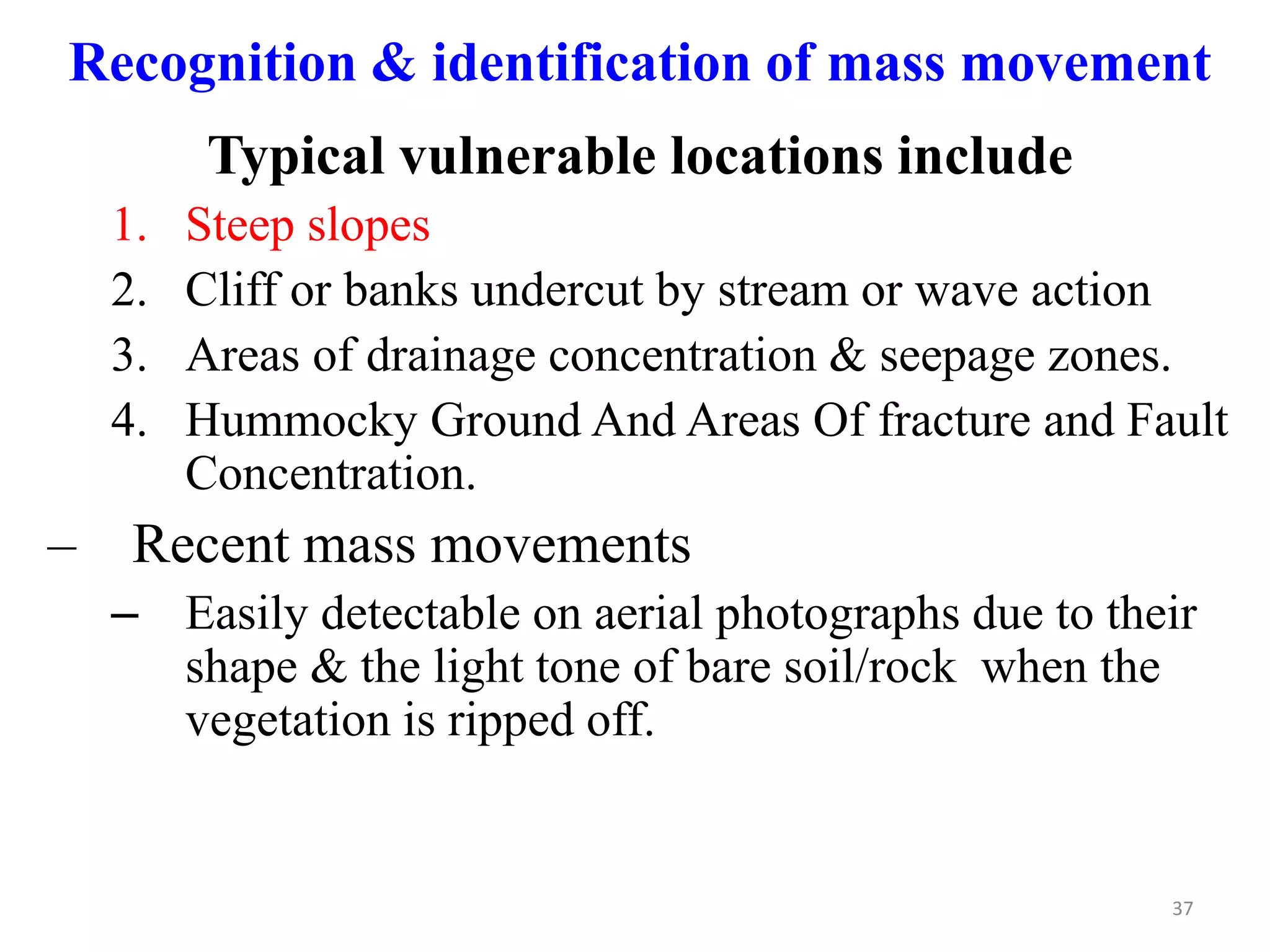
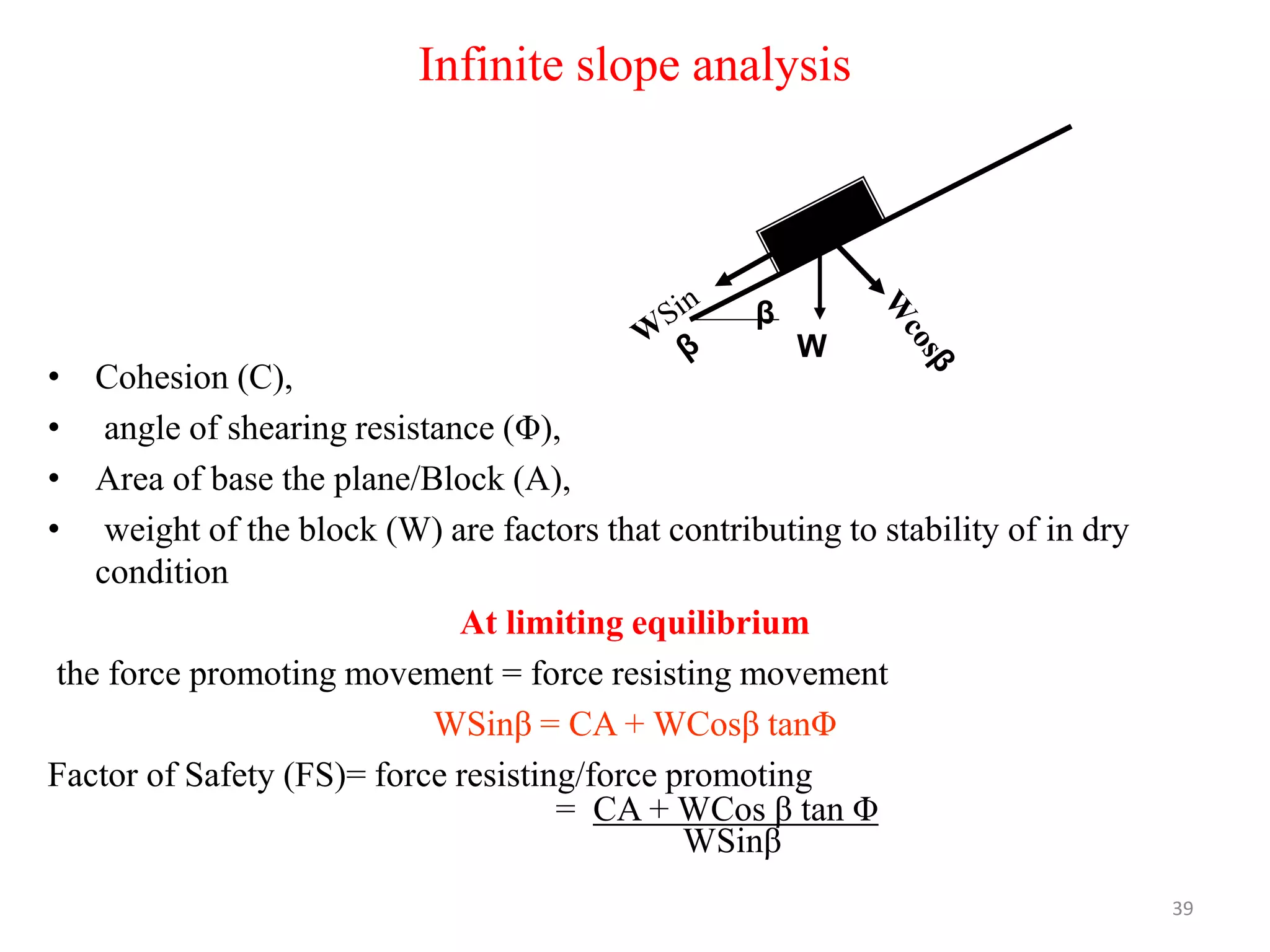
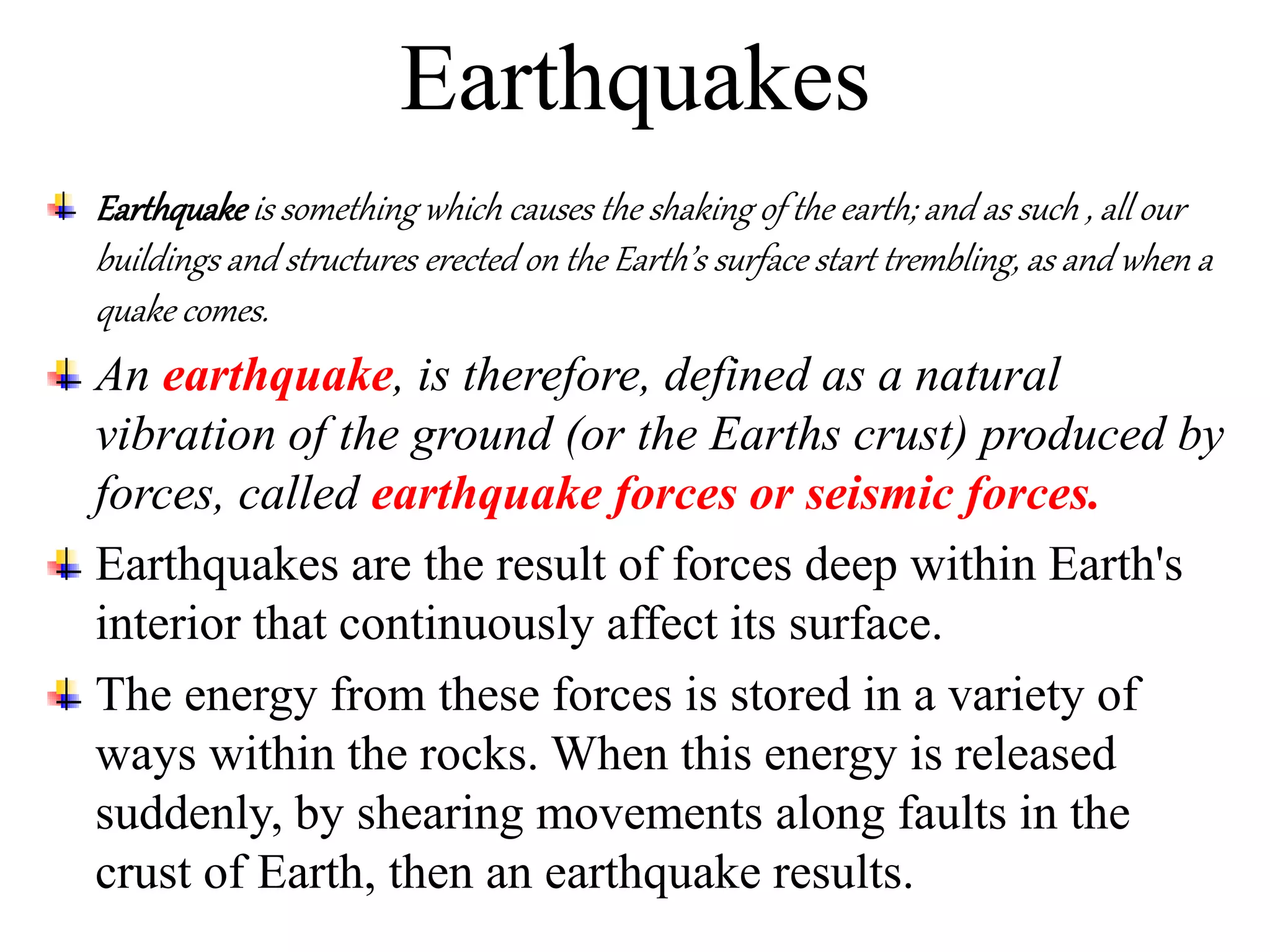
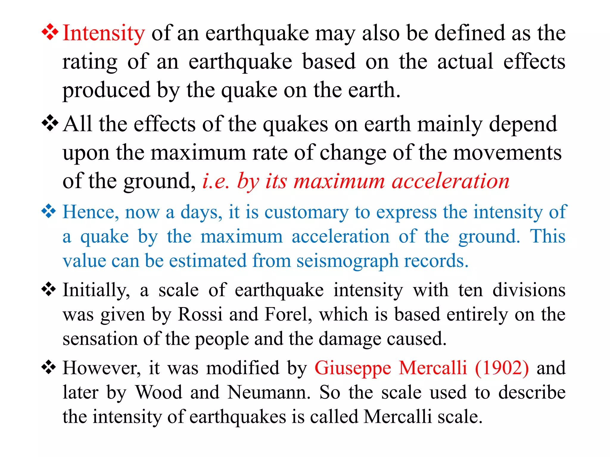
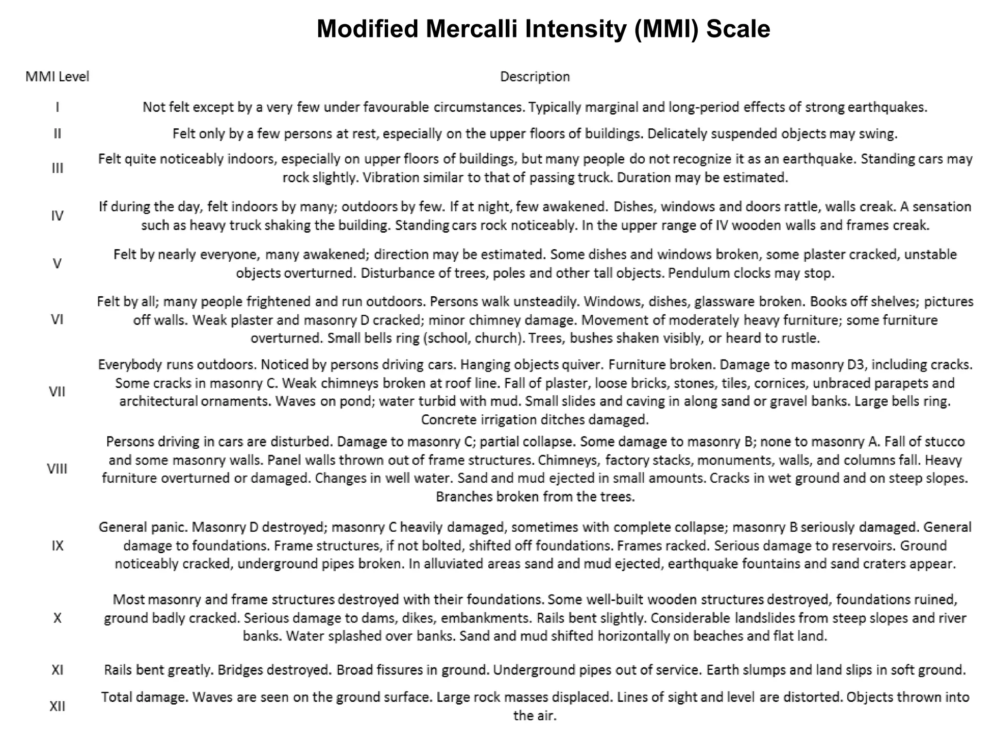
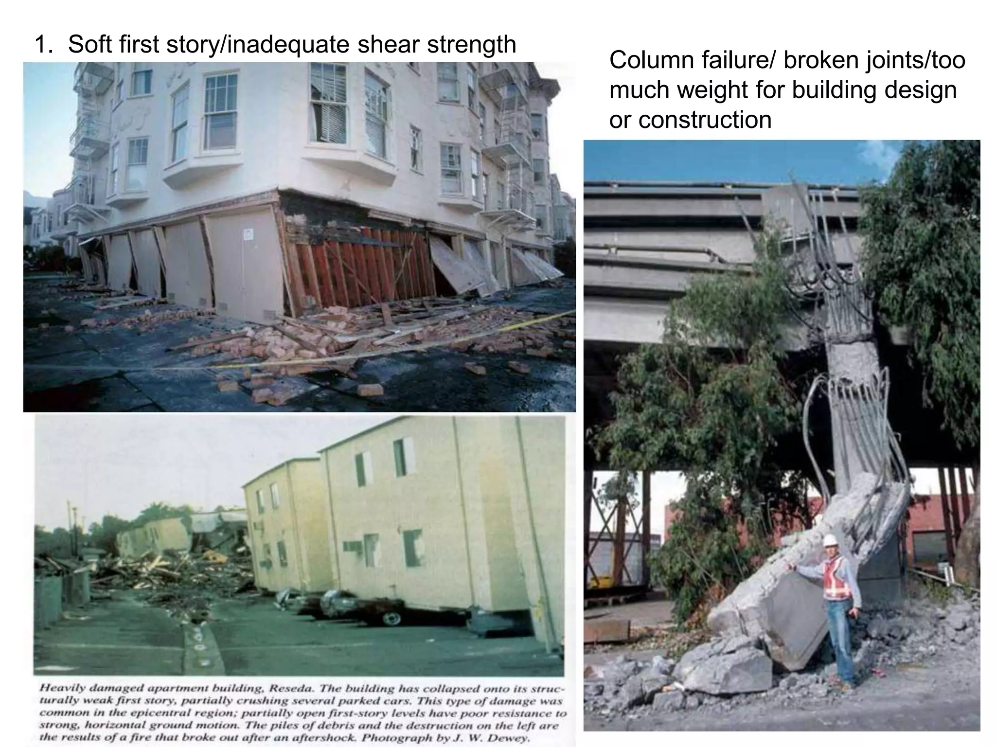
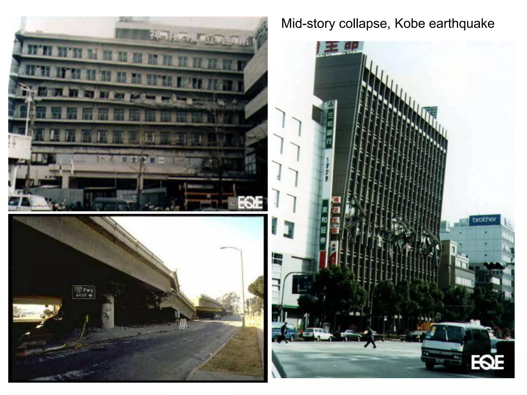
The document discusses mass movement and earthquakes. It defines mass movement as the downslope movement of rock and soil under the influence of gravity. It classifies different types of mass movement such as falls, slides, flows, spreads, and topples. It also discusses causes, triggers, economics impacts, and remedial measures for slope instability issues. Regarding earthquakes, it defines them as natural vibrations within the Earth's crust produced by forces within the Earth. It discusses measuring the severity of earthquakes in terms of magnitude and intensity.
Definition, classification & types of landslideTarikIslam9
General Information about Bangladesh
Bangladesh is consisted of a total land area of 147570 km² with hilly areas of 17,342 km² (8.5% of total area of Bangladesh).
Chattagram Hill tracts is the wide ranging hilly area in the southeastern part of the country. Rangamati, Bandarban and Khagrachari are three unique geographical and cultural landscape administrative districts in this region.
Landslides are a common hazard in the Chittagong Hill Districts (CHD) of Bangladesh. The communities that live on dangerous hill slopes in CHD repeatedly experience landslide hazards during the monsoon season, with casualties, economic losses and property damage.
Contents:
1. Concept of Earthquake
2. Hazards Associated to Earthquake
- Ground Shaking
- Ground Rapture
- Tsunami
- Earthquake induced landslide
3. What do to BEFORE, DURING, AFTER Earthquake
Instructions for Submissions thorugh G- Classroom.pptxJheel Barad
This presentation provides a briefing on how to upload submissions and documents in Google Classroom. It was prepared as part of an orientation for new Sainik School in-service teacher trainees. As a training officer, my goal is to ensure that you are comfortable and proficient with this essential tool for managing assignments and fostering student engagement.
Operation “Blue Star” is the only event in the history of Independent India where the state went into war with its own people. Even after about 40 years it is not clear if it was culmination of states anger over people of the region, a political game of power or start of dictatorial chapter in the democratic setup.
The people of Punjab felt alienated from main stream due to denial of their just demands during a long democratic struggle since independence. As it happen all over the word, it led to militant struggle with great loss of lives of military, police and civilian personnel. Killing of Indira Gandhi and massacre of innocent Sikhs in Delhi and other India cities was also associated with this movement.
Students, digital devices and success - Andreas Schleicher - 27 May 2024..pptxEduSkills OECD
Andreas Schleicher presents at the OECD webinar ‘Digital devices in schools: detrimental distraction or secret to success?’ on 27 May 2024. The presentation was based on findings from PISA 2022 results and the webinar helped launch the PISA in Focus ‘Managing screen time: How to protect and equip students against distraction’ https://www.oecd-ilibrary.org/education/managing-screen-time_7c225af4-en and the OECD Education Policy Perspective ‘Students, digital devices and success’ can be found here - https://oe.cd/il/5yV
How to Make a Field invisible in Odoo 17Celine George
It is possible to hide or invisible some fields in odoo. Commonly using “invisible” attribute in the field definition to invisible the fields. This slide will show how to make a field invisible in odoo 17.
The Roman Empire A Historical Colossus.pdfkaushalkr1407
The Roman Empire, a vast and enduring power, stands as one of history's most remarkable civilizations, leaving an indelible imprint on the world. It emerged from the Roman Republic, transitioning into an imperial powerhouse under the leadership of Augustus Caesar in 27 BCE. This transformation marked the beginning of an era defined by unprecedented territorial expansion, architectural marvels, and profound cultural influence.
The empire's roots lie in the city of Rome, founded, according to legend, by Romulus in 753 BCE. Over centuries, Rome evolved from a small settlement to a formidable republic, characterized by a complex political system with elected officials and checks on power. However, internal strife, class conflicts, and military ambitions paved the way for the end of the Republic. Julius Caesar’s dictatorship and subsequent assassination in 44 BCE created a power vacuum, leading to a civil war. Octavian, later Augustus, emerged victorious, heralding the Roman Empire’s birth.
Under Augustus, the empire experienced the Pax Romana, a 200-year period of relative peace and stability. Augustus reformed the military, established efficient administrative systems, and initiated grand construction projects. The empire's borders expanded, encompassing territories from Britain to Egypt and from Spain to the Euphrates. Roman legions, renowned for their discipline and engineering prowess, secured and maintained these vast territories, building roads, fortifications, and cities that facilitated control and integration.
The Roman Empire’s society was hierarchical, with a rigid class system. At the top were the patricians, wealthy elites who held significant political power. Below them were the plebeians, free citizens with limited political influence, and the vast numbers of slaves who formed the backbone of the economy. The family unit was central, governed by the paterfamilias, the male head who held absolute authority.
Culturally, the Romans were eclectic, absorbing and adapting elements from the civilizations they encountered, particularly the Greeks. Roman art, literature, and philosophy reflected this synthesis, creating a rich cultural tapestry. Latin, the Roman language, became the lingua franca of the Western world, influencing numerous modern languages.
Roman architecture and engineering achievements were monumental. They perfected the arch, vault, and dome, constructing enduring structures like the Colosseum, Pantheon, and aqueducts. These engineering marvels not only showcased Roman ingenuity but also served practical purposes, from public entertainment to water supply.
How to Split Bills in the Odoo 17 POS ModuleCeline George
Bills have a main role in point of sale procedure. It will help to track sales, handling payments and giving receipts to customers. Bill splitting also has an important role in POS. For example, If some friends come together for dinner and if they want to divide the bill then it is possible by POS bill splitting. This slide will show how to split bills in odoo 17 POS.
2024.06.01 Introducing a competency framework for languag learning materials ...Sandy Millin
http://sandymillin.wordpress.com/iateflwebinar2024
Published classroom materials form the basis of syllabuses, drive teacher professional development, and have a potentially huge influence on learners, teachers and education systems. All teachers also create their own materials, whether a few sentences on a blackboard, a highly-structured fully-realised online course, or anything in between. Despite this, the knowledge and skills needed to create effective language learning materials are rarely part of teacher training, and are mostly learnt by trial and error.
Knowledge and skills frameworks, generally called competency frameworks, for ELT teachers, trainers and managers have existed for a few years now. However, until I created one for my MA dissertation, there wasn’t one drawing together what we need to know and do to be able to effectively produce language learning materials.
This webinar will introduce you to my framework, highlighting the key competencies I identified from my research. It will also show how anybody involved in language teaching (any language, not just English!), teacher training, managing schools or developing language learning materials can benefit from using the framework.
Ethnobotany and Ethnopharmacology:
Ethnobotany in herbal drug evaluation,
Impact of Ethnobotany in traditional medicine,
New development in herbals,
Bio-prospecting tools for drug discovery,
Role of Ethnopharmacology in drug evaluation,
Reverse Pharmacology.
The Indian economy is classified into different sectors to simplify the analysis and understanding of economic activities. For Class 10, it's essential to grasp the sectors of the Indian economy, understand their characteristics, and recognize their importance. This guide will provide detailed notes on the Sectors of the Indian Economy Class 10, using specific long-tail keywords to enhance comprehension.
For more information, visit-www.vavaclasses.com
2. The rock surface of the continents of the Earth, on
which we are living, is undergoing constant and
continuous destruction, by a process called
‘Denudation’.
This rock surface is broken into fragments by
weathering, and erosion, which is defined as the
destructive mechanisms caused by the agents of
transportation.
All the material that is dislodged from the earth
crust by weathering or in any other manner, tends
to move down slope under the influence of gravity,
known as mass movement.
3. Mass movement
• Mass movement is the down slope movement of rock
and/or surficial material in mass under the influence
of gravity.
• The term landslide is used in alternative with the
mass movement/mass wasting
• Mass movement
– Occur in terrain ranging from vertical cliff to slopes as
gentle as one or two degrees
– Velocity range from extremely slow to extremely rapid
– In completely dry to completely wetted state
• Materials include natural rock, soil, artificial fills, or
combination these
4. Economics/crisis of Mass Movement
• Financial losses: divided into two groups
– Direct costs: incurred by actual damage of
installations (highways, railroads, Industrial plants,
mines, houses, communication facilities, electrical
power, etc) or property.
– Indirect costs: loss of tax revenues on properties
devalued as a result of mass movement.
• Loss of productivity of agricultural or forest lands affected
by mass movement.
• Loss of industrial productivity due to interruption of
transport system by mass movement.
• The indirect costs are certainly very difficult to
estimate.
5. Predicted economic losses from geologic hazards in
California from 1970-2000.
s. No. Geologic hazards Cost in US Dollar
1 Earthquake shaking 21 billion USD
2 Mass movement 10 billion USD
3 Flooding 6.5 billion USD
4 Erosion 600 million USD
5 Expansive soil 150 million USD
6 Fault displacement 76 million USD
7 Volcanic eruption 49 million USD
8 Tsunami 41 million USD
9 subsidence 26 million USD
6. Causes/Triggering mechanism of Mass Movement
1. Undercutting of the slope
2. Overloading of the slope
3. Vibrations from Earthquake or explosions
4. Over-steepening of a slope
5. Removal of slope vegetation
6. Introduction of water into slope material
7. Ice wedging
8. Biological activity, etc.
7. Cont…
When mass movement do occur one
particular condition has to be fulfilled
The shear stress must be greater than the
shear strength
Causes can be classified into two groups
Factors that contribute to an increase of the
shear stress &
Factors that contribute to a decrease of the
shear strength
Water is another factor contributing to both groups
8. Factors that contribute to increase
the shear stress
1) Removal of lateral support
a) Erosion
Steams and rivers
Waves and long shore or tidal currents
b) Work/activities of human
Cuts, quarries, pits and canals
Lakes and reservoirs are created & their levels
altered
9. 2. Surcharge/overloading: results from both natural & human
agencies
From natural activities
a) Weight of rain, snow and water from springs
b) Accumulation of talus overriding landslide materials
c) Vegetation (weight of large trees)
d) Seepage pressures of percolating water
From human activities
a) Construction of fill
b) Waste piles
c) Weight of building and other structures
d) Weight of water from leaking pipelines, sewers, canals
and reservoirs.
10. 3. Transitory earth stresses
a) Earthquake and blasting
b) Vibration from machinery
c) Traffic, thunder, etc
4. Removal of underlying support
a) Undercutting of banks by rivers and by waves
b) Subterranean erosion in which soluble material,
such as carbonates, salt or gypsum is removed and
granular material beneath firmer material is
worked out
c) Mining and similar actions by human agencies
d) Squeezing out of underlying plastic material
11. 5. Regional tilting
A progressive increase in the slope angle through
regional tilting contribute to some landslides.
6. Increase in Lateral Pressure: may be
caused by:
a) Water in cracks and caverns
b) Freezing of water in cracks
c) Swelling as a result of hydration of clay or
anhydrite.
12. Factors that contribute to lower or
reduce shear strength
Divided in to two groups
Factors stemming from the initial
state or inherent characteristics of
materials
The changing or variable factors
that tend to lower the shear strength of
material
13. • Initial state/Inherent characteristics
– Composition: inherently weak, organic materials,
sedimentary clays and shales, volcanic tuffs, etc
– Texture: loose structure of individual particles, in sensitive
materials, loess, sands of low density, porous organic
material, etc
– Gross structure: discontinuities, Fault, Bedding Plane,
Cleavage, Joints, Breccias, strata inclination towards free
face and slope orientation.
• Changing or variable factors
– Disintegration of material due to weathering
– Changes in effective inter-granular pressure & friction due
to water content and pressure in pores
– Changes in structures such as fissuring of shales and pre-
consolidated clays and fracturing and loosening of rock
slopes due to release of vertical or lateral pressure in
valleys, walls, cuts, etc
14. Classification of Mass Movement
1. FALLS
These can occur in either soil or rock masses, and usually
occur on extremely steep slopes.
Falls may arise due to:
Gravity stresses leading to shear surfaces.
Undermining of a slope (due to wave action, river erosion or
careless excavation etc.), allowing the development of unstable
overhangs.
Progressive weakening of a cliff unit (perhaps by weathering),
causing a block to rotate and become unstable, resulting in
toppling.
Water effects in a joint-bounded mass of rocks. These forces
may even be able to rupture un-jointed rocks.
Temperature changes in dry areas. These changes open and
close the rock joints, allowing small pieces of debris to fall into
them and prevent closure.
Seismic shocks which dislodge debris.
15.
16. 2. SLIDES
• These can occur over much more shallow slopes than
falls.
Slides may arise due to:
– A block bounded by joints may be pushed by forces from
water in the joints, and the block then slides down
intersecting joint-planes or along a steep joint or bedding
plane.
– Shear surfaces may form within the soil or rock body. The
surfaces will often be similar to a circle, arc, but may have
a flat bottom. The resulting slides will be rotational,
translational or compound
– Mudslides sometimes take place when there is much
rainwater present to infiltrate the soil.
17.
18. 3. FLOWS
• A flow is a movement of a mass of soil which
involves a much greater internal deformation
than a slide.
• In a cohesive, clay soil, the moisture content
of the soil must be above the liquid limit,
otherwise the movement is a slide. In this case
the material behaves as a fluid.
• This is not the case for non-cohesive,
granular soils, where flows can even take
place in dry soil.
19.
20. 4. LATERAL SPREADS
• The dominant mode of movement is lateral,
accompanied by shear and/or tensile fractures.
– Overall extension
– No recognized, well defined basal shear surface or
zone or plastic flow
– Occur mainly in bed rock.
• Involve fracturing & extension of coherent
material either bed rock or soil due to
liquefaction of subjacent (underlying) material.
21. 5. TOPPLING
Toppling failure is generally associated with steep
slopes in which the jointing is near vertical.
Involves the overturning of individual blocks and
Governed by discontinuity spacing as well as
orientation.
The likelihood of toppling increases with increasing
inclination of the discontinuities.
Water pressure within discontinuities helps promote the
development of toppling.
Hoek & Bray (1977), toppling occurs when the weight
vector, which passes through the centre of gravity of
the block, falls outside the base of the block
22.
23. Type of movement Type of material
Bed rock Engineering soils
pred. coarse Pred. fine
Falls Rock fall Debris fall Earth fall
Topples Rock topples Debris topple Earth topple
Slide Rot . Few units Rock slump Debris slump Earth slump
Trans Rock block slide
Rock slide
Debris block slide
Debris slide
Earth block slide
Earth slide
Many
units
Lateral spreads Rock spread Debris spread Earth spread
Flows Rock flow (deep
creep
Debris flow
(soil creep)
Earth flow
(soil creep)
complex Combination of two or more types of movement
Principal types of Mass Movement (after Varne’s 1978)
24. Extremely rapid
3m/sec
Very rapid
0.3m/min
rapid
1.5m/day
Moderate
Slow
Very Slow
Extremely Slow
1.5m/month
1.5m/year
0.06m/year
VELOCITY OF MASS
MOVEMENT
The range of mass movement
velocities is very wide and
reaches from several cm/year to
over 100km/hour.
The scale shown gives the
approximate ranges of rates of
Mass Movement.
25. 25
REMEDIAL/CORRECTIVE MEASURES
FOR SLOPE INSTABILITY
LOADING THE TOE
This method is most effective for deep-seated instability.
The berm can either be constructed from material which is removed from
the crest of the slope (involving regrading of the slope), or
from that which is brought to the site from elsewhere.
26. 26
REGRADING THE SLOPE
This can be done in three ways:-
1. Regrading the slope to a flatter angle,
2. Reducing the overall slope height, keeping its profile unchanged,
3. Removing some material from the crest and placing it at the toe.
Achieving a flatter slope angle
27. 27
Reducing the height of the Slope
DRAINAGE SURFACE & SUB-SURFACE METHODS
Surface Drainage on a slope
28. Deep Drains
• These perform the function of modifying the shape of the
seepage flow in the slope material.
• They can be:-
– Deep trenches (although they are more commonly shallow),
– Vertical bored drains - filled with sand or gravel,
– Horizontal bored drains - lined with perforated pipes.
29. 29
SOIL/ROCK ANCHORING
• Often these soil anchors are stressed/Tensioned, and
• The axial load on the anchor increases the effective
stresses at depth, therefore increasing the strength of
the slope.
• A vector component of the force may also act to help
stabilize the slope against destabilizing forces.
30. 30
SHEET PILING
• This is an expensive remedial procedure, and is not
commonly used unless the recovery scheme is very
large.
31. 31
RETAINING STRUCTURES
• As a whole, retaining structures are not particularly
effective methods of remedy.
• Difficult to construct on an already moving slide.
• One use of them, though, is to ensure complete stability
of an existing (old) landslide, which may in the future
be reactivated.
• We estimate the force acting on a retaining wall by
using the interslice forces from stability analysis.
• The wall provides additional resistance which is only
mobilized by further deformation of the slope.
• The force then acts along the line of action (see
diagram below) into the soil or rock beneath the slope.
32. 32
GEOTEXTILES
• Geotextiles are man-made (usually plastic based)
soil reinforcement materials.
• In the area of slope stabilization, geogrids are
used eg. In an embankment fill to reduce the
amount of movement possible, keeping the fill in
place.
• Very often the geogrid is used as an anchor,
providing a reaction against the disturbing
moment.
• They are often also used to repair small slides in
engineering earthworks.
34. 34
"GRASSING-OVER" THE SLOPE
• By covering over a slope with either sand or grass,
we immediately reduce the amount of water which
can infiltrate it.
• This method is often used in conjunction with more
effective and long-term methods. It's benefits in being
inexpensive and simple, whilst still performing a
stabilizing function, make it worth serious
consideration.
WHICH METHOD IS BEST?
• Generally, in looking at a failing slope, we need to
choose a primary stabilization method i.e. one which
will immediately take effect in stopping the slide.
35. 35
METHODS Remarks
1
Regrading the
Slope
(includes Loading
the Toe)
Has an immediate effect
Unlikely to become un-effective with time.
2 Drainage
Should be used if regarding is impractical
Has immediate effect in high-permeability soils.
Takes more time to take effect in fine-grained
soils.
Surface drainage is very common.
3
Incorporating
Structures into the
Slope
(eg. nailing, geo-
textiles, retaining
structures).
These structures can be active (eg. Stressed
nails/anchors),
or passive (eg. walls or sheet piling.)
Passive schemes only take effect on further
movement of the slope, which of course may not
be desirable.
36. 36
LANDSLIDE IN SOUTHERN SWEDEN: destroying 15
houses and injured 4 people, more than 100 habitants
evacuated.
37. 37
Recognition & identification of mass movement
Typical vulnerable locations include
1. Steep slopes
2. Cliff or banks undercut by stream or wave action
3. Areas of drainage concentration & seepage zones.
4. Hummocky Ground And Areas Of fracture and Fault
Concentration.
– Recent mass movements
– Easily detectable on aerial photographs due to their
shape & the light tone of bare soil/rock when the
vegetation is ripped off.
38. 38
Methods of slope analysis
• Stability of slopes is mainly related to
– Slope angle
– Strength of the materials and discontinuities in the slope, and
– Groundwater situation
• There are different types of slope analysis
– Infinite slope analysis
• Cohesive material –no seepage
• Cohesive soil- seepage and water table at the surface
• Cohesion less soil- seepage and water table at the surface
• Cohesion less soil- dry condition
– The circular arc analysis
– Method of slices
• Ordinary method of slices
• Bishop's simplified methods of slices
• Semi graphical approximation
– Stability analysis with the help of chart
39. 39
Infinite slope analysis
• Cohesion (C),
• angle of shearing resistance (Φ),
• Area of base the plane/Block (A),
• weight of the block (W) are factors that contributing to stability of in dry
condition
At limiting equilibrium
the force promoting movement = force resisting movement
WSinβ = CA + WCosβ tanΦ
Factor of Safety (FS)= force resisting/force promoting
= CA + WCos β tan Φ
WSinβ
W
β
40. Earthquakes
Earthquake is something which causes the shaking of the earth; and as such , all our
buildings and structures erected on the Earth’s surface start trembling, as and when a
quake comes.
An earthquake, is therefore, defined as a natural
vibration of the ground (or the Earths crust) produced by
forces, called earthquake forces or seismic forces.
Earthquakes are the result of forces deep within Earth's
interior that continuously affect its surface.
The energy from these forces is stored in a variety of
ways within the rocks. When this energy is released
suddenly, by shearing movements along faults in the
crust of Earth, then an earthquake results.
41. A general study of earthquakes includes:
consideration of the nature of ground faults,
propagation of shock waves through the earth mass,
the specific nature of recorded major quakes, etc.
Earthquake engineering covers the investigation
and solution of the problems created by damaging
earthquakes, and consequently the work involved
in the practical application of these solutions, i.e.
in planning, designing, constructing and
managing earthquake-resistant structures and
facilities.
42. Measuring Earthquakes:
Magnitude and Intensity
The severity of an earthquake can be expressed in
terms of both intensity and magnitude.
The most widely accepted indicators of the size of an
earthquake are its magnitude and intensity.
The two terms are quite different, however, and they
are often confused.
Intensity is based on the observed effects of ground
shaking on people, buildings, and natural features. It
varies from place to place within the disturbed region
depending on the location of the observer with
respect to the earthquake epicenter.
43. Intensity of an earthquake may also be defined as the
rating of an earthquake based on the actual effects
produced by the quake on the earth.
All the effects of the quakes on earth mainly depend
upon the maximum rate of change of the movements
of the ground, i.e. by its maximum acceleration
Hence, now a days, it is customary to express the intensity of
a quake by the maximum acceleration of the ground. This
value can be estimated from seismograph records.
Initially, a scale of earthquake intensity with ten divisions
was given by Rossi and Forel, which is based entirely on the
sensation of the people and the damage caused.
However, it was modified by Giuseppe Mercalli (1902) and
later by Wood and Neumann. So the scale used to describe
the intensity of earthquakes is called Mercalli scale.
44. • The intensity scale consists of a series of certain key
responses such as people awakening, movement of
furniture, damage to chimneys, and finally - total
destruction.
• Although numerous intensity scales have been
developed over the last several hundred years to
evaluate the effects o f earthquakes, the one currently
used in the United States is the Modified Mercalli
Intensity (MMI) Scale.
• This scale, composed of 12 increasing levels of
intensity that range from imperceptible shaking to
catastrophic destruction, is designated by Roman
numerals.
46. Magnitude (M) of an Earthquake: is a measure of
the size of an earthquake based on the total amount of the
energy released by an earthquake, when the over-strained rocks
suddenly rebound to cause the given earthquake.
Magnitude is related to the amount of seismic energy released
at the hypocenter of the earthquake.
It is based on the amplitude of the earthquake waves recorded
on instruments, which have a common calibration.
Magnitude is thus represented by a single, instrumentally
determined value. It is a value that tells a reader the amount of
seismic energy released by it.
The scale which is used to measure magnitude of an earthquake
is called Richter magnitude scale. It was developed in 1935 by
Charles F. Richter of the California Institute of Technology as a
mathematical device to compare the size of earthquakes.
47. Class Magnitude
Great 8 or more
Major 7 - 7.9
Strong 6 - 6.9
Moderate 5 - 5.9
Light 4 - 4.9
Minor 3 -3.9
Earthquake Magnitude Classes
Depending on their
magnitude, earthquakes are
classified into categories
ranging from minor to great.
Magnitude Earthquake Effects
Estimated
Number
Each Year
2.5 or less
Usually not felt, but can be
recorded by seismograph.
900,000
2.5 to 5.4
Often felt, but only causes
minor damage.
30,000
5.5 to 6.0
Slight damage to buildings
and other structures.
500
6.1 to 6.9
May cause a lot of damage in
very populated areas.
100
7.0 to 7.9
Major earthquake. Serious
damage.
20
8.0 or
greater
Great earthquake. Can totally
destroy communities near the
epicenter.
One every
5 to 10
years
The table below briefly describes earthquake effects
corresponding to various magnitude levels and also
gives an estimated number of earthquakes of different
magnitudes that happen in the world each year.
48. Difference between Earthquake Magnitude and Intensity
Magnitude of an earthquake is
determined based on measuring
the ground motion with
instruments (seismographs).
magnitude is a unique indicator
of a size of an earthquake -
each earthquake is
characterized with a single
value which indicates its
magnitude.
Magnitude is a fixed value
independent of distance from
the epicenter of the earthquake
Intensity of an earthquake is
determined based on
observations of earthquake
effects on building structures
and human perceptions.
each earthquake is
characterized with various
intensities, depending on the
location of a particular site
with respect to the epicenter.
Intensity decreases as we
move farther from the
epicenter.
49. Engineering problems related to earthquakes
During an earthquake, the ground on which the structure is
erected, suddenly acquires very strong motions in directions
which can not be known before hand, and for a duration which is
also indeterminable.
Not only the direction of motion but also the nature of motion of
the ground is highly complex and unpredictable.
It might be horizontal acceleration, vertical acceleration, or
rotation, or a combination of some or all of these, simultaneously
the problem becomes still more complicated as it is not known
whether the structure has to withstand one or two shocks or
repeated shocks, during the life time of the structure.
Many types of building, structure or ground failure are observed
in actual earthquake damage. When earthquake shaking occurs, a
building gets thrown from side to side and/or up and down.
53. General Effects of Earthquakes
The ground movements caused by earthquakes can
have several types of damaging effects. Some of the
major effects are:
Ground shaking, i.e. back-and-forth motion of the ground,
caused by the passing waves of vibration through the
ground;
Soil failures, such as liquefaction and landslides, caused by
shaking;
Surface fault ruptures, such as cracks, vertical shifts, general
settlement of an area, landslides, etc.
Tidal waves (tsunamis), i.e. large waves on the surface of
bodies of water that can cause major damage to shoreline
areas.
54. Some factors that affect the amount of damage
that occurs are:
The building designs,
Magnitude of the quake,
The distance from the epicenter
The type of surface material the building rest on etc
The greatest danger of an earthquake comes
from falling buildings and structures and flying
glass, stones and other objects.
55. If you live in an earthquake-prone area, here are
some steps that can be taken to minimize risks:
Affix bookcases, cabinets, refrigerators and furniture to the walls.
Fit cabinets with ‘childproof locks,’ so doors will remain closed
and items won’t fly out.
California and Japan sell silicone putty kits that can be used to
stick dishes and other breakables to the walls.
Have a backpack prepared and attached to the bed, containing
shoes, a flashlight and batteries, keys, money, first-aid supplies
and medicines, a knife, food, water, ID and insurance information.
Keep shoes next to your bed, so you can put them on as soon as a
quake begins
Have a family evacuation plan including phone numbers and safe
place to which to evacuate.
Establish escape routes from each room in the house.
56. If you are in an Earthquake:
If you are indoors, find a secure location to wait out the quake, such as
under a heavy table or desk, or in an interior hallway where you can brace
yourself between two walls. doorways are among the safest places to stand,
thanks to the strong beams overhead. However, watch out for swinging
doors. Stay away from windows.
If you are outdoors, try to get into an open area, away from falling
buildings, power lines, trees, etc.
If you are in a crowded public area, crouch down, with your hands
protecting your head and neck.
If you are in your car, pull over to the side, away from power lines and
overpasses, and stay inside the car until shaking has subsided.
Be sure to put on shoes immediately, to avoid injury from stepping on
broken glass and objects.
Check yourself and others for injuries.
Survey the exterior of your home for structural damage to the chimney,
roof, foundation and walls.
Do not use your automobile unless there is an emergency.
If you must leave the area, try to leave word where you can be contacted.