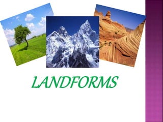
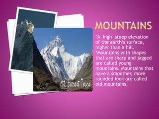
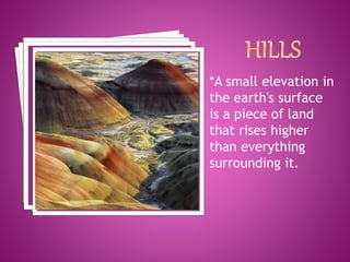
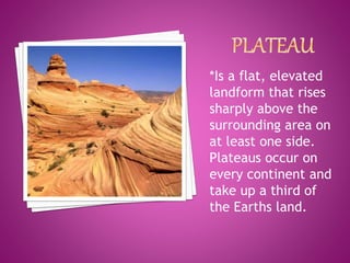
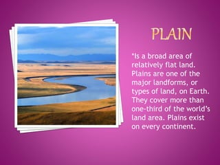
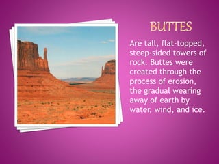
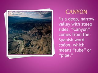
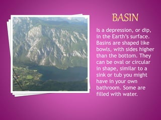
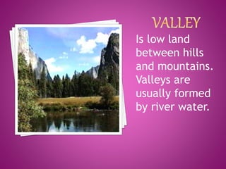
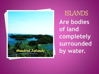
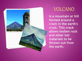
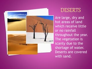
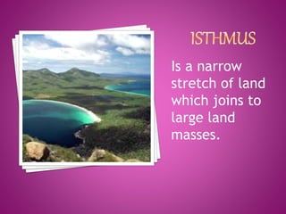
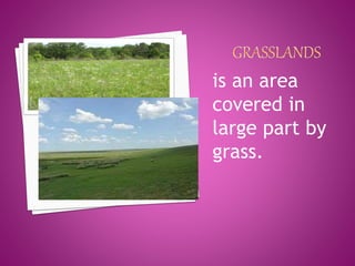
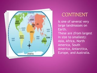
Is a natural feature of the Earth's
surface. Landforms are arrangement
on the landscape or the study of
same is known as topography.
*A high steep elevation
of the earth’s surface,
higher than a hill.
*Mountains with shapes
that are sharp and jagged
are called young
mountains. Mountains that
have a smoother, more
rounded look are called
old mountains.
*A small elevation in
the earth's surface
is a piece of land
that rises higher
than everything
surrounding it.
*Is a flat, elevated
landform that rises
sharply above the
surrounding area on
at least one side.
Plateaus occur on
every continent and
take up a third of
the Earths land.
*Is a broad area of
relatively flat land.
Plains are one of the
major landforms, or
types of land, on Earth.
They cover more than
one-third of the world’s
land area. Plains exist
on every continent.
Are tall, flat-topped,
steep-sided towers of
rock. Buttes were
created through the
process of erosion,
the gradual wearing
away of earth by
water, wind, and ice.
*Is a deep, narrow
valley with steep
sides. “Canyon”
comes from the
Spanish word
cañon, which
means “tube” or
“pipe.”
Is a depression, or dip,
in the Earth’s surface.
Basins are shaped like
bowls, with sides higher
than the bottom. They
can be oval or circular
in shape, similar to a
sink or tub you might
have in your own
bathroom. Some are
filled with water.
Is low land
between hills
and mountains.
Valleys are
usually formed
by river water.
Are bodies
of land
completely
surrounded
by water.
Is a mountain or hill
formed around a
crack in the earth's
crust. This crack
allows molten rock
and other hot
materials to be
thrown out from
the earth.
Are large, dry and
hot areas of land
which receive little
or no rainfall
throughout the year.
The vegetation is
scanty due to the
shortage of water.
Deserts are covered
with sand.
Is a piece of land that is
surrounded by water
from three sides. for
examples the southern
part of India is a
peninsula as it is
surrounded by the
Arabian sea, bay of
Bengal and the Indian
ocean and is joined to
land on the fourth side.
Is a part of
land
extending
in to a
water body
Is a narrow
stretch of land
which joins to
large land
masses.
is an area
covered in
large part by
grass.
Is one of several very
large landmasses on
Earth.
These are (from largest
in size to smallest):
Asia, Africa, North
America, South
America, Antarctica,
Europe, and Australia.
LANDFORMS in GEOGRAPHY

LANDFORMS in GEOGRAPHY

  • 3.
    Is a naturalfeature of the Earth's surface. Landforms are arrangement on the landscape or the study of same is known as topography.
  • 5.
    *A high steepelevation of the earth’s surface, higher than a hill. *Mountains with shapes that are sharp and jagged are called young mountains. Mountains that have a smoother, more rounded look are called old mountains.
  • 6.
    *A small elevationin the earth's surface is a piece of land that rises higher than everything surrounding it.
  • 7.
    *Is a flat,elevated landform that rises sharply above the surrounding area on at least one side. Plateaus occur on every continent and take up a third of the Earths land.
  • 8.
    *Is a broadarea of relatively flat land. Plains are one of the major landforms, or types of land, on Earth. They cover more than one-third of the world’s land area. Plains exist on every continent.
  • 9.
    Are tall, flat-topped, steep-sidedtowers of rock. Buttes were created through the process of erosion, the gradual wearing away of earth by water, wind, and ice.
  • 10.
    *Is a deep,narrow valley with steep sides. “Canyon” comes from the Spanish word cañon, which means “tube” or “pipe.”
  • 11.
    Is a depression,or dip, in the Earth’s surface. Basins are shaped like bowls, with sides higher than the bottom. They can be oval or circular in shape, similar to a sink or tub you might have in your own bathroom. Some are filled with water.
  • 12.
    Is low land betweenhills and mountains. Valleys are usually formed by river water.
  • 13.
  • 14.
    Is a mountainor hill formed around a crack in the earth's crust. This crack allows molten rock and other hot materials to be thrown out from the earth.
  • 15.
    Are large, dryand hot areas of land which receive little or no rainfall throughout the year. The vegetation is scanty due to the shortage of water. Deserts are covered with sand.
  • 16.
    Is a pieceof land that is surrounded by water from three sides. for examples the southern part of India is a peninsula as it is surrounded by the Arabian sea, bay of Bengal and the Indian ocean and is joined to land on the fourth side.
  • 17.
    Is a partof land extending in to a water body
  • 18.
    Is a narrow stretchof land which joins to large land masses.
  • 19.
    is an area coveredin large part by grass.
  • 20.
    Is one ofseveral very large landmasses on Earth. These are (from largest in size to smallest): Asia, Africa, North America, South America, Antarctica, Europe, and Australia.