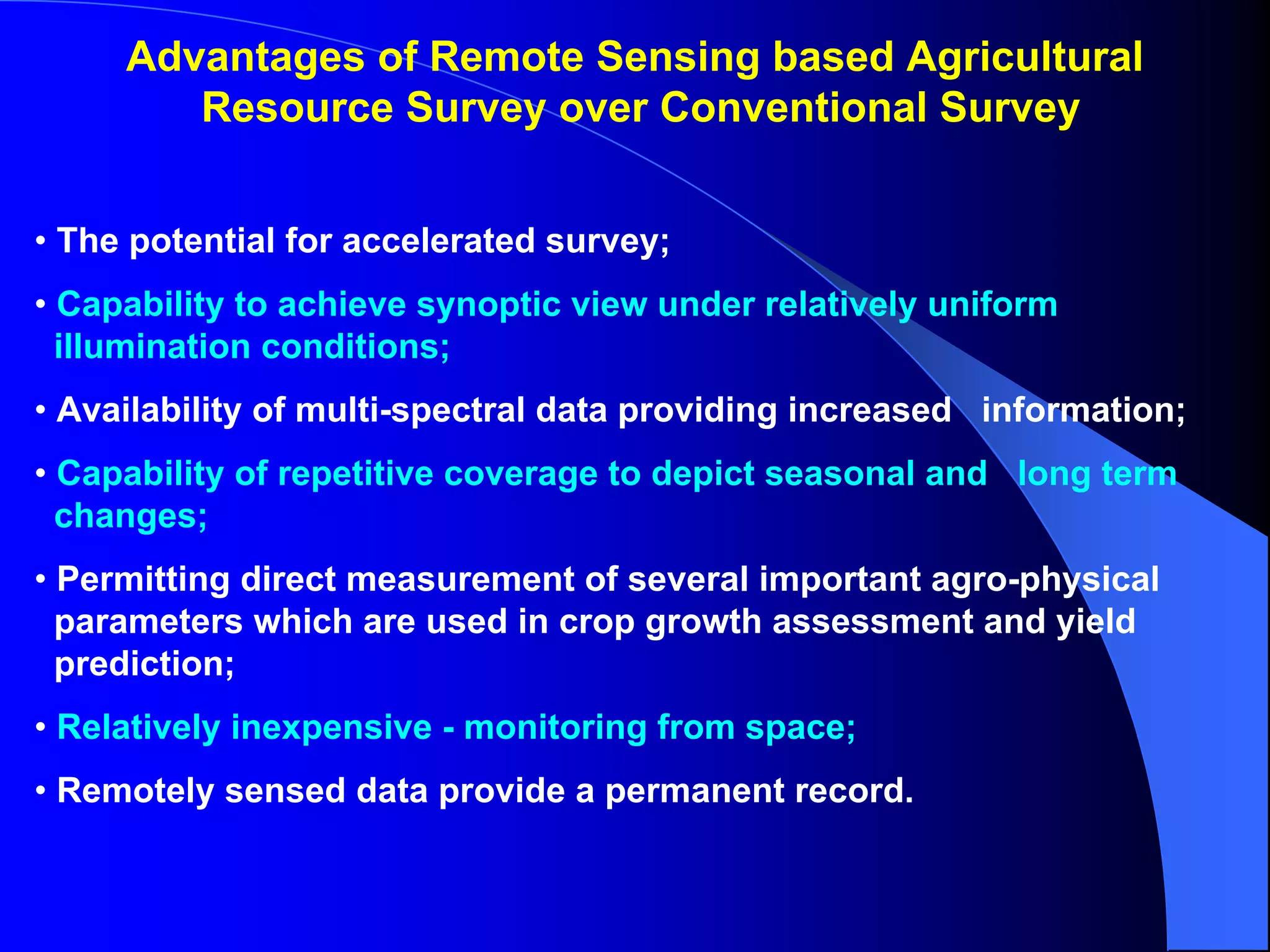
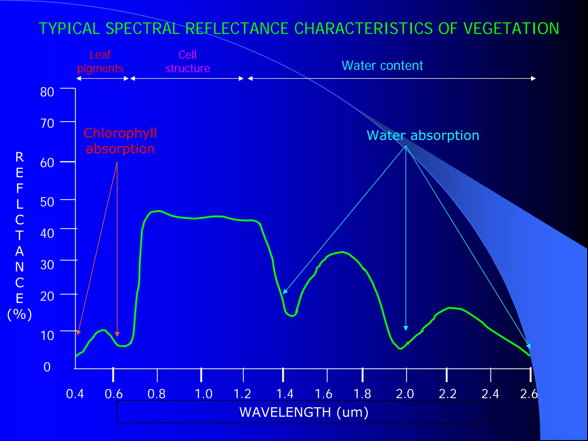
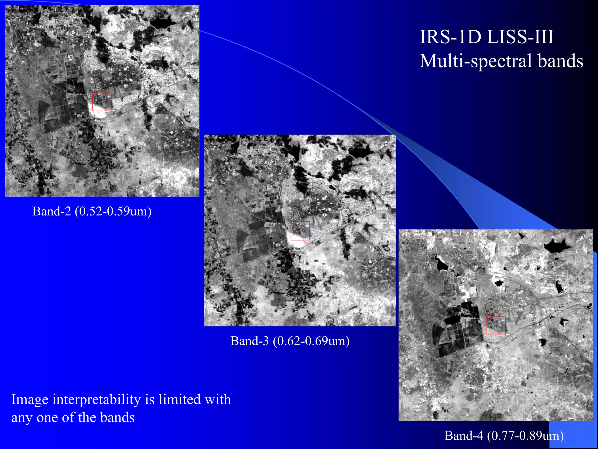
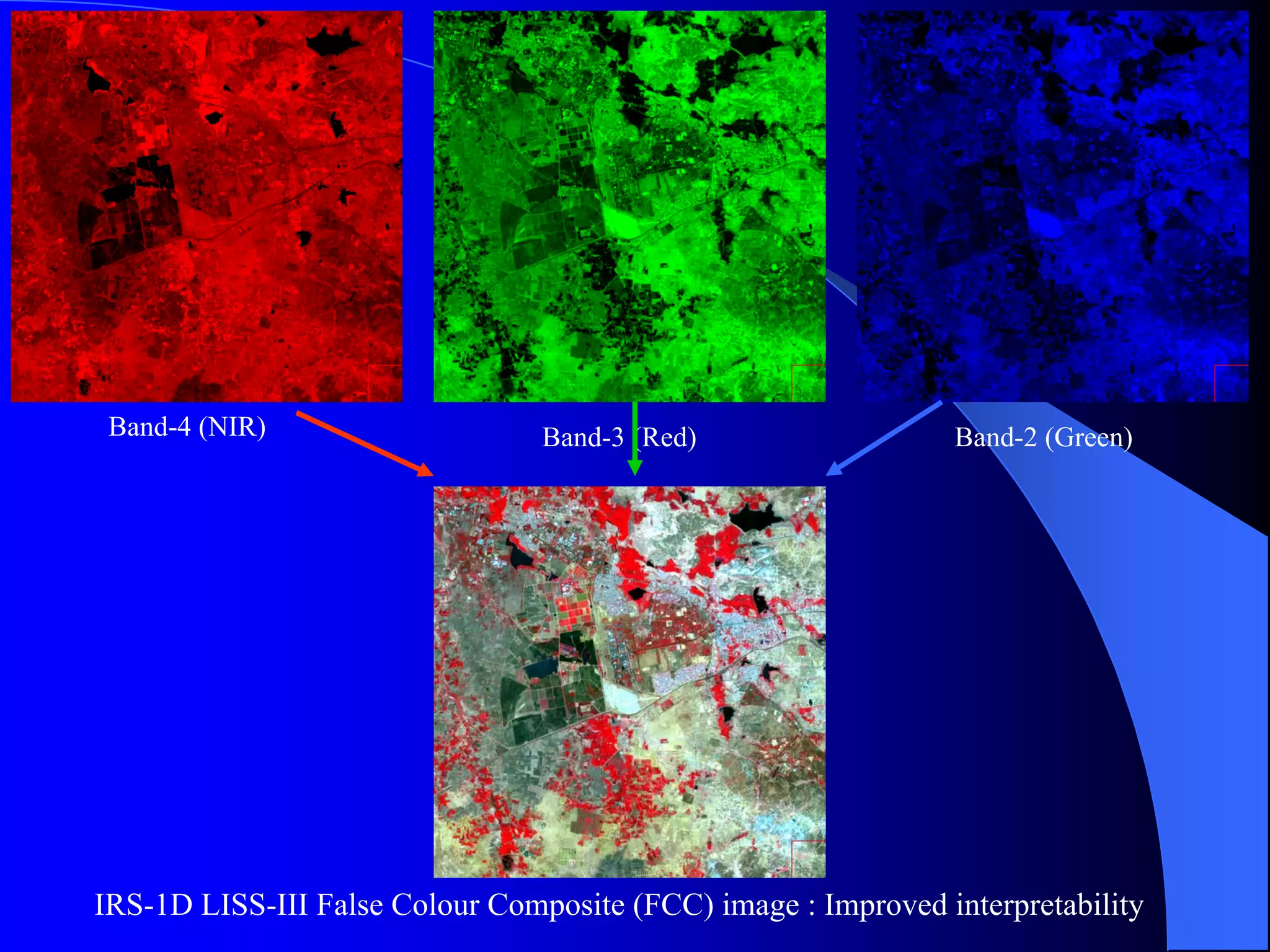
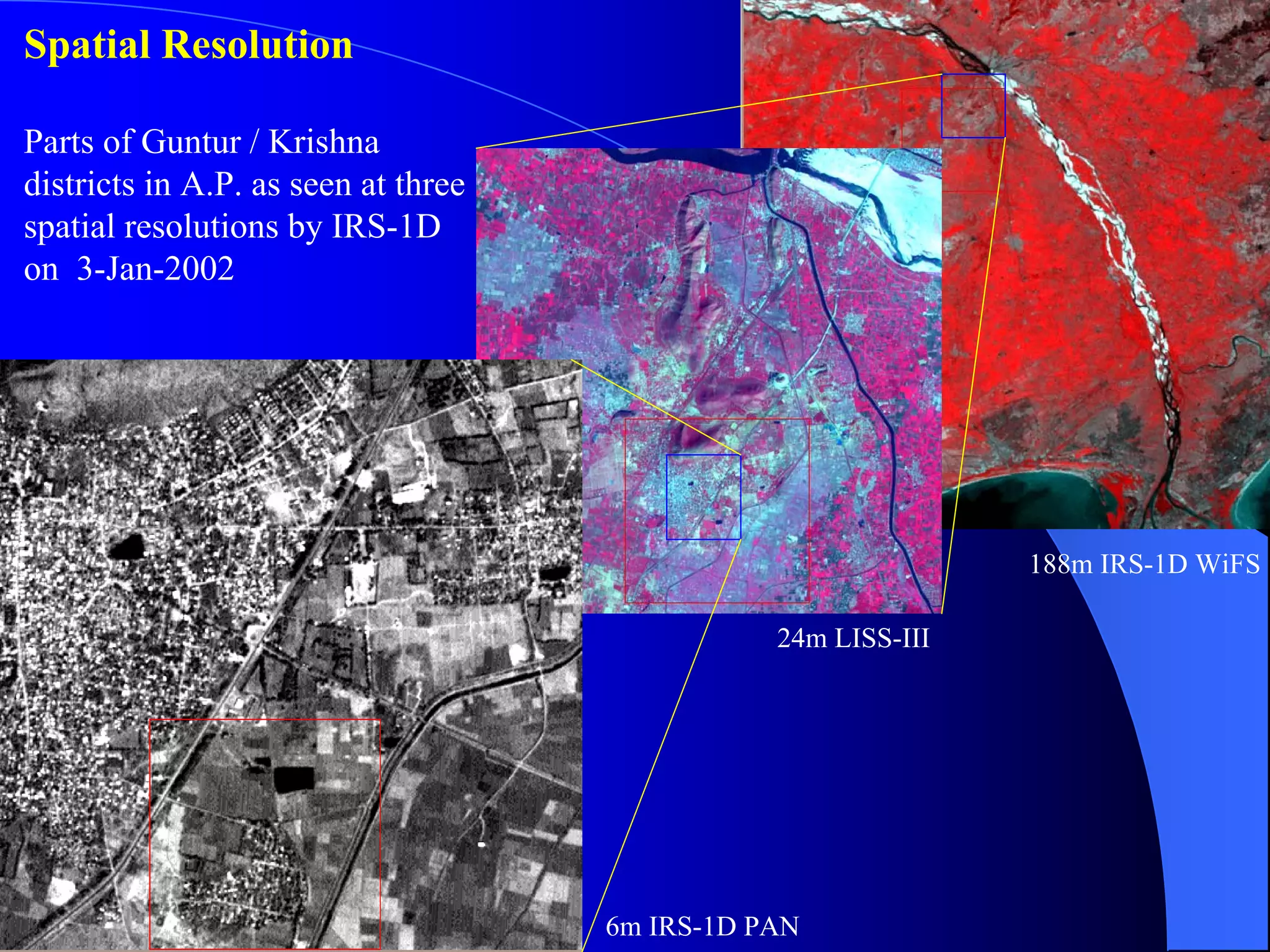
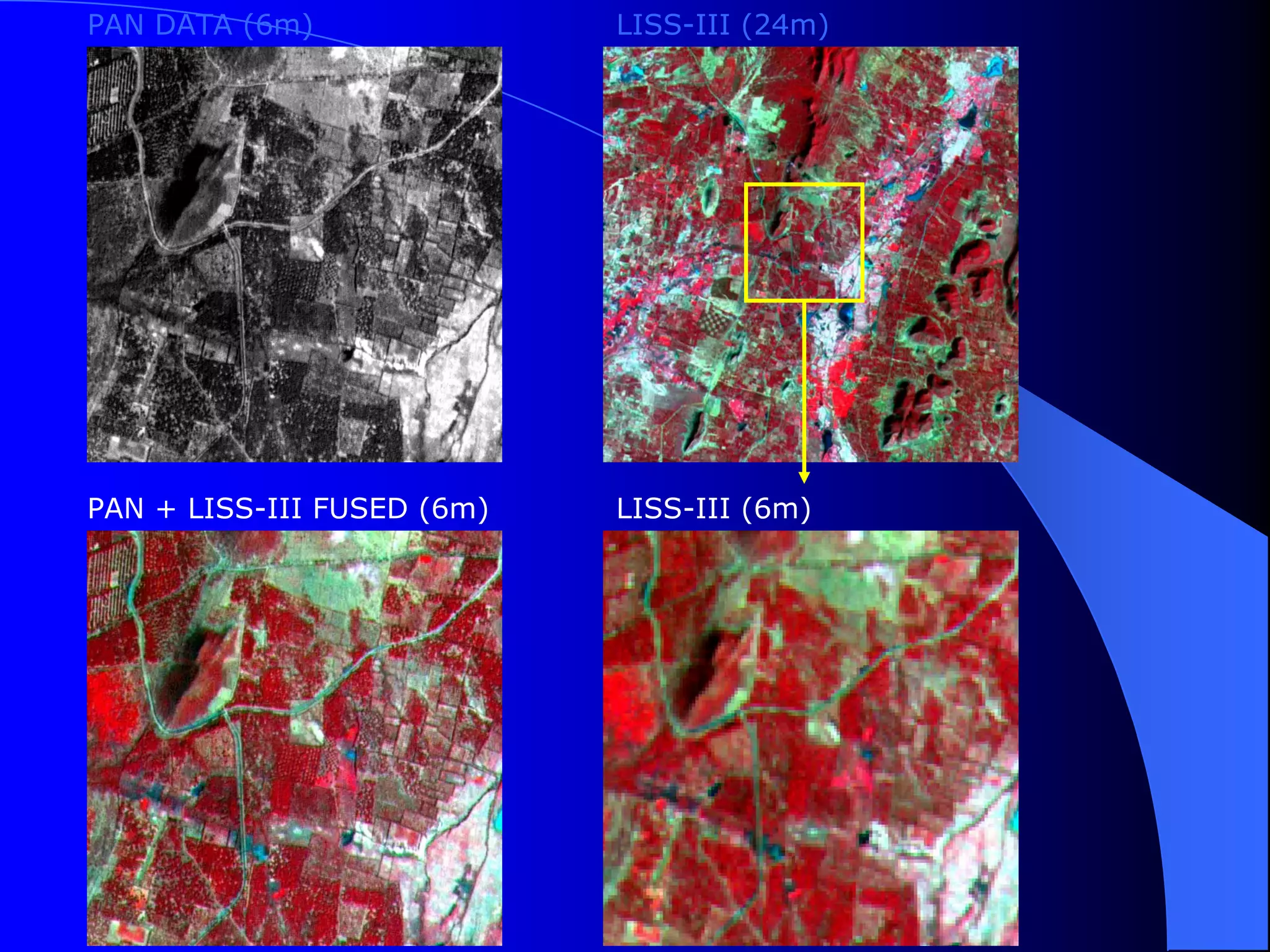
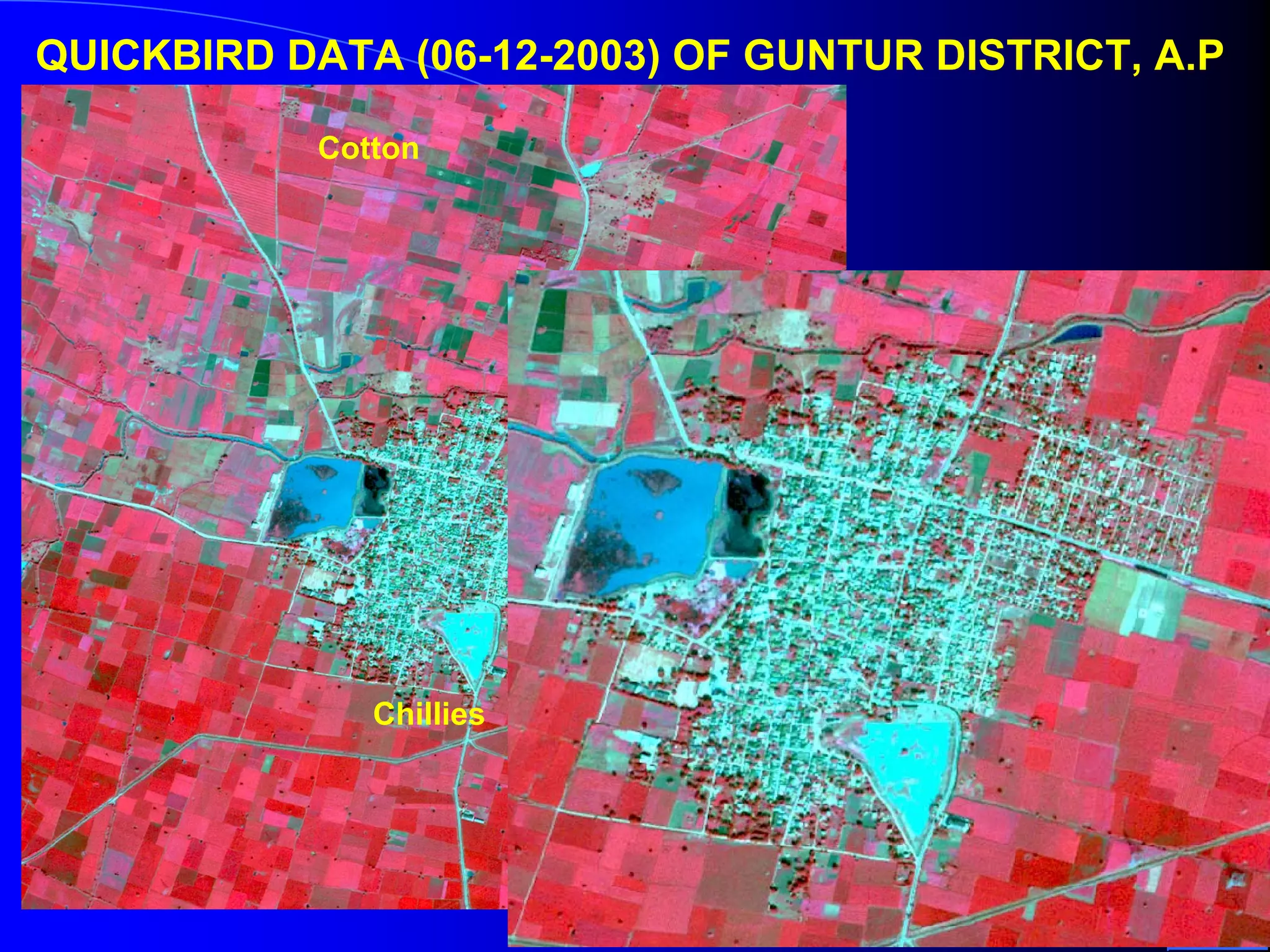
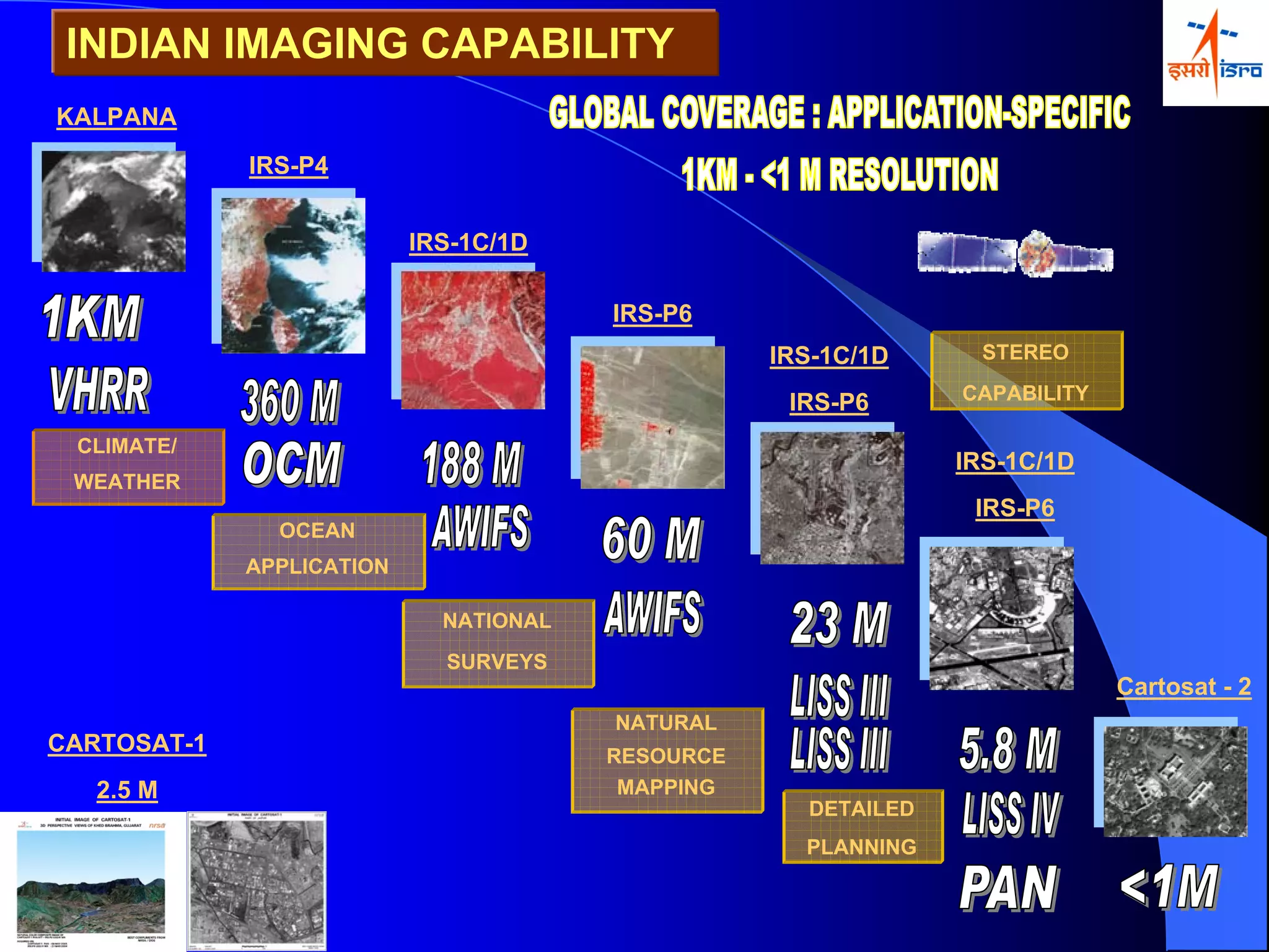
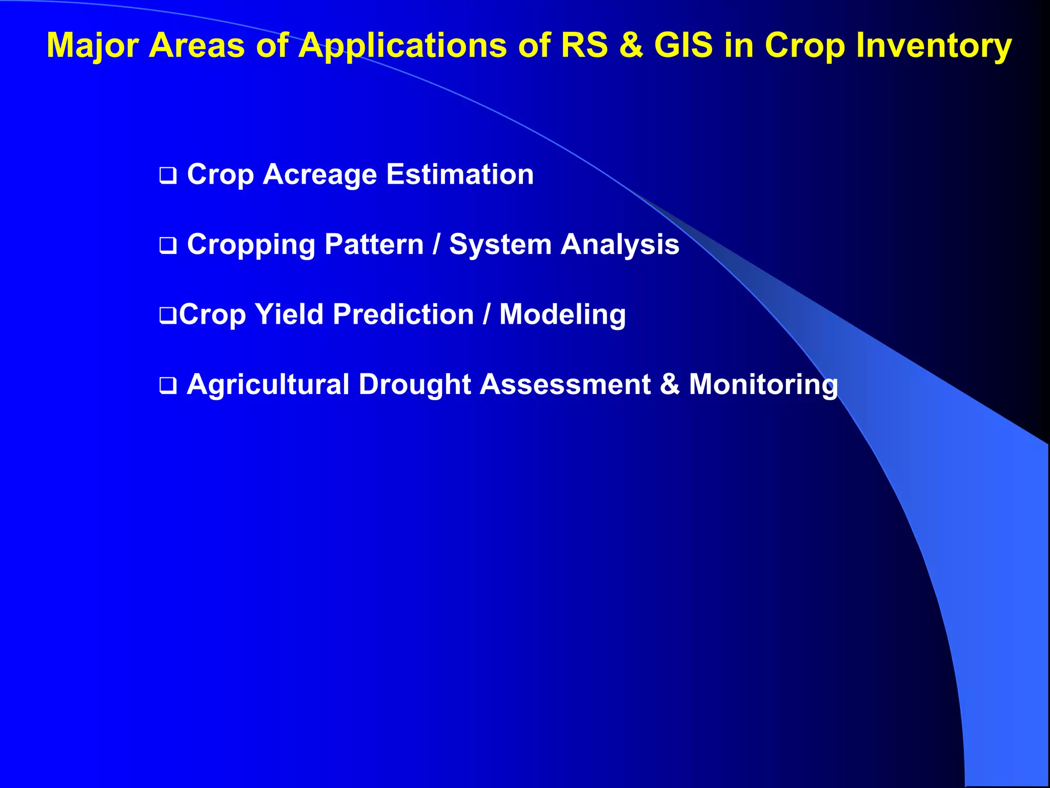
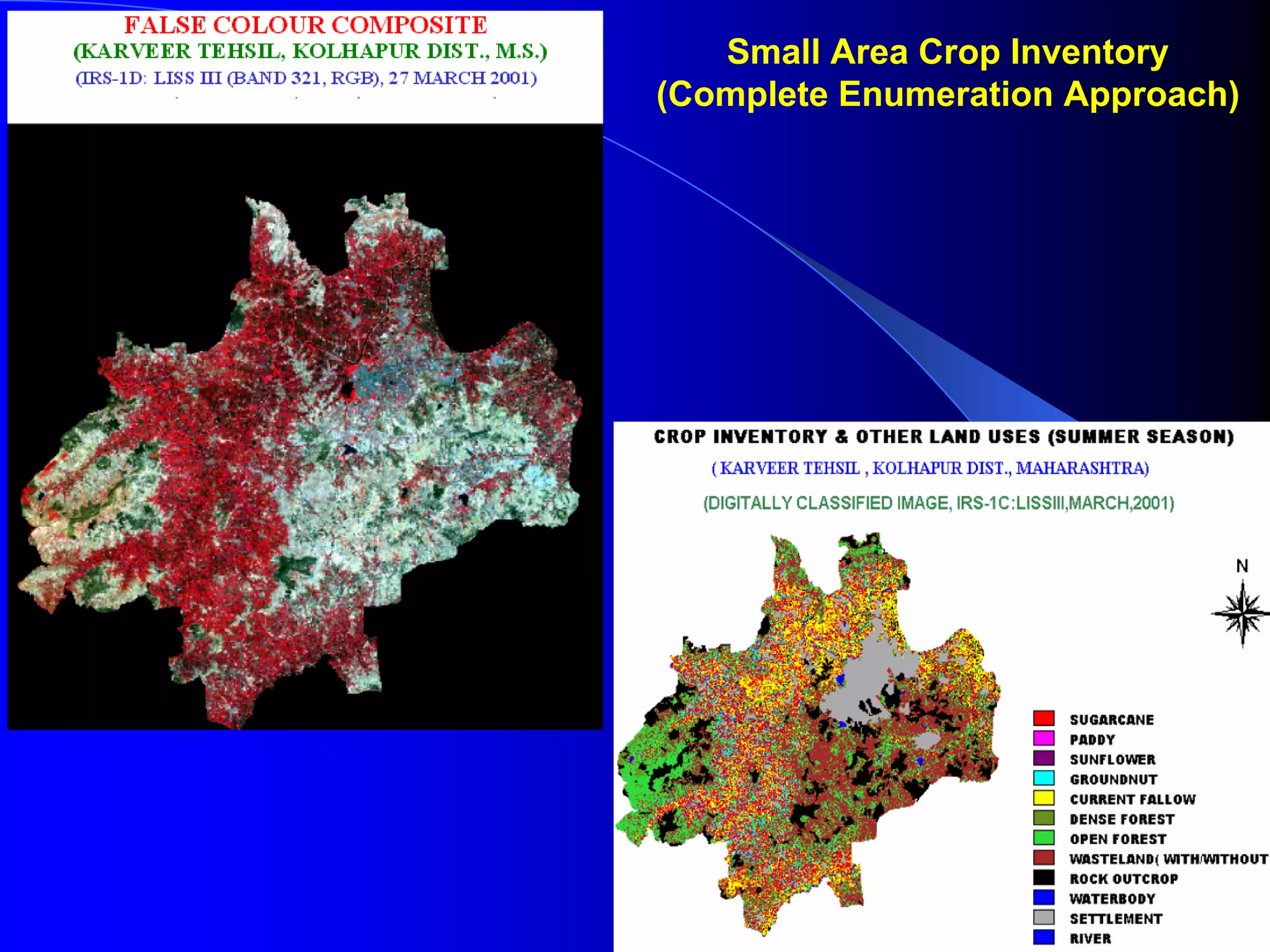
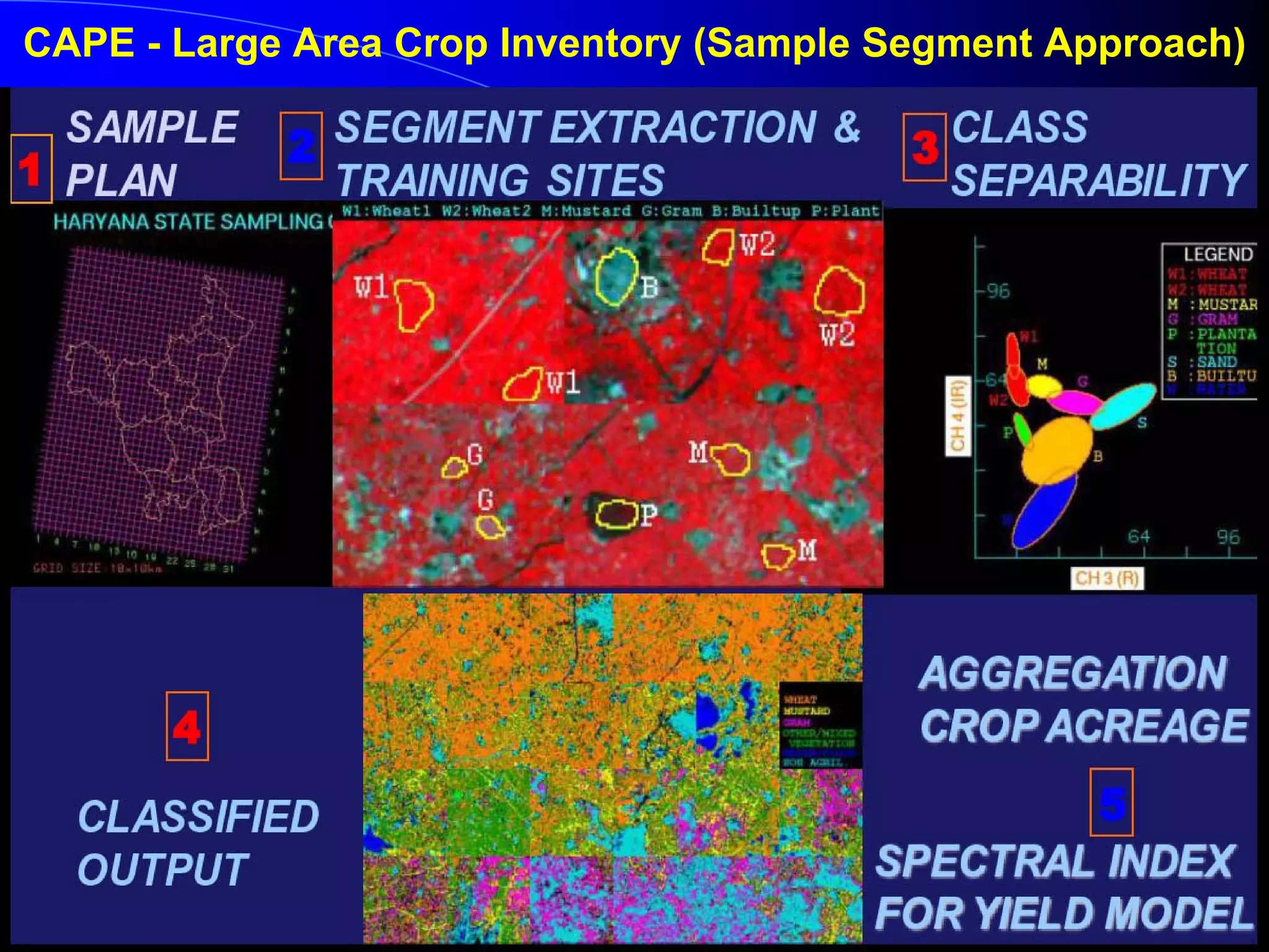
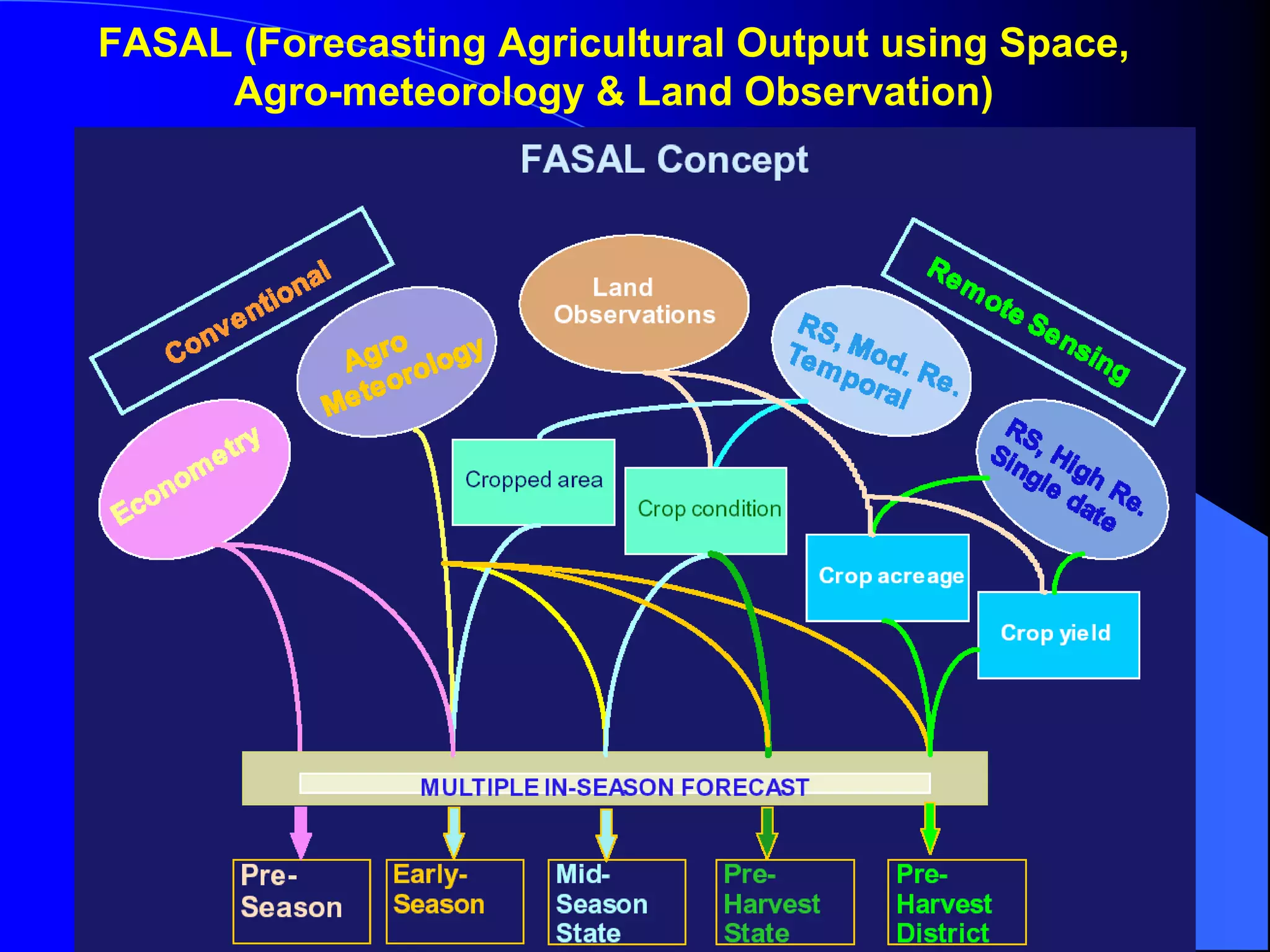
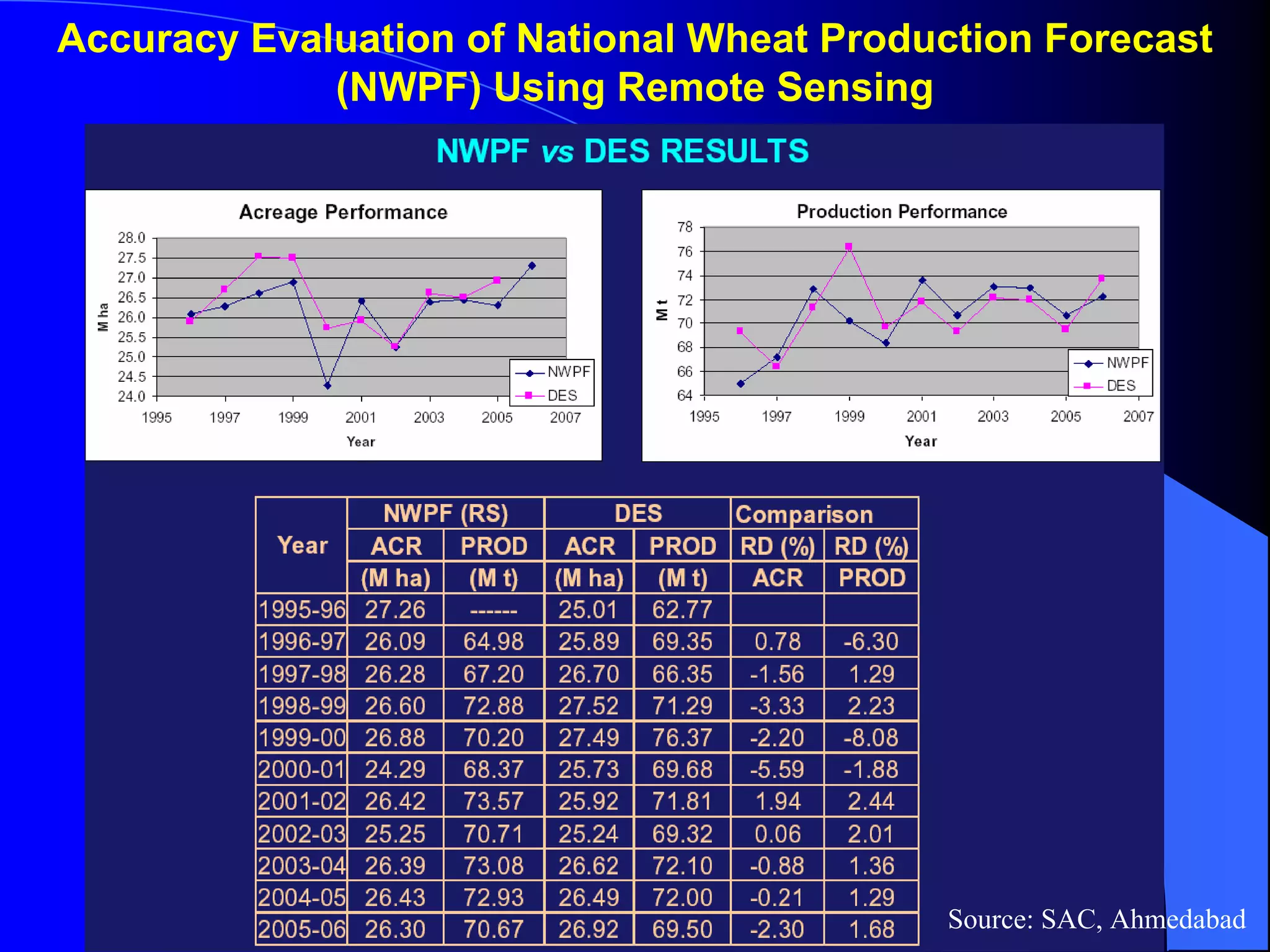
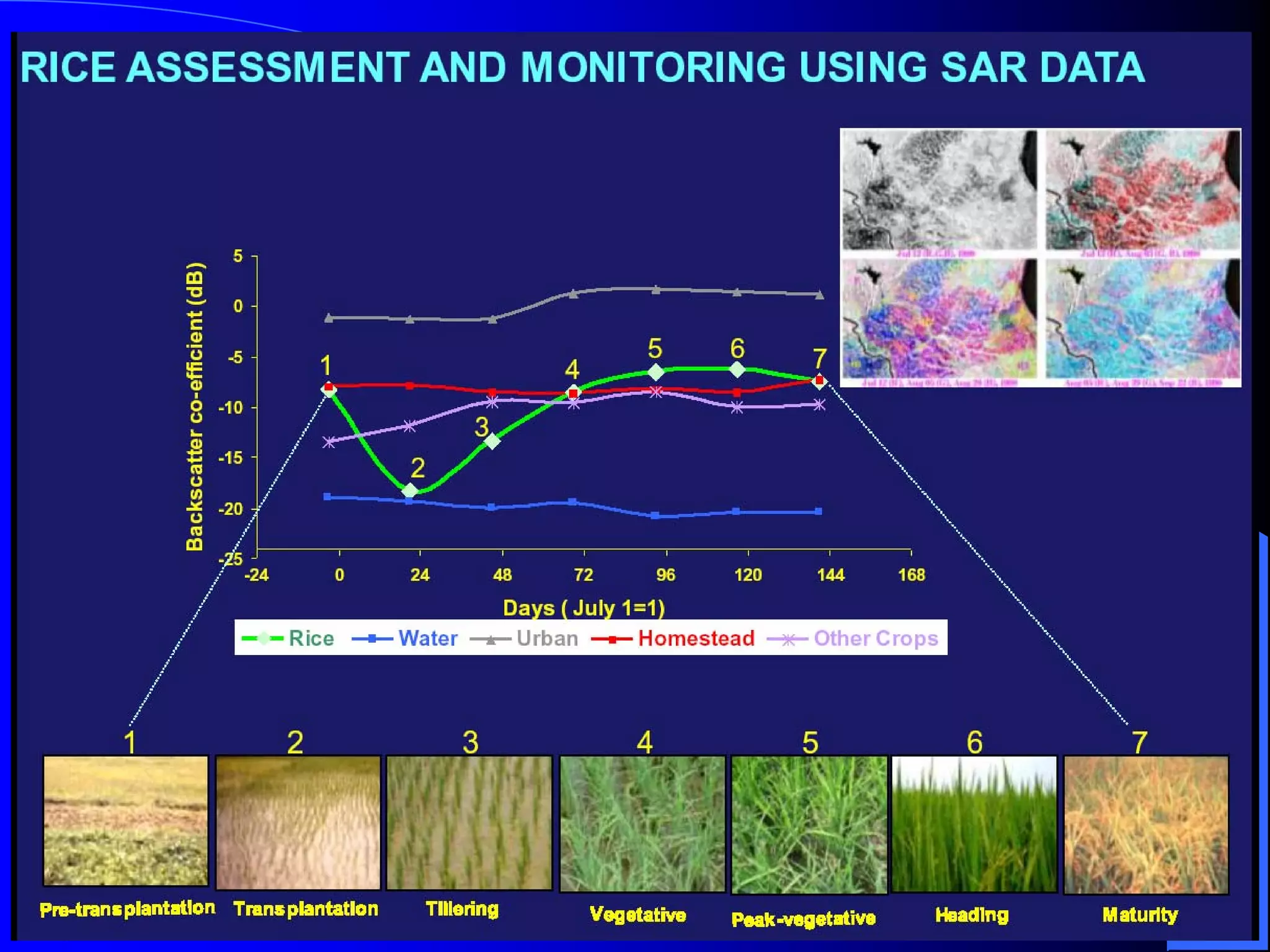
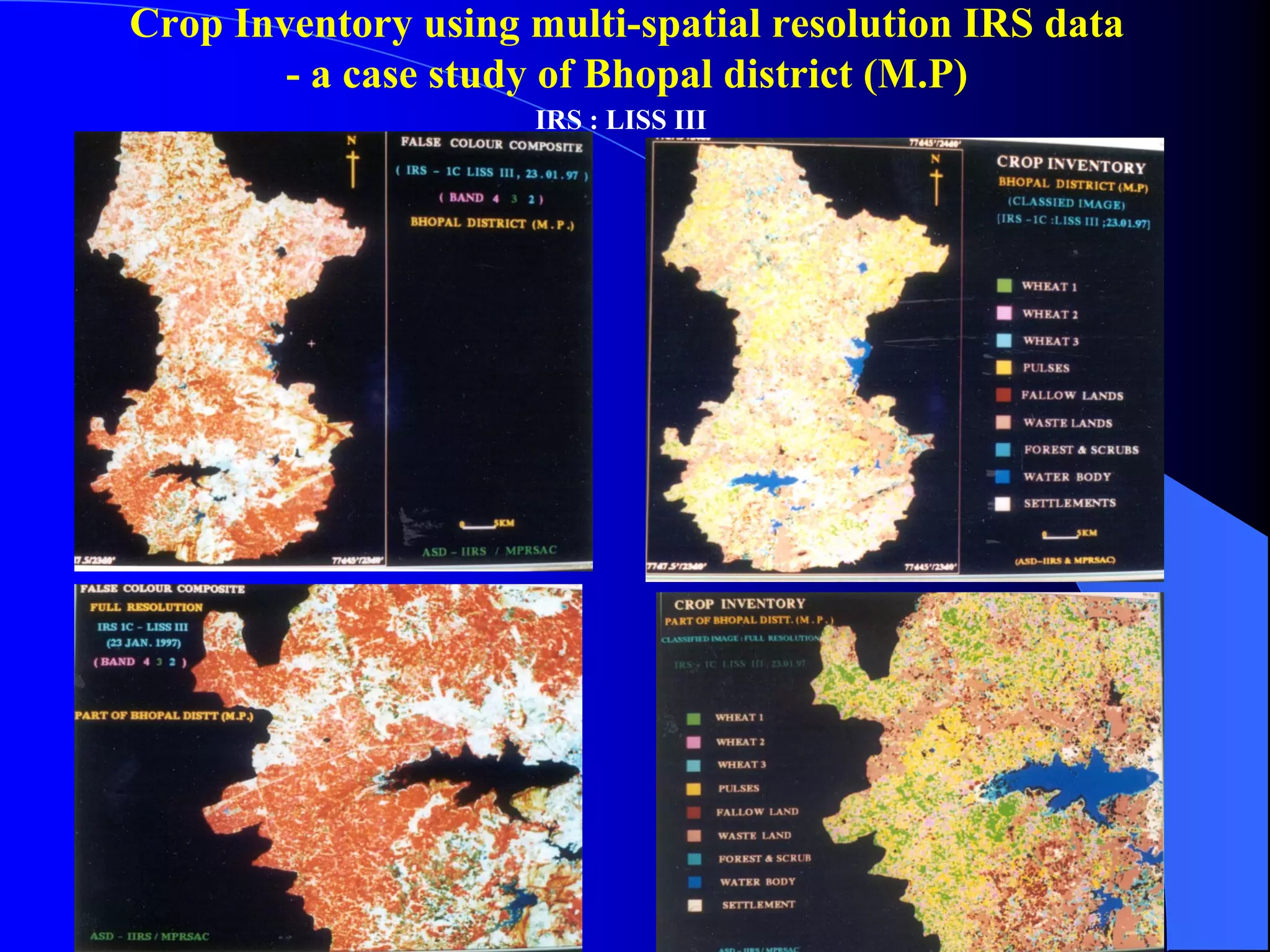
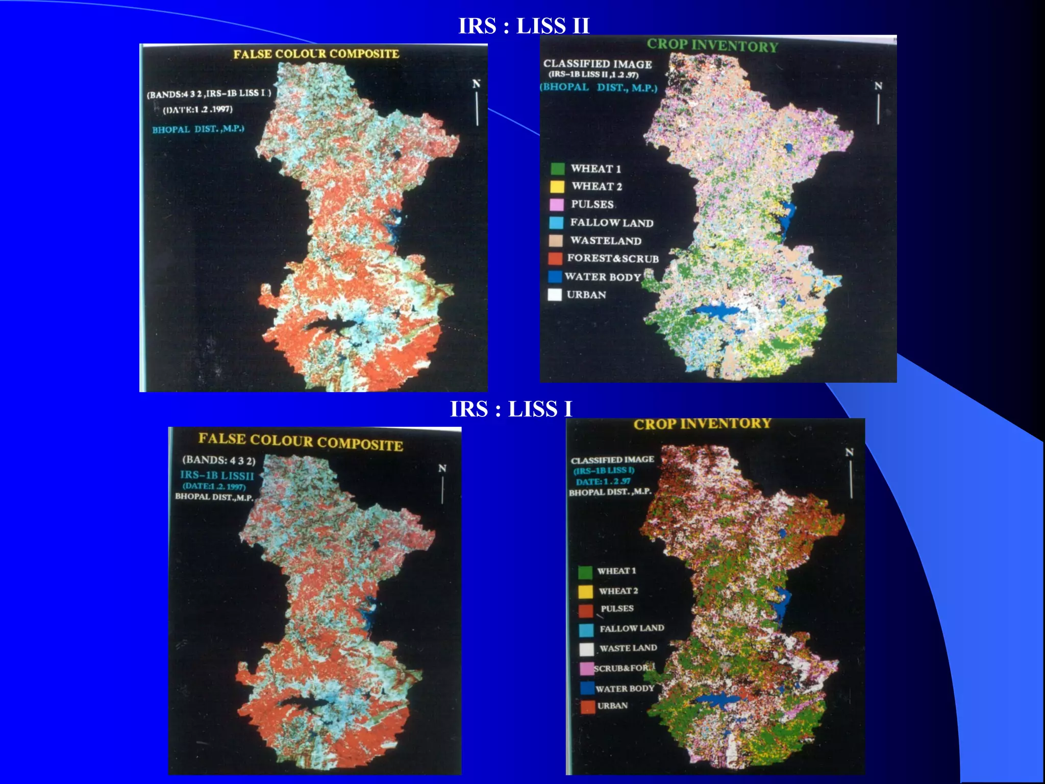
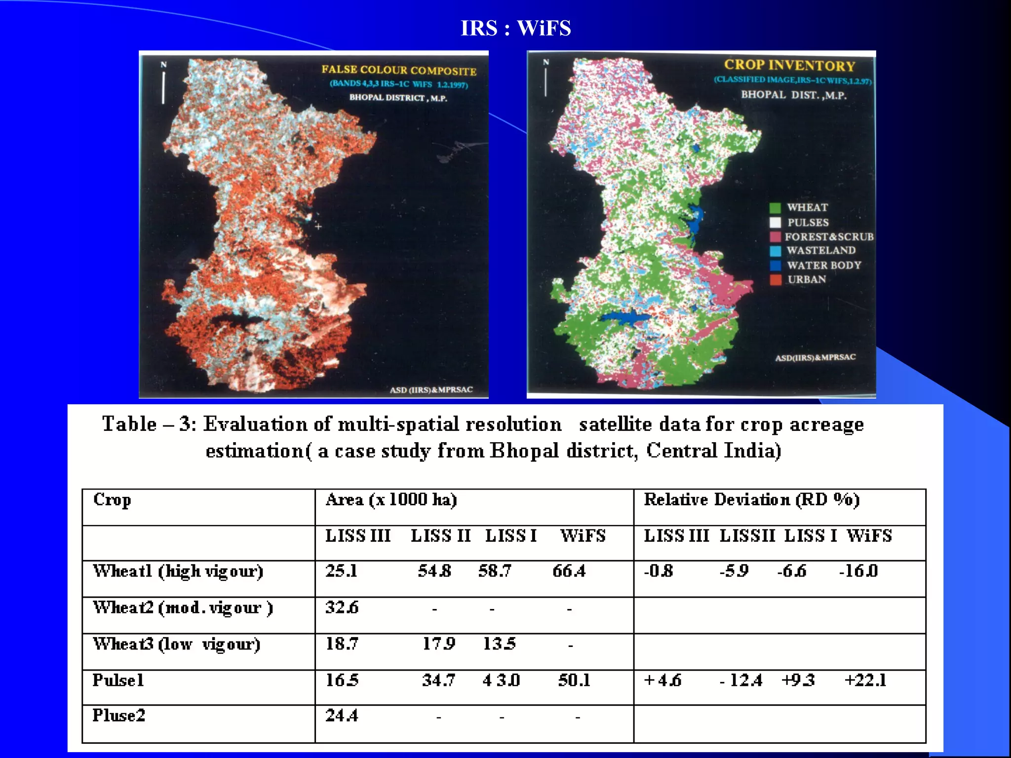
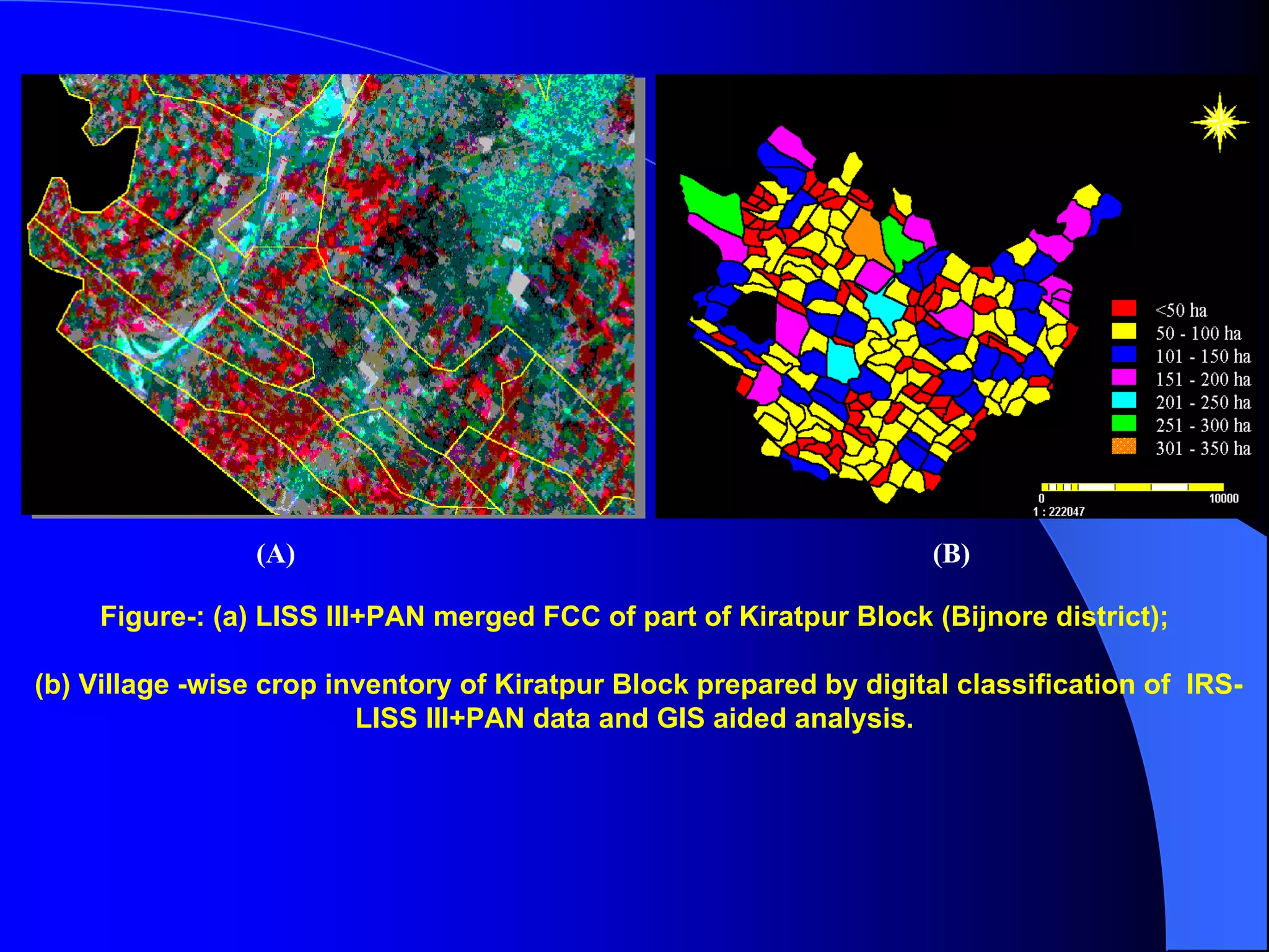
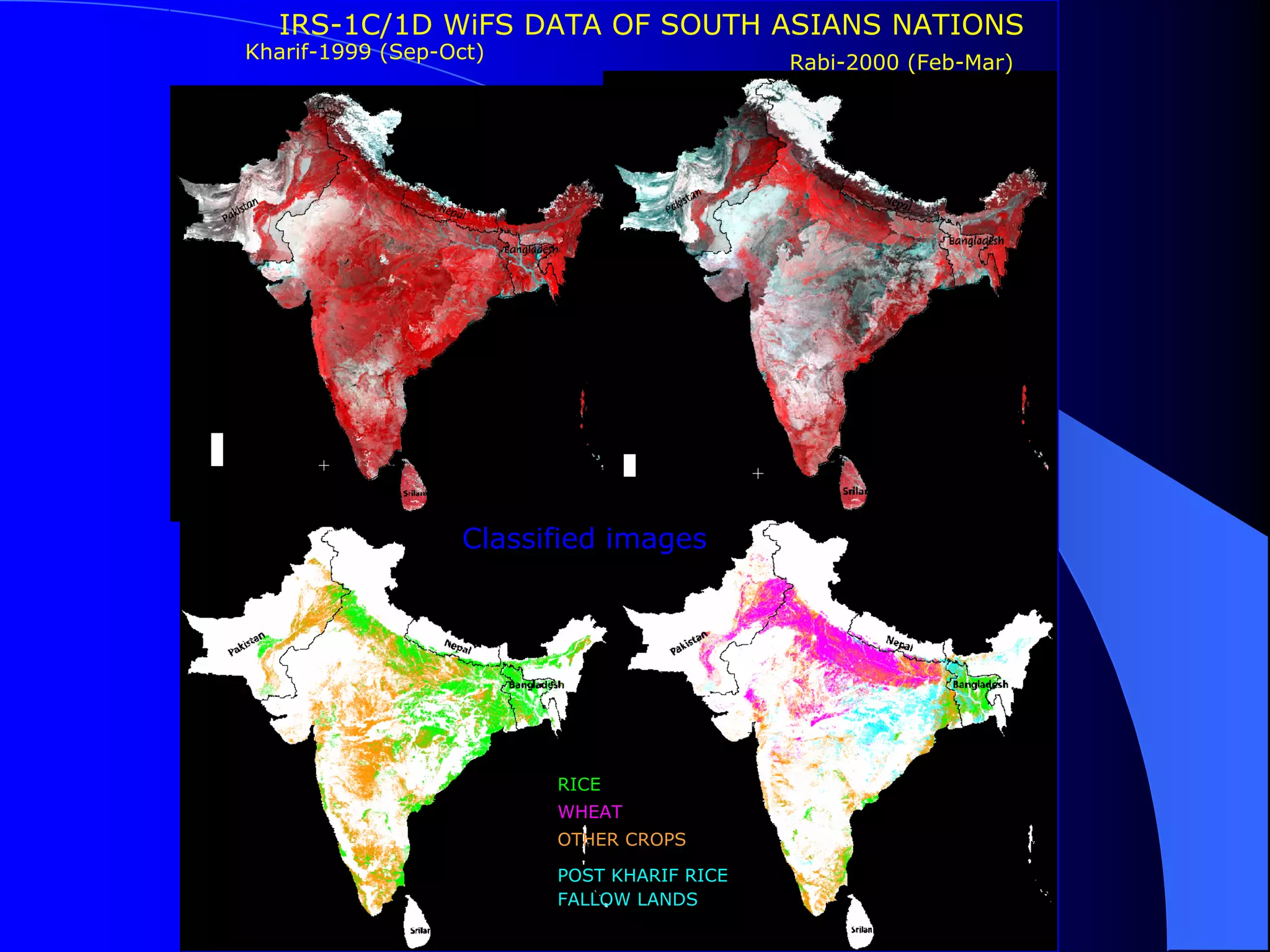
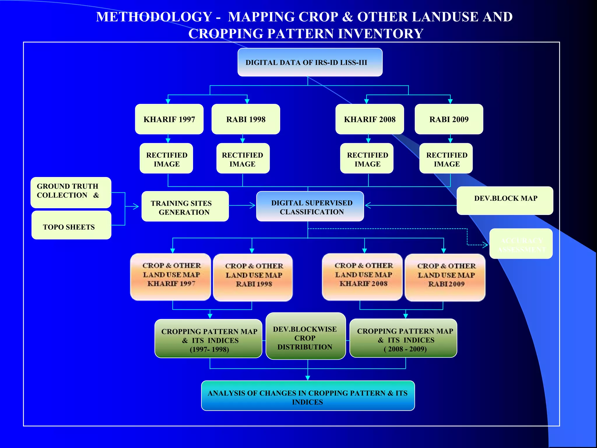
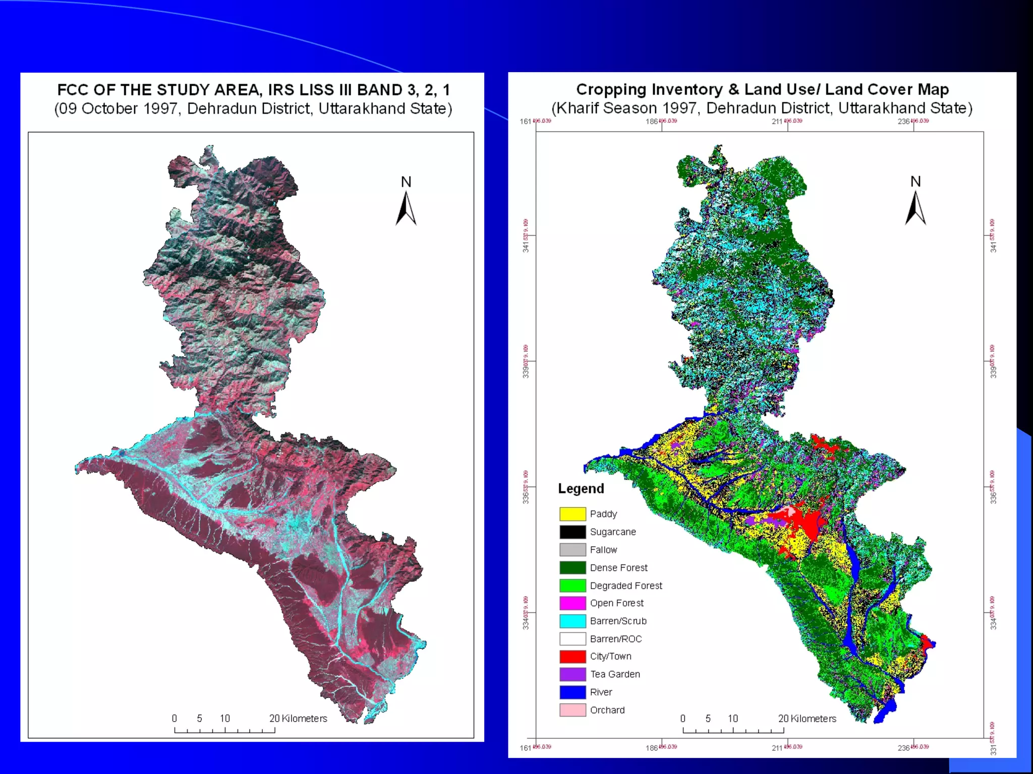
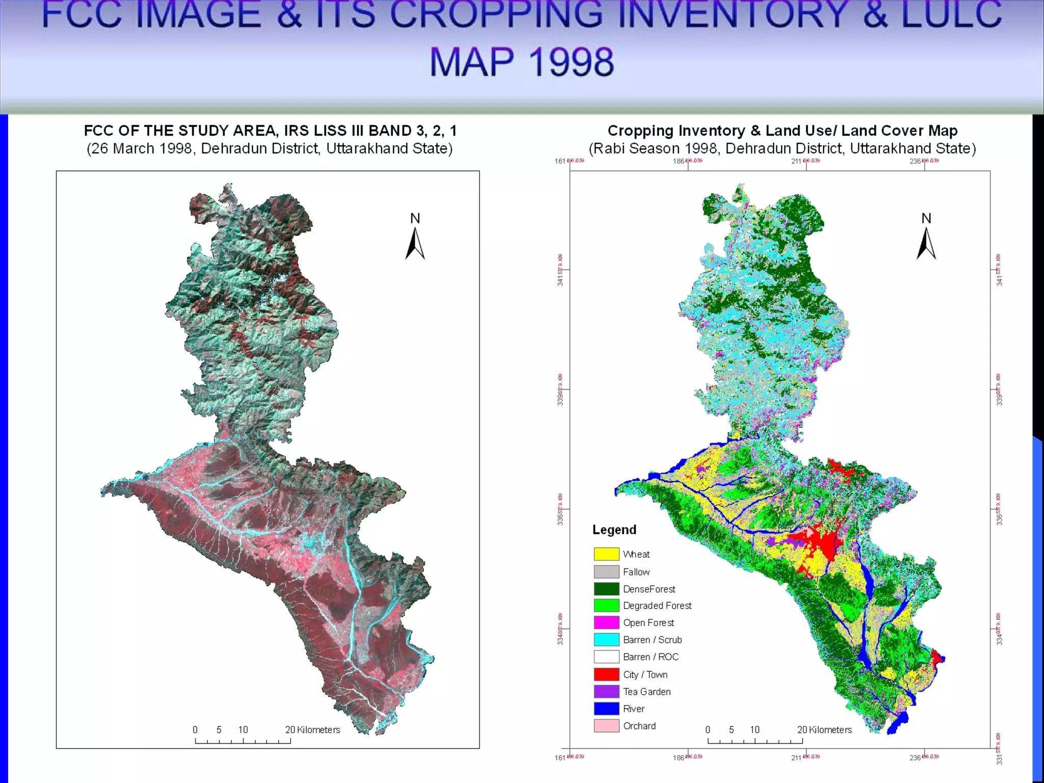
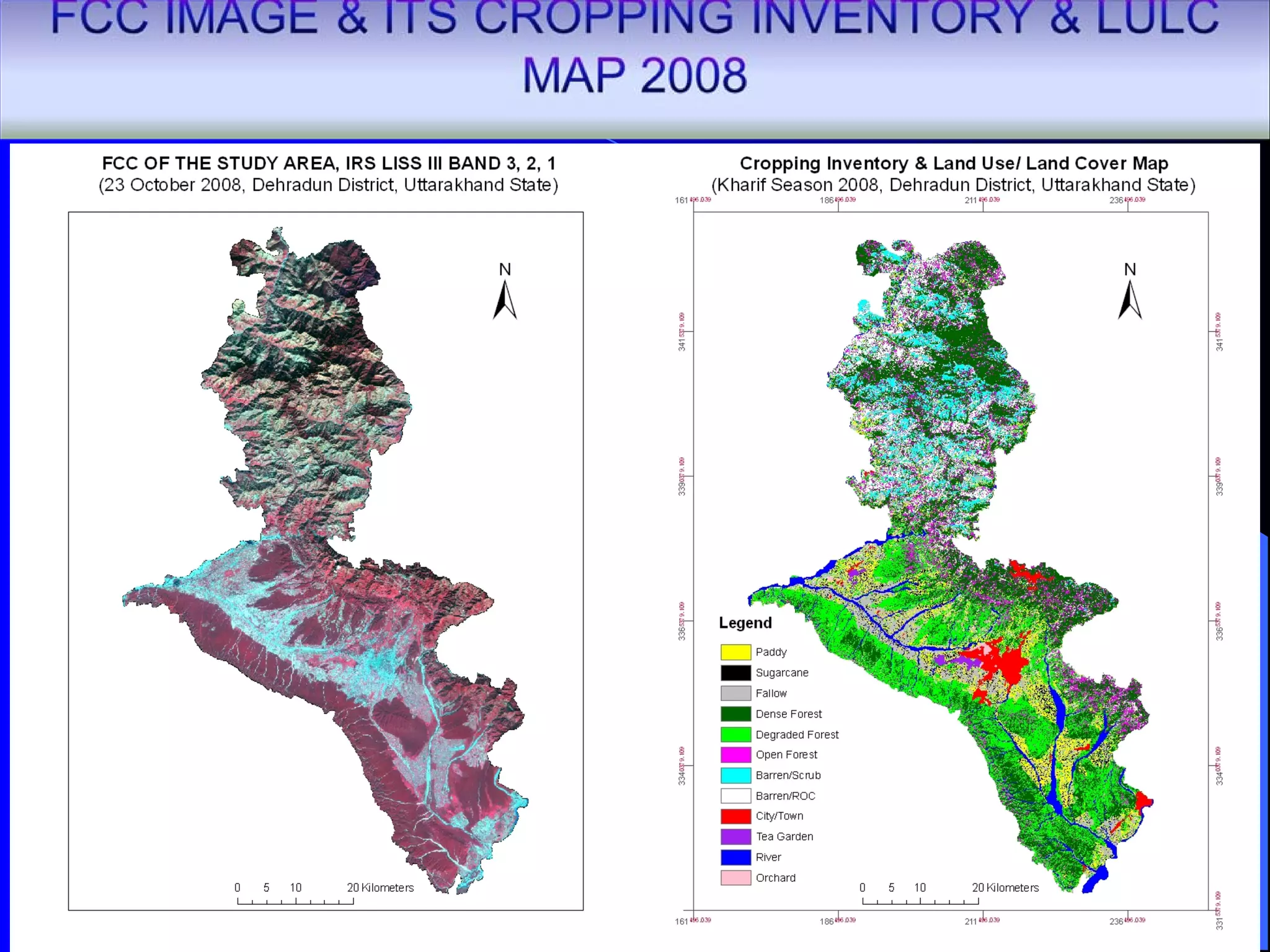
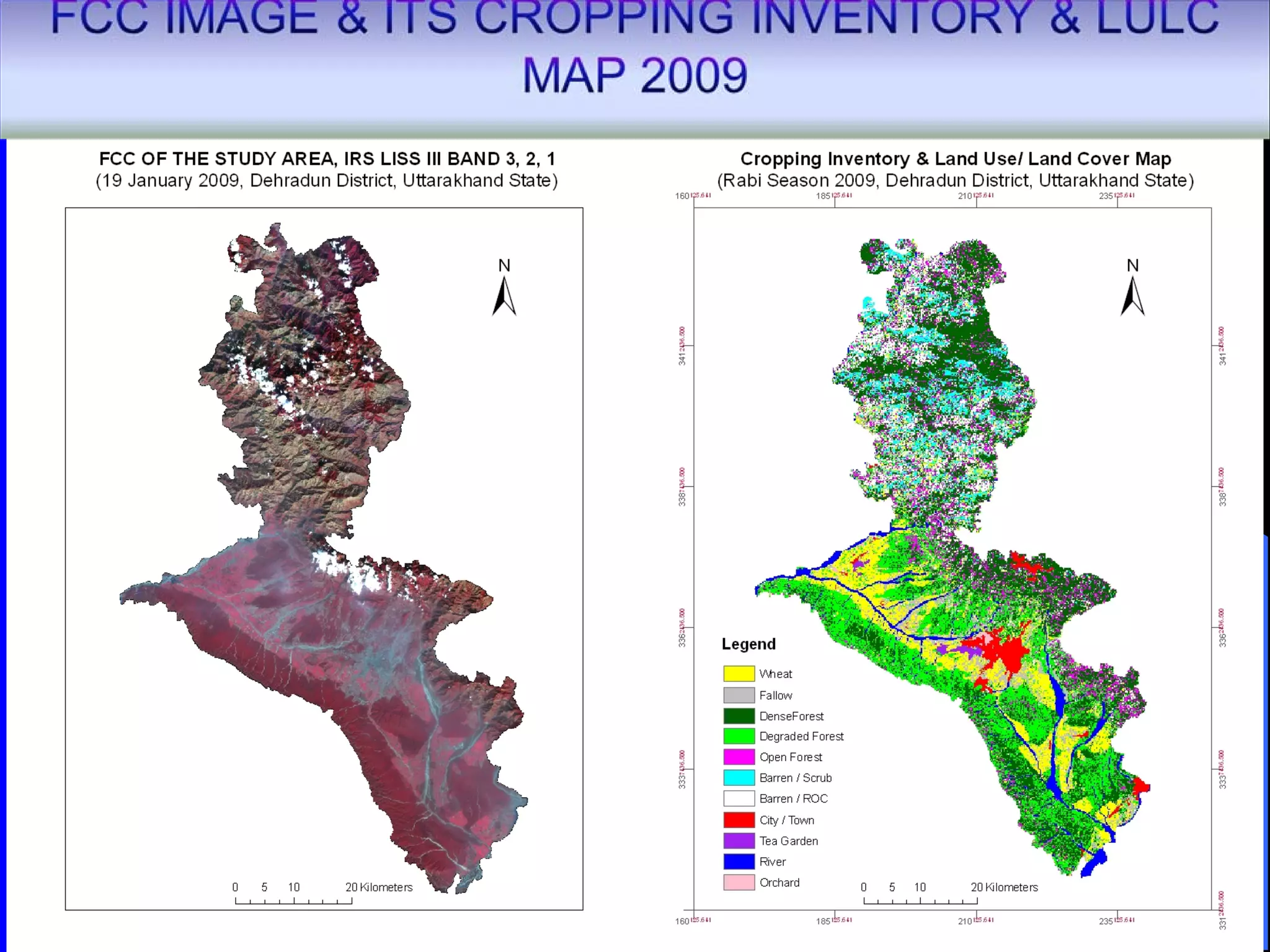
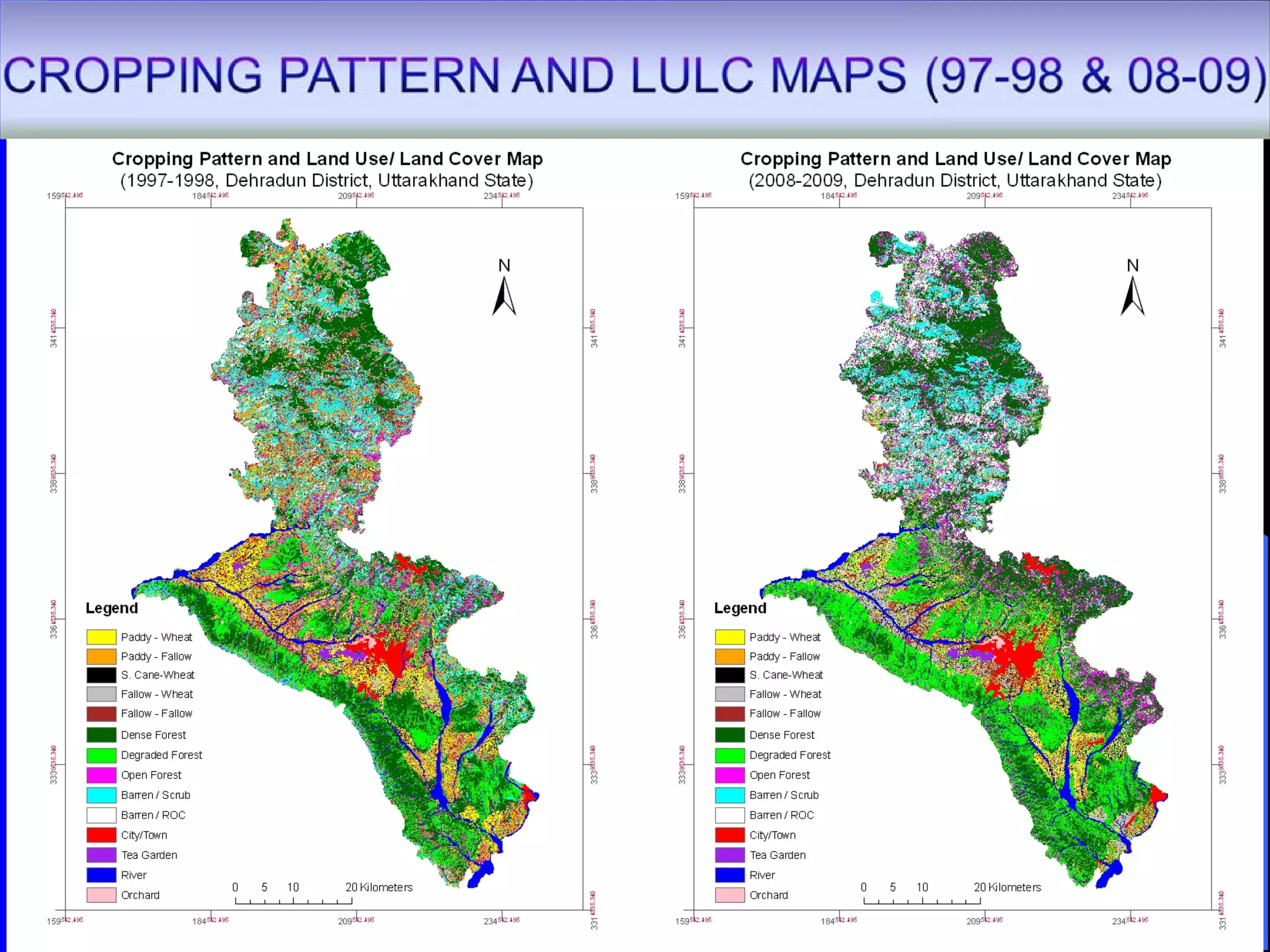
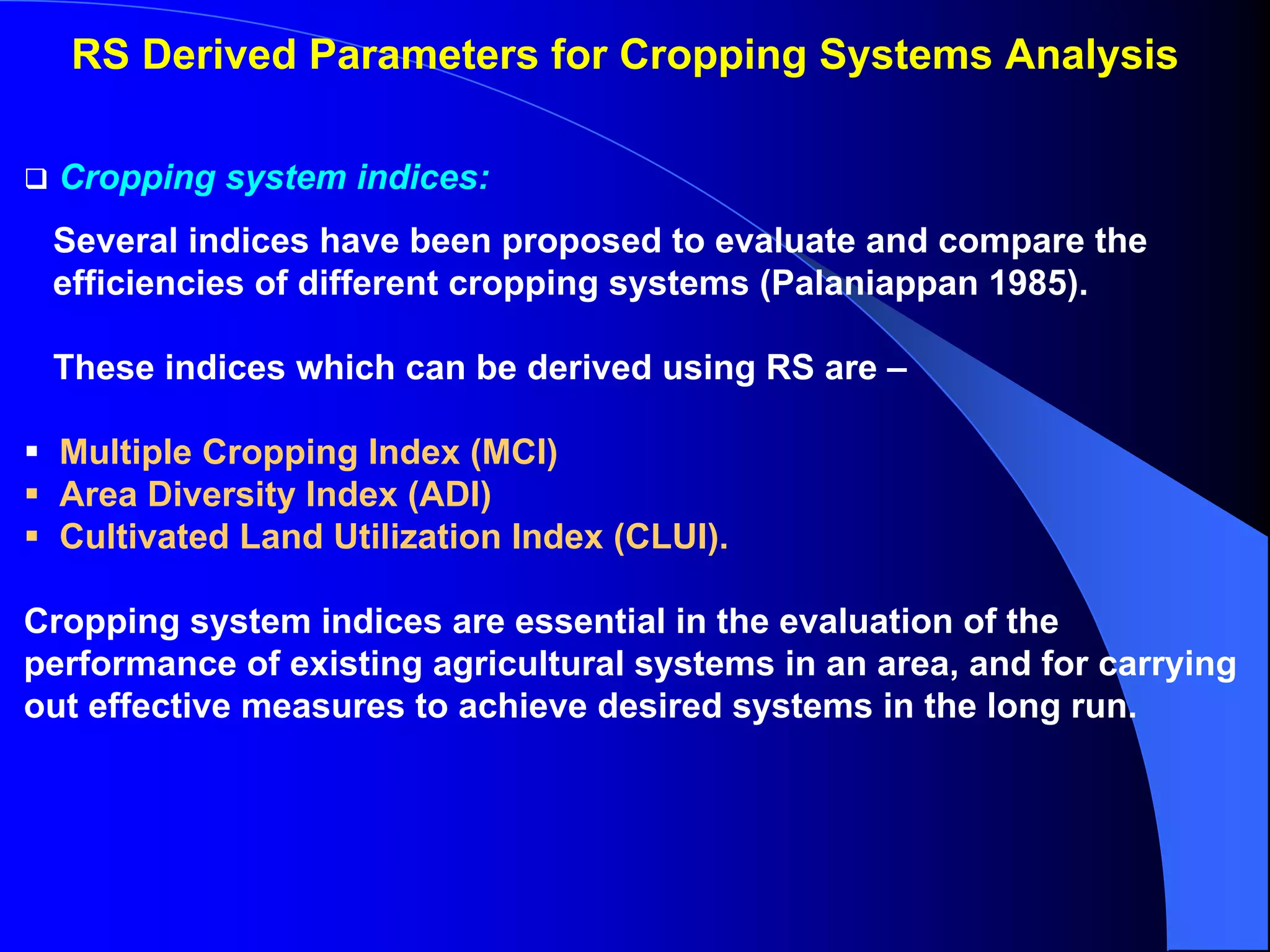
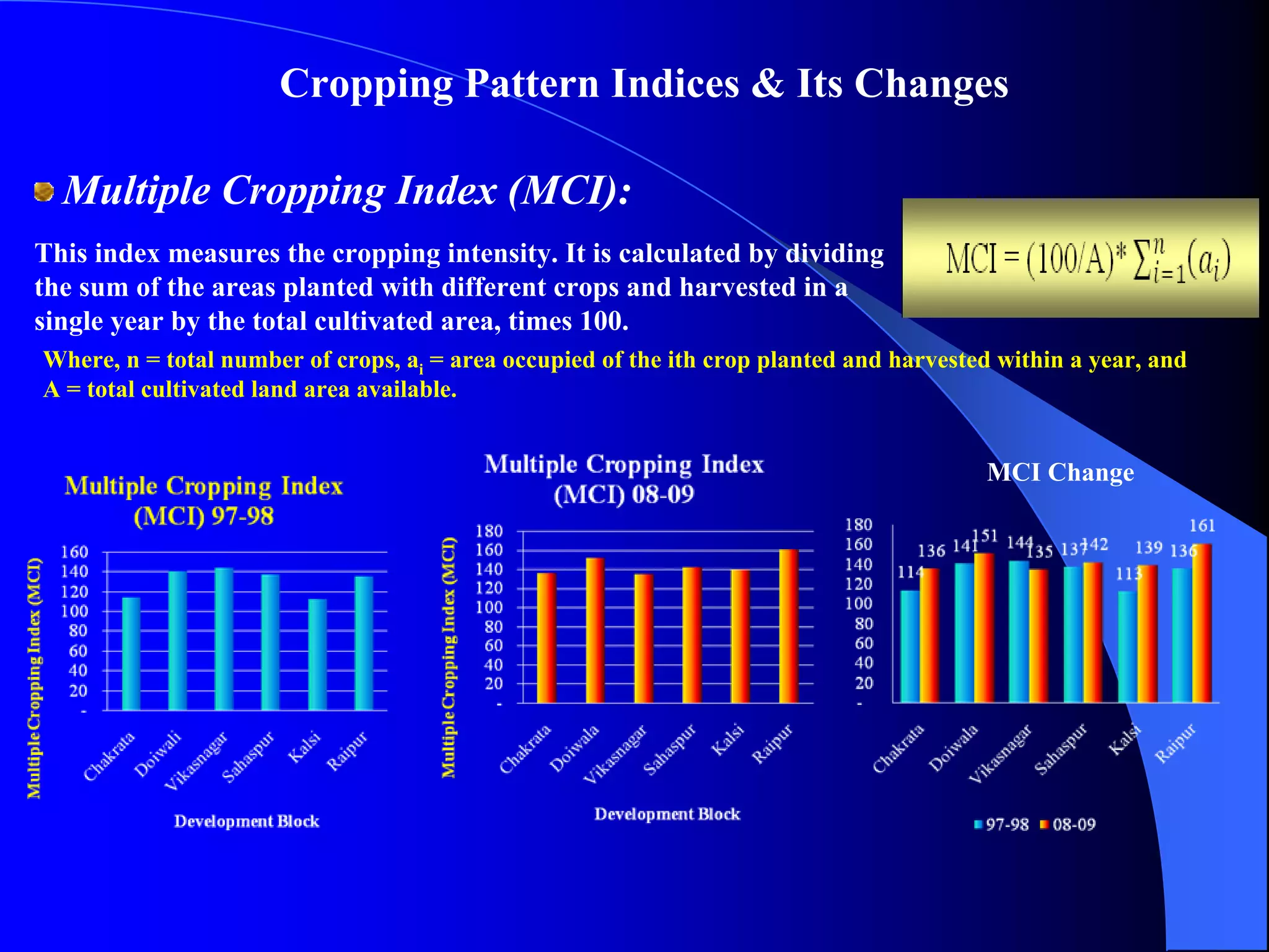
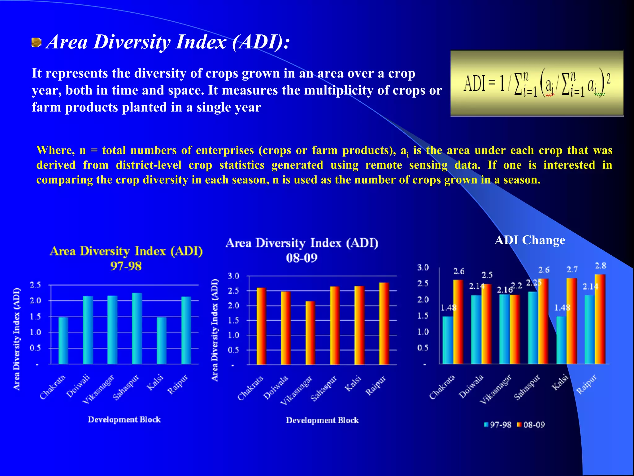
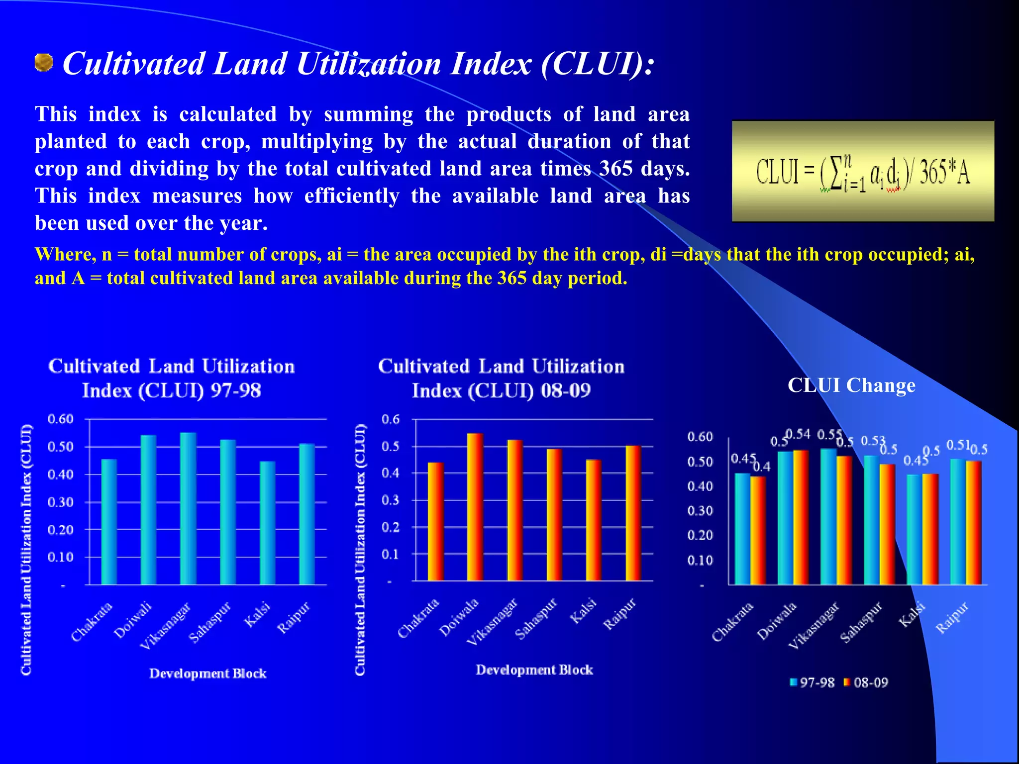
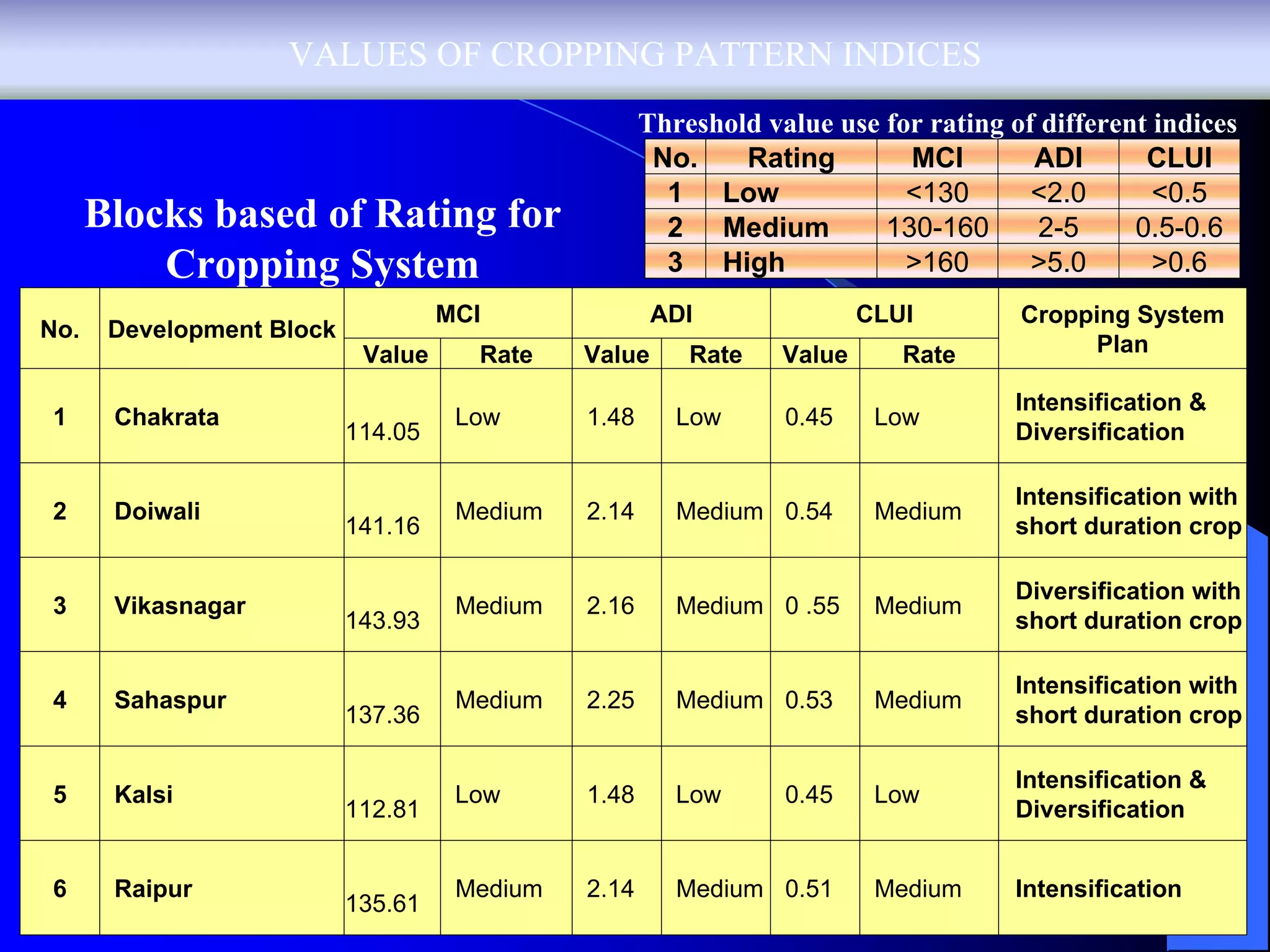
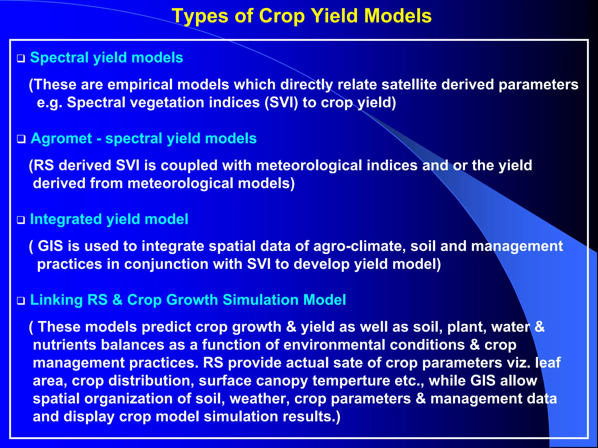
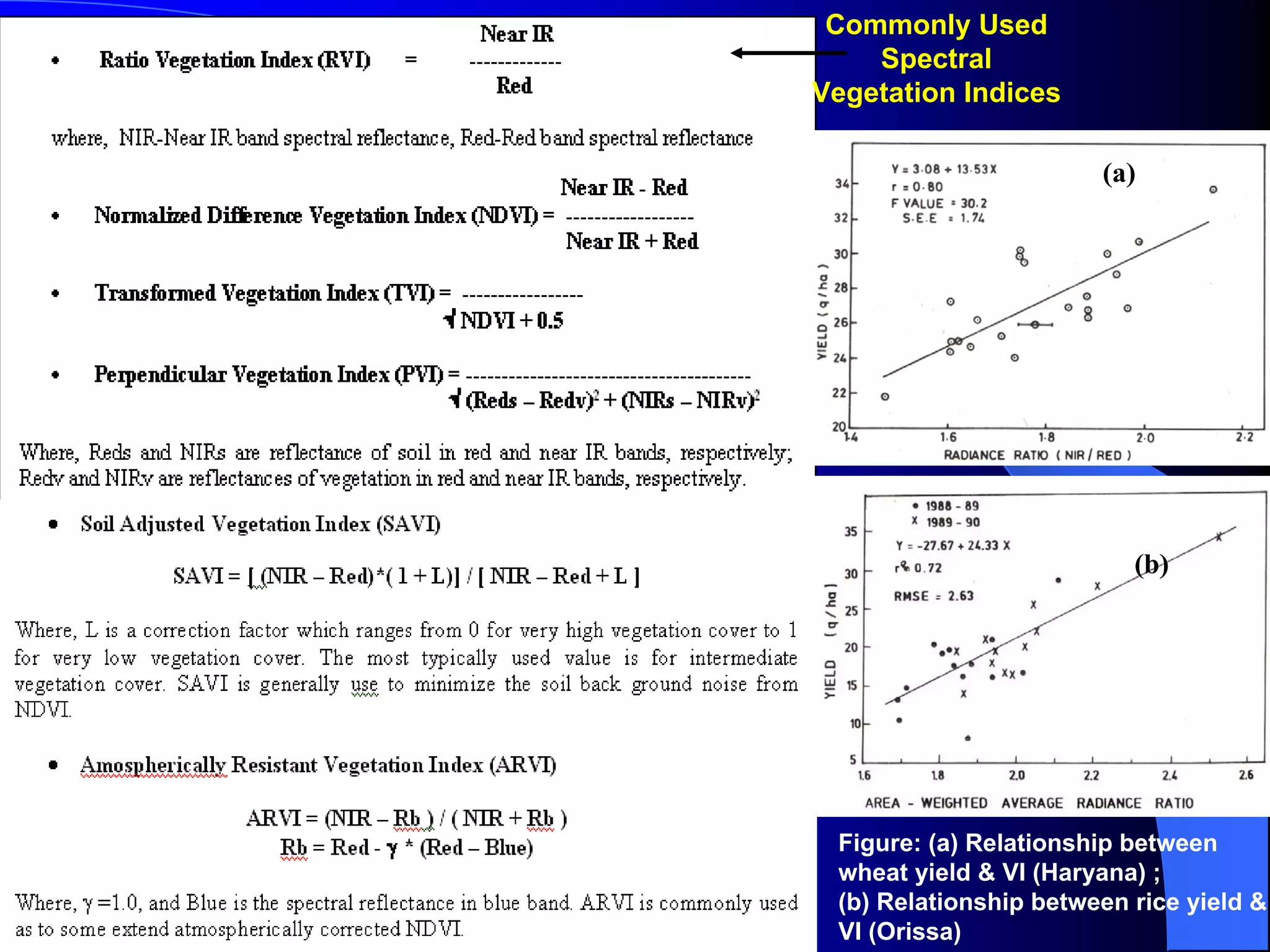
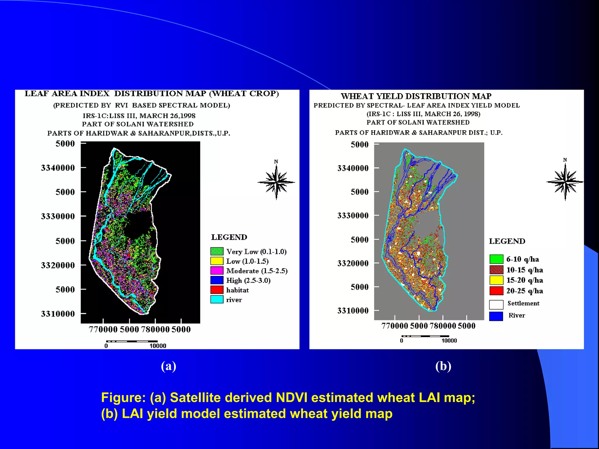
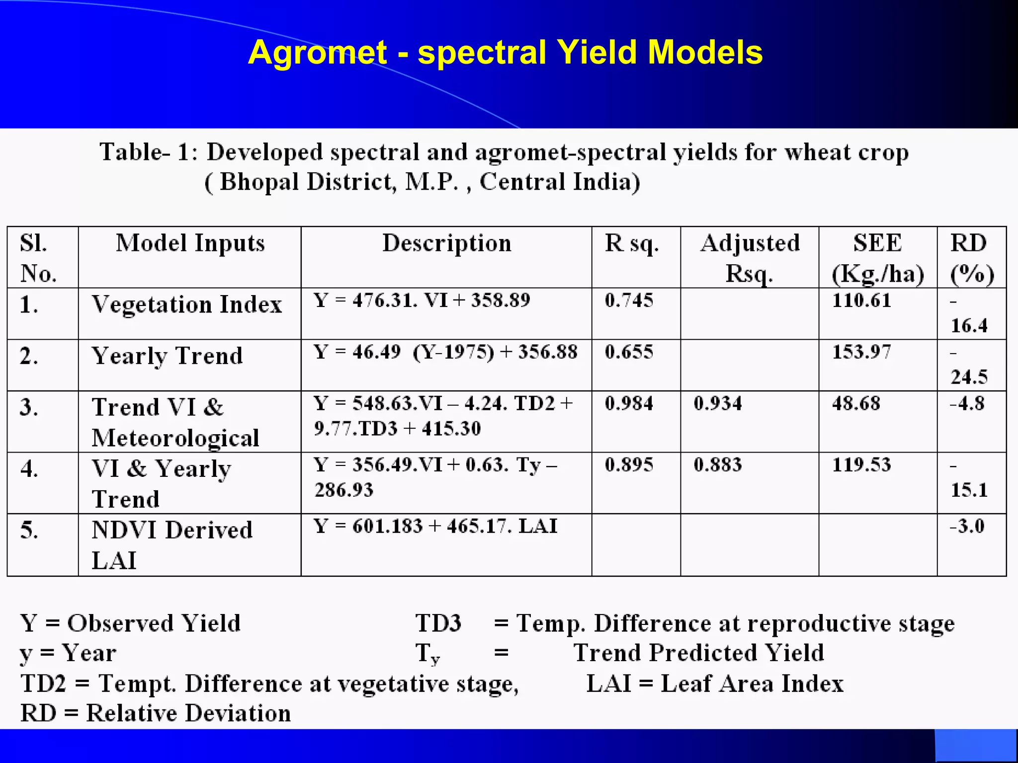
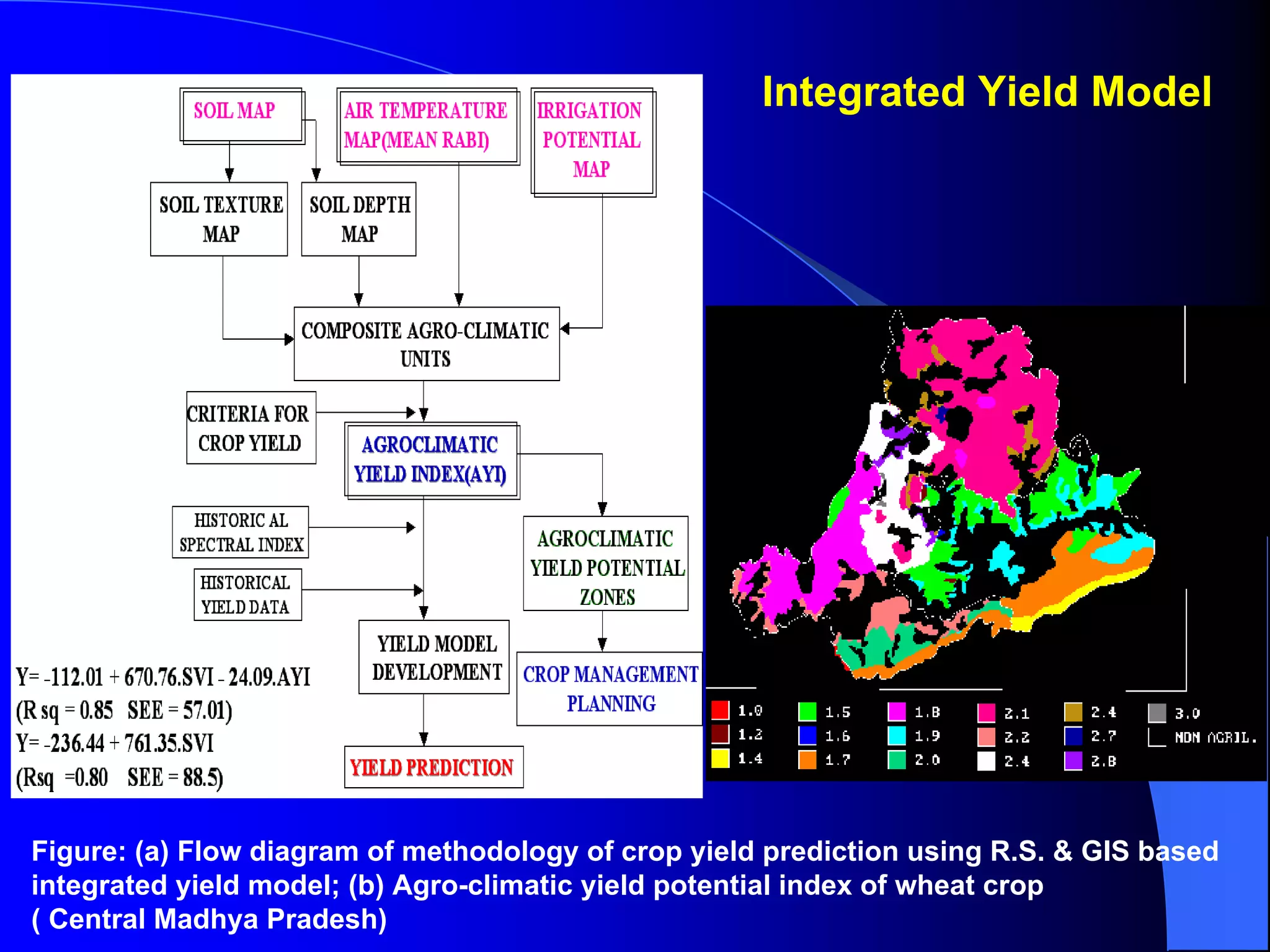
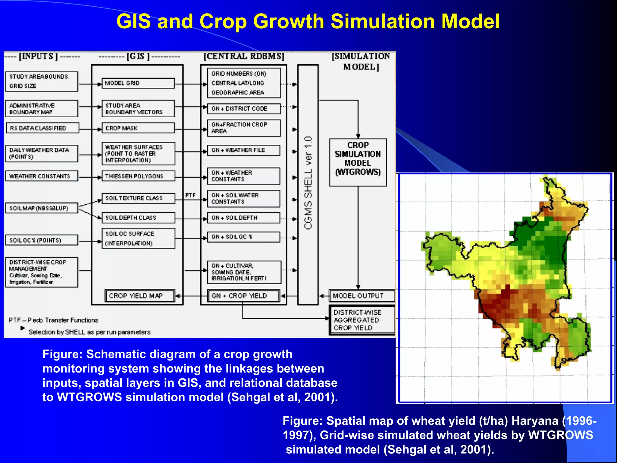
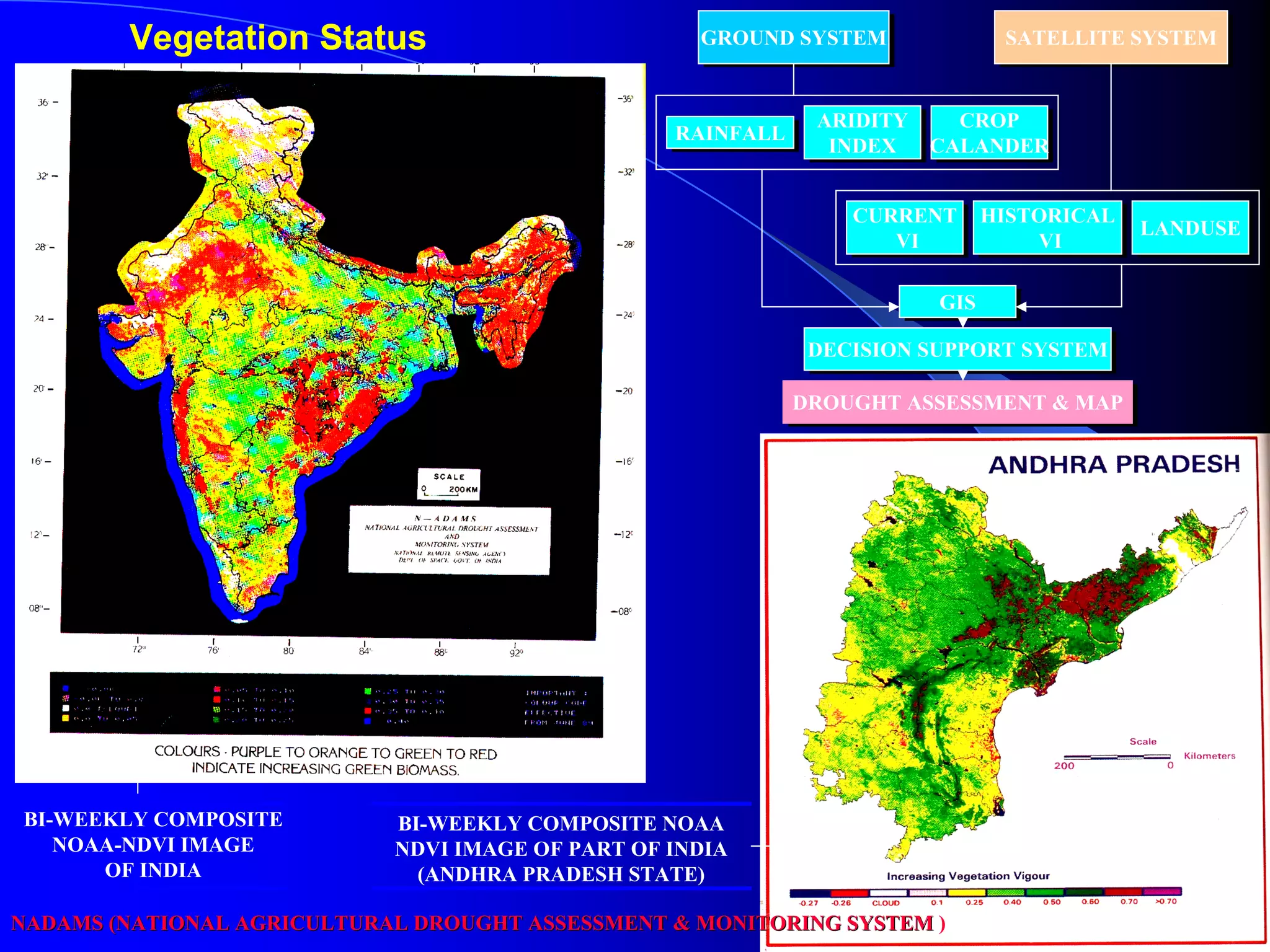
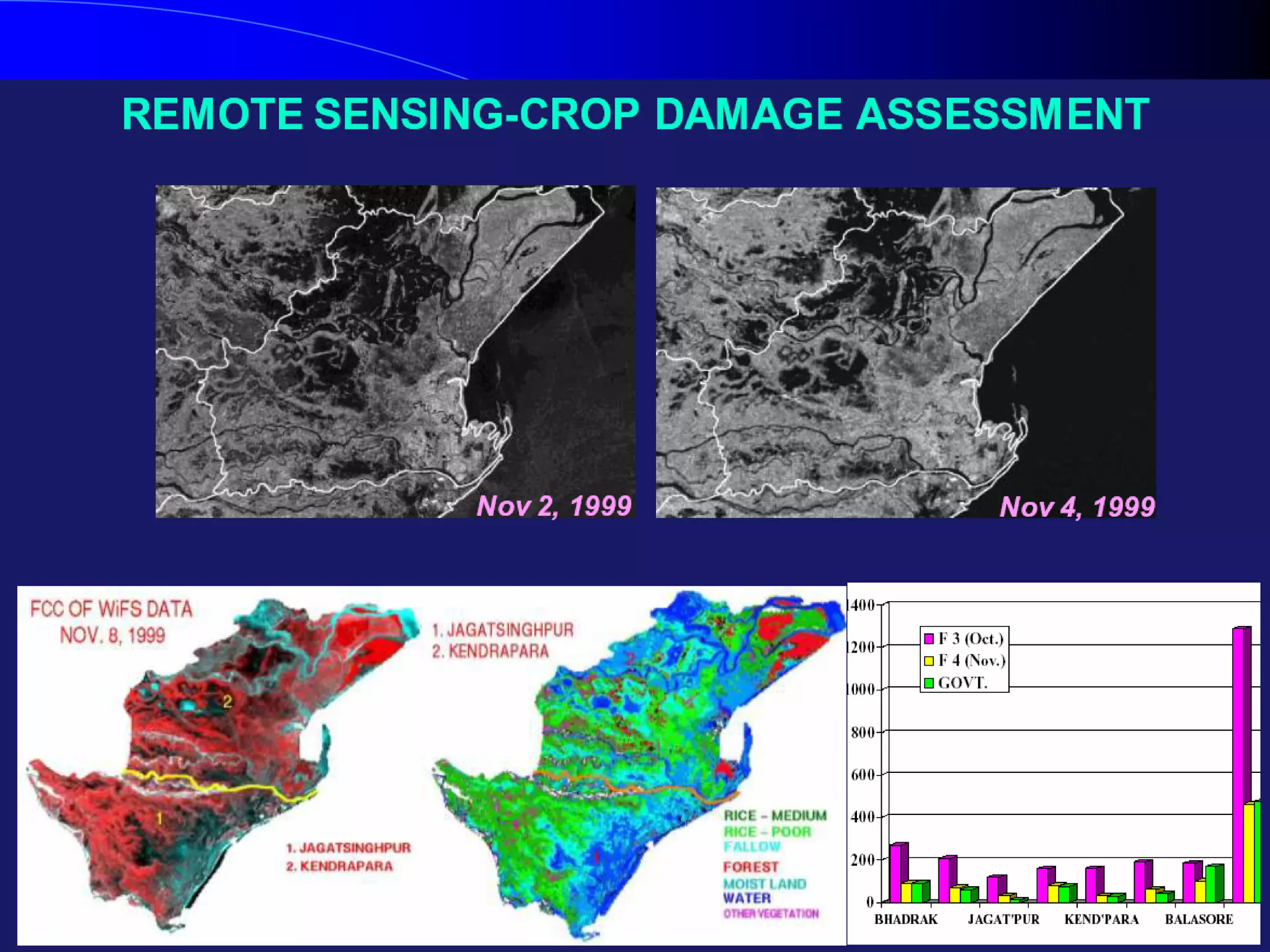
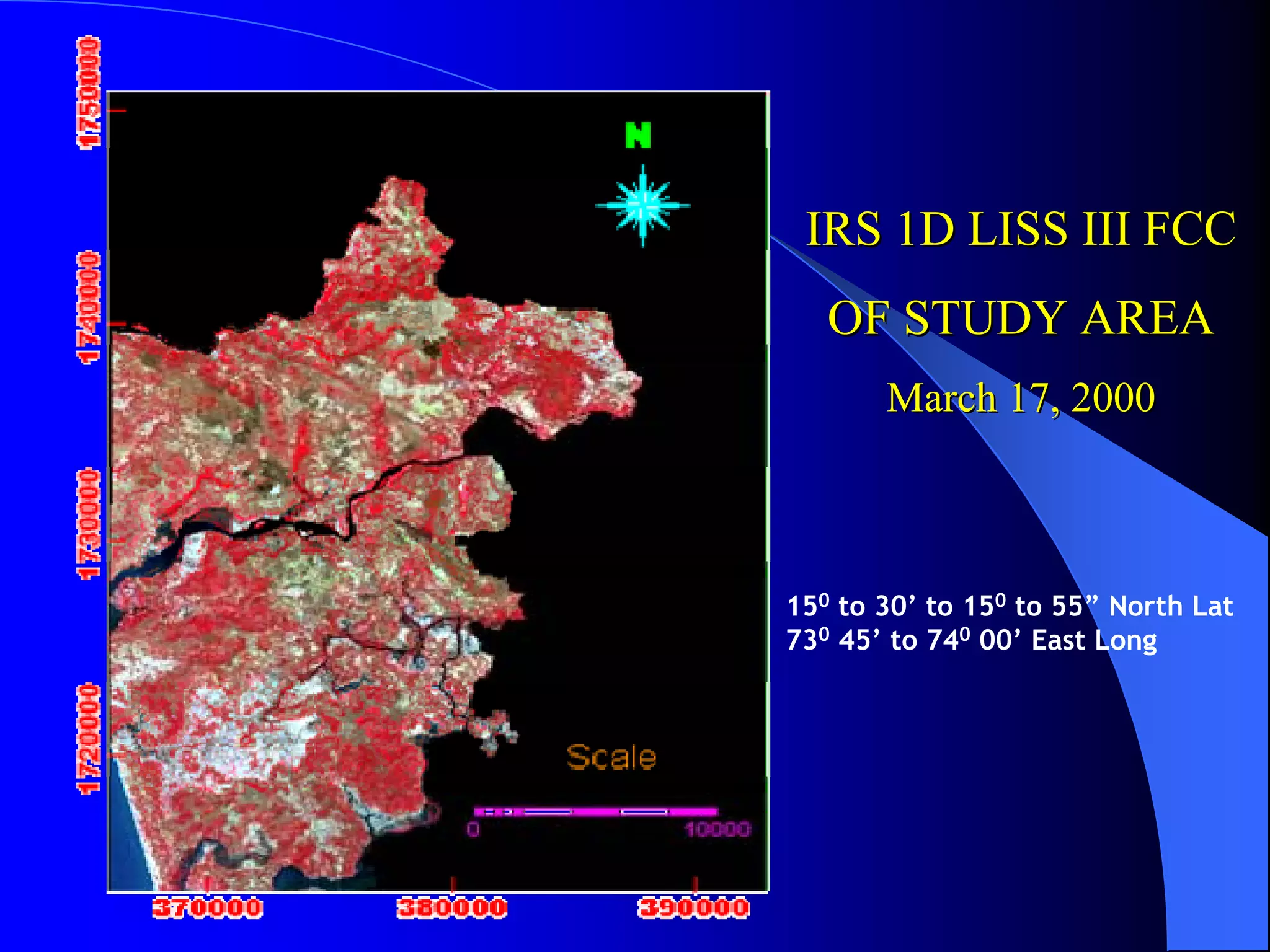
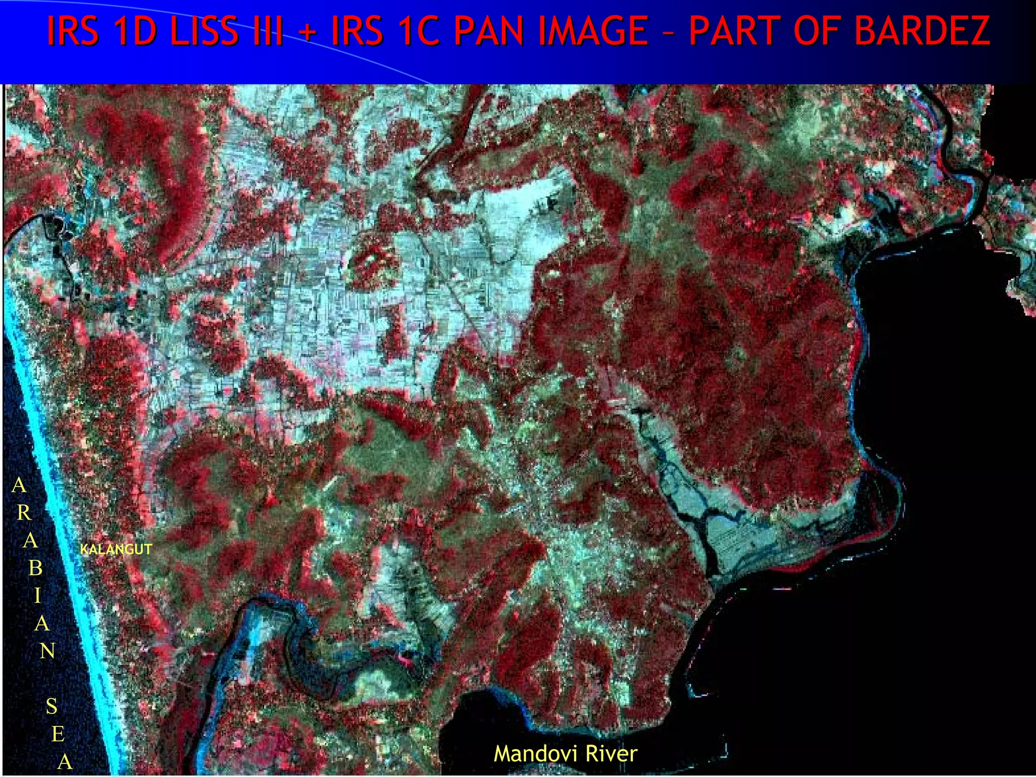
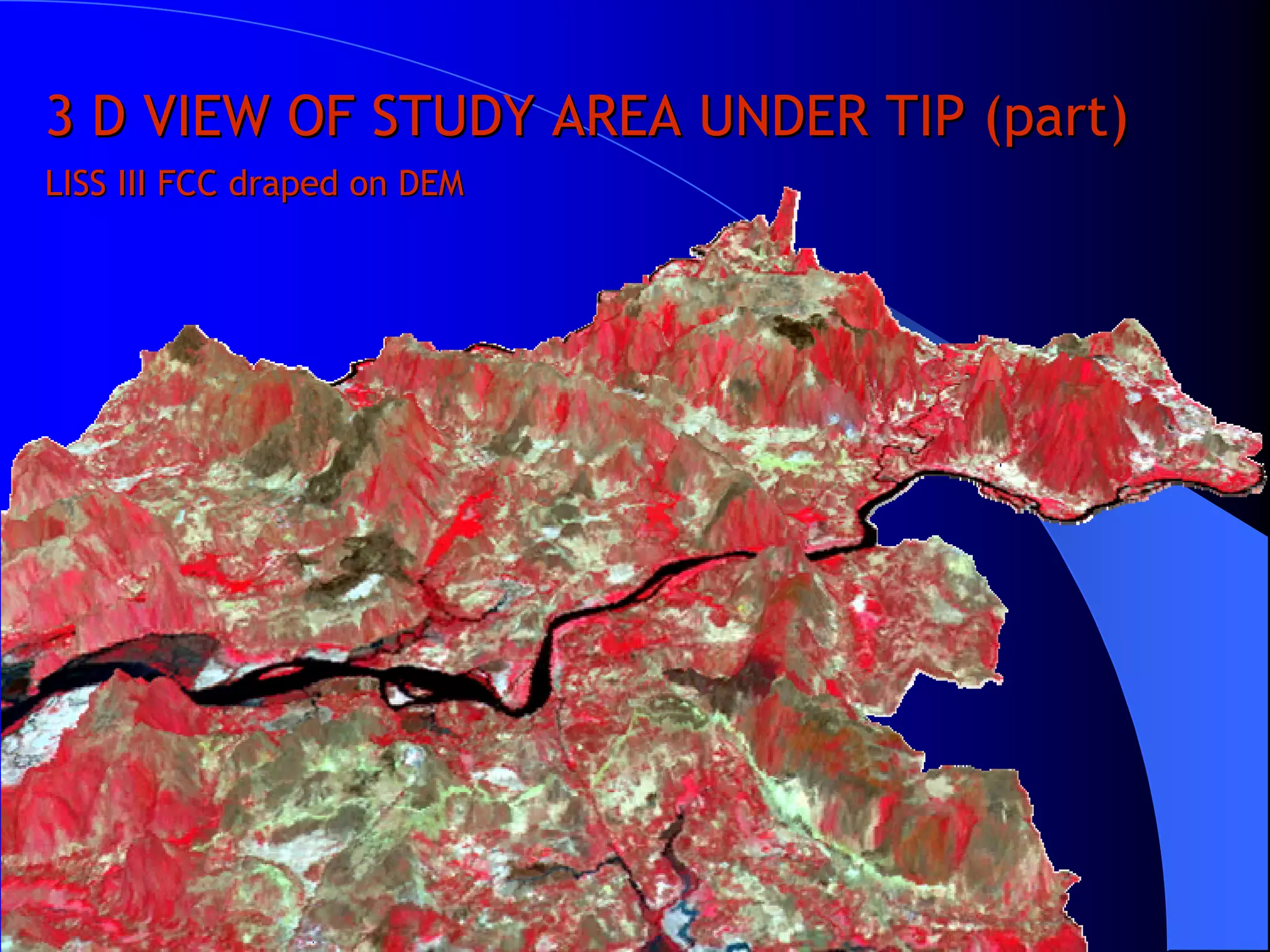
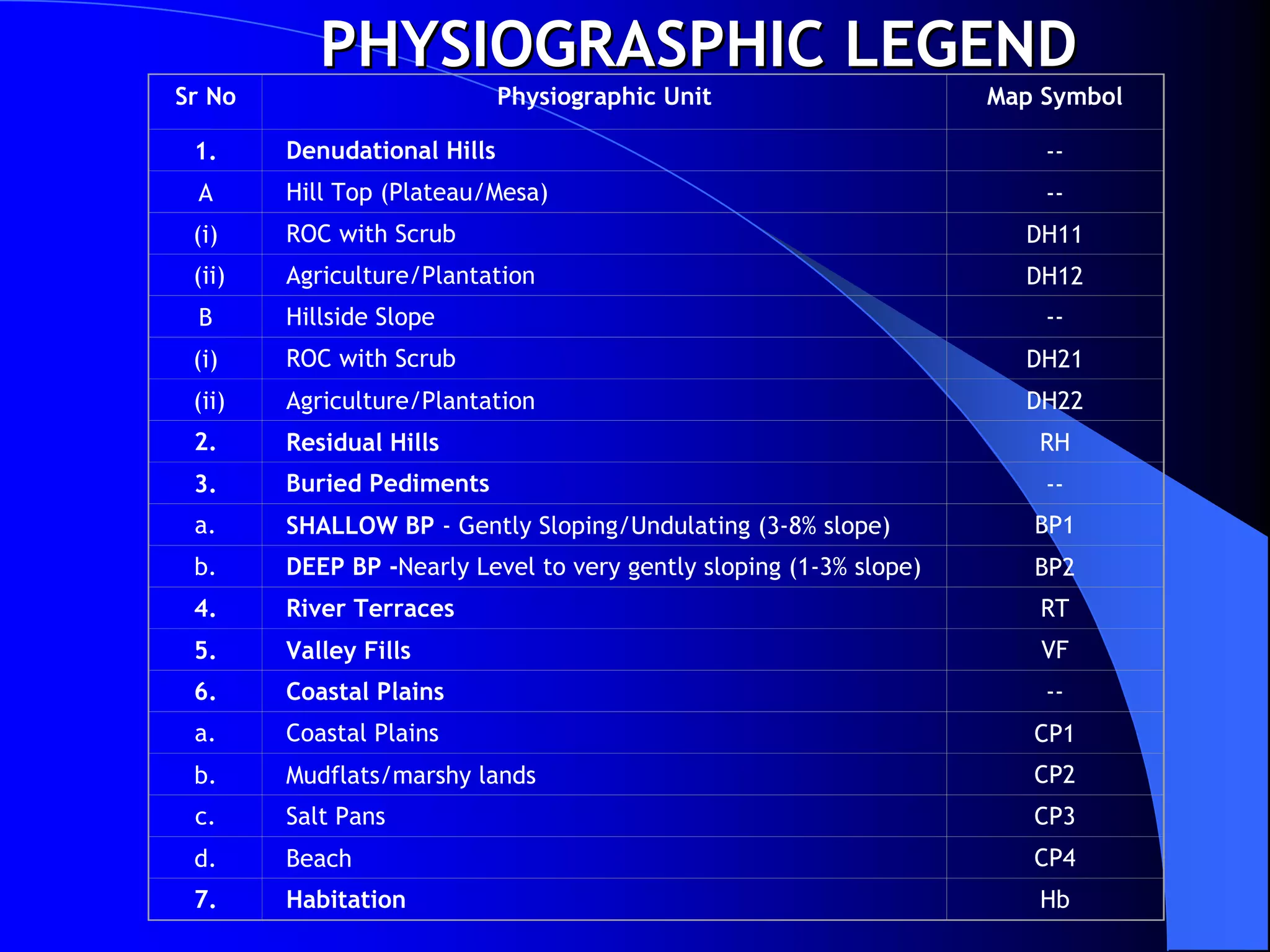
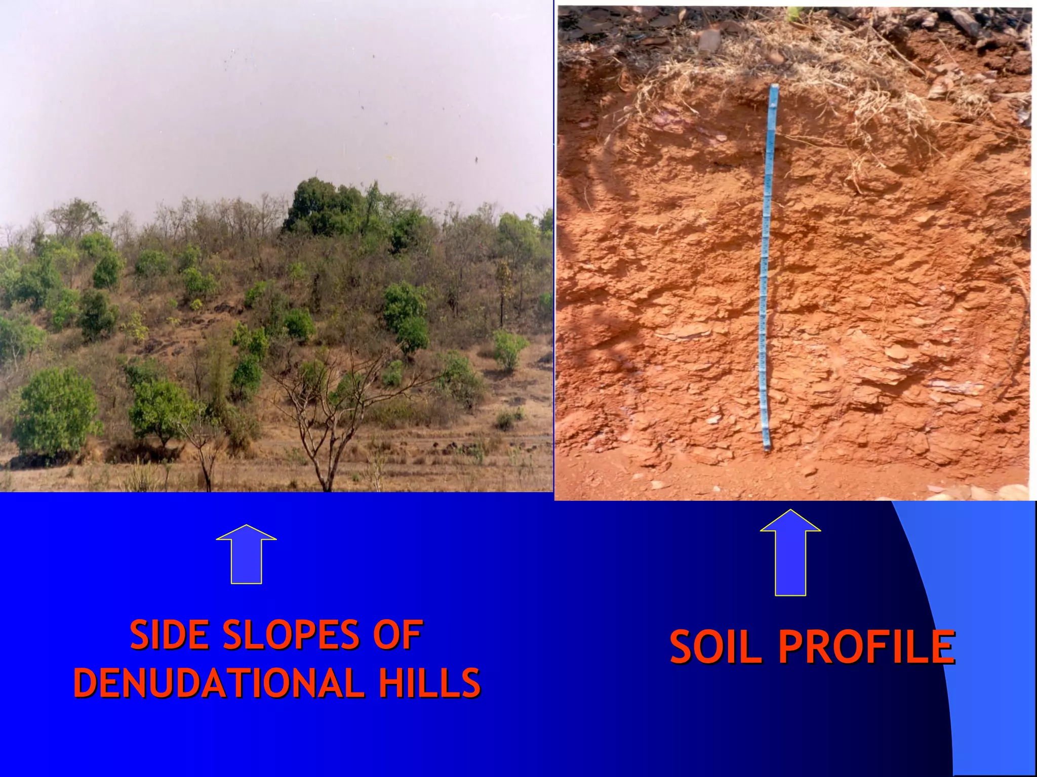
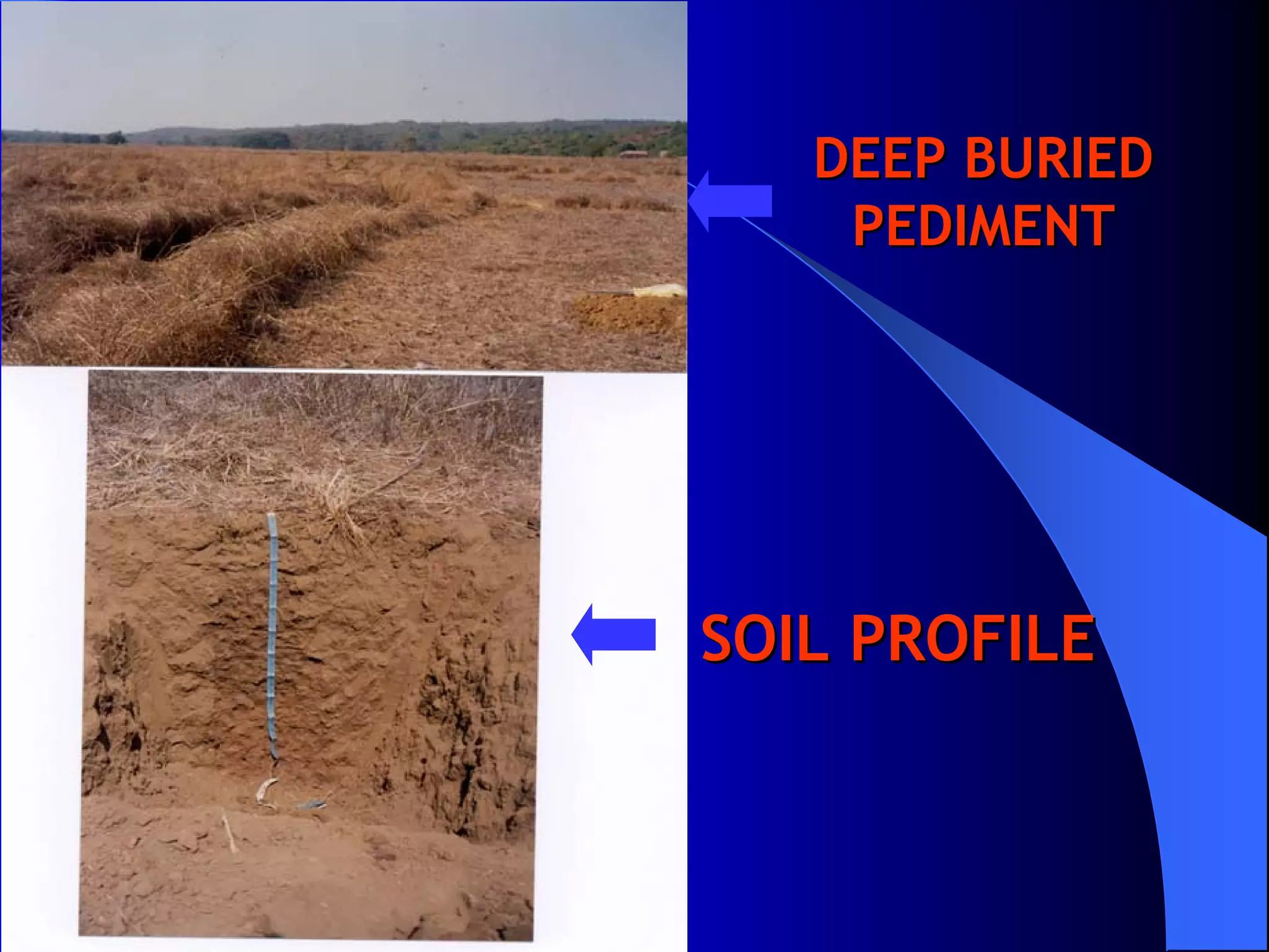
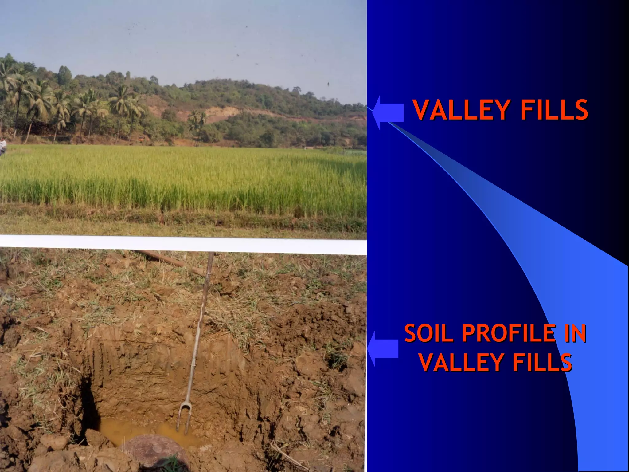
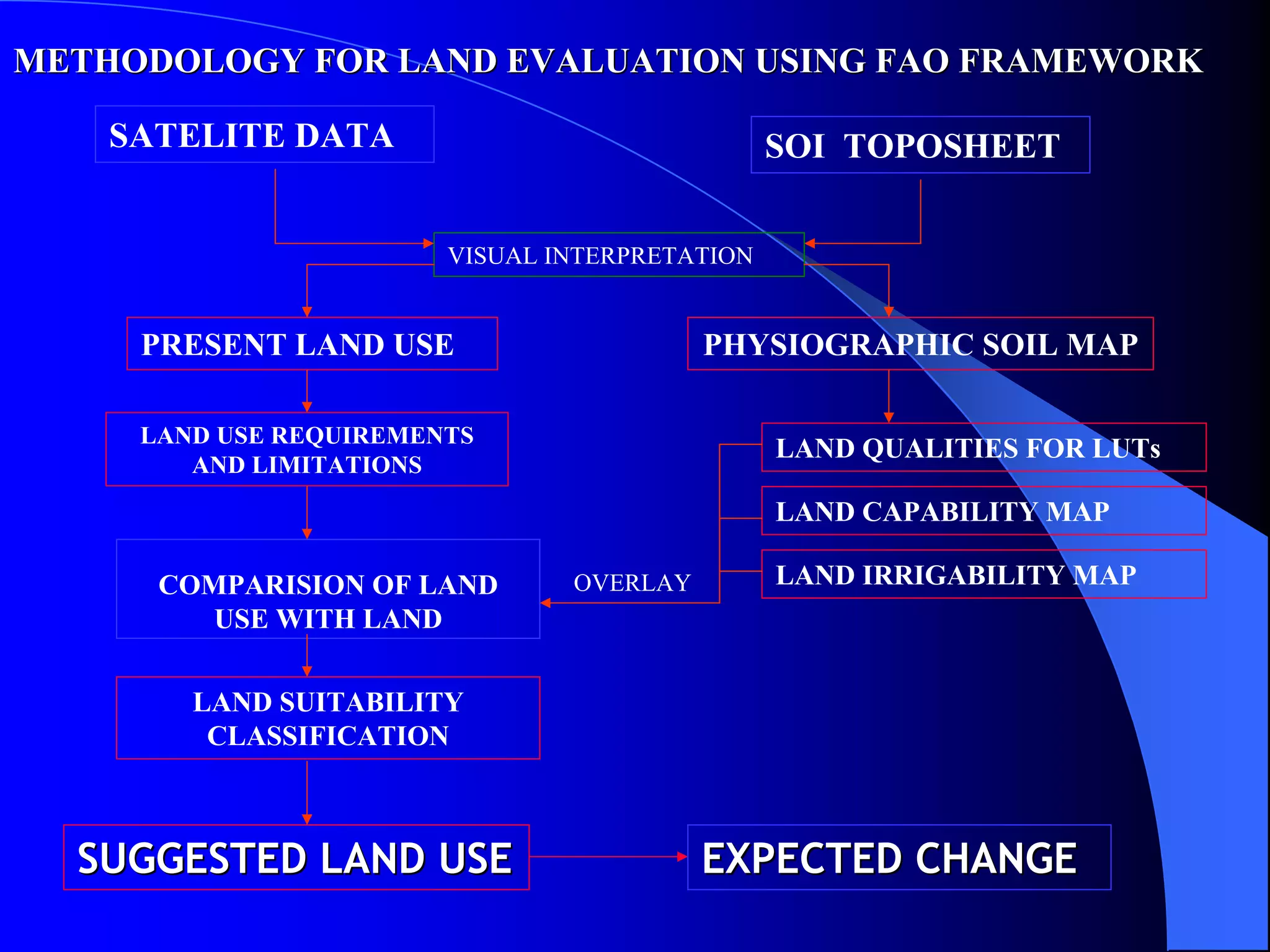
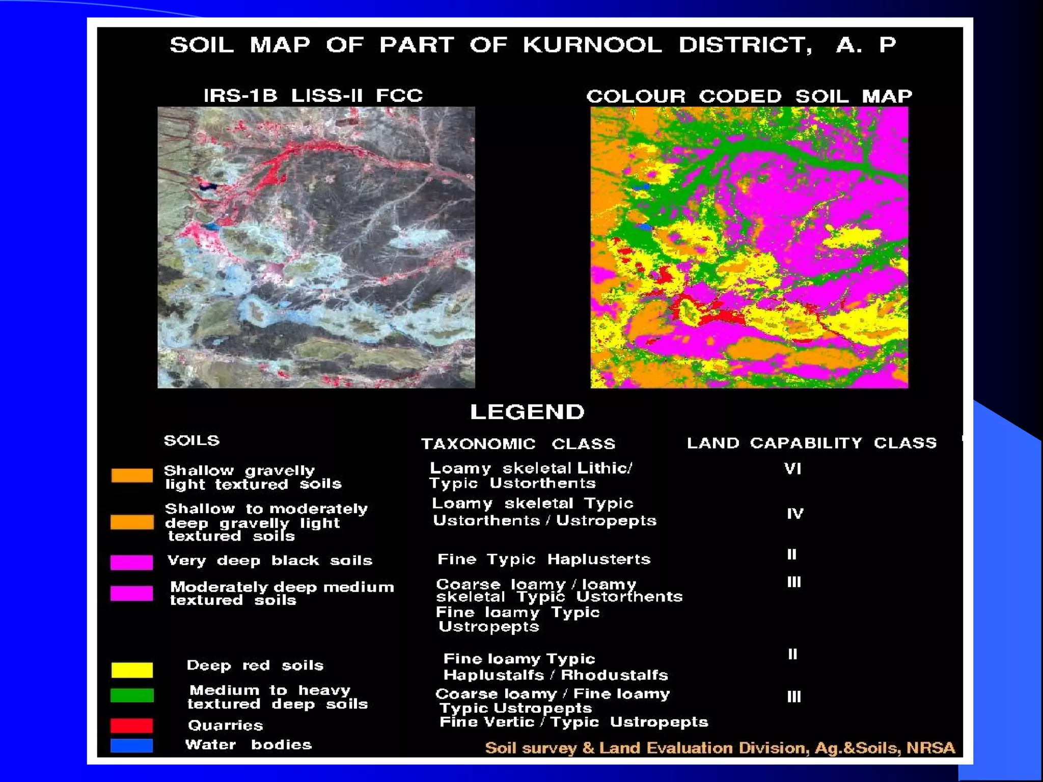
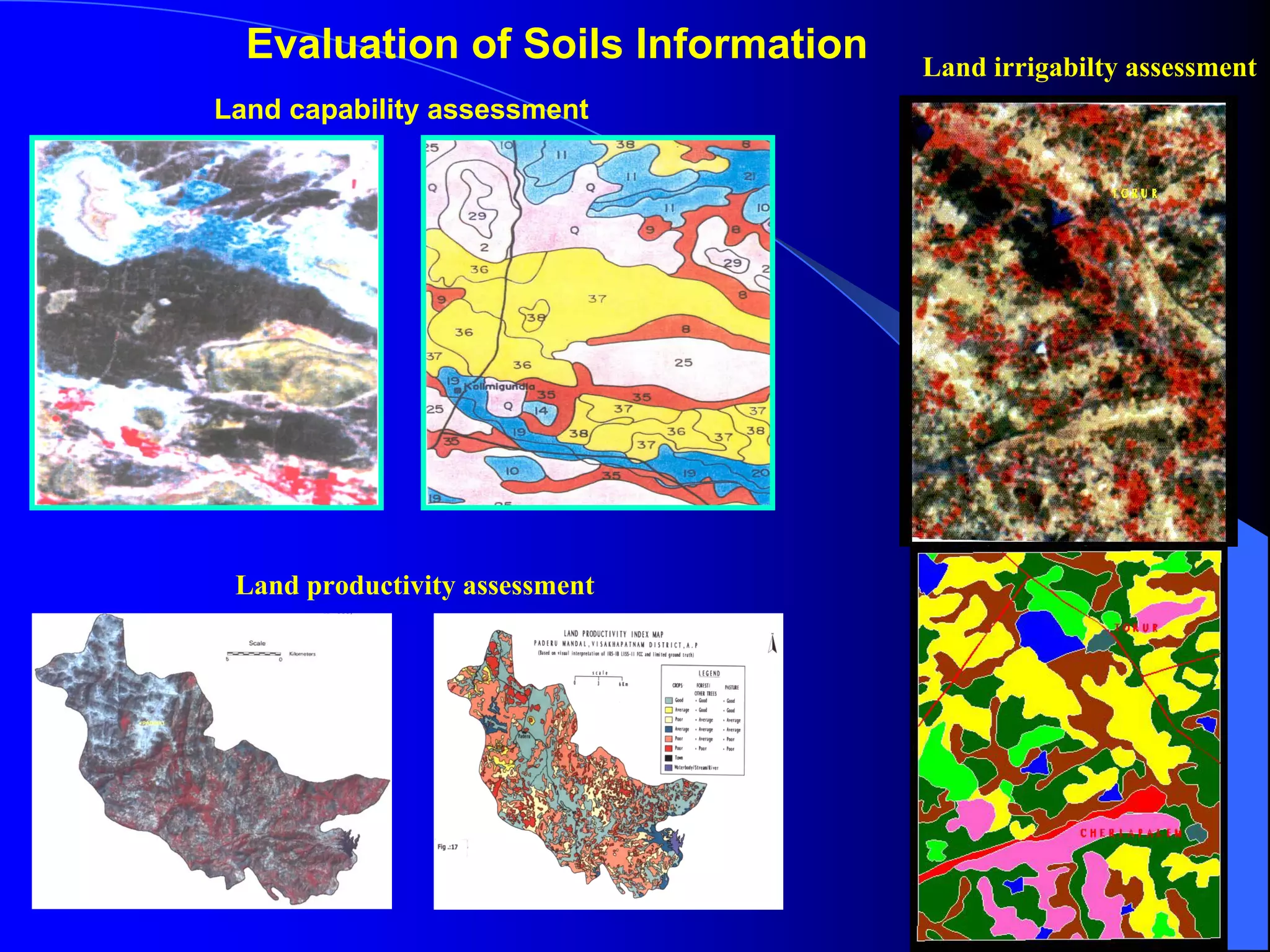
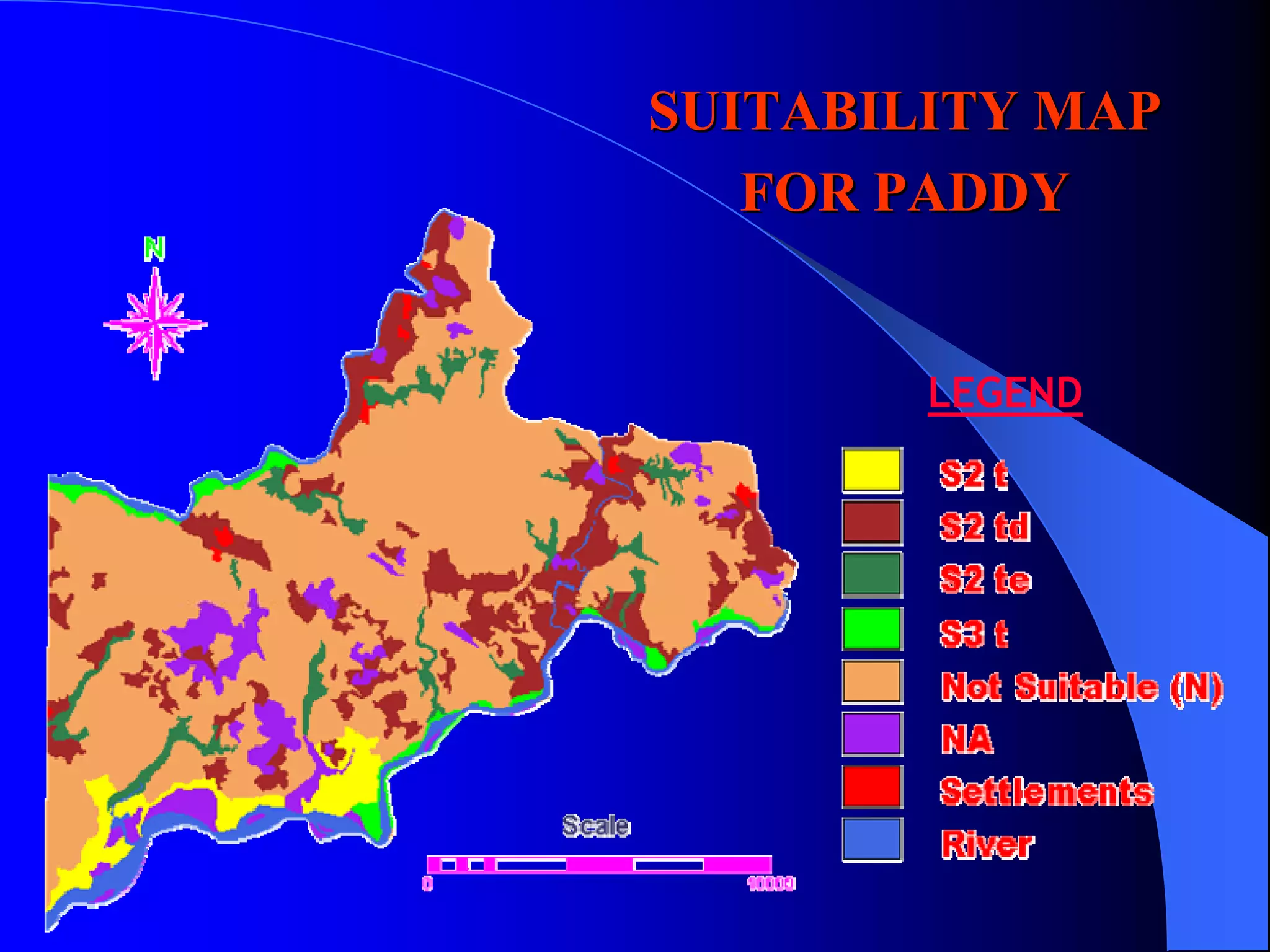
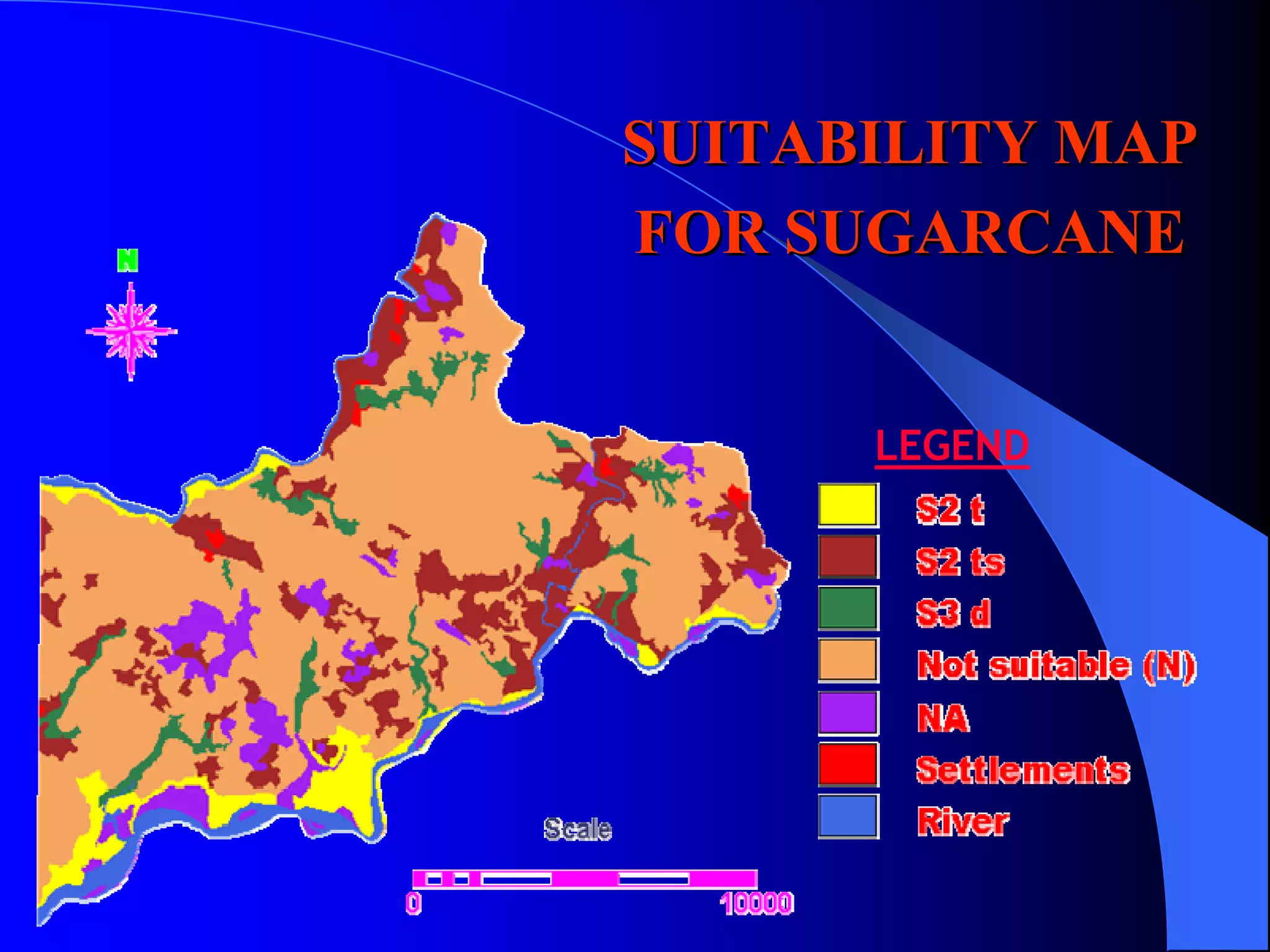
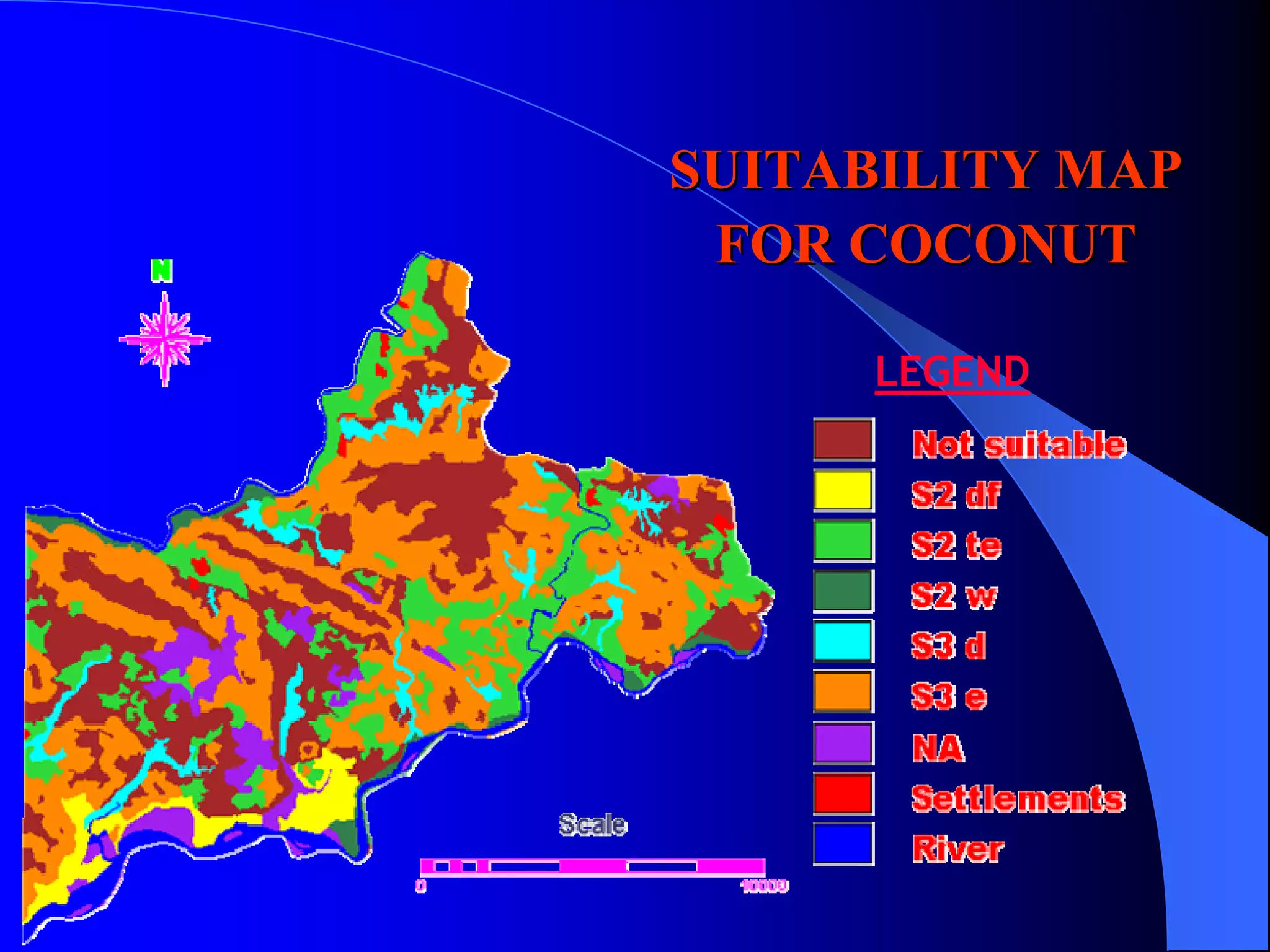
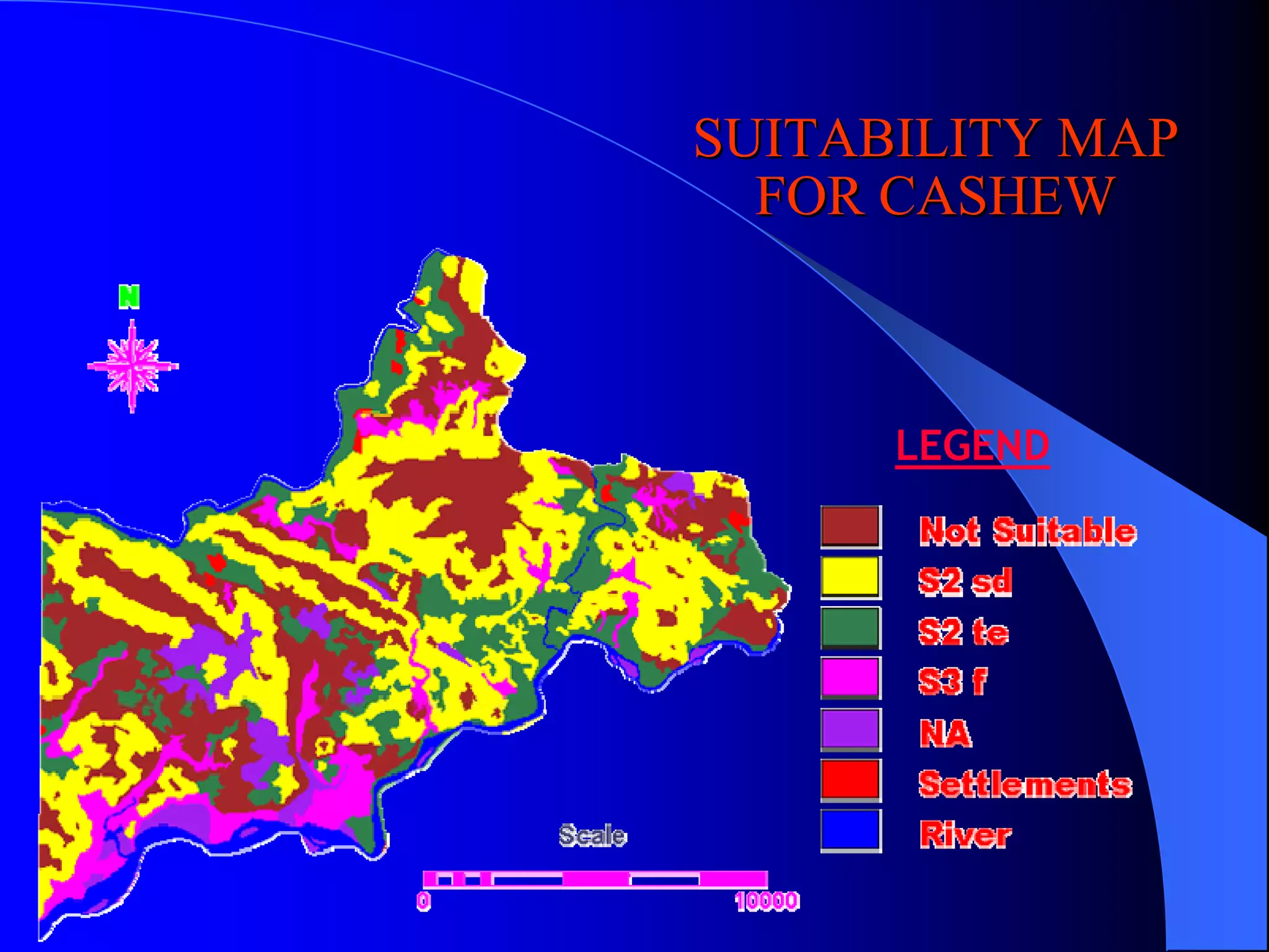
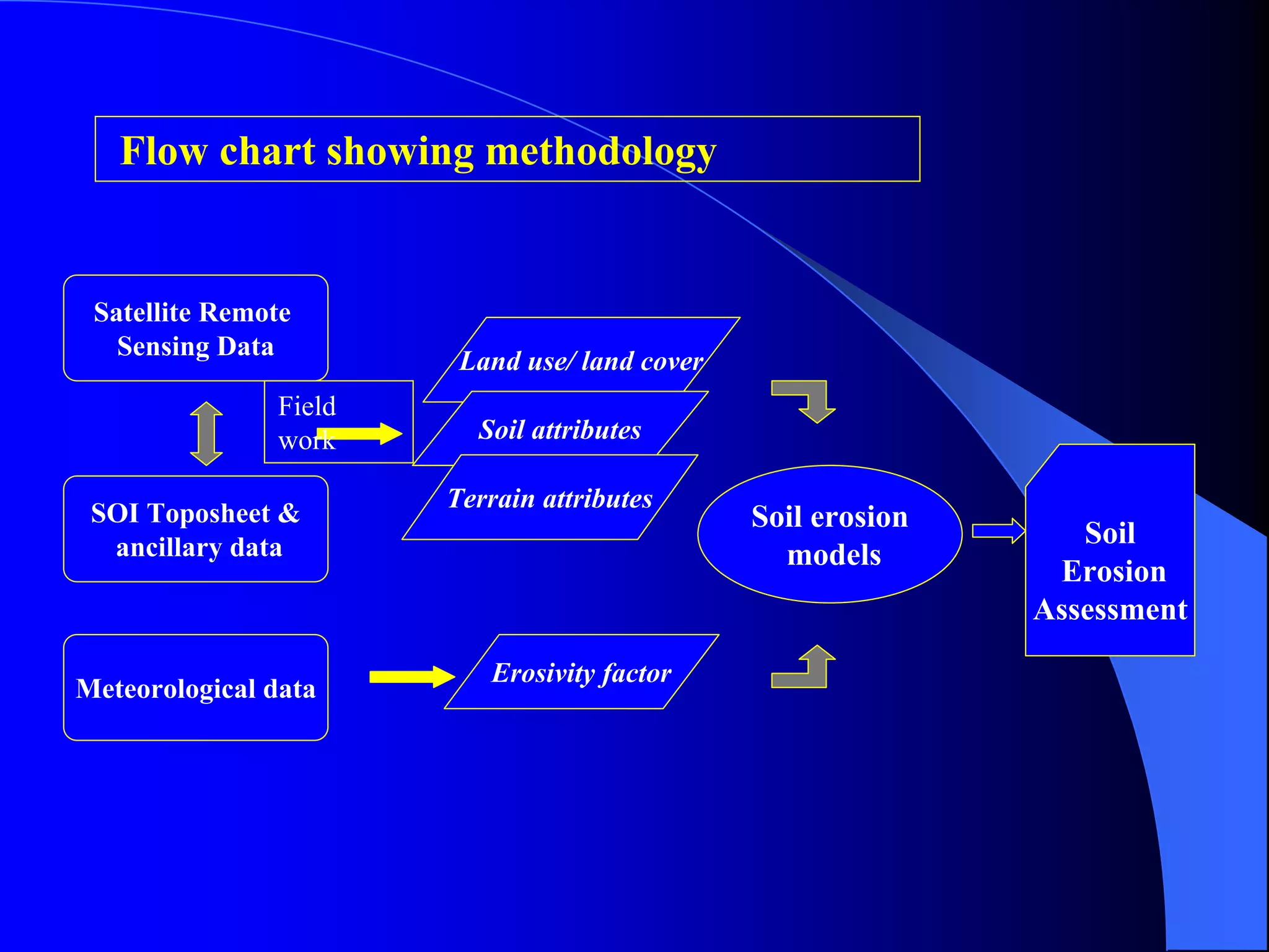
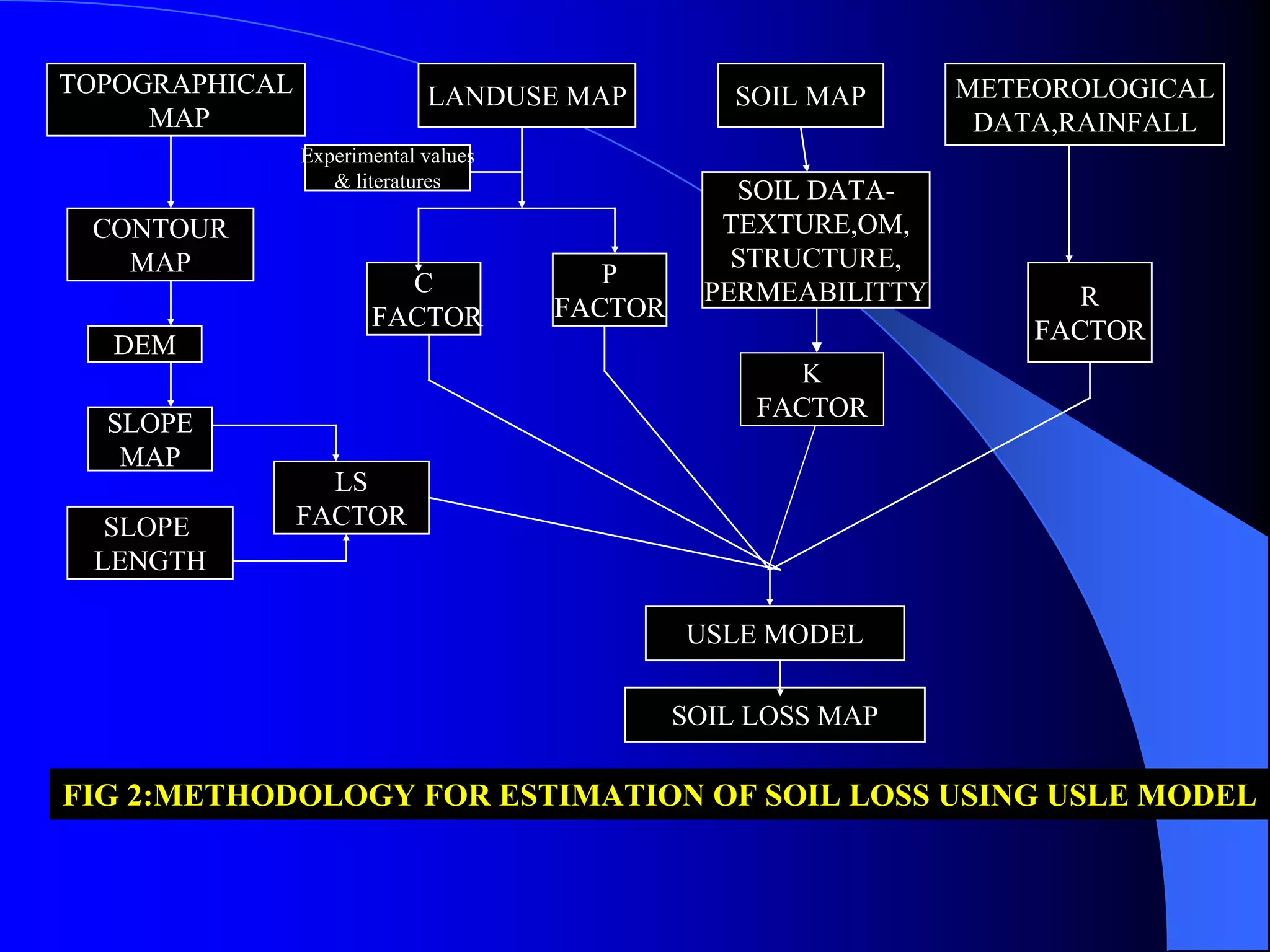
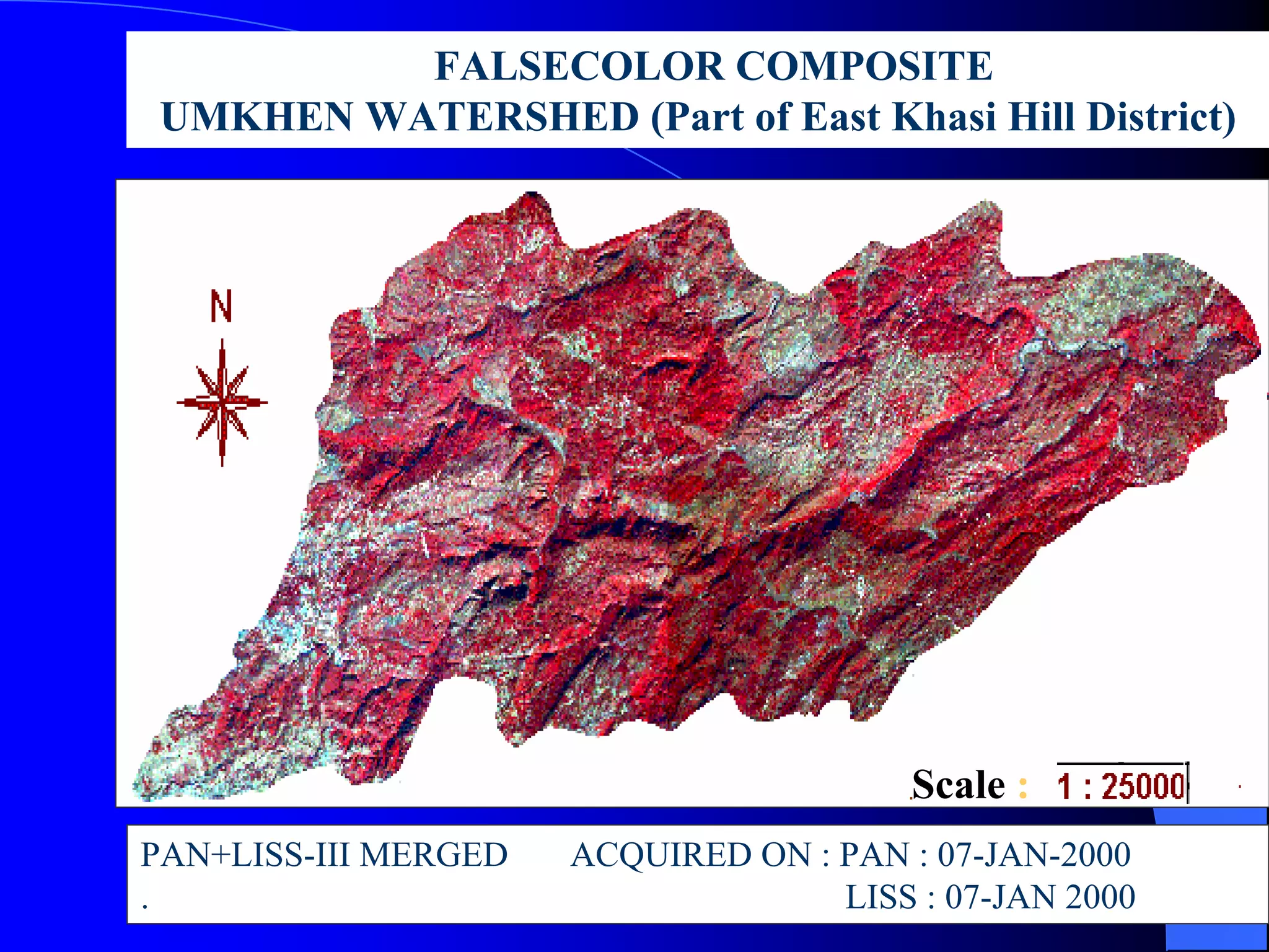
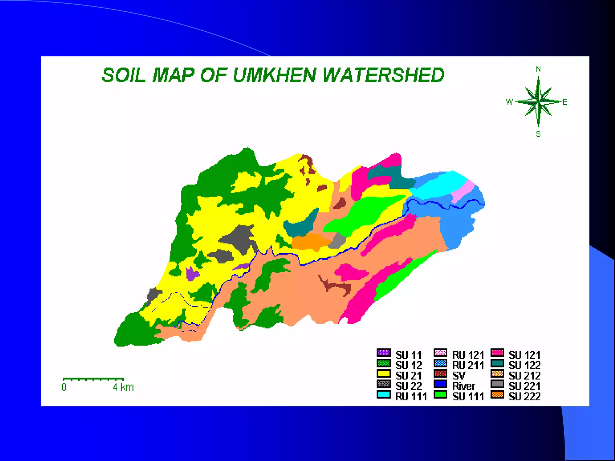
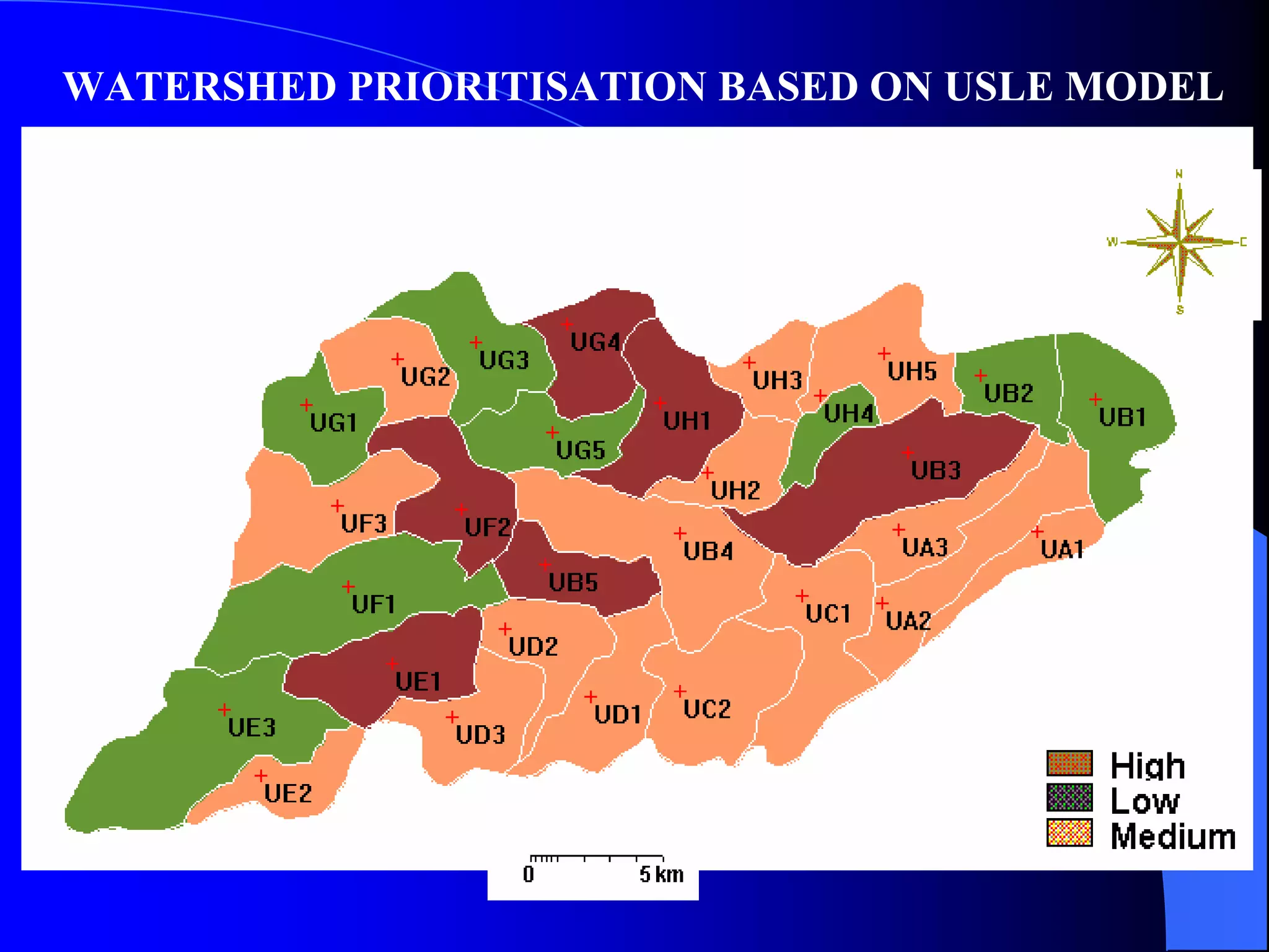
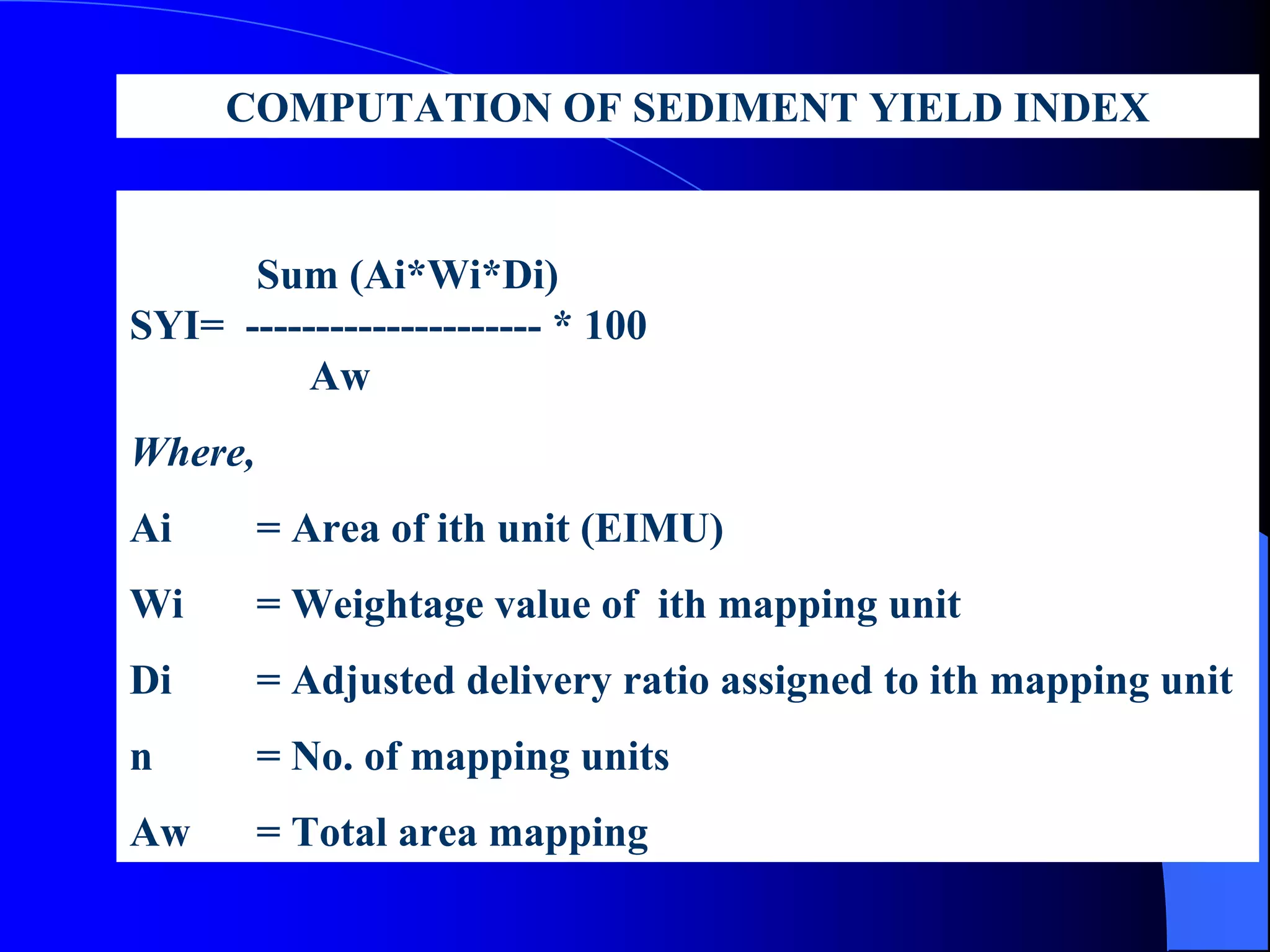
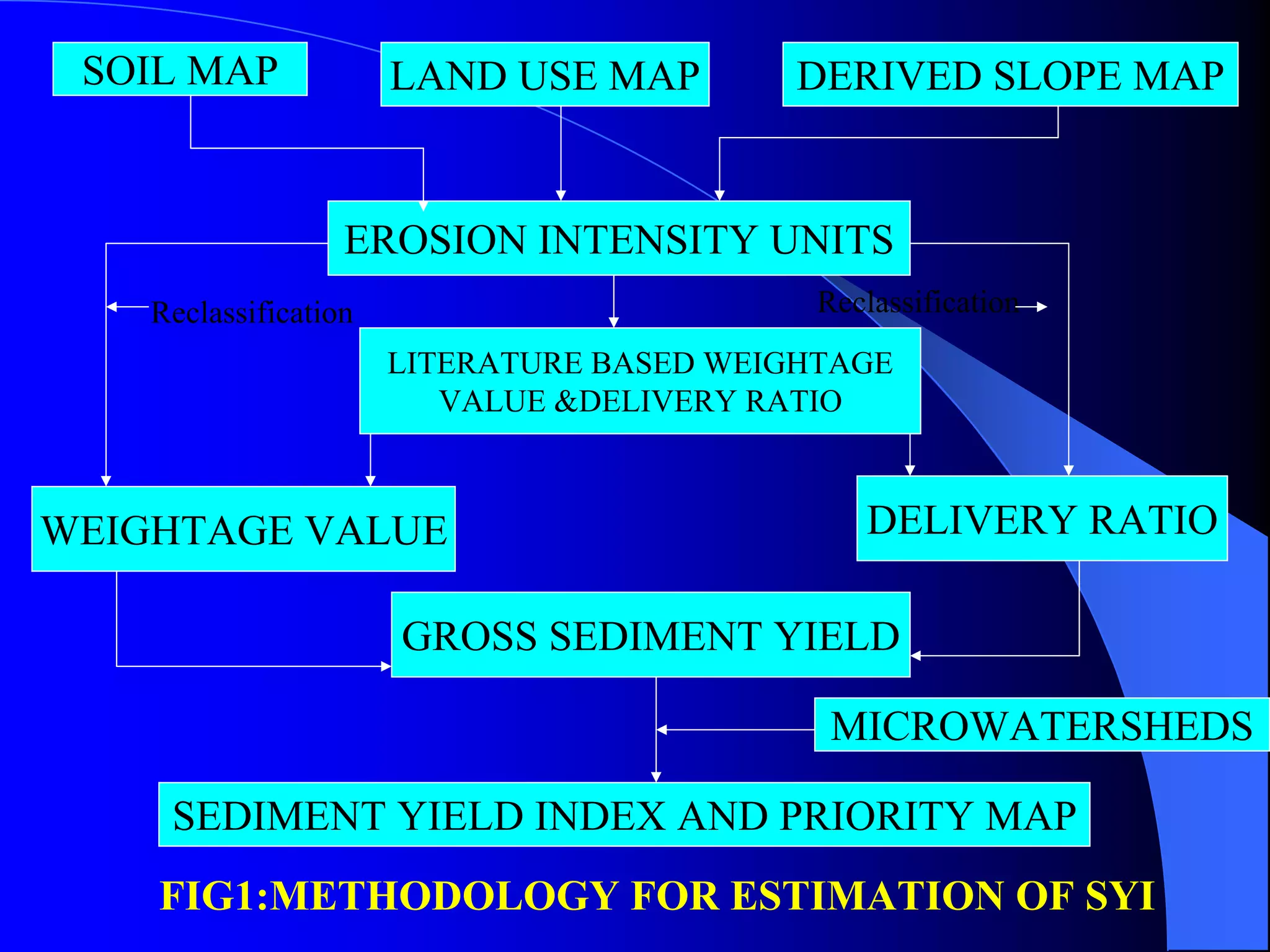
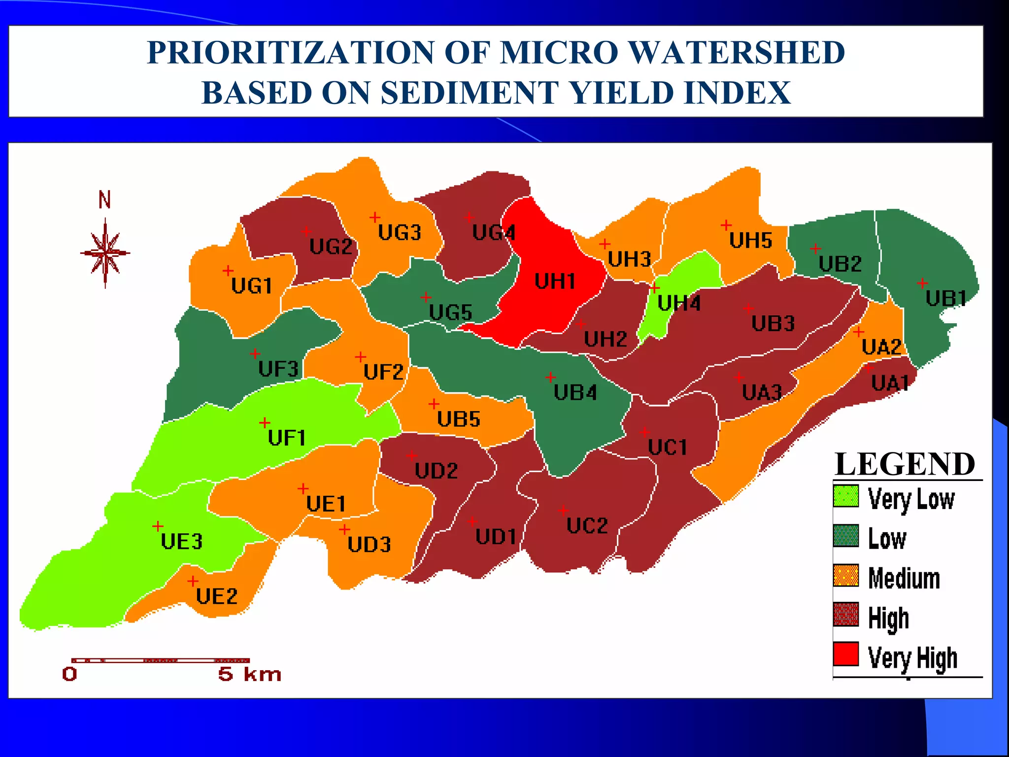
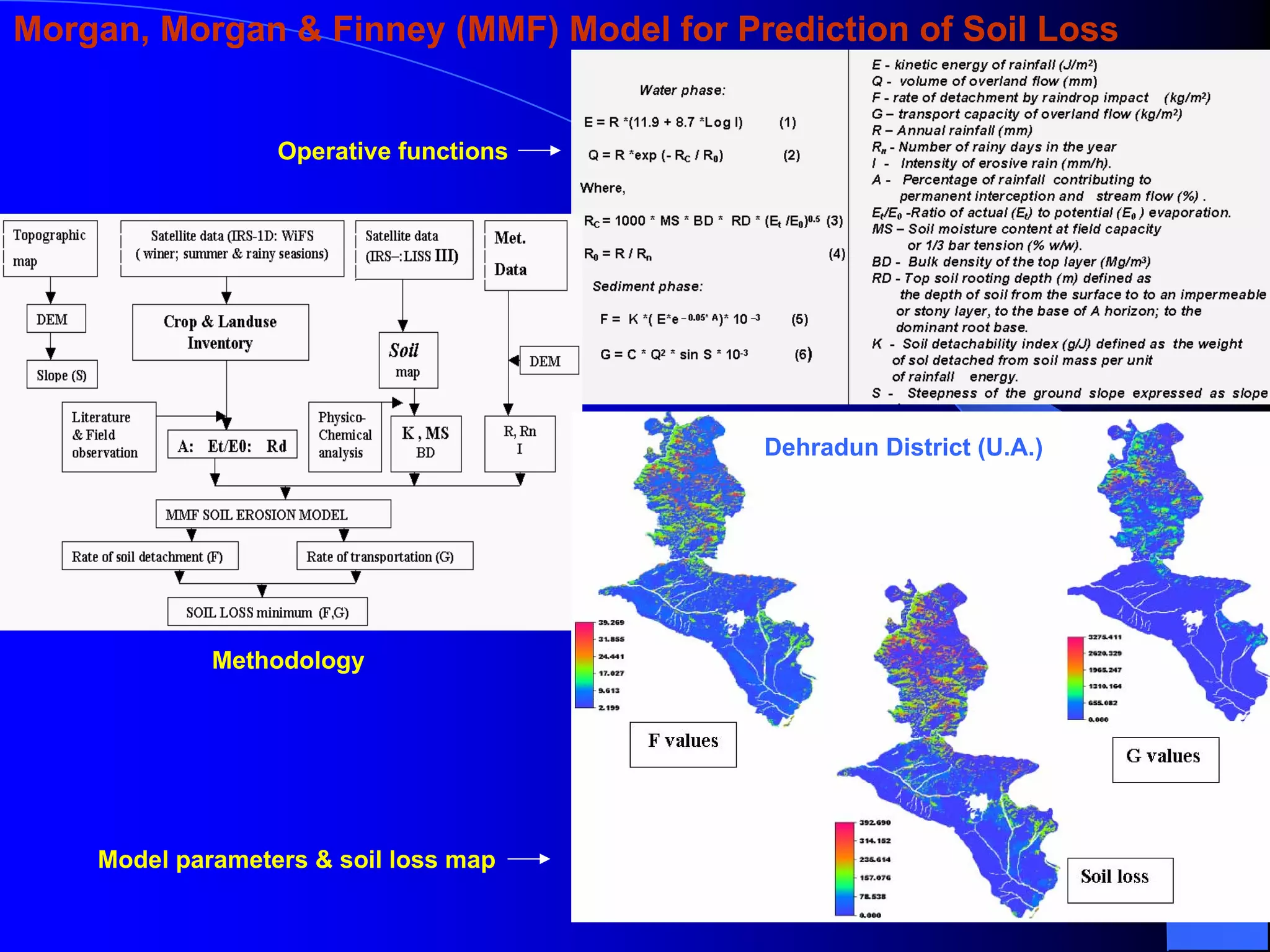
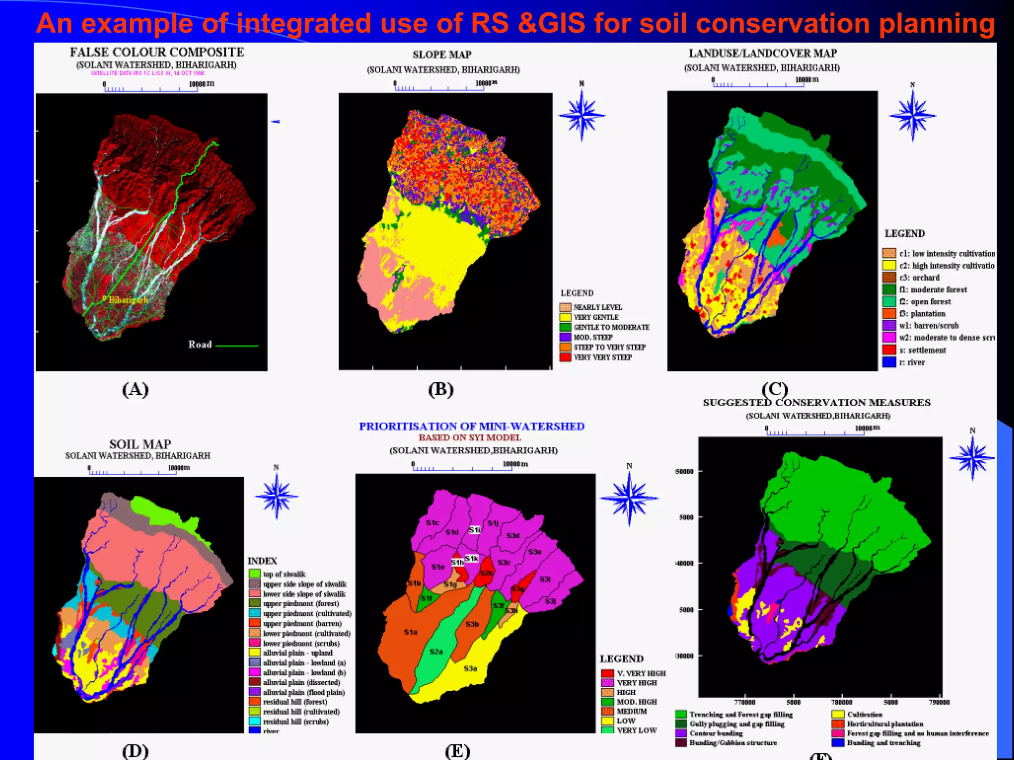
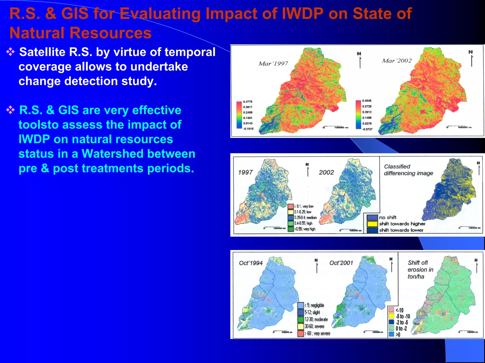
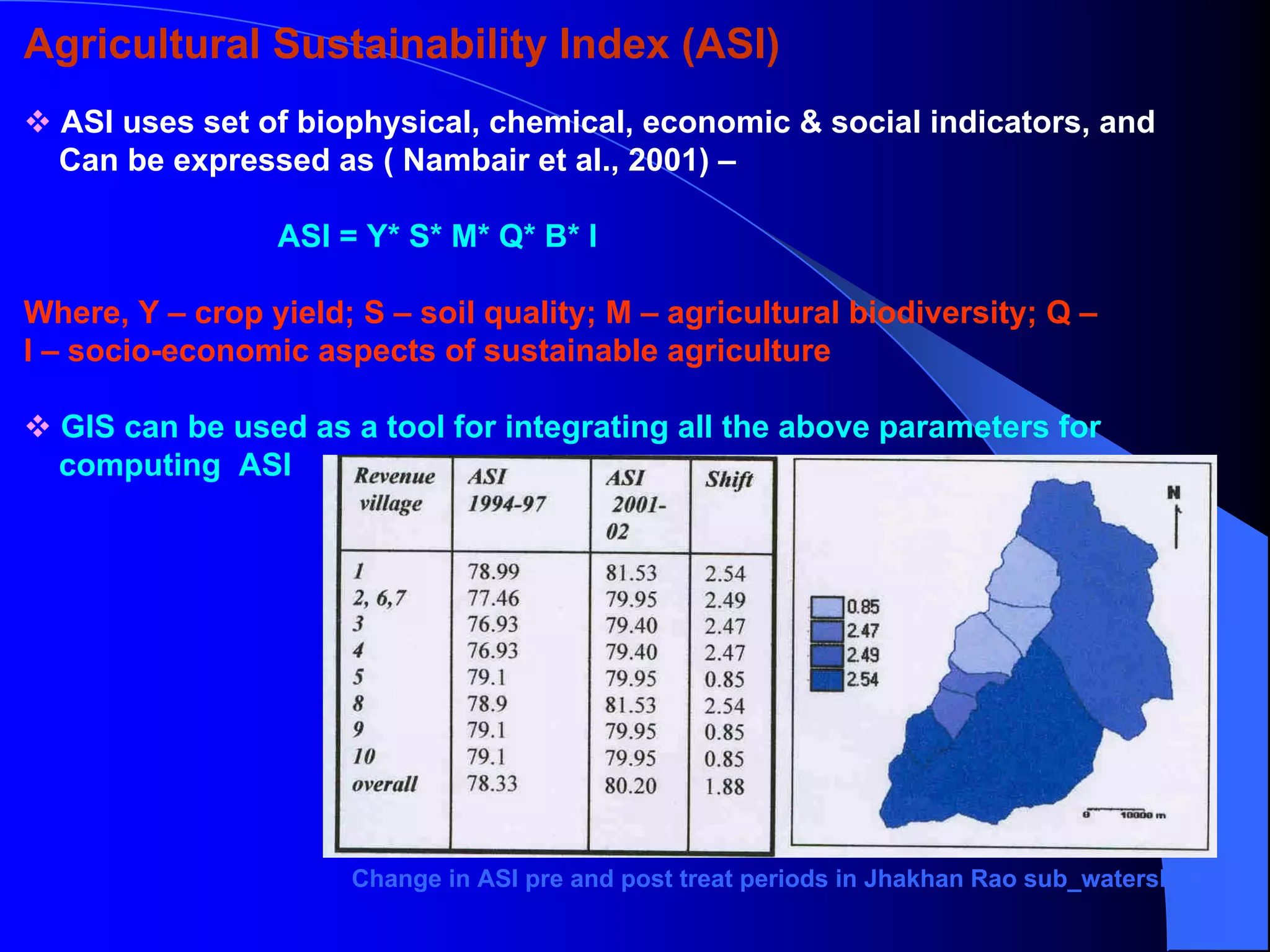
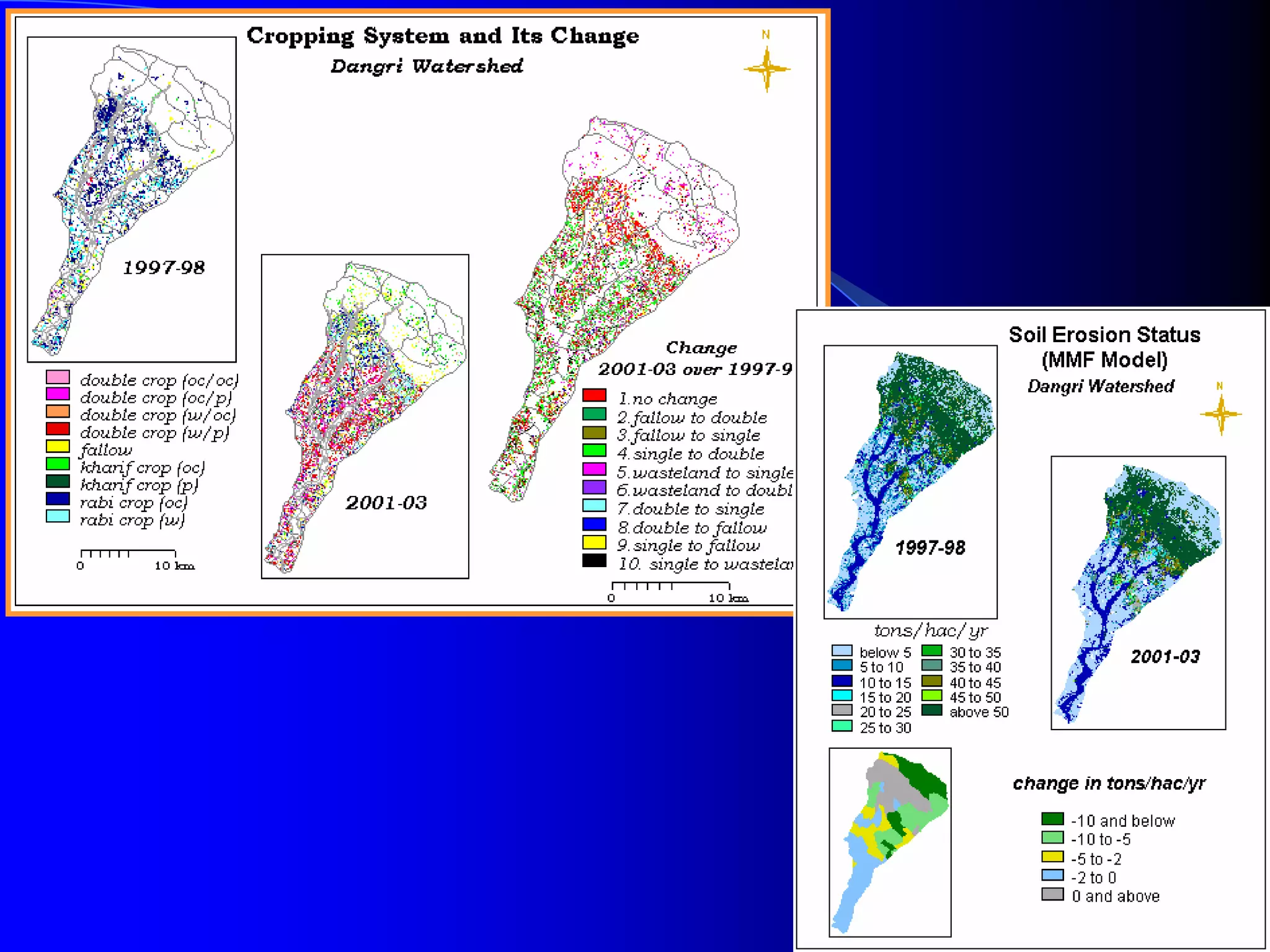
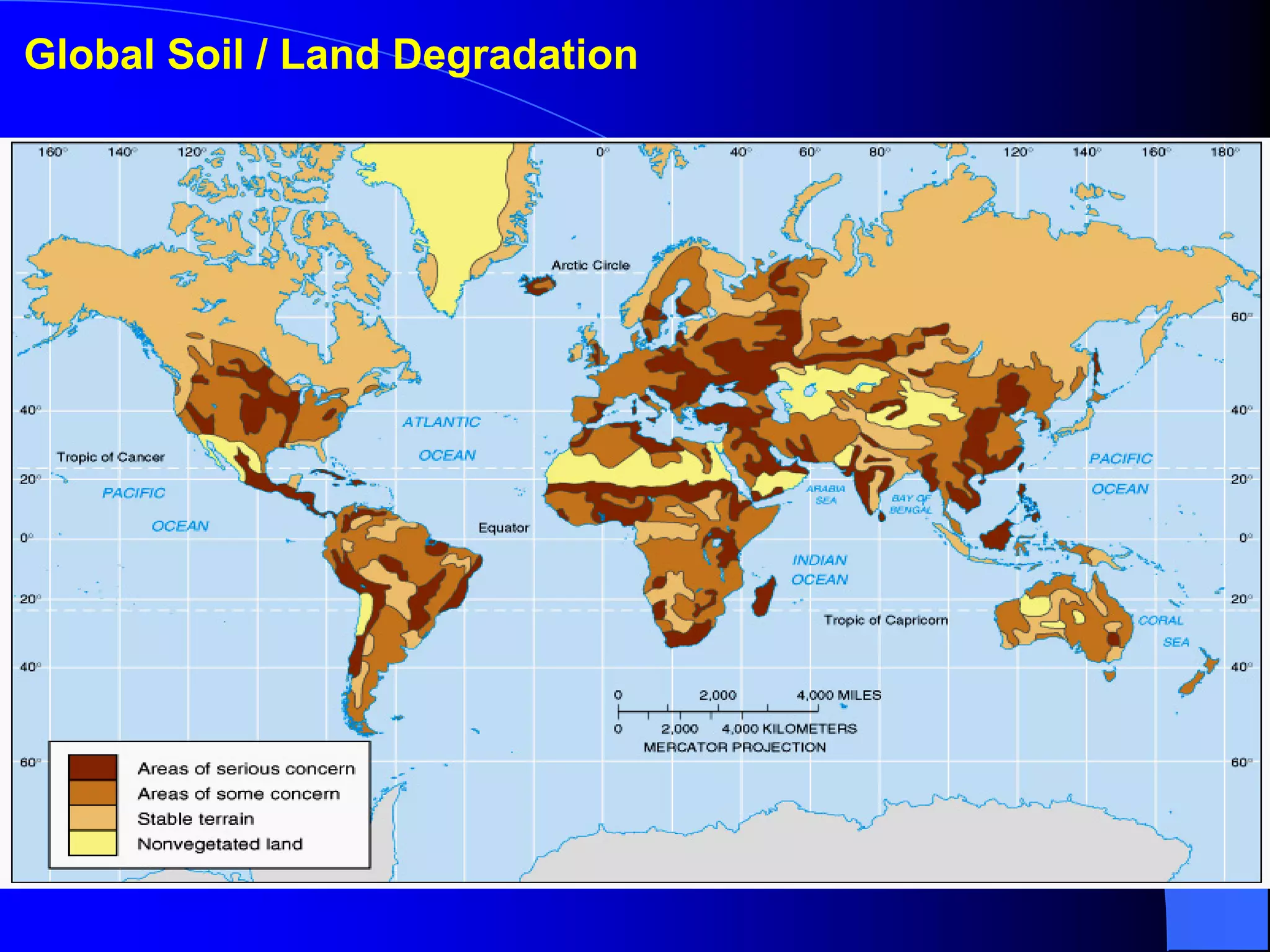
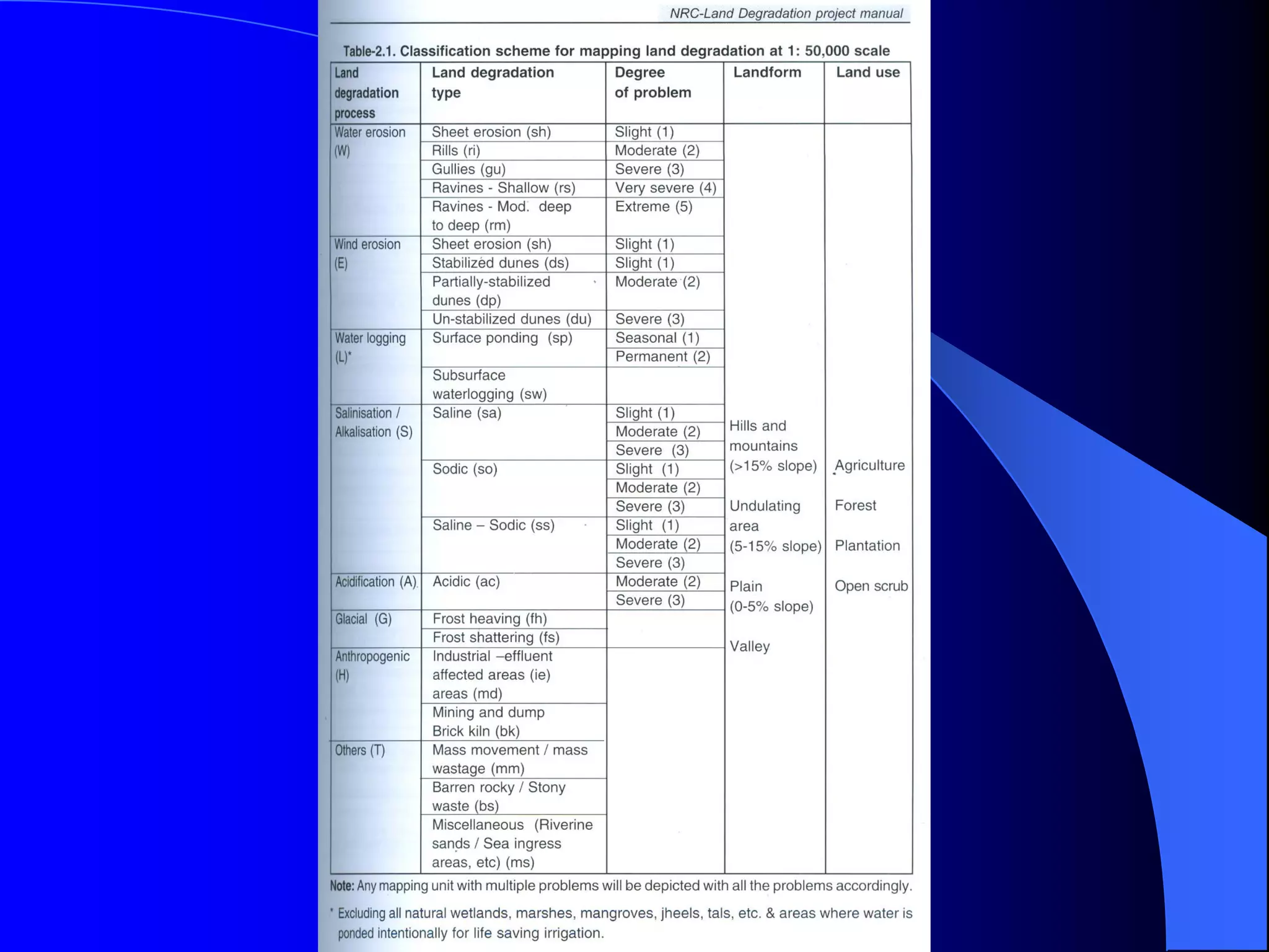
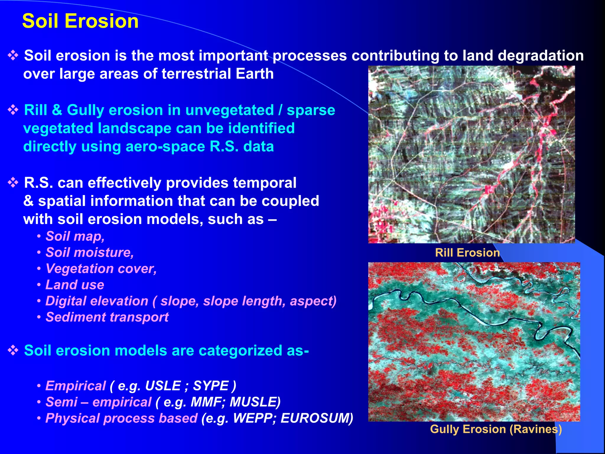
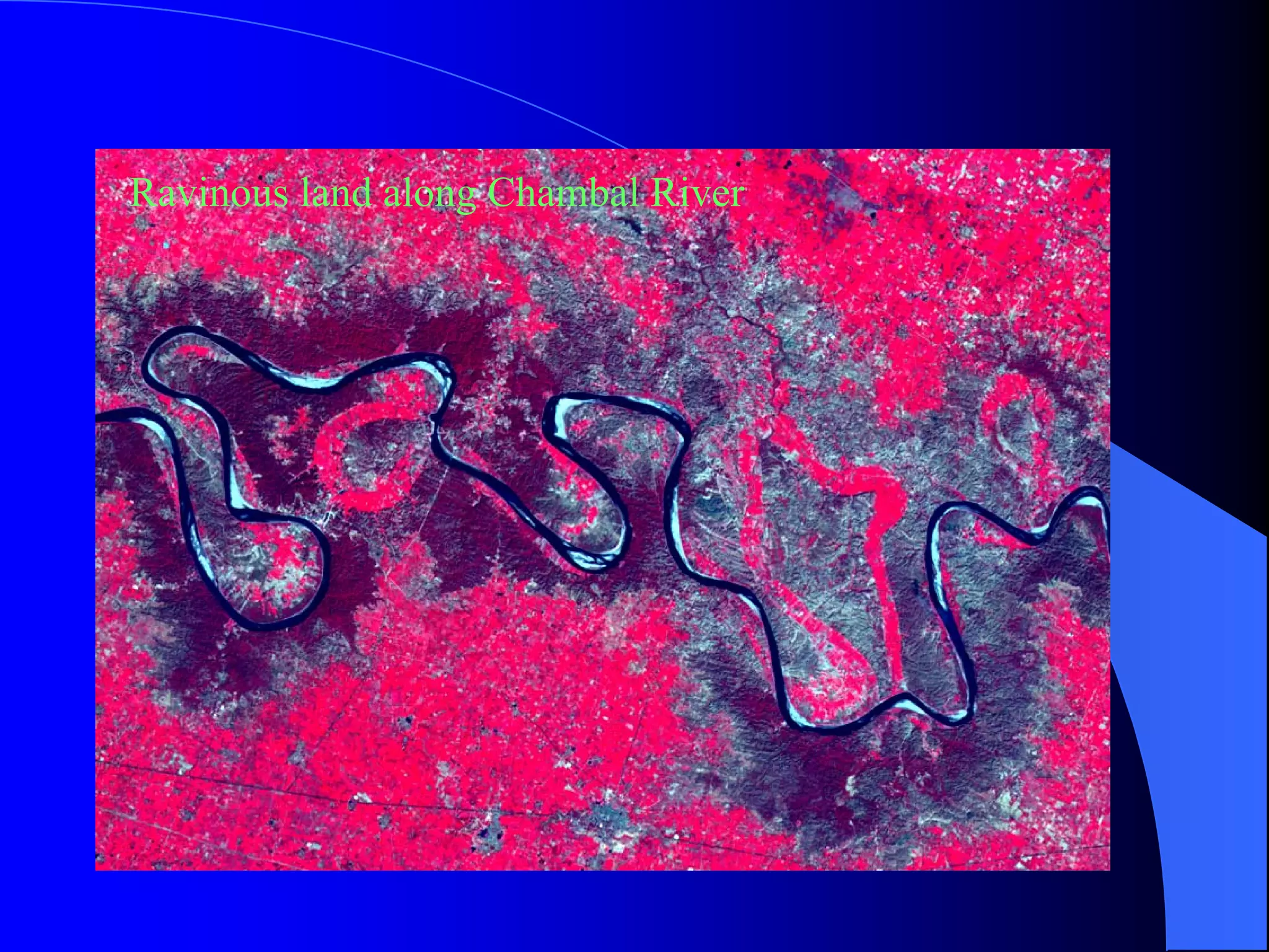
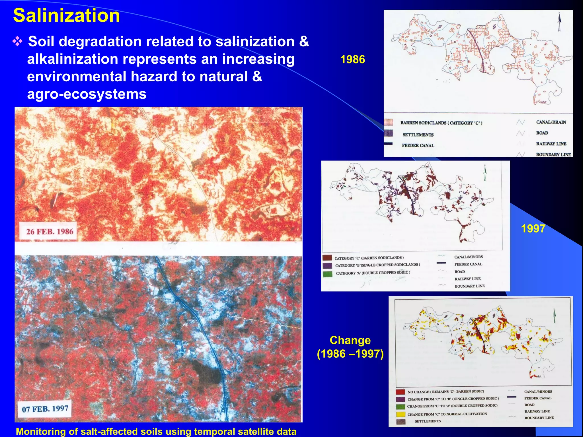
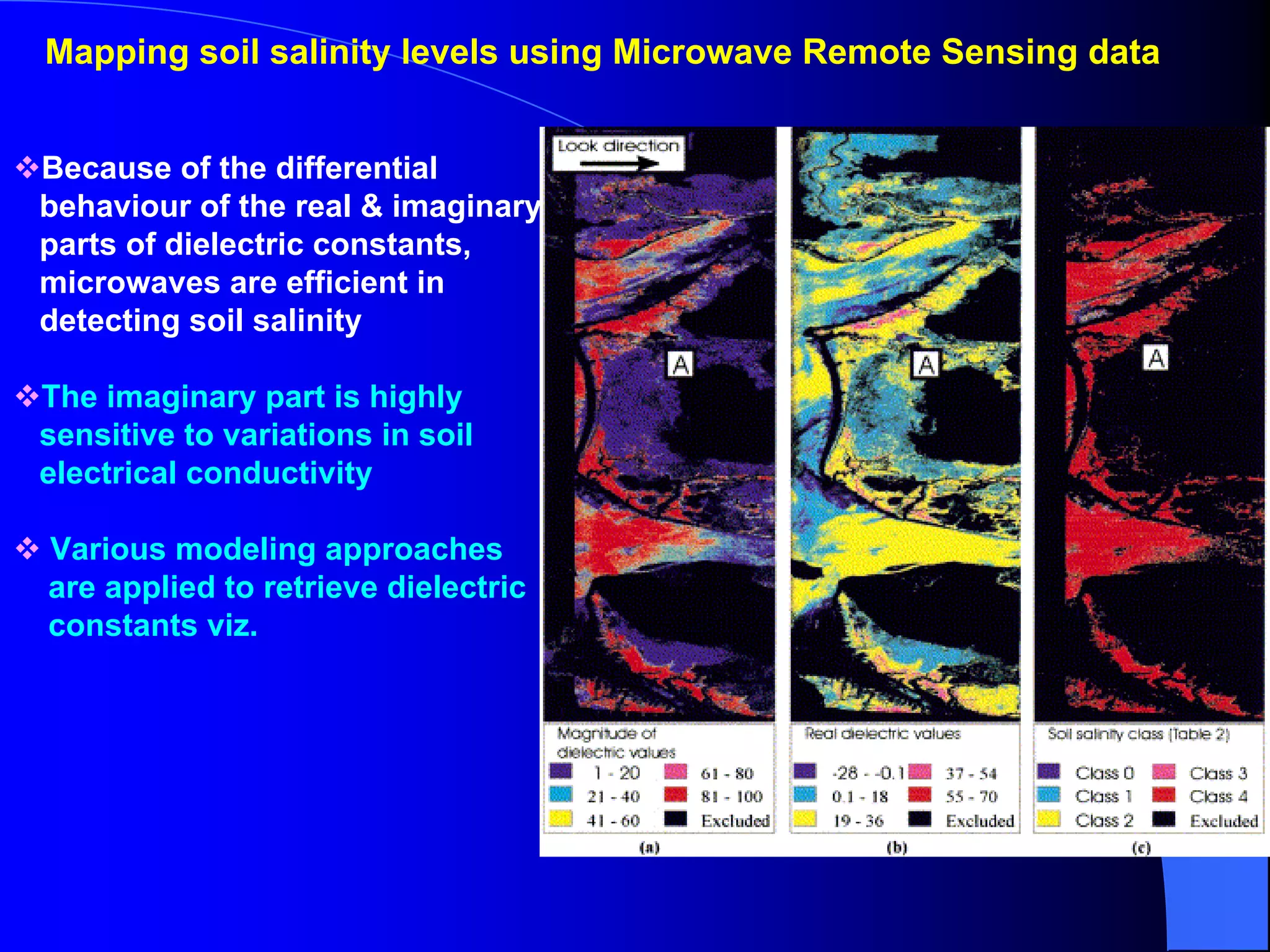
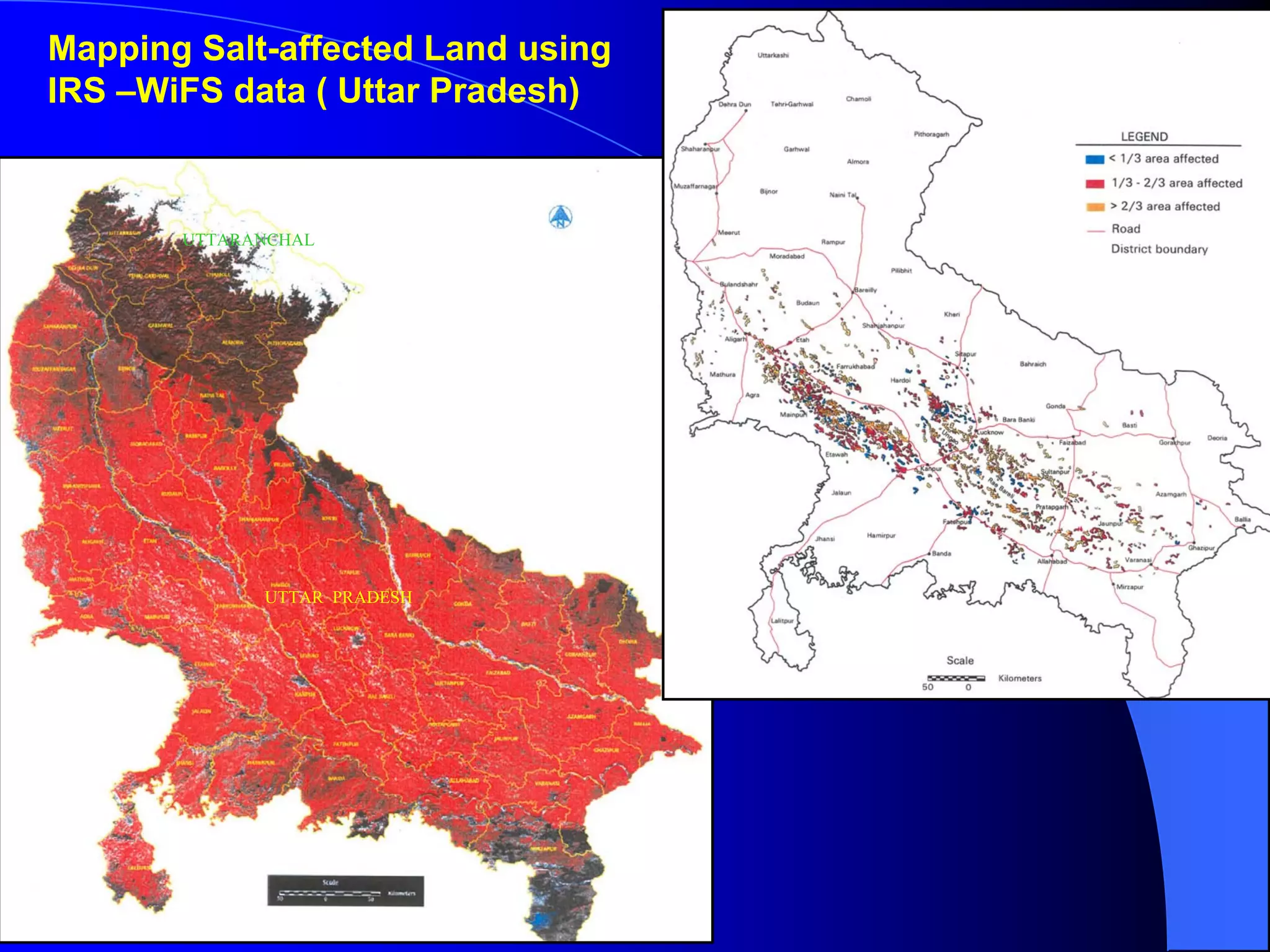
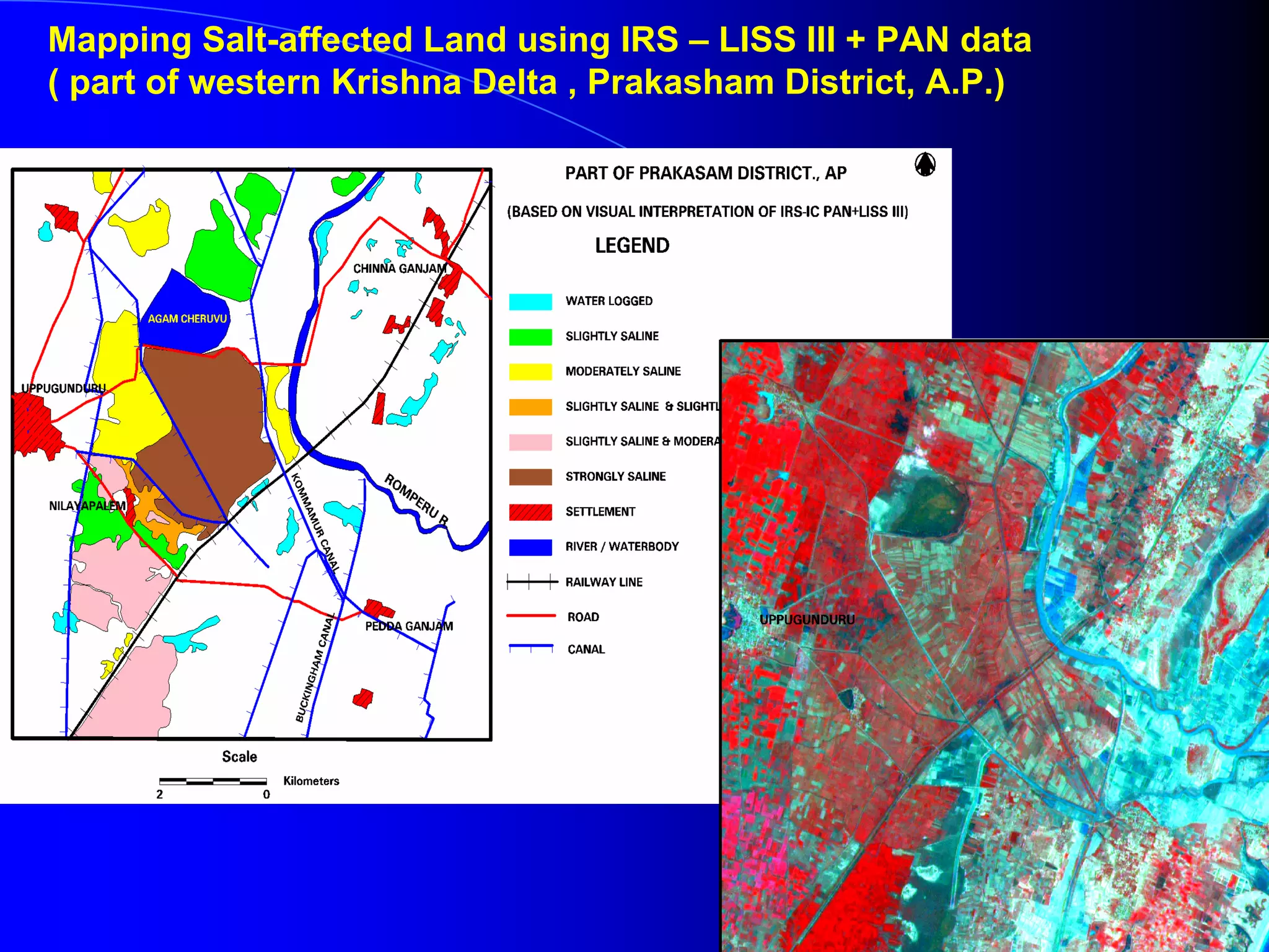
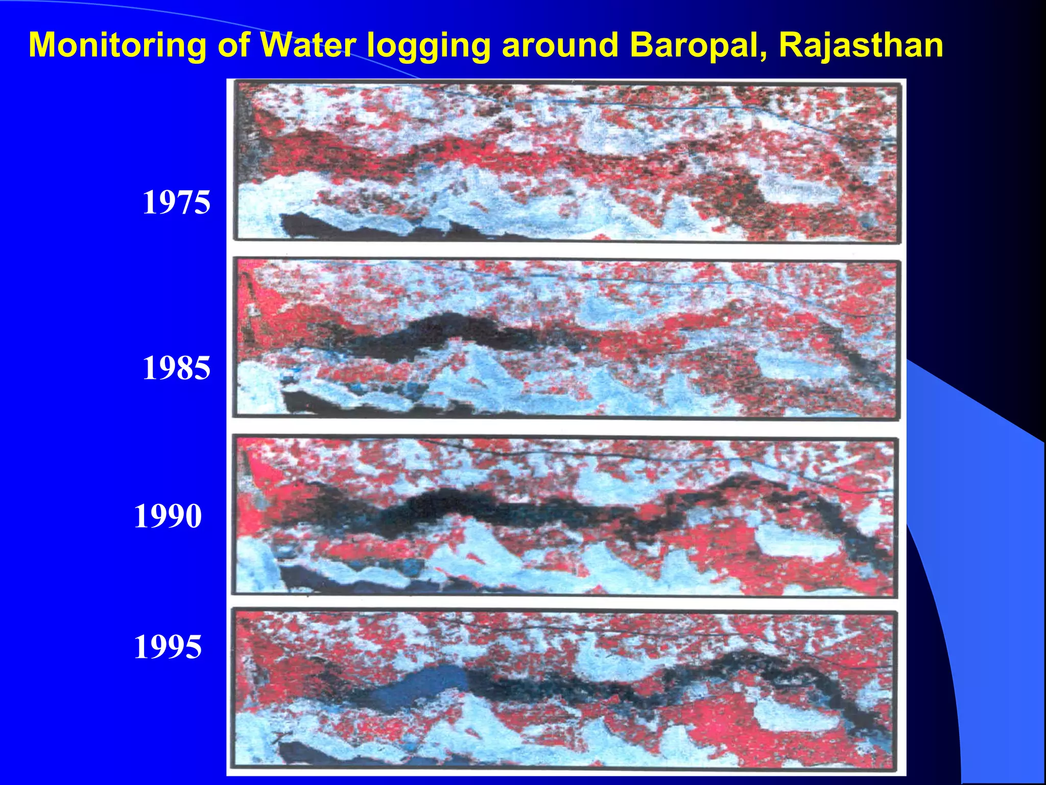
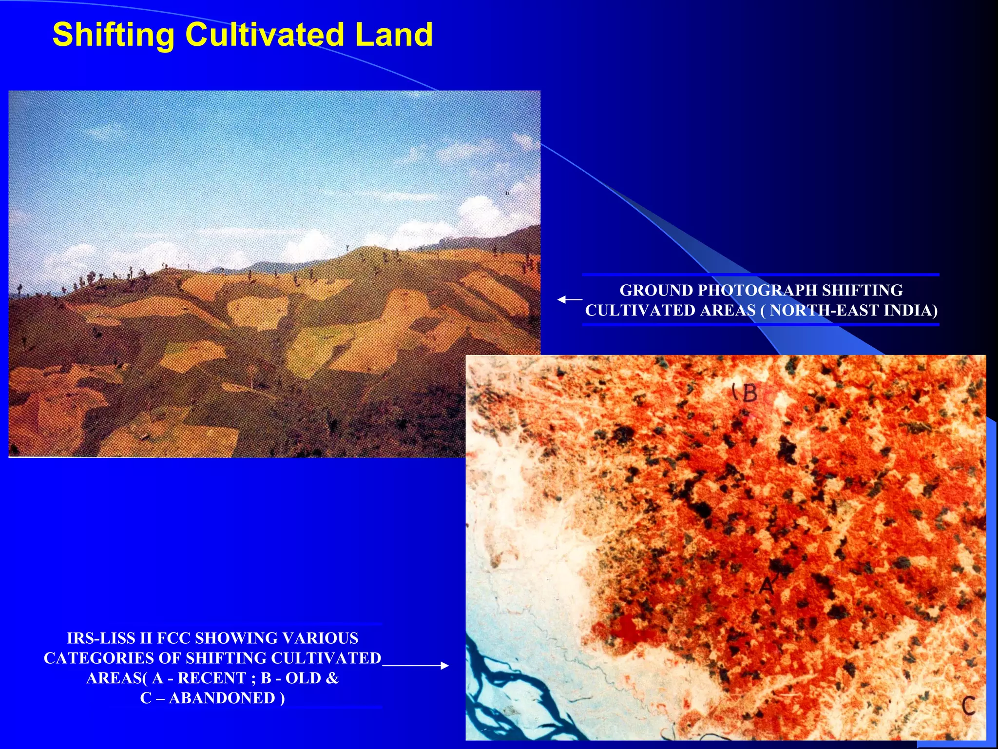
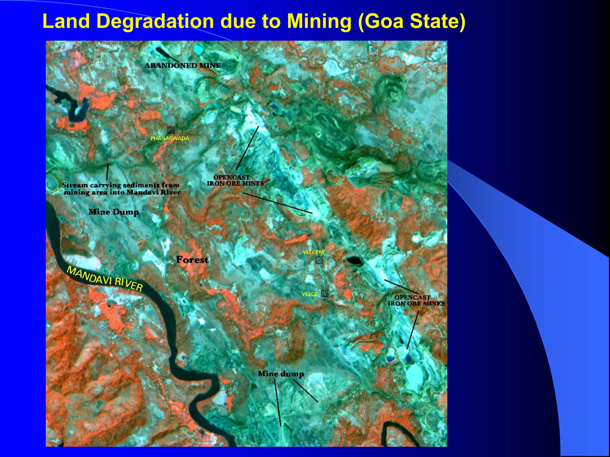
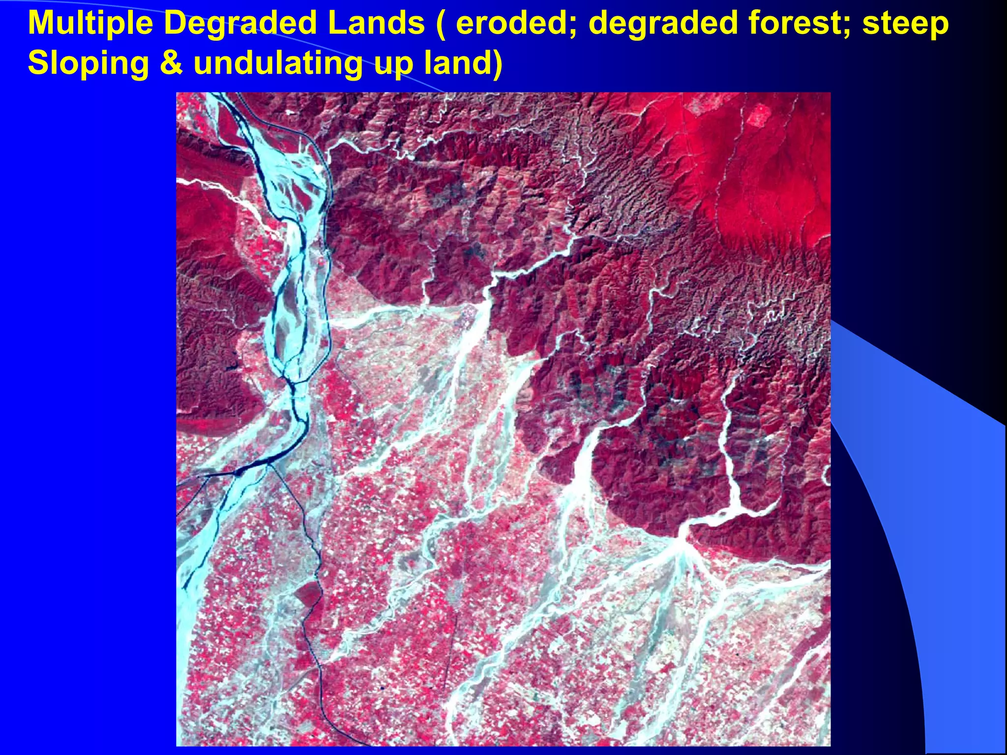
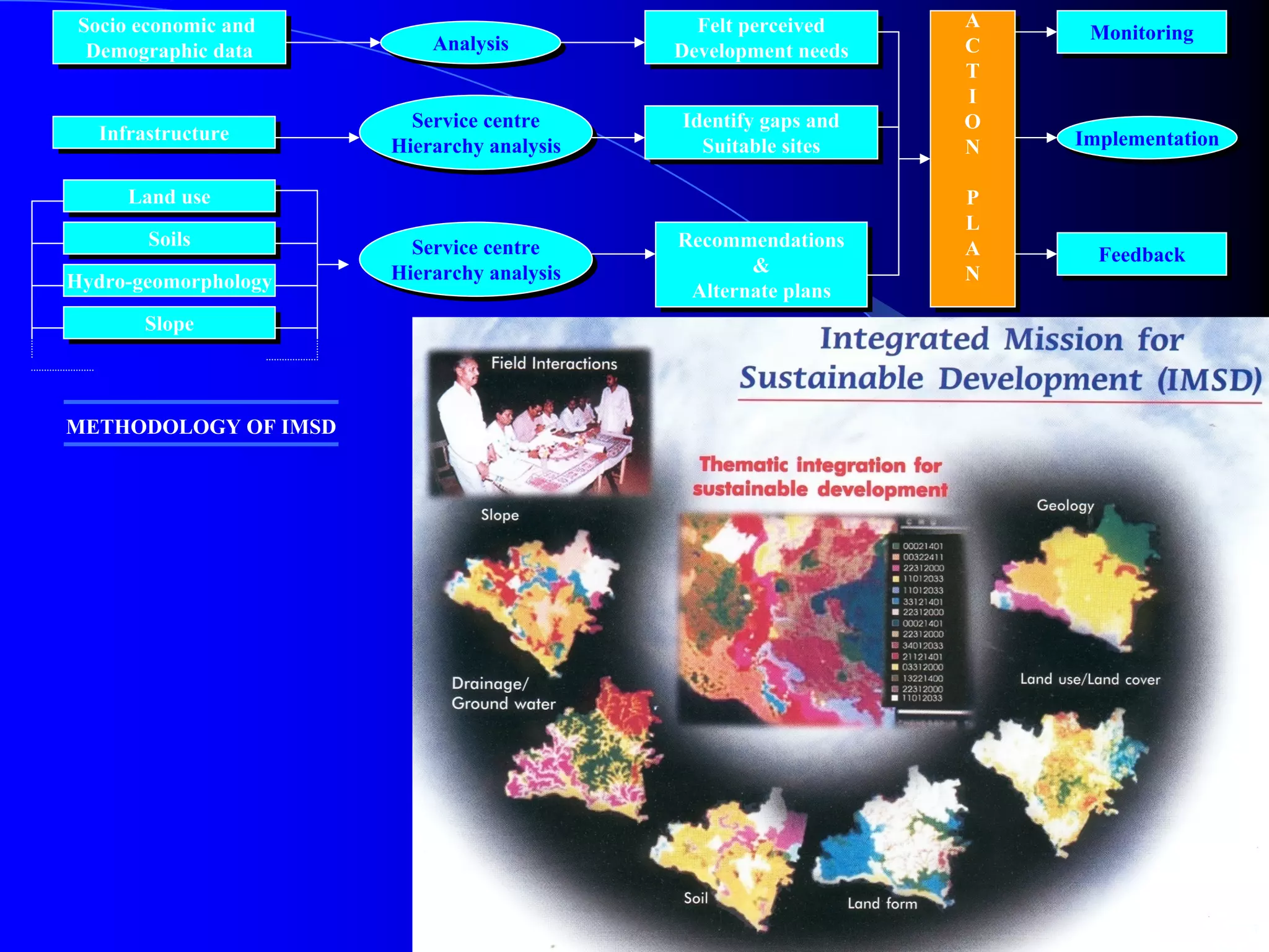
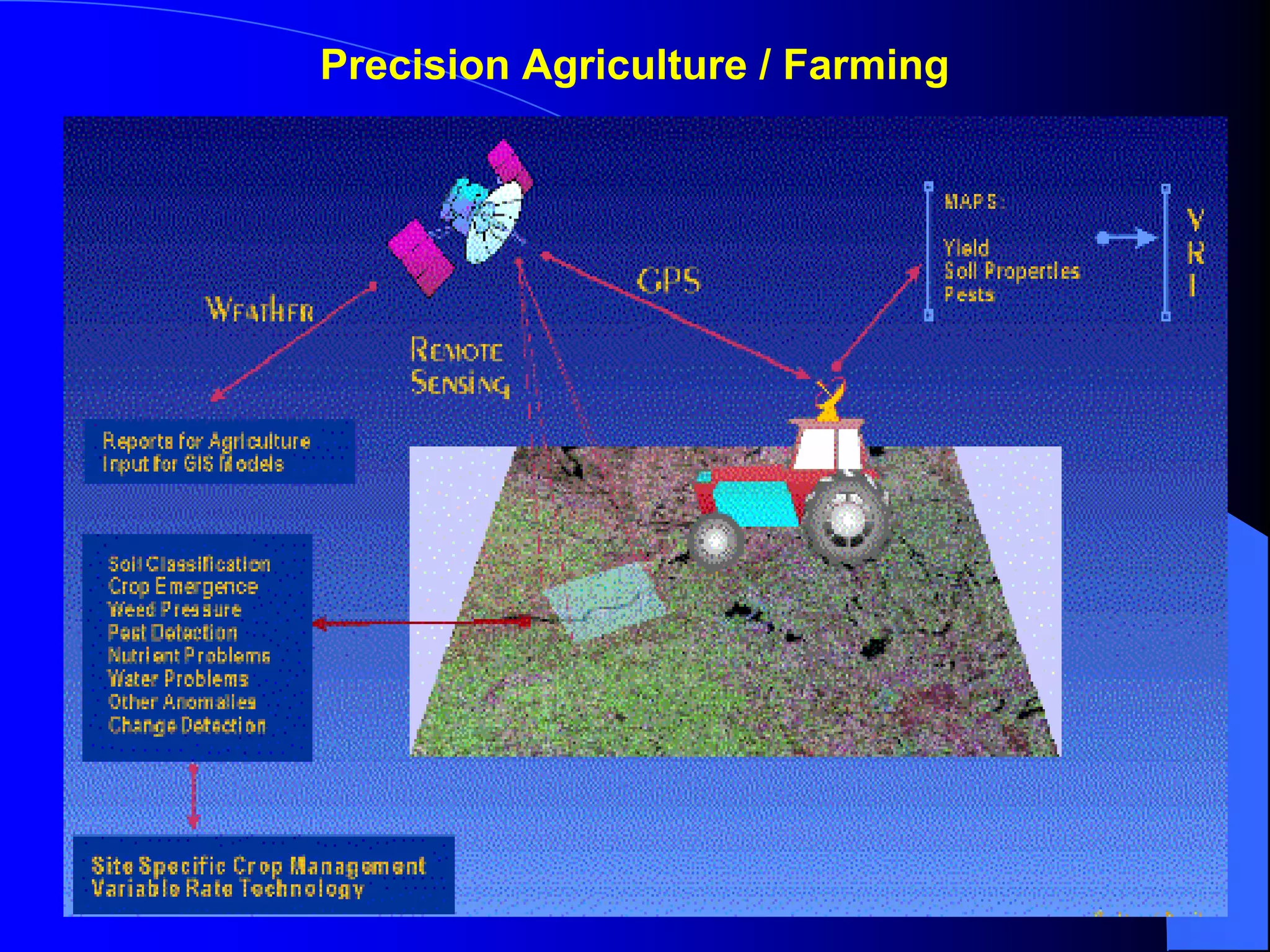
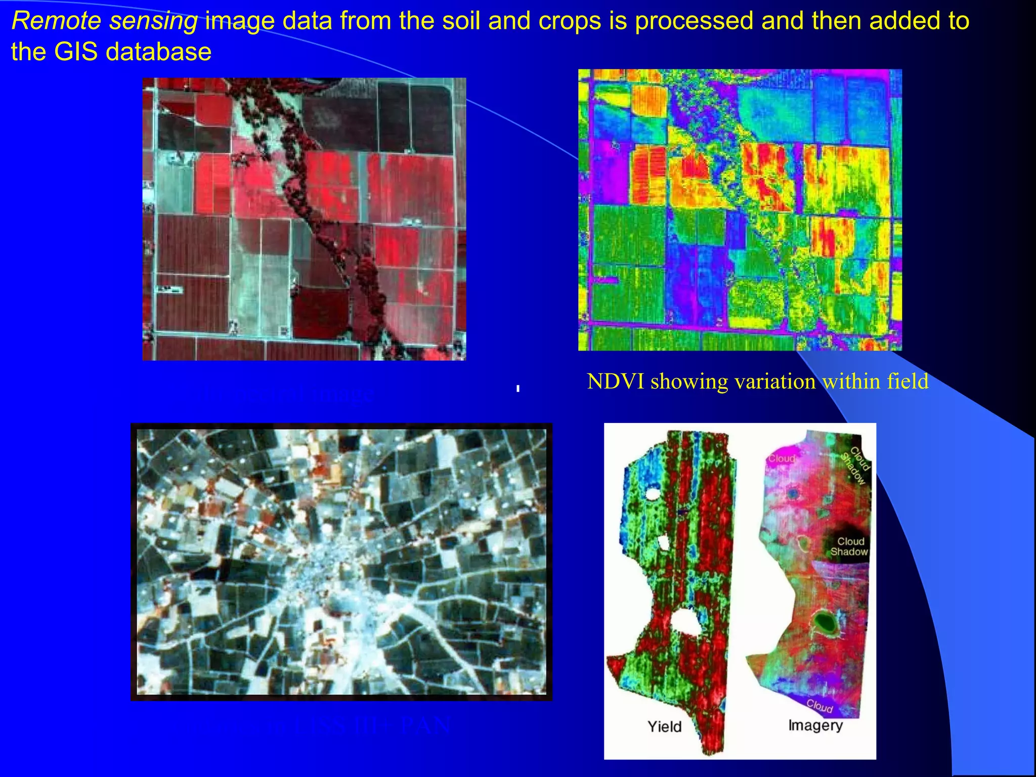
This document discusses the use of remote sensing and GIS applications in agriculture in India. It provides details on the advantages of remote sensing for agricultural surveys compared to conventional methods. It also describes typical spectral reflectance characteristics of vegetation and bands of the IRS-1D LISS-III satellite. The document outlines India's satellite capabilities for remote sensing and examples of applications like crop inventory, yield prediction, and drought monitoring. It discusses challenges in India including small fields and issues developing methodology for crop surveys and inventory using remote sensing techniques.