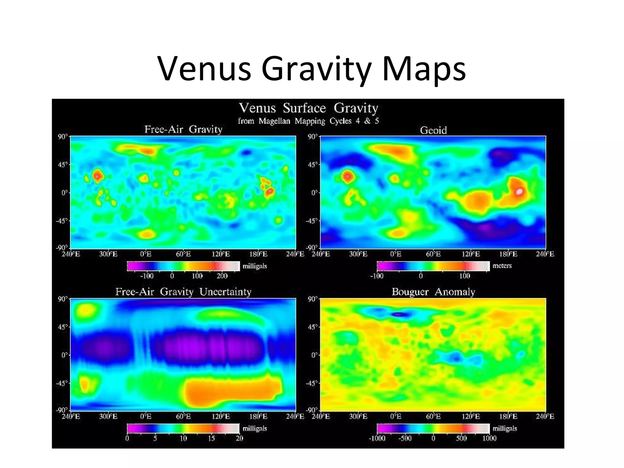
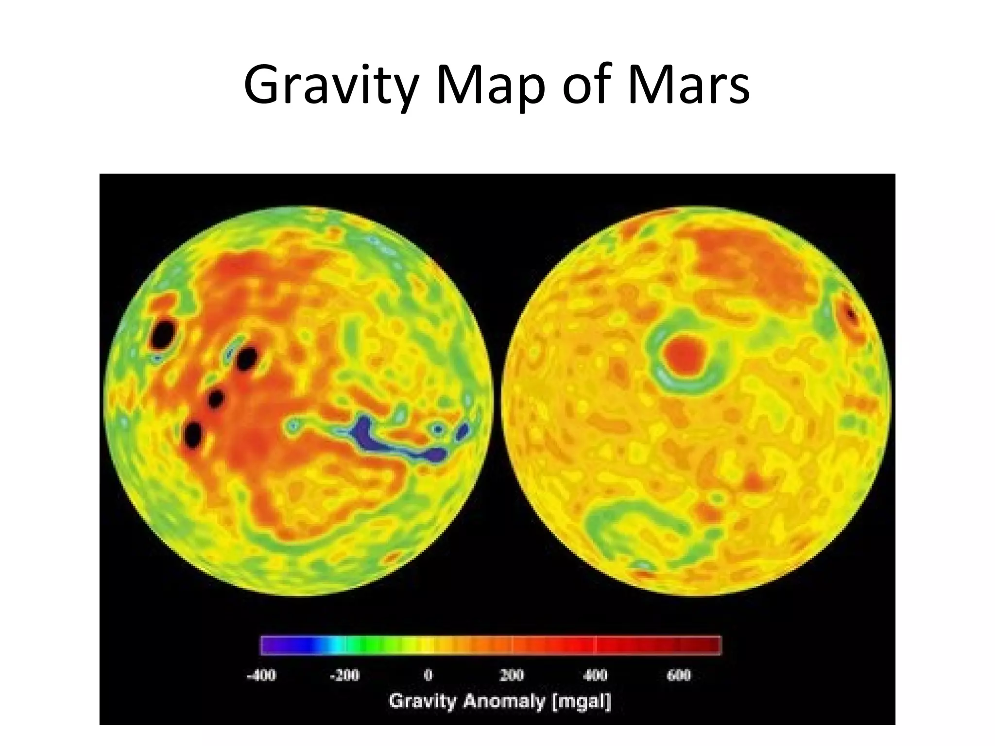
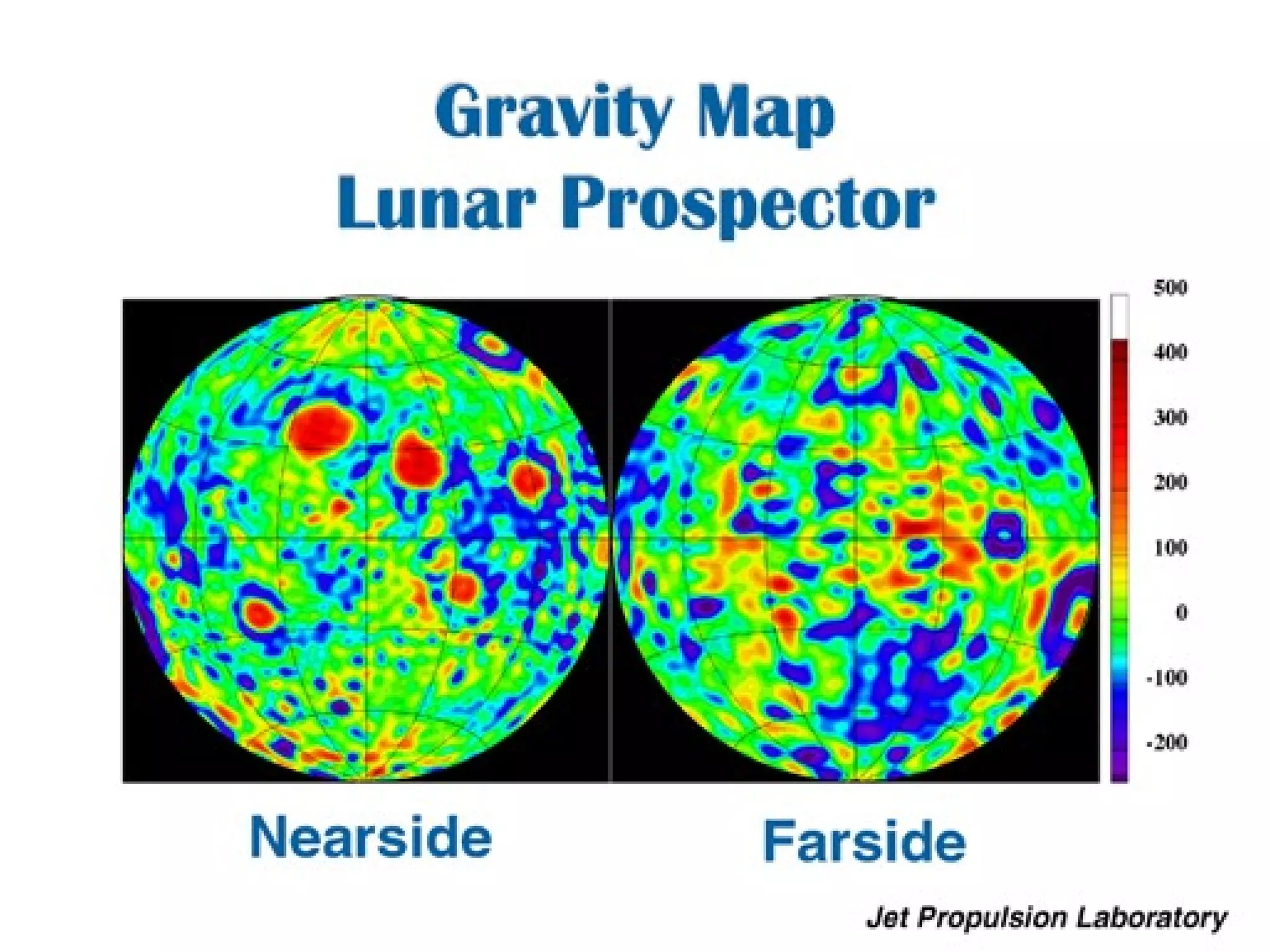
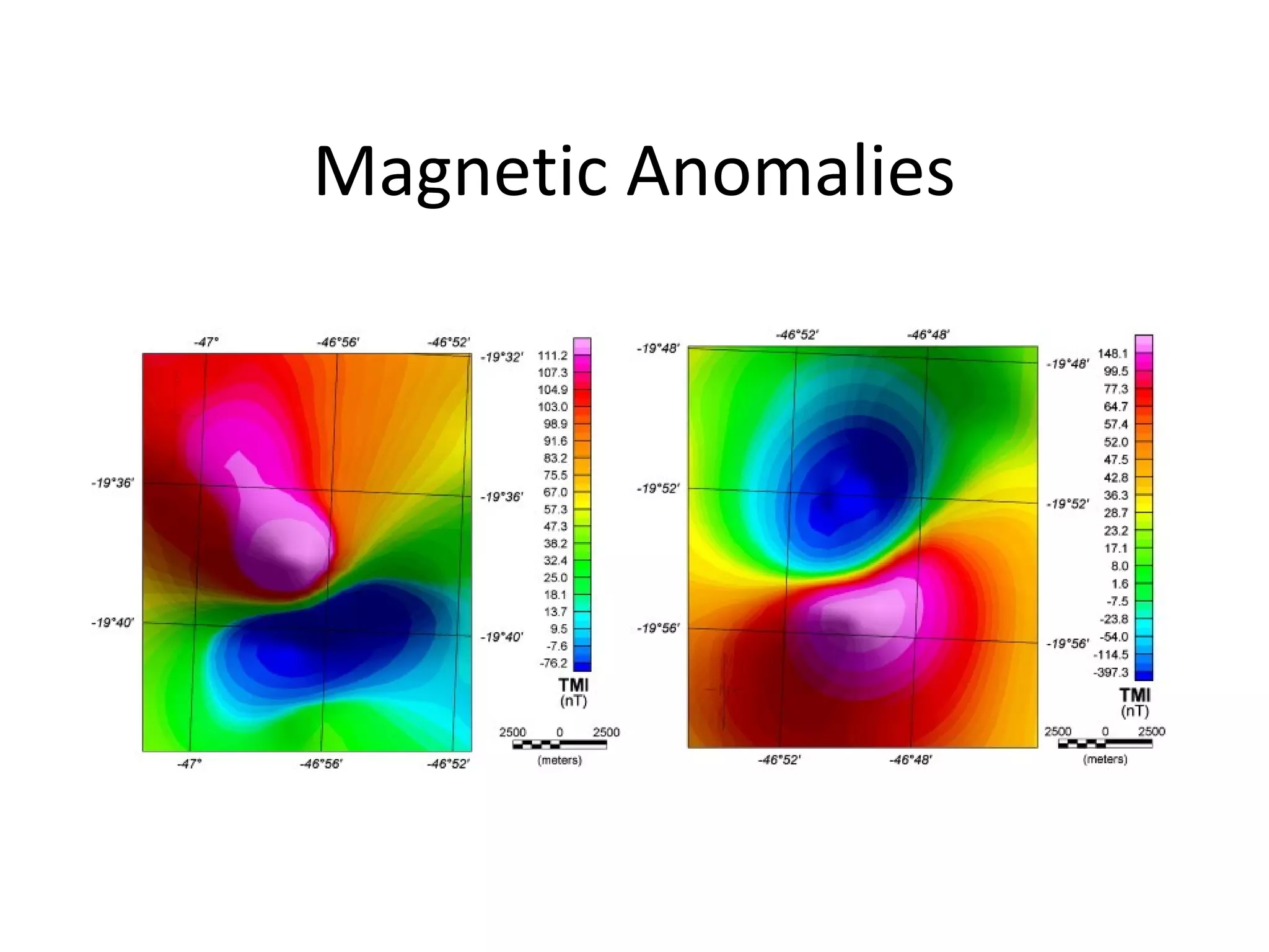
- Gravity and magnetic mapping techniques measure small variations in the Earth's gravity and magnetic fields to infer properties of subsurface geology.
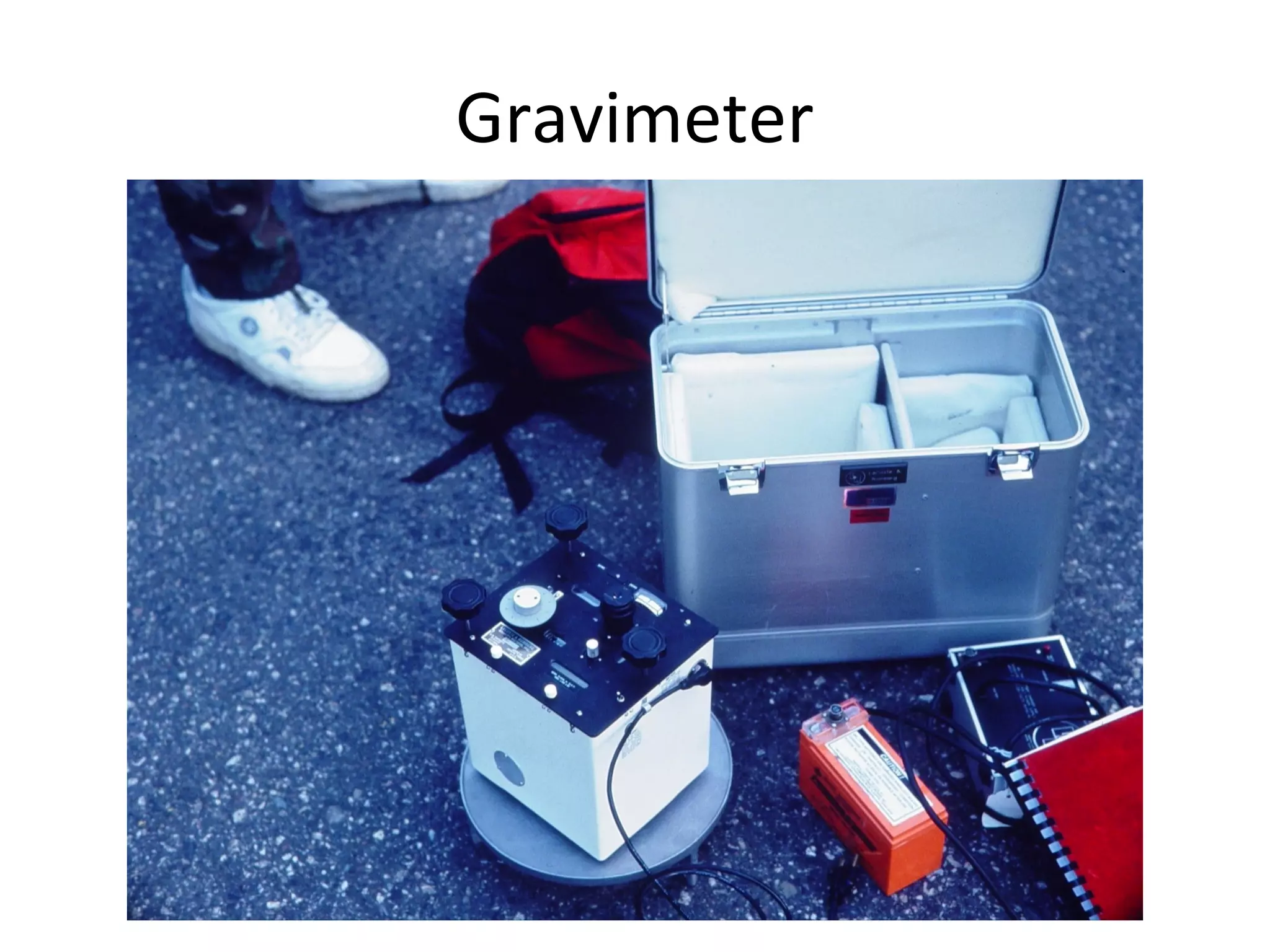
- Gravity mapping uses highly sensitive spring balances called gravimeters to detect variations as small as 0.001 mgal, while magnetic mapping uses electronic instruments to continuously record magnetic field variations.
- Corrections must be applied to gravity and magnetic data to account for factors like latitude, elevation, density variations, and temporal changes in the magnetic field.
- Interpretation of the residual anomaly maps provides constraints on the locations, shapes, and depths of subsurface density and magnetic sources, allowing inference of geological structures.
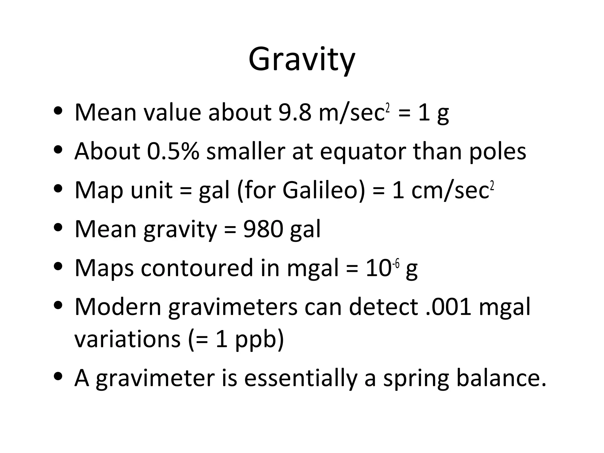
Gravity
• Mean valueabout 9.8 m/sec2
= 1 g
• About 0.5% smaller at equator than poles
• Map unit = gal (for Galileo) = 1 cm/sec2
• Mean gravity = 980 gal
• Maps contoured in mgal = 10-6
g
• Modern gravimeters can detect .001 mgal
variations (= 1 ppb)
• A gravimeter is essentially a spring balance.
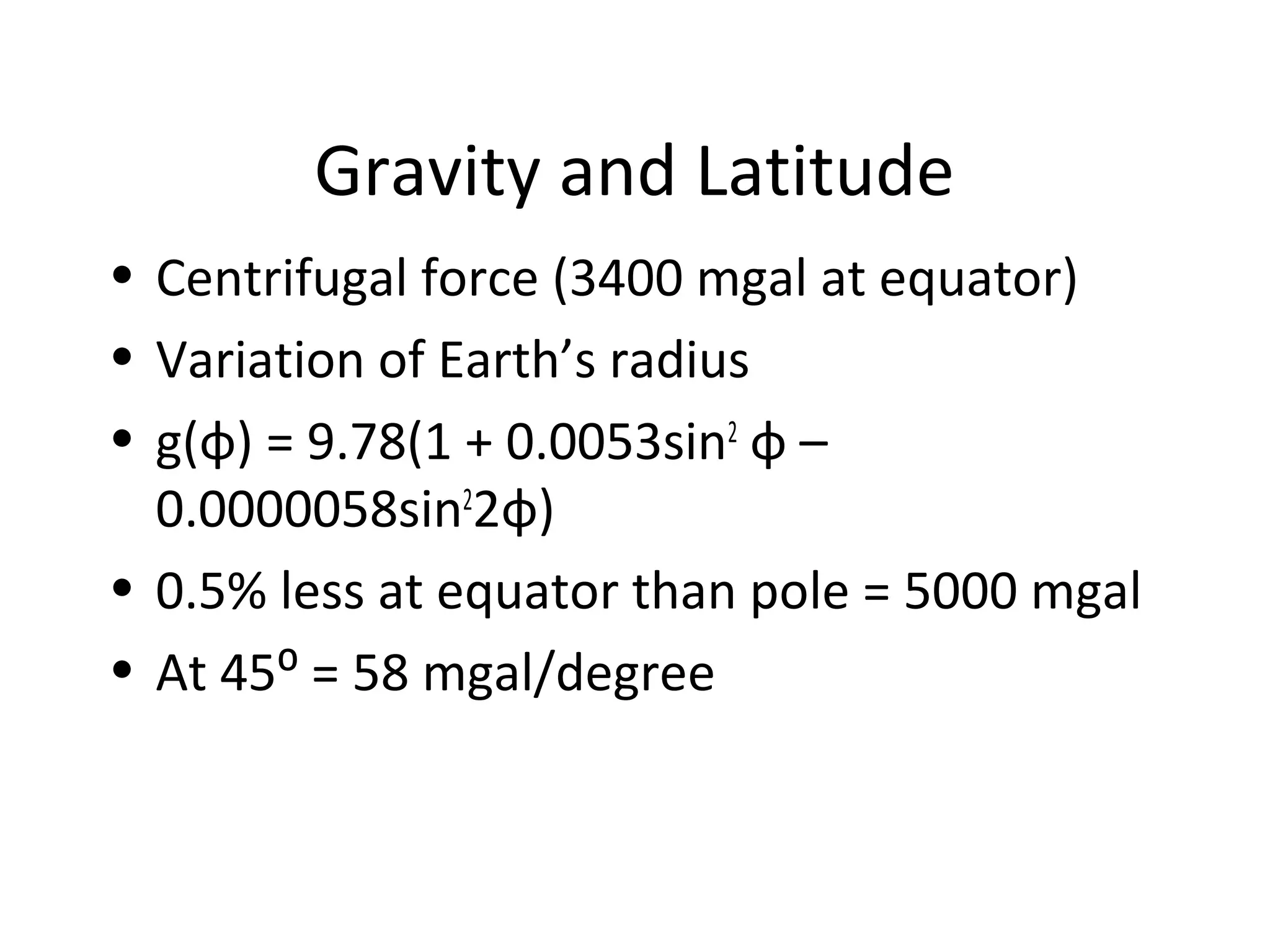
Gravity and Latitude
•Centrifugal force (3400 mgal at equator)
• Variation of Earth’s radius
• g(φ) = 9.78(1 + 0.0053sin2
φ –
0.0000058sin2
2φ)
• 0.5% less at equator than pole = 5000 mgal
• At 45⁰ = 58 mgal/degree
6.
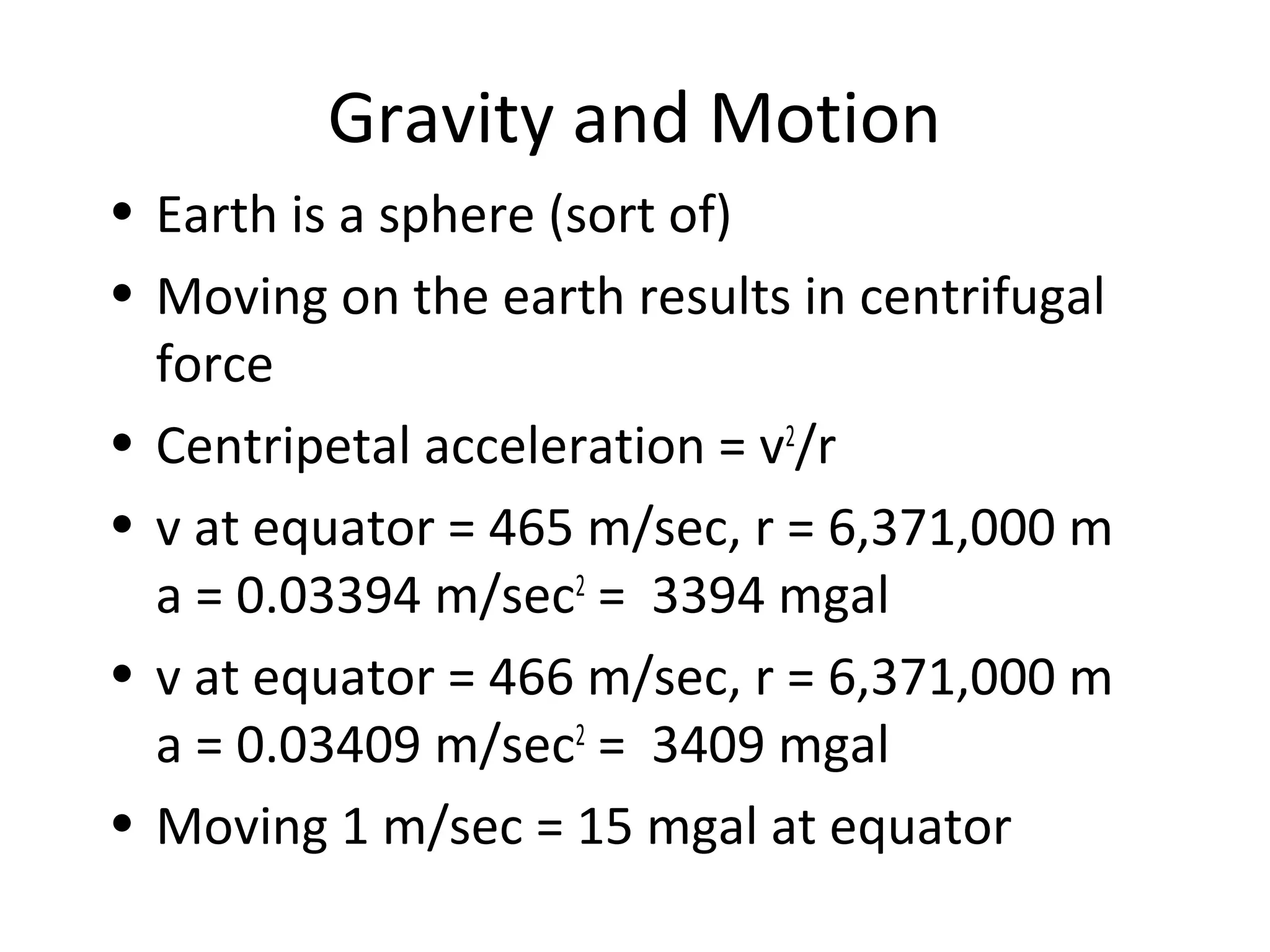
Gravity and Motion
•Earth is a sphere (sort of)
• Moving on the earth results in centrifugal
force
• Centripetal acceleration = v2
/r
• v at equator = 465 m/sec, r = 6,371,000 m
a = 0.03394 m/sec2
= 3394 mgal
• v at equator = 466 m/sec, r = 6,371,000 m
a = 0.03409 m/sec2
= 3409 mgal
• Moving 1 m/sec = 15 mgal at equator
7.
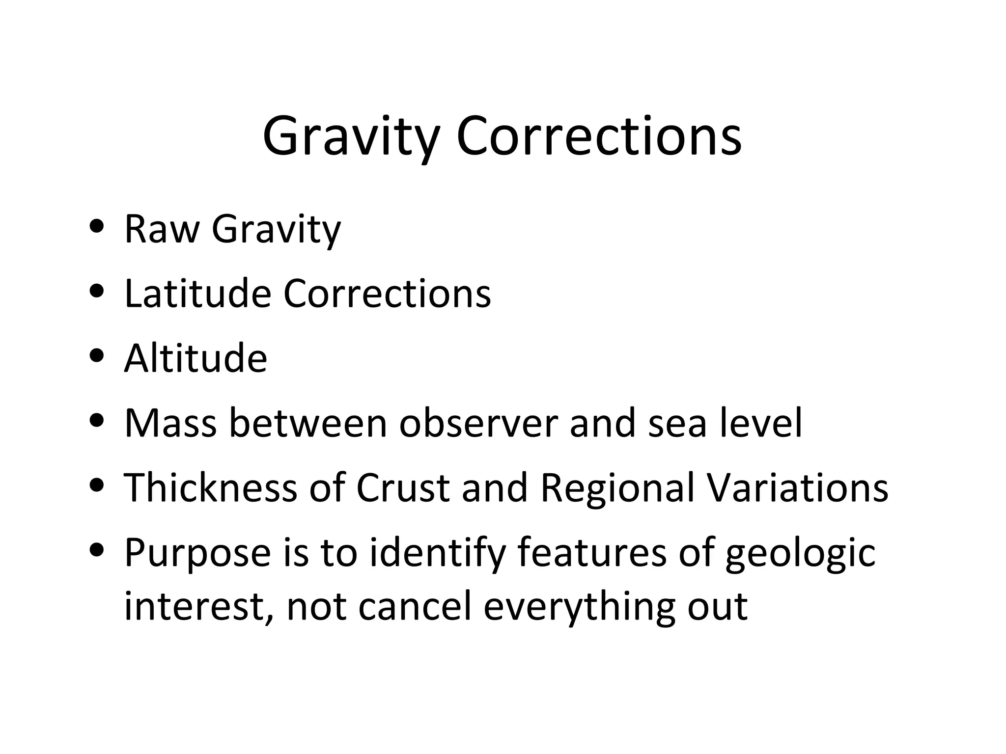
Gravity Corrections
• RawGravity
• Latitude Corrections
• Altitude
• Mass between observer and sea level
• Thickness of Crust and Regional Variations
• Purpose is to identify features of geologic
interest, not cancel everything out
8.
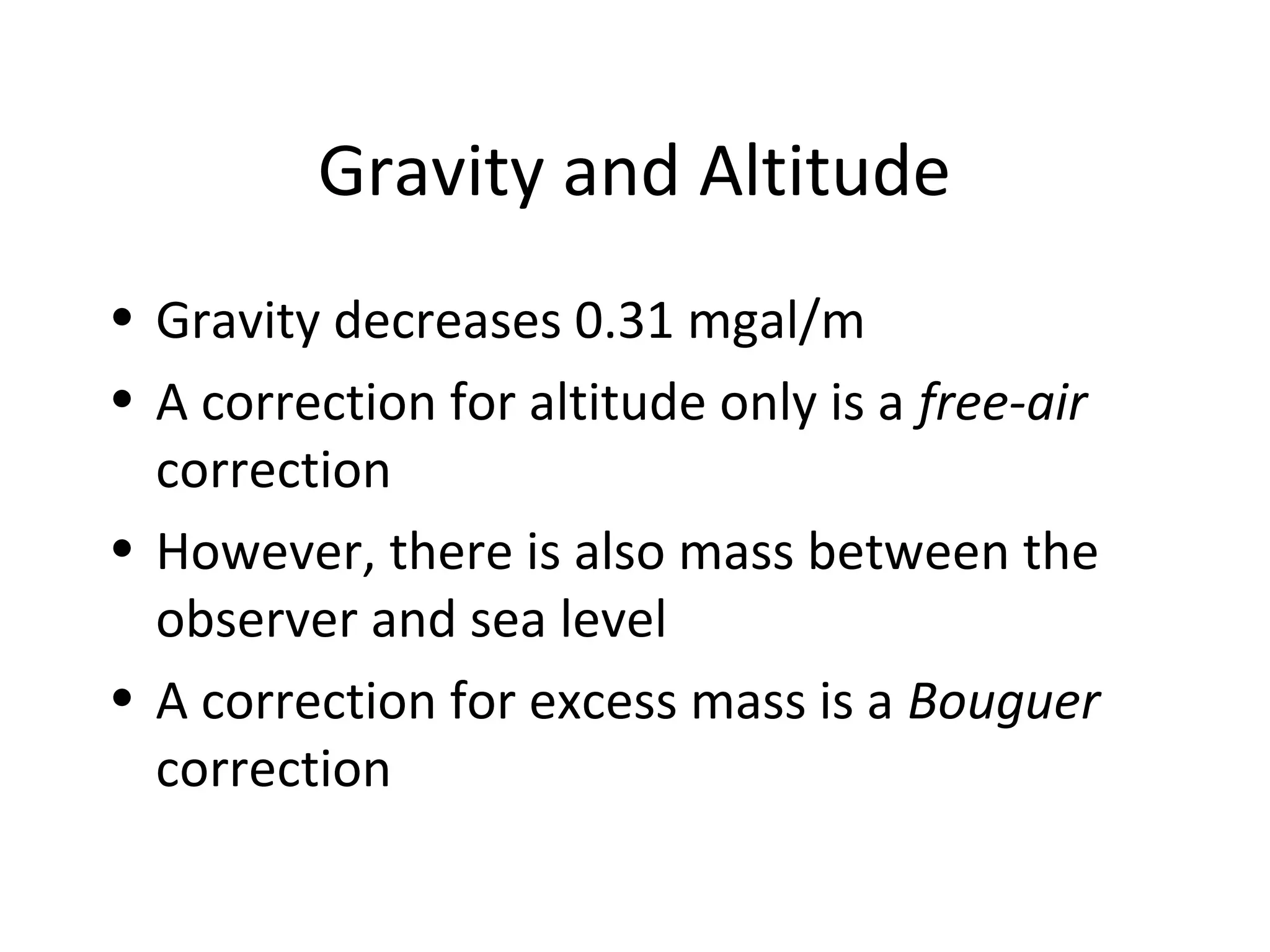
Gravity and Altitude
•Gravity decreases 0.31 mgal/m
• A correction for altitude only is a free-air
correction
• However, there is also mass between the
observer and sea level
• A correction for excess mass is a Bouguer
correction
9.
Gravitational Attraction ofa Plate
• Attraction of a plate = 2 πG ρ t
• Note there is no elevation term
• If ρ = 1000 kg/m3
and t = 1 m
• 2 πG ρ t = 41.93 × 10⁻⁸
m/s2
= 0.042 mgal
• For ρ = 2700 kg/m3
, correction = 0.11
mgal/m
• Combined with altitude correction, total
correction = 0.19 mgal/m
10.
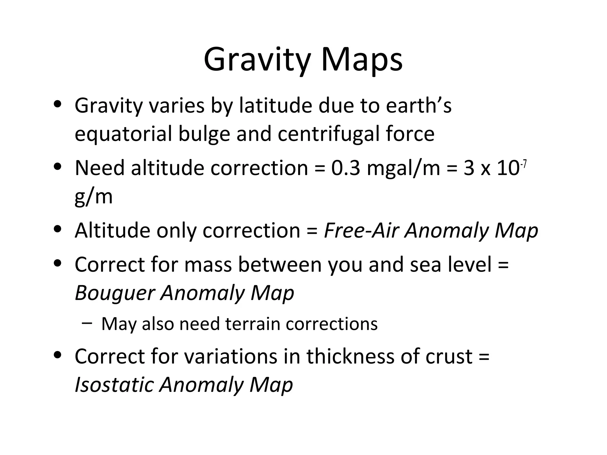
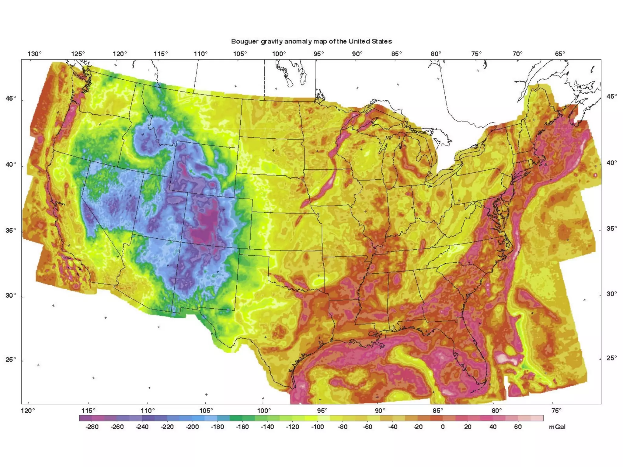
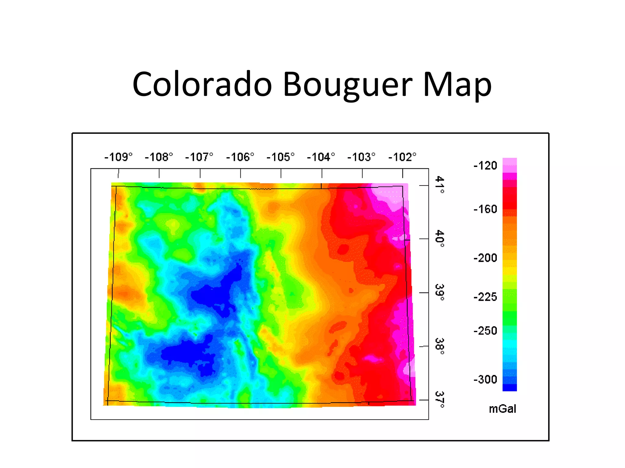
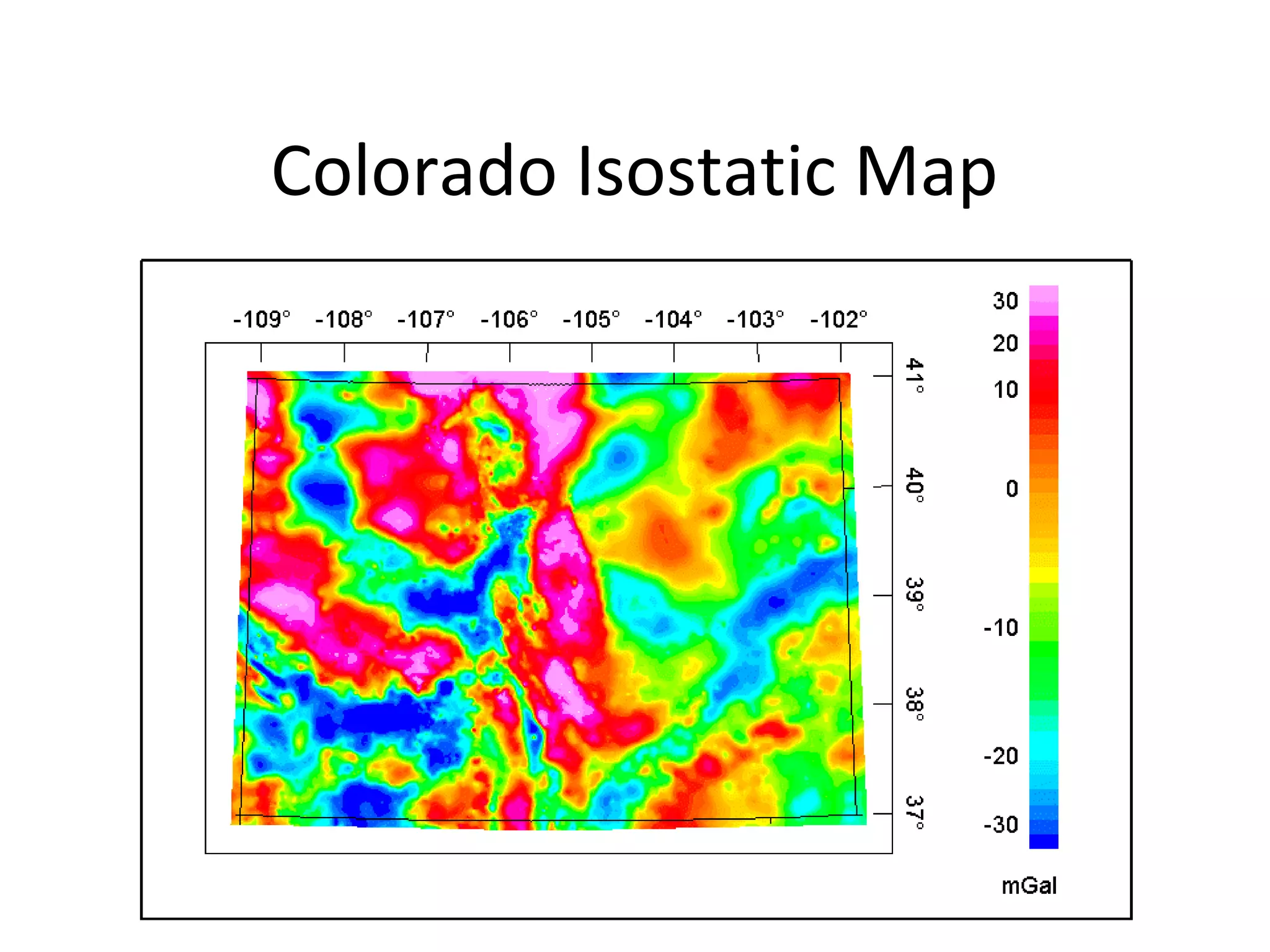
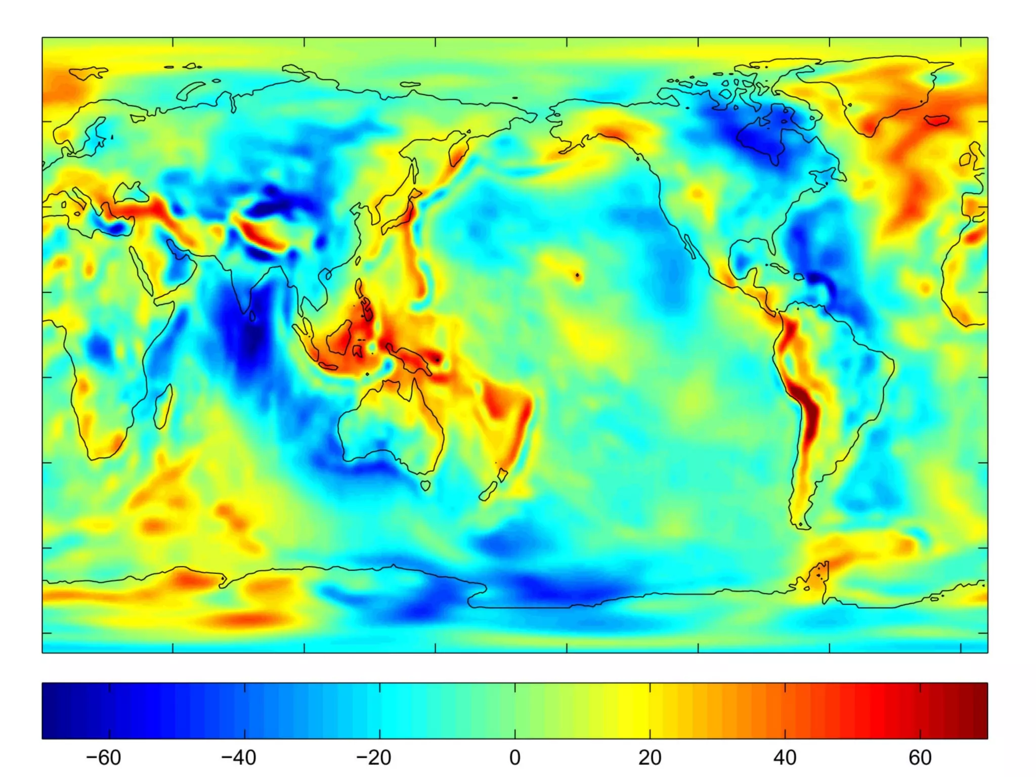
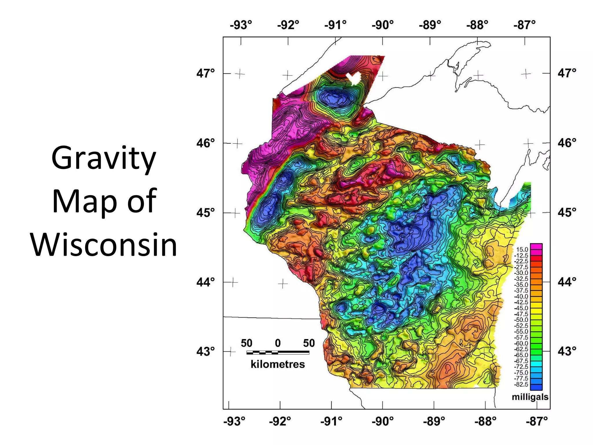
Gravity Maps
• Gravityvaries by latitude due to earth’s
equatorial bulge and centrifugal force
• Need altitude correction = 0.3 mgal/m = 3 x 10⁻⁷
g/m
• Altitude only correction = Free-Air Anomaly Map
• Correct for mass between you and sea level =
Bouguer Anomaly Map
– May also need terrain corrections
• Correct for variations in thickness of crust =
Isostatic Anomaly Map
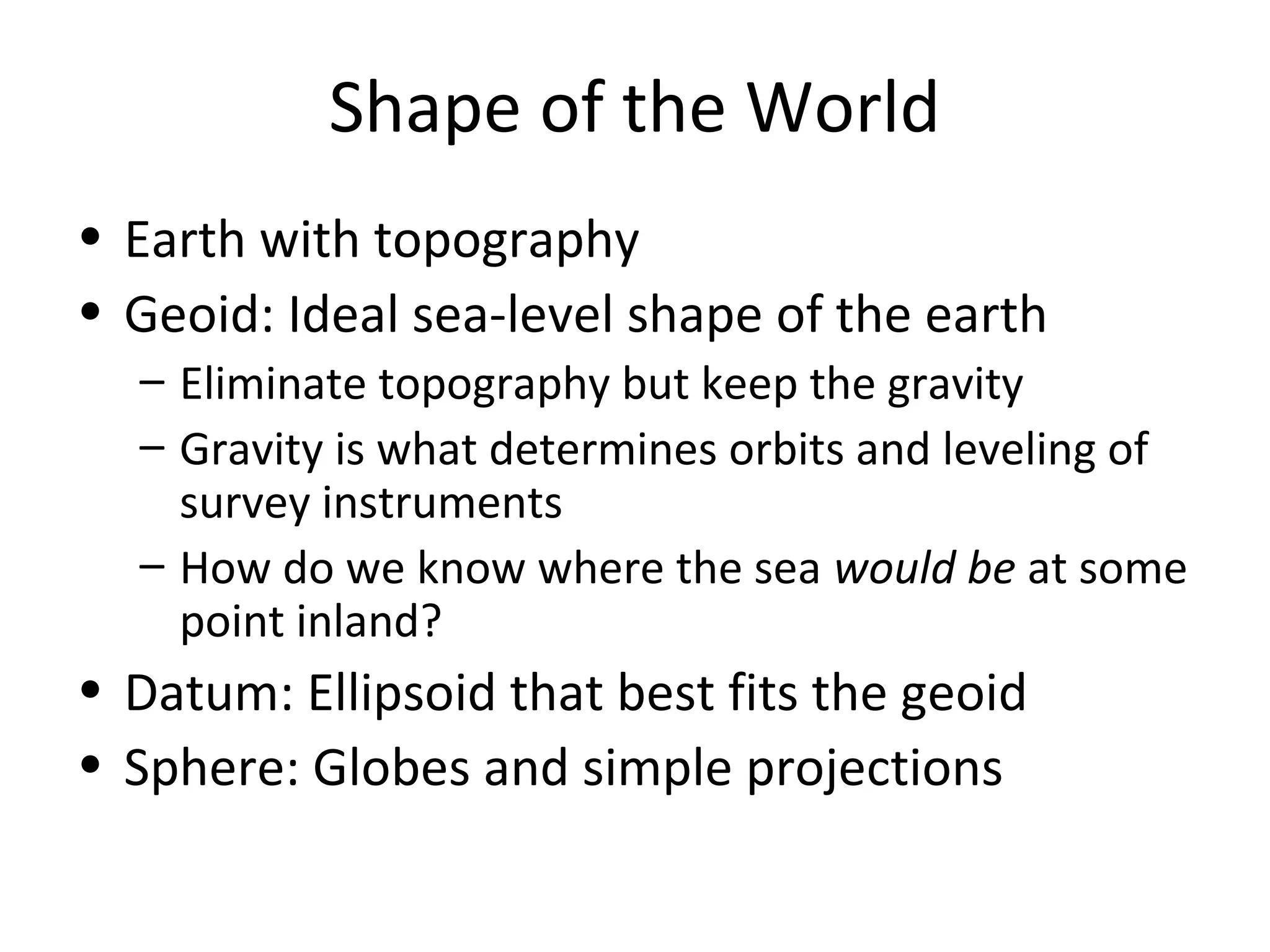
Shape of theWorld
• Earth with topography
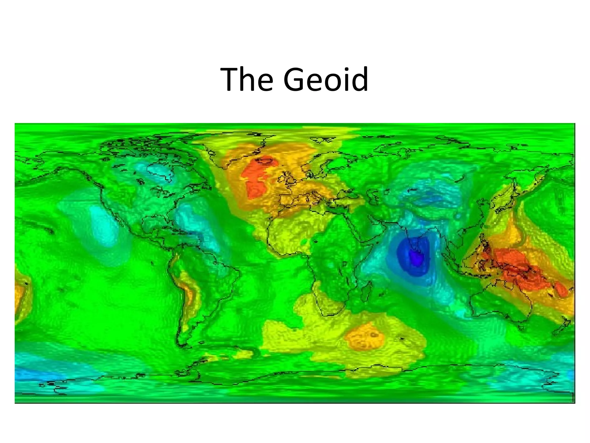
• Geoid: Ideal sea-level shape of the earth
– Eliminate topography but keep the gravity
– Gravity is what determines orbits and leveling of
survey instruments
– How do we know where the sea would be at some
point inland?
• Datum: Ellipsoid that best fits the geoid
• Sphere: Globes and simple projections
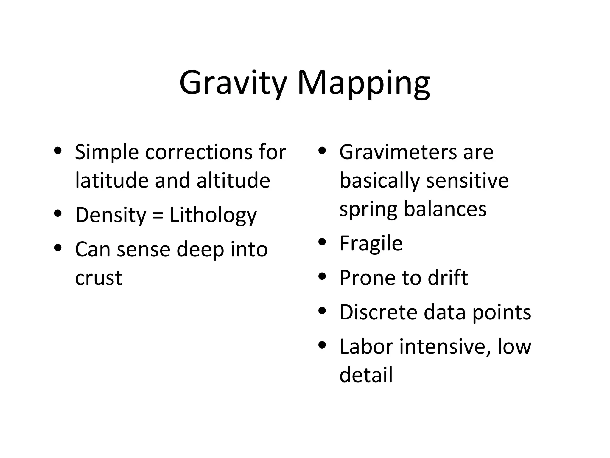
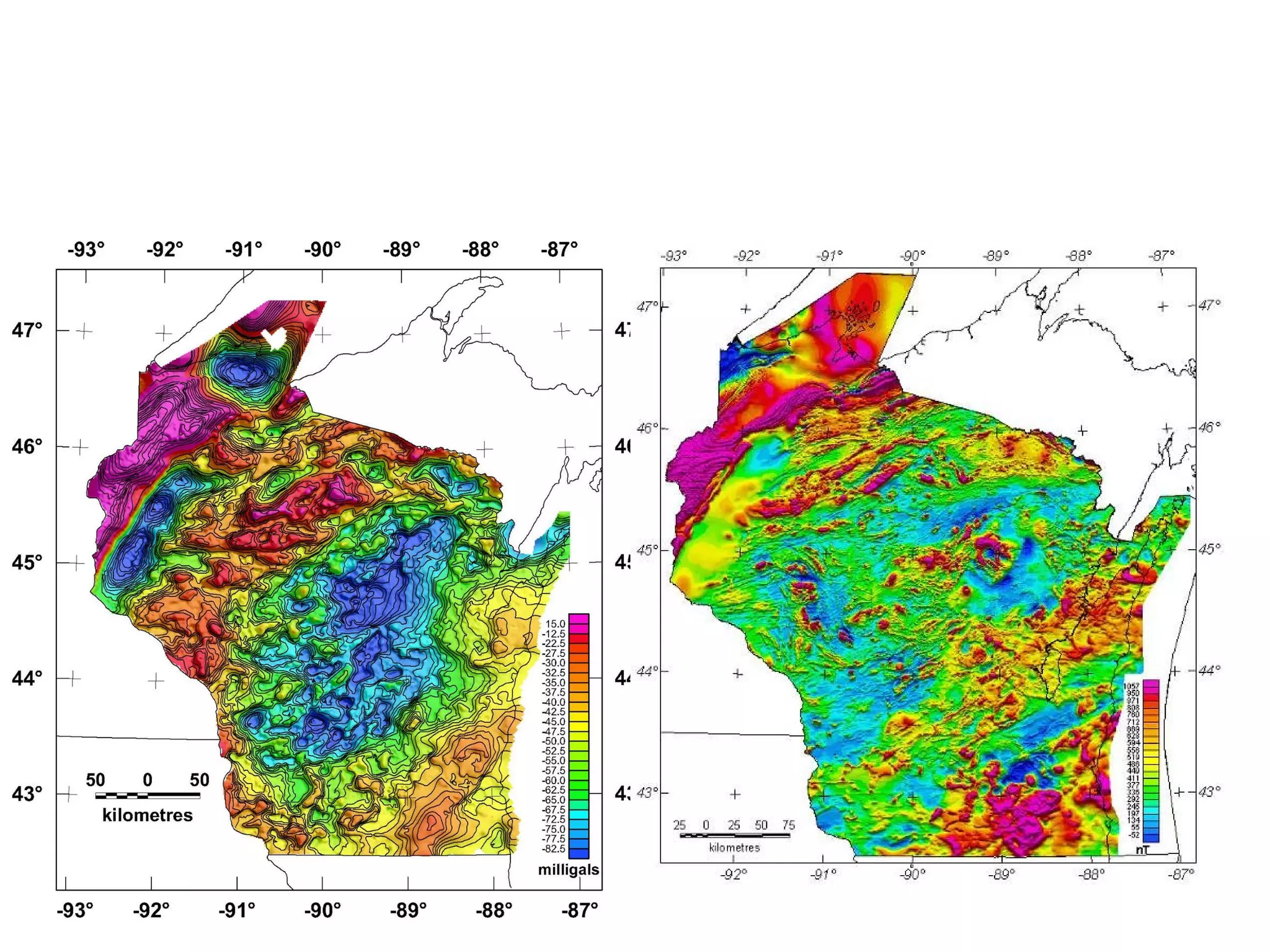
Gravity Mapping
• Simplecorrections for
latitude and altitude
• Density = Lithology
• Can sense deep into
crust
• Gravimeters are
basically sensitive
spring balances
• Fragile
• Prone to drift
• Discrete data points
• Labor intensive, low
detail
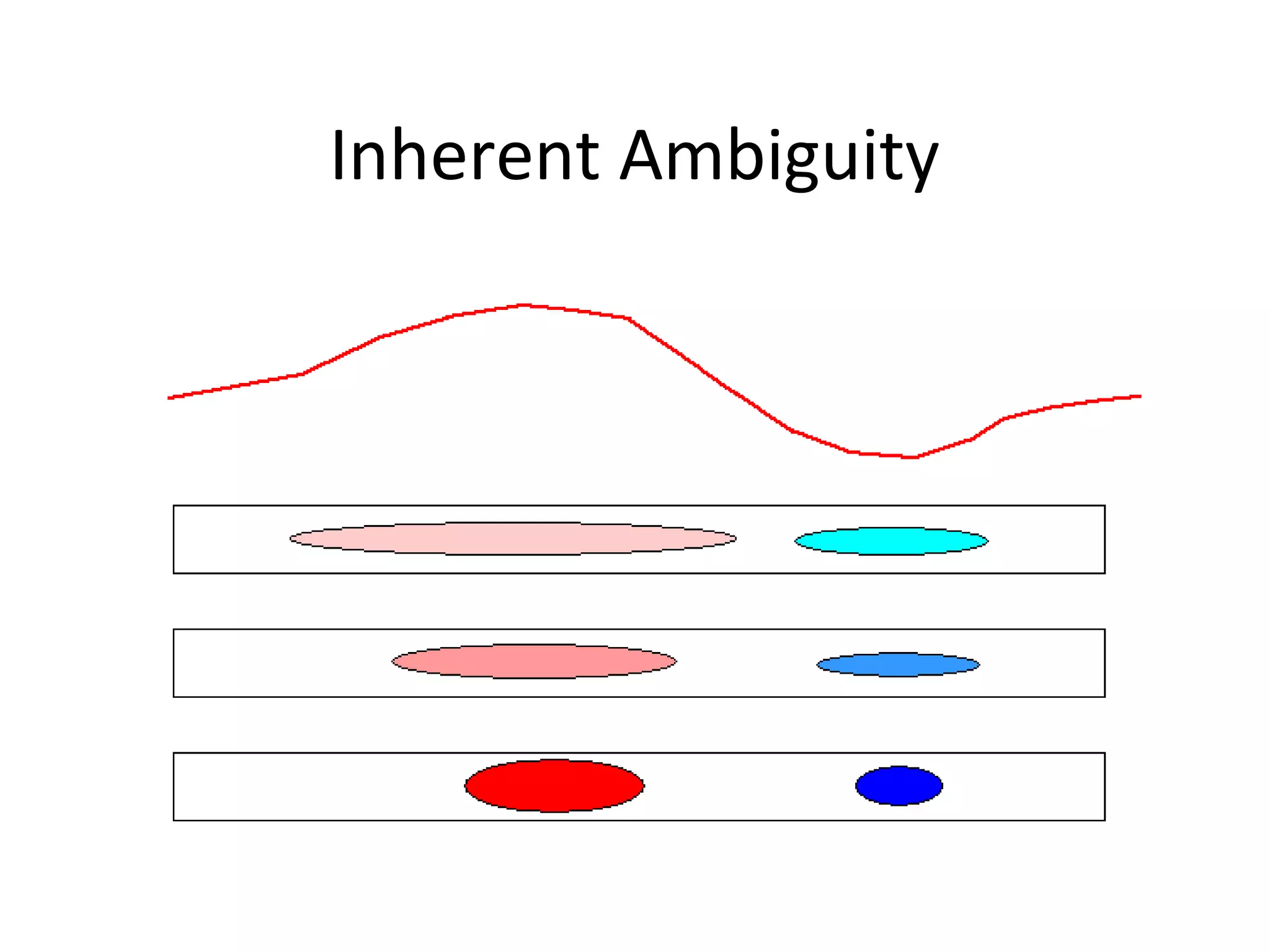
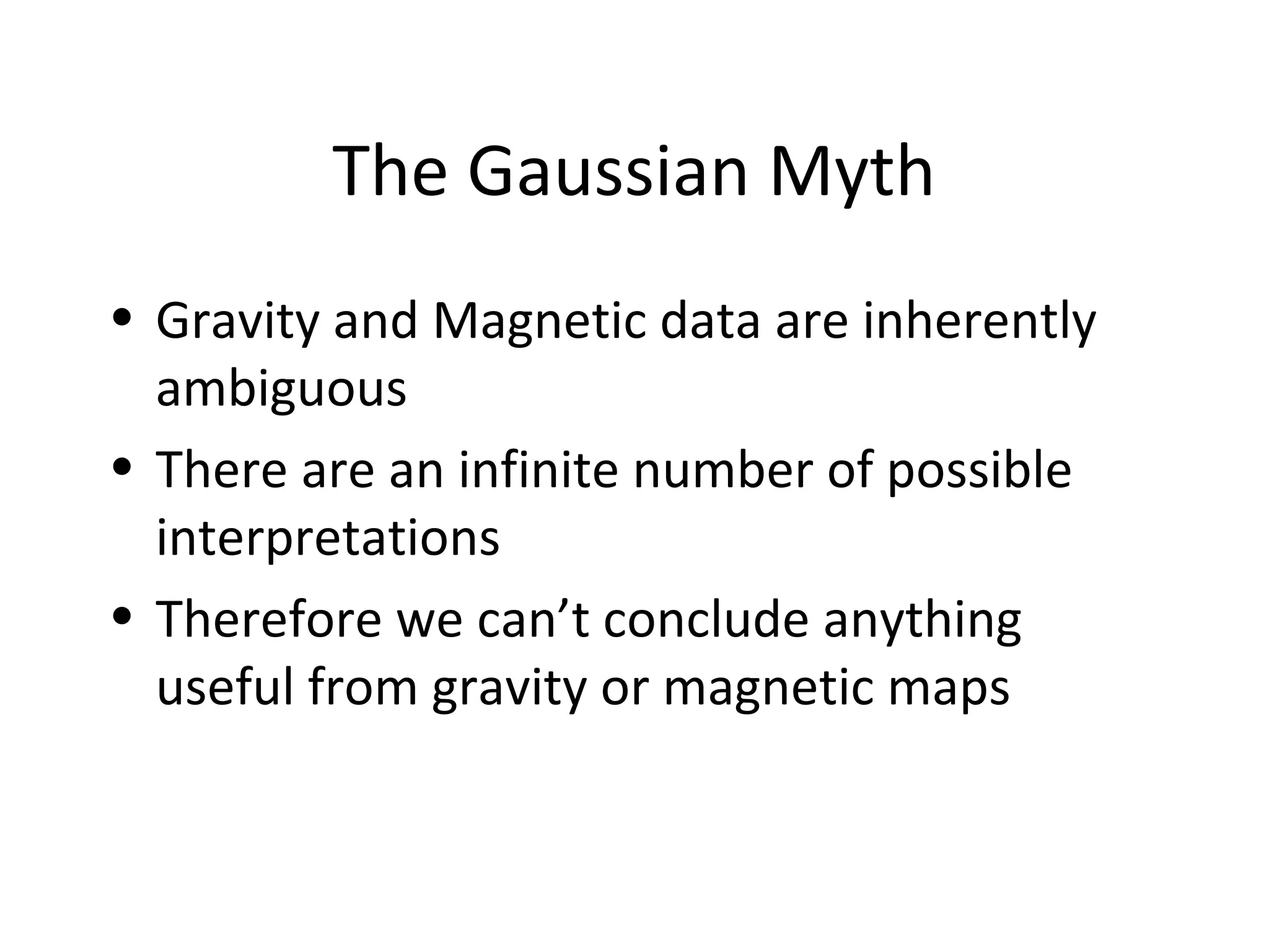
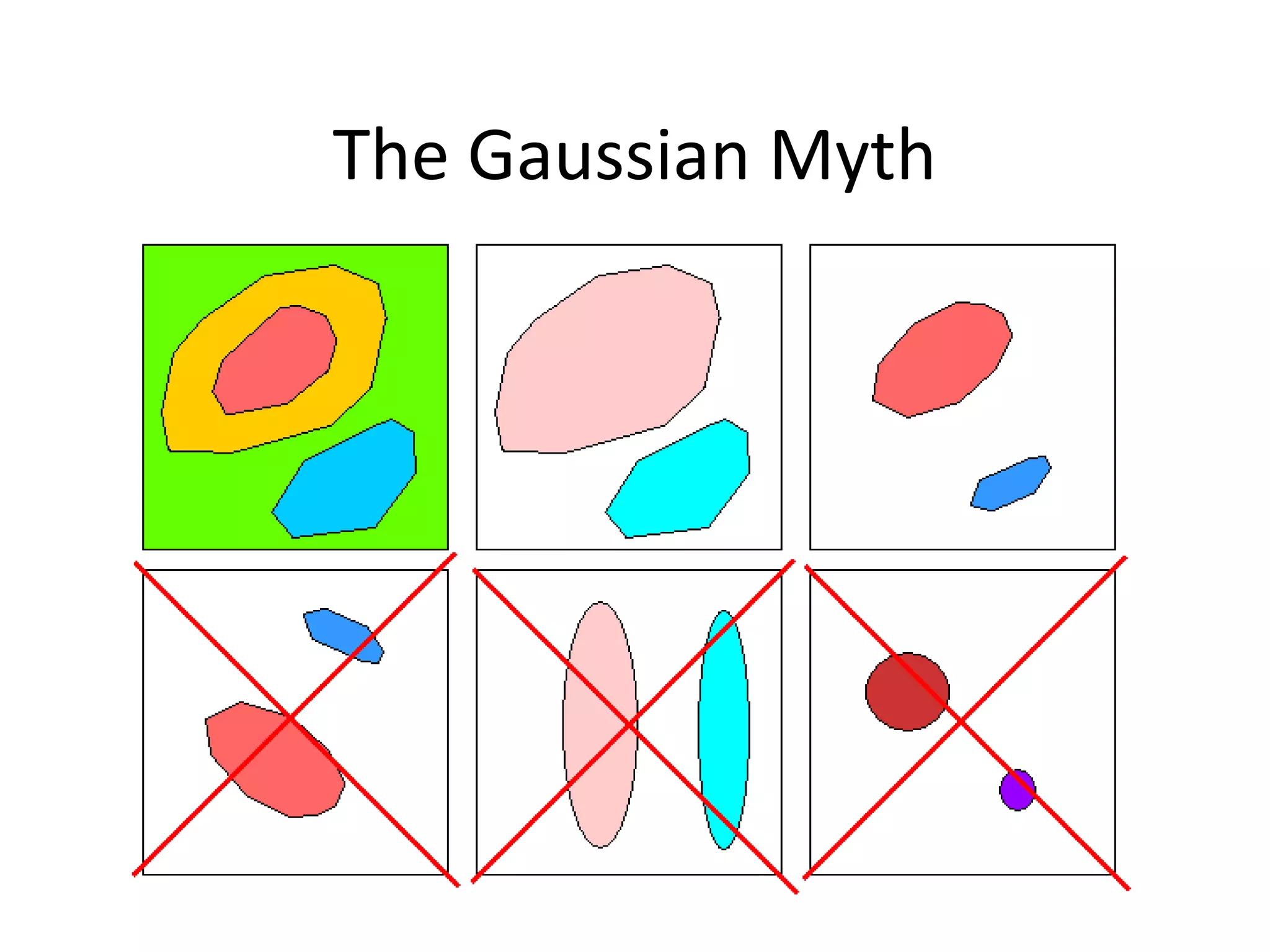
The Gaussian Myth
•Gravity and Magnetic data are inherently
ambiguous
• There are an infinite number of possible
interpretations
• Therefore we can’t conclude anything
useful from gravity or magnetic maps
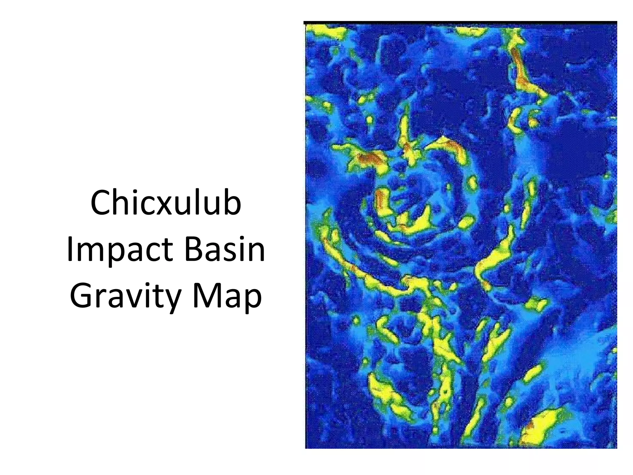
The Gaussian MythDebunked
• Locations of anomaly sources are
constrained
• Shapes of anomaly sources are constrained
• Sources cannot have geologically absurd
properties
• Maximum depths are constrained
• Total masses constrained
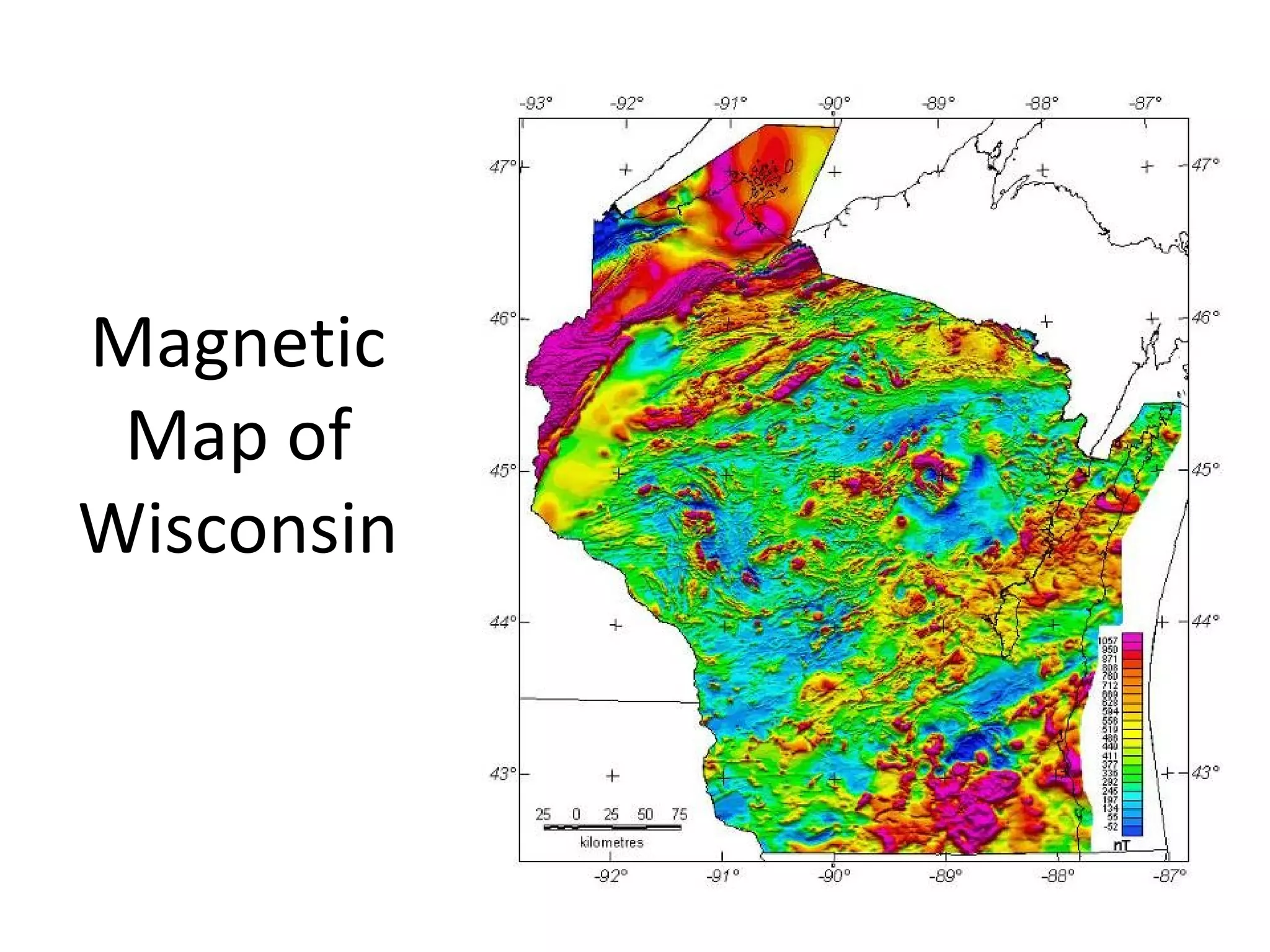
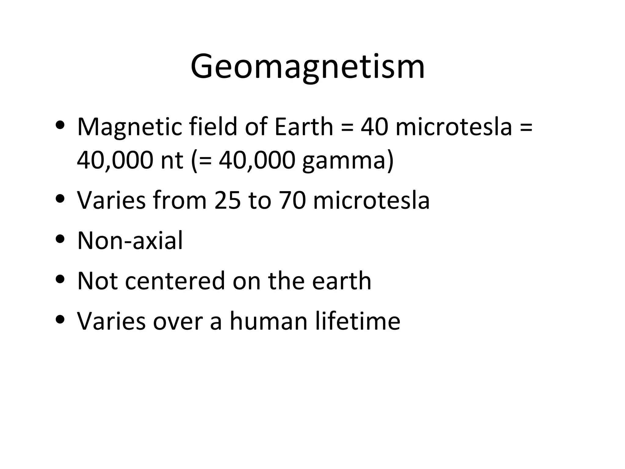
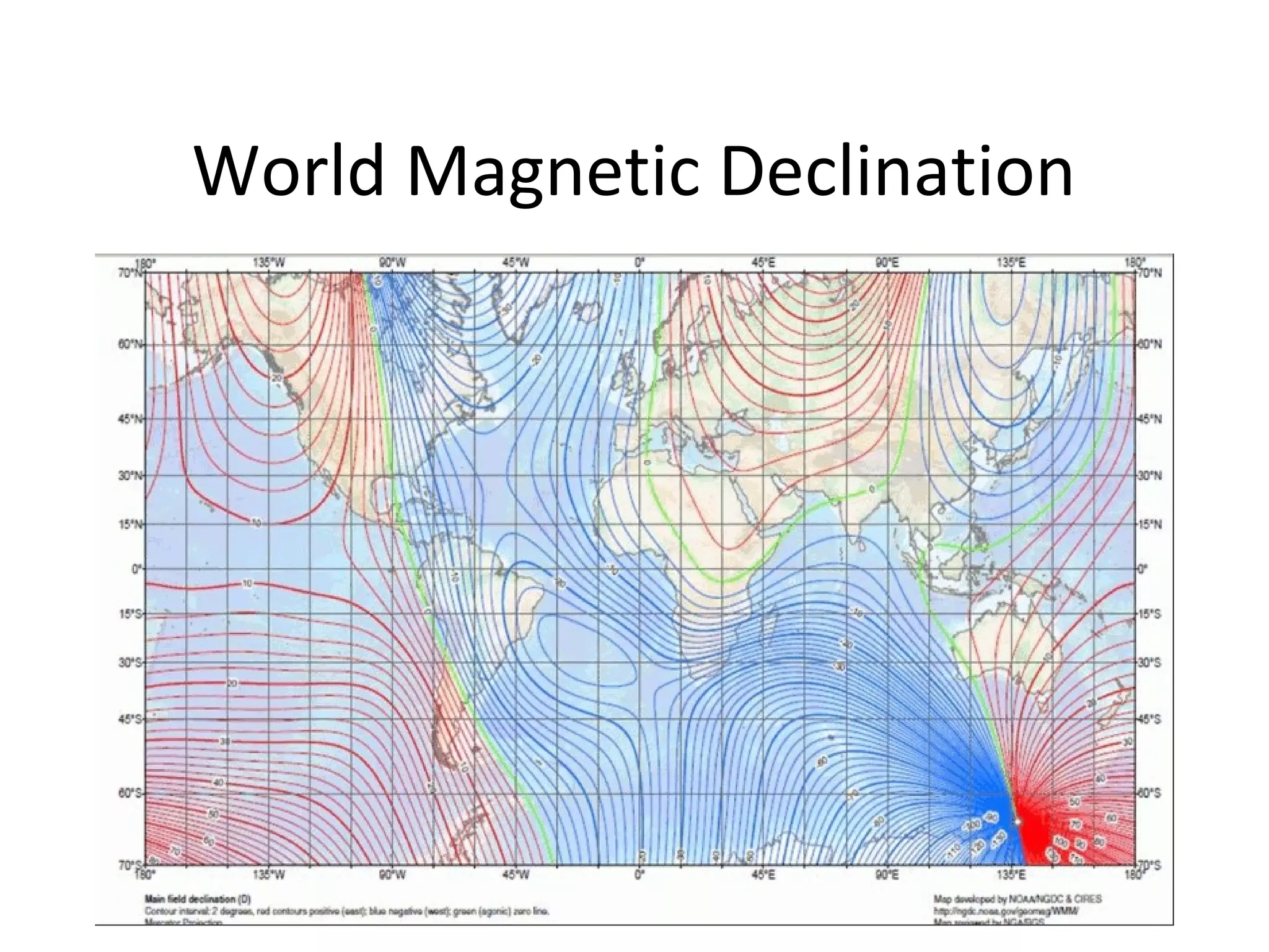
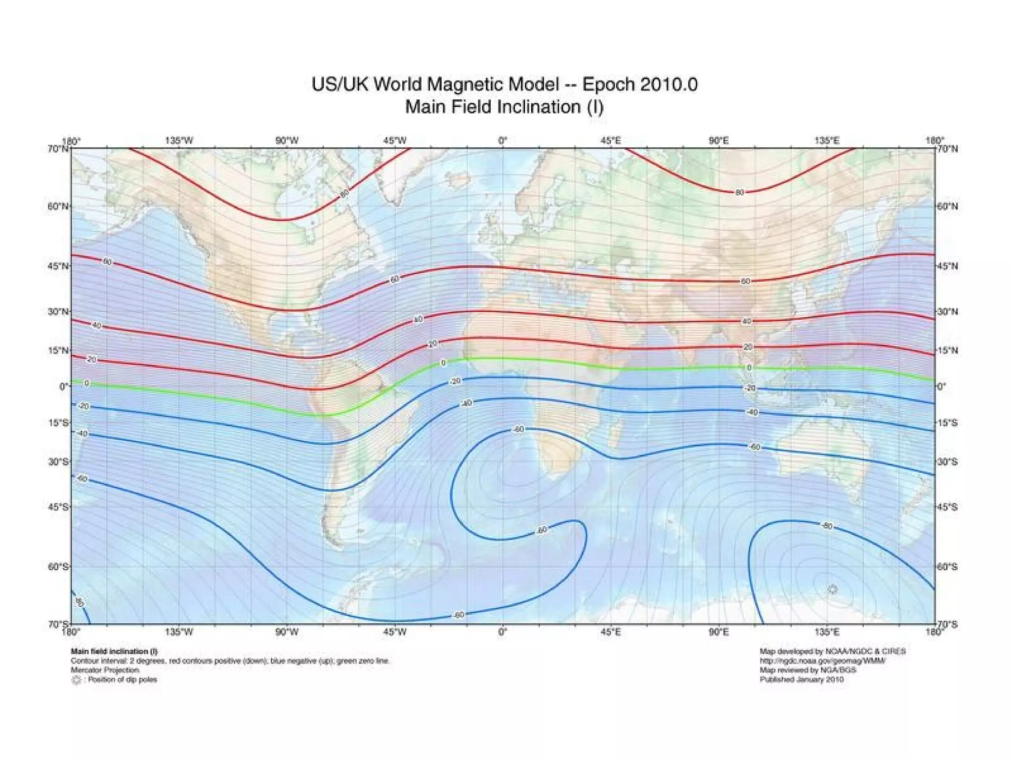
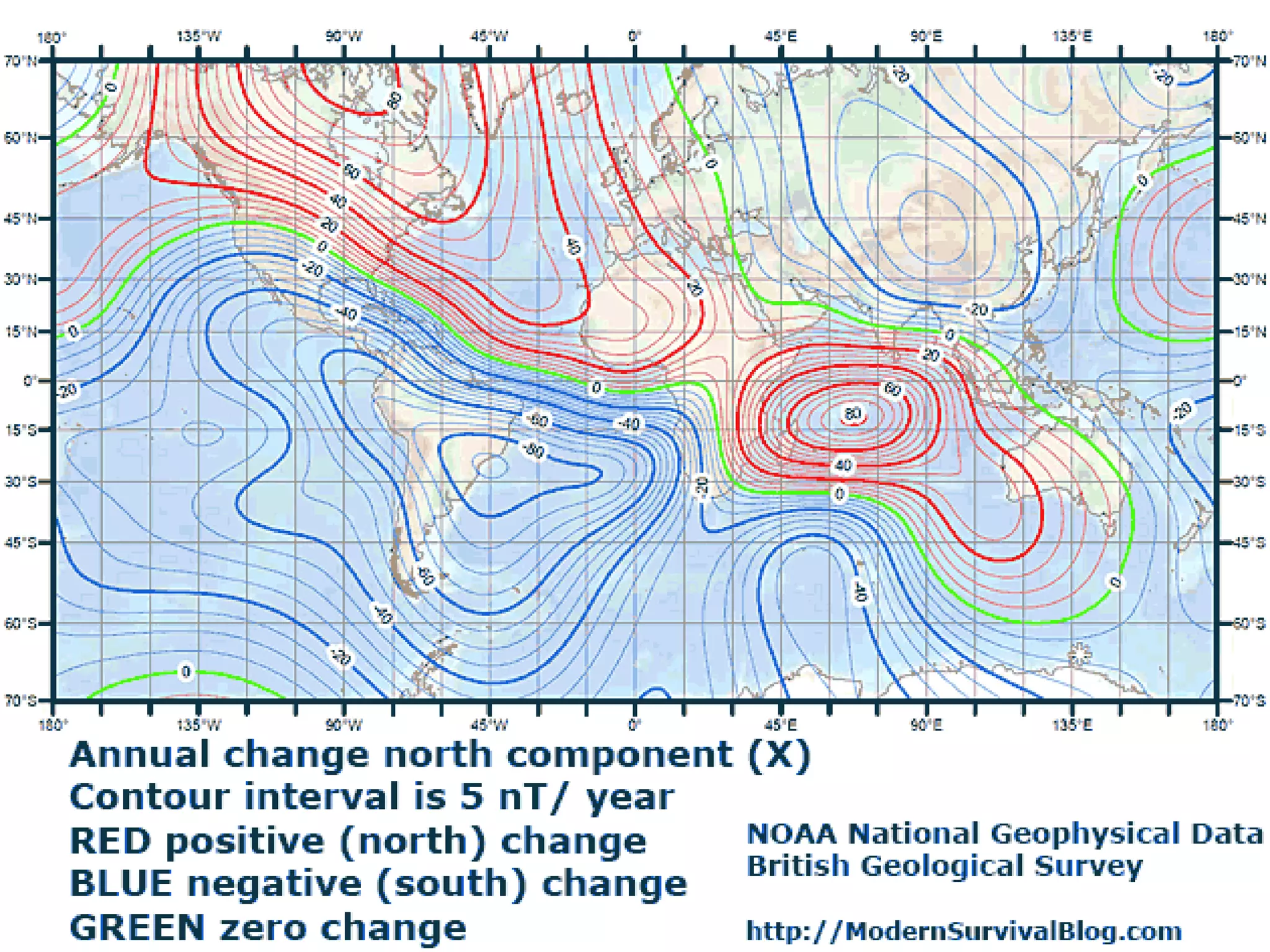
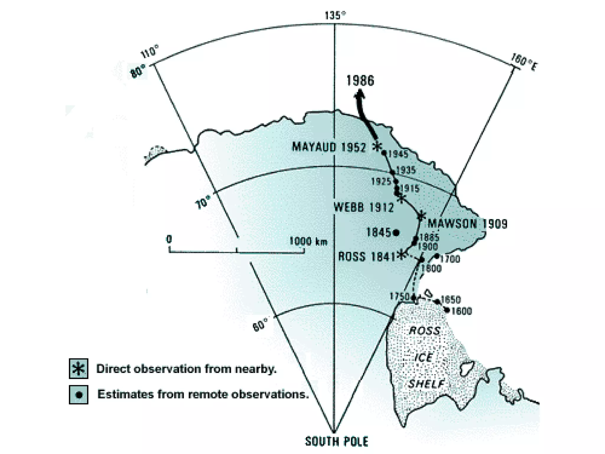
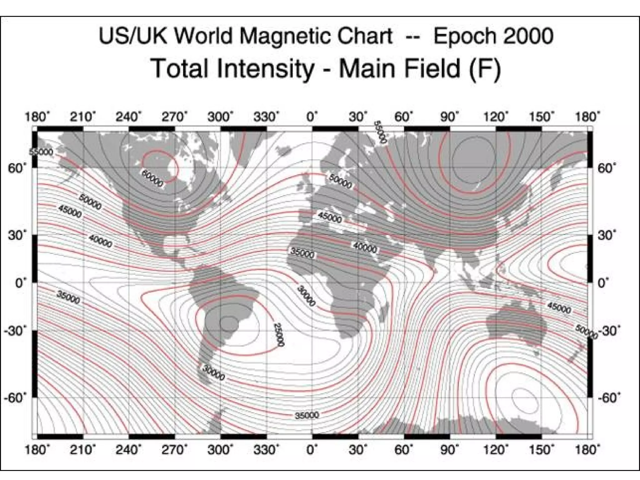
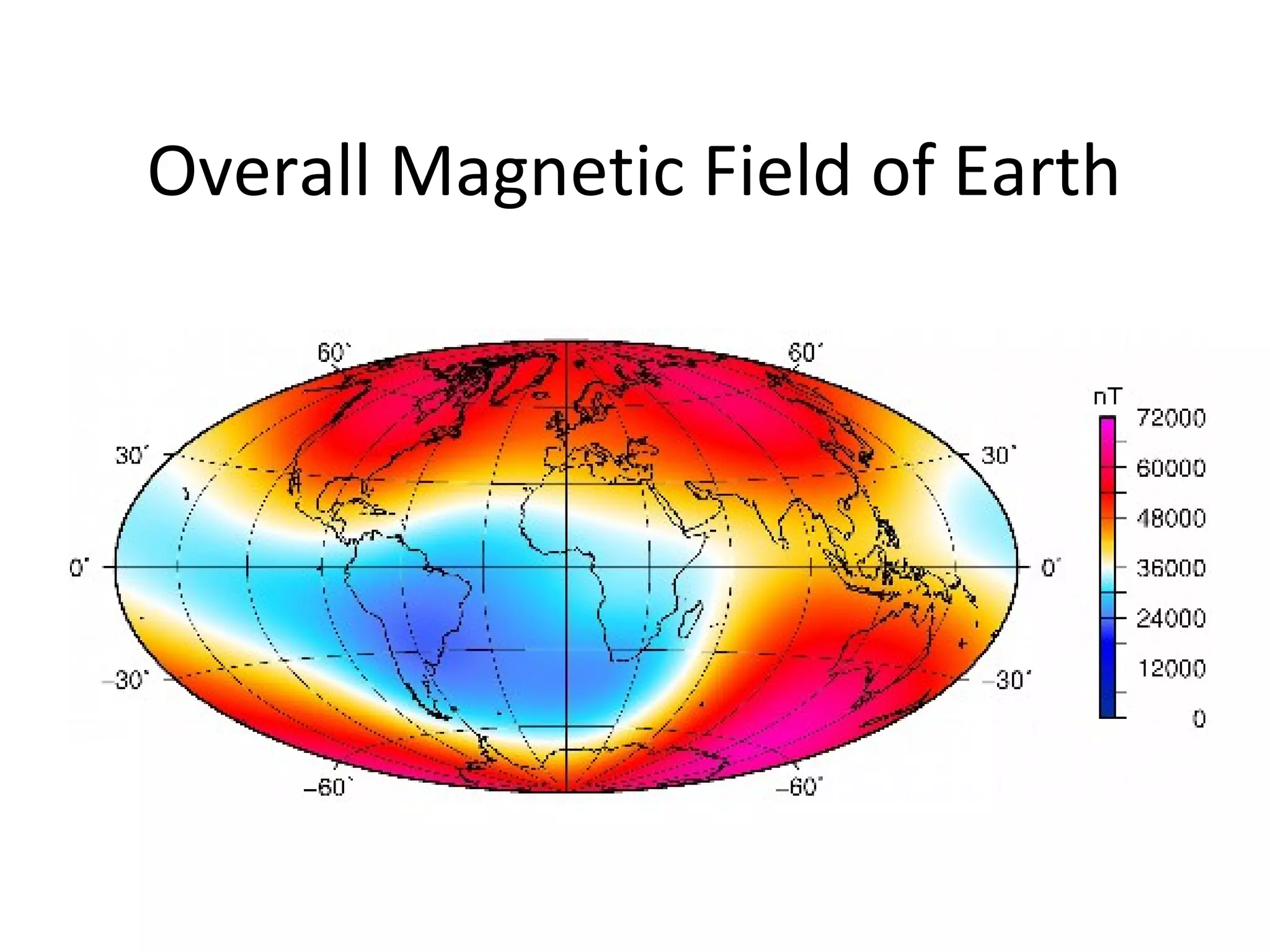
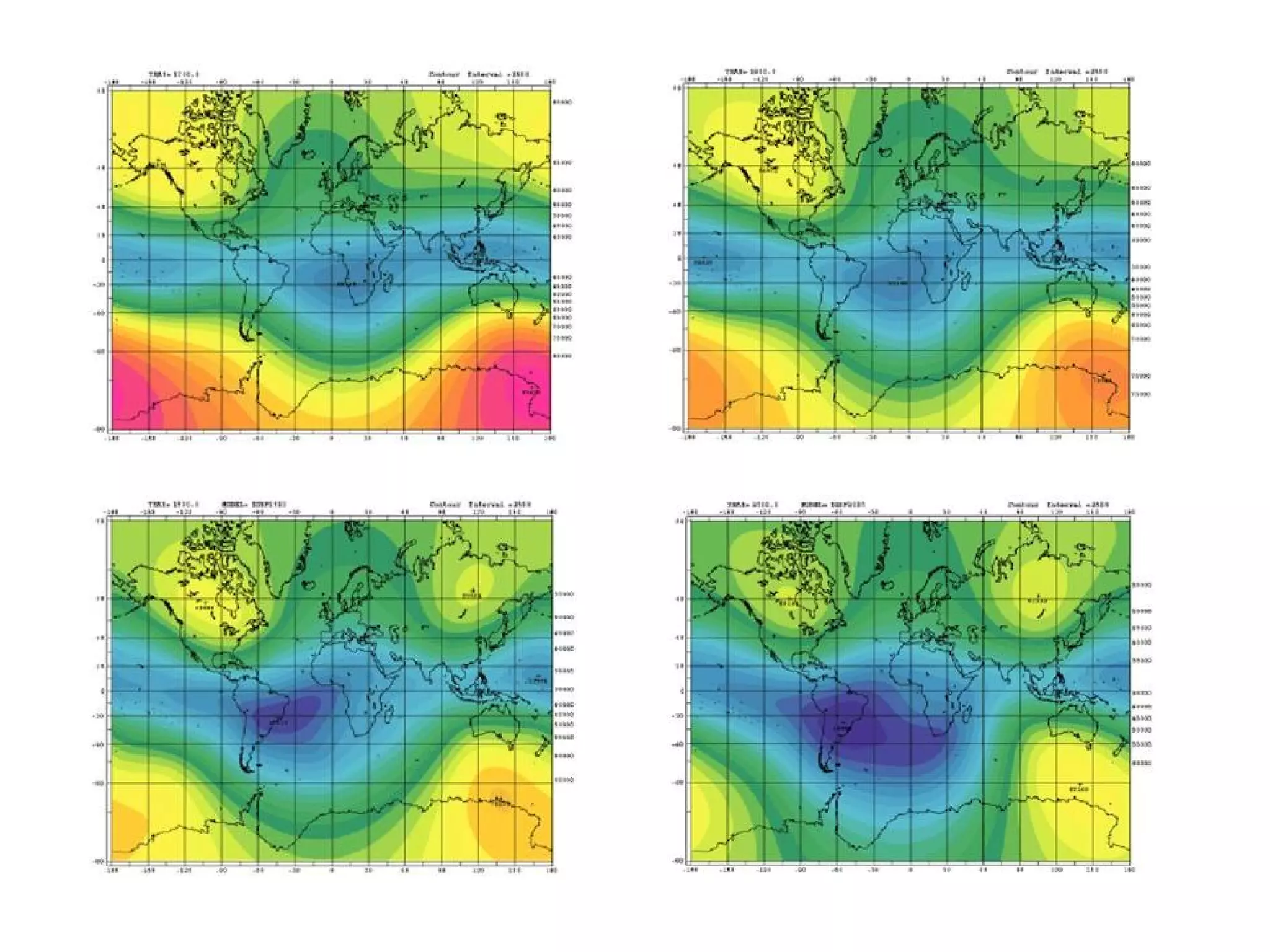
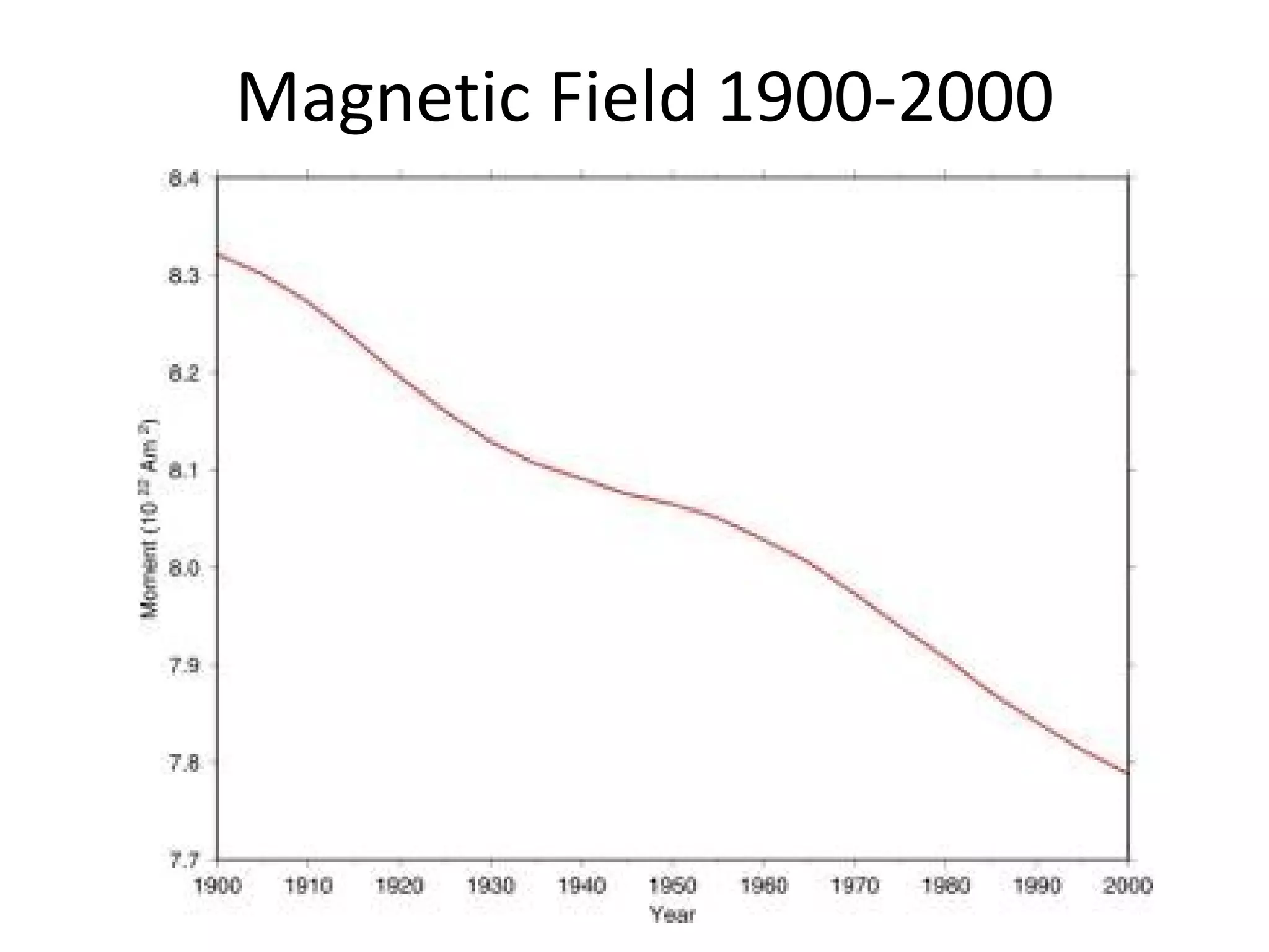
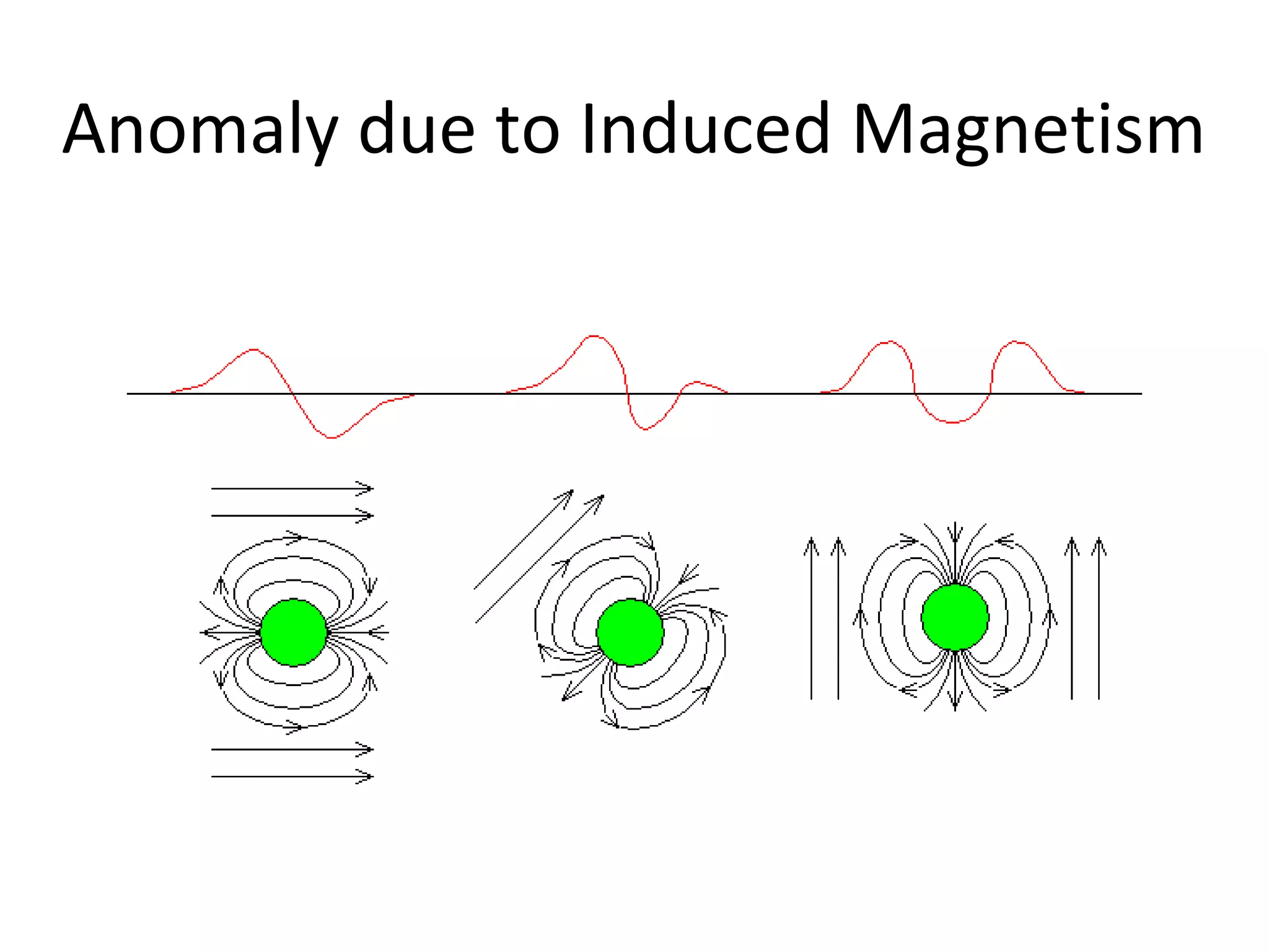
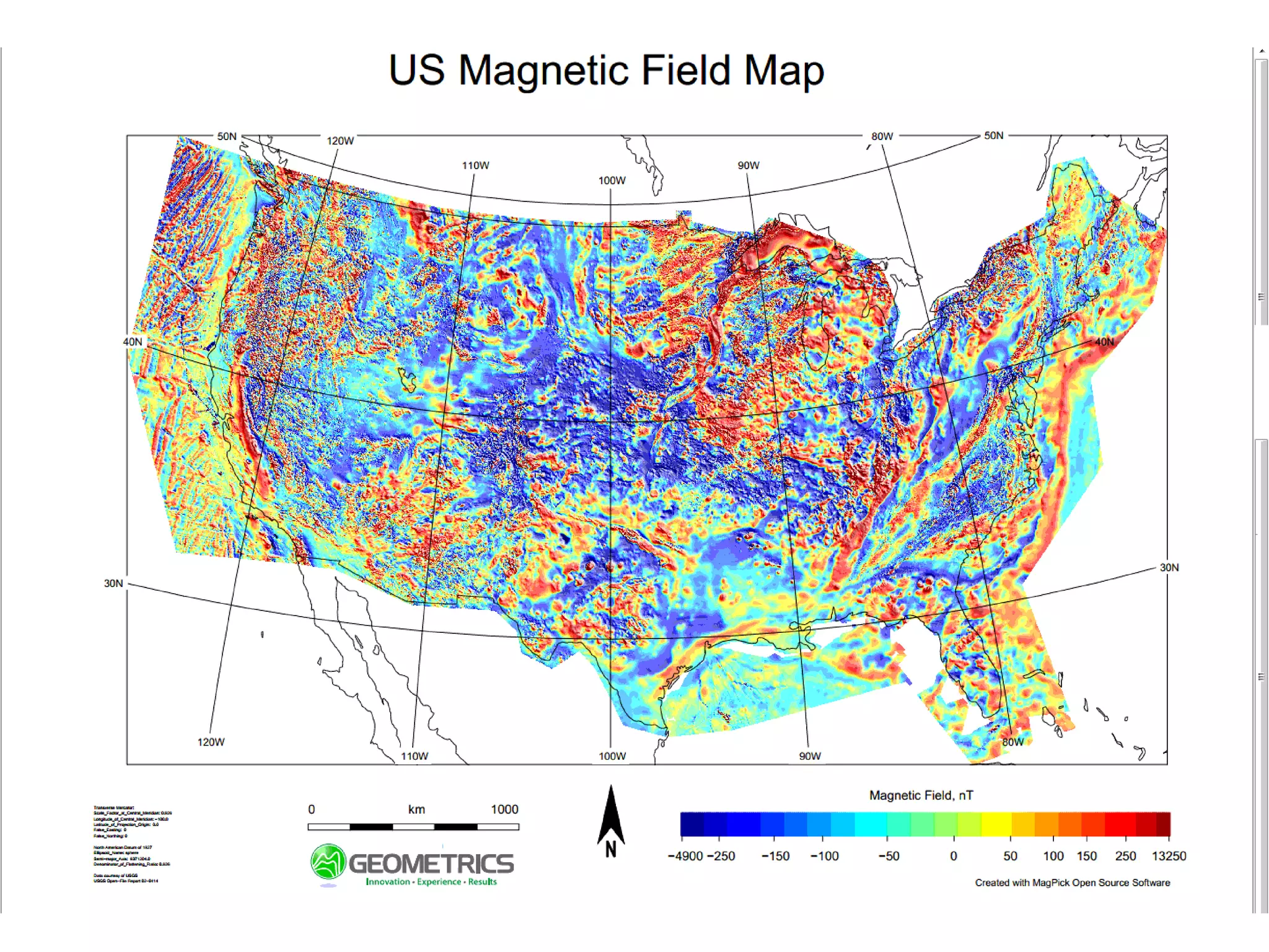
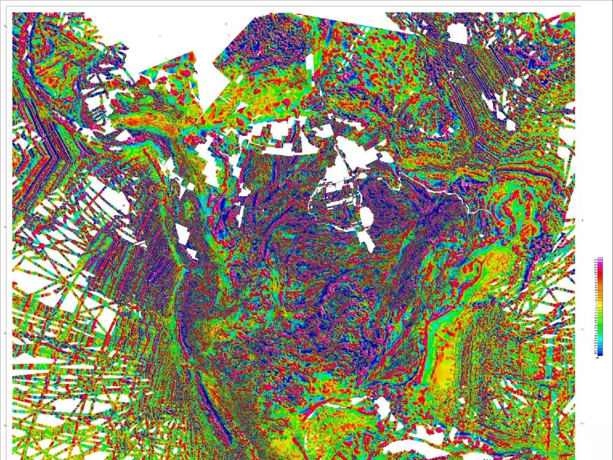
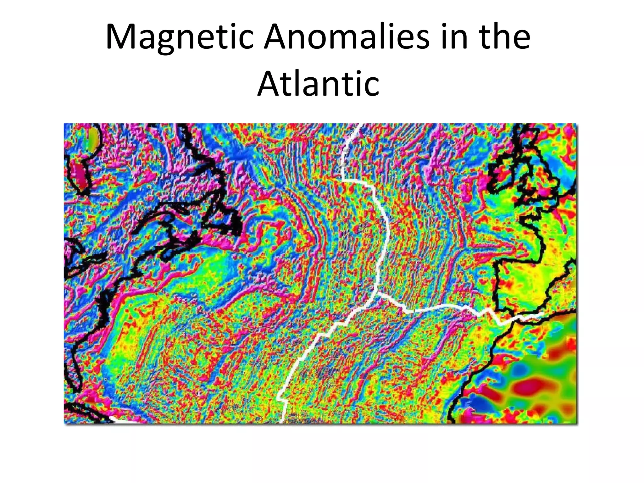
Geomagnetism
• Magnetic fieldof Earth = 40 microtesla =
40,000 nt (= 40,000 gamma)
• Varies from 25 to 70 microtesla
• Non-axial
• Not centered on the earth
• Varies over a human lifetime
36.
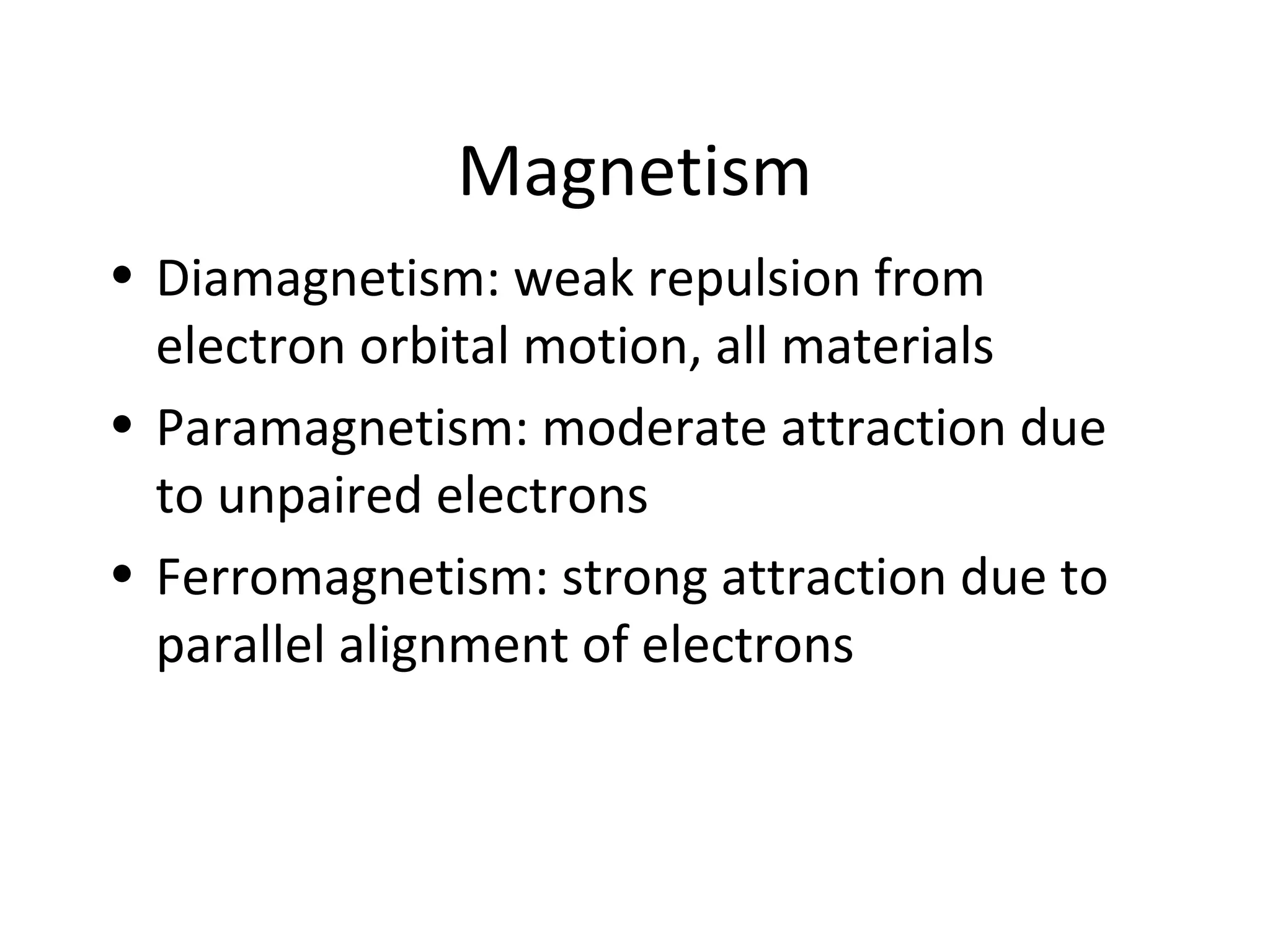
Magnetism
• Diamagnetism: weakrepulsion from
electron orbital motion, all materials
• Paramagnetism: moderate attraction due
to unpaired electrons
• Ferromagnetism: strong attraction due to
parallel alignment of electrons
37.
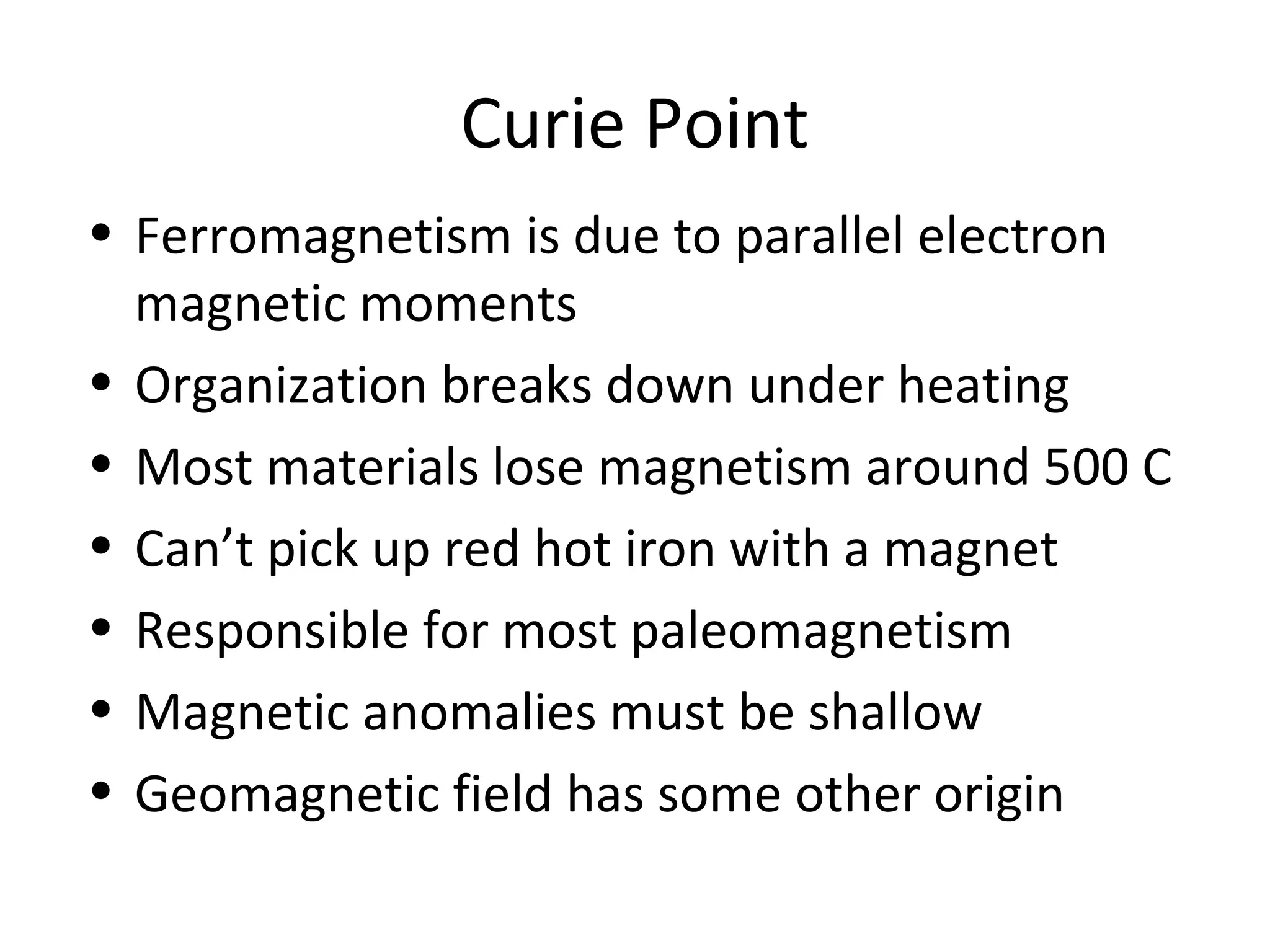
Curie Point
• Ferromagnetismis due to parallel electron
magnetic moments
• Organization breaks down under heating
• Most materials lose magnetism around 500 C
• Can’t pick up red hot iron with a magnet
• Responsible for most paleomagnetism
• Magnetic anomalies must be shallow
• Geomagnetic field has some other origin
38.
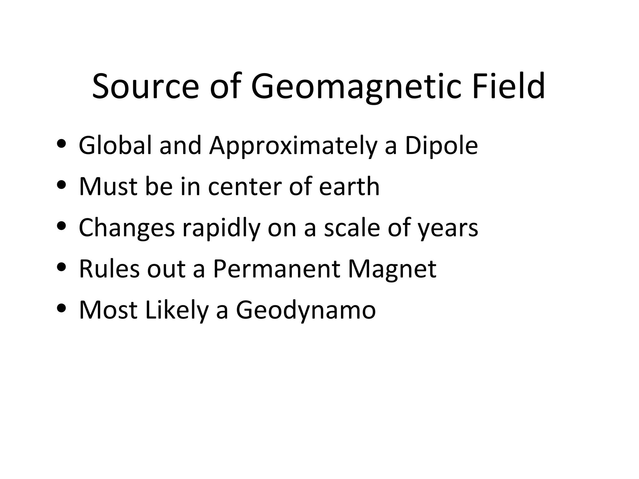
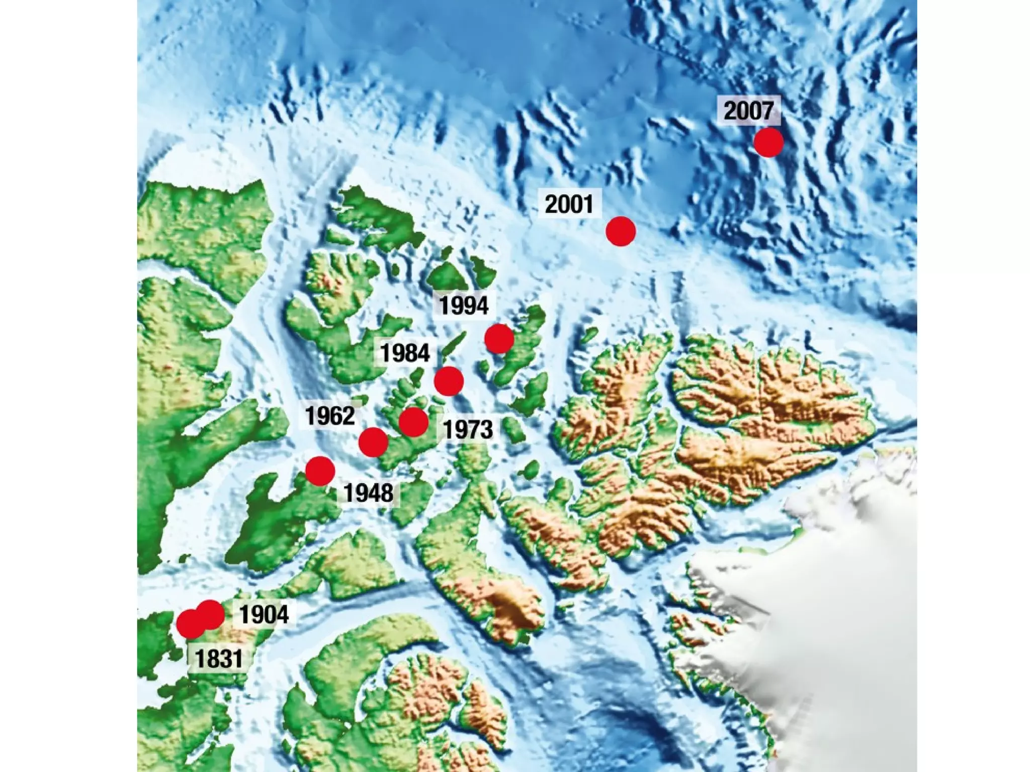
Source of GeomagneticField
• Global and Approximately a Dipole
• Must be in center of earth
• Changes rapidly on a scale of years
• Rules out a Permanent Magnet
• Most Likely a Geodynamo
39.
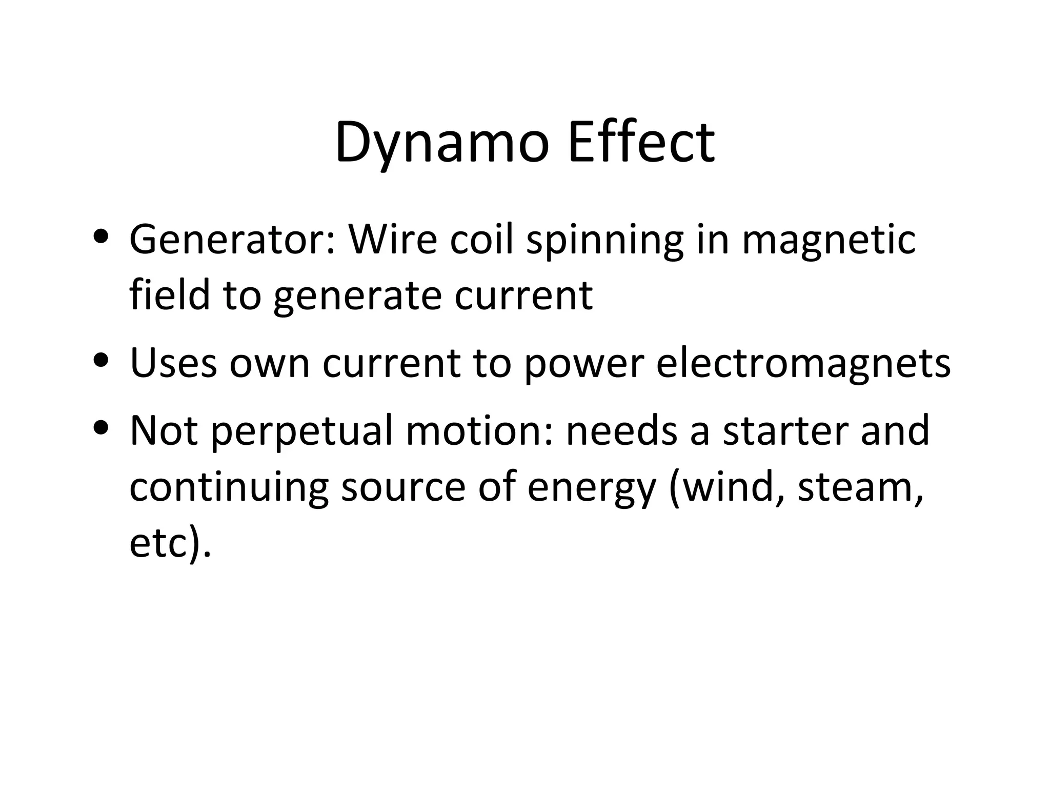
Dynamo Effect
• Generator:Wire coil spinning in magnetic
field to generate current
• Uses own current to power electromagnets
• Not perpetual motion: needs a starter and
continuing source of energy (wind, steam,
etc).
40.
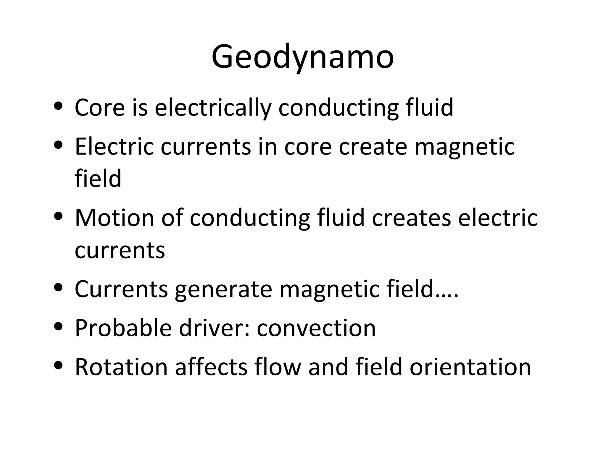
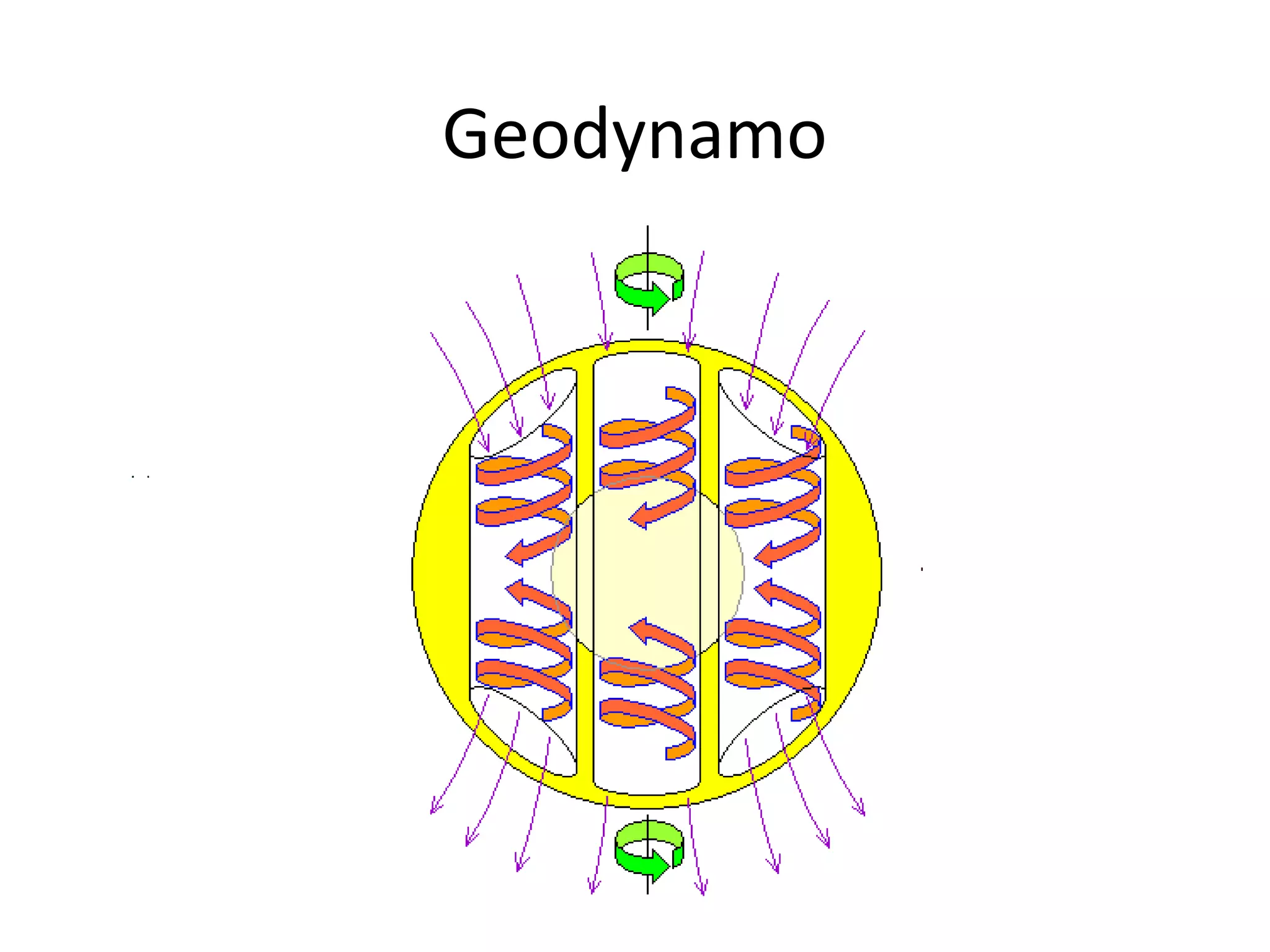
Geodynamo
• Core iselectrically conducting fluid
• Electric currents in core create magnetic
field
• Motion of conducting fluid creates electric
currents
• Currents generate magnetic field….
• Probable driver: convection
• Rotation affects flow and field orientation
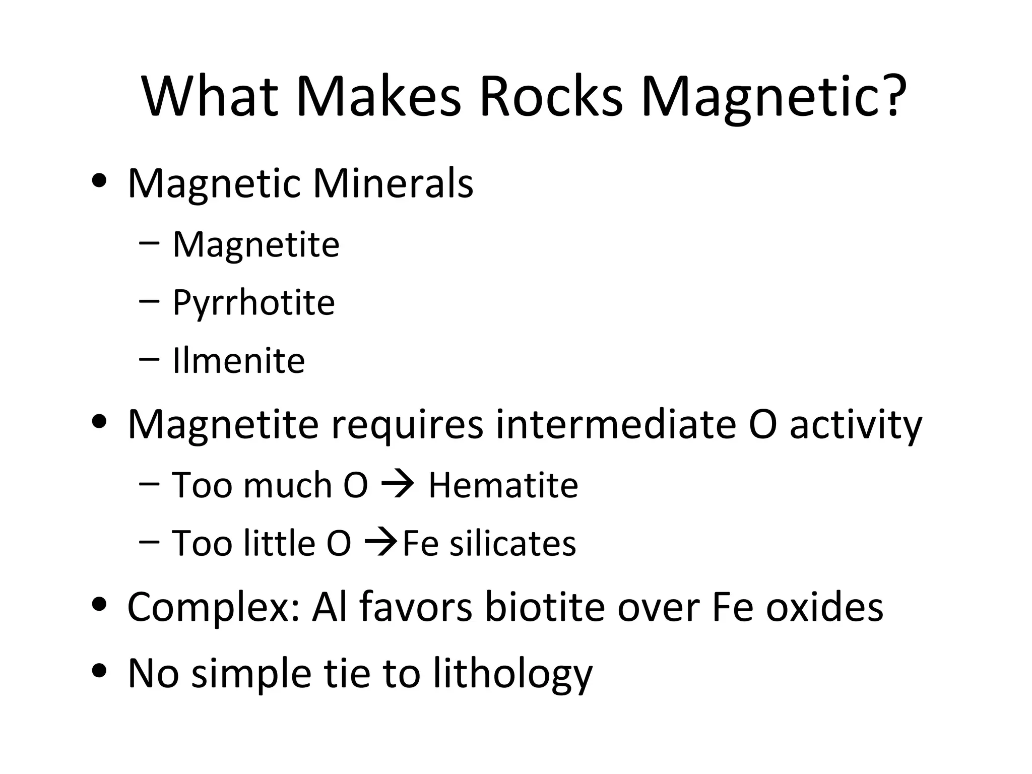
What Makes RocksMagnetic?
• Magnetic Minerals
– Magnetite
– Pyrrhotite
– Ilmenite
• Magnetite requires intermediate O activity
– Too much O Hematite
– Too little O Fe silicates
• Complex: Al favors biotite over Fe oxides
• No simple tie to lithology
53.
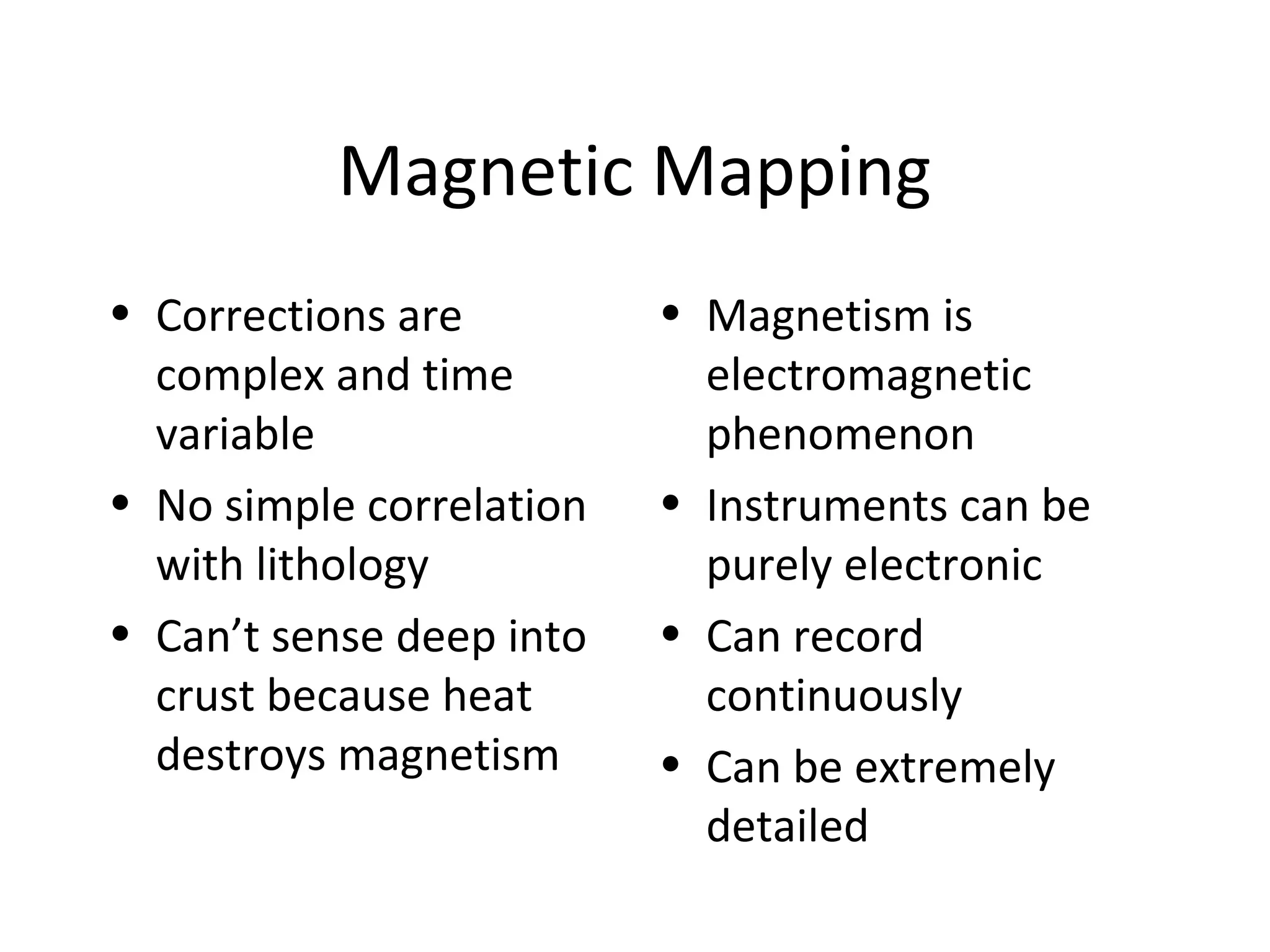
Magnetic Mapping
• Correctionsare
complex and time
variable
• No simple correlation
with lithology
• Can’t sense deep into
crust because heat
destroys magnetism
• Magnetism is
electromagnetic
phenomenon
• Instruments can be
purely electronic
• Can record
continuously
• Can be extremely
detailed
54.
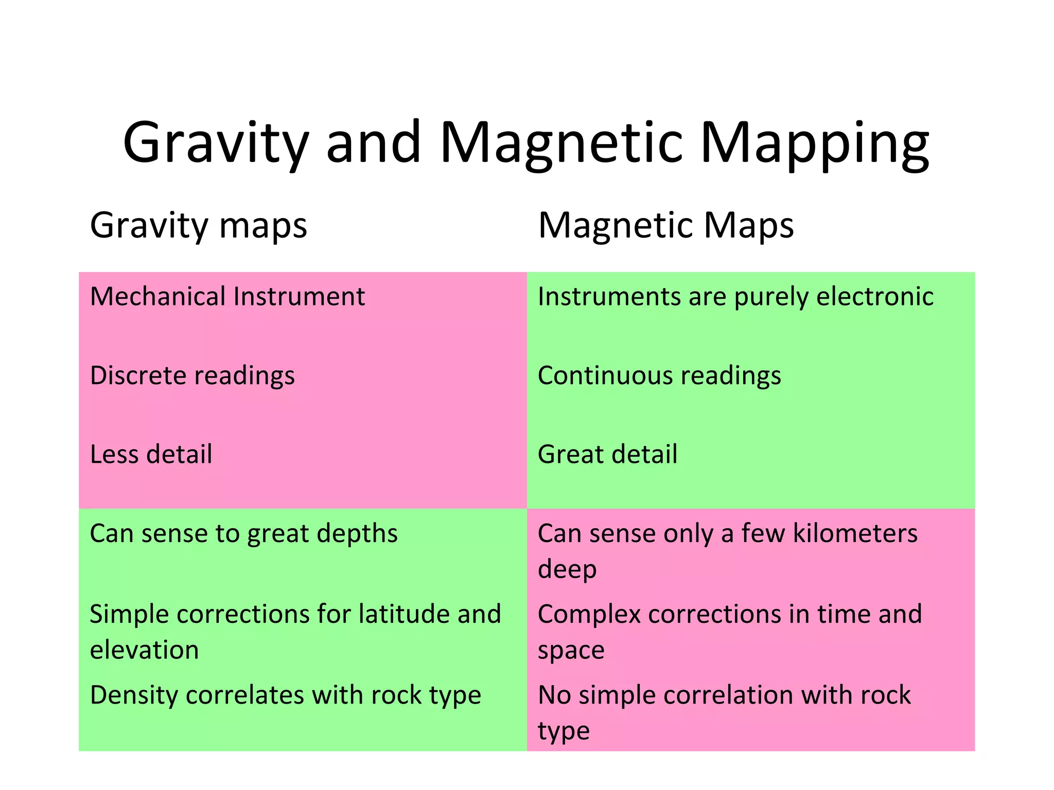
Gravity and MagneticMapping
Gravity maps Magnetic Maps
Mechanical Instrument Instruments are purely electronic
Discrete readings Continuous readings
Less detail Great detail
Can sense to great depths Can sense only a few kilometers
deep
Simple corrections for latitude and
elevation
Complex corrections in time and
space
Density correlates with rock type No simple correlation with rock
type


![Remote sensinggeology[1]](https://cdn.slidesharecdn.com/ss_thumbnails/remotesensinggeology1-130413100824-phpapp02-thumbnail.jpg?width=640&height=640&fit=bounds)


