Downloaded 21 times
![
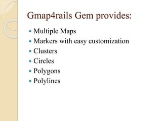
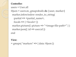
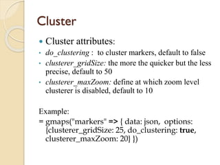
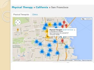
Add markers with js using addMarkers()
Example:
var home_pin = [{picture:
"/assets/referral_engine/pins/home.png", width:
32, lat: "#{@practice.latitude}", lng:
"#{@practice.longitude}"}];
Gmaps.map.addMarkers(home_pin)](https://image.slidesharecdn.com/gmap-140220115802-phpapp01/85/Integration-of-Google-map-in-Rails-Application-7-320.jpg)
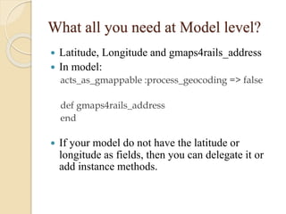
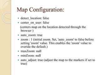
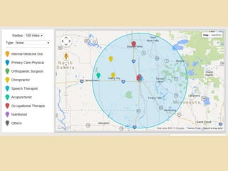
![Circles
Create circle:
attributes to pass: latitude, longitude, radius, stroke-color, fill-opacity
Example:
circle = [{lng: longitude, lat: latitude, radius: radius,
strokeColor: "#00bdce", fillOpacity: 0.15}].to_json
Gmaps.map.circles = JSON.parse(data.circle)
Gmaps.map.create_circles()
Clear existing circles:
Gmaps.map.clear_circles()](https://image.slidesharecdn.com/gmap-140220115802-phpapp01/85/Integration-of-Google-map-in-Rails-Application-11-320.jpg)
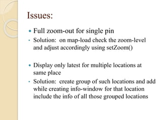


This document discusses how to integrate Google Maps into a Rails application using the Gmap4rails gem. It covers adding maps and markers to models and controllers, configuring map options like zoom level and clustering, and addressing issues like full zoom-out for single pins or displaying multiple locations. The gem provides features like markers, circles, polygons, clustering, and customizing marker windows. Models need latitude, longitude, and an address method, and controllers generate JSON for markers.


![Some R Examples[R table and Graphics] -Advanced Data Visualization in R (Some...](https://cdn.slidesharecdn.com/ss_thumbnails/exampless-160922204223-thumbnail.jpg?width=640&height=640&fit=bounds)


![[2015/2016] Geolocation and mapping](https://cdn.slidesharecdn.com/ss_thumbnails/06bgeo-160413121805-thumbnail.jpg?width=640&height=640&fit=bounds)


![Getting Started with Apache Spark: Big Data Made Simple [Free Meetup]](https://cdn.slidesharecdn.com/ss_thumbnails/apachesparkgettingstarted-260203175547-8361bcc3-thumbnail.jpg?width=640&height=640&fit=bounds)


