Downloaded 14 times


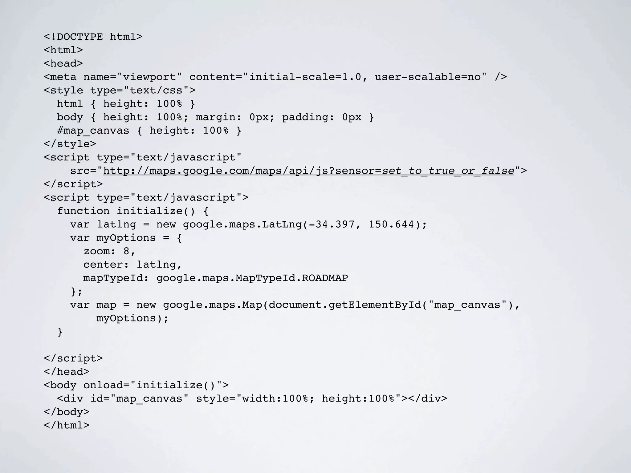
![STYLING IN CODE
var stylez = [{
featureType: 'road.local',
elementType: 'geometry',
stylers: [{
hue: '#00ff00'
}, {
saturation: 100
}]
}, {
featureType: 'landscape',
elementType: 'geometry',
stylers: [{
hue: '#000000'
}]
}];
var styledMapType = new google.maps.StyledMapType(stylez, {
map: map,
name: 'Coffee Map!'
});
map.mapTypes.set('coffee-style', styledMapType);
map.setMapTypeId('coffee-style');](https://image.slidesharecdn.com/gis-gmaps-101210143407-phpapp01/75/Ioannis-Doxaras-on-GIS-and-Gmaps-at-1st-GTUG-meetup-Greece-10-2048.jpg)


![FUSION AS A WEB DB
http://www.google.com/fusiontables/api/query?sql=<statement>
sql=INSERT INTO 274708 (CityDescription,
CityLocation)
<Polygon> VALUES ('Tokyo Metropolis', '35.69 139.69')
<outerBoundaryIs>
<coordinates> lng,lat[,alt]
lng,lat[,alt] ... </coordinates> sql=UPDATE 274814
</outerBoundaryIs> SET Route = '<LineString> <coordinates>
</Polygon> 78.47,17.37 -91.58,32.44 2.35,48.85 </
coordinates> </LineString>'
<LineString> WHERE ROWID = '1'
<coordinates> lng,lat[,alt]
lng,lat[,alt] ... </coordinates>
</LineString> sql=INSERT INTO 274319 (volunteer_id, plot)
VALUES (45,
<Point> '<Polygon> <outerBoundaryIs>
<coordinates> lng,lat[,alt] </ <coordinates> -117.85,35.3 -117.85,35.301
coordinates> -117.851,35.301 -117.851,35.3 -117.85,35.3 </
</Point> coordinates>
</outerBoundaryIs> </Polygon>'](https://image.slidesharecdn.com/gis-gmaps-101210143407-phpapp01/75/Ioannis-Doxaras-on-GIS-and-Gmaps-at-1st-GTUG-meetup-Greece-23-2048.jpg)

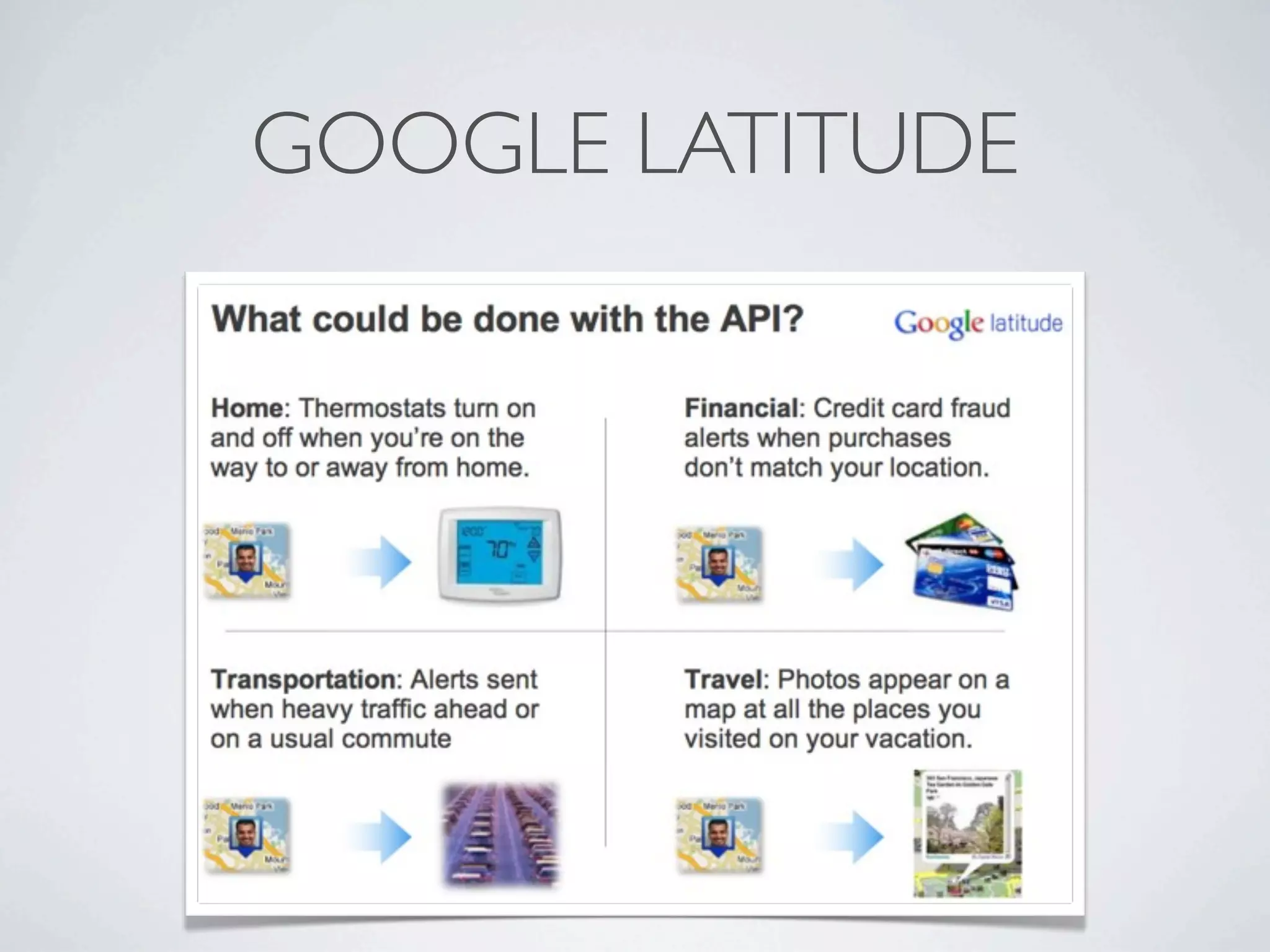


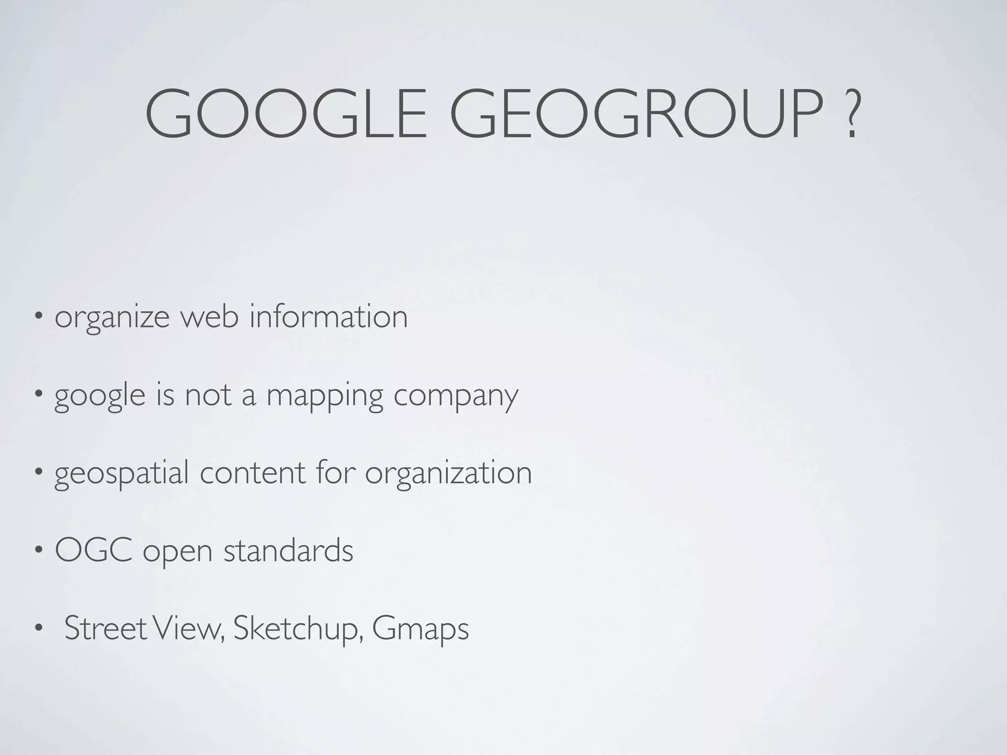
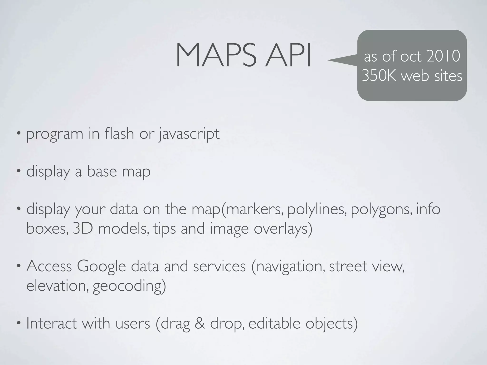
Google provides mapping and geospatial APIs and services like Maps API, Fusion Tables, and Latitude that allow developers to display base maps, overlay data, and build location-aware applications. These services can be used to organize web information geographically, access Google mapping data and services, and allow users to interact with maps. Google is focusing on improving these APIs and services to support new features, better performance on mobile, and new data management and analytics capabilities.


![[2015/2016] Geolocation and mapping](https://cdn.slidesharecdn.com/ss_thumbnails/06bgeo-160413121805-thumbnail.jpg?width=640&height=640&fit=bounds)


![[DevFest Strasbourg 2025] - NodeJs Can do that !!](https://cdn.slidesharecdn.com/ss_thumbnails/devfeststrasbourg2025-nodejscandothat-251127142731-da65b6fd-thumbnail.jpg?width=640&height=640&fit=bounds)
![[BDD 2025 - Mobile Development] Crafting Immersive UI with E2E and AGSL Shade...](https://cdn.slidesharecdn.com/ss_thumbnails/md-craftingimmersiveuiwithe2eandagslshaderveronicaputrianggraini-251124030840-0c677f44-thumbnail.jpg?width=640&height=640&fit=bounds)
![[BDD 2025 - Mobile Development] Mobile Engineer and Software Engineer: Are we...](https://cdn.slidesharecdn.com/ss_thumbnails/md-mobileengineerandsoftwareengineerarewestillrelevantsidiqpermana-251127010650-55224ef1-thumbnail.jpg?width=640&height=640&fit=bounds)


![[BDD 2025 - Artificial Intelligence] AI for the Underdogs: Innovation for Sma...](https://cdn.slidesharecdn.com/ss_thumbnails/ai-aifortheunderdogsinnovationforsmallbusinesses-251124030839-72a599a4-thumbnail.jpg?width=640&height=640&fit=bounds)


