Download as PDF, PPTX
![Client side rendering of maps using MapCSS 11
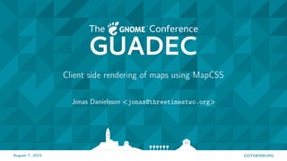
Mapbox Vector tile format
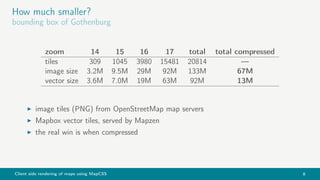
Geometry
MoveTo(3, 6), LineTo(8, 12), LineTo(20, 34), ClosePath
Encoded as: [ 9 6 12 18 10 12 24 44 15 ]
| | ‘> [00001 111] command type 7 (ClosePath), length 1
| | ===== relative LineTo(+12, +22) == LineTo(20, 34)
| | ===== relative LineTo(+5, +6) == LineTo(8, 12)
| ‘> [00010 010] = command type 2 (LineTo), length 2
| ==== relative MoveTo(+3, +6)
‘> [00001 001] = command type 1 (MoveTo), length 1
contains a stream of repeatable commands
MoveTo, LineTo, ClosePath
parameters uses zigzag encoding](https://image.slidesharecdn.com/37qv2e2fqacnl1xtapwv-signature-0e97af9a1aaee9da655d136e181bfa460c18fc08194edba6351327a62804d87c-poli-150810095534-lva1-app6892/85/Client-side-rendering-of-maps-using-MapCSS-11-320.jpg)
![Client side rendering of maps using MapCSS 12
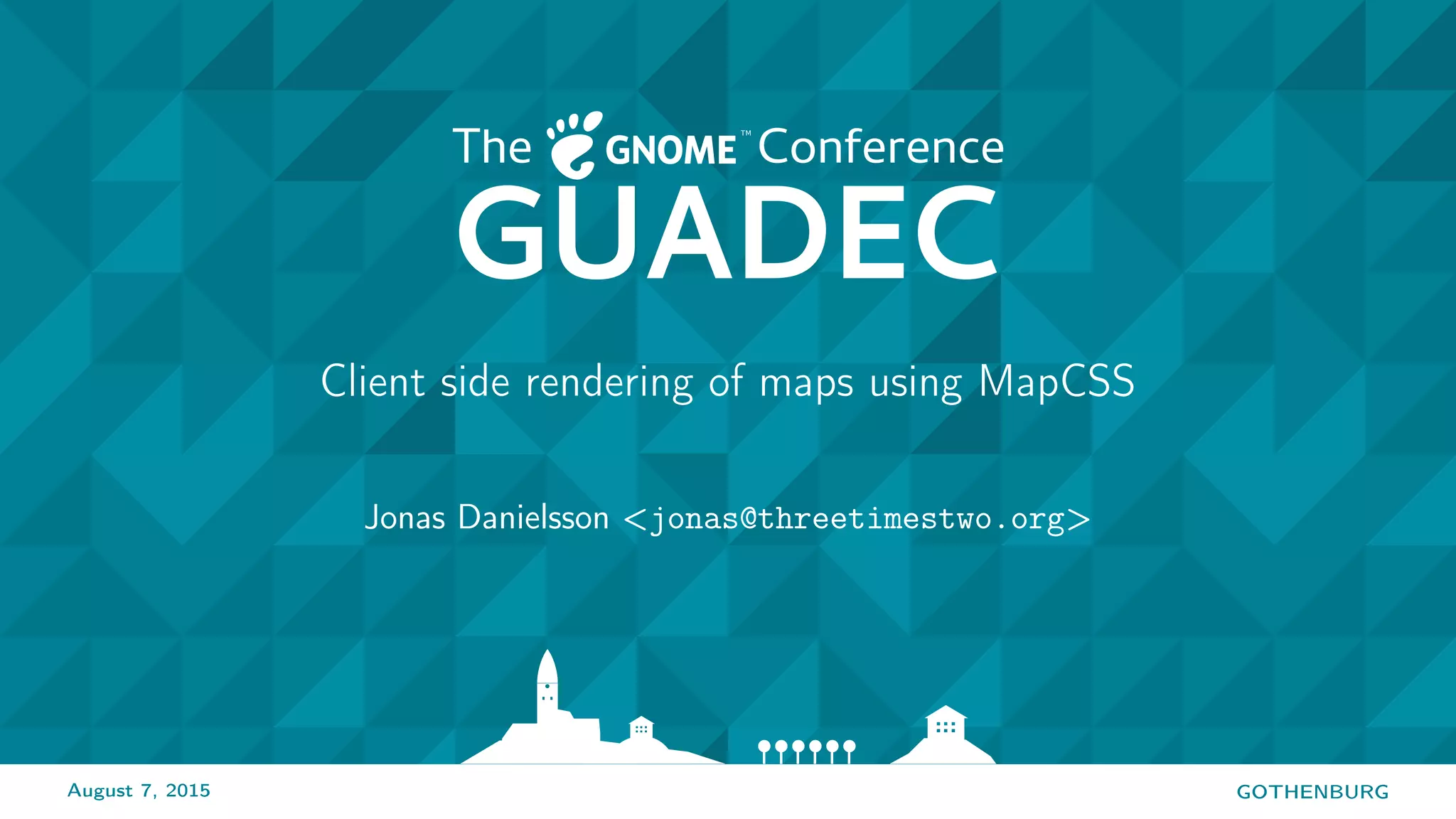
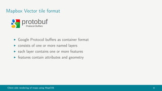
way[highway=secondary],
way[highway=road],
way[highway=residential] {
width: 7;
color: white;
z-index: 5;
}
stylesheet language for maps
operates on OSM tags, supports zoom filters](https://image.slidesharecdn.com/37qv2e2fqacnl1xtapwv-signature-0e97af9a1aaee9da655d136e181bfa460c18fc08194edba6351327a62804d87c-poli-150810095534-lva1-app6892/85/Client-side-rendering-of-maps-using-MapCSS-12-320.jpg)
![Client side rendering of maps using MapCSS 14
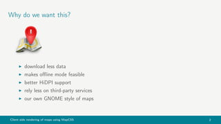
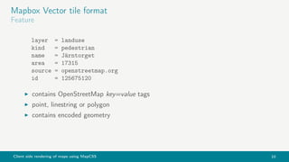
MapCSS
tests
way[is_tunnel=yes] {
dashes: 3, 3;
}
way|z8-17[highway=motorway][is_bridge=yes] {
casing-color: #cc6500;
}
binary operators allowed: !=, !=, = , >, <, >=, <=
or unary: way[highway]
restrict to zoom level: area|z17-19[building]](https://image.slidesharecdn.com/37qv2e2fqacnl1xtapwv-signature-0e97af9a1aaee9da655d136e181bfa460c18fc08194edba6351327a62804d87c-poli-150810095534-lva1-app6892/85/Client-side-rendering-of-maps-using-MapCSS-14-320.jpg)


Client side rendering of maps using MapCSS allows for downloading less data, enabling offline mode, better support for high-resolution displays, less reliance on third-party services, and creating custom GNOME map styles. It uses vector tiles which are smaller in size than raster image tiles and can be rendered using the MapCSS styling language to style OpenStreetMap map features. Current work includes improving the vector-tile-glib library and adding offline support to GNOME Maps.


