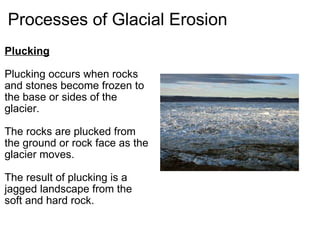
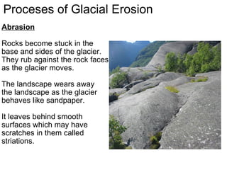
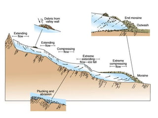
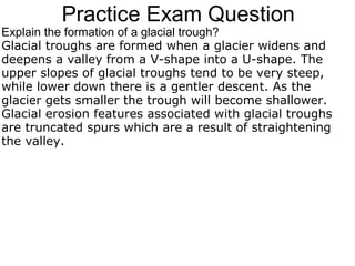
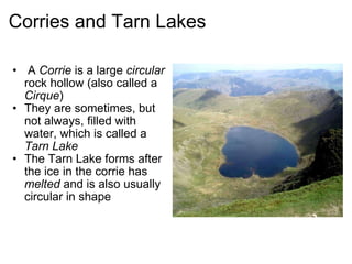
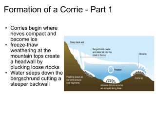
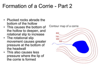
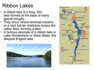
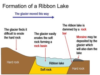
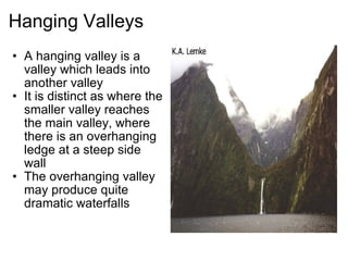
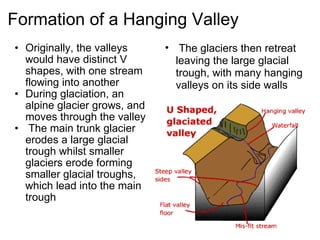
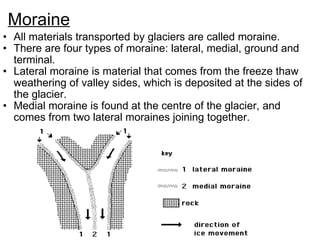
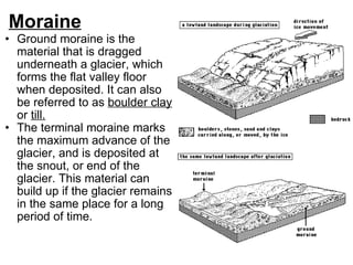
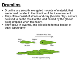
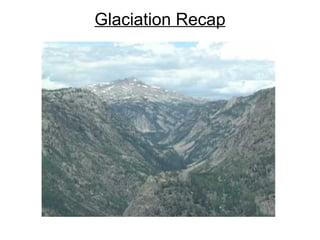
2. Specification Freeze thaw and the processes of erosion – abrasion and plucking . The characteristics and formation of corries, aretes, pyramidal peaks, glacial troughs, ribbon lakes, hanging valleys, truncated spurs, boulder clay/till, moraines and drumlins . Recognise and describe glacial features on Ordnance Survey maps and photographs.
3. Specification The processes should be understood in the context of their role in forming the glacial features listed. Candidates should appreciate the landscapes produced in areas of glaciation and that it is the assembly of the features that makes the glaciated landscape distinctive. The use of photographs and Ordnance Survey maps would prove helpful in this context. Candidates may be expected to name examples and describe the characteristics of the features and explain their formation with reference to the appropriate processes that have been at work.
4.
5. Specification One case study e.g. the Lake District, Alps, Rockies, Himalayas is advised to enable students to describe and explain the human uses of the landscape in upland glaciated areas. Contemporary issues may include depopulation of these remote areas, conflicts between authorities promoting tourism and local inhabitants, environmental degradation etc. Students should be aware of the different attitudes and values of the groups and examples of the strategies being used to combat the issues. Opportunities prevail for decision makingexercises e.g. on plans for new winter sports facilities or speed limits on lakes etc.
6.
7.
8.
9.
10.
11.
12.
13.
14.
15.
16. Practice Exam Question Explain the formation of a glacial trough? Glacial troughs are formed when a glacier widens and deepens a valley from a V-shape into a U-shape. The upper slopes of glacial troughs tend to be very steep, while lower down there is a gentler descent. As the glacier gets smaller the trough will become shallower. Glacial erosion features associated with glacial troughs are truncated spurs which are a result of straightening the valley.