Downloaded 167 times
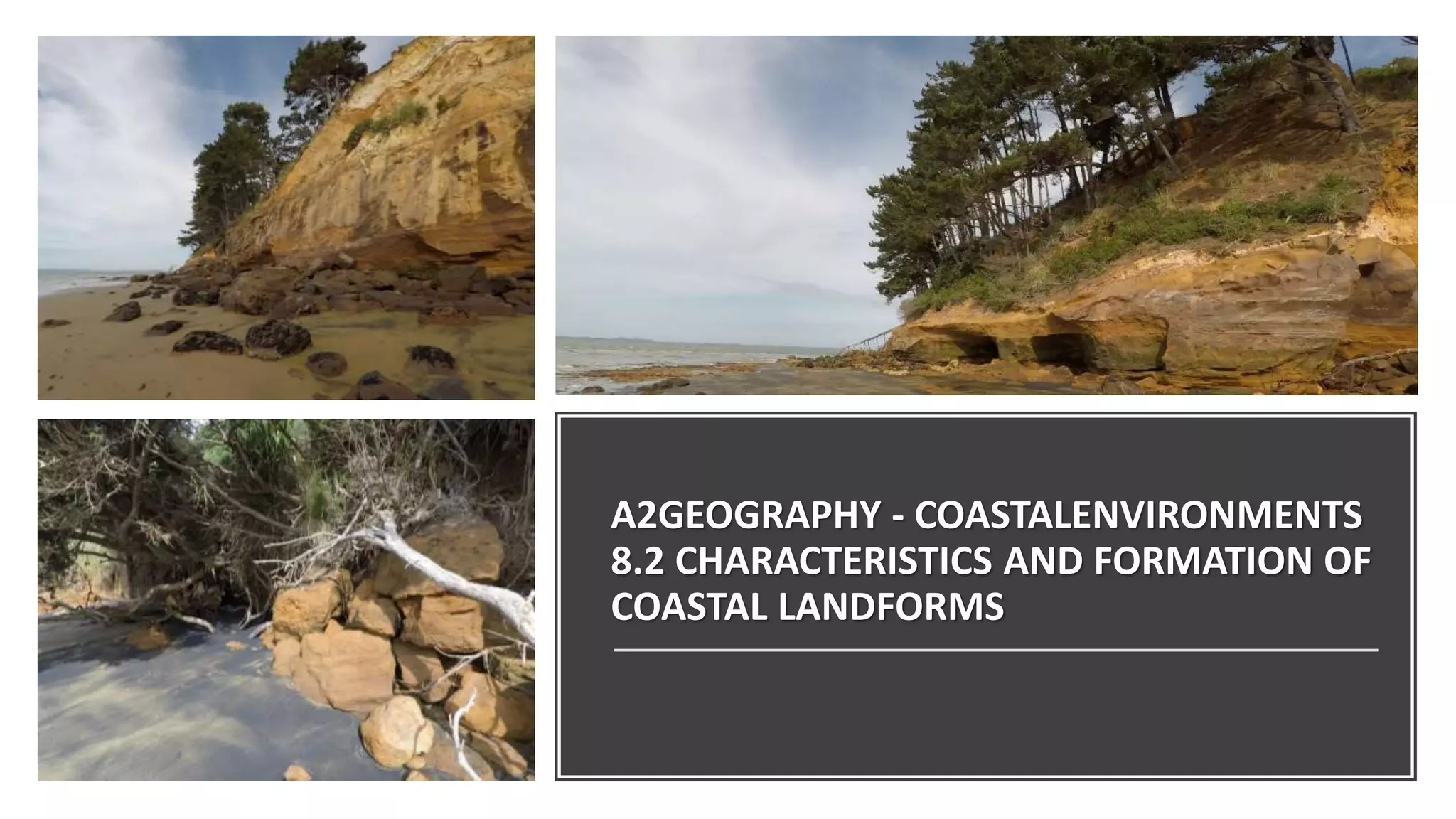

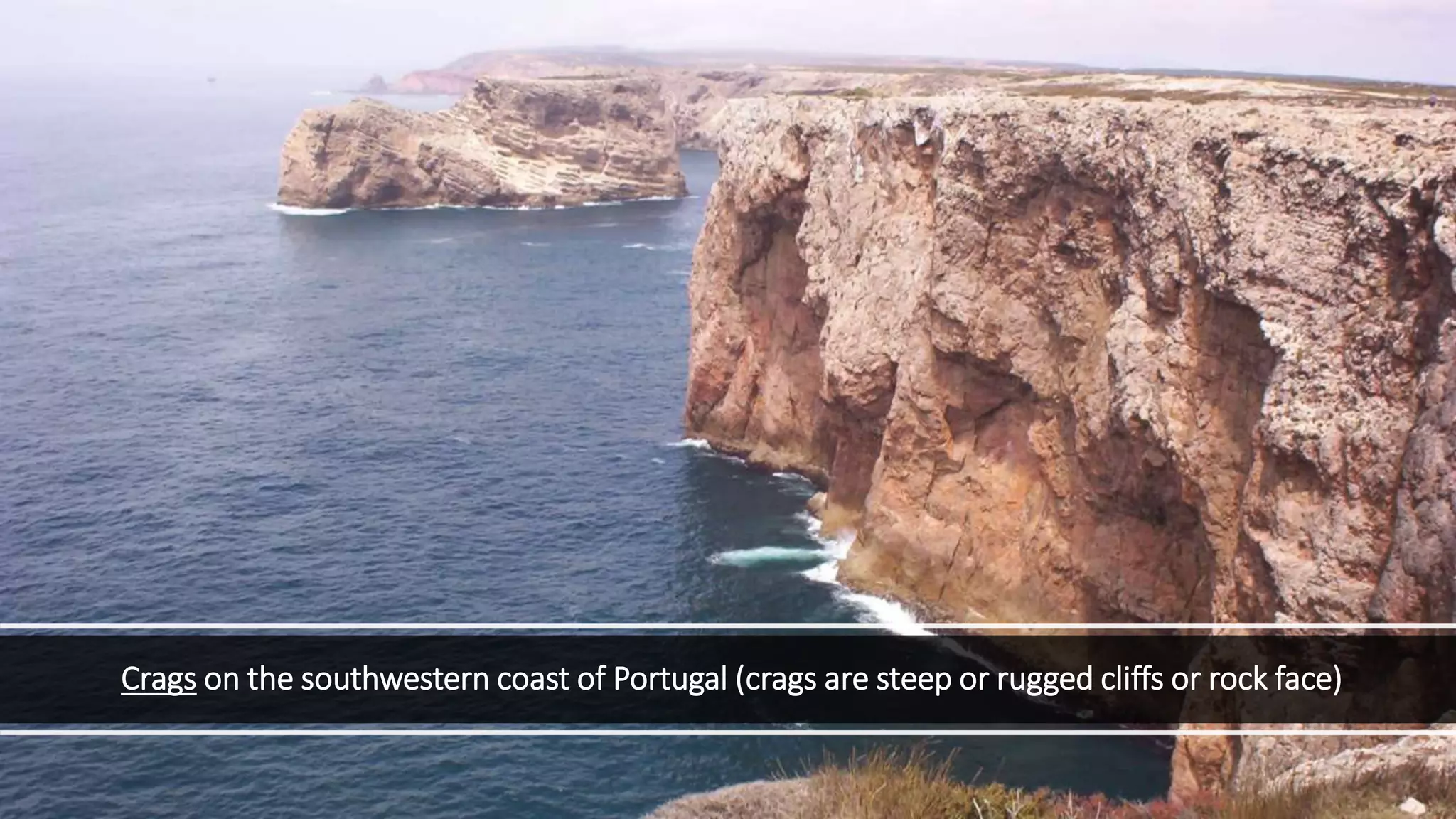
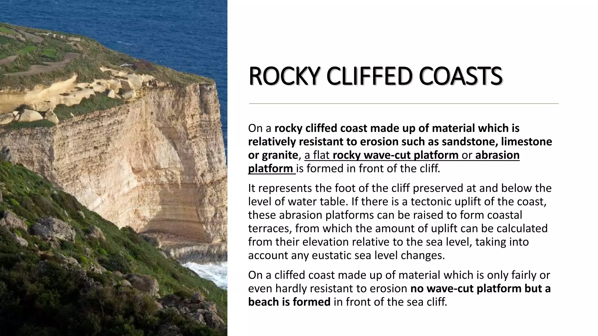
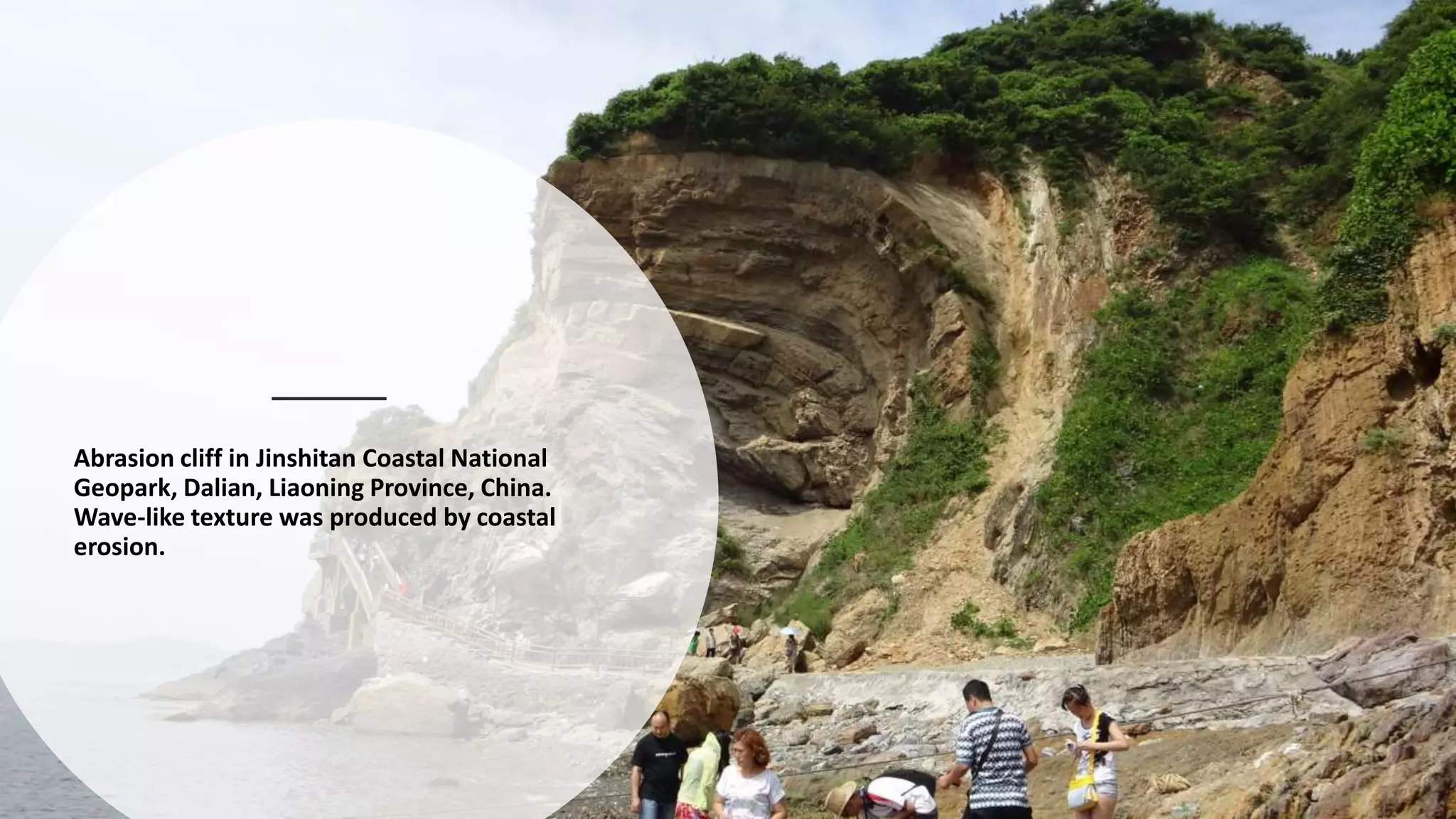
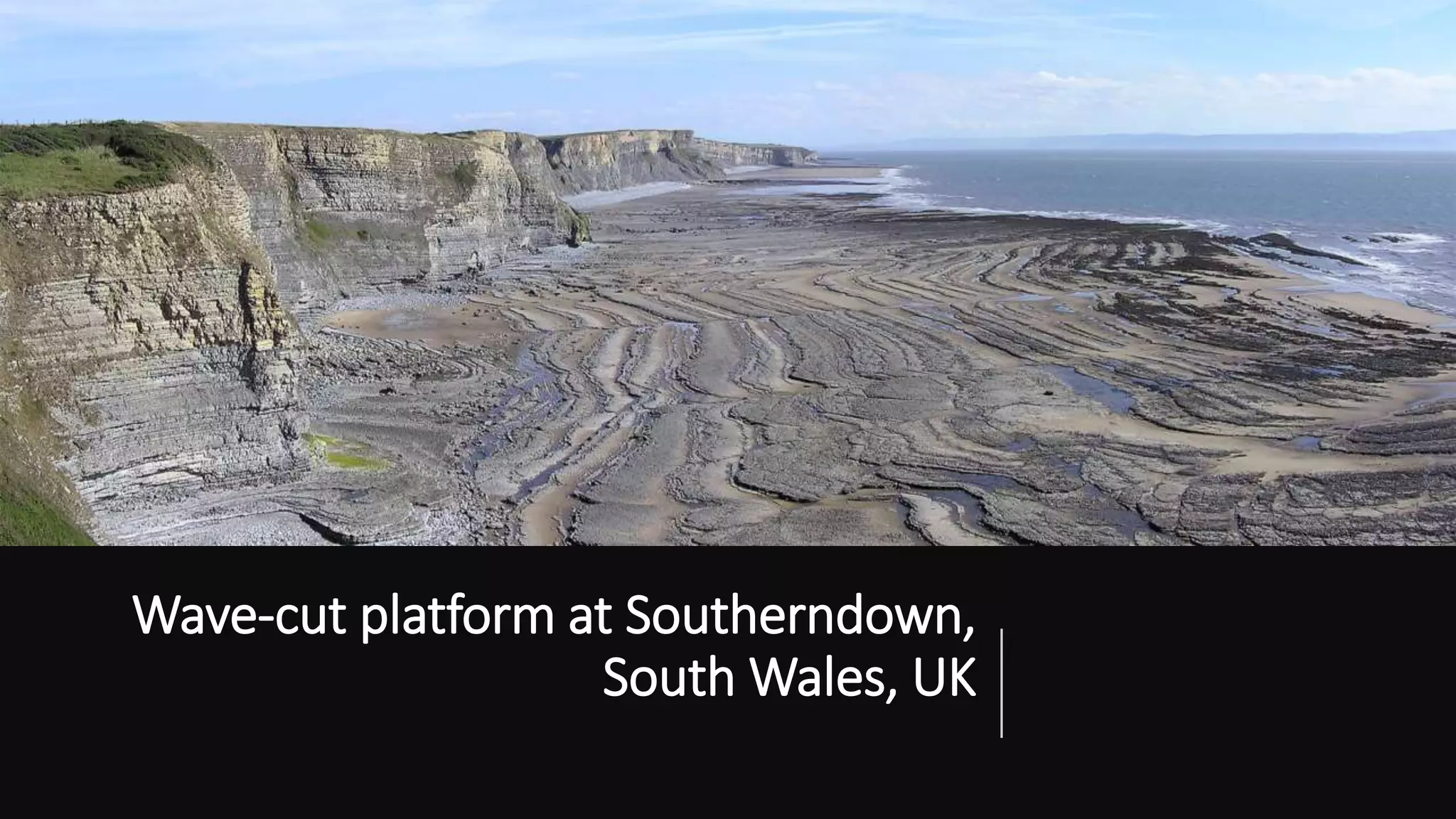
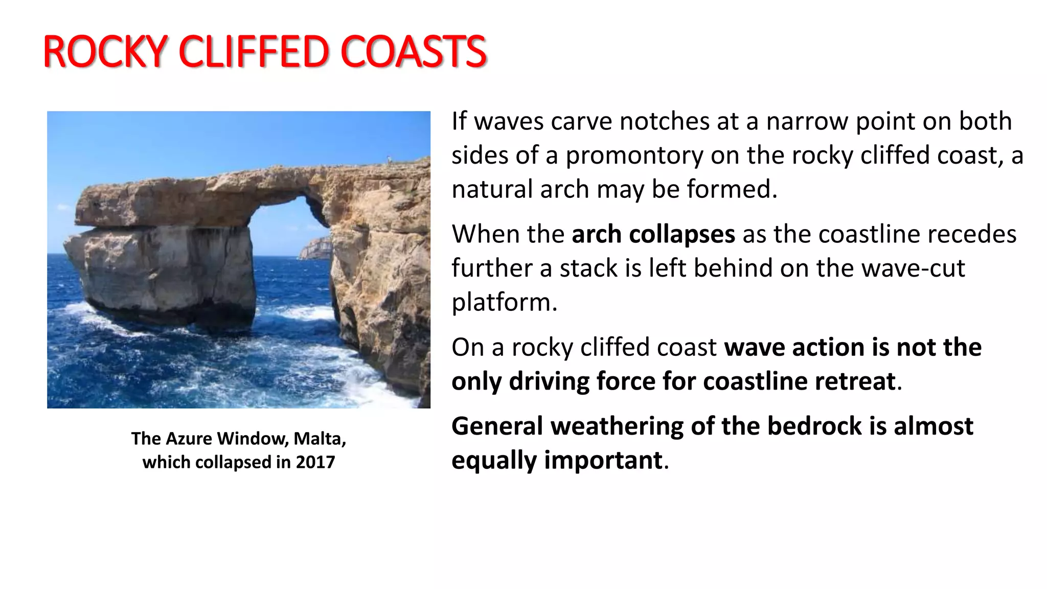
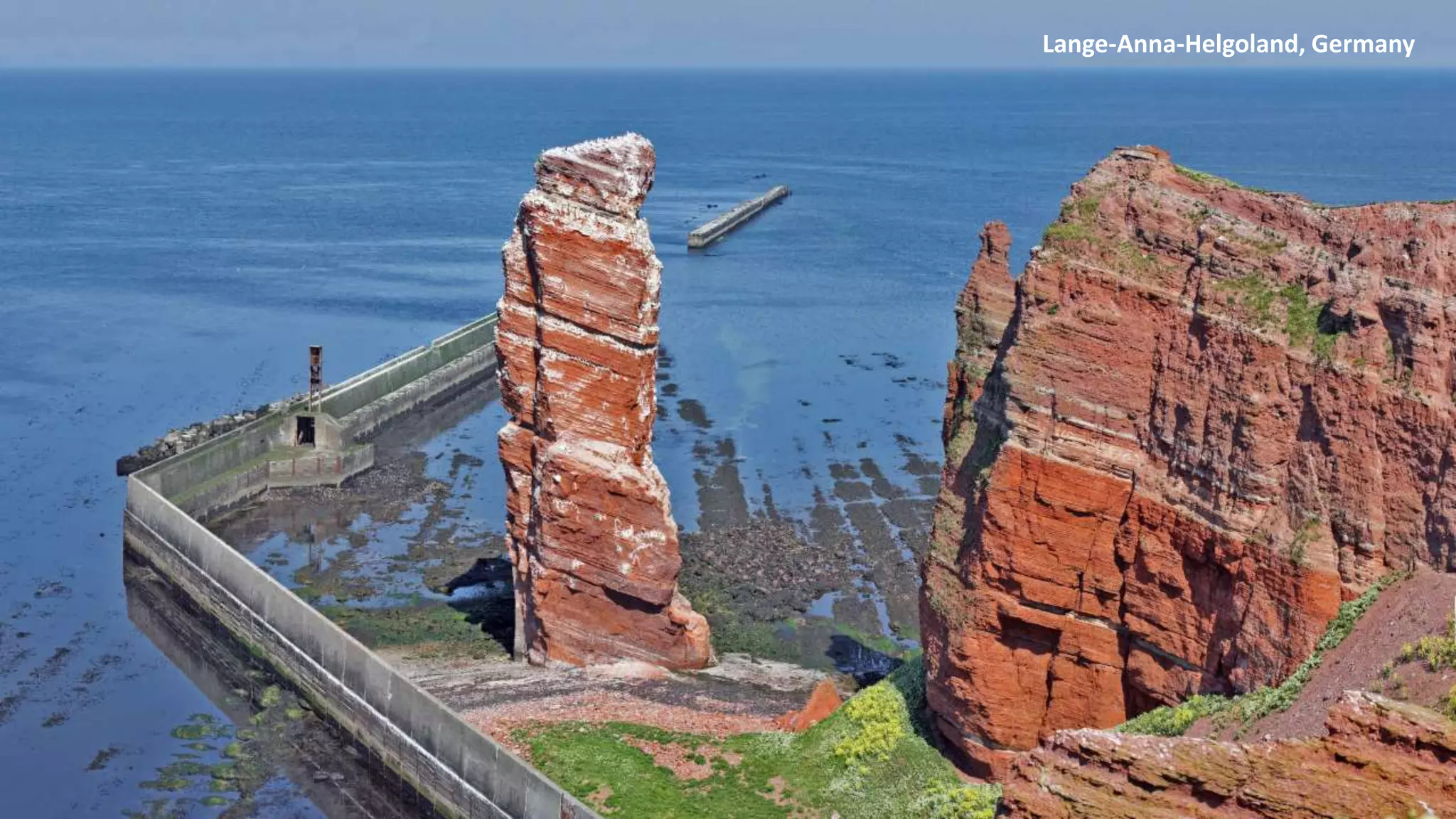
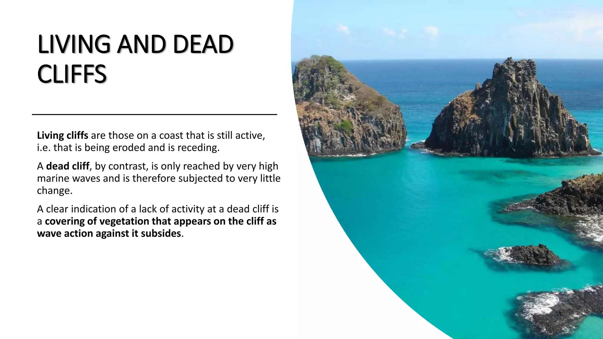
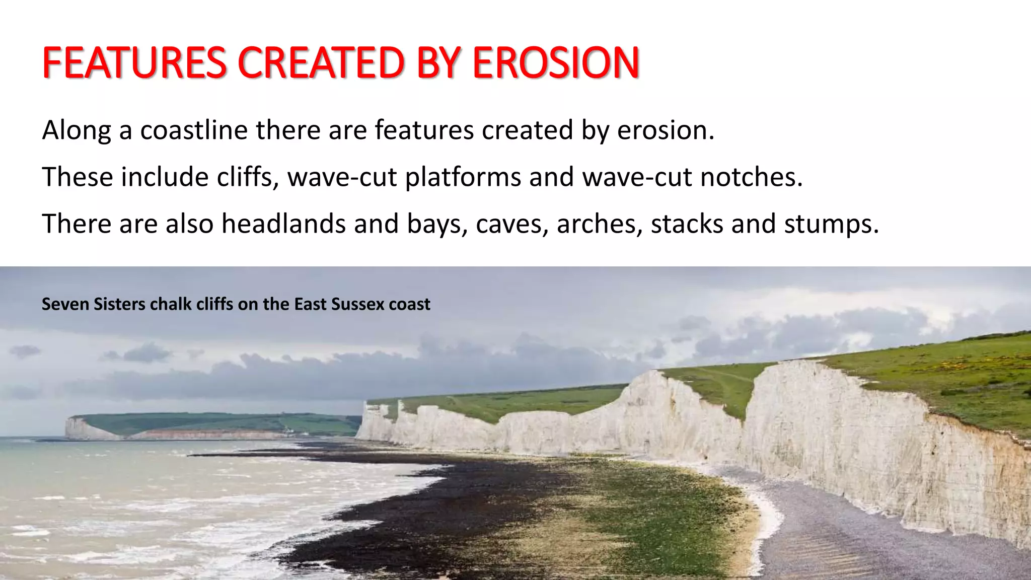
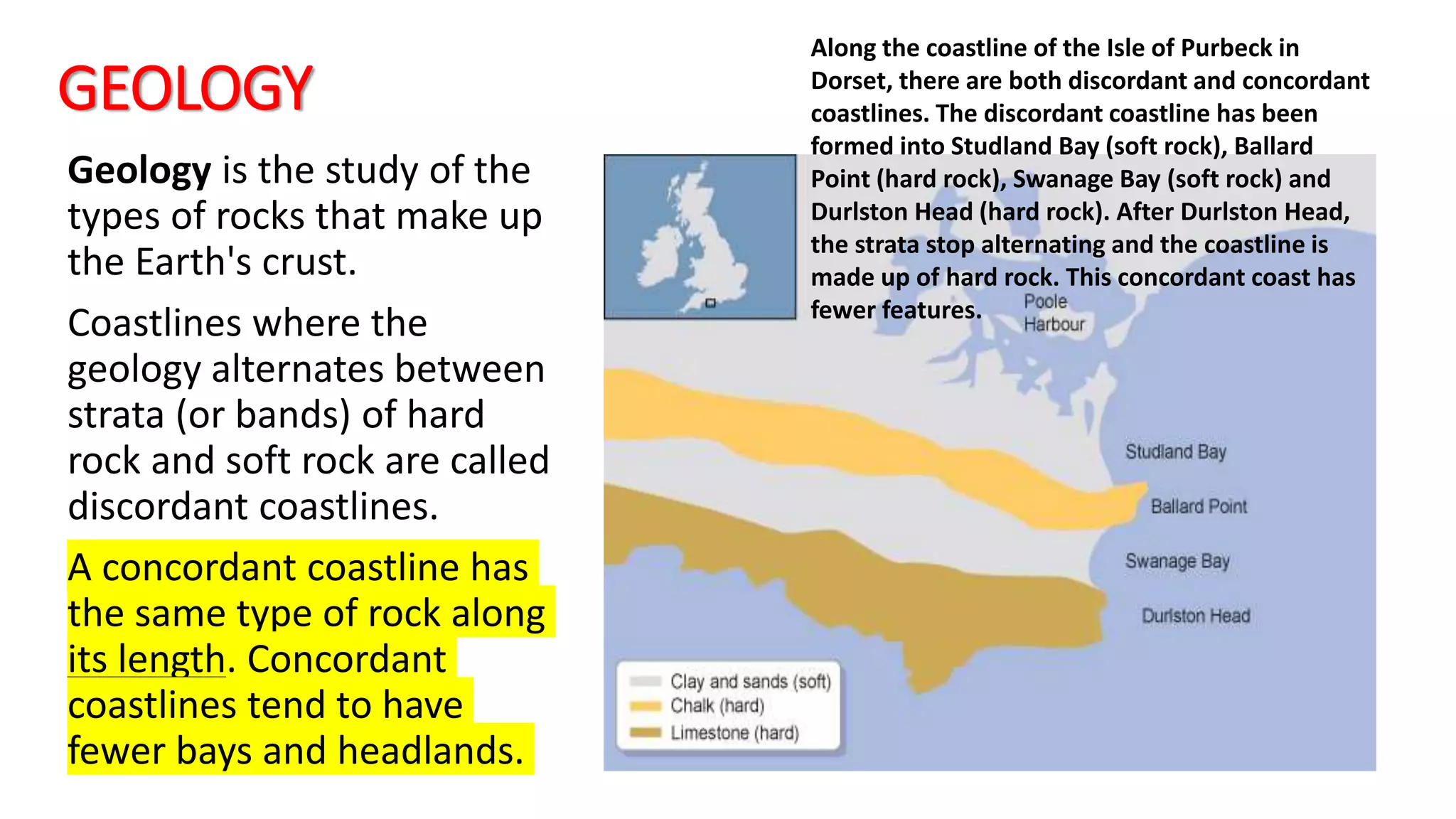
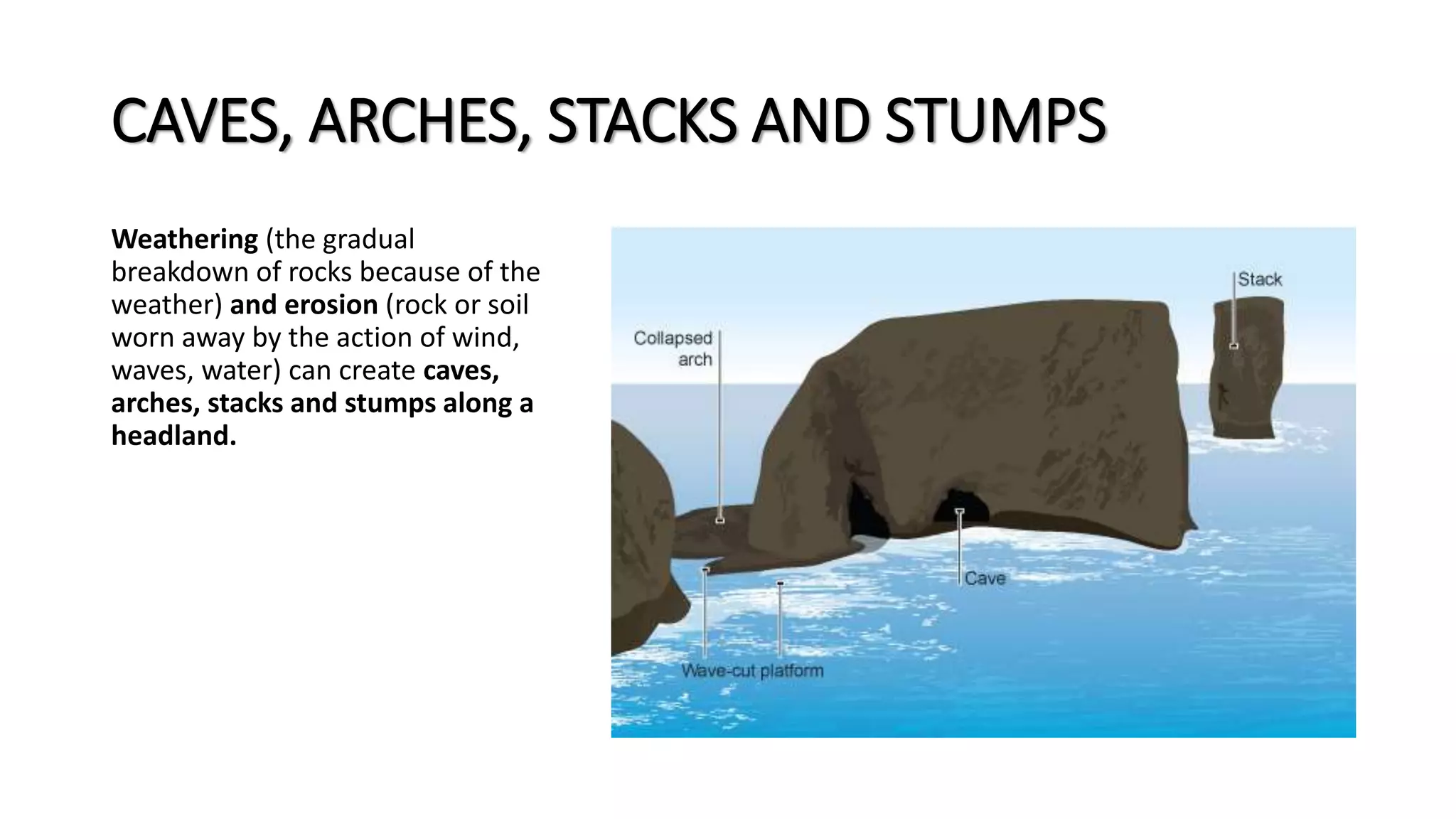
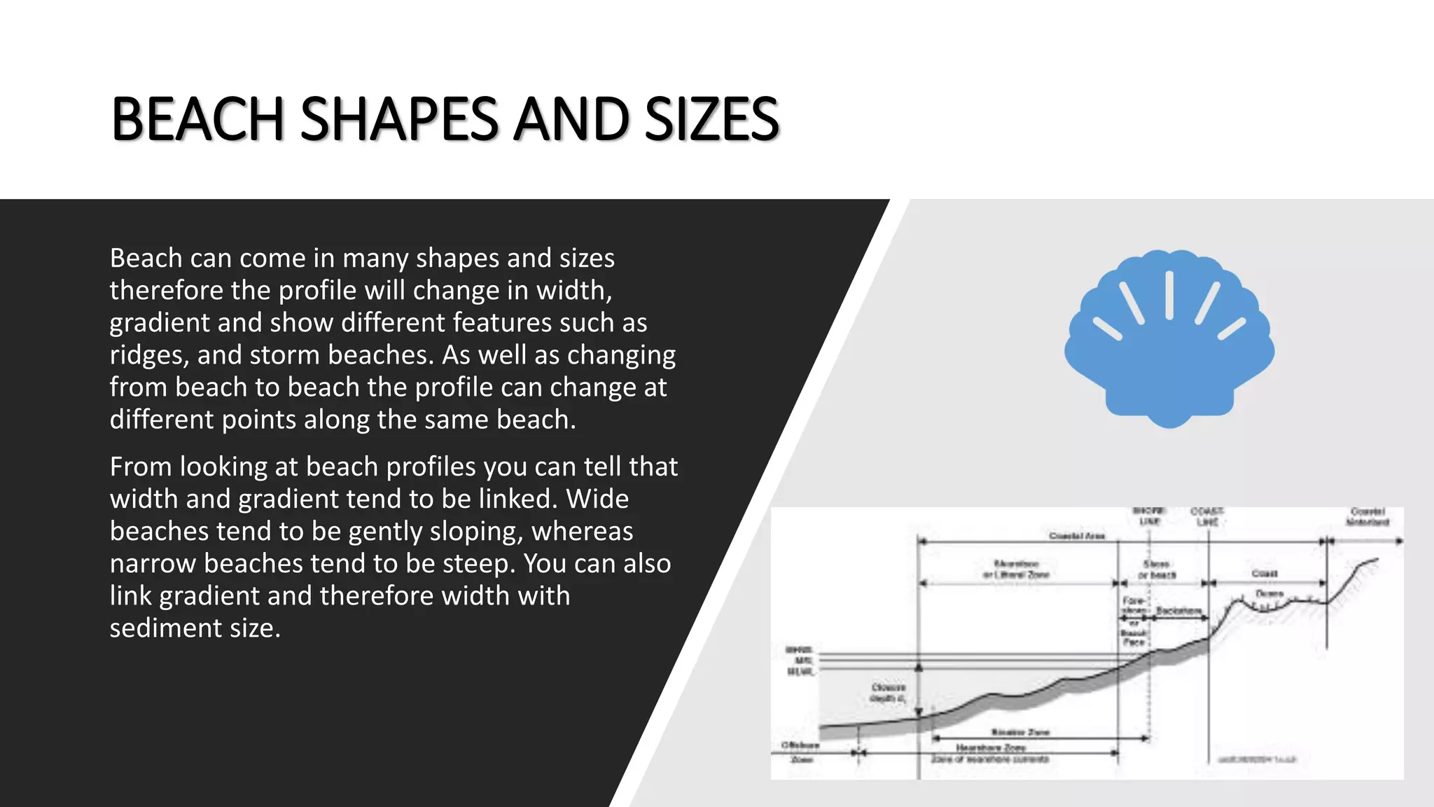
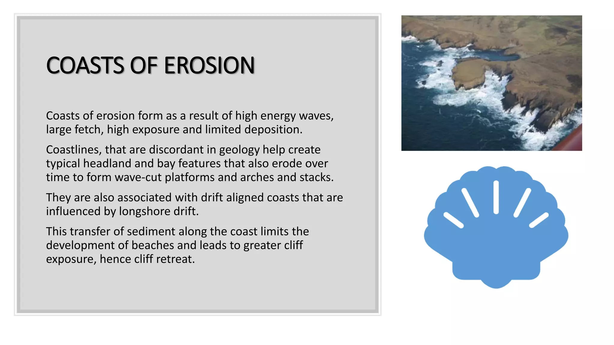
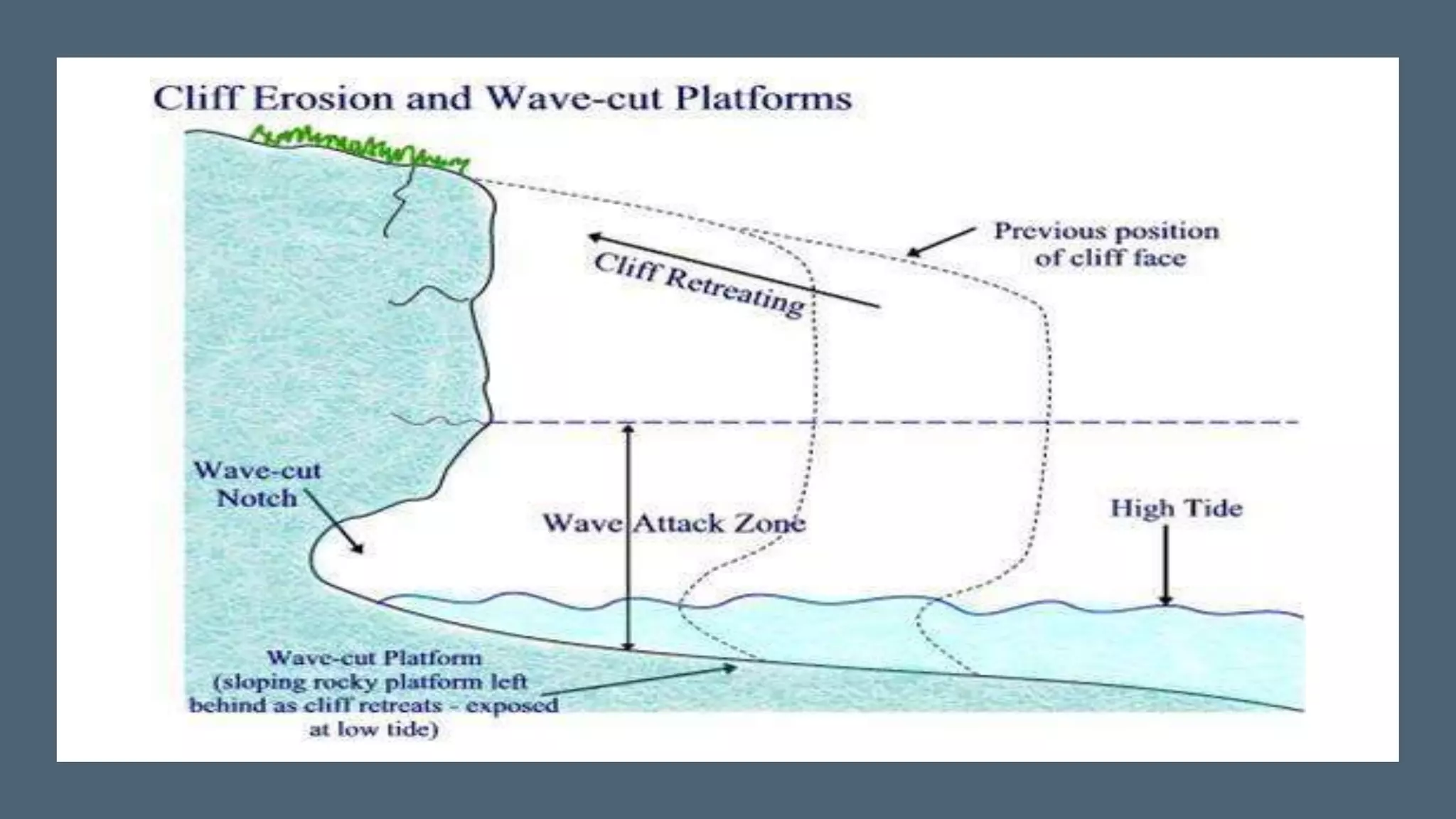
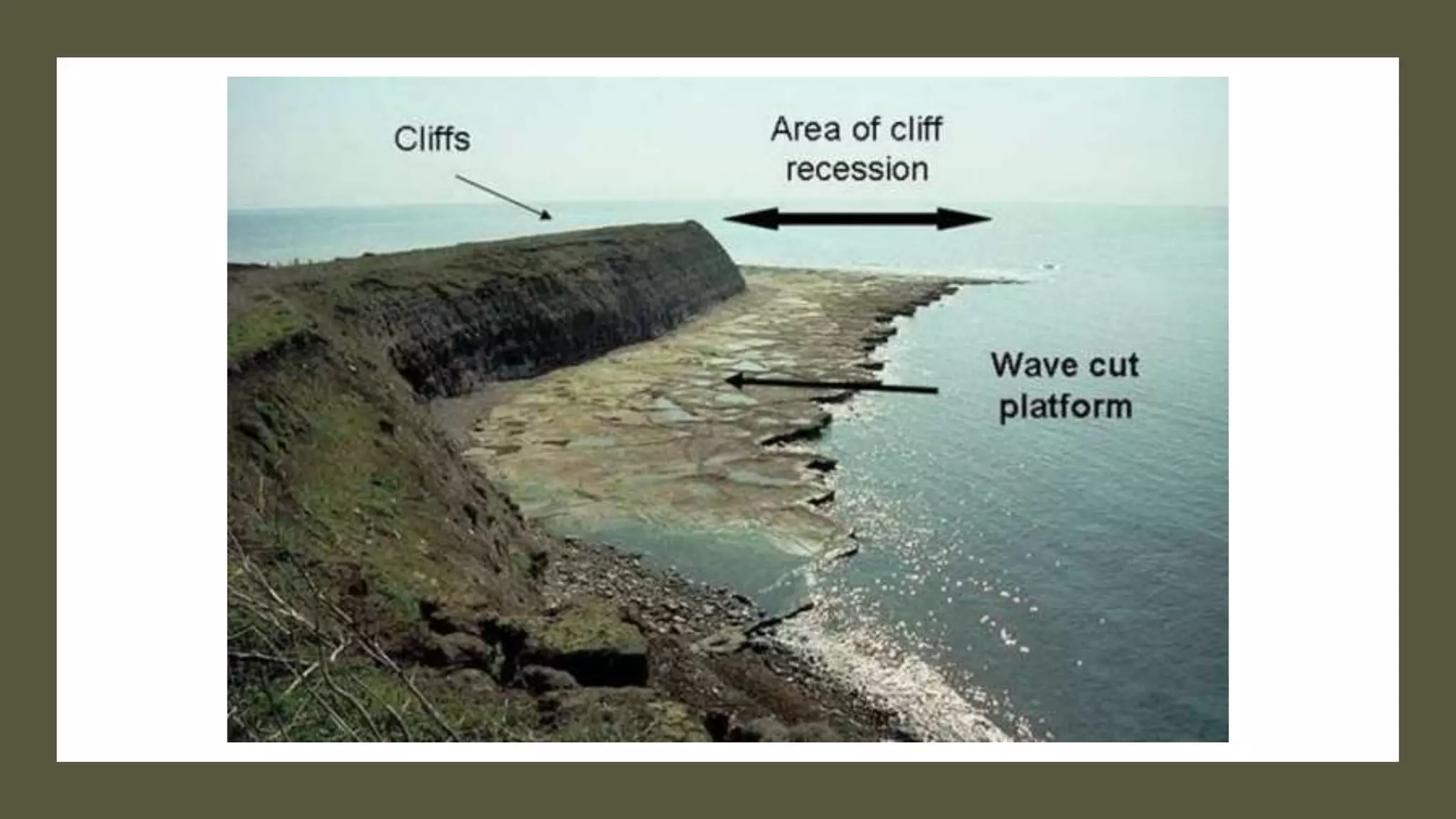
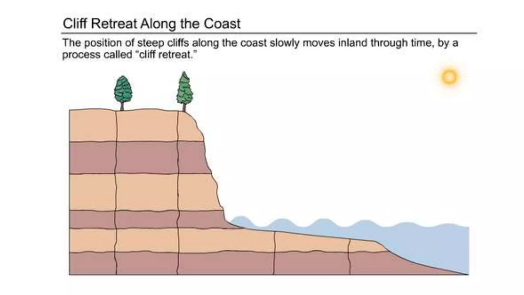
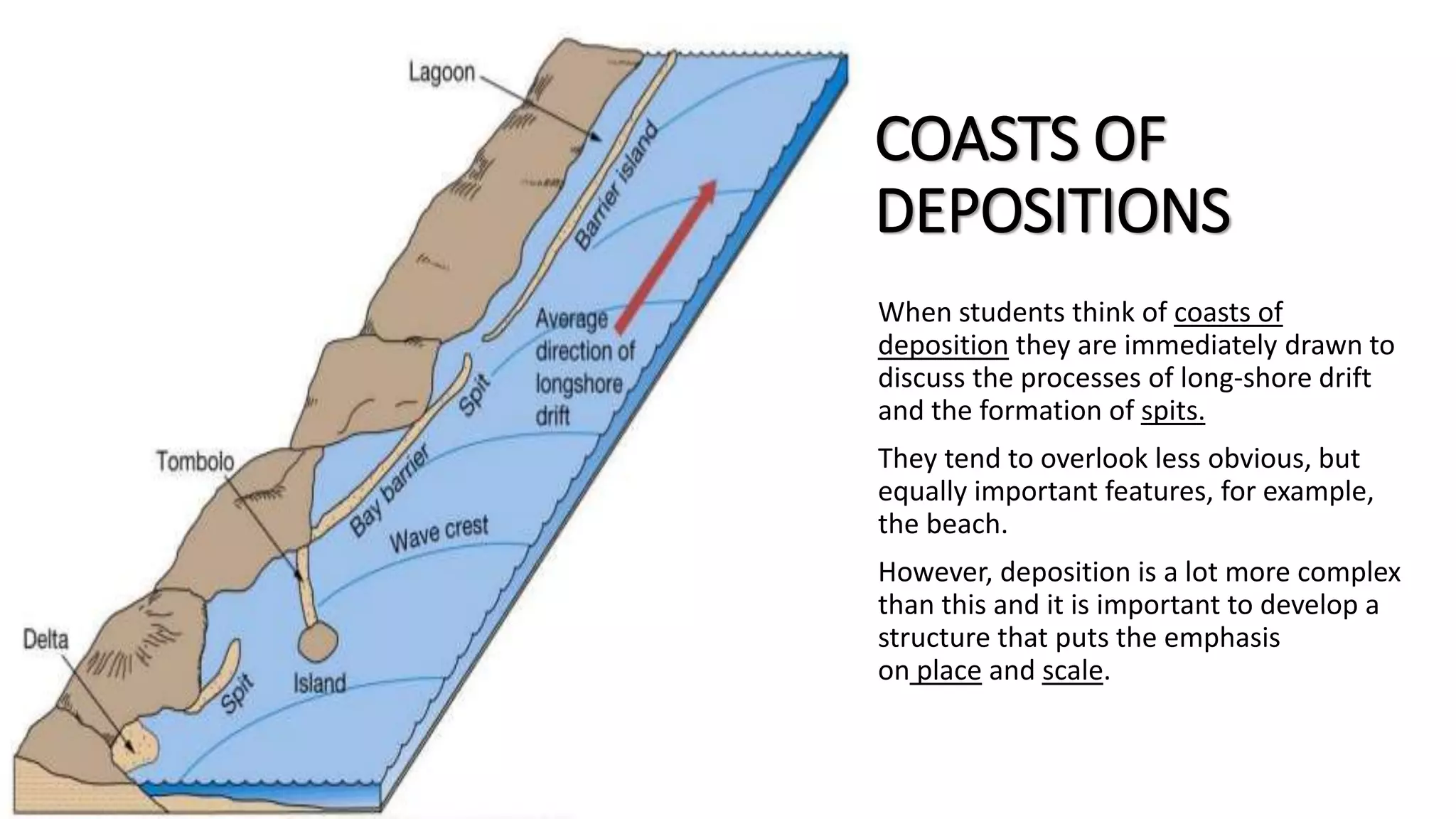
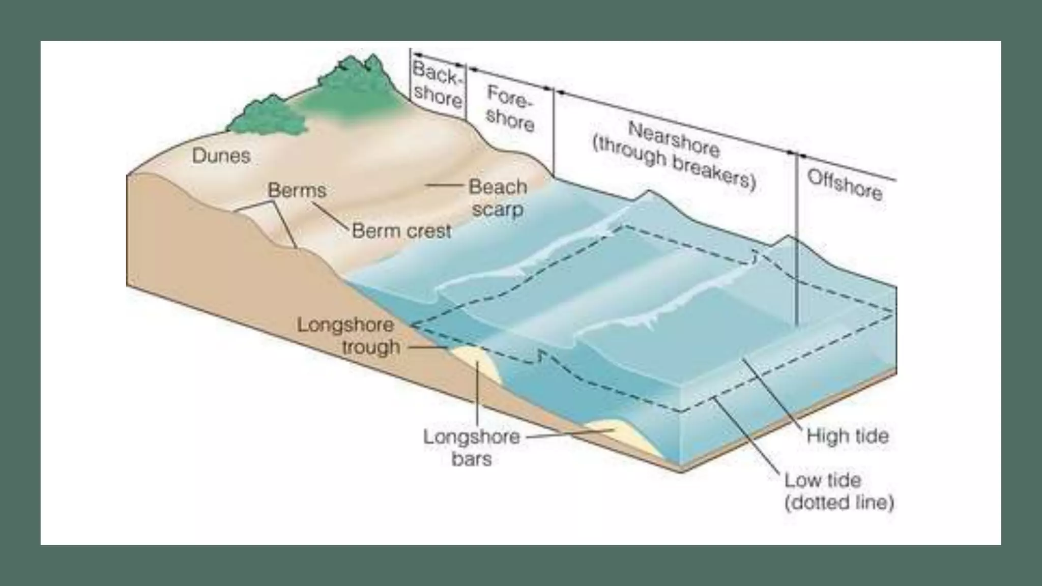
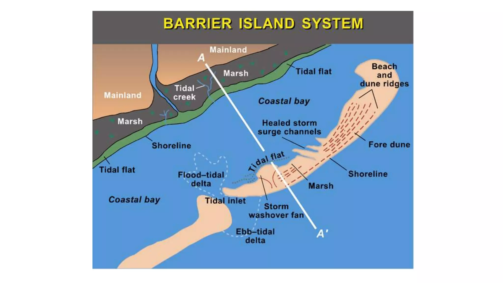
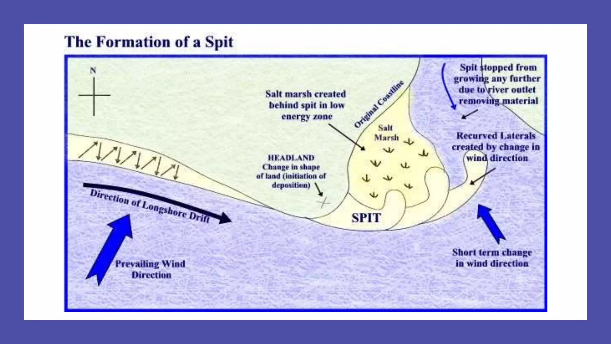
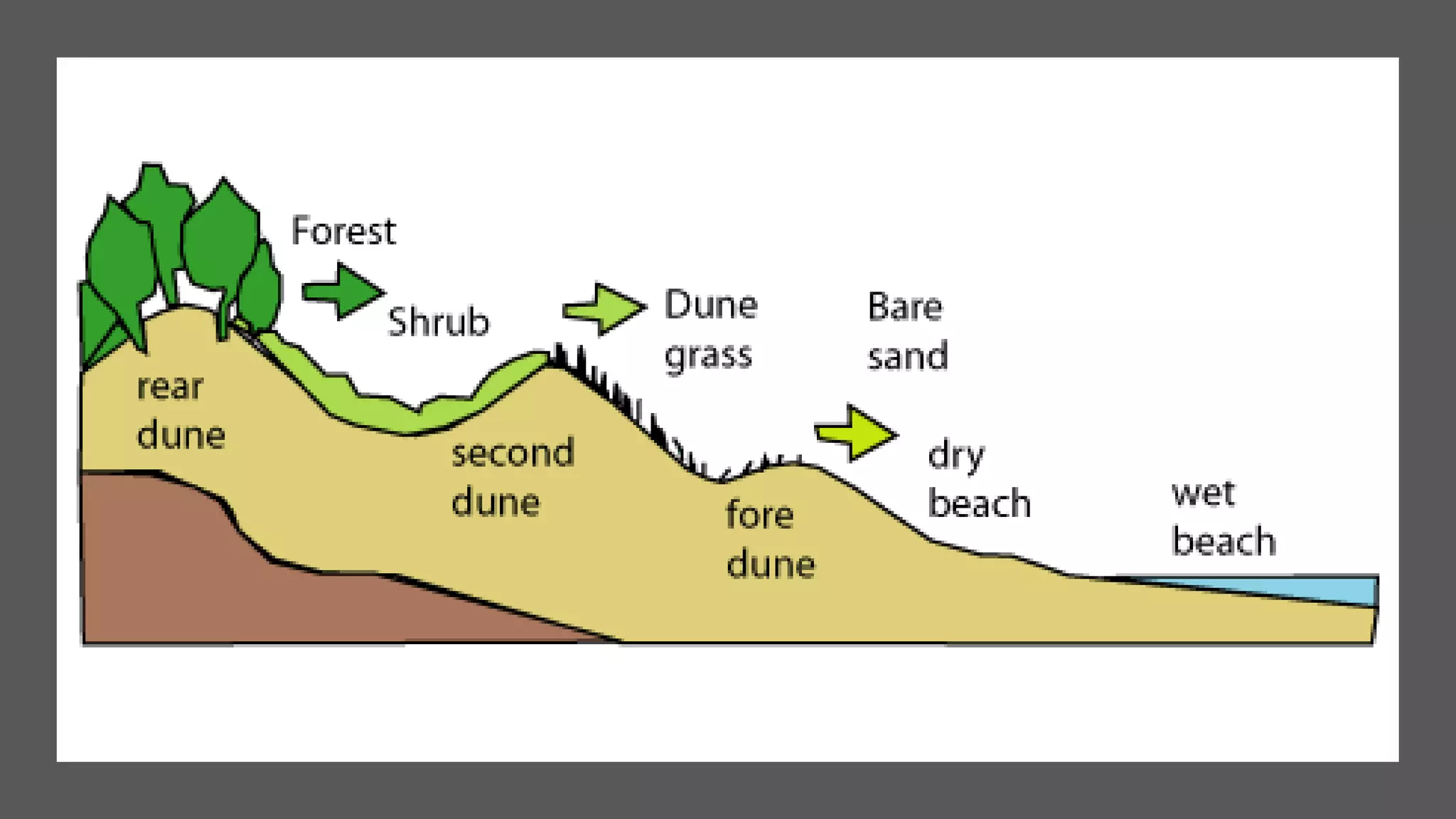

The document details the characteristics and formation of various coastal landforms, focusing on erosional features like cliffs, caves, arches, and stacks, as well as depositional landforms such as beaches, spits, and dunes. It also explains processes like wave action, weathering, and sediment transport that shape these coastal environments, including the effects of sea level change. The interplay between geology and coastal processes is emphasized, highlighting diverse coastal formations around the world.


