Download to read offline
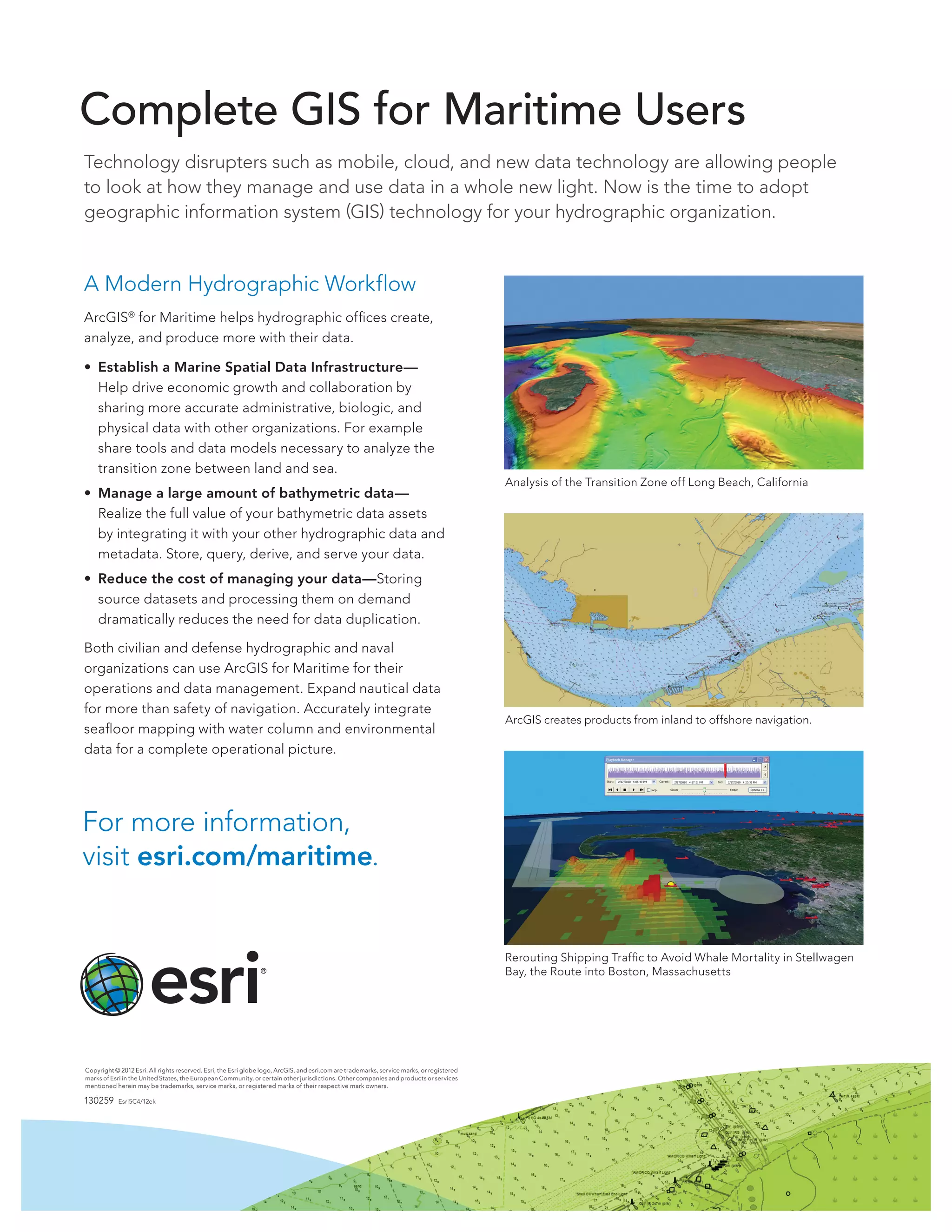

A geographic information system (GIS) can help hydrographic organizations better manage and share their bathymetric and maritime data. ArcGIS for Maritime allows hydrographic offices to create, analyze, and produce more with their data by establishing a marine spatial data infrastructure to share accurate administrative, biological, and physical data. It also helps manage large amounts of bathymetric data by integrating it with other hydrographic data and metadata to derive and serve the data. Both civilian and defense hydrographic organizations can use ArcGIS for Maritime to expand their use of nautical data beyond safety of navigation to integrate seafloor mapping with water column and environmental data.


![Vibe Coding vs. Spec-Driven Development [Free Meetup]](https://cdn.slidesharecdn.com/ss_thumbnails/vibecodingvsspecdrivendevelopment-251209105622-43f455e7-thumbnail.jpg?width=640&height=640&fit=bounds)


