Downloaded 82 times

![Manage
Take Charge of Workflows, Data, and Products
Data that is collected must be structured and managed to ensure that it can be used
appropriately. This requires organising the data into feature classes, enriching it with
attributes and relationships, and implementing metadata to enable accurate use. Multiple
datasets and types should be managed centrally to reduce or eliminate data redundancy.
The scalable enterprise system architecture centred on the ArcGIS geodatabase produces
better quality, manageable workflows, and an authoritative and reliable dataset.
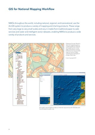
Case Study—BKG, Germany
Within the Federal Republic of Germany, the BKG’s products include topographic reference data in digital
responsibility of acquisition and provision of form as vector and raster data and corresponding maps at
topographic reference data and technical geodata different scales as well as geodetic reference networks for
mainly belongs to the Länder (states). The German planimetry, altimetry, and gravimetry. Since 1989, BKG has
Federal Agency for Cartography and Geodesy been using Esri software products to create its business
(Bundesamt für Kartographie und Geodäsie [BKG]) products such as digital landscape models (vector data)
manages and coordinates the country’s spatial in scales of 1:25,000 (Basis-DLM), 1:250,000 (DLM250), and
reference systems and makes topographic refer- 1:1,000,000 (DLM1000); digital topographic maps (raster data)
ence data available to the federal government and in six scales; and digital elevation models and gazetteers.
the public.
The information technology network is built on Esri’s ArcGIS
software, which helps BKG reliably and efficiently fulfil its
national mapping tasks. Its Internet site has been designed
using common Internet programming techniques such
as HTML, JavaServer Pages (JSP™), and Java™. BKG oper-
ates a metadata system that supports software-based and
organisation-wide standards that are essential for effective
data sharing. The BKG website also provides an online order
and delivery system, online coordinate transformations, a web
gazetteer, interactive maps, and downloads of data along
with the corresponding internal workflow management pro-
cesses needed for updating information. The GeoDataCenter
of BKG also manages the Internet portal, which offers a broad
variety of web services.
BKG offers a continuous and maintainable colour imagery
service for all of Germany. The base data (40 cm resolution
orthoimagery from the 16 federal state agencies) came as
100,000 tiles with 6 TB of raw data in five different projec-
tions. BKG—using ArcGIS—was able to immediately use this
data, optimise the data and software system for performance
reasons, and offer the service well within the time frame—a
real success.
The BKG GeoDataCenter portal is built on Esri server
software and offers Open Geospatial Consortium, Inc ®.
(OGC®)-compliant web map services.
9](https://image.slidesharecdn.com/gis-for-national-mapping-110920170028-phpapp02/85/GIS-for-National-Mapping-and-Charting-9-320.jpg)
![Share
Maximise the Value of Your Data
Share maps, charts, atlases, data, and web services more easily and efficiently in the formats
customers need. By providing data through traditional means, as well as cloud-based and
mobile technology, you can add value to your offerings, generating revenue through differ-
ent models. By providing authoritative data, those consuming it can visualise and analyse
geographic information, making more informed decisions.
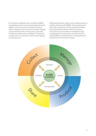
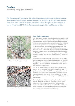
Case Study—Geografická služba ACR
Geografická služba ACR (the Geographic Service of the
Armed Forces of the Czech Republic [GeoS]) produces
maps for the Multinational Geospatial Co-Production
Program (MGCP). This programme brings together
28 participating countries from all over the world to
promote nonsovereign data production in nations
where commercial satellite imagery is the primary data
source. The maps, called MGCP Derived Graphics
(MDG), resemble Topographic Line Maps at 1:50,000
scale (TLM50) to support international humanitarian and
peacekeeping operations in these areas.
The cartographic tools in ArcGIS help GeoS create the
correct symbology on the generated map. Rule match-
ing for each single feature is based on properly defined GeoS produces maps for the Multinational Geospatial
attribute combinations. This database-driven approach Co-Production Program, like this one for the country of Afghanistan.
to symbolisation provides many advantages—the digital
landscape model and the digital cartographic model User-defined tools for processing other data sources
can coexist in one dataset, and geometry edits of have been established for assembling and successfully
cartographic representations do not change the original applying spot height generation. Digital Terrain Elevation
feature geometry. Quick symbology matching based Data (DTED) was implemented to create contour lines as
on attribute combinations is achieved through a user- well as shaded relief. This helps improve terrain portrayal
defined Python® script to convert the landscape model and map readability.
into the cartographic model.
ArcGIS provides map composition creation, where
appropriate layers are symbolised and arranged to create
the topographic maps. The map composition is then
exported for additional processing. Digital processing is
then finished in a publishing programme, where the map
and shaded relief are merged. Using ArcGIS to create
MGCP data and maps helps GeoS’s customers in their
need for rapid map output of the highest quality.
For more information, visit esri.com/maps.
11](https://image.slidesharecdn.com/gis-for-national-mapping-110920170028-phpapp02/85/GIS-for-National-Mapping-and-Charting-11-320.jpg)


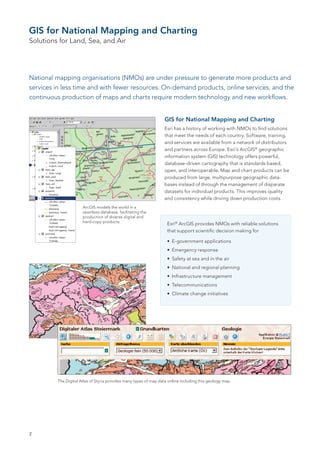
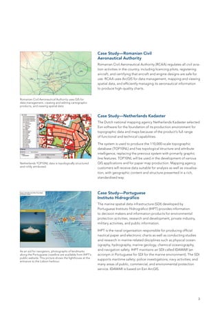
National mapping organizations are under pressure to create more products with fewer resources using modern technology. Esri's ArcGIS software offers a database-driven cartography solution that improves quality, consistency, and reduces costs. It provides reliable solutions for applications such as emergency response, infrastructure management, and climate change initiatives. Several case studies show how national mapping agencies in Romania, the Netherlands, and Portugal use ArcGIS for data management, map production, and online mapping services.