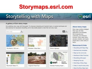
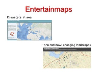
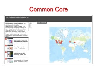
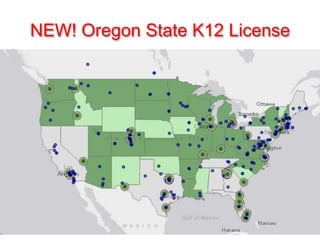
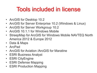
Story Maps
Mary Bucy
Western Oregon University
Center for Geography Education in Oregon
2013 Annual Conference
Oct. 19, 2013
What is a story map?

Exploring the Fowey and Lerryn estuaries, Cornwall, England
World Map of Story Maps
Storymaps.esri.com
Hurricane Sandy
Entertainmaps
Disasters at sea

Then and now: Changing landscapes
Common Core
Let’s make a story map
NEW! Oregon State K12 License
Tools included in license
•
•
•
•
•
•
•
•
•
•
•
•

ArcGIS for Desktop 10.2
ArcGIS for Server Enterprise 10.2 (Windows & Linux)
ArcGIS for Server Workgroup 10.2
ArcGIS 10.1.1 for Windows Mobile
StreepMap for ArcGIS for Windows Mobile NAVTEQ North
America 2012 & Europe 2012
Data & Maps
ArcPad
ArcGIS for Aviation /ArcGIS for Maratine
ESRI Business Analyst
ESRI CityEngine
ESRI Defense Mapping
ESRI Production Mapping
Story Maps & ArcGIS Resources
http://tinyurl.com/mcsasam

Making a Quick Story Map
http://tinyurl.com/k273mug

OGA 2013 presentation

  • 1.
    Story Maps Mary Bucy WesternOregon University Center for Geography Education in Oregon 2013 Annual Conference Oct. 19, 2013
  • 2.
    What is astory map? Exploring the Fowey and Lerryn estuaries, Cornwall, England
  • 3.
    World Map ofStory Maps
  • 4.
  • 5.
  • 6.
    Entertainmaps Disasters at sea Thenand now: Changing landscapes
  • 7.
  • 8.
    Let’s make astory map
  • 10.
    NEW! Oregon StateK12 License
  • 11.
    Tools included inlicense • • • • • • • • • • • • ArcGIS for Desktop 10.2 ArcGIS for Server Enterprise 10.2 (Windows & Linux) ArcGIS for Server Workgroup 10.2 ArcGIS 10.1.1 for Windows Mobile StreepMap for ArcGIS for Windows Mobile NAVTEQ North America 2012 & Europe 2012 Data & Maps ArcPad ArcGIS for Aviation /ArcGIS for Maratine ESRI Business Analyst ESRI CityEngine ESRI Defense Mapping ESRI Production Mapping
  • 12.
    Story Maps &ArcGIS Resources http://tinyurl.com/mcsasam Making a Quick Story Map http://tinyurl.com/k273mug

Editor's Notes

  • #3 Different types of maps you could use as a base mapShow how to find them on ArcGIS online (?)Maps can be run and viewed interactively without logging in or using anything but browserwww.josephkerski.com/resources/web-mapswww.josephkerski.com/storymaps/colorado_shortlistAnother example: www.audubon.org/ploverwww.barbareeduke.com/commoncore -- great resource showing how storymaps correlate with Common Core reading standardsWhat are storymaps good for? Show how to use the maps for analysisOther uses for storymaps
  • #5 Created by ESRI staff ( -- came from Nat Geographic)Galviston hurricane = #3 – zoom in and look at the barrier island.Galviston hurricane from 1900 (most destructive nat disaster in historyTrack where it wasZoom in – show the barrier island (maybe find Sandy also??)
  • #7 Topics not normally associated with geographyDisasters at sea (uses oceans base map)Zoom in so you can see what is under the sea where shipwrecks were (map has an error on a date of wreck off Australia—teachable moment)Links in the popups
  • #8 www.barbareeduke.com/commoncore -- great resource showing how storymaps correlate with Common Core reading standards