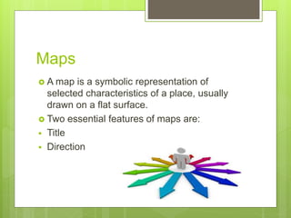
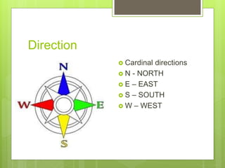
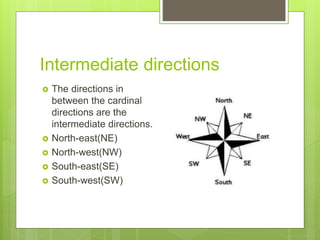
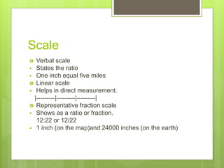
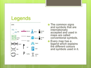
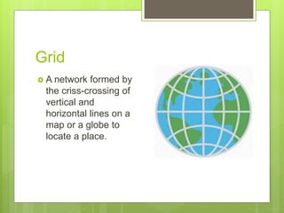
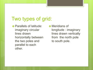
Essential
features of maps
Chapter 2
Maps
 A map is a symbolic representation of
selected characteristics of a place, usually
drawn on a flat surface.
 Two essential features of maps are:
 Title
 Direction
Title
 The map title tells us what kind of information
is provided in it.
Direction
 Cardinal directions
 N - NORTH
 E – EAST
 S – SOUTH
 W – WEST
Intermediate directions
 The directions in
between the cardinal
directions are the
intermediate directions.
 North-east(NE)
 North-west(NW)
 South-east(SE)
 South-west(SW)
Scale
 Verbal scale
 States the ratio
 One inch equal five miles
 Linear scale
 Helps in direct measurement.
|---------|---------|---------|
 Representative fraction scale
 Shows as a ratio or fraction.
12:22 or 12/22
 1 inch (on the map)and 24000 inches (on the earth)
Legends
 The common signs
and symbols that are
internationally
accepted and used in
maps are called
conventional symbols.
 Every map has a
legend which explains
the different colours
and symbols used in it.
Geographical features
 River
 Meanders
 Tributaries
 Distributaries
 Delta
 Fold mountain
 Block mountain
River
 A river is a natural flowing watercourse,
usually freshwater, flowing towards an ocean,
sea, lake or another river.
Meanders
 A meander is a curve
in a river. Meanders
form a snake-like
pattern as the river
flows across a fairly
flat valley floor. The
position of the curves
changes over time.
Tributaries
 A tributary is a river
or stream that feeds
into a larger body of
water.
Distributaries
 A branch of a river
that does not return
to the main stream
after leaving it.
Delta
 A river delta is a low-
lying plain or
landform that occurs
at the mouth of a
river near where it
flows into an ocean
or another larger
body of water.
Fold mountain
 Fold mountains are
mountains that form
mainly by the effects
of folding on layers
within the upper part
of the Earth's crust.
Block mountain
 Fault-block
mountains are
formed by the
movement of large
crustal blocks when
forces in the Earth's
crust pull it apart.
Grid
 A network formed by
the criss-crossing of
vertical and
horizontal lines on a
map or a globe to
locate a place.
Two types of grid:
 Parallels of latitude:
imaginary circular
lines drawn
horizontally between
the two poles and
parallel to each
other.
 Meridians of
longitude : imaginary
lines drawn vertically
from the north pole
to south pole.
Essential Features Of Maps ( class- 6 )

Essential Features Of Maps ( class- 6 )

  • 1.
  • 2.
    Maps  A mapis a symbolic representation of selected characteristics of a place, usually drawn on a flat surface.  Two essential features of maps are:  Title  Direction
  • 3.
    Title  The maptitle tells us what kind of information is provided in it.
  • 4.
    Direction  Cardinal directions N - NORTH  E – EAST  S – SOUTH  W – WEST
  • 5.
    Intermediate directions  Thedirections in between the cardinal directions are the intermediate directions.  North-east(NE)  North-west(NW)  South-east(SE)  South-west(SW)
  • 6.
    Scale  Verbal scale States the ratio  One inch equal five miles  Linear scale  Helps in direct measurement. |---------|---------|---------|  Representative fraction scale  Shows as a ratio or fraction. 12:22 or 12/22  1 inch (on the map)and 24000 inches (on the earth)
  • 7.
    Legends  The commonsigns and symbols that are internationally accepted and used in maps are called conventional symbols.  Every map has a legend which explains the different colours and symbols used in it.
  • 8.
    Geographical features  River Meanders  Tributaries  Distributaries  Delta  Fold mountain  Block mountain
  • 9.
    River  A riveris a natural flowing watercourse, usually freshwater, flowing towards an ocean, sea, lake or another river.
  • 10.
    Meanders  A meanderis a curve in a river. Meanders form a snake-like pattern as the river flows across a fairly flat valley floor. The position of the curves changes over time.
  • 11.
    Tributaries  A tributaryis a river or stream that feeds into a larger body of water.
  • 12.
    Distributaries  A branchof a river that does not return to the main stream after leaving it.
  • 13.
    Delta  A riverdelta is a low- lying plain or landform that occurs at the mouth of a river near where it flows into an ocean or another larger body of water.
  • 14.
    Fold mountain  Foldmountains are mountains that form mainly by the effects of folding on layers within the upper part of the Earth's crust.
  • 15.
    Block mountain  Fault-block mountainsare formed by the movement of large crustal blocks when forces in the Earth's crust pull it apart.
  • 16.
    Grid  A networkformed by the criss-crossing of vertical and horizontal lines on a map or a globe to locate a place.
  • 17.
    Two types ofgrid:  Parallels of latitude: imaginary circular lines drawn horizontally between the two poles and parallel to each other.  Meridians of longitude : imaginary lines drawn vertically from the north pole to south pole.