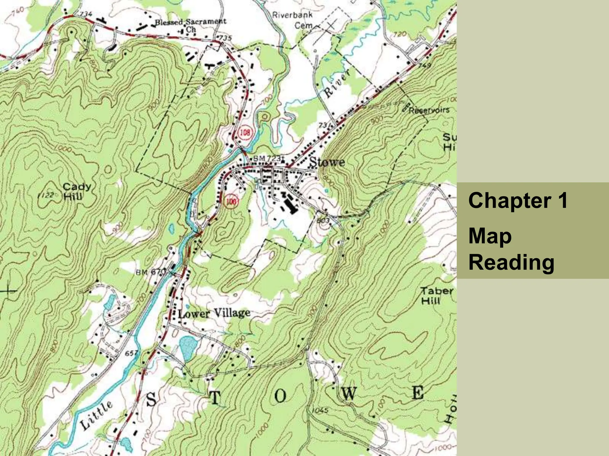
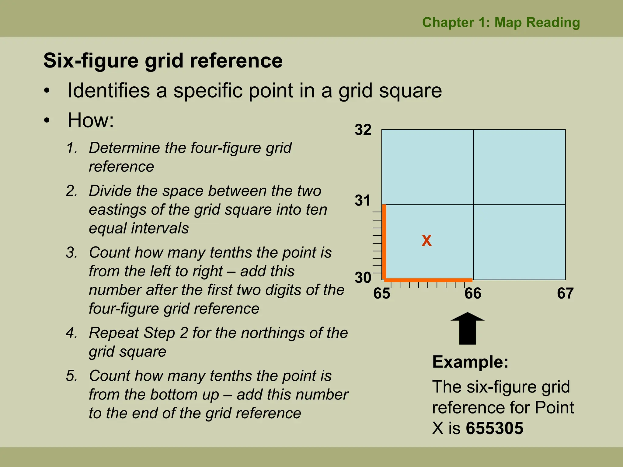
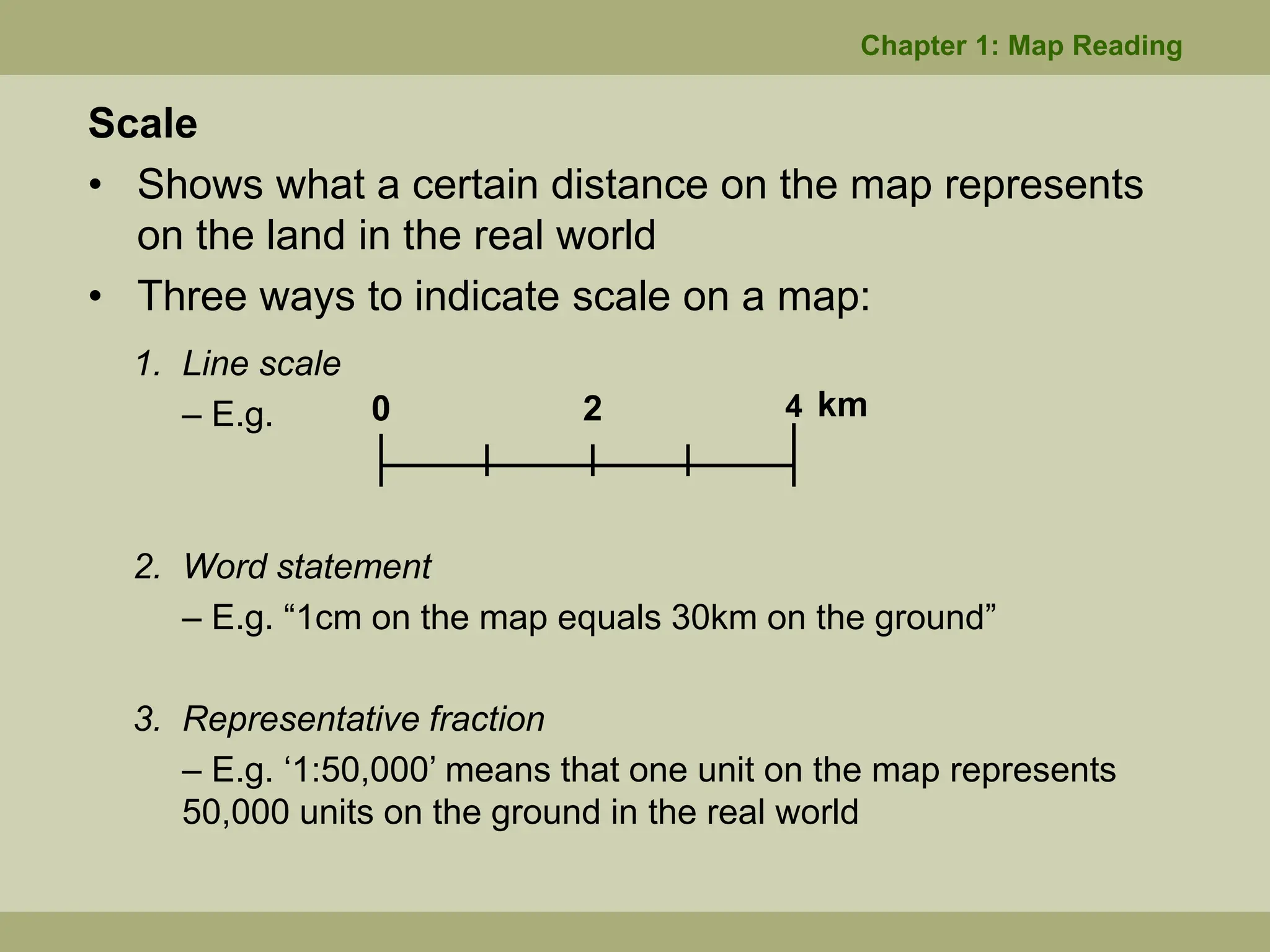
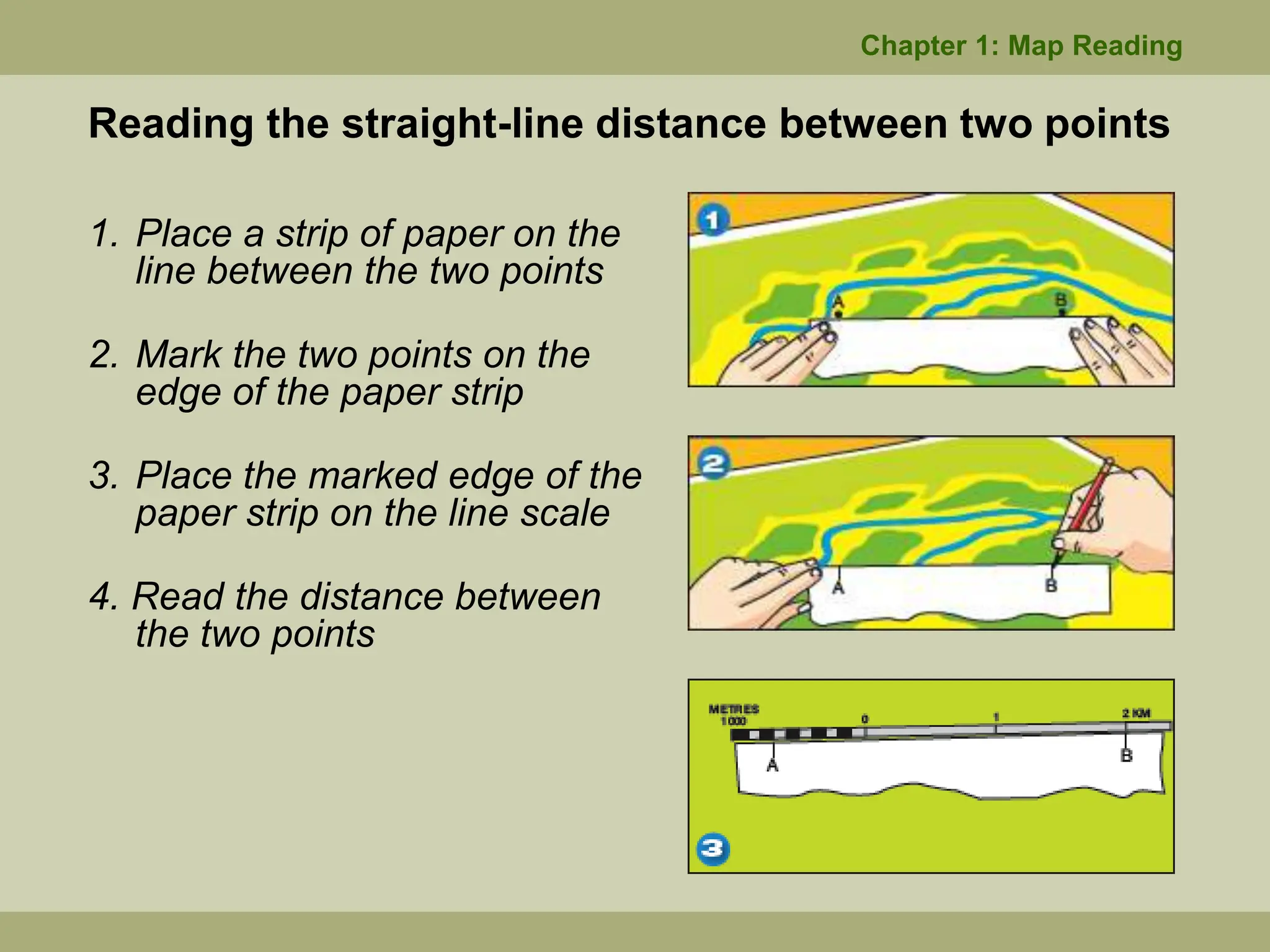
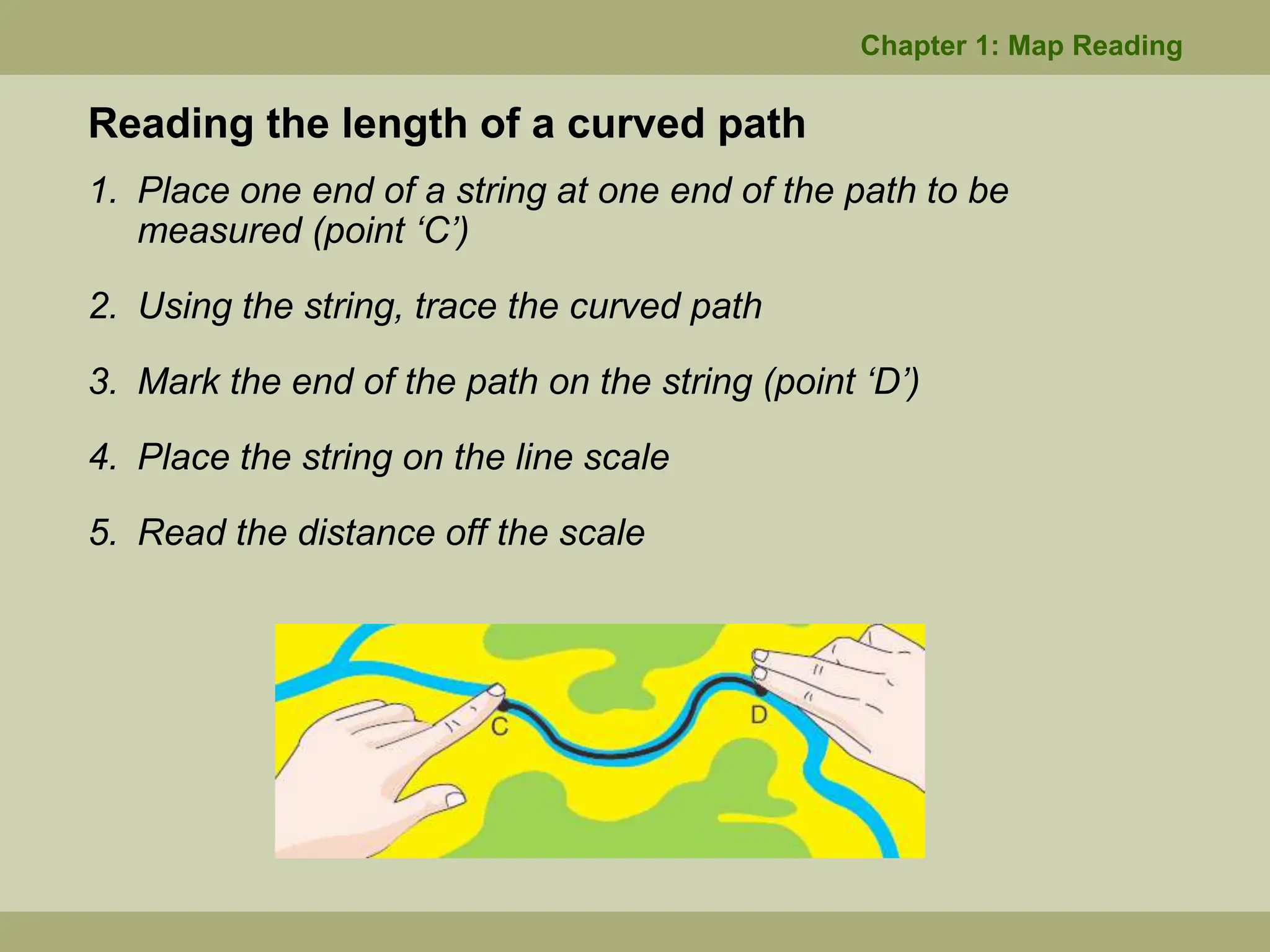
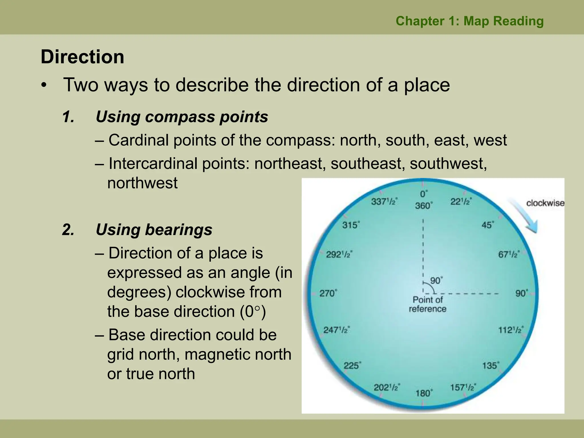
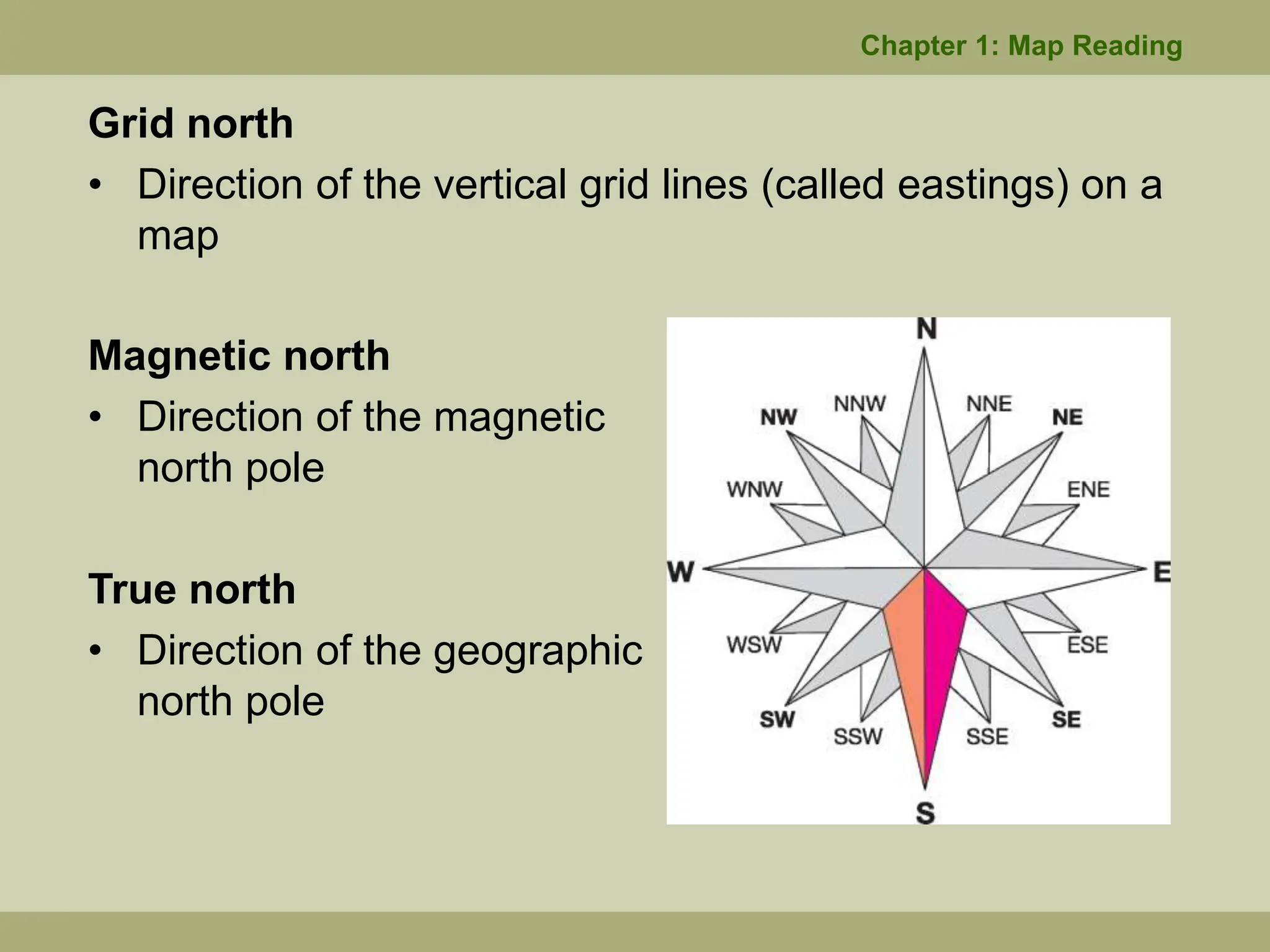
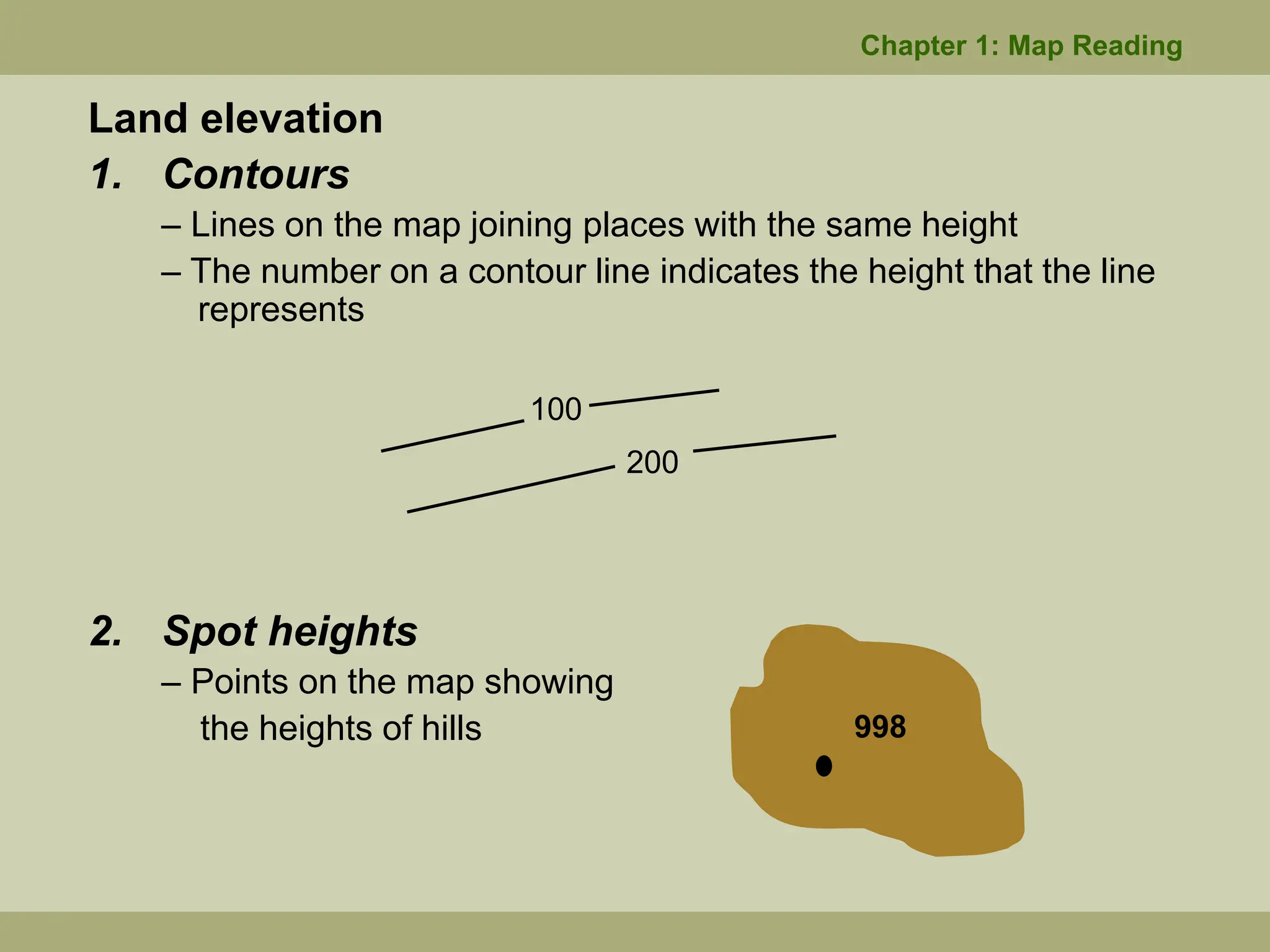
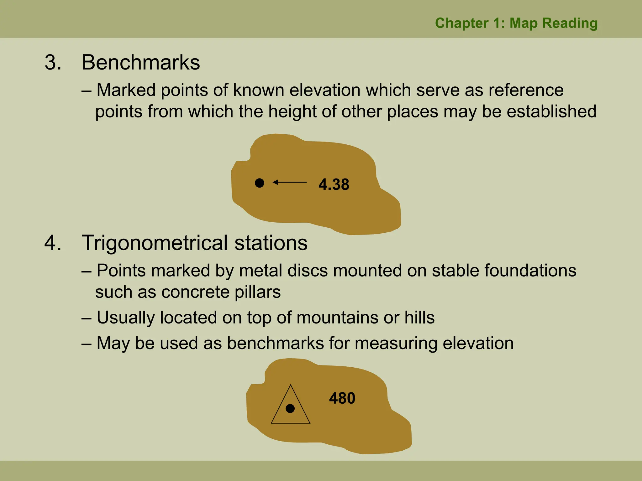
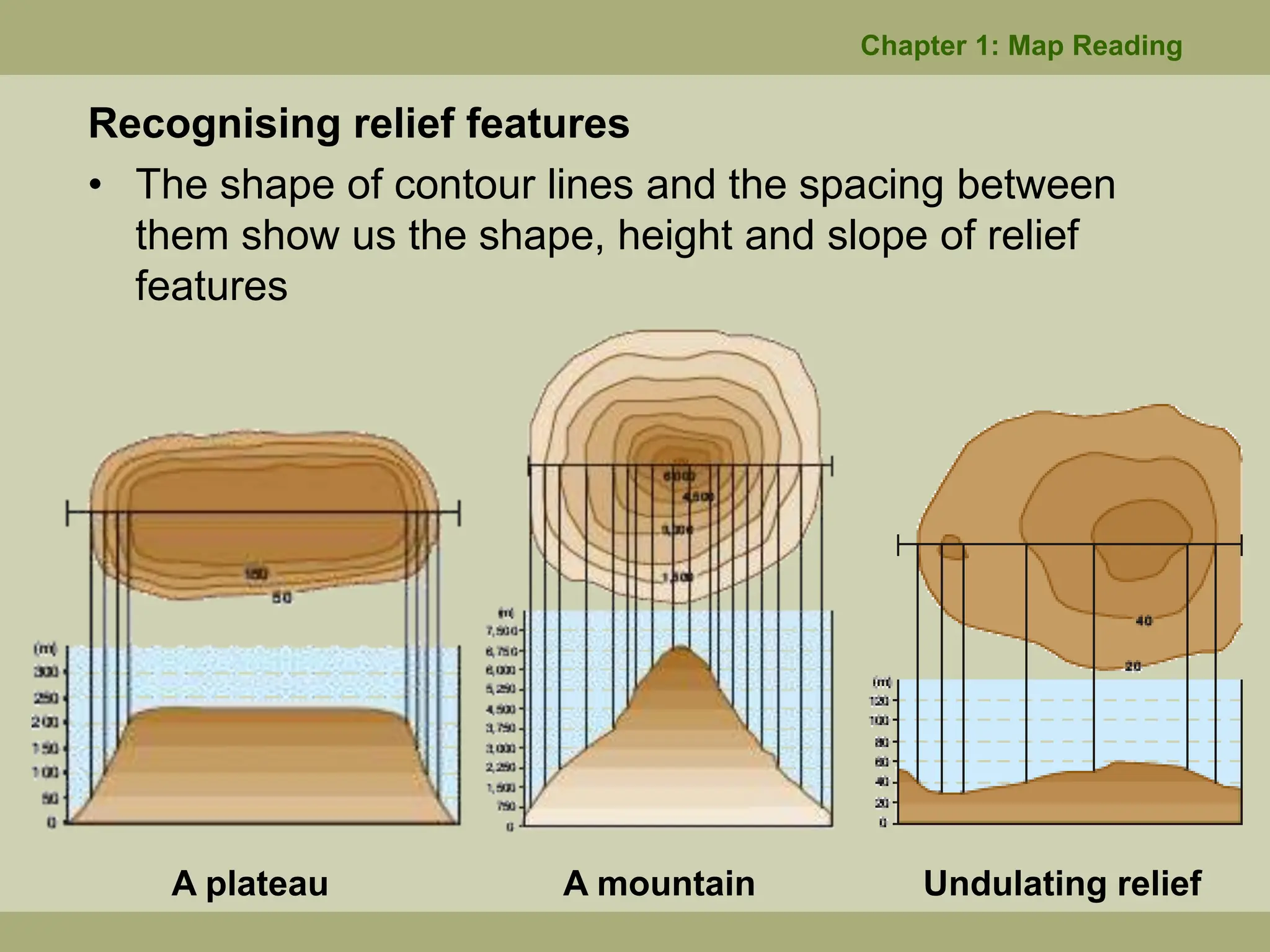
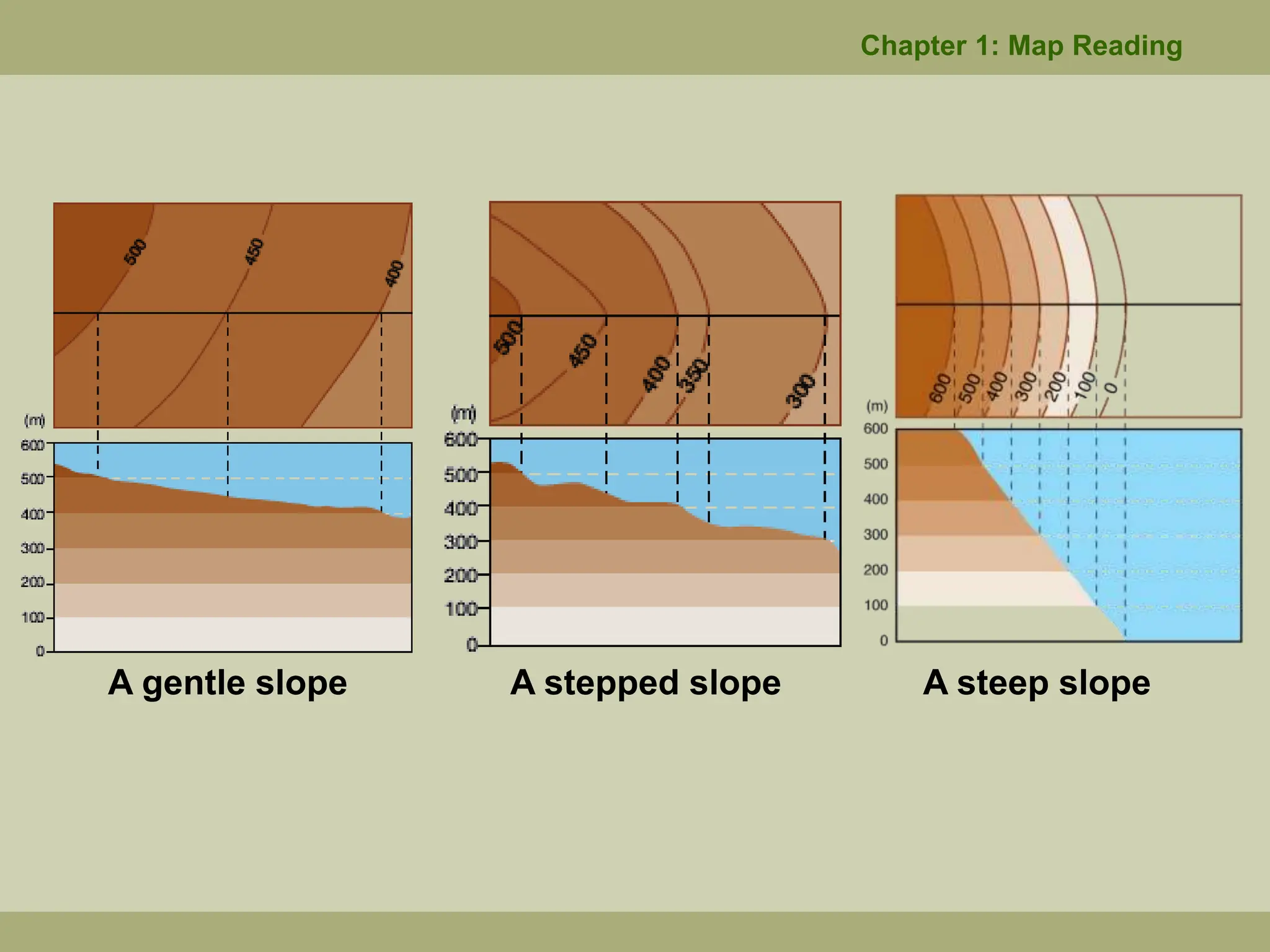
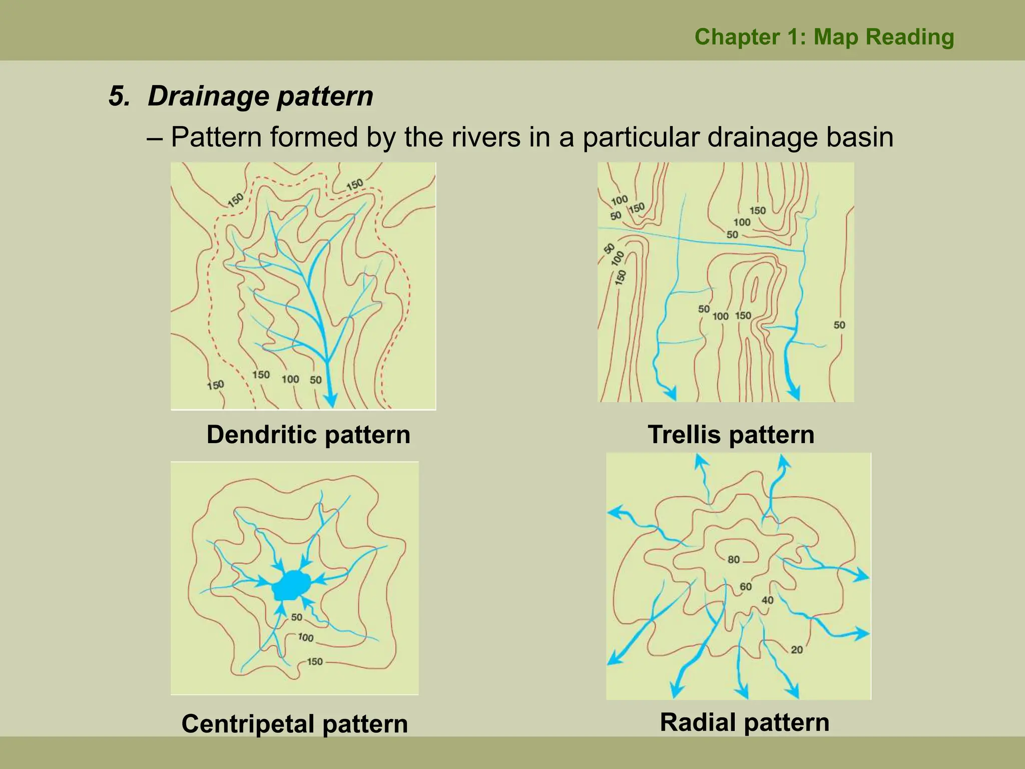
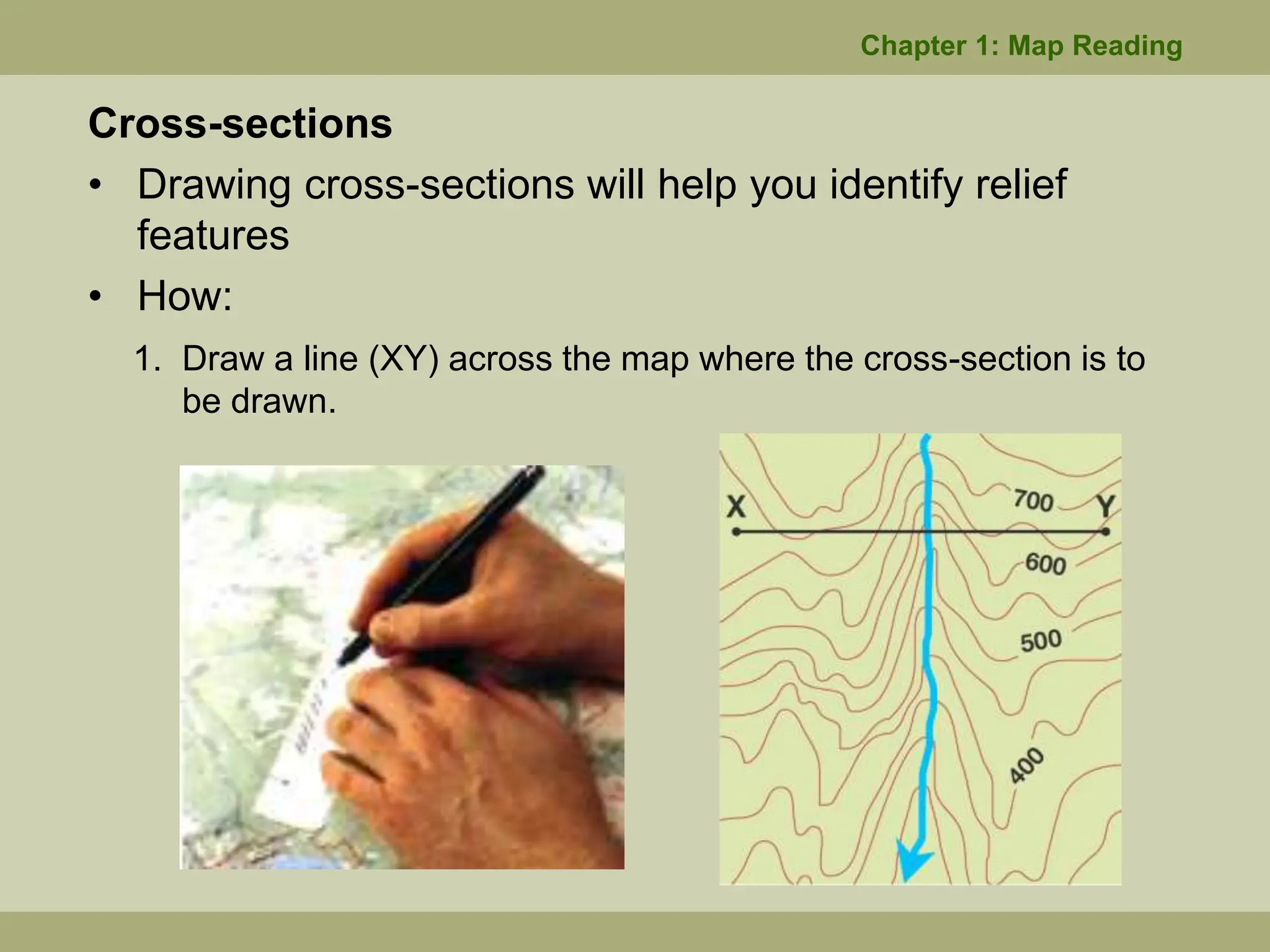
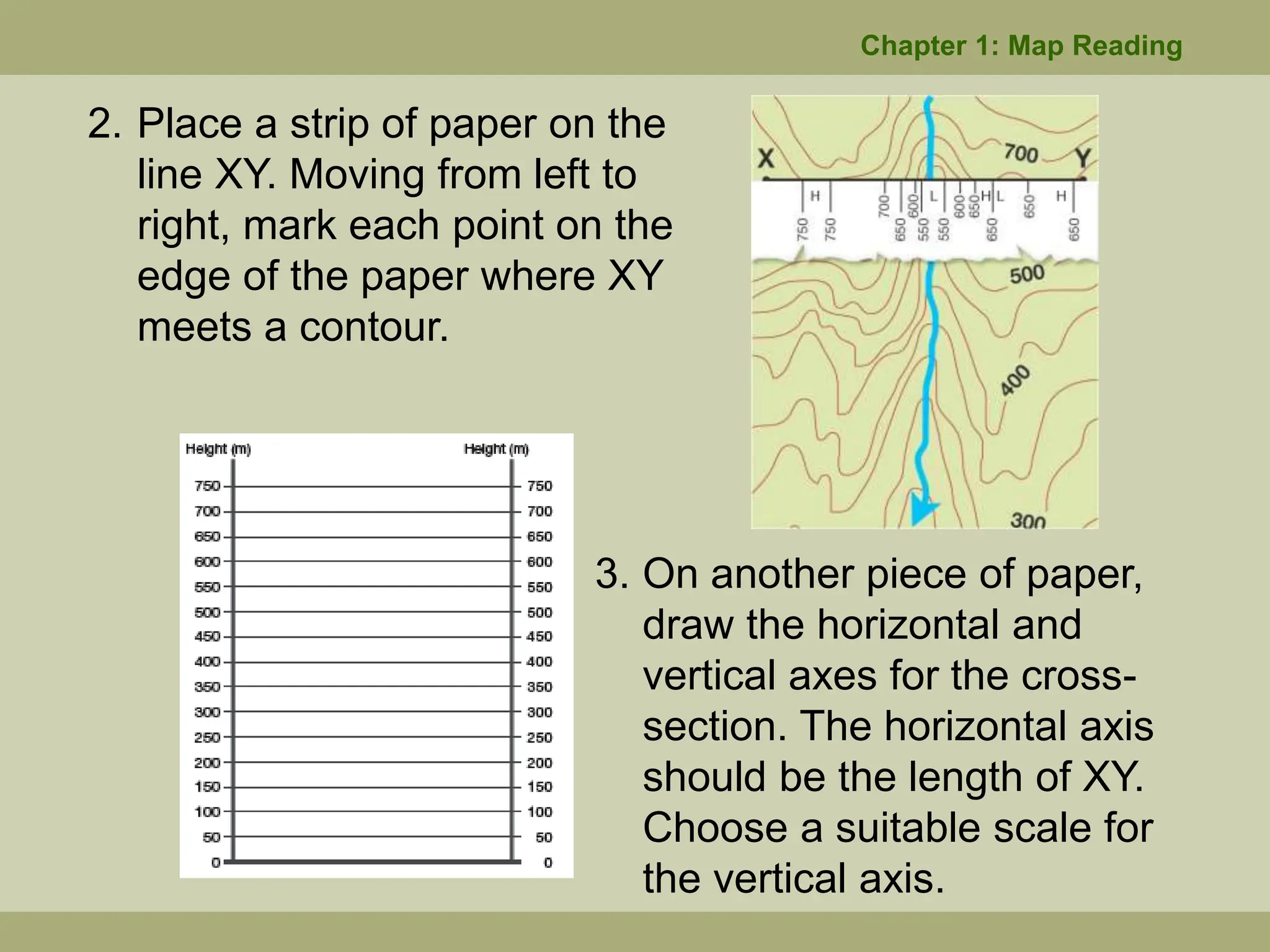
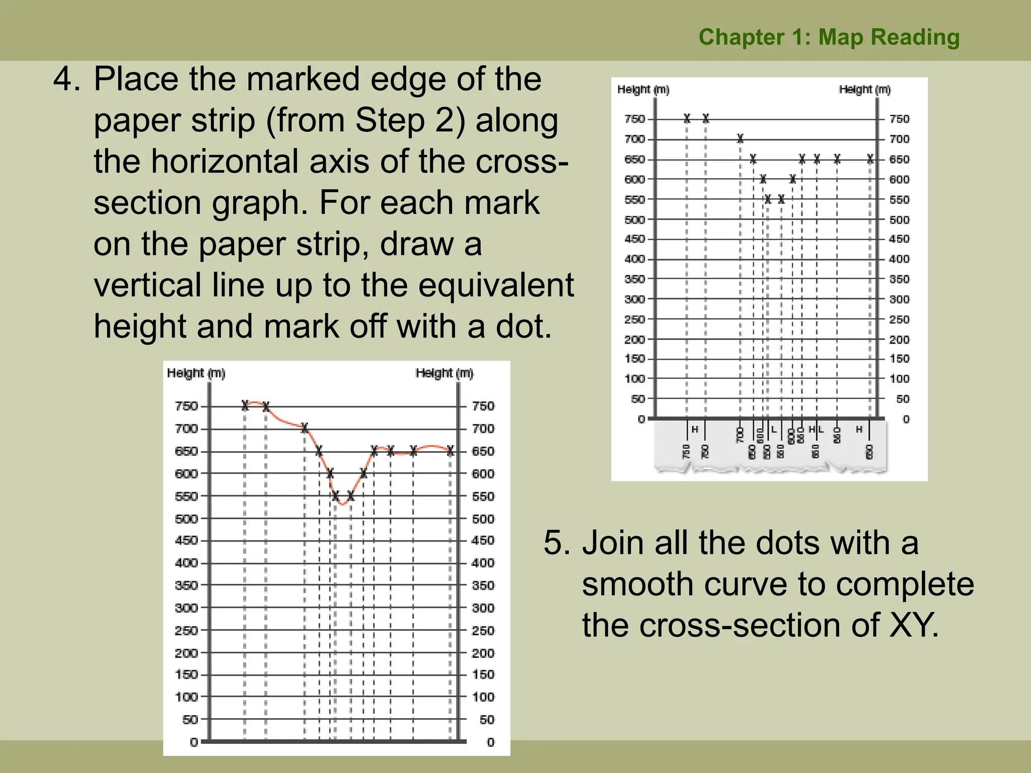
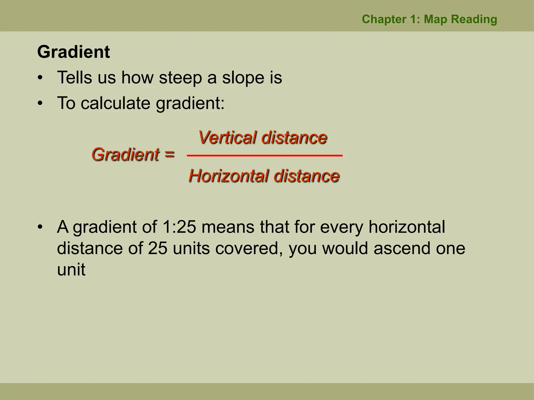
Chapter 1 covers the fundamentals of topographic map reading, detailing its key components such as grid lines, scales, and the representation of physical and human features. It explains how to determine grid references with examples, the methods for measuring straight and curved distances, and describes directions using compass points and bearings. Additionally, it highlights contour lines for elevation, river features, drainage patterns, and calculating gradients, ultimately presenting techniques for interpreting and creating cross-sections of relief features.