The presentation aiding the lecture Fundamentals of Geology for the course CE 8392 Engineering Geology handled by Prof. Rathnavel Pon for Akshaya College of Engineering and Technology, Coimbatore
This presentation explains about different Seismic Zones Of India.It will help Young civil Engineers, Geologist to know about different earthquake Zones & to plan accordingly civil engineering structures.
hie guys
Its a small presentation on Earthquake Resistant Structures
some basic fundamentals about its causes its effect and few techniques to resist it..
This presentation gives detailed information about earthquake , its types , waves , faults , especially in asian countries .A detailed case study of earthquake In NEPAL in 2015 is also covered in this with pictures . Also how it is measured and its warning system , vulnerability, deployment and future aspects has been covered .
HOPE YOU LIKE IT AND GET FULL INFORMATION!!!!!
River is a most Important agent in geological field and most important roll of the physical, Chemical and biological erosion. It is common factors of river.
this paper tells about reasons for earthquakes, how the earthquakes happen,earthquake effects on buildings,how the buildings are respond to the earthquakes and design methods to be fallowed while designing a structure to resist earthquakes
WHAT IS AN EARTHQUAKE?
Where Do Earthquakes Happen?
Why Do Earthquakes Happen?
How Are Earthquakes Studied?
How To Locate The Earthquake's Epicenter?
SCALES FOR EARTHQUAKE MEASUREMENT
What Are Earthquake Hazards?
The most important for an architecture or civil engineer is to provide a comfortable and aesthetically beautiful building. This lecture contains all the specifications which are important for a drwaing
This lecture contains the detail of isometric projections of an object. This will improve your skills to draw isometric views which is the major part of engineering drawings.
Introduction to proteus for dummies. It is a software used to simulate electrical circuits. It saves time and also appliances. It is widely used now a days in electrical technology.
Overview of the fundamental roles in Hydropower generation and the components involved in wider Electrical Engineering.
This paper presents the design and construction of hydroelectric dams from the hydrologist’s survey of the valley before construction, all aspects and involved disciplines, fluid dynamics, structural engineering, generation and mains frequency regulation to the very transmission of power through the network in the United Kingdom.
Author: Robbie Edward Sayers
Collaborators and co editors: Charlie Sims and Connor Healey.
(C) 2024 Robbie E. Sayers
Democratizing Fuzzing at Scale by Abhishek Aryaabh.arya
Presented at NUS: Fuzzing and Software Security Summer School 2024
This keynote talks about the democratization of fuzzing at scale, highlighting the collaboration between open source communities, academia, and industry to advance the field of fuzzing. It delves into the history of fuzzing, the development of scalable fuzzing platforms, and the empowerment of community-driven research. The talk will further discuss recent advancements leveraging AI/ML and offer insights into the future evolution of the fuzzing landscape.
Cosmetic shop management system project report.pdfKamal Acharya
Buying new cosmetic products is difficult. It can even be scary for those who have sensitive skin and are prone to skin trouble. The information needed to alleviate this problem is on the back of each product, but it's thought to interpret those ingredient lists unless you have a background in chemistry.
Instead of buying and hoping for the best, we can use data science to help us predict which products may be good fits for us. It includes various function programs to do the above mentioned tasks.
Data file handling has been effectively used in the program.
The automated cosmetic shop management system should deal with the automation of general workflow and administration process of the shop. The main processes of the system focus on customer's request where the system is able to search the most appropriate products and deliver it to the customers. It should help the employees to quickly identify the list of cosmetic product that have reached the minimum quantity and also keep a track of expired date for each cosmetic product. It should help the employees to find the rack number in which the product is placed.It is also Faster and more efficient way.
Automobile Management System Project Report.pdfKamal Acharya
The proposed project is developed to manage the automobile in the automobile dealer company. The main module in this project is login, automobile management, customer management, sales, complaints and reports. The first module is the login. The automobile showroom owner should login to the project for usage. The username and password are verified and if it is correct, next form opens. If the username and password are not correct, it shows the error message.
When a customer search for a automobile, if the automobile is available, they will be taken to a page that shows the details of the automobile including automobile name, automobile ID, quantity, price etc. “Automobile Management System” is useful for maintaining automobiles, customers effectively and hence helps for establishing good relation between customer and automobile organization. It contains various customized modules for effectively maintaining automobiles and stock information accurately and safely.
When the automobile is sold to the customer, stock will be reduced automatically. When a new purchase is made, stock will be increased automatically. While selecting automobiles for sale, the proposed software will automatically check for total number of available stock of that particular item, if the total stock of that particular item is less than 5, software will notify the user to purchase the particular item.
Also when the user tries to sale items which are not in stock, the system will prompt the user that the stock is not enough. Customers of this system can search for a automobile; can purchase a automobile easily by selecting fast. On the other hand the stock of automobiles can be maintained perfectly by the automobile shop manager overcoming the drawbacks of existing system.
Hybrid optimization of pumped hydro system and solar- Engr. Abdul-Azeez.pdffxintegritypublishin
Advancements in technology unveil a myriad of electrical and electronic breakthroughs geared towards efficiently harnessing limited resources to meet human energy demands. The optimization of hybrid solar PV panels and pumped hydro energy supply systems plays a pivotal role in utilizing natural resources effectively. This initiative not only benefits humanity but also fosters environmental sustainability. The study investigated the design optimization of these hybrid systems, focusing on understanding solar radiation patterns, identifying geographical influences on solar radiation, formulating a mathematical model for system optimization, and determining the optimal configuration of PV panels and pumped hydro storage. Through a comparative analysis approach and eight weeks of data collection, the study addressed key research questions related to solar radiation patterns and optimal system design. The findings highlighted regions with heightened solar radiation levels, showcasing substantial potential for power generation and emphasizing the system's efficiency. Optimizing system design significantly boosted power generation, promoted renewable energy utilization, and enhanced energy storage capacity. The study underscored the benefits of optimizing hybrid solar PV panels and pumped hydro energy supply systems for sustainable energy usage. Optimizing the design of solar PV panels and pumped hydro energy supply systems as examined across diverse climatic conditions in a developing country, not only enhances power generation but also improves the integration of renewable energy sources and boosts energy storage capacities, particularly beneficial for less economically prosperous regions. Additionally, the study provides valuable insights for advancing energy research in economically viable areas. Recommendations included conducting site-specific assessments, utilizing advanced modeling tools, implementing regular maintenance protocols, and enhancing communication among system components.
Courier management system project report.pdfKamal Acharya
It is now-a-days very important for the people to send or receive articles like imported furniture, electronic items, gifts, business goods and the like. People depend vastly on different transport systems which mostly use the manual way of receiving and delivering the articles. There is no way to track the articles till they are received and there is no way to let the customer know what happened in transit, once he booked some articles. In such a situation, we need a system which completely computerizes the cargo activities including time to time tracking of the articles sent. This need is fulfilled by Courier Management System software which is online software for the cargo management people that enables them to receive the goods from a source and send them to a required destination and track their status from time to time.
Welcome to WIPAC Monthly the magazine brought to you by the LinkedIn Group Water Industry Process Automation & Control.
In this month's edition, along with this month's industry news to celebrate the 13 years since the group was created we have articles including
A case study of the used of Advanced Process Control at the Wastewater Treatment works at Lleida in Spain
A look back on an article on smart wastewater networks in order to see how the industry has measured up in the interim around the adoption of Digital Transformation in the Water Industry.
Student information management system project report ii.pdfKamal Acharya
Our project explains about the student management. This project mainly explains the various actions related to student details. This project shows some ease in adding, editing and deleting the student details. It also provides a less time consuming process for viewing, adding, editing and deleting the marks of the students.
COLLEGE BUS MANAGEMENT SYSTEM PROJECT REPORT.pdfKamal Acharya
The College Bus Management system is completely developed by Visual Basic .NET Version. The application is connect with most secured database language MS SQL Server. The application is develop by using best combination of front-end and back-end languages. The application is totally design like flat user interface. This flat user interface is more attractive user interface in 2017. The application is gives more important to the system functionality. The application is to manage the student’s details, driver’s details, bus details, bus route details, bus fees details and more. The application has only one unit for admin. The admin can manage the entire application. The admin can login into the application by using username and password of the admin. The application is develop for big and small colleges. It is more user friendly for non-computer person. Even they can easily learn how to manage the application within hours. The application is more secure by the admin. The system will give an effective output for the VB.Net and SQL Server given as input to the system. The compiled java program given as input to the system, after scanning the program will generate different reports. The application generates the report for users. The admin can view and download the report of the data. The application deliver the excel format reports. Because, excel formatted reports is very easy to understand the income and expense of the college bus. This application is mainly develop for windows operating system users. In 2017, 73% of people enterprises are using windows operating system. So the application will easily install for all the windows operating system users. The application-developed size is very low. The application consumes very low space in disk. Therefore, the user can allocate very minimum local disk space for this application.
Vaccine management system project report documentation..pdfKamal Acharya
The Division of Vaccine and Immunization is facing increasing difficulty monitoring vaccines and other commodities distribution once they have been distributed from the national stores. With the introduction of new vaccines, more challenges have been anticipated with this additions posing serious threat to the already over strained vaccine supply chain system in Kenya.
Gen AI Study Jams _ For the GDSC Leads in India.pdf
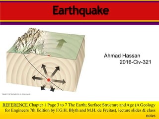
Earthquakes: Introduction and Evaluation
1. Ahmad Hassan
2016-Civ-321
REFERENCE Chapter 1 Page 3 to 7 The Earth; Surface Structure andAge (AGeology
for Engineers 7th Edition by F.G.H. Blyth and M.H. de Freitas), lecture slides & class
notes
Earthquake
2. Outline
What is an Earthquake?
Cause of Earthquake
Measuring Earthquake
Earthquake’s Epicenter Located?
Size and Strength of an Earthquake Measured?
Destruction from Earthquake
Earthquake Prediction
Remedial Measures
Case Studies
3. What IsSeismology?
Seismology is the study of earthquakes andseismic
wavesthat move through and around the earth. A
seismologist is ascientist who studies earthquakes
and seismic waves.
Seismic waves are the wavesof energy causedby
the sudden breaking of rock within the earth or an
explosion. Theyare the energy that travelsthrough
the earth and is recorded onseismographs.
4. Typesof SeismicWaves
There are several different kinds of seismic waves,
and they all move in different ways. The two main
types of wavesare body waves and surfacewaves.
Body waves can travel through the earth's inner
layers, but surface waves can only move along the
surface of the planet like ripples on water.
Earthquakes radiate seismic energy as both body
and surface waves.
5. Measuring Earthquakes
What are Seismic Waves?
Response of material to the arrival of energy fronts
released by rupture
Body Waves: P and S waves
Surface Waves: R and L waves
6. Seismic wave behavior
– P waves arrive first, then S waves, then L and R
– Average speeds for all these waves is known
– After an earthquake, the difference in arrival times at a
seismograph station can be used to calculate the distance
from the seismograph to the epicenter.
How is an Earthquake’s EpicenterLocated?
7. Body waves
Traveling through the interior of the earth, body
waves arrive before the surface waves emitted by
an earthquake. These waves are of a higher
frequency than surface waves.
8. P- waves
Thefirst kind of body wave is the P wave or primary wave.
Thisis the fastest kind of seismic wave, and, consequently, the
first to 'arrive' at aseismic station. ThePwave can move
through solid rock and fluids, like water or the liquid layers of
the earth. It pushes and pulls the rock it moves through just like
sound waves push and pull the air.
Haveyou ever heard abig clap of thunder and heard the
windows rattle at the sametime? Thewindows rattle because
the sound waves were pushing and pulling on the windowglass
much like Pwaves push and pull onrock.
9. P- waves
Sometimes animals canhear the Pwavesof an earthquake. Dogs,
for instance, commonly begin barking hysterically just before an
earthquake 'hits' (or more specifically, before the surface waves
arrive). Usually people canonly feel the bump and rattle of these
waves.
Pwavesare also known ascompressional waves, becauseof the
pushing and pulling they do. Subjected to aPwave, particles move in
the samedirection that the the wave is moving in, which is the
direction that the energy is traveling in, and is sometimes called the
'direction of wavepropagation.
11. S-Waves
The second type of body wave is the S wave or
secondary wave, which is the second wave you
feel in an earthquake. An Swave is slower than a
Pwave and can only move through solid rock, not
through any liquid medium.
It is this property of S waves that led
seismologists to conclude that the Earth's outer
core is a liquid. S waves move rock particles up
and down, or side-to-side-perpendicular to the
direction that the wave is traveling in (the
direction of wavepropagation).
14. Surfacewaves
Travelling only through the crust, surfacewaves
are of alower frequency than body waves,and
are easily distinguished on aseismogram asa
result.
Though they arrive after body waves,it is surface
wavesthat are almost entirely responsible forthe
damageand destruction associated with
earthquakes. Thisdamageand the strength of the
surface wavesare reduced in deeper
earthquakes.
15. LoveWaves
• Thefirst kind of surface wave is called aLove
wave, named after A.E.H.Love,aBritish
mathematician who worked out the
mathematical model for this kind of wave in
1911.
• It's the fastest surface wave and movesthe
ground from side-to-side. Confined to the
surface of the crust, Lovewavesproduce
entirely horizontal
17. RayleighWaves
• Theother kind of surface wave is the Rayleigh
wave, named for JohnWilliam Strutt, Lord
Rayleigh, who mathematically predicted the
existence of this kind of wave in1885.ARayleigh
wave rolls along the ground just like awave rolls
acrossalake or an ocean.
• Becauseit rolls, it moves the ground up and
down, and side-to-side in the samedirectionthat
the wave is moving. Most of the shaking felt from
an earthquake is due to the Rayleigh wave,which
canbe much larger than the otherwaves
21. What Is anEarthquake?
Earthquakes
An earthquake is the vibration of Earth
produced by the rapid release of energy
Focus and Epicenter
• Focus or hypocenter is the point within Earth where the
earthquake starts.
• Epicenter is the location on the surface directly above
the focus.
Faults
• Faults are fractures in Earth where movement has
occurred or breaking of rocks.
23. Cause of Earthquakes
Elastic Rebound Theory
Most earthquakes are produced by the rapid release of
elastic energy stored in rock that has been subjected to
great forces.
When the strength of the rock is exceeded, it suddenly
breaks, causing the vibrations of an earthquake.
Rupture occurs and the rocks quickly rebound to an un
deformed shape
Energy is released in waves that radiate outward from the
fault
25. Cause of Earthquakes
Aftershocks and Foreshocks
• An aftershock is a small earthquake that
follows the main earthquake. Continuing
adjustment of position results in aftershocks.
• A foreshock is a small earthquake that often
precedes a major earthquake.
26. Measuring Earthquakes
Earthquake Waves
Seismographs
are instruments
that record
earthquake
waves.
Seismograms are
traces of amplified,
electronically
recorded ground
motion made by
seismographs.
28. How is an Earthquake'sEpicenter
Located?
• In order to locate the epicenter of an earthquake you will
need to examine its seismograms as recorded by three
different seismic stations. On each of these seismograms
you will have to measure the S - P time interval (in
seconds). The S - P time interval will then be used to
determine the distance the waves have traveled from the
origin to thatstation.
• The actual location of the earthquake's epicenter will be on
the perimeter of a circle drawn around the recording
station. The radius of this circle is the epicentral distance.
One S - P measurement will produce one epicentral
distance: the direction from which the waves came is
unknown. Three stations are needed in order to
"triangulate" the location.
29. Example
• Step 1:
• Locate the required
Area.
• Wehave selected “San
Francisco area”.
30. Example
hundredsof
• Step 2:
• There are
seismic datarecording
stations throughout the
United States and the rest
of the world. In order to
locate the epicenter of this
earthquake, you need to
estimate the time interval
between the arrival of the P
and Swaves(the S-P
interval)on the
threeseismograms from
different stations.
31. Example
• Step2:
• You have to measure the
interval to the closest
second and then use a
graph to convert the S-P
interval to the epicentral
distance. On the sample
seismogram at the right
the vertical lines are
spaced at 2 second
intervals and the S-Ptime
is about 36interval
seconds.
34. Las Vegas, NV Seismic
Station S-PInterval
Find S-Ptime interval
from the given
Seismograph.
Scale:1 big box is
equal to 10seconds.
35. Example
• Usethe S-Pgraph to the
right and the estimates
you made for the S-Ptime
intervals for the three
seismograms (shown
again for your
convenience) to complete
the table below. The
horizontal grid is in one
second intervals. Then
click the Find Epicenter
button.
38. How is an Earthquake’sEpicenter
Located?
zones.
Earthquake Distance
• The epicenter is located using the
differencein the arrival times between P
and S wave recordings, which are related
to distance.
Earthquake Direction
• Travel-time graphs from three or more
seismographs can be used to find the
exact
location of an earthquake epicenter.
•A circle where the radius equals the
distance to the epicenter is drawn.
• The intersection of the circles locates
the epicenter
Earthquake Zones
• About 95 percent of the major
earthquakes occur in a few narrow
39. Locating an Earthquake
The farther away a seismograph is from the focus of an earthquake,
the longer the interval between the arrivals of the P- and S- waves
40. Size and Strength of an Earthquake
Measured?
Historically, scientists have used two different
types of measurements
intensity
magnitude
41. How are the Size and Strength of an Earthquake Measured?
• Modified Mercalli Intensity Map
– 1994 Northridge, CA earthquake,
magnitude 6.7
• Intensity
– subjective
measure of the
kind of damage
done and
people’s
reactions to it
– isoseismal lines
identify areas of
equal intensity
42. Modified Mercalli Scale
I. Instrumental
II. Feeble
III. Slight
IV. Moderate
V. Rather Strong
VI. Strong
VII. Very Strong
VIII. Destructive
IX. Ruinous
X. Disastrous
XI. Very Disastrous
XII. Catastrophic
Not felt except by a very few under especially favorableconditions.
Felt only by a few persons at rest, especially on upper floors of buildings. Delicately suspended objects
may swing.
Felt quite noticeably by persons indoors, especially on the upper floors of buildings. Many do not
recognize it as an earthquake. Standing motor cars may rock slightly. Vibration similar to the passing of a
truck. Duration estimated.
Felt indoors by many, outdoors by few during the day. At night, some awakened. Dishes, windows, doors
disturbed; walls make cracking sound. Sensation like heavy truck striking building. Standing motor cars
rocked noticeably. Dishes and windows rattle.
Felt by nearly everyone; many awakened. Some dishes and windows broken. Unstable objects
overturned. Clocks may stop.
Felt by all; many frightened and run outdoors, walk unsteadily. Windows, dishes, glassware broken; books
off shelves; some heavy furniture moved or overturned; a few instances of fallen plaster. Damageslight.
Difficult to stand; furniture broken; damage negligible in building of good design and construction; slight to
moderate in well-built ordinary structures; considerable damage in poorly built or badly designed
structures; some chimneys broken. Noticed by persons driving motorcars.
Damage slight in specially designed structures; considerable in ordinary substantial buildings with partial
collapse. Damage great in poorly built structures. Fall of chimneys, factory stacks, columns, monuments,
walls. Heavy furniture moved.
General panic; damage considerable in specially designed structures, well designed frame structures
thrown out of plumb. Damage great in substantial buildings, with partial collapse. Buildings shifted off
foundations.
Some well built wooden structures destroyed; most masonry and frame structures destroyedwith
foundation. Rails bent.
Few, if any masonry structures remain standing. Bridges destroyed. Rails bentgreatly.
Total damage - Almost everything is destroyed. Lines of sight and level distorted. Objects thrown into the
air. The ground moves in waves or ripples. Large amounts of rock may move.
43. How are the Size and Strength of an Earthquake Measured?
• Magnitude
– Richter scale
measures total
amount of energy
released by an
earthquake;
independent of
intensity
– based onAmplitude
of the largest wave
produced by an
event is corrected
for distance and
assigned a value on
an open-ended
logarithmic scale
Each unit of Richter magnitude equatesto
roughly a 32-fold energy increase
44. Size and Strength of an Earthquake
Measured?
Momentum Magnitude
• Derived from the amount of displacement
that occurs along the fault zone
• Moment magnitude is the most widely used
measurement for earthquakes because it is the
only magnitude scale that estimates the energy
released by earthquakes.
• Measures very large earthquakes
(surface area of fault) x(avg. displacementalong
fault) x(rigidity ofrock)
47. The Economics and Societal Impacts of EQs
Damage in Oakland, CA, 1989• Building collapse
• Ground failure /
Liquefaction
• Tsunami
• Fire
48. Destruction from Earthquakes
Seismic Vibrations
The damage to buildings and other structures
from earthquake waves depends on
several factors.
the intensity
duration of the vibrations
the nature of the material on which the
structure is built
the design of the structure.
51. Destruction from Earthquakes
Tsunamis: the Japanese word for “seismic sea wave”
Cause of Tsunamis
ab•A tsunami triggered by an earthquake occurs where asl
of the ocean floor is displaced vertically along a fault.
•A tsunami also can occur when the vibration of aquake
sets an underwater landslide into motion.
Although tsunamis travel quickly, there is sufficient time to
evacuate all but the area closest to the epicenter.
52. Destruction from Earthquakes
Other Dangers
Landslides
• With many earthquakes,
the greatest damage
to structures is from
landslides and ground
subsidence, or the sinking of
the ground triggered by
vibrations.
Fire
• In the San Francisco earthquake of 1906, most
of the destruction was caused by fires that started when gas and
electrical lines were cut.
53. Predicting Earthquakes
Short-Range Predictions
• So far, methods for short-range predictions of earthquakes have
not been successful.
Long-Range Forecasts
• Scientists don’t yet understand enough about how and where
earthquakes will occur to make accurate long-term predictions.
54. Remedial Measures
Increase public awareness about hazardrisk
management.
Build capacity of professionals andgovernment
officials.
Safebuilding practices and earthquake
resistant design.
Develop and enforce simple building codes for
rural and peri-urbanareas.
56. Kashmir Earthquake
8th October 2005
7.6-magnitude
earthquake took place on
Saturday 8th October at
0925 local time.
The epicentre was
Muzzaffarabad the capital
of the Pakistan
administered region of
Kashmir, 80km north-east
of Islamabad.
It was followed by 20
powerful aftershocks