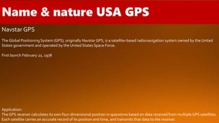
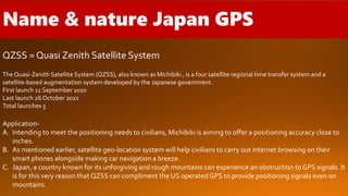
HISTORY OF GPS AND ALL
COUNTRY GPS NAME,NATURE
Presented by-
ANURAG GHOSH (UID-21143031026)
M.SC GEO-INFORMATICS 3RD SEMESTER
Pandit Raghunath Murmu Smriti Mahavidyalaya
Bankura University
Date-15 Aug 2022
INTRODUCTION
HISTORY OF GPS
ALL COUNTRY GPS NAME, NATURE
GPS = Global Positioning System.
Developed by US Department of Defense for 20 years.
The Global Positioning System is a world wide satellite bases radio navigation
system formed from a constellation of 24 satellites and their ground stations. It’s
used to determine accurate geodetic position and altitude on the earth surface.
GPS is the only system today able to show our exact position on the earth any
time, any weather, any where.
GPS receiver has to know two things about the satellite, location & distance.
Location = where the place.
Distance = velocity of transmitted signal (300000000 meters per second )
multiplied by the travel time (time taken by signal at the receiver).
1. 1973 NAVSTAR Global Positioning System Developed
2. 1978 Launch of first 4 satellite launched
3. 1982 Prototype Macrometer testing at M.I.T. Hatch’s synergism paper
4. 1983 Geodetic network densification (Eifel, Germany) President Reagan offers GPS to the world “free of charge”
5. 1984 Geodetic network densification (Montgomery County, Pennsylvania) Engineering survey at Stanford
Remondi’s dissertation
6. 1985 Precise geoid undulation differences for Eifel network Codeless dual-band observations Kinematic GPS
surveying Antenna swap for ambiguity initialization First international symposium on precise positioning with GPS
7. 1986 Challenger accident (January 28) 10 cm aircraft positioning.
8. 1987 JPL baseline repeatability tests to 0.2−0.04 ppm
9. 1989 Launch of first Block II satellite OTF solutionWide area differential GPS (WADGPS) concepts U.S. Coast Guard GPS
Information Center (GPSIC).
10. 1990 GEOID90 for NAD83 datum.
11. 1991 NGS ephemeris service GIG91 experiment (January 22–February 13)
12. 1992 IGS campaign (June 21−September 23) Initial solutions to deal with antispoofing (AS) Narrow correlator spacingC/A-
code receiver Attitude determination system
13. 1993 24th satellite launched.
14. 1994 IGS service beginning January 1 Antispoofing implementation (January 31) RTCM recommendations on differential
GPS (Version 2.1) National Spatial Reference System Committee (NGS) Multiple (single-frequency) receiver experiments for
OTF Proposal to monitor the earth’s atmosphere with GPS (occultations).
15. 1995 Full operational capability (FOC) on July 17 Precise point positioning (PPP) at JPL.
16. 1996 Presidential Decision Directive, first U.S. GPS policy
17. 1998Vice president announces second GPS civil signal at 1227.60 MHz JPL’s automated GPS data analysis service via
Internet
18. 1999Vice president announces GPS modernization initiative and third civil GPS signal at 1176.45 MHz IGDG (Internet-based
global differential GPS) at JPL
19. 2000 Military accuracy available to all users.
IRNSS = Indian Regional Navigation Satellite System.
NavIC = National with Indian Constellation.
Applications of NavIC-
A. NavIC can became the leading light for travelers providing land navigation information.
B. It can be used to lay hands on accurate location coordinates linked to aerial terrestrial and marine navigation.
The Indian Regional Navigation Satellite System (IRNSS), with an operational name of NavIC is an autonomous regional satellite
navigation system that provides accurate real time positioning and timing services.
Total satellites 8
Satellites in orbit 7
First launch 1 July 2013
Last launch 12 April 2018
Total launches 9
Navstar GPS
The Global Positioning System (GPS), originally Navstar GPS, is a satellite-based radionavigation system owned by the United
States government and operated by the United States Space Force.
First launch February 22, 1978
Application-
The GPS receiver calculates its own four-dimensional position in spacetime based on data received from multipleGPS satellites.
Each satellite carries an accurate record of its position and time, and transmits that data to the receiver.
Galileo
Application-
The primary object of Galileo is to offer an exclusive system of high-precision positioning to all the nation conglomerated under
the umbrella of European Union.The was a step to avoid relying on GLONASS, the GPS system of Russian, Bei-Dou of China or
the United State GPS.This was to counter an imminent danger coming from any one of the countries suspending their
positioning services to the EU.
Galileo is a created by the European Union through the European SpaceAgency (ESA), operated by the European Union Agency
for the Space Programmed (EUSPA).
First launch 2011
Total launches 28
GLONASS = Globalnaya Navigazionnaya Sputnikovaya Systema or Global
Navigation Satellite System
Application-
A. GLONASS combining with the capabilities of GPS finds its application in phone baseband chips sold by well-
known vendors like Broadcom, Qualcomm and Exynos.
B. It was in 2011 that swepos reference station of Sweden providing real-time positioning information with meter
accuracy was the first overseas company to employ the capabilities of GLONASS.
GLONASS is a Russian satellite navigation system operating as part of a radionavigation-satellite service.
First launch 12 October 1982
Last launch 7 July 2022
Total satellites 26
QZSS = Quasi Zenith Satellite System
Application-
A. Intending to meet the positioning needs to civilians, Michibiki is aiming to offer a positioning accuracy close to
inches.
B. As mentioned earlier, satellite geo-location system will help civilians to carry out internet browsing on their
smart phones alongside making car navigation a breeze.
C. Japan, a country known for its unforgiving and rough mountains can experience an obstruction to GPS signals. It
is for this very reason that QZSS can compliment the US operated GPS to provide positioning signals even on
mountains.
The Quasi-Zenith Satellite System (QZSS), also known as Michibiki , is a four satellite regional time transfer system and a
satellite-based augmentation system developed by the Japanese government.
First launch 11 September 2010
Last launch 26 October 2021
Total launches 5
Bei-Dou Navigation Satellite System (BDS)
Application –
China native Bei-Dou navigation system has some interesting uses that can simplify your every day life. All the way from bank
cards to shared bicycles, this navigation system can also help in identifying unmanned patrol vehicles.
First launch 31 October 2000
Last launch 23 June 2020
Total launches 59
GPS HISTORY

GPS HISTORY

  • 1.
    HISTORY OF GPSAND ALL COUNTRY GPS NAME,NATURE Presented by- ANURAG GHOSH (UID-21143031026) M.SC GEO-INFORMATICS 3RD SEMESTER Pandit Raghunath Murmu Smriti Mahavidyalaya Bankura University Date-15 Aug 2022
  • 2.
  • 3.
    GPS = GlobalPositioning System. Developed by US Department of Defense for 20 years. The Global Positioning System is a world wide satellite bases radio navigation system formed from a constellation of 24 satellites and their ground stations. It’s used to determine accurate geodetic position and altitude on the earth surface. GPS is the only system today able to show our exact position on the earth any time, any weather, any where.
  • 4.
    GPS receiver hasto know two things about the satellite, location & distance. Location = where the place. Distance = velocity of transmitted signal (300000000 meters per second ) multiplied by the travel time (time taken by signal at the receiver).
  • 5.
    1. 1973 NAVSTARGlobal Positioning System Developed 2. 1978 Launch of first 4 satellite launched 3. 1982 Prototype Macrometer testing at M.I.T. Hatch’s synergism paper 4. 1983 Geodetic network densification (Eifel, Germany) President Reagan offers GPS to the world “free of charge” 5. 1984 Geodetic network densification (Montgomery County, Pennsylvania) Engineering survey at Stanford Remondi’s dissertation 6. 1985 Precise geoid undulation differences for Eifel network Codeless dual-band observations Kinematic GPS surveying Antenna swap for ambiguity initialization First international symposium on precise positioning with GPS 7. 1986 Challenger accident (January 28) 10 cm aircraft positioning. 8. 1987 JPL baseline repeatability tests to 0.2−0.04 ppm
  • 6.
    9. 1989 Launchof first Block II satellite OTF solutionWide area differential GPS (WADGPS) concepts U.S. Coast Guard GPS Information Center (GPSIC). 10. 1990 GEOID90 for NAD83 datum. 11. 1991 NGS ephemeris service GIG91 experiment (January 22–February 13) 12. 1992 IGS campaign (June 21−September 23) Initial solutions to deal with antispoofing (AS) Narrow correlator spacingC/A- code receiver Attitude determination system 13. 1993 24th satellite launched. 14. 1994 IGS service beginning January 1 Antispoofing implementation (January 31) RTCM recommendations on differential GPS (Version 2.1) National Spatial Reference System Committee (NGS) Multiple (single-frequency) receiver experiments for OTF Proposal to monitor the earth’s atmosphere with GPS (occultations). 15. 1995 Full operational capability (FOC) on July 17 Precise point positioning (PPP) at JPL. 16. 1996 Presidential Decision Directive, first U.S. GPS policy
  • 7.
    17. 1998Vice presidentannounces second GPS civil signal at 1227.60 MHz JPL’s automated GPS data analysis service via Internet 18. 1999Vice president announces GPS modernization initiative and third civil GPS signal at 1176.45 MHz IGDG (Internet-based global differential GPS) at JPL 19. 2000 Military accuracy available to all users.
  • 8.
    IRNSS = IndianRegional Navigation Satellite System. NavIC = National with Indian Constellation. Applications of NavIC- A. NavIC can became the leading light for travelers providing land navigation information. B. It can be used to lay hands on accurate location coordinates linked to aerial terrestrial and marine navigation. The Indian Regional Navigation Satellite System (IRNSS), with an operational name of NavIC is an autonomous regional satellite navigation system that provides accurate real time positioning and timing services. Total satellites 8 Satellites in orbit 7 First launch 1 July 2013 Last launch 12 April 2018 Total launches 9
  • 9.
    Navstar GPS The GlobalPositioning System (GPS), originally Navstar GPS, is a satellite-based radionavigation system owned by the United States government and operated by the United States Space Force. First launch February 22, 1978 Application- The GPS receiver calculates its own four-dimensional position in spacetime based on data received from multipleGPS satellites. Each satellite carries an accurate record of its position and time, and transmits that data to the receiver.
  • 10.
    Galileo Application- The primary objectof Galileo is to offer an exclusive system of high-precision positioning to all the nation conglomerated under the umbrella of European Union.The was a step to avoid relying on GLONASS, the GPS system of Russian, Bei-Dou of China or the United State GPS.This was to counter an imminent danger coming from any one of the countries suspending their positioning services to the EU. Galileo is a created by the European Union through the European SpaceAgency (ESA), operated by the European Union Agency for the Space Programmed (EUSPA). First launch 2011 Total launches 28
  • 11.
    GLONASS = GlobalnayaNavigazionnaya Sputnikovaya Systema or Global Navigation Satellite System Application- A. GLONASS combining with the capabilities of GPS finds its application in phone baseband chips sold by well- known vendors like Broadcom, Qualcomm and Exynos. B. It was in 2011 that swepos reference station of Sweden providing real-time positioning information with meter accuracy was the first overseas company to employ the capabilities of GLONASS. GLONASS is a Russian satellite navigation system operating as part of a radionavigation-satellite service. First launch 12 October 1982 Last launch 7 July 2022 Total satellites 26
  • 12.
    QZSS = QuasiZenith Satellite System Application- A. Intending to meet the positioning needs to civilians, Michibiki is aiming to offer a positioning accuracy close to inches. B. As mentioned earlier, satellite geo-location system will help civilians to carry out internet browsing on their smart phones alongside making car navigation a breeze. C. Japan, a country known for its unforgiving and rough mountains can experience an obstruction to GPS signals. It is for this very reason that QZSS can compliment the US operated GPS to provide positioning signals even on mountains. The Quasi-Zenith Satellite System (QZSS), also known as Michibiki , is a four satellite regional time transfer system and a satellite-based augmentation system developed by the Japanese government. First launch 11 September 2010 Last launch 26 October 2021 Total launches 5
  • 13.
    Bei-Dou Navigation SatelliteSystem (BDS) Application – China native Bei-Dou navigation system has some interesting uses that can simplify your every day life. All the way from bank cards to shared bicycles, this navigation system can also help in identifying unmanned patrol vehicles. First launch 31 October 2000 Last launch 23 June 2020 Total launches 59