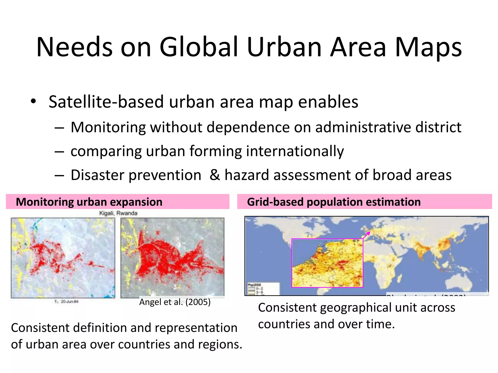
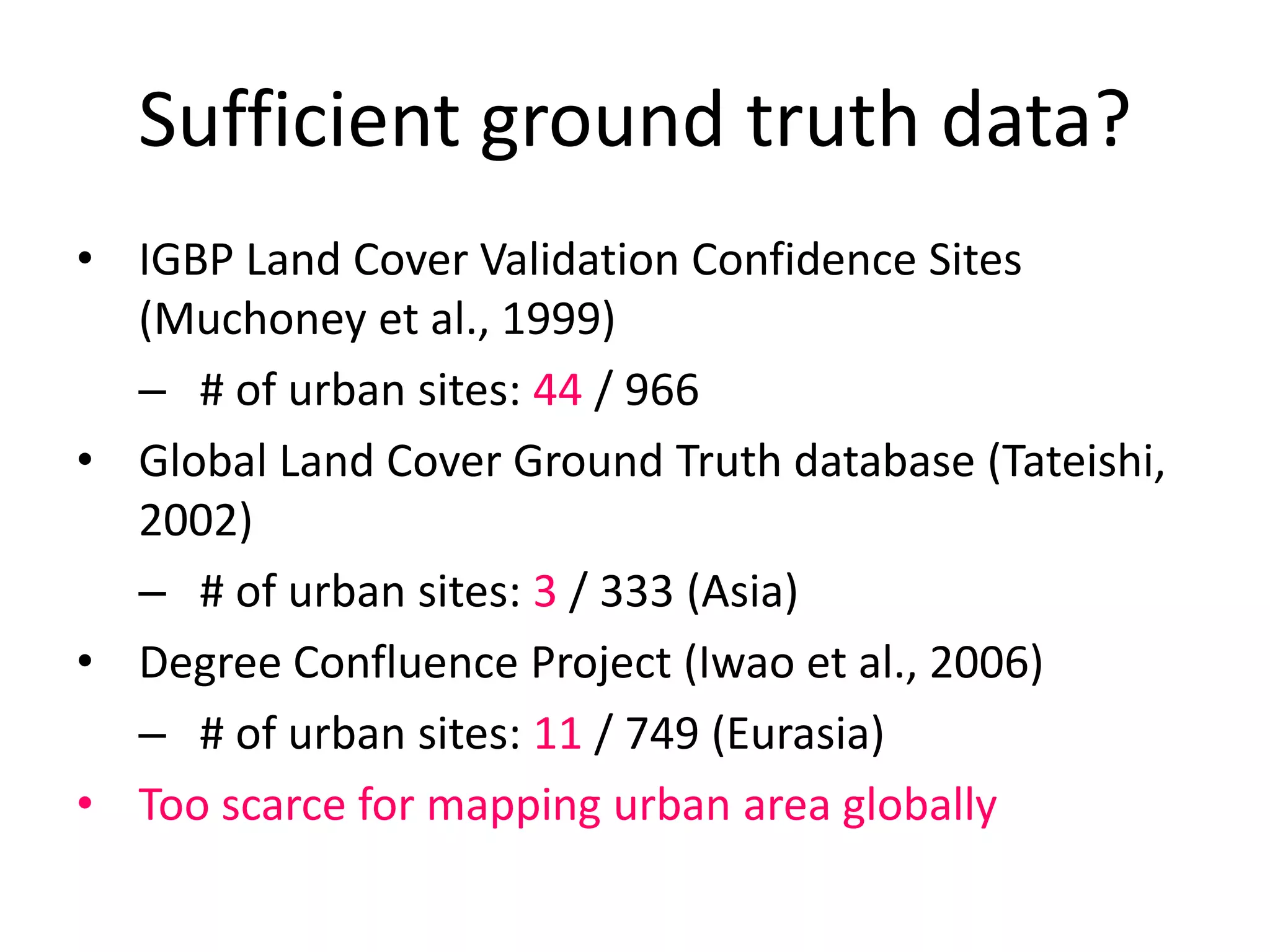
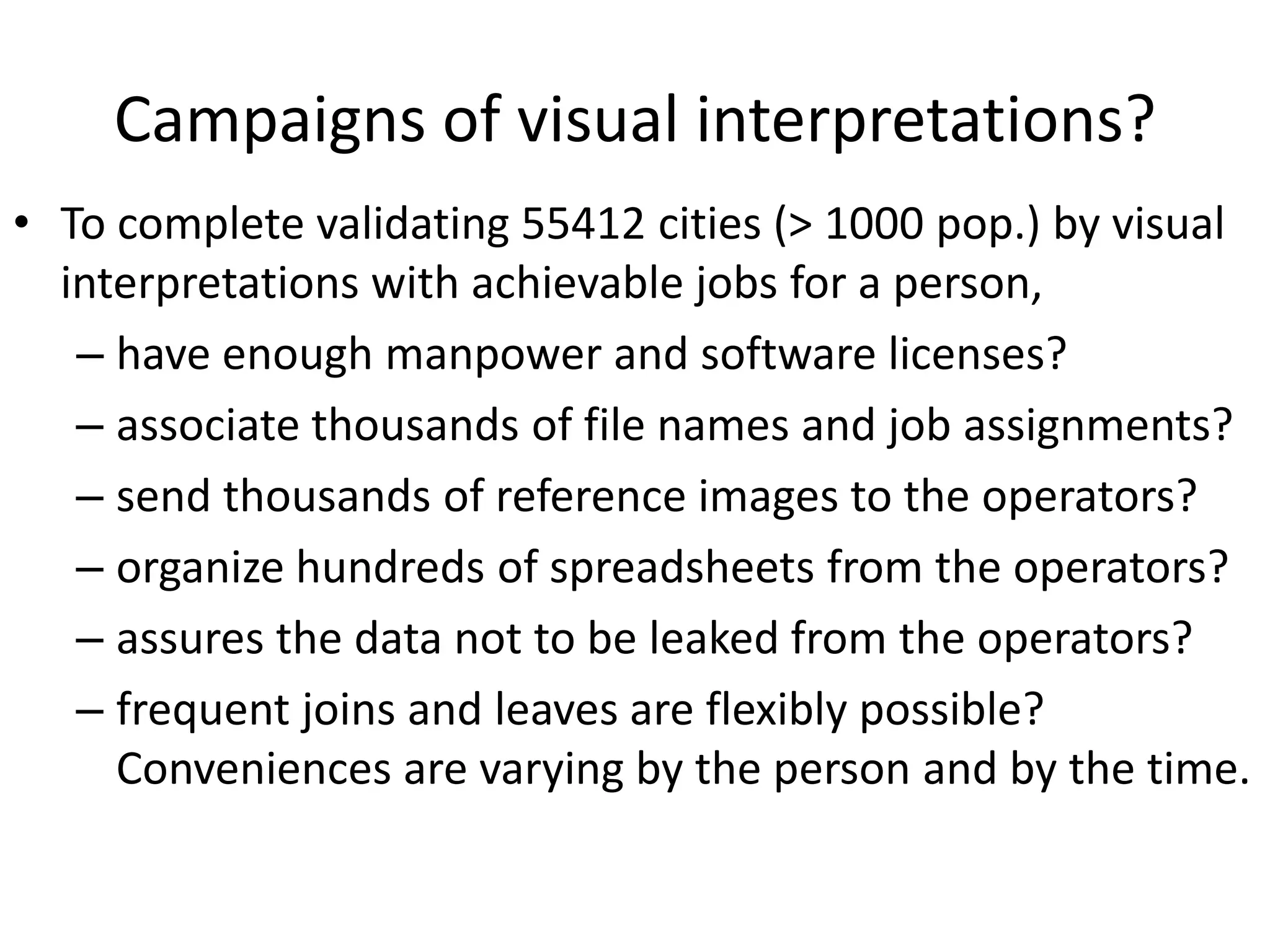
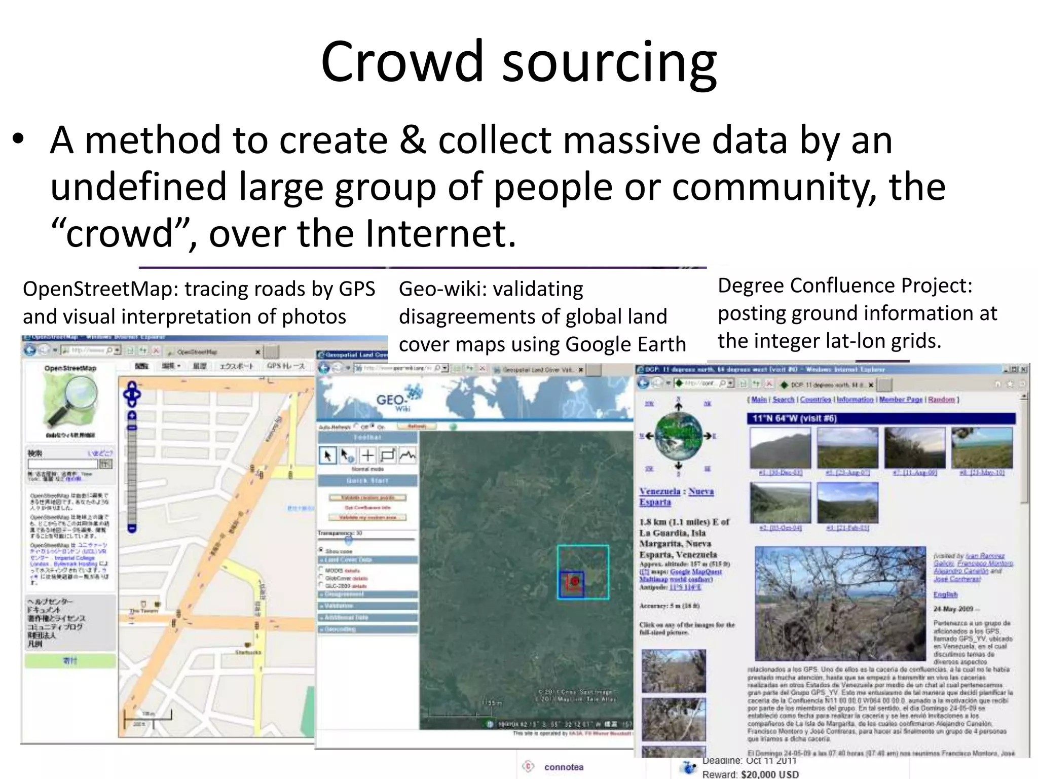
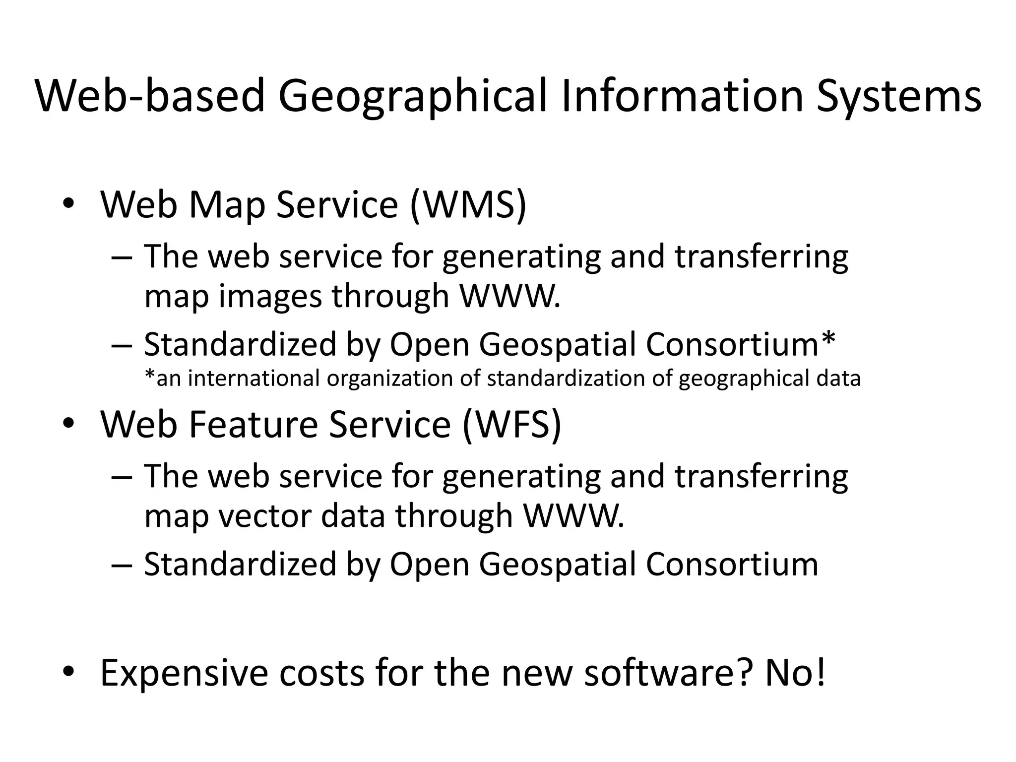
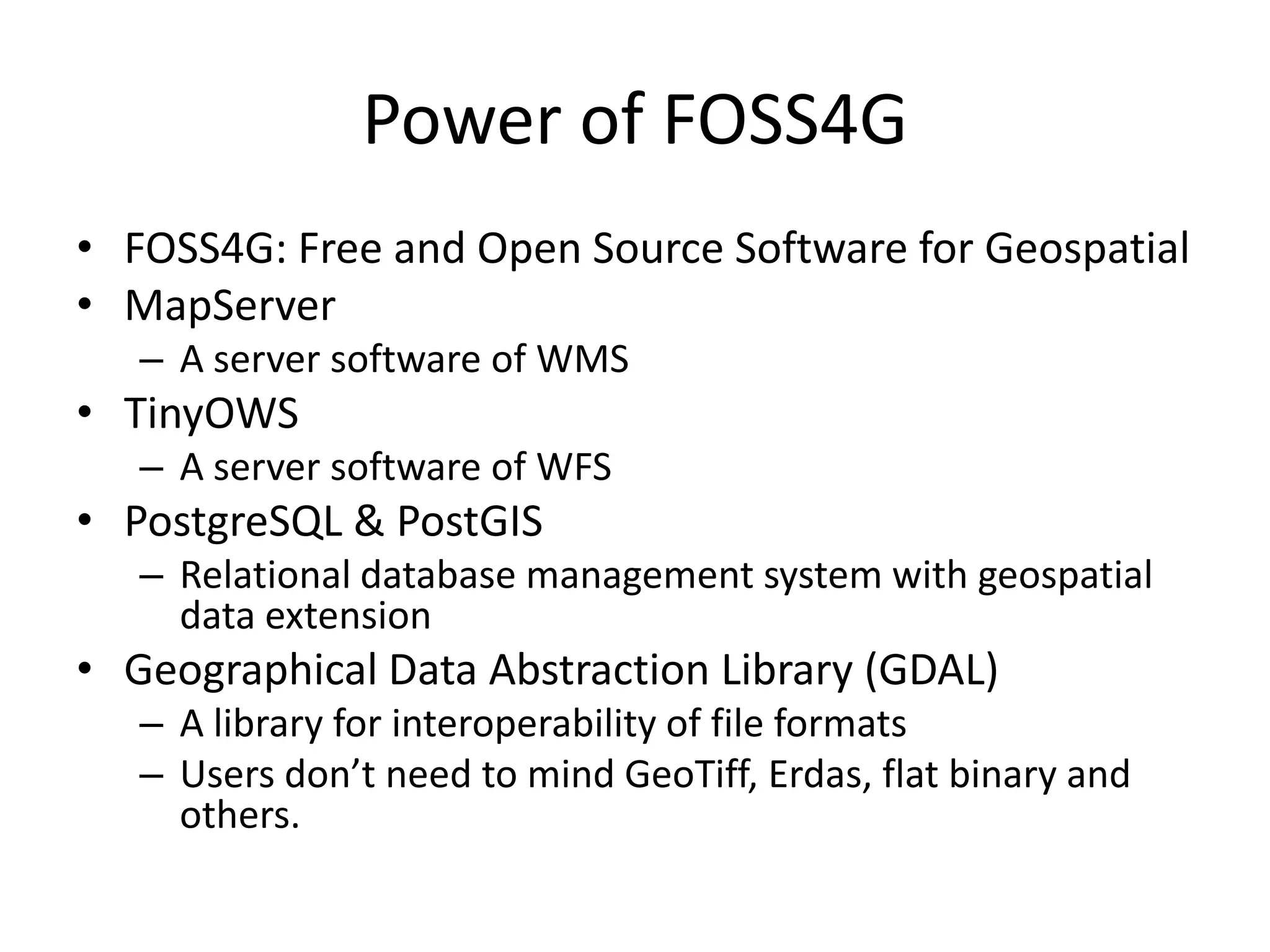
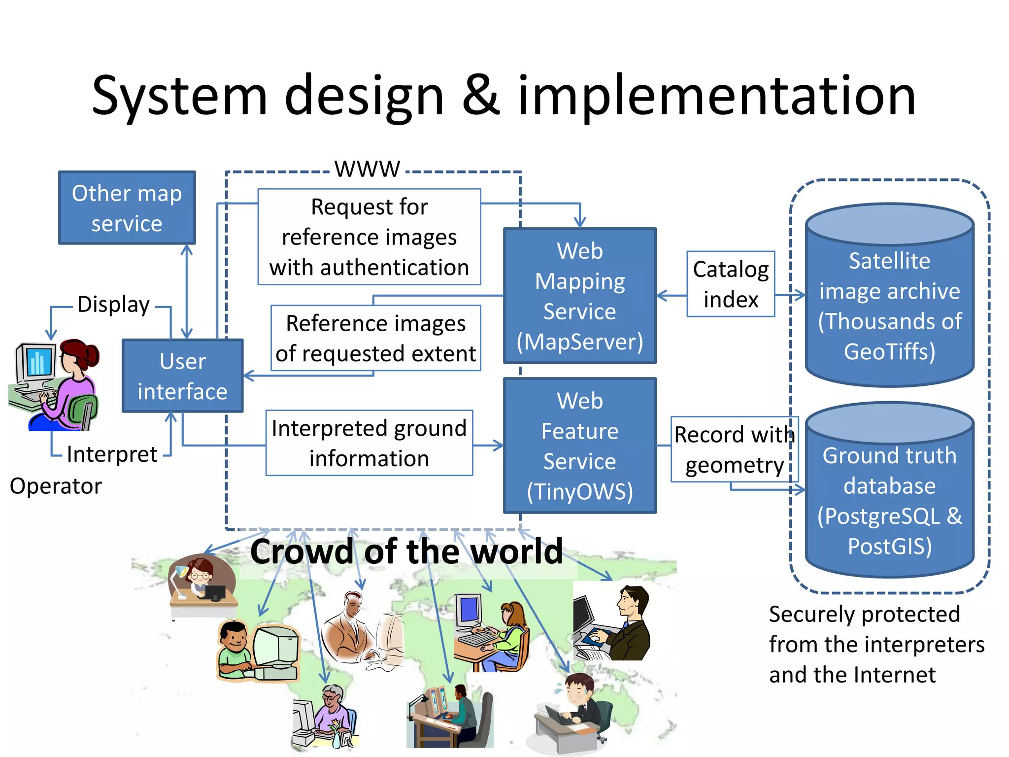
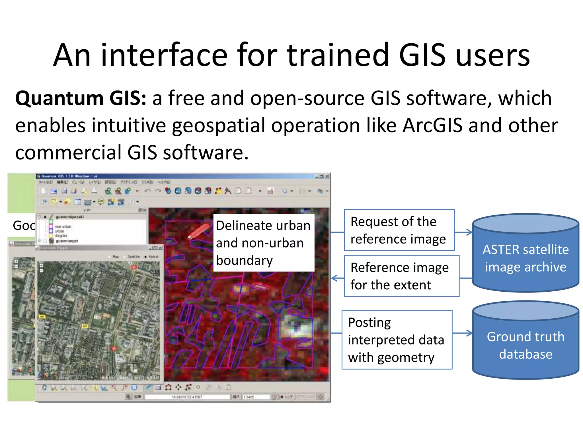
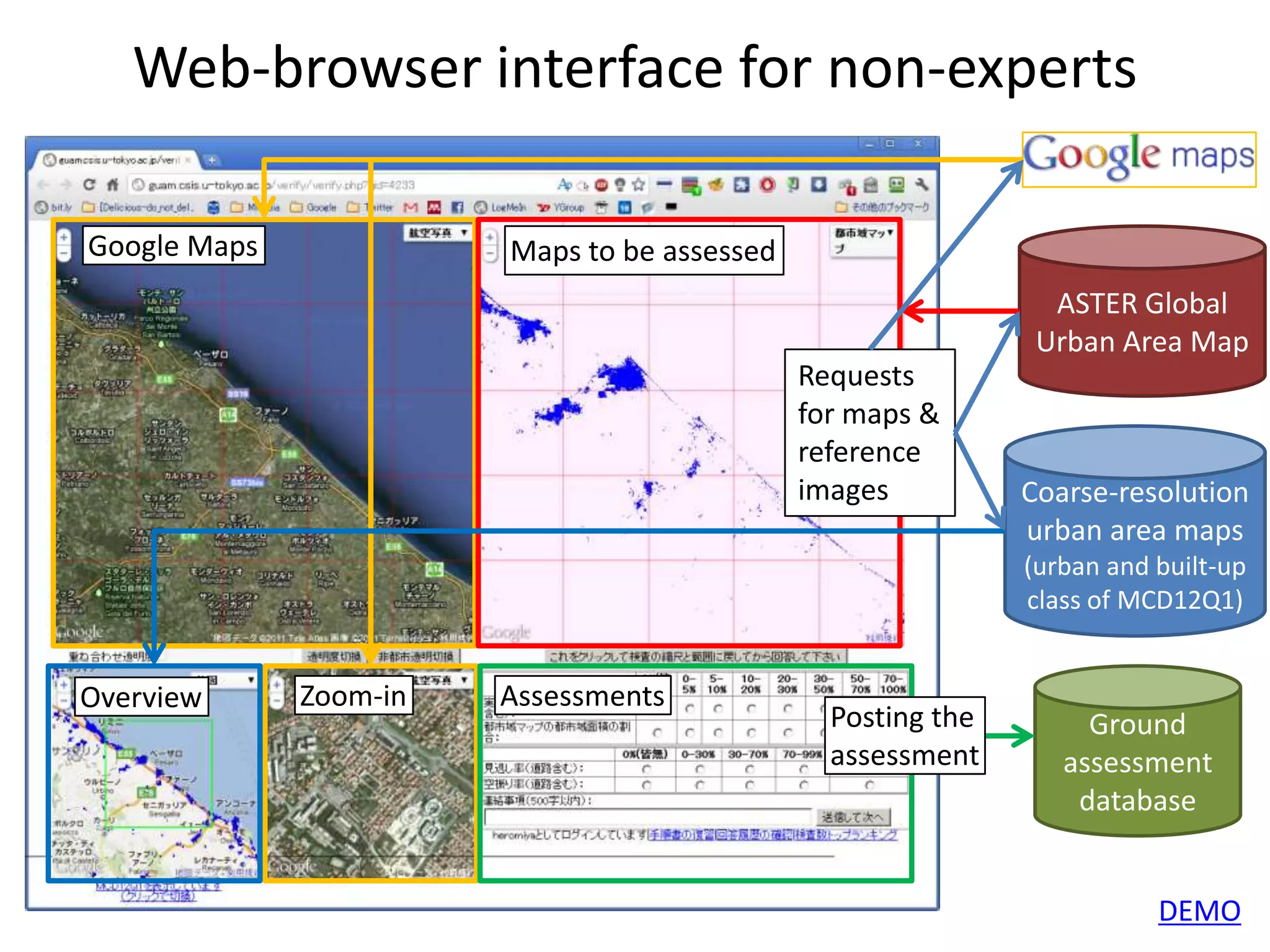
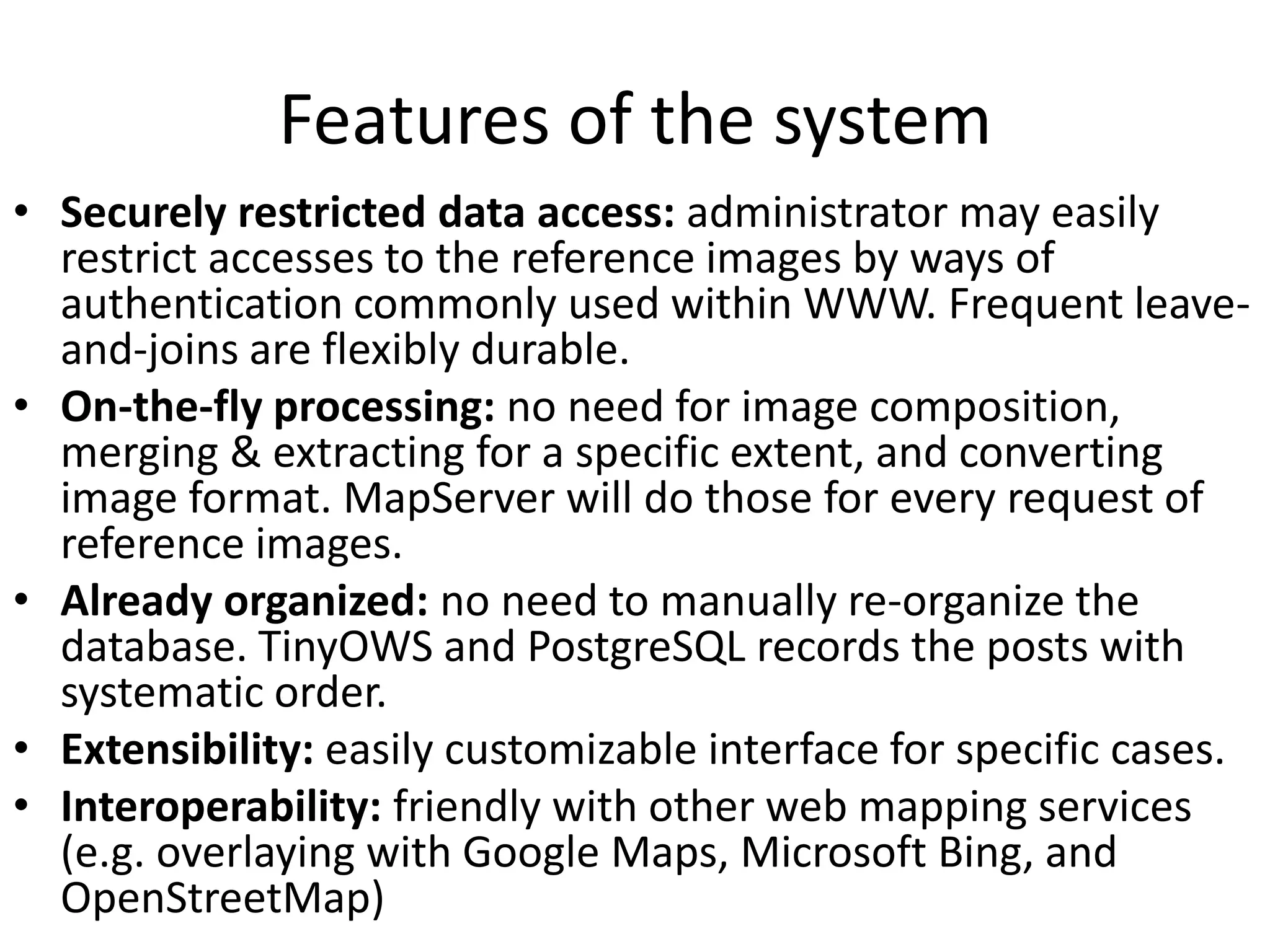
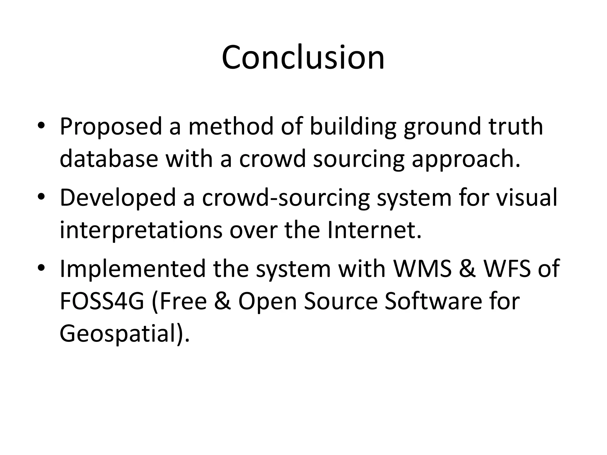

This document proposes a crowd-sourcing approach to build a ground truth database for global urban area mapping. It describes existing ground truth data sources as being too scarce. It then outlines the design and implementation of a web-based crowd-sourcing system using free and open source software like MapServer, TinyOWS, and PostgreSQL to allow trained and untrained users to interpret satellite imagery and delineate urban boundaries from anywhere in the world. The system is intended to efficiently create a large ground truth dataset in a secure and organized manner.


![Vibe Coding vs. Spec-Driven Development [Free Meetup]](https://cdn.slidesharecdn.com/ss_thumbnails/vibecodingvsspecdrivendevelopment-251209105622-43f455e7-thumbnail.jpg?width=640&height=640&fit=bounds)


