GIS Urban Design
•Download as PPT, PDF•
4 likes•338 views

A Geographic Information System (GIS) is a computer system for capturing, storing, analyzing and managing data and associated attributes which are spatially referenced to Earth. GIS allows users to create interactive queries, analyze spatial information, edit data in maps, and present the results of all these operations. The document outlines the key components of a GIS including computer hardware, software modules, and databases for organizing spatial data. It also discusses different methods for inputting existing data, maps, and field observations into a digital GIS format.

Recommended
More Related Content
What's hot
What's hot (20)
Viewers also liked
Viewers also liked (12)
Similar to GIS Urban Design
Similar to GIS Urban Design (20)
More from Purushottam Uttarwar
More from Purushottam Uttarwar (9)
Recently uploaded
Recently uploaded (20)
GIS Urban Design
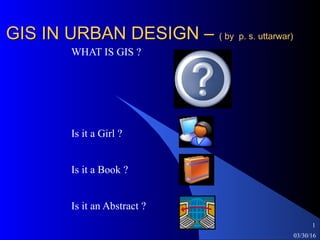
- 1. 03/30/16 1 GIS IN URBAN DESIGN –GIS IN URBAN DESIGN – ( by p. s. uttarwar)( by p. s. uttarwar) WHAT IS GIS ? Is it a Girl ? Is it a Book ? Is it an Abstract ?
- 2. 03/30/16 2 Analogue vs DigitalAnalogue vs Digital A change in 21st century Analogue – Maps Digital _ Computers Communication Speed Generation of large amount of data Storage and Retrieval
- 3. 03/30/16 3 IntroductionIntroduction A Geographic Information System (GIS) is an information system that is designed to work with data referenced by spatial or geographic coordinates. In other words, a GIS is both a database system with specific capabilities for spatially referenced data, as well a set of operations for working with data. In a sense, a GIS may be thought of higher order map. What is difference between DATA & Information ? Any relevant background and interest of the audience ?
- 4. 03/30/16 4 AgendaAgenda List of the topics to be covered - Data collection and conversion into maps. - Scientific study of the earth. - Need for spatial data. The time allotted to each topic is about 15 minutes.
- 5. 03/30/16 5 OverviewOverview The paper maps & accompanying database /information is difficult to handle Advantages/Disadvantages UPDATIN G AUTO MATI ON DIGITAL COSTSPEED 3 D MAPS Retriev al AnalysisVolume
- 6. 03/30/16 6 Composition of GISComposition of GIS GIS have 3 components – - Computer Hardware - Sets of application software module - Database/Organization
- 8. 03/30/16 8 DATA INPUTDATA INPUT Existing Maps Field Observations Sensors Interactive Terminal Digitizers Text Files Scanners Magnetic Media
- 10. 03/30/16 10 Where to Get More InformationWhere to Get More Information Other training sessions List books, articles, electronic sources Consulting services, other sources