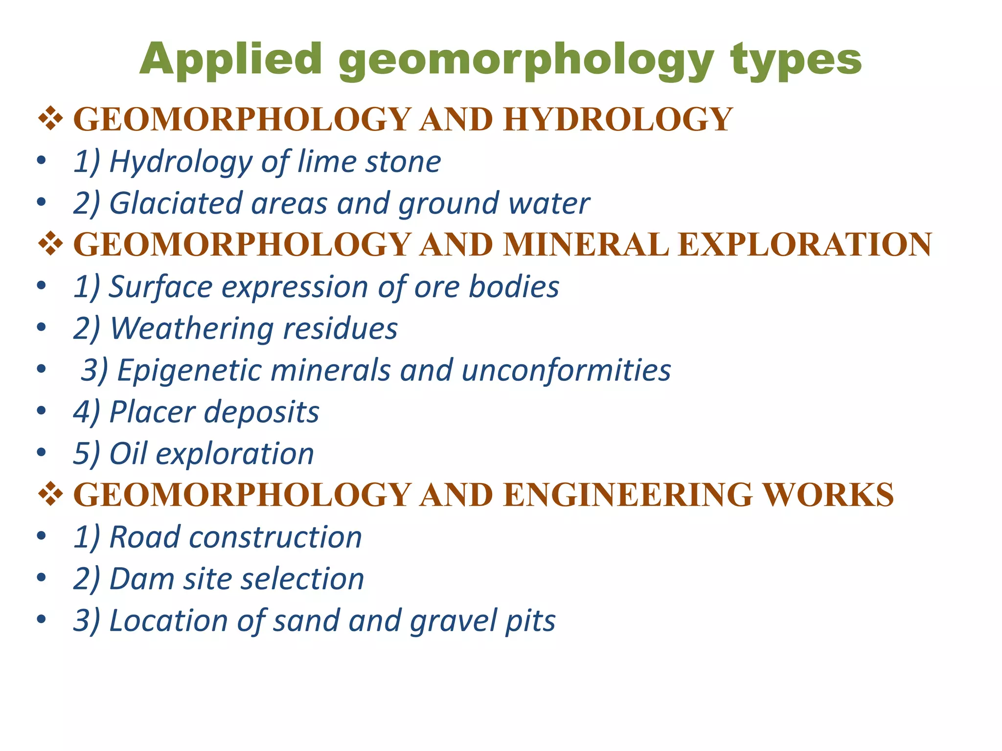
APPLIED GEOMORPHOLOGY
Applied geomorphology is a field of science where
the research outcomes provide information
geomorphic landforms or processes that may be of
concern to society, and where relevant, provides
solution to problems of geomorphic context.
Applied geomorphology examines geomorphic
impacts that affect society, as well as society impact
on geomorphic forms and processes.
The application of geomorphic knowledge to
problem solving spans all of the classic traditions of
geomorphology and is use for human-environmental
solutions across a broad range of geographic,
including coastal shoreline erosion control, landslide
risk assessments, and dam related river management
issue.
Continued
Resources, particularly maps, models, and
prediction tools, provided by applied
geomorphologist are useful to scientists,
engineers, consultants, and decision-makers
involved with hazards, land-use planning, natural
resources, environmental management, and
global environment change.
 Applied geomorphologist working independently
or serving on multidisciplinary advisory panels
are well positioned to influence public policy to
the benefit of society and the earth sciences.
Continued
• There has been an increasing recognition of the practical
application of geomorphic principles and the findings of
geomorphological research to human beings who are
influenced by and, in turn, influenced the surface features
of the earth.
• Continuous increase in population has led to pressure on
land resources, extension of agriculture to hilly and
marginal lands resulted in man induced catastrophies like
soil erosion, landslides, sedimentation and floods.
• A proper interpretation of landforms throws light upon the
geologic history, structure, and lithology of a region.
• As geology becomes more specialized there is growing
possibility that the application of geomorphology to
problems of applied geology will be overlooked.
Continued
The role of applied geomorphology relates
mainly to the problems of analyzing and
monitoring landscape forming processes that may
arise from human interference.
Human beings have over time tried to tame and
modify geomorphic/environmental processes to
suit their economic needs.
Geomorphology has diverse application over a
large area of human activity while
geomorphologist may serve more effectively the
need of society.
Applied geomorphology types
 GEOMORPHOLOGY AND HYDROLOGY
• 1) Hydrology of lime stone
• 2) Glaciated areas and ground water
 GEOMORPHOLOGY AND MINERAL EXPLORATION
• 1) Surface expression of ore bodies
• 2) Weathering residues
• 3) Epigenetic minerals and unconformities
• 4) Placer deposits
• 5) Oil exploration
 GEOMORPHOLOGY AND ENGINEERING WORKS
• 1) Road construction
• 2) Dam site selection
• 3) Location of sand and gravel pits
Continued
GEOMORPHOLOGYAND MILITARY
GEOLOGY
GEOMORPHOLOGYAND REGIONAL
PLANNING
GEOMORPHOLOGYAND
URBANIZATION
GEOMORPHOLOGYAND COASTAL
ZONE MANAGEMENT
GEOMORPHOLOGYAND HAZARD
MANAGEMENT
Other application of geomorphology
Some of the applications of geomorphic have
been used in applied geomorphology but there
are other fields where geomorphic knowledge
of terrain is more important.
Soil map
Topographic map
Air photographs and satellite imageries
Remote sensing
GIS

APPLIED GEOMORPHOLOGY ppt.pptx

  • 1.
    APPLIED GEOMORPHOLOGY Applied geomorphologyis a field of science where the research outcomes provide information geomorphic landforms or processes that may be of concern to society, and where relevant, provides solution to problems of geomorphic context. Applied geomorphology examines geomorphic impacts that affect society, as well as society impact on geomorphic forms and processes. The application of geomorphic knowledge to problem solving spans all of the classic traditions of geomorphology and is use for human-environmental solutions across a broad range of geographic, including coastal shoreline erosion control, landslide risk assessments, and dam related river management issue.
  • 2.
    Continued Resources, particularly maps,models, and prediction tools, provided by applied geomorphologist are useful to scientists, engineers, consultants, and decision-makers involved with hazards, land-use planning, natural resources, environmental management, and global environment change.  Applied geomorphologist working independently or serving on multidisciplinary advisory panels are well positioned to influence public policy to the benefit of society and the earth sciences.
  • 3.
    Continued • There hasbeen an increasing recognition of the practical application of geomorphic principles and the findings of geomorphological research to human beings who are influenced by and, in turn, influenced the surface features of the earth. • Continuous increase in population has led to pressure on land resources, extension of agriculture to hilly and marginal lands resulted in man induced catastrophies like soil erosion, landslides, sedimentation and floods. • A proper interpretation of landforms throws light upon the geologic history, structure, and lithology of a region. • As geology becomes more specialized there is growing possibility that the application of geomorphology to problems of applied geology will be overlooked.
  • 4.
    Continued The role ofapplied geomorphology relates mainly to the problems of analyzing and monitoring landscape forming processes that may arise from human interference. Human beings have over time tried to tame and modify geomorphic/environmental processes to suit their economic needs. Geomorphology has diverse application over a large area of human activity while geomorphologist may serve more effectively the need of society.
  • 5.
    Applied geomorphology types GEOMORPHOLOGY AND HYDROLOGY • 1) Hydrology of lime stone • 2) Glaciated areas and ground water  GEOMORPHOLOGY AND MINERAL EXPLORATION • 1) Surface expression of ore bodies • 2) Weathering residues • 3) Epigenetic minerals and unconformities • 4) Placer deposits • 5) Oil exploration  GEOMORPHOLOGY AND ENGINEERING WORKS • 1) Road construction • 2) Dam site selection • 3) Location of sand and gravel pits
  • 6.
  • 7.
    Other application ofgeomorphology Some of the applications of geomorphic have been used in applied geomorphology but there are other fields where geomorphic knowledge of terrain is more important. Soil map Topographic map Air photographs and satellite imageries Remote sensing GIS