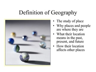
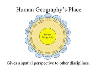
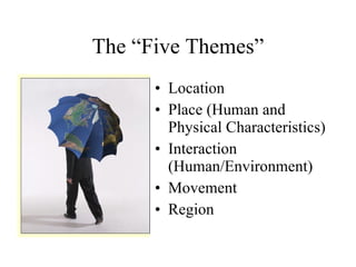
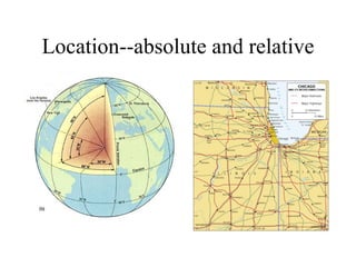
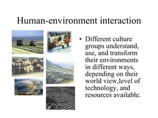
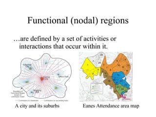
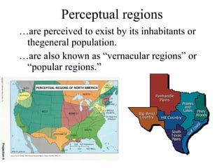
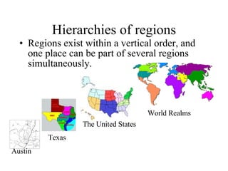
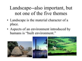
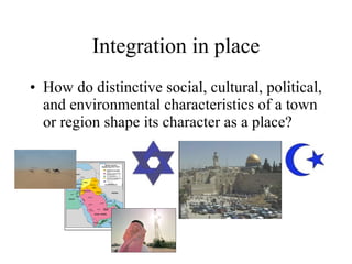
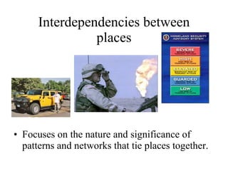
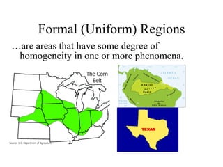
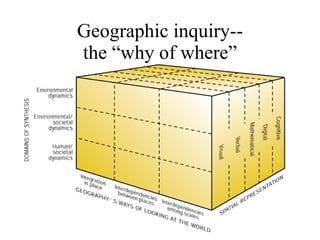
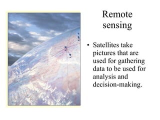
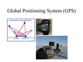
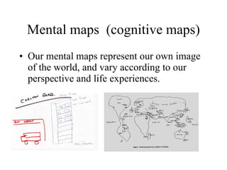
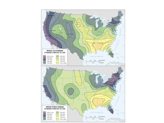
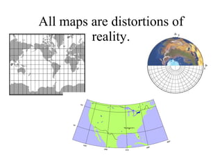
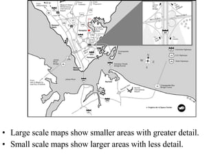
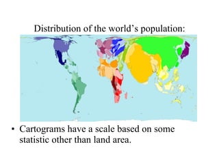
Human Geography
Definition of Geography The study of place Why places and people are where they are What their location means in the past, present, and future How their location affects other places
Human Geography’s Place  Gives a spatial perspective to other disciplines.
The “Five Themes” Location Place (Human and Physical Characteristics) Interaction (Human/Environment) Movement Region
Location--absolute and relative
Human-environment interaction Different culture groups understand, use, and transform their environments in different ways, depending on their world view,level of technology, and resources available.
Regions A region displays some degree of uniformity that differentiates it from surrounding territories. The region is the basic unit of study for the geographer. The criteria used to define a region can vary according to the phenomenon being considered.
Functional (nodal) regions …are defined by a set of activities or interactions that occur within it. Eanes Attendance area map A city and its suburbs
Perceptual regions … are perceived to exist by its inhabitants or thegeneral population. … are also known as “vernacular regions” or “popular regions.”
Hierarchies of regions Regions exist within a vertical order, and one place can be part of several regions simultaneously. Austin Texas The United States World Realms
Landscape--also important, but not one of the five themes Landscape is the material character of a place. Aspects of an environment introduced by humans is “built environment.”
Spatial Themes National Research Council Focus on integrative themes and implications for research and policy making.
Integration in place How do distinctive social, cultural, political, and environmental characteristics of a town or region shape its character as a place?
Interdependencies between places Focuses on the nature and significance of patterns and networks that tie places together.
Interdependencies among scales What happens at one scale is the result of factors operating at different scales--on a “local-global continuum.”
Formal (Uniform) Regions …are areas that have some degree of homogeneity in one or more phenomena.
Geographic inquiry-- the “why of where”
What does a geographer do? Cartography and remote sensing Location of public facilities Marketing and location of industry Geography and the law Disease ecology Urban and regional planning Issues of economic development
Role of maps Maps reflect the spatial aspect of geography.  They are the “language” of the geographer.
Geographic Information Systems GIS technology uses powerful computer programs to layer several sets of data so that conclusions can be drawn.
Remote sensing Satellites take pictures that are used for gathering data to be used for analysis and decision-making.
Global Positioning System (GPS)
Mental maps  (cognitive maps) Our mental maps represent our own image of the world, and vary according to our perspective and life experiences.
Environmental perception Where do Californian students prefer to live? --based on the “total impression” they have of a place.
 
All maps are distortions of reality.
Large scale maps show smaller areas with greater detail. Small scale maps show larger areas with less detail.
Pin dot maps Dr. Snow’s map of Cholera deaths in London
Proportional Symbol Map


Distribution of the world’s population: Cartograms have a scale based on some statistic other than land area.

Ch1

  • 1.
  • 2.
    Definition of GeographyThe study of place Why places and people are where they are What their location means in the past, present, and future How their location affects other places
  • 3.
    Human Geography’s Place Gives a spatial perspective to other disciplines.
  • 4.
    The “Five Themes”Location Place (Human and Physical Characteristics) Interaction (Human/Environment) Movement Region
  • 5.
  • 6.
    Human-environment interaction Differentculture groups understand, use, and transform their environments in different ways, depending on their world view,level of technology, and resources available.
  • 7.
    Regions A regiondisplays some degree of uniformity that differentiates it from surrounding territories. The region is the basic unit of study for the geographer. The criteria used to define a region can vary according to the phenomenon being considered.
  • 8.
    Functional (nodal) regions…are defined by a set of activities or interactions that occur within it. Eanes Attendance area map A city and its suburbs
  • 9.
    Perceptual regions …are perceived to exist by its inhabitants or thegeneral population. … are also known as “vernacular regions” or “popular regions.”
  • 10.
    Hierarchies of regionsRegions exist within a vertical order, and one place can be part of several regions simultaneously. Austin Texas The United States World Realms
  • 11.
    Landscape--also important, butnot one of the five themes Landscape is the material character of a place. Aspects of an environment introduced by humans is “built environment.”
  • 12.
    Spatial Themes NationalResearch Council Focus on integrative themes and implications for research and policy making.
  • 13.
    Integration in placeHow do distinctive social, cultural, political, and environmental characteristics of a town or region shape its character as a place?
  • 14.
    Interdependencies between placesFocuses on the nature and significance of patterns and networks that tie places together.
  • 15.
    Interdependencies among scalesWhat happens at one scale is the result of factors operating at different scales--on a “local-global continuum.”
  • 16.
    Formal (Uniform) Regions…are areas that have some degree of homogeneity in one or more phenomena.
  • 17.
    Geographic inquiry-- the“why of where”
  • 18.
    What does ageographer do? Cartography and remote sensing Location of public facilities Marketing and location of industry Geography and the law Disease ecology Urban and regional planning Issues of economic development
  • 19.
    Role of mapsMaps reflect the spatial aspect of geography. They are the “language” of the geographer.
  • 20.
    Geographic Information SystemsGIS technology uses powerful computer programs to layer several sets of data so that conclusions can be drawn.
  • 21.
    Remote sensing Satellitestake pictures that are used for gathering data to be used for analysis and decision-making.
  • 22.
  • 23.
    Mental maps (cognitive maps) Our mental maps represent our own image of the world, and vary according to our perspective and life experiences.
  • 24.
    Environmental perception Wheredo Californian students prefer to live? --based on the “total impression” they have of a place.
  • 25.
  • 26.
    All maps aredistortions of reality.
  • 27.
    Large scale mapsshow smaller areas with greater detail. Small scale maps show larger areas with less detail.
  • 28.
    Pin dot mapsDr. Snow’s map of Cholera deaths in London
  • 29.
  • 30.
  • 31.
  • 32.
  • 33.
    Distribution of theworld’s population: Cartograms have a scale based on some statistic other than land area.