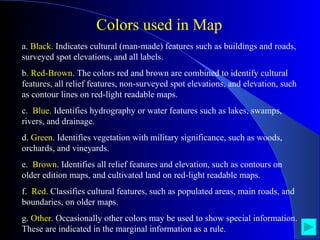
Mapping Space Around US
Maths Project On Mapping Space Around Us R Karthik - VIII Standard ‘B’ Sec. Pon Vidyashram, Injambakkam, Chennai-600041 Project Assigned by : Mrs.Prasana, Class Teacher.
Mapping Space Around Us Agenda 1. What is a Map? 2. Colors used in Map 3. Symbols used in Map 4. Scales used in Maps 5. Our Locale : Injambakkam in Map 6. Map Study of  Our School -  Pon Vidyashram 7. Maps of Tourist Areas Around Us  8. Points to Remember
What is a Map? A map is a graphic representation of a portion of the earth's surface drawn to scale, as seen from above.  It uses  colors, symbols, scales and labels  to represent features found on the ground.
a.  Black.  Indicates cultural (man-made) features such as buildings and roads, surveyed spot elevations, and all labels. b.  Red-Brown . The colors red and brown are combined to identify cultural features, all relief features, non-surveyed spot elevations, and elevation, such as contour lines on red-light readable maps. c.  Blue.  Identifies hydrography or water features such as lakes, swamps, rivers, and drainage. d.  Green . Identifies vegetation with military significance, such as woods, orchards, and vineyards. e.  Brown . Identifies all relief features and elevation, such as contours on older edition maps, and cultivated land on red-light readable maps. f.  Red . Classifies cultural features, such as populated areas, main roads, and boundaries, on older maps. g.  Other . Occasionally other colors may be used to show special information. These are indicated in the marginal information as a rule. Colors used in Map
Symbols used in Map
Scales used in Maps
A map is a  scaled  graphic representation of a portion of the earth's surface.  The  scale  of the map permits the user to convert distance on the map to distance on the ground or vice versa.  The ability to determine distance on a map, as well as on the earth's surface, is an important factor in planning and executing military missions.  Scales used in Maps
Scale is reported as a representative fraction with the map distance as the numerator and the ground distance as the denominator. Representative fraction (scale)= map distance / ground distance Scales used in Maps
Distances Shown on the map are proportional to the actual distance on the ground. While drawing a map, we should take care about: How much of actual distance is denoted by  1mm or 1cm in the map - It can be :  1cm = 1 Kilometers or 10 Km or 100Km  etc. - This scale can vary from map to map but not with in the map. Scales used in Maps
Map Scale Classifications Large 1:75,000 and larger  Medium 1:1,000,000 but smaller than 1:75,000  Small Maps 1:1,000,000 and smaller
Understanding Scale used in Maps On a 1:250,000 scale map, the prescribed symbol for a building covers an area about 500 feet square on the ground;  - a road symbol is equivalent to a road about 520 feet wide on the ground;  - the symbol for a single-track railroad (the length of a cross-tie) is equivalent to a railroad cross-tie about 1,000 feet on the ground.
Our Locale : Injambakkam in Map
Injambakkam Aerial Map Canal ECR Bay of Bengal
Injambakkam Road Map
Map Study of  Our School Pon Vidyashram
Pon Vidyashram Map
Map to Pon Vidyashram From North(Adyar)
Map to Pon Vidyashram from Sholinganallur
Map to Pon Vidyashram from Kanathur
Maps of Tourist Areas Around Us
Muttukadu Boat House
Injambakkam to Muttukadu Map
Mahabalipuram
Injambakkam to Mahabalipuram Map
Points to remember A map depicts the location of a particular object/place in relation to other objects/places. Symbols and colors are used to depict the different objects/places. There is no reference or perspective in map, i.e., objects that are closer to the observer are shown to be of the same size as those that are farther away. Maps use a scale which is fixed for a particular map. It reduces the real distances proportionately to distances on paper.
R Karthik,  VIII-B THANK YOU

Mappingk

  • 1.
  • 2.
    Maths Project OnMapping Space Around Us R Karthik - VIII Standard ‘B’ Sec. Pon Vidyashram, Injambakkam, Chennai-600041 Project Assigned by : Mrs.Prasana, Class Teacher.
  • 3.
    Mapping Space AroundUs Agenda 1. What is a Map? 2. Colors used in Map 3. Symbols used in Map 4. Scales used in Maps 5. Our Locale : Injambakkam in Map 6. Map Study of Our School - Pon Vidyashram 7. Maps of Tourist Areas Around Us 8. Points to Remember
  • 4.
    What is aMap? A map is a graphic representation of a portion of the earth's surface drawn to scale, as seen from above. It uses colors, symbols, scales and labels to represent features found on the ground.
  • 5.
    a. Black. Indicates cultural (man-made) features such as buildings and roads, surveyed spot elevations, and all labels. b. Red-Brown . The colors red and brown are combined to identify cultural features, all relief features, non-surveyed spot elevations, and elevation, such as contour lines on red-light readable maps. c. Blue. Identifies hydrography or water features such as lakes, swamps, rivers, and drainage. d. Green . Identifies vegetation with military significance, such as woods, orchards, and vineyards. e. Brown . Identifies all relief features and elevation, such as contours on older edition maps, and cultivated land on red-light readable maps. f. Red . Classifies cultural features, such as populated areas, main roads, and boundaries, on older maps. g. Other . Occasionally other colors may be used to show special information. These are indicated in the marginal information as a rule. Colors used in Map
  • 6.
  • 7.
  • 8.
    A map isa scaled graphic representation of a portion of the earth's surface. The scale of the map permits the user to convert distance on the map to distance on the ground or vice versa. The ability to determine distance on a map, as well as on the earth's surface, is an important factor in planning and executing military missions. Scales used in Maps
  • 9.
    Scale is reportedas a representative fraction with the map distance as the numerator and the ground distance as the denominator. Representative fraction (scale)= map distance / ground distance Scales used in Maps
  • 10.
    Distances Shown onthe map are proportional to the actual distance on the ground. While drawing a map, we should take care about: How much of actual distance is denoted by 1mm or 1cm in the map - It can be : 1cm = 1 Kilometers or 10 Km or 100Km etc. - This scale can vary from map to map but not with in the map. Scales used in Maps
  • 11.
    Map Scale ClassificationsLarge 1:75,000 and larger Medium 1:1,000,000 but smaller than 1:75,000 Small Maps 1:1,000,000 and smaller
  • 12.
    Understanding Scale usedin Maps On a 1:250,000 scale map, the prescribed symbol for a building covers an area about 500 feet square on the ground; - a road symbol is equivalent to a road about 520 feet wide on the ground; - the symbol for a single-track railroad (the length of a cross-tie) is equivalent to a railroad cross-tie about 1,000 feet on the ground.
  • 13.
    Our Locale :Injambakkam in Map
  • 14.
    Injambakkam Aerial MapCanal ECR Bay of Bengal
  • 15.
  • 16.
    Map Study of Our School Pon Vidyashram
  • 17.
  • 18.
    Map to PonVidyashram From North(Adyar)
  • 19.
    Map to PonVidyashram from Sholinganallur
  • 20.
    Map to PonVidyashram from Kanathur
  • 21.
    Maps of TouristAreas Around Us
  • 22.
  • 23.
  • 24.
  • 25.
  • 26.
    Points to rememberA map depicts the location of a particular object/place in relation to other objects/places. Symbols and colors are used to depict the different objects/places. There is no reference or perspective in map, i.e., objects that are closer to the observer are shown to be of the same size as those that are farther away. Maps use a scale which is fixed for a particular map. It reduces the real distances proportionately to distances on paper.
  • 27.
    R Karthik, VIII-B THANK YOU