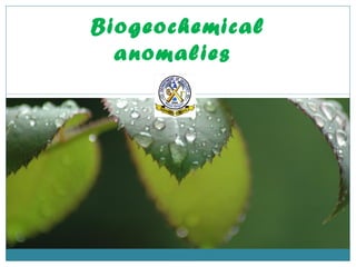
Biogeochemical anomalies occur where vegetation contains abnormally high concentrations of metals. Different plant species take up different amounts of inorganic materials from the soil based on factors like their root depth and water source. Plants with deep roots directly over an ore deposit can show biogeochemical anomalies from taking up mobile elements in soil solutions. Biogeochemical surveys first determine the optimal plant species, plant part, and elements to sample through an orientation survey. They then involve systematically collecting and analyzing plant samples according to a grid or vegetation distribution to identify anomalies.
Metallogenic Epoch and Province
Metallogenetic Epochs
Metallogenetic epochs, as defined above, are specific periods characterised by formation of large number of mineral deposits. It does not mean that all the mineral deposits formed during a definite metallogenetic epochs. In India the chief metallogenetic epochs were:
1. Precambrian
2. Late Palaeozoic
3. Late Mesozoic to Early Tertiary
Introduction of mineral deposits: Mineral deposit ; A geological definition of an ore deposit; Ore Deposit Environments; The significance of ore deposit size; Which commodities are included by the definition of Ore Deposits ; The extraction of an economic commodity from ore ; Geological Factors Affecting Economics of Ore Extraction ; Shape and depth of the deposit; Mineralogy and texture of the ore; The presence of multiple extractable products; Metals enrichment factors; Ore Deposit Constitutes; Ore Deposit Geology and Related Sciences; Structural Control Ore Deposits; Depth of Occurrence Mineral deposits; Nature of Mineralization; Morphology of Ore Deposit; Geographical Localization of Ore Deposits;
Orebodies; oreshoots; ore deposits; ore reserves
CLASSIFICATION OF ORE DEPOSITS
The Mixture of ore minerals are gangue minerals form an Ore deposit. The ore
deposits are generally found enclosed within the country rocks. The ore deposits
are formed in many different ways. Depending upon the process that may
operate to produce them, the ore deposits may be classified as follow:
Magmatic ore deposits.
Sublimation ore deposits.
Pegmatitic ore deposits.
Contact metasomatic ore deposits.
Hydrothermal ore deposits
Cavity filling deposits.
Replacement deposits.
Sedimentation ore deposits.
Evaporation ore deposits.
Residual and mechanical concentration deposits
Metamorphic ore deposits.
MAGMATIC ORE DEPOSITS:
The magmatic ore deposits are the magmatic products which crystallize from
magmas. The magmatic ore deposits are classified as follows:
o Early magmatic deposits
o Late magmatic deposits
Early magmatic deposits:
Early magmatic deposits are formed during the
early stage of the magmatic period. In this case the
ore minerals crystallize earlier than the rock
silicates. The Minerals of Nickel, Chromium, and
Platinum are usually found as early magmatic
deposits. The early magmatic deposits can be sub
divided into two groups:
o Dissemination deposits
o Segregation deposits
Dissemination deposits:
When magma crystallizes
conditions, a granular igneous rock is formed. In
such a rock early formed crystals of
may occur in dissemination.
Segregation deposits:
Magmatic segregation deposits are
formed as a result of gravitative
crystallization differentiation. In
case, the ore mineral which crystallize
early, get ocean-trated on a particular
part of igneous part. The ore deposits
thus formed are known as “Segregation
deposits”.
rly under seated
ore minerals
such
Late Magmatic Deposits:
The ore deposits which are formed to
called late magmatic deposits. The late magmatic deposits contain those ore
minerals which have crystallized at rather low temperature from the residual
magma. The magma which is left after crystallization of early for
is called residual magma. This magma frequently contains many ore minerals. The
late magmatic deposits include most of the magmatic deposits of iron and
titanium ores, these deposits are almost always associated with mafic igneous
rocks.
SUBLIMATION DEPOSITS:
Sublimation is a very minor process of formation of ore deposits. Sublimation
deposits contain only those minerals which have been volatilized by hear and
subsequently redeposit in the same form at low temperature and pressure. The
sublimation deposits are found associated with Volcanoes and Fumaroles. Sulfur
of this origin has been mined in Japan, Italy, and Mexico.
GEOLOGICAL THERMOMETERS
DEFINITION AND CLASSIFICATION
Proper understanding of origin of mineral deposits and their classification requires the knowledge of formation-temperatures of these deposits. Certain minerals, present over there, give information’s with regard to temperatures of their formations and of the enclosing deposits and they are known as geological thermometers. These geological thermometers may be classed chiefly into the following groups based on their preciseness:
1. The thermometers that record fairly accurately the specific temperature condition of formation of deposits.
2. The thermometers that provide an upper or a lower temperature, above or below which the deposits do not form
3. The thermometers that provide a range of temperature within which the deposits form; and
4. The thermometers that serve as rough indications of temperatures of formation of mineral deposits.
The presence of two or more of less precise geological thermometers in a deposit narrows the range of temperature of formation for the deposits
Gravity anomaly across reagional structuresAmit K. Mishra
Gravity Anomaly across continents and ocean, gravity anomaly across mid-oceanic ridges, gravity anomaly across orogenic belts, and gravity anomaly across subduction zones.
PHYTOREMEDIATION IN ENVT. MANAGEMENT - BIOTECHNOLGY ROLE...KANTHARAJAN GANESAN
It deals with, the various technologies involved in phytoremediation, mechanism, factors and biotechnology interventions for the improvement of remediation process etc...
Bryophytes are a diverse group of land plants.
Have large ecological impact.
23,000 described species world wide.
Largest group of land plants except for the flowering plants.
Integral part of natural environment of forest ecosystems.
Bryophytes are of small size.
Some of them attain a height up to half meter or a little more.
Store large amount of water, nutrients and carbon in their biomass.
In peatlands, bryophytes function as carbon sinks, which is a matter of great concern when considered with the rise of global carbon dioxide level.
Ability to remain alive for a long period without water even
under high temperature, and then resume photosynthesis within seconds after being moistened by rain or dew.
Most bryophytes are ectohydric, i.e., ability to absorb water, inorganic nutrients and mineral elements directly from the atmosphere rather than the soil and substratum.
Bryophytes possess short-lived sporophytic and dominant gametophytic phase.
This PPT contains all the information related to Environmental Forensics.
You can understand the concept explained in the PPT by watching the video:
https://youtu.be/Fyp0kgw2LWc
Don't forget to Like, Subscribe, Comment on YouTube and follow on Instagram - Abode
Follow Abode on Instagram @abdearth for more!
PHYTOREMEDIATION OF CONTAMINATED SOILS (WAQAS AZEEM)Waqas Azeem
Metals contaminated soil are prevailing all over the world with different concentration. There is a need for a cost effective and environment friendly technique for the remediation of these soils, i.e. Phytoremediation...!
Salinity stress
Categorization of salt affected soils
CAUSES OF SALINITY IN SOIL
Salinity effects on Plants
Injuries due to salt stress
different strategies to avoid salt injury
salt tolerance
salt avoidance
salt evasion
halophytes
non halophytes
glycophytes
Breeding for salt tolerance
How to Make a Field invisible in Odoo 17Celine George
It is possible to hide or invisible some fields in odoo. Commonly using “invisible” attribute in the field definition to invisible the fields. This slide will show how to make a field invisible in odoo 17.
The Art Pastor's Guide to Sabbath | Steve ThomasonSteve Thomason
What is the purpose of the Sabbath Law in the Torah. It is interesting to compare how the context of the law shifts from Exodus to Deuteronomy. Who gets to rest, and why?
2024.06.01 Introducing a competency framework for languag learning materials ...Sandy Millin
http://sandymillin.wordpress.com/iateflwebinar2024
Published classroom materials form the basis of syllabuses, drive teacher professional development, and have a potentially huge influence on learners, teachers and education systems. All teachers also create their own materials, whether a few sentences on a blackboard, a highly-structured fully-realised online course, or anything in between. Despite this, the knowledge and skills needed to create effective language learning materials are rarely part of teacher training, and are mostly learnt by trial and error.
Knowledge and skills frameworks, generally called competency frameworks, for ELT teachers, trainers and managers have existed for a few years now. However, until I created one for my MA dissertation, there wasn’t one drawing together what we need to know and do to be able to effectively produce language learning materials.
This webinar will introduce you to my framework, highlighting the key competencies I identified from my research. It will also show how anybody involved in language teaching (any language, not just English!), teacher training, managing schools or developing language learning materials can benefit from using the framework.
The French Revolution, which began in 1789, was a period of radical social and political upheaval in France. It marked the decline of absolute monarchies, the rise of secular and democratic republics, and the eventual rise of Napoleon Bonaparte. This revolutionary period is crucial in understanding the transition from feudalism to modernity in Europe.
For more information, visit-www.vavaclasses.com
How to Split Bills in the Odoo 17 POS ModuleCeline George
Bills have a main role in point of sale procedure. It will help to track sales, handling payments and giving receipts to customers. Bill splitting also has an important role in POS. For example, If some friends come together for dinner and if they want to divide the bill then it is possible by POS bill splitting. This slide will show how to split bills in odoo 17 POS.
How to Create Map Views in the Odoo 17 ERPCeline George
The map views are useful for providing a geographical representation of data. They allow users to visualize and analyze the data in a more intuitive manner.
Students, digital devices and success - Andreas Schleicher - 27 May 2024..pptxEduSkills OECD
Andreas Schleicher presents at the OECD webinar ‘Digital devices in schools: detrimental distraction or secret to success?’ on 27 May 2024. The presentation was based on findings from PISA 2022 results and the webinar helped launch the PISA in Focus ‘Managing screen time: How to protect and equip students against distraction’ https://www.oecd-ilibrary.org/education/managing-screen-time_7c225af4-en and the OECD Education Policy Perspective ‘Students, digital devices and success’ can be found here - https://oe.cd/il/5yV
Palestine last event orientationfvgnh .pptxRaedMohamed3
An EFL lesson about the current events in Palestine. It is intended to be for intermediate students who wish to increase their listening skills through a short lesson in power point.
Unit 8 - Information and Communication Technology (Paper I).pdfThiyagu K
This slides describes the basic concepts of ICT, basics of Email, Emerging Technology and Digital Initiatives in Education. This presentations aligns with the UGC Paper I syllabus.
The Roman Empire A Historical Colossus.pdfkaushalkr1407
The Roman Empire, a vast and enduring power, stands as one of history's most remarkable civilizations, leaving an indelible imprint on the world. It emerged from the Roman Republic, transitioning into an imperial powerhouse under the leadership of Augustus Caesar in 27 BCE. This transformation marked the beginning of an era defined by unprecedented territorial expansion, architectural marvels, and profound cultural influence.
The empire's roots lie in the city of Rome, founded, according to legend, by Romulus in 753 BCE. Over centuries, Rome evolved from a small settlement to a formidable republic, characterized by a complex political system with elected officials and checks on power. However, internal strife, class conflicts, and military ambitions paved the way for the end of the Republic. Julius Caesar’s dictatorship and subsequent assassination in 44 BCE created a power vacuum, leading to a civil war. Octavian, later Augustus, emerged victorious, heralding the Roman Empire’s birth.
Under Augustus, the empire experienced the Pax Romana, a 200-year period of relative peace and stability. Augustus reformed the military, established efficient administrative systems, and initiated grand construction projects. The empire's borders expanded, encompassing territories from Britain to Egypt and from Spain to the Euphrates. Roman legions, renowned for their discipline and engineering prowess, secured and maintained these vast territories, building roads, fortifications, and cities that facilitated control and integration.
The Roman Empire’s society was hierarchical, with a rigid class system. At the top were the patricians, wealthy elites who held significant political power. Below them were the plebeians, free citizens with limited political influence, and the vast numbers of slaves who formed the backbone of the economy. The family unit was central, governed by the paterfamilias, the male head who held absolute authority.
Culturally, the Romans were eclectic, absorbing and adapting elements from the civilizations they encountered, particularly the Greeks. Roman art, literature, and philosophy reflected this synthesis, creating a rich cultural tapestry. Latin, the Roman language, became the lingua franca of the Western world, influencing numerous modern languages.
Roman architecture and engineering achievements were monumental. They perfected the arch, vault, and dome, constructing enduring structures like the Colosseum, Pantheon, and aqueducts. These engineering marvels not only showcased Roman ingenuity but also served practical purposes, from public entertainment to water supply.
3. IntroductionIntroduction
Geochemical exploration also known as geochemical prospecting and exploration
geochemistry, is the search for economic deposits of minerals or petroleum by
detection of abnormal concentrations of chemical elements or hydrocarbons in
surficial materials such as soils, waters and plants.
Geochemical prospecting for buried ore deposits is an ancient technique. For
thousands of years prospectors have sought iron and copper stains on rocks as
possible indicators of mineralization below; the strains are geochemical
anomalies that arise as a result of the interaction of the atmosphere and
rainwater with a sulphide mineral deposit, and the dispersion of the oxidized
products so formed.
The various methods of geochemical exploration may be classified according to
the type of sample in the search for ore deposits
Litho geochemical method
Pedo geochemical method
Hydro geochemical method
Biogeochemical method
4. Geochemical anomaliesGeochemical anomalies
Geochemical anomalies have been identified by setting threshold values,
which mark the upper and lower limits of normal variation for a
particular population of data. Values within the threshold values are
referred to as background values and those above or below as anomalies.
In mineral exploration interest is generally in positive anomalies, on the
assumption that ore deposits and their weathering have increased
element abundances above normal crustal levels. However, negative
anomalies can also be important, for example where they reflect
depletion in some elements during host rock alteration accompanying ore
formation.
At many locations within and on the earth concentrations of some
element or set of elements are found which are much higher than the
background concentrations normally encountered in the host material.
The host can be any naturally occurring substance such as rock, soil, a
stream or lake sediment, glacial debris, vegetation, or water, and the
5. Biogeochemical anomaliesBiogeochemical anomalies
Biogeochemical anomalies are areas where vegetation contains an
abnormally high concentration of metals.
Different species of plant take up different amounts of inorganic
material from the soil and the peculiar habit of each plant must be
understood.
Deep rooted plants that obtain their water from the zone of
saturation below the water table phreatophytes are in contrast to
shallow rooted xerophytes that can survive exclusively on vadose
water derived from rainfall.
The contrast between the background and anomalous values are
related to the mobility of element in soil solutions where the plant
is deep rooted directly over an ore deposit or in a superjacent soil
anomaly. In such cases, the biogeochemical anomaly will also be
superjacent.
6. It has been observed that many species of
plants take up anomalous metals from an
ore body located at depth of 10-15mts.For
e.g., in Arizona live roots have been
reported at depths of 55 m in an
unconsolidated overburden overlying
porphyry copper deposits.
The concentrations of trace elements
decreases in the order of leaves, twigs,
root and bark.
In cases where the parent anomaly is
lateral groundwater or hydromorphic soil
anomaly the resulting biogeochemical
anomaly will also show the corresponding
displacement with respect to the ore.
Controlling factors: the plant species
sampled, the plant organ sampled, age of
the plant or organ depth of the root
system, health of the plant amount and
direction of sunlight, soil, Eh & pH, soil
moisture and interferences due to other
7. Biogeochemical surveyBiogeochemical survey
Biogeochemical surveys are used in cases where vegetation can be used as a test medium.
The first stage is orientation survey during which the following aspects are determined.
The optimum species based on distribution, contrast of anomalies, ease of recognition, ease
of sampling and depth of the root system.
Part of the plant to be sampled: twigs, leaves, roots, bark, wood.
Best indicator elements
Effects of sunlight, drainage and interference of other elements
Amount of vegetation required to give adequate ash.
Contamination from dust or other sources
Sampling pattern and intergrowth.
In biogeochemical survey deep rooted plants are generally preferred to shallow rooted
plants. In areas where densely populated vegetation are to be sampled the sampling points
can be plot as geometric grid of profile lines. In areas where vegetation is widely scattered,
sample points can be in places where they are available. During the chemical analysis
burning of plant organs should be carried out with a relatively low oxygen supply so that
the sample does not burst into flames but with sufficient oxygen supply to minimize
volatization of an oxidized organic matter.
8. Geobotanical IndicatorsGeobotanical Indicators
Geobotanical studies have been used since ancient times as a prospecting tool.
It has long been known that specific plants or plant communities are
indicative of a high concentration of a given chemical element in the soil.
All living plants respond to changes in physical, chemical and biological
environment which is reflected by their characteristic habit of growth.
Geobotany is the study of plant in relation to their geological environment
many factors other than geologic factor can have a major influence on the
health and major distribution like sunlight, length of season.
Morphological changes in plants due to anomalous concentration of trace
elements include dwarfism, gigantism, mottling [dots on leaves] and chlorosis
[yellowing of leaves], abnormal fruits, changes of flower color and
disturbances in the rhythm of growth and flowering. These abnormal colors
and morphological changes of plants are caused by the presence of poisonous
element in the nutrient solution and referred to as toxicity.
9. There are two types of indicator plants:
Universal indicators
Local indicators
Universal indicators are found only on
mineralized soils and do not grows elsewhere.
Universal indicators are extremely useful
within limited areas of similar climate, geology
and topography.
e.g., Calamine violet which grows only on soils
rich with anomalous Zn content.
Local indicators are species that grow
preferentially on mineralized ground within
limited areas but grow over non-mineralized
areas in other regions.
e.g., a local indicator of copper in Arizona is the
California poppy, observed over outcrop of the
san manual copper porphyry deposit and at
other deposits.
Calamine
violet
California
poppy
13. Elements Effects
Cobalt White dead patches on leaves .
Copper Purple stem, stunted roots, chlorosis of leaves and dwarfism .
Iron Darkening of leaves, thickened roots.
14. Elements Effects
Manganese Curling of leaf margins,
distortion of laminae .
Molybdenum Stunting, yellow -orange coloration.
Uranium Abnormal number of chromosome in unusual shape of fruits.
Zinc Dead areas on leaf tips , stunted roots .
15. Geobotanical Survey TechniquesGeobotanical Survey Techniques
i. Population map of all species growing both in the vicinity of known but
undisturbed mineralization and in barren areas of other similar characters
to be made.
ii. Indicators plants are best found and mapped when they are in bloom,
mapping plants at other times of the year may be done but work progresses
at a slower rate and there is a chance of missing certain useful species as
indicators of ore deposits.
iii. Once a system of identifying geobotanical indicators has been established, a
geobotanical survey consists merely in plotting their occurrence on a map
and then sketching the outlines of areas where they occur.
iv. Remote sensing techniques can be developed for a rapid survey because the
IR radiations are very sensitive incase of plants it has been established
that vegetation with metal toxicity has a different reflection spectrum
than normal vegetation.
16. Geobotanical surveys are useful in groundwater exploration because desert
plant respond spectacularly to the availability of water. Phreatophytes
indicate a water table within the reach of their root system ,in contrast
xerophytes have shallow roots which depends on occasional rains for their
survival ferns of considered to indicate water log soil or ground water
seepage areas. A high salinity is indicated by the presence of halophytes
plants with their roots in bituminous soil tend to have peculiar form
distinguished by their gigantism and deformed form of these plant show a
tendency for abnormal blooming.
Geobotanical anomalies have the advantage of rapid scanning of large areas
at low cost however the problems in such method are related to identification
of species, plant spacing, depth and type of over burden etc.,
Phreatophyt
es
Xerophyte Halophyte
18. ReferencesReferences
Books:
Geochemistry in mineral exploration by A W. Rose, H E.Hawkes &
J S Webb. Academic press. pp 657.
Courseware of Geological survey of India 2005.
Prospecting and Exploration of Mineral Deposits by M. Kuzvert &
M. Bohmer. Elsevier publication, 1986. pp 51-110.
Websites :
www.google.com
www.wikipedia.com
www.geology.com