Downloaded 159 times

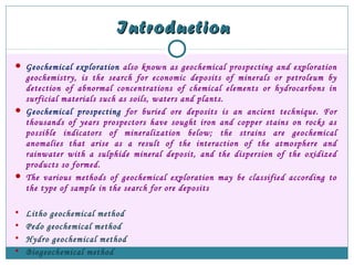

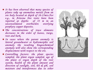
![Geobotanical IndicatorsGeobotanical Indicators
Geobotanical studies have been used since ancient times as a prospecting tool.
It has long been known that specific plants or plant communities are
indicative of a high concentration of a given chemical element in the soil.
All living plants respond to changes in physical, chemical and biological
environment which is reflected by their characteristic habit of growth.
Geobotany is the study of plant in relation to their geological environment
many factors other than geologic factor can have a major influence on the
health and major distribution like sunlight, length of season.
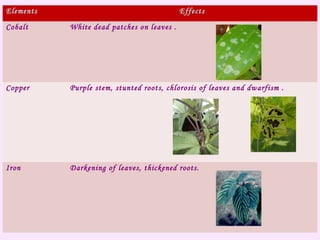
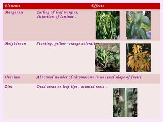
Morphological changes in plants due to anomalous concentration of trace
elements include dwarfism, gigantism, mottling [dots on leaves] and chlorosis
[yellowing of leaves], abnormal fruits, changes of flower color and
disturbances in the rhythm of growth and flowering. These abnormal colors
and morphological changes of plants are caused by the presence of poisonous
element in the nutrient solution and referred to as toxicity.](https://image.slidesharecdn.com/biogeochemicalanomalies-170612075620/85/Biogeochemical-anomalies-8-320.jpg)
![Crotalaria cobalticola
[cobalt]
Astragalus
[selenium]
Deschampsia flexnousa
[lead]](https://image.slidesharecdn.com/biogeochemicalanomalies-170612075620/85/Biogeochemical-anomalies-10-320.jpg)
![Eriogonum ovalifolium [copper]
Oceum homblei
[copper]](https://image.slidesharecdn.com/biogeochemicalanomalies-170612075620/85/Biogeochemical-anomalies-11-320.jpg)
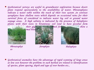


Biogeochemical anomalies occur where vegetation contains abnormally high concentrations of metals. Different plant species take up different amounts of inorganic materials from the soil based on factors like their root depth and water source. Plants with deep roots directly over an ore deposit can show superjacent biogeochemical anomalies of mobility elements. Biogeochemical surveys first determine the optimal plant species, plant part, and elements to sample through an orientation survey. They preferably use deep-rooted plants and can employ grid or scattered sampling points.


