Download as PDF, PPTX


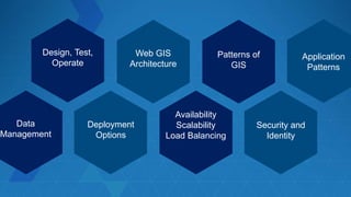
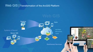
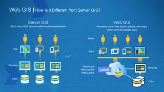
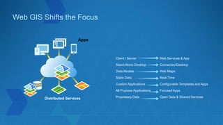
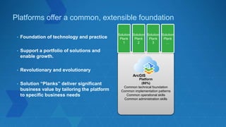
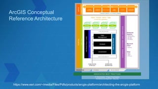
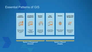
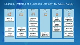
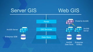
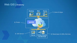
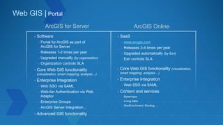
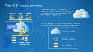
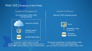
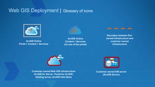
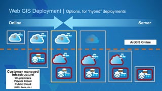
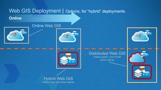
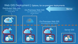
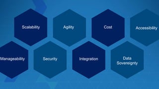


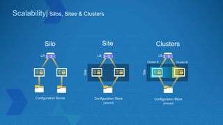
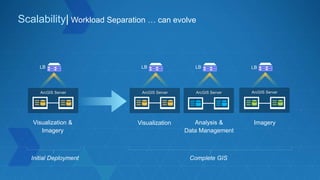
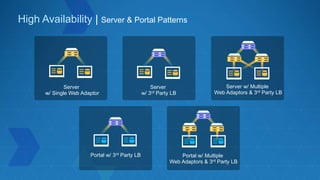
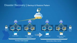
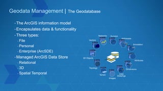
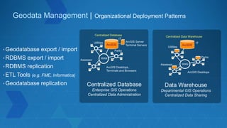
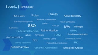
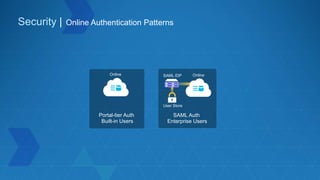
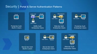

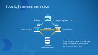
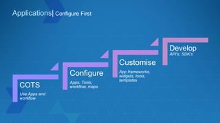
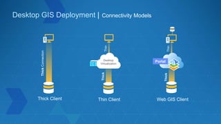
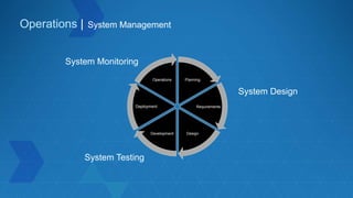
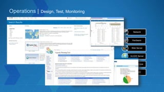


The document outlines best practices for architecting the ArcGIS platform, emphasizing deployment options, scalability, and security. It elaborates on the distinctions between web GIS and server GIS, highlighting core functionalities and integration with enterprise systems. Additionally, it discusses essential patterns for location strategies, data management, and application development within the ArcGIS ecosystem.


![Getting Started with Apache Spark: Big Data Made Simple [Free Meetup]](https://cdn.slidesharecdn.com/ss_thumbnails/apachesparkgettingstarted-260203175547-8361bcc3-thumbnail.jpg?width=640&height=640&fit=bounds)


