SlideShare a Scribd company logo
1 of 15
Public
The Road Ahead
• The climate
• Esri roadmap
• Some demos
Public
Public
Social
Systems
Environmental
Systems
The future of our world depends on us being able to...
…see the world as a single ecosystem
Economic
Systems
GIS provides the technology for abstracting geography
and a language for organizing and applying Geographic Knowledge
Modeling our world . . .
. . . a platform for understanding
. . . and taking action
Geography is the science of our world
. . . providing a way to organise our knowledge…
helping us Interoperate across every discipline
What is a GIS?
A system for managing, sharing and applying geographic information
A virtual representation of the physical world
GIS
IOT / Real-Time
(Smart)
Measurements
Mapping &
Visualization
Maps & Data
Drones and
Satellites
Analytics
and AI
Monitoring &
Reporting
Planning, Policy
& Decision Making
Customer Engagement
A digital twin
BIM Data
Public
Climate challenges
across the African
continent
50 countries working
together to defend
against climate change
Public
African
Groundwater
Resources
Coastal changes
The issue
• Nearly 20,000 miles of coastline
• Large GDP & environmental impact
• Mega-projects impacting delta
areas (hydro-dams etc)
The innovation
• 30+ years of Landsat & Sentinel
data analysed
• Brought to decision making
workflows via ArcGIS
The users
• Senegal monitoring costal changes
to manage fishery plans
• South Africa investigating links to
tourism changes
Public
African
Population
Density
Food security
The issue
• Population of 1.2 billion
• Existing issues being exaggerated
through climate change
• Knowing what food is where, stock
levels, health
The innovation
• Simple field collection to identify staple
food stocks
• Earth observation data plus ArcGIS
used to detect change, field
boundaries, crop health
The users
• Kenya tracking food staples supply
chain
• Ethiopia monitoring crop health and
yields
Public
Climate change
community
The issue
• Climate is a huge topic with a huge
audience spread across a continent
• Lots of open data and existing work
plus active geospatial community
The innovation
• Bring climate community together.
www.africageoportal.com
• Educating on geospatial technology
for decision making
The users
• 1000s accessing open data, tools
and learning to fight their local
climate challenges
African
Cities
Public
Public
Public
. . . Continued Focus on Quality and Performance
Enterprise
11.0
Pro
3.0
Online
ArcGIS
2022
ArcGIS
2021
Enterprise
10.9
Pro
2.8
Online
Enterprise
11.x
Pro
3.x Online
ArcGIS
2023
ArcGIS road map
Comprehensive
Spatial Analysis System
World Class Enterprise Platform
Continued Capability Advancement
Public
Incremental Releases
Continuous Improvements
. . . Continued Focus on Quality and Performance
Text Analytics
Spatiotemporal
Big Data
Augmented Reality
Imagery
IoT
GeoAI
3D
Situational Awareness
BIM
Web Editing
Predictive Analysis
Indoors
Terrain Editing
Smart Mapping
Unstructured Data
SaaS
Machine
Learning
Voice-Assisted Capture
Accessibility
Voxels
Developer Experience
Digital Twins
Knowledge
Graphs
Kubernetes Usability
Cloud Native
3D Reality Capture
Web ModelBuilder
Utility Networks
Game Engines
Collaboration
PaaS
Metadata & Search
Security
Cloud Computing
Enterprise
11.0
Pro
3.0
Online
ArcGIS
2022
ArcGIS
2021
Enterprise
10.9
Pro
2.8 Online
Enterprise
11.x
Pro
3.x
Online
ArcGIS
2023
Road Map
Public
ArcGIS | Q1, 2023 Release Plans
ArcGIS Drone2Map
ArcGIS API for Python
ArcGIS GeoAnalytics Engine
ArcGIS Monitor
ArcGIS StoryMaps (Online)
January February March
ArcGIS 2023
• ArcGIS Pro 3.1*
ArcGIS Business Analyst (Pro)
ArcGIS Online
ArcGIS AppStudio
ArcGIS AllSource
ArcGIS API for JavaScript
ArcGIS Drone2Map
ArcGIS Knowledge (Pro)
ArcGIS Field Maps
ArcGIS Indoors (Pro)
ArcGIS Notebooks (Online)
ArcGIS GeoBIM (Online)
ArcGIS StoryMaps (Online)
ArcGIS World Geocoder
ArcGIS Velocity
ArcGIS IPS (Pro, Mobile)
ArcGIS 2023
• ArcGIS Enterprise 11.1*
ArcGIS AllSource
ArcGIS Business Analyst (Enterprise)
ArcGIS GeoBIM (Enterprise)
ArcGIS Mission (Enterprise)
ArcGIS Reality
ArcGIS StoryMaps (Online, Enterprise)
Track Viewer Web App (Enterprise)
ArcGIS Workflow Manager (Enterprise)

More Related Content

Similar to Esri UK Road Ahead Welsh Conference

Challenges on geo spatial visual analytics eurographics
Challenges on geo spatial visual analytics eurographicsChallenges on geo spatial visual analytics eurographics
Challenges on geo spatial visual analytics eurographicsRaffaele de Amicis
 
Smartrural Digital resilience for rural worlds
Smartrural Digital resilience for rural worldsSmartrural Digital resilience for rural worlds
Smartrural Digital resilience for rural worldsAlfonso Crisci
 
Digital4Climate-Leveraging Digital innovations & data for climate action
Digital4Climate-Leveraging Digital innovations & data for climate action Digital4Climate-Leveraging Digital innovations & data for climate action
Digital4Climate-Leveraging Digital innovations & data for climate action Soren Gigler
 
IoT Meets Geo
IoT Meets GeoIoT Meets Geo
IoT Meets GeoRaj Singh
 
GIS Lecture Note.ppt
GIS Lecture Note.pptGIS Lecture Note.ppt
GIS Lecture Note.pptwarkisafile1
 
ESA Ramani Huria: Mapping for Flood Resilience, Fusing Remote Sensing and Com...
ESA Ramani Huria: Mapping for Flood Resilience, Fusing Remote Sensing and Com...ESA Ramani Huria: Mapping for Flood Resilience, Fusing Remote Sensing and Com...
ESA Ramani Huria: Mapping for Flood Resilience, Fusing Remote Sensing and Com...Mark Iliffe
 
2019 Locate19 OGC Symposia
2019 Locate19 OGC Symposia2019 Locate19 OGC Symposia
2019 Locate19 OGC SymposiaPLACE
 
ICRISAT Global Planning Meeting 2019: Digital Agriculture and Youth by Ram Dh...
ICRISAT Global Planning Meeting 2019: Digital Agriculture and Youth by Ram Dh...ICRISAT Global Planning Meeting 2019: Digital Agriculture and Youth by Ram Dh...
ICRISAT Global Planning Meeting 2019: Digital Agriculture and Youth by Ram Dh...ICRISAT
 
Gis powerpoint
Gis powerpointGis powerpoint
Gis powerpointkaushdave
 
Smart Cities and Big Data - Research Presentation
Smart Cities and Big Data - Research PresentationSmart Cities and Big Data - Research Presentation
Smart Cities and Big Data - Research Presentationannegalang
 
Compass Informatics - Overview
Compass Informatics - OverviewCompass Informatics - Overview
Compass Informatics - Overviewgoriain
 
TechM GIS Utilities
TechM GIS UtilitiesTechM GIS Utilities
TechM GIS UtilitiesTechM-GIS
 
CeRDI Research RUN Vietnam Agriculture Group
CeRDI Research RUN Vietnam Agriculture GroupCeRDI Research RUN Vietnam Agriculture Group
CeRDI Research RUN Vietnam Agriculture GroupHelen Thompson
 
Smarter Water and Smarter Sustainable Dubuque | 2013 Loras College Business A...
Smarter Water and Smarter Sustainable Dubuque | 2013 Loras College Business A...Smarter Water and Smarter Sustainable Dubuque | 2013 Loras College Business A...
Smarter Water and Smarter Sustainable Dubuque | 2013 Loras College Business A...Cartegraph
 
Advanced technologies and research presentation 15 Oct 2015
Advanced technologies and research presentation 15 Oct 2015Advanced technologies and research presentation 15 Oct 2015
Advanced technologies and research presentation 15 Oct 2015Helen Thompson
 
Maps for Solving the World’s Biggest Problems
Maps for Solving the World’s Biggest ProblemsMaps for Solving the World’s Biggest Problems
Maps for Solving the World’s Biggest ProblemsDawn Wright
 

Similar to Esri UK Road Ahead Welsh Conference (20)

Challenges on geo spatial visual analytics eurographics
Challenges on geo spatial visual analytics eurographicsChallenges on geo spatial visual analytics eurographics
Challenges on geo spatial visual analytics eurographics
 
Smartrural Digital resilience for rural worlds
Smartrural Digital resilience for rural worldsSmartrural Digital resilience for rural worlds
Smartrural Digital resilience for rural worlds
 
Digital4Climate-Leveraging Digital innovations & data for climate action
Digital4Climate-Leveraging Digital innovations & data for climate action Digital4Climate-Leveraging Digital innovations & data for climate action
Digital4Climate-Leveraging Digital innovations & data for climate action
 
gis.pdf
gis.pdfgis.pdf
gis.pdf
 
gis.pdf
gis.pdfgis.pdf
gis.pdf
 
IoT Meets Geo
IoT Meets GeoIoT Meets Geo
IoT Meets Geo
 
Geographical information system
Geographical information systemGeographical information system
Geographical information system
 
SensorsGST.pptx
SensorsGST.pptxSensorsGST.pptx
SensorsGST.pptx
 
GIS Lecture Note.ppt
GIS Lecture Note.pptGIS Lecture Note.ppt
GIS Lecture Note.ppt
 
ESA Ramani Huria: Mapping for Flood Resilience, Fusing Remote Sensing and Com...
ESA Ramani Huria: Mapping for Flood Resilience, Fusing Remote Sensing and Com...ESA Ramani Huria: Mapping for Flood Resilience, Fusing Remote Sensing and Com...
ESA Ramani Huria: Mapping for Flood Resilience, Fusing Remote Sensing and Com...
 
2019 Locate19 OGC Symposia
2019 Locate19 OGC Symposia2019 Locate19 OGC Symposia
2019 Locate19 OGC Symposia
 
ICRISAT Global Planning Meeting 2019: Digital Agriculture and Youth by Ram Dh...
ICRISAT Global Planning Meeting 2019: Digital Agriculture and Youth by Ram Dh...ICRISAT Global Planning Meeting 2019: Digital Agriculture and Youth by Ram Dh...
ICRISAT Global Planning Meeting 2019: Digital Agriculture and Youth by Ram Dh...
 
Gis powerpoint
Gis powerpointGis powerpoint
Gis powerpoint
 
Smart Cities and Big Data - Research Presentation
Smart Cities and Big Data - Research PresentationSmart Cities and Big Data - Research Presentation
Smart Cities and Big Data - Research Presentation
 
Compass Informatics - Overview
Compass Informatics - OverviewCompass Informatics - Overview
Compass Informatics - Overview
 
TechM GIS Utilities
TechM GIS UtilitiesTechM GIS Utilities
TechM GIS Utilities
 
CeRDI Research RUN Vietnam Agriculture Group
CeRDI Research RUN Vietnam Agriculture GroupCeRDI Research RUN Vietnam Agriculture Group
CeRDI Research RUN Vietnam Agriculture Group
 
Smarter Water and Smarter Sustainable Dubuque | 2013 Loras College Business A...
Smarter Water and Smarter Sustainable Dubuque | 2013 Loras College Business A...Smarter Water and Smarter Sustainable Dubuque | 2013 Loras College Business A...
Smarter Water and Smarter Sustainable Dubuque | 2013 Loras College Business A...
 
Advanced technologies and research presentation 15 Oct 2015
Advanced technologies and research presentation 15 Oct 2015Advanced technologies and research presentation 15 Oct 2015
Advanced technologies and research presentation 15 Oct 2015
 
Maps for Solving the World’s Biggest Problems
Maps for Solving the World’s Biggest ProblemsMaps for Solving the World’s Biggest Problems
Maps for Solving the World’s Biggest Problems
 

More from Esri UK

Welsh Conference 2023 - The Road Ahead
Welsh Conference 2023 - The Road AheadWelsh Conference 2023 - The Road Ahead
Welsh Conference 2023 - The Road AheadEsri UK
 
Welsh Conference 2023 Opening Plenary
Welsh Conference 2023 Opening PlenaryWelsh Conference 2023 Opening Plenary
Welsh Conference 2023 Opening PlenaryEsri UK
 
Solving sustainability challenges with geospatial information
Solving sustainability challenges with geospatial informationSolving sustainability challenges with geospatial information
Solving sustainability challenges with geospatial informationEsri UK
 
Streamlining the design and operation of infrastructure in Wales
Streamlining the design and operation of infrastructure in WalesStreamlining the design and operation of infrastructure in Wales
Streamlining the design and operation of infrastructure in WalesEsri UK
 
Ecological monitoring in Wales: data capture in the ERAMMP field survey
Ecological monitoring in Wales: data capture in the ERAMMP field surveyEcological monitoring in Wales: data capture in the ERAMMP field survey
Ecological monitoring in Wales: data capture in the ERAMMP field surveyEsri UK
 
Planning a brighter future with a GIS of the World
Planning a brighter future with a GIS of the WorldPlanning a brighter future with a GIS of the World
Planning a brighter future with a GIS of the WorldEsri UK
 
Help create a national walking network
Help create a national walking networkHelp create a national walking network
Help create a national walking networkEsri UK
 
Bringing ArcGIS spatial analysis to bear on IoT data
Bringing ArcGIS spatial analysis to bear on IoT dataBringing ArcGIS spatial analysis to bear on IoT data
Bringing ArcGIS spatial analysis to bear on IoT dataEsri UK
 
How climate data can help address the climate challenge
How climate data can help address the climate challengeHow climate data can help address the climate challenge
How climate data can help address the climate challengeEsri UK
 
Sweet - Esri UK
Sweet - Esri UKSweet - Esri UK
Sweet - Esri UKEsri UK
 
Enhance your maps with arcade - Esri UK
Enhance your maps with arcade - Esri UKEnhance your maps with arcade - Esri UK
Enhance your maps with arcade - Esri UKEsri UK
 
Get Further by Being Mobile – A Look at Advanced Mobile Techniques in the Arc...
Get Further by Being Mobile – A Look at Advanced Mobile Techniques in the Arc...Get Further by Being Mobile – A Look at Advanced Mobile Techniques in the Arc...
Get Further by Being Mobile – A Look at Advanced Mobile Techniques in the Arc...Esri UK
 
Arcadis - Improving Ground Engineering Data Flows - Smart Infrastructure - AC18
Arcadis - Improving Ground Engineering Data Flows - Smart Infrastructure - AC18Arcadis - Improving Ground Engineering Data Flows - Smart Infrastructure - AC18
Arcadis - Improving Ground Engineering Data Flows - Smart Infrastructure - AC18Esri UK
 
Using Jupyter Notebooks - Developers Forum - AC18
Using Jupyter Notebooks - Developers Forum - AC18Using Jupyter Notebooks - Developers Forum - AC18
Using Jupyter Notebooks - Developers Forum - AC18Esri UK
 
I Didn't Know You Could Do That -Technical - AC18
I Didn't Know You Could Do That -Technical - AC18I Didn't Know You Could Do That -Technical - AC18
I Didn't Know You Could Do That -Technical - AC18Esri UK
 
All About Angular and ArcGIS - Developers Forum - AC18
All About Angular and ArcGIS - Developers Forum - AC18All About Angular and ArcGIS - Developers Forum - AC18
All About Angular and ArcGIS - Developers Forum - AC18Esri UK
 
What's New in the Javascript API - Developers Forum - AC18
What's New in the Javascript API - Developers Forum - AC18What's New in the Javascript API - Developers Forum - AC18
What's New in the Javascript API - Developers Forum - AC18Esri UK
 
GIS Under the Radar - Smart Education - Higher - AC18
GIS Under the Radar - Smart Education - Higher - AC18GIS Under the Radar - Smart Education - Higher - AC18
GIS Under the Radar - Smart Education - Higher - AC18Esri UK
 
Switching Your Teaching to ArcGIS Pro - Smart Education - Higher - AC18
Switching Your Teaching to ArcGIS Pro - Smart Education - Higher - AC18Switching Your Teaching to ArcGIS Pro - Smart Education - Higher - AC18
Switching Your Teaching to ArcGIS Pro - Smart Education - Higher - AC18Esri UK
 
Update on ArcGIS Online for Schools - Smart Education - Schools - AC18
Update on ArcGIS Online for Schools - Smart Education - Schools - AC18Update on ArcGIS Online for Schools - Smart Education - Schools - AC18
Update on ArcGIS Online for Schools - Smart Education - Schools - AC18Esri UK
 

More from Esri UK (20)

Welsh Conference 2023 - The Road Ahead
Welsh Conference 2023 - The Road AheadWelsh Conference 2023 - The Road Ahead
Welsh Conference 2023 - The Road Ahead
 
Welsh Conference 2023 Opening Plenary
Welsh Conference 2023 Opening PlenaryWelsh Conference 2023 Opening Plenary
Welsh Conference 2023 Opening Plenary
 
Solving sustainability challenges with geospatial information
Solving sustainability challenges with geospatial informationSolving sustainability challenges with geospatial information
Solving sustainability challenges with geospatial information
 
Streamlining the design and operation of infrastructure in Wales
Streamlining the design and operation of infrastructure in WalesStreamlining the design and operation of infrastructure in Wales
Streamlining the design and operation of infrastructure in Wales
 
Ecological monitoring in Wales: data capture in the ERAMMP field survey
Ecological monitoring in Wales: data capture in the ERAMMP field surveyEcological monitoring in Wales: data capture in the ERAMMP field survey
Ecological monitoring in Wales: data capture in the ERAMMP field survey
 
Planning a brighter future with a GIS of the World
Planning a brighter future with a GIS of the WorldPlanning a brighter future with a GIS of the World
Planning a brighter future with a GIS of the World
 
Help create a national walking network
Help create a national walking networkHelp create a national walking network
Help create a national walking network
 
Bringing ArcGIS spatial analysis to bear on IoT data
Bringing ArcGIS spatial analysis to bear on IoT dataBringing ArcGIS spatial analysis to bear on IoT data
Bringing ArcGIS spatial analysis to bear on IoT data
 
How climate data can help address the climate challenge
How climate data can help address the climate challengeHow climate data can help address the climate challenge
How climate data can help address the climate challenge
 
Sweet - Esri UK
Sweet - Esri UKSweet - Esri UK
Sweet - Esri UK
 
Enhance your maps with arcade - Esri UK
Enhance your maps with arcade - Esri UKEnhance your maps with arcade - Esri UK
Enhance your maps with arcade - Esri UK
 
Get Further by Being Mobile – A Look at Advanced Mobile Techniques in the Arc...
Get Further by Being Mobile – A Look at Advanced Mobile Techniques in the Arc...Get Further by Being Mobile – A Look at Advanced Mobile Techniques in the Arc...
Get Further by Being Mobile – A Look at Advanced Mobile Techniques in the Arc...
 
Arcadis - Improving Ground Engineering Data Flows - Smart Infrastructure - AC18
Arcadis - Improving Ground Engineering Data Flows - Smart Infrastructure - AC18Arcadis - Improving Ground Engineering Data Flows - Smart Infrastructure - AC18
Arcadis - Improving Ground Engineering Data Flows - Smart Infrastructure - AC18
 
Using Jupyter Notebooks - Developers Forum - AC18
Using Jupyter Notebooks - Developers Forum - AC18Using Jupyter Notebooks - Developers Forum - AC18
Using Jupyter Notebooks - Developers Forum - AC18
 
I Didn't Know You Could Do That -Technical - AC18
I Didn't Know You Could Do That -Technical - AC18I Didn't Know You Could Do That -Technical - AC18
I Didn't Know You Could Do That -Technical - AC18
 
All About Angular and ArcGIS - Developers Forum - AC18
All About Angular and ArcGIS - Developers Forum - AC18All About Angular and ArcGIS - Developers Forum - AC18
All About Angular and ArcGIS - Developers Forum - AC18
 
What's New in the Javascript API - Developers Forum - AC18
What's New in the Javascript API - Developers Forum - AC18What's New in the Javascript API - Developers Forum - AC18
What's New in the Javascript API - Developers Forum - AC18
 
GIS Under the Radar - Smart Education - Higher - AC18
GIS Under the Radar - Smart Education - Higher - AC18GIS Under the Radar - Smart Education - Higher - AC18
GIS Under the Radar - Smart Education - Higher - AC18
 
Switching Your Teaching to ArcGIS Pro - Smart Education - Higher - AC18
Switching Your Teaching to ArcGIS Pro - Smart Education - Higher - AC18Switching Your Teaching to ArcGIS Pro - Smart Education - Higher - AC18
Switching Your Teaching to ArcGIS Pro - Smart Education - Higher - AC18
 
Update on ArcGIS Online for Schools - Smart Education - Schools - AC18
Update on ArcGIS Online for Schools - Smart Education - Schools - AC18Update on ArcGIS Online for Schools - Smart Education - Schools - AC18
Update on ArcGIS Online for Schools - Smart Education - Schools - AC18
 

Recently uploaded

SQL Database Design For Developers at php[tek] 2024
SQL Database Design For Developers at php[tek] 2024SQL Database Design For Developers at php[tek] 2024
SQL Database Design For Developers at php[tek] 2024Scott Keck-Warren
 
Unraveling Multimodality with Large Language Models.pdf
Unraveling Multimodality with Large Language Models.pdfUnraveling Multimodality with Large Language Models.pdf
Unraveling Multimodality with Large Language Models.pdfAlex Barbosa Coqueiro
 
costume and set research powerpoint presentation
costume and set research powerpoint presentationcostume and set research powerpoint presentation
costume and set research powerpoint presentationphoebematthew05
 
Developer Data Modeling Mistakes: From Postgres to NoSQL
Developer Data Modeling Mistakes: From Postgres to NoSQLDeveloper Data Modeling Mistakes: From Postgres to NoSQL
Developer Data Modeling Mistakes: From Postgres to NoSQLScyllaDB
 
CloudStudio User manual (basic edition):
CloudStudio User manual (basic edition):CloudStudio User manual (basic edition):
CloudStudio User manual (basic edition):comworks
 
Are Multi-Cloud and Serverless Good or Bad?
Are Multi-Cloud and Serverless Good or Bad?Are Multi-Cloud and Serverless Good or Bad?
Are Multi-Cloud and Serverless Good or Bad?Mattias Andersson
 
Streamlining Python Development: A Guide to a Modern Project Setup
Streamlining Python Development: A Guide to a Modern Project SetupStreamlining Python Development: A Guide to a Modern Project Setup
Streamlining Python Development: A Guide to a Modern Project SetupFlorian Wilhelm
 
"Subclassing and Composition – A Pythonic Tour of Trade-Offs", Hynek Schlawack
"Subclassing and Composition – A Pythonic Tour of Trade-Offs", Hynek Schlawack"Subclassing and Composition – A Pythonic Tour of Trade-Offs", Hynek Schlawack
"Subclassing and Composition – A Pythonic Tour of Trade-Offs", Hynek SchlawackFwdays
 
"Debugging python applications inside k8s environment", Andrii Soldatenko
"Debugging python applications inside k8s environment", Andrii Soldatenko"Debugging python applications inside k8s environment", Andrii Soldatenko
"Debugging python applications inside k8s environment", Andrii SoldatenkoFwdays
 
Nell’iperspazio con Rocket: il Framework Web di Rust!
Nell’iperspazio con Rocket: il Framework Web di Rust!Nell’iperspazio con Rocket: il Framework Web di Rust!
Nell’iperspazio con Rocket: il Framework Web di Rust!Commit University
 
Vertex AI Gemini Prompt Engineering Tips
Vertex AI Gemini Prompt Engineering TipsVertex AI Gemini Prompt Engineering Tips
Vertex AI Gemini Prompt Engineering TipsMiki Katsuragi
 
"LLMs for Python Engineers: Advanced Data Analysis and Semantic Kernel",Oleks...
"LLMs for Python Engineers: Advanced Data Analysis and Semantic Kernel",Oleks..."LLMs for Python Engineers: Advanced Data Analysis and Semantic Kernel",Oleks...
"LLMs for Python Engineers: Advanced Data Analysis and Semantic Kernel",Oleks...Fwdays
 
Story boards and shot lists for my a level piece
Story boards and shot lists for my a level pieceStory boards and shot lists for my a level piece
Story boards and shot lists for my a level piececharlottematthew16
 
WordPress Websites for Engineers: Elevate Your Brand
WordPress Websites for Engineers: Elevate Your BrandWordPress Websites for Engineers: Elevate Your Brand
WordPress Websites for Engineers: Elevate Your Brandgvaughan
 
Kotlin Multiplatform & Compose Multiplatform - Starter kit for pragmatics
Kotlin Multiplatform & Compose Multiplatform - Starter kit for pragmaticsKotlin Multiplatform & Compose Multiplatform - Starter kit for pragmatics
Kotlin Multiplatform & Compose Multiplatform - Starter kit for pragmaticscarlostorres15106
 
Automating Business Process via MuleSoft Composer | Bangalore MuleSoft Meetup...
Automating Business Process via MuleSoft Composer | Bangalore MuleSoft Meetup...Automating Business Process via MuleSoft Composer | Bangalore MuleSoft Meetup...
Automating Business Process via MuleSoft Composer | Bangalore MuleSoft Meetup...shyamraj55
 
"ML in Production",Oleksandr Bagan
"ML in Production",Oleksandr Bagan"ML in Production",Oleksandr Bagan
"ML in Production",Oleksandr BaganFwdays
 
Gen AI in Business - Global Trends Report 2024.pdf
Gen AI in Business - Global Trends Report 2024.pdfGen AI in Business - Global Trends Report 2024.pdf
Gen AI in Business - Global Trends Report 2024.pdfAddepto
 
Ensuring Technical Readiness For Copilot in Microsoft 365
Ensuring Technical Readiness For Copilot in Microsoft 365Ensuring Technical Readiness For Copilot in Microsoft 365
Ensuring Technical Readiness For Copilot in Microsoft 3652toLead Limited
 
Powerpoint exploring the locations used in television show Time Clash
Powerpoint exploring the locations used in television show Time ClashPowerpoint exploring the locations used in television show Time Clash
Powerpoint exploring the locations used in television show Time Clashcharlottematthew16
 

Recently uploaded (20)

SQL Database Design For Developers at php[tek] 2024
SQL Database Design For Developers at php[tek] 2024SQL Database Design For Developers at php[tek] 2024
SQL Database Design For Developers at php[tek] 2024
 
Unraveling Multimodality with Large Language Models.pdf
Unraveling Multimodality with Large Language Models.pdfUnraveling Multimodality with Large Language Models.pdf
Unraveling Multimodality with Large Language Models.pdf
 
costume and set research powerpoint presentation
costume and set research powerpoint presentationcostume and set research powerpoint presentation
costume and set research powerpoint presentation
 
Developer Data Modeling Mistakes: From Postgres to NoSQL
Developer Data Modeling Mistakes: From Postgres to NoSQLDeveloper Data Modeling Mistakes: From Postgres to NoSQL
Developer Data Modeling Mistakes: From Postgres to NoSQL
 
CloudStudio User manual (basic edition):
CloudStudio User manual (basic edition):CloudStudio User manual (basic edition):
CloudStudio User manual (basic edition):
 
Are Multi-Cloud and Serverless Good or Bad?
Are Multi-Cloud and Serverless Good or Bad?Are Multi-Cloud and Serverless Good or Bad?
Are Multi-Cloud and Serverless Good or Bad?
 
Streamlining Python Development: A Guide to a Modern Project Setup
Streamlining Python Development: A Guide to a Modern Project SetupStreamlining Python Development: A Guide to a Modern Project Setup
Streamlining Python Development: A Guide to a Modern Project Setup
 
"Subclassing and Composition – A Pythonic Tour of Trade-Offs", Hynek Schlawack
"Subclassing and Composition – A Pythonic Tour of Trade-Offs", Hynek Schlawack"Subclassing and Composition – A Pythonic Tour of Trade-Offs", Hynek Schlawack
"Subclassing and Composition – A Pythonic Tour of Trade-Offs", Hynek Schlawack
 
"Debugging python applications inside k8s environment", Andrii Soldatenko
"Debugging python applications inside k8s environment", Andrii Soldatenko"Debugging python applications inside k8s environment", Andrii Soldatenko
"Debugging python applications inside k8s environment", Andrii Soldatenko
 
Nell’iperspazio con Rocket: il Framework Web di Rust!
Nell’iperspazio con Rocket: il Framework Web di Rust!Nell’iperspazio con Rocket: il Framework Web di Rust!
Nell’iperspazio con Rocket: il Framework Web di Rust!
 
Vertex AI Gemini Prompt Engineering Tips
Vertex AI Gemini Prompt Engineering TipsVertex AI Gemini Prompt Engineering Tips
Vertex AI Gemini Prompt Engineering Tips
 
"LLMs for Python Engineers: Advanced Data Analysis and Semantic Kernel",Oleks...
"LLMs for Python Engineers: Advanced Data Analysis and Semantic Kernel",Oleks..."LLMs for Python Engineers: Advanced Data Analysis and Semantic Kernel",Oleks...
"LLMs for Python Engineers: Advanced Data Analysis and Semantic Kernel",Oleks...
 
Story boards and shot lists for my a level piece
Story boards and shot lists for my a level pieceStory boards and shot lists for my a level piece
Story boards and shot lists for my a level piece
 
WordPress Websites for Engineers: Elevate Your Brand
WordPress Websites for Engineers: Elevate Your BrandWordPress Websites for Engineers: Elevate Your Brand
WordPress Websites for Engineers: Elevate Your Brand
 
Kotlin Multiplatform & Compose Multiplatform - Starter kit for pragmatics
Kotlin Multiplatform & Compose Multiplatform - Starter kit for pragmaticsKotlin Multiplatform & Compose Multiplatform - Starter kit for pragmatics
Kotlin Multiplatform & Compose Multiplatform - Starter kit for pragmatics
 
Automating Business Process via MuleSoft Composer | Bangalore MuleSoft Meetup...
Automating Business Process via MuleSoft Composer | Bangalore MuleSoft Meetup...Automating Business Process via MuleSoft Composer | Bangalore MuleSoft Meetup...
Automating Business Process via MuleSoft Composer | Bangalore MuleSoft Meetup...
 
"ML in Production",Oleksandr Bagan
"ML in Production",Oleksandr Bagan"ML in Production",Oleksandr Bagan
"ML in Production",Oleksandr Bagan
 
Gen AI in Business - Global Trends Report 2024.pdf
Gen AI in Business - Global Trends Report 2024.pdfGen AI in Business - Global Trends Report 2024.pdf
Gen AI in Business - Global Trends Report 2024.pdf
 
Ensuring Technical Readiness For Copilot in Microsoft 365
Ensuring Technical Readiness For Copilot in Microsoft 365Ensuring Technical Readiness For Copilot in Microsoft 365
Ensuring Technical Readiness For Copilot in Microsoft 365
 
Powerpoint exploring the locations used in television show Time Clash
Powerpoint exploring the locations used in television show Time ClashPowerpoint exploring the locations used in television show Time Clash
Powerpoint exploring the locations used in television show Time Clash
 

Esri UK Road Ahead Welsh Conference

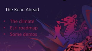
  • 1. Public The Road Ahead • The climate • Esri roadmap • Some demos
  • 4. Social Systems Environmental Systems The future of our world depends on us being able to... …see the world as a single ecosystem Economic Systems
  • 5. GIS provides the technology for abstracting geography and a language for organizing and applying Geographic Knowledge Modeling our world . . . . . . a platform for understanding . . . and taking action Geography is the science of our world . . . providing a way to organise our knowledge… helping us Interoperate across every discipline
  • 6. What is a GIS? A system for managing, sharing and applying geographic information A virtual representation of the physical world GIS IOT / Real-Time (Smart) Measurements Mapping & Visualization Maps & Data Drones and Satellites Analytics and AI Monitoring & Reporting Planning, Policy & Decision Making Customer Engagement A digital twin BIM Data
  • 7. Public Climate challenges across the African continent 50 countries working together to defend against climate change
  • 8. Public African Groundwater Resources Coastal changes The issue • Nearly 20,000 miles of coastline • Large GDP & environmental impact • Mega-projects impacting delta areas (hydro-dams etc) The innovation • 30+ years of Landsat & Sentinel data analysed • Brought to decision making workflows via ArcGIS The users • Senegal monitoring costal changes to manage fishery plans • South Africa investigating links to tourism changes
  • 9. Public African Population Density Food security The issue • Population of 1.2 billion • Existing issues being exaggerated through climate change • Knowing what food is where, stock levels, health The innovation • Simple field collection to identify staple food stocks • Earth observation data plus ArcGIS used to detect change, field boundaries, crop health The users • Kenya tracking food staples supply chain • Ethiopia monitoring crop health and yields
  • 10. Public Climate change community The issue • Climate is a huge topic with a huge audience spread across a continent • Lots of open data and existing work plus active geospatial community The innovation • Bring climate community together. www.africageoportal.com • Educating on geospatial technology for decision making The users • 1000s accessing open data, tools and learning to fight their local climate challenges African Cities
  • 13. Public . . . Continued Focus on Quality and Performance Enterprise 11.0 Pro 3.0 Online ArcGIS 2022 ArcGIS 2021 Enterprise 10.9 Pro 2.8 Online Enterprise 11.x Pro 3.x Online ArcGIS 2023 ArcGIS road map Comprehensive Spatial Analysis System World Class Enterprise Platform Continued Capability Advancement
  • 14. Public Incremental Releases Continuous Improvements . . . Continued Focus on Quality and Performance Text Analytics Spatiotemporal Big Data Augmented Reality Imagery IoT GeoAI 3D Situational Awareness BIM Web Editing Predictive Analysis Indoors Terrain Editing Smart Mapping Unstructured Data SaaS Machine Learning Voice-Assisted Capture Accessibility Voxels Developer Experience Digital Twins Knowledge Graphs Kubernetes Usability Cloud Native 3D Reality Capture Web ModelBuilder Utility Networks Game Engines Collaboration PaaS Metadata & Search Security Cloud Computing Enterprise 11.0 Pro 3.0 Online ArcGIS 2022 ArcGIS 2021 Enterprise 10.9 Pro 2.8 Online Enterprise 11.x Pro 3.x Online ArcGIS 2023 Road Map
  • 15. Public ArcGIS | Q1, 2023 Release Plans ArcGIS Drone2Map ArcGIS API for Python ArcGIS GeoAnalytics Engine ArcGIS Monitor ArcGIS StoryMaps (Online) January February March ArcGIS 2023 • ArcGIS Pro 3.1* ArcGIS Business Analyst (Pro) ArcGIS Online ArcGIS AppStudio ArcGIS AllSource ArcGIS API for JavaScript ArcGIS Drone2Map ArcGIS Knowledge (Pro) ArcGIS Field Maps ArcGIS Indoors (Pro) ArcGIS Notebooks (Online) ArcGIS GeoBIM (Online) ArcGIS StoryMaps (Online) ArcGIS World Geocoder ArcGIS Velocity ArcGIS IPS (Pro, Mobile) ArcGIS 2023 • ArcGIS Enterprise 11.1* ArcGIS AllSource ArcGIS Business Analyst (Enterprise) ArcGIS GeoBIM (Enterprise) ArcGIS Mission (Enterprise) ArcGIS Reality ArcGIS StoryMaps (Online, Enterprise) Track Viewer Web App (Enterprise) ArcGIS Workflow Manager (Enterprise)