Download to read offline
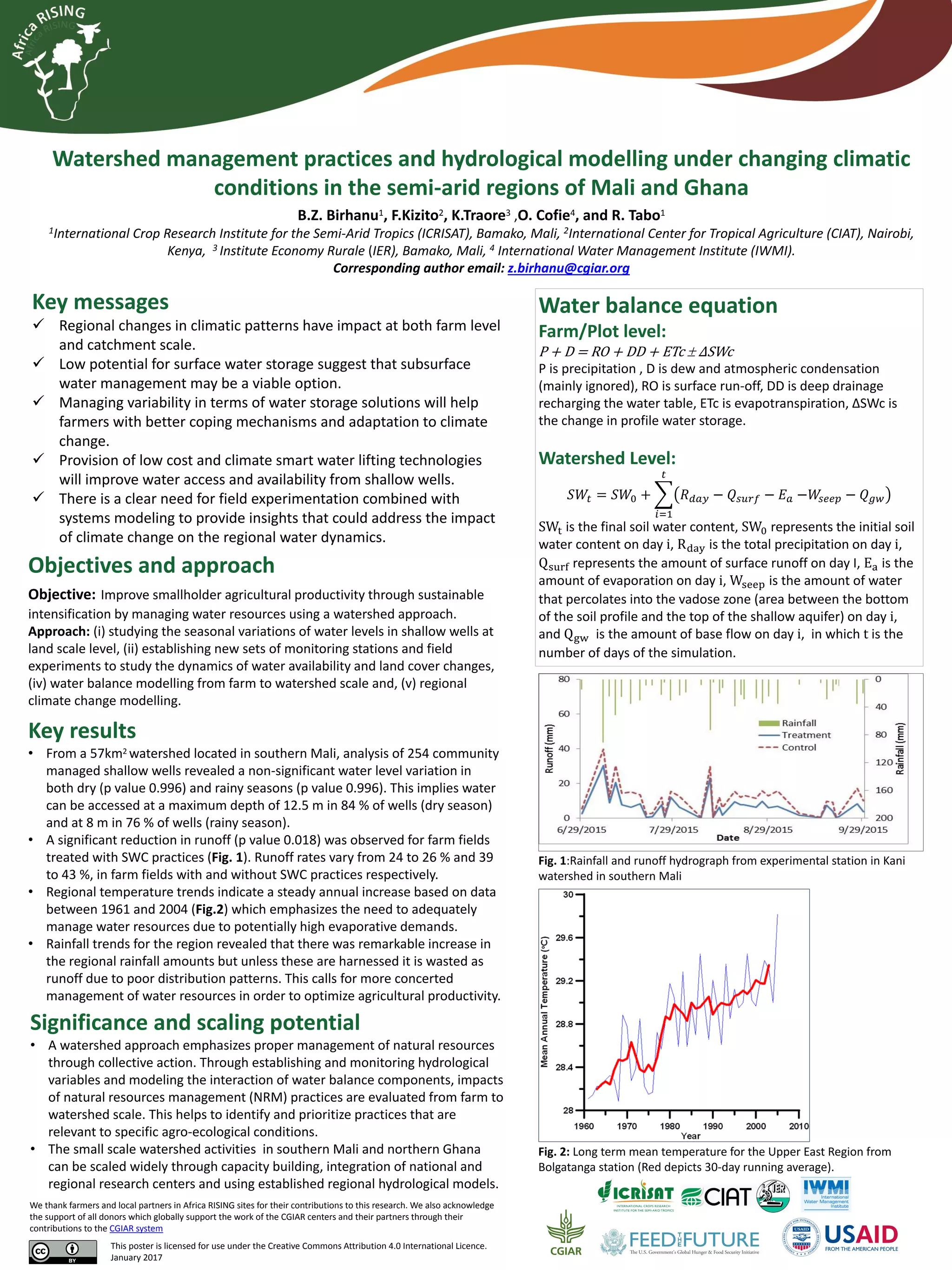

This document summarizes a study on watershed management practices and hydrological modeling under changing climatic conditions in Mali and Ghana. The objectives are to improve smallholder productivity through sustainable intensification by managing water resources using a watershed approach. Key results show shallow wells can access water at depths of 8-12.5 meters. Areas with soil and water conservation practices had 26-43% less runoff. Regional temperature data shows steady annual increases, emphasizing the need for improved water management. The study establishes monitoring stations to evaluate impacts of management practices from farm to watershed scales to identify effective practices for different agro-ecological conditions.