Objectives:
- Develop an integrated agricultural and urban modeling system
- Characterize decadal and regional impacts associated with agriculture/urban expansion for selected regions in the continental US
- Examine socio-economic impacts associated with agri-urban development including urban farms/community gardens
- Educate next generation of interdisciplinary scientists
Objectives
- Develop an integrated agricultural and urban modeling system
Characterize decadal and regional impacts associated with agriculture/urban expansion for selected regions in the continental US
- Examine socio-economic impacts associated with agri-urban development including urban farms/community gardens
- Educate next generation of interdisciplinary scientists
Objectives
- Assess types and densities of NA bacteria in diverse manures and manured soils
- Identify physico-chemical conditions that favor NA activity in soil and reduce N2O emissions
- Evaluate the impact of climate adaptive management practices (C addition, low disturbance) on GHG tradeoffs
Objectives
- Compare effects of climate and land use on fluxes within the same climate zone and among the mesic and semi-arid regions
- Combine multi-scale observations (satellite, flux sites, inventories, tall towers) in neural networks to determine how current climate, land-use and land cover influence processes
- Modify CLM to reduce uncertainties in simulated effects of land use and land cover on biogeochemical and biophysical processes (crops, poplar)
- Investigate future climate variability, and effects of changes in land use and land cover on terrestrial processes
El 29 de febrero y el 1 de marzo de 2016, la Fundación Ramón Areces analizó la relación entre 'Big Data y el cambio climático' en unas jornadas. ¿Puede el Big Data ayudar a reducir el cambio climático? ¿Cómo contribuirá ese análisis masivo de datos a prevenir y gestionar catástrofes naturales? Son solo algunas de las preguntas a las que intentarán responder los ponentes. Las ciencias vinculadas al clima tienen en el Big Data una herramienta muy prometedora para afrontar diferentes fenómenos asociados al cambio climático.
Executive Summary of EPA Draft Report on Fracking Impacts on Water Supplies -...Marcellus Drilling News
An Executive Summary for a draft EPA report titled "Assessment of the Potential Impacts of Hydraulic Fracturing
for Oil and Gas on Drinking Water Resources". The study reviews data from 950 sources and concludes that while certain known and minor affects can happen (drawing down water too low), fracking DOES NOT POLLUTE WATER SUPPLIES. That is the takeaway from this study by the Obama EPA.
This presentation includes introduction to Earthquakes, Seismic Waves, Shallow Focus and Deep Focus Earthquakes, Aftershocks, Earthquake Storms, Effects/Impacts of Earthquakes, Earthquake Predictions.
Planning and environmental impact assessment (EIA)tesdev
Planning and environmental impact assessment (EIA).
Towards efficient and effective EIAs and how GIS can help.
Janet Burns
RSK Principal Environmental Consultant
Eia methods for transportation projectKushal Patel
Environmental Impact Assessment (EIA) OF TRANSPORTATION PROJECTS study is a time-consuming process because it has a large number of dependent and independent variables which have to be taken into account (e.g. land use, land price, population density, socio-economic level, road accessibility, railway accessibility, air quality, ground water quality, noise level, biological content, historical value, archeological and visual importance), which also have different consequences. Traditionally, environmental data was collected to test hypotheses and simulate environmental systems using in situ (field) methodology
Learn from the National Aeronautics and Space Administration (NASA) about what their modeling and forecasting says about current and future weather patterns, and the impacts these patterns will have on agriculture, food security, climate, natural disasters, and more, especially for the Southeast.
Modeling the Effects of Land Use Change on FloodingAdam Nayak
Due to population growth, urban areas in Oregon have been expanding, leading to increases in impervious surfaces and net losses in wetlands, riparian vegetation, and forestation in the Northwest. Utilizing ArcGIS and NOAA’s C-CAP imagery, this study classifies and analyzes urban land use changes between 1996 and 2010. These findings shed light on the importance of land use management in urban settings and are being used by local watershed councils to advocate for changes within their stream basins.
Effects from Farmer-led Collective Action on Water Use & Irrigated CropsKrystal Drysdale
A Presentation at KSU's 2015 Risk & Profit Conference:
We evaluate changes in irrigation decisions in response to two collective action water policies in Kansas: the Rattlesnake Creek Management Plan and the Sheridan 6 LEMA. We estimate the impact of the two policies on total water use, water use intensity (inches per acre irrigated), total irrigated acreage, and cropping patterns. Our results indicate how farmers adjusted to the policies and what proportion of reduced water withdrawals (if any) were achieved through changes in irrigated acres, changes in cropping patterns, or change in the intensity of irrigation.
DSD-INT 2017 Groundwater system analysis using isotope measurement data, San ...Deltares
Presentation by Cinthya Gómez Castro (Costa Rica) at the iMOD International User Day, during Delft Software Days - Edition 2017. Tuesday, 31 October 2017, Delft.
2017 Open Space Conference - Ellie Cohen - Accelerating Nature-based Solution...OpenSpaceCouncil
*Please note that animations in this presentations are not visible when viewed through Slideshare.
Ellie Cohen, Executive Director, Point Blue Conservation Science, spoke at the 2017 Open Space Conference, Eyes on the Horizon, Boots on the Trail on May 18, 2017 at the Craneway Pavilion in Richmond, CA. More info on the Bay Area Open Space Council's website: http://openspacecouncil.org/community-events/conference/
Objectives
- Develop an approach to identify the land-surface changes due to wildfires
- Detect land-surface property changes for multiple mega-fires in the U.S.
- Develop a scheme to parameterize the changes
Objectives
- Understand and model the new paradigm of soil carbon (C) stabilization at the C-microbe-mineral interface with varying:
-Carbon input chemistry
-Microbial community composition, and
-Soil mineralogy
- Integrate findings across spatial (molecular to landscape) and temporal scales using:
Gradients of soil age (~40 to 250 ka), and climate (~300 to 1200 mm yr-1)
- Incorporate improved mechanistic understanding of C stabilization/destabilization into new reactive transport models
Objectives
- Understand, model and predict greenhouse gases emissions from grasslands and winter wheat croplands under changing microbes, climate, livestock and manure use across the scales of field, farm and watershed
- Broaden STEM education for K-12 and college students and teachers, and engage farmers, ranchers, decision makers, and citizen scientists to participate in in-situ data collection and analyses
Objective
Understand and quantify the nature of land-atmosphere interactions
- as they exist today
- as they may be modulated by the radiatively-driven component of climate change
- as they may evolve with changing land use
Objectives
Characterize the soil microbial community across different management practices and measure the corresponding greenhouse gas fluxes.
Determine the adaptation and acclimation of the soil microbial community climate change.
Improve a soil greenhouse gas emission model to predict greenhouse gas emissions under global change scenarios.
Objective:
We are addressing a fundamental information gap on how belowground C-cycling is impacted by the replacement of native rangelands with non-native communities. Our specific objective is to determine if C cycling processes are altered by conversion of native to exotic-dominated grasslands using ongoing experiments and comparative studies.
Framework
Farm operators make strategic and tactic decisions based on dynamic climate and market processes. However, they do not access and use all the information enabled by powerful information technologies.
Objectives
- Develop a working intellectual foundation to support development of local adaptation and mitigation strategies
- Identify stakeholder and extension staff needs and concerns.
- “Mainstream” Climate Literacy in Extension’s educational programs and materials.
- Develop a strong working partnership between Extension and research groups (such as the Hub and Sub Hub efforts, and state climate offices)
- Share resources and approaches to programs and teaching about climate
- Develop approaches to program evaluation
Objectives:
- Determine how soil moisture and nutrients regulate microbial C-use efficiency (CUE)
- Develop mathematical functions that can be incorporated into earth system models
- Improve our ability to predict the impact of climate change on soil C-sequestration in agricultural systems
Objectives:
- Identify alleles that adapt chickens to the stress of a changing environment.
- Identify alleles that improve nutrient utilization in production lines of chickens.
- Identify novel alleles in African chickens where birds have been naturally selected to be more tolerant of climate variation.
- Explore how crop and forest management influences decadal scale climate predictions
- Improve the representation of managed ecosystems in Earth system models
- Specific focus on institutional strengths: soil carbon dynamics, pine plantation forestry, plant physiology under warming temperatures, forest nitrogen cycling
- Evaluate and reduce uncertainty associated with ecological processes in climate predictions
Objectives:
- Link the DayCent/Century model to the UCLA Land Surface model
- Determine the impact of agriculture practice in the U.S. and Asia on soil nutrient cycling, greenhouse gas fluxes, and global carbon cycling
- Evaluate the impact of AMO, PDO, and ENSO sea surface temperature on grassland plant production in the U.S. Great Plains
Objectives:
There was a dramatic geographic shift in agriculture in the 20th century which concentrated grain production in a small area in the upper Midwest and concentrated vegetable, potato, cotton and other crops in the arid West. This new geography may be extremely vulnerable to climate change and variability. The Midwest droughts 2012 and the current California drought are illustrative of the problems our USDA-EaSM proposal foresaw in 2010.
It is the objective of this project to determine whether a more distributed geographical production system with the SE increasing irrigated production is both economically and environmentally sustainable.
Objectives:
- Discern location shifts for different agricultural production systems
- Set up spatially explicit modeling framework to assess climate and other driving factors behind adoption of different production systems
- Project evolution of production systems under alternative climate scenarios and assess outcomes from alternative adaptation strategies
More from National Institute of Food and Agriculture (20)
Characterization and the Kinetics of drying at the drying oven and with micro...Open Access Research Paper
The objective of this work is to contribute to valorization de Nephelium lappaceum by the characterization of kinetics of drying of seeds of Nephelium lappaceum. The seeds were dehydrated until a constant mass respectively in a drying oven and a microwawe oven. The temperatures and the powers of drying are respectively: 50, 60 and 70°C and 140, 280 and 420 W. The results show that the curves of drying of seeds of Nephelium lappaceum do not present a phase of constant kinetics. The coefficients of diffusion vary between 2.09.10-8 to 2.98. 10-8m-2/s in the interval of 50°C at 70°C and between 4.83×10-07 at 9.04×10-07 m-8/s for the powers going of 140 W with 420 W the relation between Arrhenius and a value of energy of activation of 16.49 kJ. mol-1 expressed the effect of the temperature on effective diffusivity.
"Understanding the Carbon Cycle: Processes, Human Impacts, and Strategies for...MMariSelvam4
The carbon cycle is a critical component of Earth's environmental system, governing the movement and transformation of carbon through various reservoirs, including the atmosphere, oceans, soil, and living organisms. This complex cycle involves several key processes such as photosynthesis, respiration, decomposition, and carbon sequestration, each contributing to the regulation of carbon levels on the planet.
Human activities, particularly fossil fuel combustion and deforestation, have significantly altered the natural carbon cycle, leading to increased atmospheric carbon dioxide concentrations and driving climate change. Understanding the intricacies of the carbon cycle is essential for assessing the impacts of these changes and developing effective mitigation strategies.
By studying the carbon cycle, scientists can identify carbon sources and sinks, measure carbon fluxes, and predict future trends. This knowledge is crucial for crafting policies aimed at reducing carbon emissions, enhancing carbon storage, and promoting sustainable practices. The carbon cycle's interplay with climate systems, ecosystems, and human activities underscores its importance in maintaining a stable and healthy planet.
In-depth exploration of the carbon cycle reveals the delicate balance required to sustain life and the urgent need to address anthropogenic influences. Through research, education, and policy, we can work towards restoring equilibrium in the carbon cycle and ensuring a sustainable future for generations to come.
Artificial Reefs by Kuddle Life Foundation - May 2024punit537210
Situated in Pondicherry, India, Kuddle Life Foundation is a charitable, non-profit and non-governmental organization (NGO) dedicated to improving the living standards of coastal communities and simultaneously placing a strong emphasis on the protection of marine ecosystems.
One of the key areas we work in is Artificial Reefs. This presentation captures our journey so far and our learnings. We hope you get as excited about marine conservation and artificial reefs as we are.
Please visit our website: https://kuddlelife.org
Our Instagram channel:
@kuddlelifefoundation
Our Linkedin Page:
https://www.linkedin.com/company/kuddlelifefoundation/
and write to us if you have any questions:
info@kuddlelife.org
Natural farming @ Dr. Siddhartha S. Jena.pptxsidjena70
A brief about organic farming/ Natural farming/ Zero budget natural farming/ Subash Palekar Natural farming which keeps us and environment safe and healthy. Next gen Agricultural practices of chemical free farming.
Summary of the Climate and Energy Policy of Australia
Mehta nifa talk-final
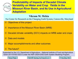
1. Predictability of Impacts of Decadal Climate
Variability on Water and Crop Yields in the
Missouri River Basin, and Its Use in Agricultural
Adaptation
Vikram M. Mehta
The Center for Research on the Changing Earth System, Catonsville, Maryland
Vikram Mehta NIFAPDs’Meeting, San Francisco, CA 17 December 2016
Supported by the U.S. Department of Agriculture – National Institute of Food and Agriculture
Grant 2011-67003-30213 under the NSF-USDA-DOE Earth System Modeling Program.
⦿ Objectives of this project
⦿ Importance of the Missouri River Basin (MRB)
⦿ Decadal climate variability (DCV) impacts on MRB water and crops
⦿ Data and models
⦿ Major accomplishments and other outcomes
⦿ The future?
2. The Team
Vikram Mehta, Norman Rosenberg, Katherin Mendoza, and Hui Wang
The Center for Research on the Changing Earth System, Catonsville, Maryland
Cody Knutson, Nicole Wall, Tonya Haigh, and Tonya Bernadt
National Drought Mitigation Center, Univ. of Nebraska – Lincoln, Nebraska
Bruce McCarl, Mario Fernandez, Pei Huang, Jinxiu Ding,
Theepakorn Jithitikulchai
Raghavan Srinivasan, Prasad Daggupati, and Deb Debjani
Texas A & M University, College Station, Texas
Amita Mehta and Saikumar Popuri
NASA-UMBC Joint Center for Earth System Technology, Catonsville, Maryland
Vikram Mehta NIFAPDs’Meeting, San Francisco, CA 17 December 2016
3. Using the Missouri River Basin as a case study:
☞ To develop an ‘end-to-end’, decadal climate
and impacts prediction system
☞ To develop an adaptive water and agriculture
management system
Vikram Mehta NIFAPDs’Meeting, San Francisco, CA 17 December 2016
Overarching Objectives
4. Importance of the Missouri River Basin
Missouri River Basin
Largest
river
basin
in the US
Covers
500,000
sq. miles,
10 States,
many Native
American
reservations,
parts of
Alberta and
Saskatchewan
Value of crops
and livestock
over
$100 billion
per year
117 million
acres cropland,
only 12 million
acres irrigated
Produces 46% of wheat, 22% of grain corn, 34% of
cattle in the United States
Dependence on the Missouri River for drinking water, irrigation and industrial needs, hydro-electricity, recreation, navigation,
and fish and wildlife habitat
Over 2000
urban centers
of various sizes
Vikram Mehta NIFAPDs’Meeting, San Francisco, CA 17 December 2016
5. Urban Areas in the Missouri River Basin
Vikram Mehta NIFAPDs’Meeting, San Francisco, CA 17 December 2016
Over 2000 urban areas
Increasing
competition
for water
among
various
sectors
6. Droughts and Water in the Main Stem Reservoirs
Water in the Main Stem
Reservoirs
Vikram Mehta NIFAPDs’Meeting, San Francisco, CA 17 December 2016
Severe to Extreme DroughtArea
(Lower figure, courtesy Kevin Grody, USACE)
7. Pacific Decadal Oscillation and wheat production in the MRB
Vikram Mehta NIFAPDs’Meeting, San Francisco, CA 17 December 2016
Average
production
6.6 million
tons
Average
production
13.8 million
tons
Correlation coefficients between the PDO and wheat production time series
0.5 without smoothing and 0.65 after smoothing all time series.
8. Decadal Climate and Impacts Information for
Decision Support in the Missouri River Basin
DCV
phenomena
Influences
on Basin
hydro-
meteorology
Influences
on
Agriculture
Urban water
Industries
Navigation
Recreation
Others
Rural and
urban
economies;
Local,
regional,
national,
international
economies
Adaptation
strategies
via
understanding,
prediction, and
scenario
development
Data,
information,
and
decision-
support
systems
Active
involvement of
stakeholders
and
policymakers
Applications
In various
sectors
A system adaptable
to other river basins also
Vikram Mehta NIFAPDs’Meeting, San Francisco, CA 17 December 2016
9. Data and Models
◉ Observed streamflow data from U.S. Geological Survey: Many gauge
locations, 1961 - 2010
◉ Crop yield estimates from the USDA – National Agricultural Statistical
Service (NASS): County totals, 1961 - 2010
◉Observations-based precipitation, daily max. and min. temperatures,
surface winds, surface air humidity: 12 km x 12 km, 1961 - 2010
◉Decadal sea-surface temperature and hydro-meteorological predictions
by 4 Earth System Models (NCAR-CCSM4, GFDL CM2.1, UKMO-HadCM3,
and MIROC5): Monthly, various spatial resolutions, 1961 to 2010
◉Calibrated and validated 12 km x 12 km version of the Soil and Water
Assessment Tool (SWAT) for the entire MRB
◉ Water and crop choices model RIVERSIM, optimized for the MRB
Vikram Mehta NIFAPDs’Meeting, San Francisco, CA 17 December 2016
10. Hybrid Dynamical-Statistical Prediction
System for Decadal Climate and
Hydro-meteorology
1961 – 2010
ocean-
atmosphere-
land hindcasts
Earth System Model
(ESM)
1961-2010
=me history
of
greenhouse
gases,
volcanic and
other
aerosol
op=cal
depths, solar
radia=on;
Projected
values
aFer 2010 Ensemble
ini=aliza=on system;
10-year experiments
ini=alized in 1960,
1970, …, 2000
2011 – 2036
ocean-
atmosphere-
land forecasts
Dynamical System for SST Prediction
(CMIP5)
Models used in this study
Vikram Mehta NIFAPDs’Meeting, San Francisco, CA 17 December 2016
GFDL – CM2.1
UKMO – HadCM3
MIROC5
NCAR – CCSM4
11. SWAT Setup and Calibration - Validation
ŸCharacterization of ~ 14,000
watersheds
ŸSub-watersheds and streams
ŸLanduse – land cover at
30 m resolution, crop rotation and
irrigation
ŸIrrigated land and soil data
ŸPrecipitation, temperature, winds,
solar radiation data at 12 km x 12 km
ŸCrop yield calibration; Winter and
spring wheat, corn (dryland and
irrigated), soybean (dryland and
irrigated)
ŸWater yield (total surface and base
flow) calibration
ŸWater abstractions and other man-
made changes not captured
Calibration and validation in each of
these 11 land use classes
Vikram Mehta NIFAPDs’Meeting, San Francisco, CA 17 December 2016
12. Types of SWAT Experiments
SWATObserved Hydro-
meteorological
data; 1961 - 2010
Idealized
Hydro-
meteorological
data from
DCV scenarios
Water yield,
stream flow,
crop yields
Comparison
with observed
data; 1961 - 2010
SWAT Water yield,
stream flow,
crop yields
Inter-comparison
of impacts of
scenarios
SWATHindcast
Hydro-
meteorological
data; 1961 - 2010
Water yield,
stream flow,
crop yields
Comparison
with observed
data; 1961 - 2010
Vikram Mehta NIFAPDs’Meeting, San Francisco, CA 17 December 2016
13. Observed and SWAT-simulated streamflow anomalies (cu. m/s)
in wet (1982-86) and dry (1987-90) Epochs
Dry: 1987 - 90
Vikram Mehta NIFAPDs’Meeting, San Francisco, CA 17 December 2016
USGS
SWAT
Wet: 1982 - 86
USGS
SWAT
Decreased flows in western
Montana and northern Kansas,
and increased flows elsewhere
Increased flows in western
Montana and northern Kansas,
and decreased flows elsewhere
14. Observed and SWAT-simulated winter wheat yield
anomalies (t/ha) in wet (1982-86) and dry (1987-90)
Epochs
Wet: 1982 - 86 Dry: 1987 - 90
Decreased yields in western
Montana and southeast MRB,
and increased yields elsewhere
Increased yields in western
Montana and southeast MRB,
and decreased yields elsewhere
NASS
Vikram Mehta NIFAPDs’Meeting, San Francisco, CA 17 December 2016
SWAT
NASS
SWAT
15. Selected sub-basins for development of predictability and
adaptation methodologies
Platte
Lower
Grand
James
Marias
Vikram Mehta NIFAPDs’Meeting, San Francisco, CA 17 December 2016
16. Decadal prediction of the Pacific Decadal Oscillation
index by the MIROC5 Earth System Model: 1981-2020
Vertical dashed lines – forecast start times
Shading:
±1 std. dev.
of ensemble
Impacts
prediction
periods
indicated
by
PDO+
1982-84
2003-06
PDO-
1988-90
2007-13
Vikram Mehta NIFAPDs’Meeting, San Francisco, CA 17 December 2016
17. ehta NIFAPDs’Meeting, San Francisco, CA
Winter wheat prediction in the Platte River sub-basin
Winter wheat
yield anomaly
prediction with
50-year NASS
data statistics
PDO+
Winter wheat
yield anomaly
prediction with
SWAT
Actual 1982-84
Actual yield
anomalies
PDO-
Actual 1988-90
Predicted PDO+ 1982-84 Predicted PDO- 1988-90
Vikram M 17 December 2016
18. ehta NIFAPDs’Meeting, San Francisco, CA
Barley prediction in the Marias sub-basin
Barley yield
anomaly
prediction with
50-year NASS
data statistics
Barley yield
anomaly
prediction with
SWAT
Actual 1982-84
Actual yield
anomalies
Predicted PDO+ 1982-84 Predicted PDO- 1988-90
Actual 1988-90
PDO+ PDO-
Vikram M 17 December 2016
19. Corn prediction in the James River sub-basin
Corn yield
anomaly
prediction with
50-year NASS
data statistics
Actual yield
anomalies
Predicted PDO+ 2003-06 Predicted PDO- 2007-13
Actual
2003-06
Vikram Mehta NIFAPDs’Meeting, San Francisco, CA 17 December 2016
Actual
2007-13
20. Why is there value?
ŸDecision makers would likely make adjustments for revised
expectations of crop yields and water supply.
v If farmers knew water demands would be higher and supplies smaller,
they might plant a smaller area.
v If they knew some crop yields would be lower and others higher, they
might shift crop mix.
v If water planners knew water would be short, they might encourage
conservation, reduce use, and negotiate options to buy out some
agricultural water rights.
ŸThese actions compared to actions based on the historical climatic
record would generate value.
Vikram Mehta NIFAPDs’Meeting, San Francisco, CA 17 December 2016
Value of decadal climate information to MRB
agriculture
21. Difference
82 29 53
• Modeling Scope
– 16 crops, 411 counties in MRB; irrigated and dryland
cropping; municipal and industrial water use
– DCV impacts on 5 crops: wheat (spring and winter), corn,
sorghum, soybeans; hydrological flow balance; reservoir
storage
• Uncertainty about which combination of phases of major DCV
phenomena will occur in the next one year
• Includes crop insurance
Value of DCV Information (in million $)
Vikram Mehta NIFAPDs’Meeting, San Francisco, CA 17 December 2016
Perfect information on
next year’s DCV phase
relative to historical
frequency
Reduced uncertainty
on next year’s DCV
phase (based on this
year’s phase) relative
to historical
frequency
Water and Agriculture Choices RIVERSIM model
22. NIFAPDs’Meeting, San Francisco, CA
Decadal climate variability based crop adaptation options for farmers
Example: Corn – soybean – wheat – hay planting choices in
the Platte River sub-basin, given DCV phase combination prediction
PDO+, TAG- PDO-, TAG+
Vikram Mehta 17 December 2016
Corn Corn
Hay Hay
Soybeans Soybeans
Winter
wheat
Winter
wheat
23. Summary of accomplishments
• Simulations of DCV phenomena and their decadal
predictability assessed in four Earth System Models (ESMs)
• Statistical hydro-meteorological prediction system, using
predicted DCV indices as predictors, developed
• Statistical downscaling scheme developed for ESM data
• Very high resolution land use-hydrology-crop model Soil and
Water Assessment Tool (SWAT) calibrated and validated for
the MRB; water and crop yield simulation and prediction
experiments conducted
Vikram Mehta NIFAPDs’Meeting, San Francisco, CA 17 December 2016
24. Summary of accomplishments
•Skillful, multiyear to decadal prediction of indices of the PDO
and other DCV phenomena possible in some cases, especially
since the 1980s.
•These predicted DCV indices are shown to be useful for
multiyear to decadal prediction of water yields, streamflow, and
crop yields in the Missouri River Basin.
•The predicted crop yields are shown to be useful for, among
other applications, adaptation of choice of crops to plant.
•Value of DCV information to MRB agricultural economy
estimated at $30 – 80 million per year.
Vikram Mehta NIFAPDs’Meeting, San Francisco, CA 17 December 2016
25. Research Capacity-building
Project people: 6 senior scientists, 2 research scientists, 1 post-doctoral
scientist,1 research associate, 5 Ph.D. students, 16 undergrad. students, 3
outreach specialists, 1 web programmer, 1 administrative officer, 1
information technologist
Minorities and Under-represented groups: 6 women, 1 Hispanic
Institution network: 1 non-profit organization and 3 Universities
Project website: Missouri.crces.org
Stakeholder Advisory Team (SAT): Representatives from water,
agriculture, and natural resources management sectors in the MRB;
academics; state and federal officials
Vikram Mehta NIFAPDs’Meeting, San Francisco, CA 17 December 2016
26. Other outcomes
Completed Ph.D.s: 4 (TexasA & M University)
Ph.D. in progress: 1 (University of Maryland – Baltimore County (UMBC))
Undergraduate student interns: 16 in UMBC under the NSF Research
Experience for Undergraduates (REU) Program
Papers published: 7; Papers in preparation: 4
Conference/Workshop and other talks and posters: 10
Vikram Mehta NIFAPDs’Meeting, San Francisco, CA 17 December 2016
27. The Future?
●Decadal prediction of water and crop yields at the county
level and development of fine-scale adaptation options in the
MRB.
●County-level assessment of value of DCV information to
agricultural economy in the MRB.
● Simulation and prediction of coupled food-energy-water
securities in the MRB and the Mississippi River Basin.
● Adaptation of models and methodologies to the Mississippi
and Ohio River Basins to develop prediction and adaptation
systems for water, crops, and water-borne transportation of
agricultural and other materials/products.
Vikram Mehta NIFAPDs’Meeting, San Francisco, CA 17 December 2016