Downloaded 27 times

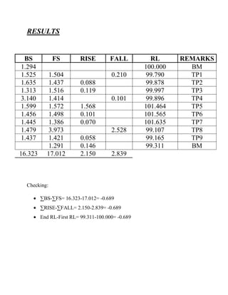
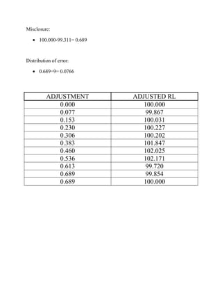

This document defines key terms used in leveling such as bench mark, line of collimation, axis of the telescope, foresight, intermediate sight, and station. It describes the objective of leveling is to determine relative heights and elevations to prepare contour maps, longitudinal sections, and layouts. It provides sample leveling results including backsight, foresight, rise, fall, and reduced levels which are checked and any error is distributed and adjusted. The conclusion states that leveling is used to design construction projects by measuring height differences and calculating earthwork volumes.


