Seismic interpretation and well logging techniques
•Download as PPTX, PDF•
28 likes•2,806 views

Seismic interpretation and well logging techniques

Recommended
More Related Content
What's hot
What's hot (20)
Viewers also liked
Viewers also liked (15)
Similar to Seismic interpretation and well logging techniques
Similar to Seismic interpretation and well logging techniques (20)
More from Pramoda Raj
More from Pramoda Raj (20)
Recently uploaded
Recently uploaded (20)
Seismic interpretation and well logging techniques
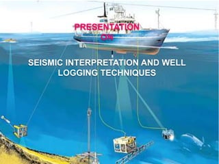
- 1. Guided by Prof. L. Mahesh Bilwa PRESENTATION ON SEISMIC INTERPRETATION AND WELL LOGGING TECHNIQUES
- 2. AIMS AND OBJECTIVES INTODUCTION PETROLEUM BASINS OF INDIA PETROLEUM SYSTEMS ELEMENTS AND PROCESSES GEO-PHYSICAL EXPLORATION IN OIL EXPLORATION SEISMIC METHOD SEISMIC SURVEY WELL LOGGING AND ITS TOOLS WELL LOG INTERPRETATION SEISMIC INTERPRETATION CONCLUSION REFERENCES CONTENTS
- 3. AIMS AND OBJECTIVES The aim of the work carried out is to know about the seismic interpretation and well logging techniques employed in hydrocarbon exploration. The objectives of this works were : To know the principles and working of seismic interpretation. To study the well log section and interpretation for further understanding of the interested pay horizon. To bring out the relationship between the different litho-units and petroleum system present in the area supported collected data.
- 4. METHODOLOGY Planning of the work. Collection data from ONGC expert Lab work Petroleum exploration and various methods involved Preparation of final report
- 5. • Petroleum and natural combustible gas have been known to man since Antiquity, long before our Era. • Petroleum production on a large industrial scale, however, was started only a little more than one hundred and forty years ago. • Petroleum is a naturally occurring, yellow-to-black liquid found in geologic formations beneath the Earth's surface, which is commonly refined into various types of fuels. • Petroleum is recovered mostly through oil drilling. • Seismic method is one of the important geophysical methods used in the petroleum exploration. • One of the oldest and most used methods that depend on the geophysical properties of rocks is subsurface well logging. INTODUCTION
- 6. PETROLEUM BASINS OF INDIA Sedimentary basins are regions of the earth of long-term subsidence creating accommodation space for infilling by sediments. So far, 26 basins have been recognized and they have been divided into four categories based on their degree of prospectivity as presently known. There are total 26 sedimentary basins in India, of which 7 sedimentary basins are the major importance for Hydrocarbon reserves. They are Assam Shelf A&AA FB KG Basin Cauvery Basin Rajasthan Basin Cambay Basin Mumbai Offshore
- 7. The Krishna –Godavari basin, located on the east coast of India between Visakhapatnam town in north and Ongole town in south. Covers an area of 28,000 km2onland and extends into the Bay of Bengal covering an area of 24000 km2 up to 200m isobaths and additional 18000 km2 up to 2000 m isobaths. Well Data Number of Exploratory wells on ONLAND -375 OFFSHORE – 182 Conti…
- 8. Krishna – Godavari Basin
- 9. PETROLEUM SYSTEMS AND PETROLEUM BASIN OF INDIA Certain conditions come together for oil accumulations to develop known as petroleum system.
- 10. Petroleum system elements Source Rock - A rock with abundant hydrocarbon-prone organic matter Reservoir Rock - A rock in which oil and gas accumulates Porosity - space between rock grains in which oil accumulates Permeability - passage-ways between pores through which oil and gas moves Seal Rock - A rock through which oil and gas cannot move effectively (such as mudstone and claystone) Migration Route - Avenues in rock through which oil and gas moves from source rock to trap Trap - The structural and stratigraphic configuration that focuses oil and gas into an accumulation.
- 11. Petroleum System Processes Generation - Burial of source rock to temperature and pressure regime sufficient to convert organic matter into hydrocarbon. Migration - Movement of hydrocarbon out of the source rock toward and into a trap Accumulation - A volume of hydrocarbon migrating into a trap faster than the trap leaks resulting in an accumulation. Preservation - Hydrocarbon remains in reservoir and is not altered by biodegradation or “water-washing”. Timing - Trap forms before and during hydrocarbon migration.
- 12. Cap Rock In late Jurrasic to Upper Creatceous sequence, the regional cap is provided by Raghavapuram shale and Paleocene blastic trap. In Paleocene – Eocene sequence, the regional cap is provided by the widespread impervious unit Bhimanapalli Limestone. In the younger Mio-Pliocene sequence, the Godaveri clay provides regional cap. Traps The seismo-geological data indicate that the entrapment of hydrocarbons occurs in small to medium sized structures. Anticlinal structures are the traps for lower Eocene reservoirs.
- 13. Source rocks: Vadaparru-Ravva shale is the main source rock. Palakollu-Pasarlapudi shale of upper Paleocene age have a fair to good source rock potential. Krishna/Gopalli- Konukallu the potential source rocks are Krishna /Golapalli formation. Kommugudem-Mandapeta fluvial regime is very good source rock. Reservoir Rocks: The reservoir rocks occur in arenaceous sequences of different formations ranging in age from Permo-Triassic to Pliocene, except a few local accumulations in carbonates and volcanic.
- 14. Geo-physical exploration for oil and Natural Gas Exploration is the art of searching for the purpose of discovering natural resources. Exploration occurs in all non- sessile animal species, including humans. Hydrocarbon exploration is the search for oil and natural gas by petroleum geologists and geophysicists. The areas which are thought to contain hydrocarbons are subjected to gravity, magnetic and seismic surveys on the regional scale are carried out.
- 15. SEISMIC METHOD Seismic method is one of the important geophysical methods used in the petroleum exploration. The term Geophysics means Physics of the earth or the study of the physical properties of the earth. Principles : Seismic prospecting depends upon the difference in wave velocity and transmission pattern of elastic waves through different rock formations. The waves are generated by explosives, hammering big nails, weight dropping techniques Prospecting based on the analysis of elastic waves generated in the earth by artificial means. The elastic waves produced during sudden disturbance are called as Seismic wave. These seismic waves are recorded using the instrument, Seismograph and the record obtained is Seismogram. It is an important geophysical prospecting applied in oil and natural gas deposits, deep ground water exploration, depth estimation, geotechnical problems.
- 16. SEISMIC SURVEY Set of geophysical methods of exploration based on a study of artificially induced waves of elastic vibrations propagating in the Earth crust. Seismic exploration, broadly speaking, creates a picture of the subsurface by recording vibrations as they bounce back from geological formations. The resulting data is called seismic lines.
- 17. o One of the oldest and most used methods that depend on the geophysical properties of rocks is subsurface well logging. These methods are particularly good when surface outcrops are not available. Well logs are results of several geophysical measurements recorded in a well bore. They consist of key information about formation drilled i.e. To identify the productive zones of hydrocarbon. To define the petro-physical parameters like porosity, permeability, hydrocarbon saturation and lithology of zones. To determine depth, thickness, formation temperature and pressure of a reservoir. To distinguish between oil, gas and water zones in a reservoir. To measure hydrocarbon mobility. WELL LOGGING
- 18. A LOG TYPES Lithological Logs Spontaneous Potential (SP) Gamma Ray (GR) Porosity Logs Neutron Density Sonic Resistivity Logs (Fluid Type) Resistivity Induction Other Dip meter Caliper Temperature Acoustic Formation micro imager (FMI).
- 19. Interpretation of well log section
- 21. CONCLUSION The main part of work is on interpretation of seismic and well log. The collection of data enabled to read the depth of log borehole, types of lithology by the principles of gamma, neutron, density, etc., these are the tools which applied to read the subsurface lithological data. The calculations of well log interpretation reveals that as the water percentage decreases the hydrocarbon percentage increases the vice versa also is true. In overall conclusion of this particular dissertation work helped us to read well log sections and also seismic section or how to interpret. This is an important piece of work it was unable to have an exposure for final semester geology students to complete the course. For students it’s a great opportunity to work in ONGC helped in great way to learn some of the basics in seismic interpretation and well log.
- 22. REFERENCES Edwin S. Robinson and Cahit Coruh, (1995), Basic exploration Geophysics by Virginia Polytechnic Institute and State University. Pages- 502, 531-536. Robertson, (1989), Text book of Krishna-Godavari Basin. Stratigraphy, Petroleum Geochemistry and Petroleum Geology, Volume-I Part-A. R.E.Chapman, (1978) Petroleum Geology, pages-1 to 21. G. Narayana Rao, Sedimentation and Sub-surface Stratigraphy of KG-basin by Pages-27-44, 96-100. M.B.Ramachanra Rao, formerly chief geophysicist, GSI, Outlines of geophysical prospecting- A manual for geologist, Pages 217-228. R. E. Chapman, Petroleum Geology pages-1 to 21, Published by Elsevier Science publishing.com.inc, pages-1 to 21. Robertson, Text book of Krishna-Godavari Basin. Stratigraphy, Petroleum Geochemistry and Petroleum Geology, Volume-I Part-A, Page76-105. R.Vaidayanadhan and M.Ramakrishnan, 2008, Geology of India volume 2 published by the Geological Society of India, Pages 911-916. R. L. Sengbush (President Pexcon International Inc.), Seismic Exploration Methods, Published by-IHRDC, Publishers, 137 Newbery Street, Boston and MA02116, Pages-1 to 29. Seismic Exploration Methods by R.L. Sengbush (President Pexcon International Inc.) pages-1 to 29. Published by-IHRDC, Publishers, 137 Newbery Street, Boston, and MA02116. Published by- Elsevier Science publishing.com.inc. Published by John Wiley and Sons, Inc, USA, 1988. Sedimentation and Sub-surface Stratigraphy of KG-basin by G. Narayana Rao, Pages-27-44, 96-100, Well Logging ( in non-technical language) 2nd edition by David E. Johnson and Katheryne E. pile, pages 1-4, published by Penn well publishing company,2002.
- 23. Thank you