1. The document analyzes tight oil resources in the Yingtai area of the Songliao Basin in China. Seismic attribute analysis and geostatistical inversion were used to predict the distribution of reservoir sand bodies ("desserts") in the main layer, aiming to guide horizontal well development.
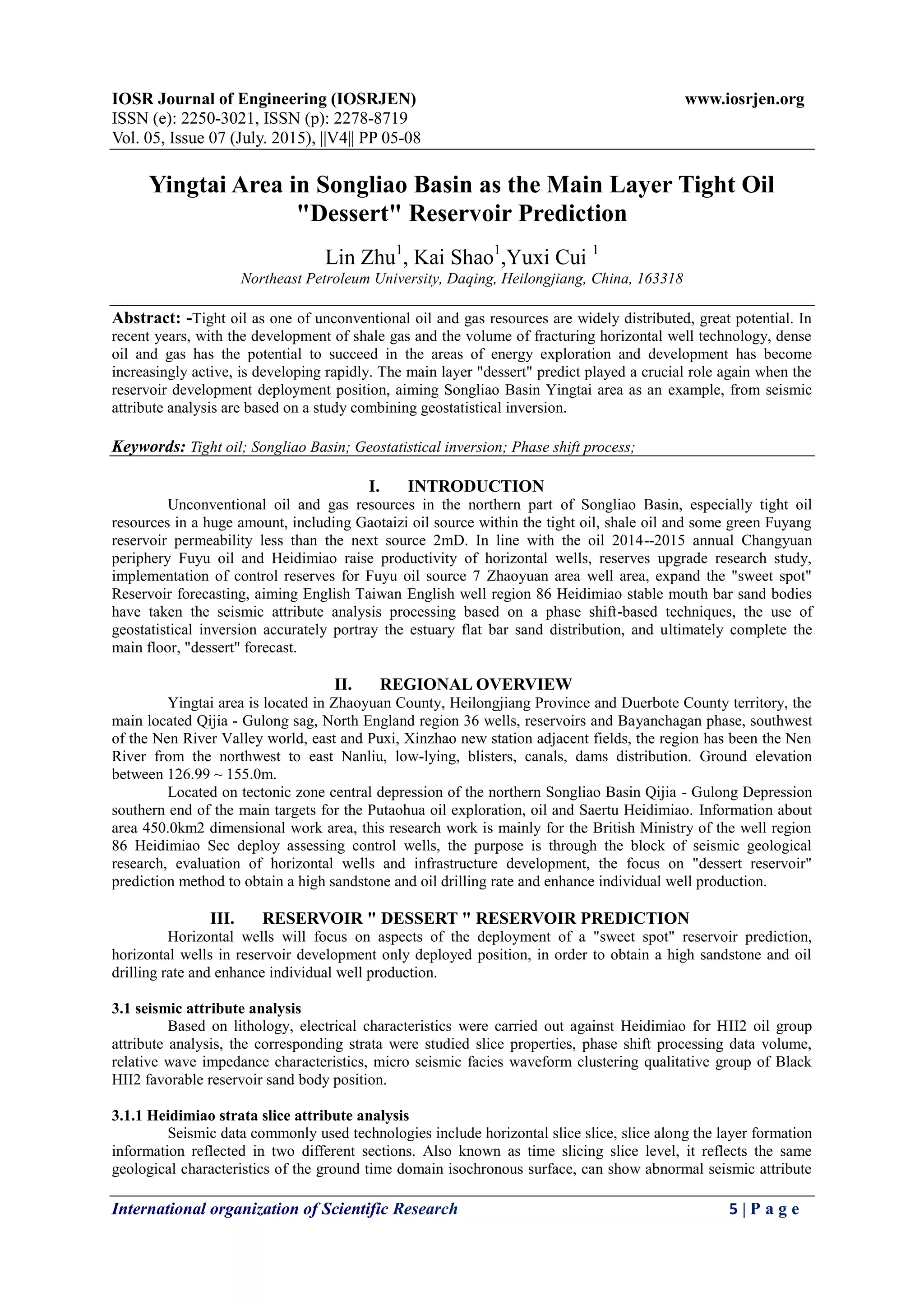
2. Seismic attribute analysis including slice attributes and phase shift processing was used to qualitatively identify favorable reservoir sand in the Heidimiao formation.
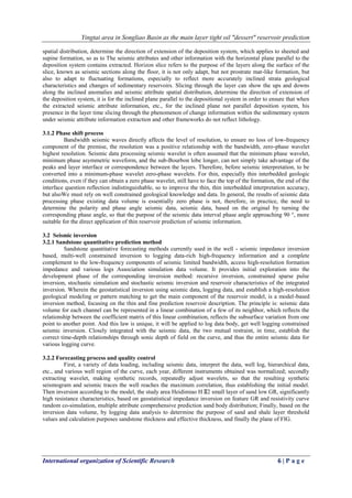
3. Geostatistical inversion using well log data, seismic data, and reservoir modeling quantitatively predicted the spatial distribution of sand bodies in the thin Heidimiao HII2 layer to accurately identify drilling targets.
![Yingtai area in Songliao Basin as the main layer tight oil "dessert" reservoir prediction
International organization of Scientific Research 8 | P a g e
REFERENCES
[1] Stephen A. Sonnenberg, Aris Pramudito. Petroleum geology of the giant ElmCoulee field,W illiston
Basin. AAPG Bulletin, v.93, no. 9 (September 2009), pp. 1127~1153.
[2] Mackey,S.D.and Bridge,J.S.Three-dimensional model of alluvial stratigraphy:theory and
application.Journal of Sedimentary Research,1995,B65(1):7~31.
[3] Clavier C, Coates G, Dumanoir J. The theoretical and experimental bases for the “dual water” model for
interpretation of shaly sands. SPE 6859, 1977. 1—27.
[4] Clavier C, Coates G, Dumanoir J. The theoretical and experimental bases for the dual-water model for
interpretation of shaly sands. SPEJ, 1984, 24(2): 153—168
[5] Cander H.What is unconventional resources[R]. Long Beach,California:AAPG Annual Convention
and Exhibition,2012.
[6] GarberM.China:nearly half reserves are in marginal reservoirs[N].18WPC News of WPC,2005,78~89](https://image.slidesharecdn.com/b05740508-150808061923-lva1-app6892/85/B05740508-4-320.jpg)


![Old man logan 005 [t]](https://cdn.slidesharecdn.com/ss_thumbnails/oldmanlogan005t-150807074207-lva1-app6891-thumbnail.jpg?width=640&height=640&fit=bounds)


