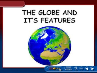
THE GLOBE AND ITS FEATURES
•Download as PPTX, PDF•
18 likes•16,363 views

THE GLOBE AND ITS FEATURES

Recommended
More Related Content
What's hot
What's hot (20)
Similar to THE GLOBE AND ITS FEATURES
Similar to THE GLOBE AND ITS FEATURES (20)
Recently uploaded
Recently uploaded (20)
THE GLOBE AND ITS FEATURES
- 2. Based on recorded history, the most probable earliest globe was constructed by the Greek geographer Crates of Mallus.
- 3. What is a globe ? A globe : Is a model of the earth Gives an accurate picture of the earth’s surface Shows the location of places on the a smaller scale
- 4. 29 % of the earth’s surface is land. Large land masses are called continents. There are seven continents: Asia Africa North America South America Europe Australia Antarctica 71% of earth’s surface is covered by water. Large water bodies are called oceans. There are five oceans: Indian Pacific Atlantic Arctic Southern C
- 8. • Latitude lines are imaginary lines on the earth's surface. They run east and west around the globe and tell you your distance north or south of the Equator.
- 9. • The Equator circles Earth halfway between the north and south poles separating Earth into two equal halves called the Northern Hemisphere and the Southern Hemisphere.
- 11. Lines of latitude are lines running parallel to the equator. • Latitude is the distance in degrees north or south of the equator.
- 12. Latitude is thus measured from 0° at the equator to 90° at the poles. • Locations north of the equator are referred to by degrees north latitude (N). • Locations south of the equator are referred to by degrees south latitude (S).
- 13. – Another special lines of Latitude are found at 66 ½ North and 66 ½ South of the Equator. In the Northern Hemisphere, Latitude 66 ½ is called the Arctic Circles.
- 14. – In the Southern Hemisphere, latitude 66 ½ is known as the Antarctic Circles Between the two tropics and these lines of Latitude are the Middle Latitudes Beyond Latitude 66 ½ North and South of the Equator are the High Latitudes. The Parallels are specially noted to show separation between areas that get different amounts of sunlight.
- 15. To locate positions in east and west directions, cartographers use lines of longitude, also known as Meridians. • Longitude is the distance in degrees east or west of the Prime Meridian. • The Prime Meridian, representing 0° longitude, is the reference point for longitude.
- 16. Points west of the prime meridian are numbered from 0° to 180° west longitude (W). • Points east of the prime meridian are numbered from 0° to 180° east longitude (E).
- 18. Semicircles – Lines of longitude are not parallel; they are large semicircles that extend vertically from pole to pole. – The distances covered by degrees of longitude vary with location. – One degree of longitude varies from about 111 km at the equator to essentially the distance covered by a point at the poles. Degrees of Longitude
- 19. Locating Places with Coordinates – Both latitude and longitude are needed to precisely locate positions on Earth. – For example, the location of New Orleans is 29°57´N, 90°04´W. – Note that latitude comes first in reference to the coordinates of a particular location.
- 20. is an imaginary line on Earth's surface defining the boundary between one day and the next. is located halfway around the world from the prime meridian (0° longitude) or about 180° east (or west) of Greenwich, London, UK, the reference point of time zones.
- 21. Because Earth takes about 24 hours to rotate once on its axis, it is divided into 24 times zones, each representing a different hour.
- 24. There are six different time zones in the United States.
- 25. A hemisphere means half of a sphere. HEMI= half SPHERE= circle or globe
- 26. Northern Hemisphere Southern Hemisphere Eastern Hemisphere Western Hemisphere
- 31. • Continent – Largest land masses on the planet. BIGGER than countries, states, counties, cities, and your back yard • Ocean – Largest body of water on the planet BIGGER than seas, lakes, ponds, and mud puddles CONTINENTS AND OCEANS
- 32. CONTINENTS Asia 44,029,797 (km²) Africa 28,489,869 (km²) North America 23,309,892 (km²) South America 15,539,928 (km²) Antarctica 12,949,940 (km²) Europe 7,769,964 (km²) Australia 5,179,976 (km²)
- 33. Asia Quick Facts Land Area: 17,210,000 (mi²) / 44,029,797 (km²) Population: 4,494,302,221 (2016) Largest City: Tokyo, Japan – 37,800,000 (2016) Number of Countries: 48 Highest Point / Lowest Point: Mount Everest / Dead Sea Shore Notable Geographical Features: Gobi Desert Son Doong Cave Himalayas
- 35. Africa Quick Facts Land Area: 11,670,000 (mi²) / 28,489,869 (km²) Population: 1,119,307,147 (2016) Largest City: Lagos, Nigeria – 21,000,000 (2014) Number of Countries: 54/55 (Disputed) Highest Point / Lowest Point: Mount Kilimanjaro / Lake Assal Notable Geographical Features: Sahara Desert Ngorongoro Crater Nile River
- 37. North America Quick Facts Land Area: 9,540,000 (mi²) / 23,309,892 (km²) Population: 579,024,000 (2016) Largest City: Mexico City, Mexico – 21,200,000 (2015) Number of Countries: 23 Highest Point / Lowest Point: Denali / Badwater Basin Notable Geographical Features: Grand Canyon Niagara Falls Old Faithful
- 39. South America Quick Facts Land Area: 6,888,000 (mi²) / 15,539,928 (km²) Population: 422,500,000 (2016) Largest City: São Paulo, Brazil – 21,090,791 (2014) Number of Countries: 12 (See List) Highest Point / Lowest Point: Aconcagua / Laguna del Carbón Notable Geographical Features: Iguazu Falls Galapagos Islands Atacama Desert
- 41. Antarctica Quick Facts Land Area: 5,405,000 (mi²) / 12,949,940 (km²) Population: 4,912 (2016) – None Permanent Largest City: McMurdo Station– 1,248 (2016) Number of Countries: None Highest Point / Lowest Point: Mount Vinson / Bentley Subglacial Trench Notable Geographical Features: South Pole Ross Ice Shelf
- 43. Europe Quick Facts Land Area: 3,931,000 (mi²) / 7,769,964 (km²) Population: 738,849,000 (2016) Largest City: Istanbul, Turkey – 14,657,434 (2016) Number of Countries: 50 (See List) Highest Point / Lowest Point: Mount Elbrus / Caspian Sea Shore Notable Geographical Features: Cliffs of Moher Black Forest Eisriesenwelt
- 45. Australia Quick Facts Land Area: 2,970,000 (mi²) / 5,179,976 (km²) Population: 36,304,997 (2016) Largest City: Sydney, Australia – 4,921,000 (2015) Number of Countries: 3 (See List) Highest Point / Lowest Point: Mount Kosciuszko / Lake Eyre Notable Geographical Features: Uluru Great Barrier Reef Twelve Apostles
- 49. The Pacific Ocean stretches 64,186,000 square miles and has an average depth of 15,215 feet. The Atlantic Ocean stretches 33,420,000 square miles and has an average depth of 12,881 feet. The Indian Ocean stretches 28,350,000 square miles and has an average depth of 13,002 feet.
- 50. The Arctic Ocean stretches 5,106,000 square miles and has an average depth of 3,953 feet. The Antarctic Ocean stretches 7,848,300 square miles and has an average depth of 13,100 - 16,400 feet.
- 51. Name the Continents Find The Continent Identifying Oceans and Continents
- 52. You have learned a little about each of the seven continents and five oceans. At the end of this presentation, you will fill in a blank world map.
- 55. are visual displays of numerical data arrange in vertical columns so that the data may be emphasized, compared or contrasted. Rank CONTINENTS 1 Asia 44,029,797 (km²) 2 Africa 28,489,869 (km²) 3 North America 23,309,892 (km²) 4 South America 15,539,928 (km²) 5 Antarctica 12,949,940 (km²) 6 Europe 7,769,964 (km²) 7 Australia 5,179,976 (km²)
- 56. GRAPHS is a kind of picture that makes the facts from the tables easier to understand. To Interpret the graphs, the following stage format should be used: 1. Analyzed the formation presented. 2. Identify the formation being presented. 3. Develop hypothesis from the information.
- 57. Bar graph shows comparison because it gives two kinds of information that stands for a fact or set of facts, which are placed alongside each other. 0 5000000 10000000 15000000 20000000 25000000 30000000 35000000 40000000 45000000 50000000 Asia Africa North America South America Antarctica Europe Australia Sq km Sq km
- 58. Pie graph makes it easier to see how large one part is compared with other parts.
- 59. Is a chart that uses picture symbols to stand for fixed amounts of selected things
- 62. Tells the stories and is considered the best kind of graph for showing the change in something over a stretch of time.
- 63. is a diagram that makes information easier to understand by showing how two or more sets of data are related. In using a chart, the following are helpful guides: Read the outside of the chart (Literal level) Make meaning of the chart (Interpretative Level) Go beyond the chart (Applied level)
- 64. •depicts development, growth and change by beginning with a simple course with spread outs into many branches.
- 65. Flow chart visual way of charting or showing a process from beginning to end.
- 66. •a chart showing the standard times in various parts of the world with reference to a specified time at a specified place.
- 67. shows how one part of the organization relates to other parts of the organization
- 68. Used to show similarities and differences between two things (people, places, events, ideas, etc.).
- 69. BY: ROSE DUMAYAC