Electronic Atlas and its Types
•Download as PPTX, PDF•
0 likes•543 views

A group presentation demonstrated at Kathmandu University regarding the course Modern Cartography.

Recommended
More Related Content
What's hot
What's hot (20)
Similar to Electronic Atlas and its Types
Similar to Electronic Atlas and its Types (20)
Recently uploaded
Recently uploaded (20)
Electronic Atlas and its Types
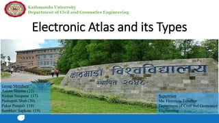
- 1. Kathmandu University Department of Civil and Geomatics Engineering Electronic Atlas and its Types 1 Group Members Ashim Sharma (22) Nishan Neupane (17) Pashupati Shah (20) Pukar Parajuli (18) Sambhav Sapkota (19) Supervisor Ms. Florencia Tuladhar Department of Civil and Geomatics Engineering
- 2. Kathmandu University Department of Civil and Geomatics Engineering Introduction 2 Atlas • A systematically arranged collection of maps • A book of maps or charts • Atlas classification based on dissemination medium: 1. Paper Atlas 2. Electronic Atlas
- 3. Kathmandu University Department of Civil and Geomatics Engineering • Primarily defined as the extension of paper atlas into digital media • A set of systematic arranged topographic and thematic layers 3 Electronic Atlas Fig: Example of electronic Atlas Source: http://www.istl.org/04-fall/article1.html (2018/07/11)
- 4. Kathmandu University Department of Civil and Geomatics Engineering4 Differences of Electronic Atlases from Paper Atlases Paper Atlases/ View-only Interactive Atlases/ Analytical Static Dynamic Passive Interactive Maps Only Maps and Multimedia Limited Complete Fixed map frames Panning and zooming possible Maps as final product Maps as interface
- 5. Kathmandu University Department of Civil and Geomatics Engineering • Started from late eighties • The first electronic atlases produced were view-only systems. An early example is The Electronic Atlas of Arkansas. • According to Siekierska and Williams(1996), the first digital atlas developed was the Electronic Atlas of Canada, 1981. 5 History
- 6. Kathmandu University Department of Civil and Geomatics Engineering • Quicker and easier to revise • Easy access • Flexible base for the creation of new map products • Presentation of dynamic phenomena • Cheaper development and production 6 Advantages of Electronic Atlases
- 7. Kathmandu University Department of Civil and Geomatics Engineering Depending on the level of interactivity: • View-only Electronic Atlases • Interactive Electronic Atlases • Analytical Electronic Atlases 7 Types of Electronic Atlases
- 8. Kathmandu University Department of Civil and Geomatics Engineering • Digital equivalents of Paper atlas • Mostly constant scale • Advantage Possible to view multiple map at same screen by dividing up Cheaper to produce 8 View-only Electronic Atlases Fig: Example of view only electronic Atlas Source:http://dsl.richmond.edu/historicalatlas/2/c/?legend =hidden&view=plate (2018/07/11)
- 9. Kathmandu University Department of Civil and Geomatics Engineering • Allow user to manipulate the data sets contained • user can change colors, choose different symbols, adjust classification methods, change the number of classes, etc 9 Interactive Electronic Atlases Fig: Example of interactive electronic Atlas Source: http://atlas.gc.ca/rced-bdece/en/index.html (2018/07/11)
- 10. Kathmandu University Department of Civil and Geomatics Engineering • allow for the highest level of interactivity facilitating additional object query functions • Full potential of the electronic environment is used • user can choose themes depending on individual needs, combine different themes, and conduct computations on areas and themes 10 Analytical Electronic Atlases
- 11. Kathmandu University Department of Civil and Geomatics Engineering 1. The Minerals and Mining Atlas of Canada 2. Colton Atlas, 1867 11 Case Study
- 12. Kathmandu University Department of Civil and Geomatics Engineering • Depicts the location of Canada's principal producing mines for the given reference year • includes locations for significant metallic, nonmetallic and industrial mineral mines, coal mines, oil sands mines, and oil and gas fields across the country • The data in this map are based on Natural Resources Canada's annual Map 12 1. The Minerals and Mining Atlas of Canada
- 13. Kathmandu University Department of Civil and Geomatics Engineering13 Fig: The atlas of Canada showing Minerals and mining locations Source:http://atlas.gc.ca/mins/en/index.html (2018/07/11)
- 14. Kathmandu University Department of Civil and Geomatics Engineering • A digital version of a historical atlas showing the historical geography of the United States • This map is about 13 by 8 inches, showing the country from the Atlantic to the Pacific Ocean. • View only atlas 14 2. Colton Atlas, 1867
- 15. Kathmandu University Department of Civil and Geomatics Engineering15 Fig: Historical view-only atlas of United States Source:http://dsl.richmond.edu/historicalatlas/32/d/ (2018/07/11)
- 16. Kathmandu University Department of Civil and Geomatics Engineering16 References • (n.d.). Retrieved from Geography: http://geography.name/dissemination-medium/ • Dymon, U. J. (1995). The Potential of Electronic Atlases for Geographic Education . 6. • Rystedt, B. ( 1995 ). Current Trends in Electronic Atlas Production . 7. • University, M. (n.d.). Retrieved from Raynor Memorial Libraries: https://libguides.marquette.edu/c.php?g=36684&p=233050
- 17. 17 Thank You For your kind attention. Any Questions?