SlideShare a Scribd company logo
1 of 38
Topographic Map DesignTopographic Map Design
and Layoutand Layout
Presented by:Presented by:
Khlaraj Chouhan (15)Khlaraj Chouhan (15)
Keshebnath Kattel (3)Keshebnath Kattel (3)
Kailashnath Pandey (1)Kailashnath Pandey (1)
Roshani Sharma (2)Roshani Sharma (2)
Presentation OutlinesPresentation Outlines
 Definition of topographic maps.Definition of topographic maps.
 Contents of topographic maps.Contents of topographic maps.
 Design ProcessDesign Process
 Map LayoutMap Layout
09/08/1509/08/15 22
What is a topographic map?What is a topographic map?
 Topographic mapsTopographic maps are detailed, accurateare detailed, accurate
graphic representations of features thatgraphic representations of features that
appear on the Earth's surface. Theseappear on the Earth's surface. These
features include: cultural: roads, buildings,features include: cultural: roads, buildings,
urban development, railways, airports,urban development, railways, airports,
names of places and geographic features,names of places and geographic features,
administrative boundaries, state andadministrative boundaries, state and
international borders, national parks andinternational borders, national parks and
reserves etc.reserves etc.
09/08/1509/08/15 33
Contents of Topographic MapsContents of Topographic Maps
• Topographic maps contain informationTopographic maps contain information
aboutabout
 the elevation and the slope of the land.the elevation and the slope of the land.
 Land use, Land cover, hydrographicLand use, Land cover, hydrographic
featuresfeatures
 Man made and cultural features (roads,Man made and cultural features (roads,
buildings, cemeteriesbuildings, cemeteries
09/08/1509/08/15 44
09/08/1509/08/15 55
09/08/1509/08/15 66
Other Topographic TermsOther Topographic Terms
 Map scale – compares distances onMap scale – compares distances on
the map with distances on earth.the map with distances on earth.
 Legend – explains symbols used onLegend – explains symbols used on
the map.the map.
 Index contours – contour lines thatIndex contours – contour lines that
are labeled to help you find theare labeled to help you find the
contour interval.contour interval.
09/08/1509/08/15 77
09/08/1509/08/15 88
What do the colors on the topographicWhat do the colors on the topographic
map represent?map represent?
 General Thumb Rules:General Thumb Rules:
• Blue lines/shapes - represent waterBlue lines/shapes - represent water
features, such as streams and lakes.features, such as streams and lakes.
• Brown – contour linesBrown – contour lines
• Black – special buildings, railroads, otherBlack – special buildings, railroads, other
man made objects.man made objects.
• Green – Woodland areasGreen – Woodland areas
• Red – Transportation layer, BuildingsRed – Transportation layer, Buildings
• Yellow – cultivated landYellow – cultivated land
09/08/1509/08/15 99
Now that I know what a topographicNow that I know what a topographic
map is, how do I read it?map is, how do I read it?
 First determine the contour intervalFirst determine the contour interval
(the distance between each contour(the distance between each contour
line)line)
 Then determine the map scaleThen determine the map scale
(usually at the bottom of the map)(usually at the bottom of the map)
 Identify any hills or depressionsIdentify any hills or depressions
 Use the legend to identify man madeUse the legend to identify man made
features.features.
09/08/1509/08/15 1010
CARTOGRAPHIC DESIGNCARTOGRAPHIC DESIGN
 Cartographic design involvesCartographic design involves
• Conceptualization of the mapConceptualization of the map
• Visualization of the mapVisualization of the map
• Construction of the mapConstruction of the map
 is an “art” to good map designis an “art” to good map design
 Is a partly mental, partlyIs a partly mental, partly
physical process in which mapsphysical process in which maps
are conceived (Imagine) andare conceived (Imagine) and
created.created.
09/08/1509/08/15 1111
Mapmakers need to understand…Mapmakers need to understand…
 The objective of the map (the message)The objective of the map (the message)
 The people who may use the map (theThe people who may use the map (the
audience)audience)
 The data that will be displayed in the mapThe data that will be displayed in the map
(the information available)(the information available)
 graphics displaying (software or manual)graphics displaying (software or manual)
 The final format of the product (printed orThe final format of the product (printed or
digital)digital)
09/08/1509/08/15 1212
The medium is the informationThe medium is the information
 PaperPaper (b/w or colour) (CMYK)(b/w or colour) (CMYK)
 FilmFilm
 MylarMylar
 Monitor (RGB)Monitor (RGB)
 ProjectionProjection
 Broadcast TVBroadcast TV
 THE DISPLAY IS PART OF THETHE DISPLAY IS PART OF THE
SYMBOLIZATIONSYMBOLIZATION09/08/1509/08/15 1313
Design ProcessDesign Process
 Involves a series of operations.Involves a series of operations.
 It is convenient to break thisIt is convenient to break this
sequence into three stages: Firstsequence into three stages: First
stage, Second stage and Third stage.stage, Second stage and Third stage.
09/08/1509/08/15 1414
First StageFirst Stage
 Several acceptable solutions are possible forSeveral acceptable solutions are possible for
graphic visualization and symbolization.graphic visualization and symbolization.
 The best result is a general design planThe best result is a general design plan
 ““Good design is simply the best solutionGood design is simply the best solution
among many, given a set of constraintsamong many, given a set of constraints
imposed by the problem” (Dent 1999)imposed by the problem” (Dent 1999)
09/08/1509/08/15 1515
Second StageSecond Stage
 Develop specific graphic planDevelop specific graphic plan
 analyzing various alternatives and chooseanalyzing various alternatives and choose
the best one.the best one.
 Decide on kinds of symbolism, number ofDecide on kinds of symbolism, number of
classes and class limits, color use,classes and class limits, color use,
typographical relationships etc.typographical relationships etc.
 You have made all but minor decisions inYou have made all but minor decisions in
this stage.this stage.
09/08/1509/08/15 1616
Third StageThird Stage
 Preparation of detail specifications for mapPreparation of detail specifications for map
construction (automated or manual)construction (automated or manual)
• About symbols, line weights, colors, letteringAbout symbols, line weights, colors, lettering
sizes etc.sizes etc.
 Specifications: all the processes involvedSpecifications: all the processes involved
in map construction.in map construction.
09/08/1509/08/15 1717
Design PrinciplesDesign Principles
1.1. LegibilityLegibility
2.2. Visual ContrastVisual Contrast
3.3. Figure-groundFigure-ground
4.4. Hierarchical structureHierarchical structure
5.5. BalanceBalance
09/08/1509/08/15 1818
LegibilityLegibility
 easy to read and understand. (symbols)easy to read and understand. (symbols)
 Clearly visible. (Size, color, line weight)Clearly visible. (Size, color, line weight)
 Identify them clearly.Identify them clearly.
 Not be confusing. (symbol, line, shape)Not be confusing. (symbol, line, shape)
 clearly distinguishable. (used size, colors,clearly distinguishable. (used size, colors,
patterns to differentiate)patterns to differentiate)
 Not, too small or too big. (Symbols)Not, too small or too big. (Symbols)
 contrasting colors and shapescontrasting colors and shapes
09/08/1509/08/15 1919
Inappropriate Contrast Appropriate Contrast
Visual ContrastVisual Contrast
09/08/1509/08/15 2020
Example of goodExample of good
line contrastline contrast
Example of poor
line contrast
Visual ContrastVisual Contrast
09/08/1509/08/15 2121
Visual ContrastVisual Contrast
Line weight Pattern Shading Hue
HUE
INTENSITYINTENSITY
SATURATION
09/08/1509/08/15 2222
Figure-Ground OrganizationFigure-Ground Organization
 Separation figure and map backgroundSeparation figure and map background
clearly.clearly.
 It is natural and fundamental characteristicsIt is natural and fundamental characteristics
of graphic map design.of graphic map design.
 Differentiation (shape, size, color)
 Closed forms
 Familiarity
 Lightness
 Detail
 Size (small and big size of area feature)
09/08/1509/08/15 2323
Figure ‘floating’Figure ‘floating’
on top onon top on
GroundGround
SuperimpositionSuperimposition
draws attention todraws attention to
FigureFigure
Figure-Ground OrganizationFigure-Ground Organization
09/08/1509/08/15 2424
Lack of contrast resultingLack of contrast resulting
in poor figure-groundin poor figure-ground
perceptionperception
Better contrast resulting
in good figure-ground
perception
Figure-Ground OrganizationFigure-Ground Organization
09/08/1509/08/15 2525
Hierarchical organization (visual hierarchy)Hierarchical organization (visual hierarchy)
 “separate meaningful characteristics and to
portray likenesses, differences, and
interrelationships” (Robinson, 1995).
 ContrastContrast
• Line character and weightLine character and weight
• TextureTexture
• ValueValue
• DetailDetail
• ColorColor
• TextText
09/08/1509/08/15 2626
Name Placement and AttributesName Placement and Attributes
 Need to consider the most effectiveNeed to consider the most effective
way of positioning type on a mapway of positioning type on a map
• Labeling Point SymbolsLabeling Point Symbols
• Labeling Linear FeaturesLabeling Linear Features
• Labeling AreasLabeling Areas
• Title and Legend textTitle and Legend text
• Other informationOther information
09/08/1509/08/15 2727
BalanceBalance
Text: Selection and PlacementText: Selection and Placement
Dhulikhel
BM 232
UK
Marga
200
La
k
e
M u d
POINT LINE AREA
CA
NV
09/08/1509/08/15 2828
Map layoutMap layout
 for presentation maps, some conventions on whatfor presentation maps, some conventions on what
to include:to include:
• a title (or caption). clearly state what the map shows.a title (or caption). clearly state what the map shows.
plus relevant date of data, sources, author, contactplus relevant date of data, sources, author, contact
info, etc.info, etc.
• a legend, so any reader can interpret the content ofa legend, so any reader can interpret the content of
the map. meaning of all symbol and coloursthe map. meaning of all symbol and colours
• scale indication. translates distance on the map toscale indication. translates distance on the map to
distance on the grounddistance on the ground
• orientation indication (the good old north arrow)orientation indication (the good old north arrow)
• borders and neat lines, grid and graticule valueborders and neat lines, grid and graticule value
 these conventions are truly follow or broken!these conventions are truly follow or broken!
09/08/1509/08/15 2929
3030
Basic Map ElementsBasic Map Elements
The Development regions of
Nepal
Scale 1: 500, 000
Modified Universal Transverse Mercator Projection
This map is produced in 1995 by Survey
Department, Nepal
0 41 2 3
hundreds of
kilometers
Legend
Map Scale
Graphical Scale
Inset
Map
Projection
Neat line Border Title
Central Development region.
Map Index A B
Map Scale
Representative Fraction
Map Body
North
Arrow
Bibliographic
information
Optical Center vs. Geometric CenterOptical Center vs. Geometric Center
Optical Center
Geometric Center
Balance and centreBalance and centre
09/08/1509/08/15 3131
BalanceBalance
Poorly
Balanced
09/08/1509/08/15 3232
BalanceBalance
Well
Balanced
09/08/1509/08/15 3333
Map Design PrinciplesMap Design Principles
 Understanding of
user requirements
 Consideration of display format
 A clear visual hierarchy
 Simplicity
3434
German designer, Dieter Rams
09/08/1509/08/15
 Legibility
 Consistency
 Accessibility
 Good composition
3535
German designer, Dieter Rams
Map Design PrinciplesMap Design Principles
09/08/1509/08/15
 What is the goal of the map? (Purpose)What is the goal of the map? (Purpose)
 Who will read the map? (Audience)Who will read the map? (Audience)
 Where will the map be used?Where will the map be used? (Condition of use)(Condition of use)
 What data is available for the composition ofWhat data is available for the composition of
the map? (Available Data)the map? (Available Data)
 What resources are available in terms ofWhat resources are available in terms of
both time and equipment?both time and equipment?
 What is the scale of map? (level of detail)What is the scale of map? (level of detail)
 What is the shape and size of area? ( GroundWhat is the shape and size of area? ( Ground
Reality)Reality)
Factors Influencing Map DesignFactors Influencing Map Design
09/08/1509/08/15 3636
Any Questions…?Any Questions…?
09/08/1509/08/15 3737
Thank you !!!Thank you !!!
09/08/1509/08/15 3838

More Related Content

What's hot

Geographic coordinate system & map projection
Geographic coordinate system & map projectionGeographic coordinate system & map projection
Geographic coordinate system & map projectionvishalkedia119
 
Geo referencing by Mashhood Arif
Geo referencing by Mashhood ArifGeo referencing by Mashhood Arif
Geo referencing by Mashhood ArifKU Leuven
 
Geometry of Aerial photograph
Geometry of Aerial photographGeometry of Aerial photograph
Geometry of Aerial photographApoorva Mathur
 
Chapter 1 (Introduction to remote sensing)
Chapter 1 (Introduction to remote sensing)Chapter 1 (Introduction to remote sensing)
Chapter 1 (Introduction to remote sensing)Shankar Gangaju
 
Remote Sensing and GIS in Land Use / Land Cover Mapping
Remote Sensing and GIS in Land Use / Land Cover MappingRemote Sensing and GIS in Land Use / Land Cover Mapping
Remote Sensing and GIS in Land Use / Land Cover MappingVenkatKamal1
 
Cartographic symbology. By proj jasper
Cartographic symbology. By proj jasperCartographic symbology. By proj jasper
Cartographic symbology. By proj jasperAgbajiJacob
 
Land use and land cover classification
Land use and land cover classification Land use and land cover classification
Land use and land cover classification Calcutta University
 
Fundamentals of remote sensing
Fundamentals of remote sensingFundamentals of remote sensing
Fundamentals of remote sensingAshok Peddi
 
Accuracy assessment of Remote Sensing Data
Accuracy assessment of Remote Sensing DataAccuracy assessment of Remote Sensing Data
Accuracy assessment of Remote Sensing DataMuhammad Zubair
 
Introduction to MAPS,Coordinate System and Projection System
Introduction to MAPS,Coordinate System and Projection SystemIntroduction to MAPS,Coordinate System and Projection System
Introduction to MAPS,Coordinate System and Projection SystemNAXA-Developers
 

What's hot (20)

georeference
georeferencegeoreference
georeference
 
Geographic coordinate system & map projection
Geographic coordinate system & map projectionGeographic coordinate system & map projection
Geographic coordinate system & map projection
 
Themating maping
Themating mapingThemating maping
Themating maping
 
Digitalcartography
DigitalcartographyDigitalcartography
Digitalcartography
 
Geo referencing by Mashhood Arif
Geo referencing by Mashhood ArifGeo referencing by Mashhood Arif
Geo referencing by Mashhood Arif
 
Geometry of Aerial photograph
Geometry of Aerial photographGeometry of Aerial photograph
Geometry of Aerial photograph
 
Chapter 1 (Introduction to remote sensing)
Chapter 1 (Introduction to remote sensing)Chapter 1 (Introduction to remote sensing)
Chapter 1 (Introduction to remote sensing)
 
Introduction to Maps
Introduction to MapsIntroduction to Maps
Introduction to Maps
 
Remote Sensing and GIS in Land Use / Land Cover Mapping
Remote Sensing and GIS in Land Use / Land Cover MappingRemote Sensing and GIS in Land Use / Land Cover Mapping
Remote Sensing and GIS in Land Use / Land Cover Mapping
 
Cartographic symbology. By proj jasper
Cartographic symbology. By proj jasperCartographic symbology. By proj jasper
Cartographic symbology. By proj jasper
 
History of cartography
History of cartographyHistory of cartography
History of cartography
 
GIS Data Types
GIS Data TypesGIS Data Types
GIS Data Types
 
Land use and land cover classification
Land use and land cover classification Land use and land cover classification
Land use and land cover classification
 
Basics in Cartography
Basics in Cartography Basics in Cartography
Basics in Cartography
 
Fundamentals of remote sensing
Fundamentals of remote sensingFundamentals of remote sensing
Fundamentals of remote sensing
 
Landsat
LandsatLandsat
Landsat
 
GIS data analysis
GIS data analysisGIS data analysis
GIS data analysis
 
Accuracy assessment of Remote Sensing Data
Accuracy assessment of Remote Sensing DataAccuracy assessment of Remote Sensing Data
Accuracy assessment of Remote Sensing Data
 
Introduction to MAPS,Coordinate System and Projection System
Introduction to MAPS,Coordinate System and Projection SystemIntroduction to MAPS,Coordinate System and Projection System
Introduction to MAPS,Coordinate System and Projection System
 
GIS data structure
GIS data structureGIS data structure
GIS data structure
 

Similar to Cartographic map design

Continuing Our Look At Primary And Secondary Data
Continuing Our Look At Primary And Secondary DataContinuing Our Look At Primary And Secondary Data
Continuing Our Look At Primary And Secondary Dataguest2137aa
 
Continuing Our Look At Primary And Secondary Data
Continuing Our Look At Primary And Secondary DataContinuing Our Look At Primary And Secondary Data
Continuing Our Look At Primary And Secondary Dataguest9fa52
 
GRP 1 GIS Presentation.pptx
GRP 1 GIS Presentation.pptxGRP 1 GIS Presentation.pptx
GRP 1 GIS Presentation.pptxGauravDas84
 
The Discipline of Cartography – philosophical basis and modern transformations
The Discipline of Cartography – philosophical basis and modern transformationsThe Discipline of Cartography – philosophical basis and modern transformations
The Discipline of Cartography – philosophical basis and modern transformationsProf Ashis Sarkar
 
Gathering And Processing Model Answers
Gathering And Processing Model AnswersGathering And Processing Model Answers
Gathering And Processing Model Answersneilgood
 
TYBSC IT PGIS Unit V Data Visualization
TYBSC IT PGIS Unit V  Data VisualizationTYBSC IT PGIS Unit V  Data Visualization
TYBSC IT PGIS Unit V Data VisualizationArti Parab Academics
 
1017 notes on maps and mapping
1017 notes on maps and mapping1017 notes on maps and mapping
1017 notes on maps and mappingJulian Swindell
 
GEOG100--Lecture 03--Maps
GEOG100--Lecture 03--MapsGEOG100--Lecture 03--Maps
GEOG100--Lecture 03--Mapsangelaorr
 
Pratiques historiques et actuelles
Pratiques historiques et actuellesPratiques historiques et actuelles
Pratiques historiques et actuellesmarionboucharlat
 
How to choose a map projection guide.pdf
How to choose a map projection guide.pdfHow to choose a map projection guide.pdf
How to choose a map projection guide.pdfAndrew Scholl
 
Surfer software
Surfer softwareSurfer software
Surfer softwareAqib Ahmed
 
DSM training - preparing auxiliary data
DSM training - preparing auxiliary dataDSM training - preparing auxiliary data
DSM training - preparing auxiliary dataTomislav Hengl
 
Fundamentals of Design for Non-Designers
Fundamentals of Design for Non-DesignersFundamentals of Design for Non-Designers
Fundamentals of Design for Non-DesignersNathaniel Jeffrey
 
Surviving question 3 on paper 2
Surviving question 3 on paper 2Surviving question 3 on paper 2
Surviving question 3 on paper 2LindyM
 

Similar to Cartographic map design (20)

Intro to Internet Mapping (epan 2011)
Intro to Internet Mapping (epan 2011)Intro to Internet Mapping (epan 2011)
Intro to Internet Mapping (epan 2011)
 
Continuing Our Look At Primary And Secondary Data
Continuing Our Look At Primary And Secondary DataContinuing Our Look At Primary And Secondary Data
Continuing Our Look At Primary And Secondary Data
 
Continuing Our Look At Primary And Secondary Data
Continuing Our Look At Primary And Secondary DataContinuing Our Look At Primary And Secondary Data
Continuing Our Look At Primary And Secondary Data
 
GRP 1 GIS Presentation.pptx
GRP 1 GIS Presentation.pptxGRP 1 GIS Presentation.pptx
GRP 1 GIS Presentation.pptx
 
The Discipline of Cartography – philosophical basis and modern transformations
The Discipline of Cartography – philosophical basis and modern transformationsThe Discipline of Cartography – philosophical basis and modern transformations
The Discipline of Cartography – philosophical basis and modern transformations
 
A step towards interactive displays of digital elevation models
A step towards interactive displays of digital elevation modelsA step towards interactive displays of digital elevation models
A step towards interactive displays of digital elevation models
 
Gathering And Processing Model Answers
Gathering And Processing Model AnswersGathering And Processing Model Answers
Gathering And Processing Model Answers
 
TYBSC IT PGIS Unit V Data Visualization
TYBSC IT PGIS Unit V  Data VisualizationTYBSC IT PGIS Unit V  Data Visualization
TYBSC IT PGIS Unit V Data Visualization
 
1017 notes on maps and mapping
1017 notes on maps and mapping1017 notes on maps and mapping
1017 notes on maps and mapping
 
Osm josm os_mmaps
Osm josm os_mmapsOsm josm os_mmaps
Osm josm os_mmaps
 
GEOG100--Lecture 03--Maps
GEOG100--Lecture 03--MapsGEOG100--Lecture 03--Maps
GEOG100--Lecture 03--Maps
 
Pratiques historiques et actuelles
Pratiques historiques et actuellesPratiques historiques et actuelles
Pratiques historiques et actuelles
 
Unit I - Introduction to Maps.pptx
Unit I - Introduction to Maps.pptxUnit I - Introduction to Maps.pptx
Unit I - Introduction to Maps.pptx
 
How to choose a map projection guide.pdf
How to choose a map projection guide.pdfHow to choose a map projection guide.pdf
How to choose a map projection guide.pdf
 
Surfer software
Surfer softwareSurfer software
Surfer software
 
Cgc Human Gis
Cgc Human GisCgc Human Gis
Cgc Human Gis
 
map.ppt
map.pptmap.ppt
map.ppt
 
DSM training - preparing auxiliary data
DSM training - preparing auxiliary dataDSM training - preparing auxiliary data
DSM training - preparing auxiliary data
 
Fundamentals of Design for Non-Designers
Fundamentals of Design for Non-DesignersFundamentals of Design for Non-Designers
Fundamentals of Design for Non-Designers
 
Surviving question 3 on paper 2
Surviving question 3 on paper 2Surviving question 3 on paper 2
Surviving question 3 on paper 2
 

Recently uploaded

Design principles on typography in design
Design principles on typography in designDesign principles on typography in design
Design principles on typography in designnooreen17
 
办理学位证(TheAuckland证书)新西兰奥克兰大学毕业证成绩单原版一比一
办理学位证(TheAuckland证书)新西兰奥克兰大学毕业证成绩单原版一比一办理学位证(TheAuckland证书)新西兰奥克兰大学毕业证成绩单原版一比一
办理学位证(TheAuckland证书)新西兰奥克兰大学毕业证成绩单原版一比一Fi L
 
PORTFOLIO DE ARQUITECTURA CRISTOBAL HERAUD 2024
PORTFOLIO DE ARQUITECTURA CRISTOBAL HERAUD 2024PORTFOLIO DE ARQUITECTURA CRISTOBAL HERAUD 2024
PORTFOLIO DE ARQUITECTURA CRISTOBAL HERAUD 2024CristobalHeraud
 
Abu Dhabi Call Girls O58993O4O2 Call Girls in Abu Dhabi`
Abu Dhabi Call Girls O58993O4O2 Call Girls in Abu Dhabi`Abu Dhabi Call Girls O58993O4O2 Call Girls in Abu Dhabi`
Abu Dhabi Call Girls O58993O4O2 Call Girls in Abu Dhabi`dajasot375
 
Architecture case study India Habitat Centre, Delhi.pdf
Architecture case study India Habitat Centre, Delhi.pdfArchitecture case study India Habitat Centre, Delhi.pdf
Architecture case study India Habitat Centre, Delhi.pdfSumit Lathwal
 
CREATING A POSITIVE SCHOOL CULTURE CHAPTER 10
CREATING A POSITIVE SCHOOL CULTURE CHAPTER 10CREATING A POSITIVE SCHOOL CULTURE CHAPTER 10
CREATING A POSITIVE SCHOOL CULTURE CHAPTER 10uasjlagroup
 
办理(USYD毕业证书)澳洲悉尼大学毕业证成绩单原版一比一
办理(USYD毕业证书)澳洲悉尼大学毕业证成绩单原版一比一办理(USYD毕业证书)澳洲悉尼大学毕业证成绩单原版一比一
办理(USYD毕业证书)澳洲悉尼大学毕业证成绩单原版一比一diploma 1
 
How to Be Famous in your Field just visit our Site
How to Be Famous in your Field just visit our SiteHow to Be Famous in your Field just visit our Site
How to Be Famous in your Field just visit our Sitegalleryaagency
 
Cosumer Willingness to Pay for Sustainable Bricks
Cosumer Willingness to Pay for Sustainable BricksCosumer Willingness to Pay for Sustainable Bricks
Cosumer Willingness to Pay for Sustainable Bricksabhishekparmar618
 
办理学位证(SFU证书)西蒙菲莎大学毕业证成绩单原版一比一
办理学位证(SFU证书)西蒙菲莎大学毕业证成绩单原版一比一办理学位证(SFU证书)西蒙菲莎大学毕业证成绩单原版一比一
办理学位证(SFU证书)西蒙菲莎大学毕业证成绩单原版一比一F dds
 
专业一比一美国亚利桑那大学毕业证成绩单pdf电子版制作修改#真实工艺展示#真实防伪#diploma#degree
专业一比一美国亚利桑那大学毕业证成绩单pdf电子版制作修改#真实工艺展示#真实防伪#diploma#degree专业一比一美国亚利桑那大学毕业证成绩单pdf电子版制作修改#真实工艺展示#真实防伪#diploma#degree
专业一比一美国亚利桑那大学毕业证成绩单pdf电子版制作修改#真实工艺展示#真实防伪#diploma#degreeyuu sss
 
办理(UC毕业证书)查尔斯顿大学毕业证成绩单原版一比一
办理(UC毕业证书)查尔斯顿大学毕业证成绩单原版一比一办理(UC毕业证书)查尔斯顿大学毕业证成绩单原版一比一
办理(UC毕业证书)查尔斯顿大学毕业证成绩单原版一比一z xss
 
2024新版美国旧金山州立大学毕业证成绩单pdf电子版制作修改#毕业文凭制作#回国入职#diploma#degree
2024新版美国旧金山州立大学毕业证成绩单pdf电子版制作修改#毕业文凭制作#回国入职#diploma#degree2024新版美国旧金山州立大学毕业证成绩单pdf电子版制作修改#毕业文凭制作#回国入职#diploma#degree
2024新版美国旧金山州立大学毕业证成绩单pdf电子版制作修改#毕业文凭制作#回国入职#diploma#degreeyuu sss
 
PORTAFOLIO 2024_ ANASTASIYA KUDINOVA
PORTAFOLIO   2024_  ANASTASIYA  KUDINOVAPORTAFOLIO   2024_  ANASTASIYA  KUDINOVA
PORTAFOLIO 2024_ ANASTASIYA KUDINOVAAnastasiya Kudinova
 
NO1 Famous Amil Baba In Karachi Kala Jadu In Karachi Amil baba In Karachi Add...
NO1 Famous Amil Baba In Karachi Kala Jadu In Karachi Amil baba In Karachi Add...NO1 Famous Amil Baba In Karachi Kala Jadu In Karachi Amil baba In Karachi Add...
NO1 Famous Amil Baba In Karachi Kala Jadu In Karachi Amil baba In Karachi Add...Amil baba
 
8377877756 Full Enjoy @24/7 Call Girls in Nirman Vihar Delhi NCR
8377877756 Full Enjoy @24/7 Call Girls in Nirman Vihar Delhi NCR8377877756 Full Enjoy @24/7 Call Girls in Nirman Vihar Delhi NCR
8377877756 Full Enjoy @24/7 Call Girls in Nirman Vihar Delhi NCRdollysharma2066
 
办理(宾州州立毕业证书)美国宾夕法尼亚州立大学毕业证成绩单原版一比一
办理(宾州州立毕业证书)美国宾夕法尼亚州立大学毕业证成绩单原版一比一办理(宾州州立毕业证书)美国宾夕法尼亚州立大学毕业证成绩单原版一比一
办理(宾州州立毕业证书)美国宾夕法尼亚州立大学毕业证成绩单原版一比一F La
 
原版1:1定制堪培拉大学毕业证(UC毕业证)#文凭成绩单#真实留信学历认证永久存档
原版1:1定制堪培拉大学毕业证(UC毕业证)#文凭成绩单#真实留信学历认证永久存档原版1:1定制堪培拉大学毕业证(UC毕业证)#文凭成绩单#真实留信学历认证永久存档
原版1:1定制堪培拉大学毕业证(UC毕业证)#文凭成绩单#真实留信学历认证永久存档208367051
 
Call Girls Meghani Nagar 7397865700 Independent Call Girls
Call Girls Meghani Nagar 7397865700  Independent Call GirlsCall Girls Meghani Nagar 7397865700  Independent Call Girls
Call Girls Meghani Nagar 7397865700 Independent Call Girlsssuser7cb4ff
 
定制(RMIT毕业证书)澳洲墨尔本皇家理工大学毕业证成绩单原版一比一
定制(RMIT毕业证书)澳洲墨尔本皇家理工大学毕业证成绩单原版一比一定制(RMIT毕业证书)澳洲墨尔本皇家理工大学毕业证成绩单原版一比一
定制(RMIT毕业证书)澳洲墨尔本皇家理工大学毕业证成绩单原版一比一lvtagr7
 

Recently uploaded (20)

Design principles on typography in design
Design principles on typography in designDesign principles on typography in design
Design principles on typography in design
 
办理学位证(TheAuckland证书)新西兰奥克兰大学毕业证成绩单原版一比一
办理学位证(TheAuckland证书)新西兰奥克兰大学毕业证成绩单原版一比一办理学位证(TheAuckland证书)新西兰奥克兰大学毕业证成绩单原版一比一
办理学位证(TheAuckland证书)新西兰奥克兰大学毕业证成绩单原版一比一
 
PORTFOLIO DE ARQUITECTURA CRISTOBAL HERAUD 2024
PORTFOLIO DE ARQUITECTURA CRISTOBAL HERAUD 2024PORTFOLIO DE ARQUITECTURA CRISTOBAL HERAUD 2024
PORTFOLIO DE ARQUITECTURA CRISTOBAL HERAUD 2024
 
Abu Dhabi Call Girls O58993O4O2 Call Girls in Abu Dhabi`
Abu Dhabi Call Girls O58993O4O2 Call Girls in Abu Dhabi`Abu Dhabi Call Girls O58993O4O2 Call Girls in Abu Dhabi`
Abu Dhabi Call Girls O58993O4O2 Call Girls in Abu Dhabi`
 
Architecture case study India Habitat Centre, Delhi.pdf
Architecture case study India Habitat Centre, Delhi.pdfArchitecture case study India Habitat Centre, Delhi.pdf
Architecture case study India Habitat Centre, Delhi.pdf
 
CREATING A POSITIVE SCHOOL CULTURE CHAPTER 10
CREATING A POSITIVE SCHOOL CULTURE CHAPTER 10CREATING A POSITIVE SCHOOL CULTURE CHAPTER 10
CREATING A POSITIVE SCHOOL CULTURE CHAPTER 10
 
办理(USYD毕业证书)澳洲悉尼大学毕业证成绩单原版一比一
办理(USYD毕业证书)澳洲悉尼大学毕业证成绩单原版一比一办理(USYD毕业证书)澳洲悉尼大学毕业证成绩单原版一比一
办理(USYD毕业证书)澳洲悉尼大学毕业证成绩单原版一比一
 
How to Be Famous in your Field just visit our Site
How to Be Famous in your Field just visit our SiteHow to Be Famous in your Field just visit our Site
How to Be Famous in your Field just visit our Site
 
Cosumer Willingness to Pay for Sustainable Bricks
Cosumer Willingness to Pay for Sustainable BricksCosumer Willingness to Pay for Sustainable Bricks
Cosumer Willingness to Pay for Sustainable Bricks
 
办理学位证(SFU证书)西蒙菲莎大学毕业证成绩单原版一比一
办理学位证(SFU证书)西蒙菲莎大学毕业证成绩单原版一比一办理学位证(SFU证书)西蒙菲莎大学毕业证成绩单原版一比一
办理学位证(SFU证书)西蒙菲莎大学毕业证成绩单原版一比一
 
专业一比一美国亚利桑那大学毕业证成绩单pdf电子版制作修改#真实工艺展示#真实防伪#diploma#degree
专业一比一美国亚利桑那大学毕业证成绩单pdf电子版制作修改#真实工艺展示#真实防伪#diploma#degree专业一比一美国亚利桑那大学毕业证成绩单pdf电子版制作修改#真实工艺展示#真实防伪#diploma#degree
专业一比一美国亚利桑那大学毕业证成绩单pdf电子版制作修改#真实工艺展示#真实防伪#diploma#degree
 
办理(UC毕业证书)查尔斯顿大学毕业证成绩单原版一比一
办理(UC毕业证书)查尔斯顿大学毕业证成绩单原版一比一办理(UC毕业证书)查尔斯顿大学毕业证成绩单原版一比一
办理(UC毕业证书)查尔斯顿大学毕业证成绩单原版一比一
 
2024新版美国旧金山州立大学毕业证成绩单pdf电子版制作修改#毕业文凭制作#回国入职#diploma#degree
2024新版美国旧金山州立大学毕业证成绩单pdf电子版制作修改#毕业文凭制作#回国入职#diploma#degree2024新版美国旧金山州立大学毕业证成绩单pdf电子版制作修改#毕业文凭制作#回国入职#diploma#degree
2024新版美国旧金山州立大学毕业证成绩单pdf电子版制作修改#毕业文凭制作#回国入职#diploma#degree
 
PORTAFOLIO 2024_ ANASTASIYA KUDINOVA
PORTAFOLIO   2024_  ANASTASIYA  KUDINOVAPORTAFOLIO   2024_  ANASTASIYA  KUDINOVA
PORTAFOLIO 2024_ ANASTASIYA KUDINOVA
 
NO1 Famous Amil Baba In Karachi Kala Jadu In Karachi Amil baba In Karachi Add...
NO1 Famous Amil Baba In Karachi Kala Jadu In Karachi Amil baba In Karachi Add...NO1 Famous Amil Baba In Karachi Kala Jadu In Karachi Amil baba In Karachi Add...
NO1 Famous Amil Baba In Karachi Kala Jadu In Karachi Amil baba In Karachi Add...
 
8377877756 Full Enjoy @24/7 Call Girls in Nirman Vihar Delhi NCR
8377877756 Full Enjoy @24/7 Call Girls in Nirman Vihar Delhi NCR8377877756 Full Enjoy @24/7 Call Girls in Nirman Vihar Delhi NCR
8377877756 Full Enjoy @24/7 Call Girls in Nirman Vihar Delhi NCR
 
办理(宾州州立毕业证书)美国宾夕法尼亚州立大学毕业证成绩单原版一比一
办理(宾州州立毕业证书)美国宾夕法尼亚州立大学毕业证成绩单原版一比一办理(宾州州立毕业证书)美国宾夕法尼亚州立大学毕业证成绩单原版一比一
办理(宾州州立毕业证书)美国宾夕法尼亚州立大学毕业证成绩单原版一比一
 
原版1:1定制堪培拉大学毕业证(UC毕业证)#文凭成绩单#真实留信学历认证永久存档
原版1:1定制堪培拉大学毕业证(UC毕业证)#文凭成绩单#真实留信学历认证永久存档原版1:1定制堪培拉大学毕业证(UC毕业证)#文凭成绩单#真实留信学历认证永久存档
原版1:1定制堪培拉大学毕业证(UC毕业证)#文凭成绩单#真实留信学历认证永久存档
 
Call Girls Meghani Nagar 7397865700 Independent Call Girls
Call Girls Meghani Nagar 7397865700  Independent Call GirlsCall Girls Meghani Nagar 7397865700  Independent Call Girls
Call Girls Meghani Nagar 7397865700 Independent Call Girls
 
定制(RMIT毕业证书)澳洲墨尔本皇家理工大学毕业证成绩单原版一比一
定制(RMIT毕业证书)澳洲墨尔本皇家理工大学毕业证成绩单原版一比一定制(RMIT毕业证书)澳洲墨尔本皇家理工大学毕业证成绩单原版一比一
定制(RMIT毕业证书)澳洲墨尔本皇家理工大学毕业证成绩单原版一比一
 

Cartographic map design

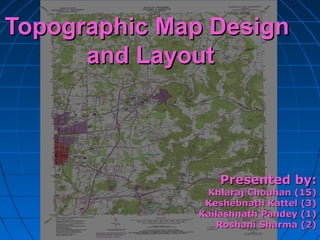
  • 1. Topographic Map DesignTopographic Map Design and Layoutand Layout Presented by:Presented by: Khlaraj Chouhan (15)Khlaraj Chouhan (15) Keshebnath Kattel (3)Keshebnath Kattel (3) Kailashnath Pandey (1)Kailashnath Pandey (1) Roshani Sharma (2)Roshani Sharma (2)
  • 2. Presentation OutlinesPresentation Outlines  Definition of topographic maps.Definition of topographic maps.  Contents of topographic maps.Contents of topographic maps.  Design ProcessDesign Process  Map LayoutMap Layout 09/08/1509/08/15 22
  • 3. What is a topographic map?What is a topographic map?  Topographic mapsTopographic maps are detailed, accurateare detailed, accurate graphic representations of features thatgraphic representations of features that appear on the Earth's surface. Theseappear on the Earth's surface. These features include: cultural: roads, buildings,features include: cultural: roads, buildings, urban development, railways, airports,urban development, railways, airports, names of places and geographic features,names of places and geographic features, administrative boundaries, state andadministrative boundaries, state and international borders, national parks andinternational borders, national parks and reserves etc.reserves etc. 09/08/1509/08/15 33
  • 4. Contents of Topographic MapsContents of Topographic Maps • Topographic maps contain informationTopographic maps contain information aboutabout  the elevation and the slope of the land.the elevation and the slope of the land.  Land use, Land cover, hydrographicLand use, Land cover, hydrographic featuresfeatures  Man made and cultural features (roads,Man made and cultural features (roads, buildings, cemeteriesbuildings, cemeteries 09/08/1509/08/15 44
  • 7. Other Topographic TermsOther Topographic Terms  Map scale – compares distances onMap scale – compares distances on the map with distances on earth.the map with distances on earth.  Legend – explains symbols used onLegend – explains symbols used on the map.the map.  Index contours – contour lines thatIndex contours – contour lines that are labeled to help you find theare labeled to help you find the contour interval.contour interval. 09/08/1509/08/15 77
  • 9. What do the colors on the topographicWhat do the colors on the topographic map represent?map represent?  General Thumb Rules:General Thumb Rules: • Blue lines/shapes - represent waterBlue lines/shapes - represent water features, such as streams and lakes.features, such as streams and lakes. • Brown – contour linesBrown – contour lines • Black – special buildings, railroads, otherBlack – special buildings, railroads, other man made objects.man made objects. • Green – Woodland areasGreen – Woodland areas • Red – Transportation layer, BuildingsRed – Transportation layer, Buildings • Yellow – cultivated landYellow – cultivated land 09/08/1509/08/15 99
  • 10. Now that I know what a topographicNow that I know what a topographic map is, how do I read it?map is, how do I read it?  First determine the contour intervalFirst determine the contour interval (the distance between each contour(the distance between each contour line)line)  Then determine the map scaleThen determine the map scale (usually at the bottom of the map)(usually at the bottom of the map)  Identify any hills or depressionsIdentify any hills or depressions  Use the legend to identify man madeUse the legend to identify man made features.features. 09/08/1509/08/15 1010
  • 11. CARTOGRAPHIC DESIGNCARTOGRAPHIC DESIGN  Cartographic design involvesCartographic design involves • Conceptualization of the mapConceptualization of the map • Visualization of the mapVisualization of the map • Construction of the mapConstruction of the map  is an “art” to good map designis an “art” to good map design  Is a partly mental, partlyIs a partly mental, partly physical process in which mapsphysical process in which maps are conceived (Imagine) andare conceived (Imagine) and created.created. 09/08/1509/08/15 1111
  • 12. Mapmakers need to understand…Mapmakers need to understand…  The objective of the map (the message)The objective of the map (the message)  The people who may use the map (theThe people who may use the map (the audience)audience)  The data that will be displayed in the mapThe data that will be displayed in the map (the information available)(the information available)  graphics displaying (software or manual)graphics displaying (software or manual)  The final format of the product (printed orThe final format of the product (printed or digital)digital) 09/08/1509/08/15 1212
  • 13. The medium is the informationThe medium is the information  PaperPaper (b/w or colour) (CMYK)(b/w or colour) (CMYK)  FilmFilm  MylarMylar  Monitor (RGB)Monitor (RGB)  ProjectionProjection  Broadcast TVBroadcast TV  THE DISPLAY IS PART OF THETHE DISPLAY IS PART OF THE SYMBOLIZATIONSYMBOLIZATION09/08/1509/08/15 1313
  • 14. Design ProcessDesign Process  Involves a series of operations.Involves a series of operations.  It is convenient to break thisIt is convenient to break this sequence into three stages: Firstsequence into three stages: First stage, Second stage and Third stage.stage, Second stage and Third stage. 09/08/1509/08/15 1414
  • 15. First StageFirst Stage  Several acceptable solutions are possible forSeveral acceptable solutions are possible for graphic visualization and symbolization.graphic visualization and symbolization.  The best result is a general design planThe best result is a general design plan  ““Good design is simply the best solutionGood design is simply the best solution among many, given a set of constraintsamong many, given a set of constraints imposed by the problem” (Dent 1999)imposed by the problem” (Dent 1999) 09/08/1509/08/15 1515
  • 16. Second StageSecond Stage  Develop specific graphic planDevelop specific graphic plan  analyzing various alternatives and chooseanalyzing various alternatives and choose the best one.the best one.  Decide on kinds of symbolism, number ofDecide on kinds of symbolism, number of classes and class limits, color use,classes and class limits, color use, typographical relationships etc.typographical relationships etc.  You have made all but minor decisions inYou have made all but minor decisions in this stage.this stage. 09/08/1509/08/15 1616
  • 17. Third StageThird Stage  Preparation of detail specifications for mapPreparation of detail specifications for map construction (automated or manual)construction (automated or manual) • About symbols, line weights, colors, letteringAbout symbols, line weights, colors, lettering sizes etc.sizes etc.  Specifications: all the processes involvedSpecifications: all the processes involved in map construction.in map construction. 09/08/1509/08/15 1717
  • 18. Design PrinciplesDesign Principles 1.1. LegibilityLegibility 2.2. Visual ContrastVisual Contrast 3.3. Figure-groundFigure-ground 4.4. Hierarchical structureHierarchical structure 5.5. BalanceBalance 09/08/1509/08/15 1818
  • 19. LegibilityLegibility  easy to read and understand. (symbols)easy to read and understand. (symbols)  Clearly visible. (Size, color, line weight)Clearly visible. (Size, color, line weight)  Identify them clearly.Identify them clearly.  Not be confusing. (symbol, line, shape)Not be confusing. (symbol, line, shape)  clearly distinguishable. (used size, colors,clearly distinguishable. (used size, colors, patterns to differentiate)patterns to differentiate)  Not, too small or too big. (Symbols)Not, too small or too big. (Symbols)  contrasting colors and shapescontrasting colors and shapes 09/08/1509/08/15 1919
  • 20. Inappropriate Contrast Appropriate Contrast Visual ContrastVisual Contrast 09/08/1509/08/15 2020
  • 21. Example of goodExample of good line contrastline contrast Example of poor line contrast Visual ContrastVisual Contrast 09/08/1509/08/15 2121
  • 22. Visual ContrastVisual Contrast Line weight Pattern Shading Hue HUE INTENSITYINTENSITY SATURATION 09/08/1509/08/15 2222
  • 23. Figure-Ground OrganizationFigure-Ground Organization  Separation figure and map backgroundSeparation figure and map background clearly.clearly.  It is natural and fundamental characteristicsIt is natural and fundamental characteristics of graphic map design.of graphic map design.  Differentiation (shape, size, color)  Closed forms  Familiarity  Lightness  Detail  Size (small and big size of area feature) 09/08/1509/08/15 2323
  • 24. Figure ‘floating’Figure ‘floating’ on top onon top on GroundGround SuperimpositionSuperimposition draws attention todraws attention to FigureFigure Figure-Ground OrganizationFigure-Ground Organization 09/08/1509/08/15 2424
  • 25. Lack of contrast resultingLack of contrast resulting in poor figure-groundin poor figure-ground perceptionperception Better contrast resulting in good figure-ground perception Figure-Ground OrganizationFigure-Ground Organization 09/08/1509/08/15 2525
  • 26. Hierarchical organization (visual hierarchy)Hierarchical organization (visual hierarchy)  “separate meaningful characteristics and to portray likenesses, differences, and interrelationships” (Robinson, 1995).  ContrastContrast • Line character and weightLine character and weight • TextureTexture • ValueValue • DetailDetail • ColorColor • TextText 09/08/1509/08/15 2626
  • 27. Name Placement and AttributesName Placement and Attributes  Need to consider the most effectiveNeed to consider the most effective way of positioning type on a mapway of positioning type on a map • Labeling Point SymbolsLabeling Point Symbols • Labeling Linear FeaturesLabeling Linear Features • Labeling AreasLabeling Areas • Title and Legend textTitle and Legend text • Other informationOther information 09/08/1509/08/15 2727 BalanceBalance
  • 28. Text: Selection and PlacementText: Selection and Placement Dhulikhel BM 232 UK Marga 200 La k e M u d POINT LINE AREA CA NV 09/08/1509/08/15 2828
  • 29. Map layoutMap layout  for presentation maps, some conventions on whatfor presentation maps, some conventions on what to include:to include: • a title (or caption). clearly state what the map shows.a title (or caption). clearly state what the map shows. plus relevant date of data, sources, author, contactplus relevant date of data, sources, author, contact info, etc.info, etc. • a legend, so any reader can interpret the content ofa legend, so any reader can interpret the content of the map. meaning of all symbol and coloursthe map. meaning of all symbol and colours • scale indication. translates distance on the map toscale indication. translates distance on the map to distance on the grounddistance on the ground • orientation indication (the good old north arrow)orientation indication (the good old north arrow) • borders and neat lines, grid and graticule valueborders and neat lines, grid and graticule value  these conventions are truly follow or broken!these conventions are truly follow or broken! 09/08/1509/08/15 2929
  • 30. 3030 Basic Map ElementsBasic Map Elements The Development regions of Nepal Scale 1: 500, 000 Modified Universal Transverse Mercator Projection This map is produced in 1995 by Survey Department, Nepal 0 41 2 3 hundreds of kilometers Legend Map Scale Graphical Scale Inset Map Projection Neat line Border Title Central Development region. Map Index A B Map Scale Representative Fraction Map Body North Arrow Bibliographic information
  • 31. Optical Center vs. Geometric CenterOptical Center vs. Geometric Center Optical Center Geometric Center Balance and centreBalance and centre 09/08/1509/08/15 3131
  • 34. Map Design PrinciplesMap Design Principles  Understanding of user requirements  Consideration of display format  A clear visual hierarchy  Simplicity 3434 German designer, Dieter Rams 09/08/1509/08/15
  • 35.  Legibility  Consistency  Accessibility  Good composition 3535 German designer, Dieter Rams Map Design PrinciplesMap Design Principles 09/08/1509/08/15
  • 36.  What is the goal of the map? (Purpose)What is the goal of the map? (Purpose)  Who will read the map? (Audience)Who will read the map? (Audience)  Where will the map be used?Where will the map be used? (Condition of use)(Condition of use)  What data is available for the composition ofWhat data is available for the composition of the map? (Available Data)the map? (Available Data)  What resources are available in terms ofWhat resources are available in terms of both time and equipment?both time and equipment?  What is the scale of map? (level of detail)What is the scale of map? (level of detail)  What is the shape and size of area? ( GroundWhat is the shape and size of area? ( Ground Reality)Reality) Factors Influencing Map DesignFactors Influencing Map Design 09/08/1509/08/15 3636
  • 38. Thank you !!!Thank you !!! 09/08/1509/08/15 3838

Editor's Notes

  1. Soft Copy vs Hard Copy Maps, CRT vs paper Red/Green/Blue (RGB) screen emitted Hue/Saturation/Value (HSV) for custom colors Cyan/Magenta/Yellow/Black (CYMK) paper reflective
  2. Map purpose, Children, Old man, General public, Skilled man power, field or laboratory, at normal reading distance or wall displays, under sunlight or artificial light positional accuracy and timeliness, completeness Computer, hardware software, Manual pen, paper, ink Ground reality: very long narrow strip area Chile, Small area