Downloaded 829 times


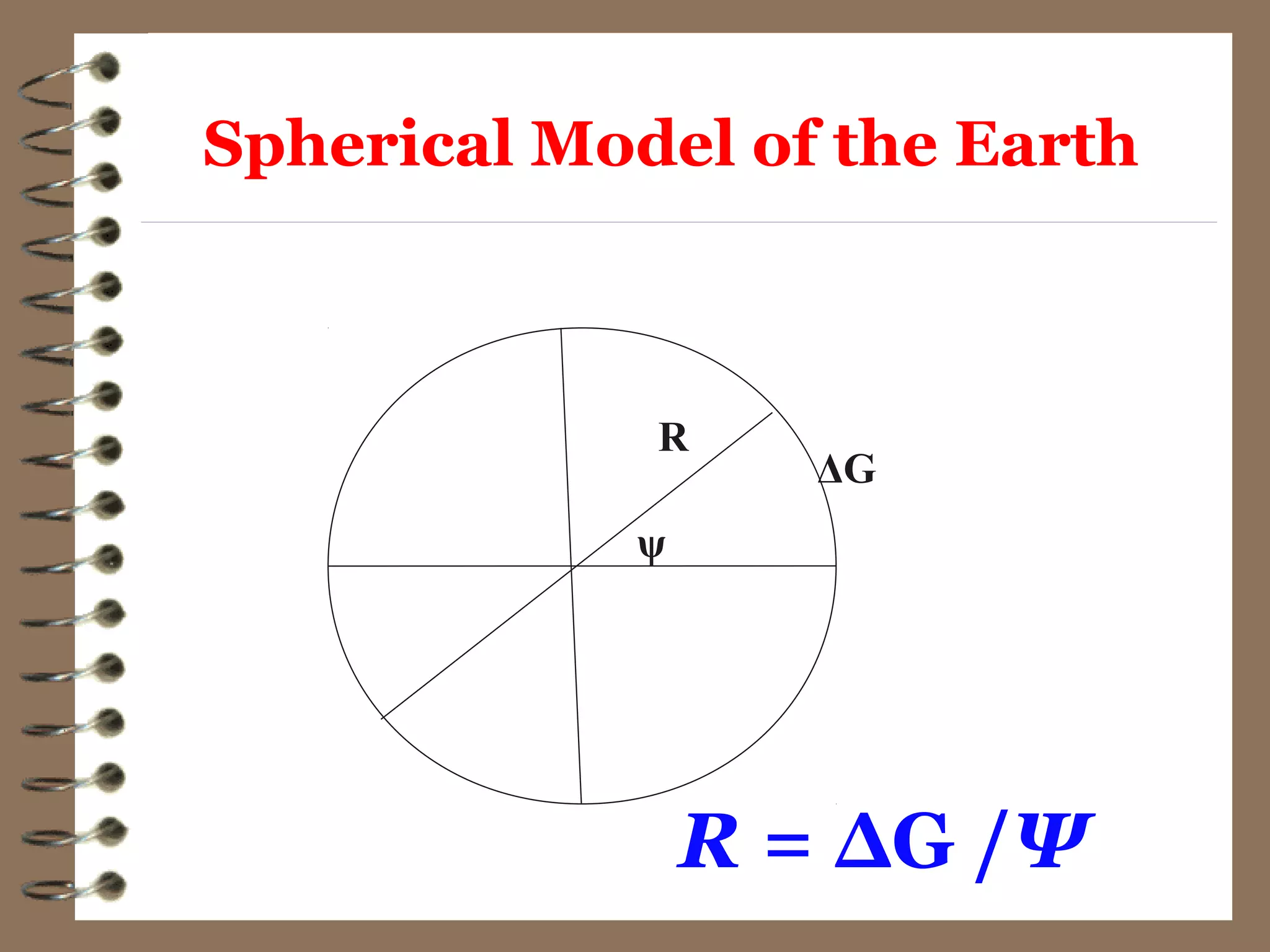
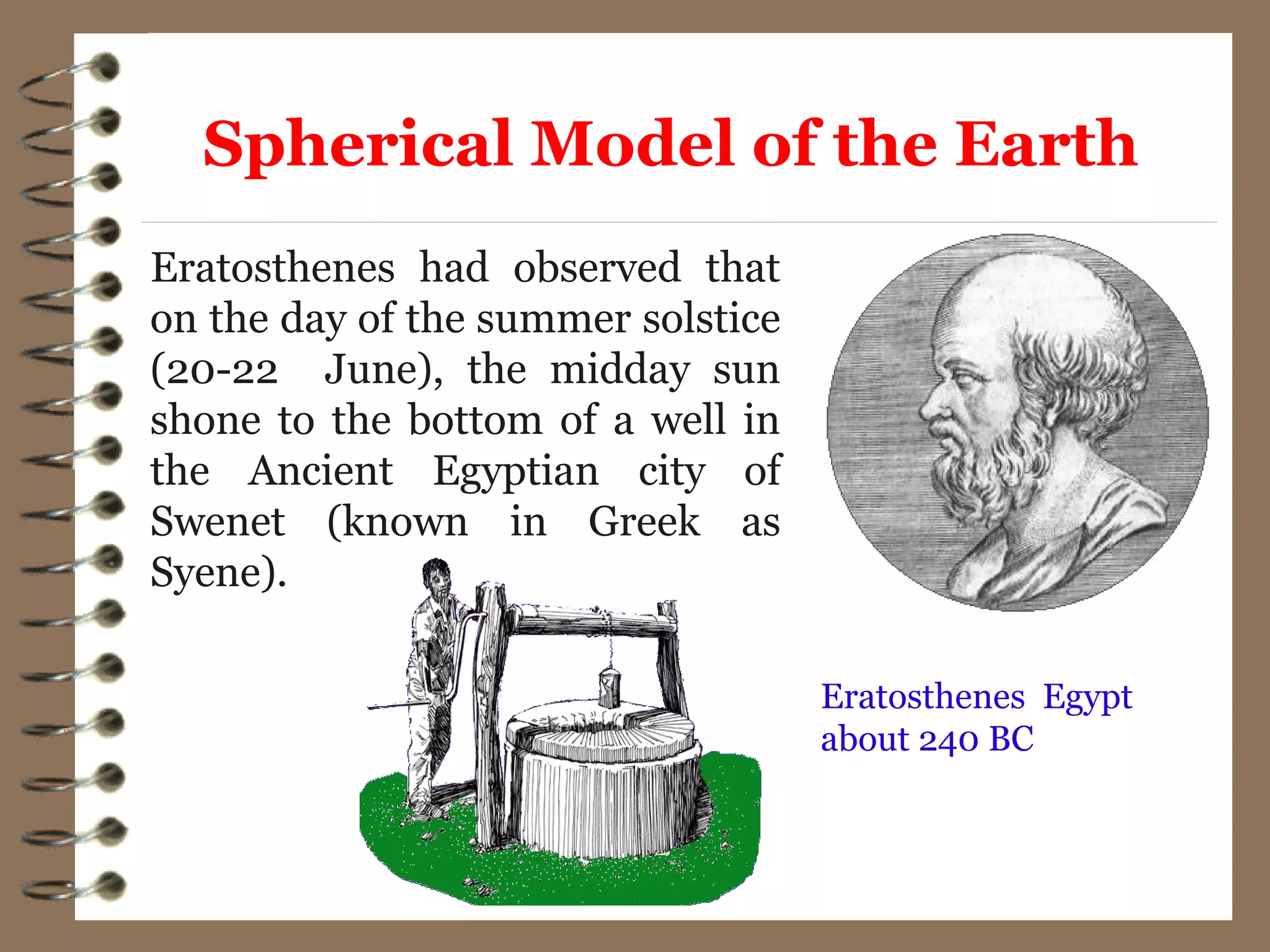
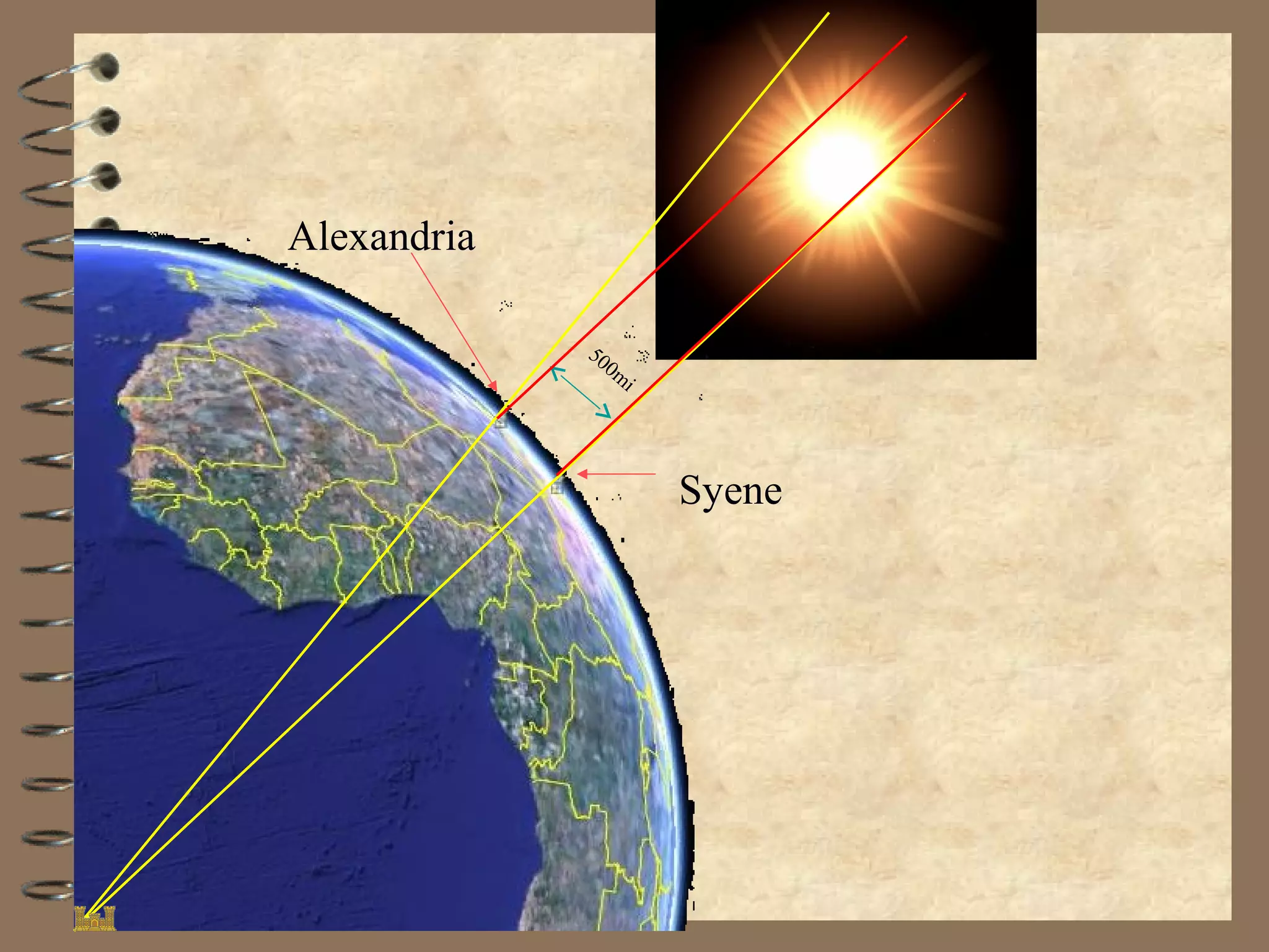
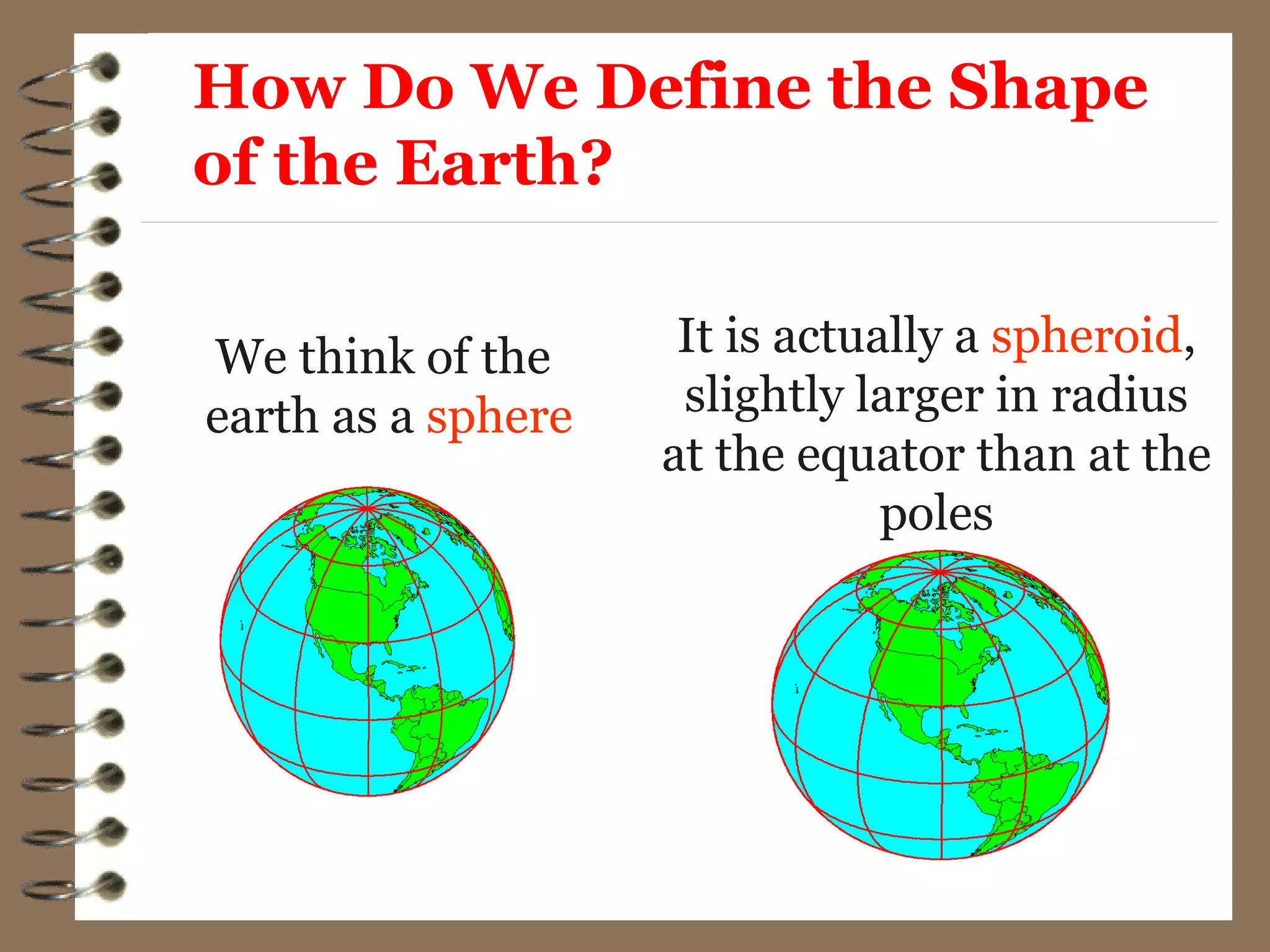
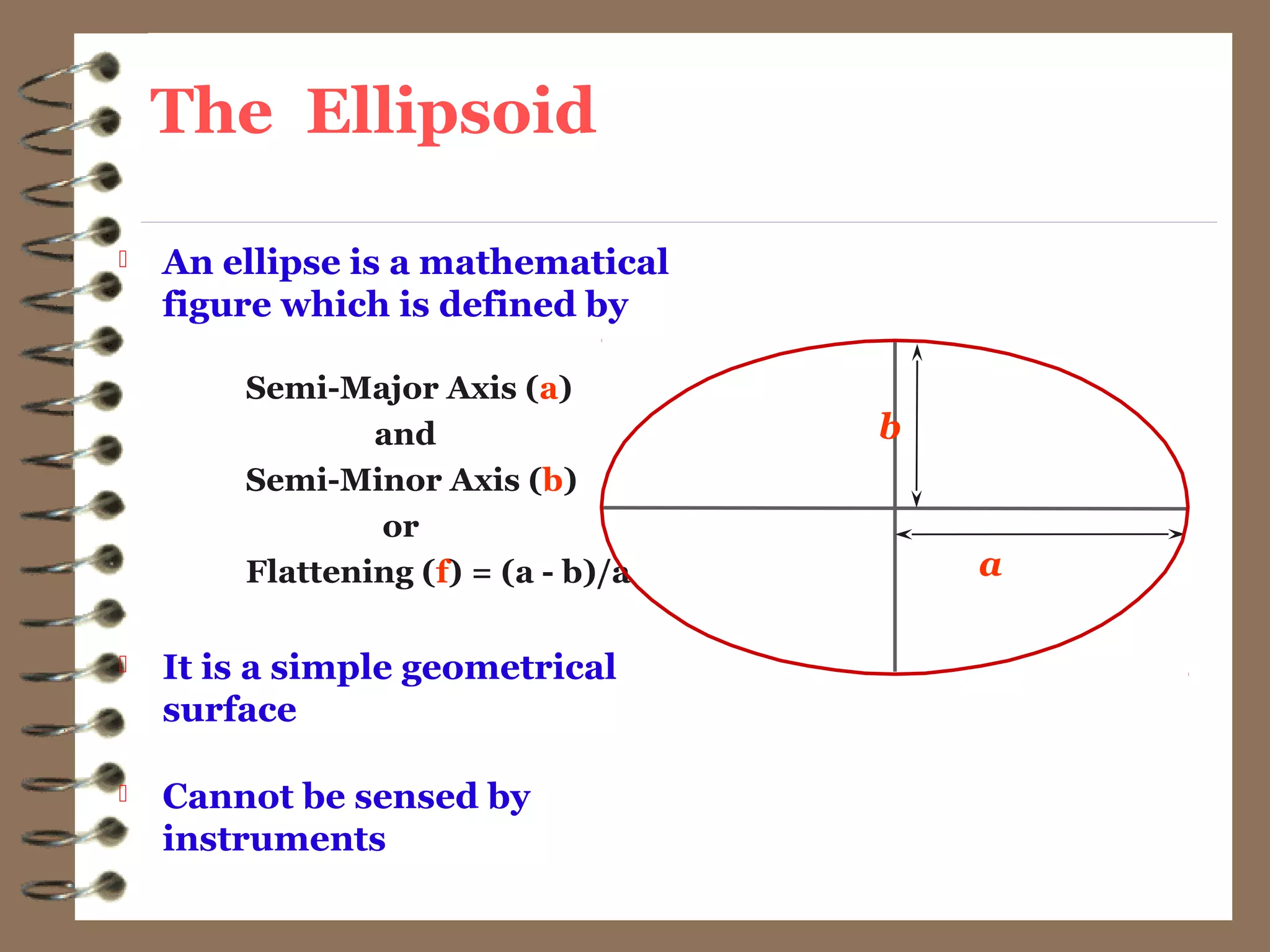
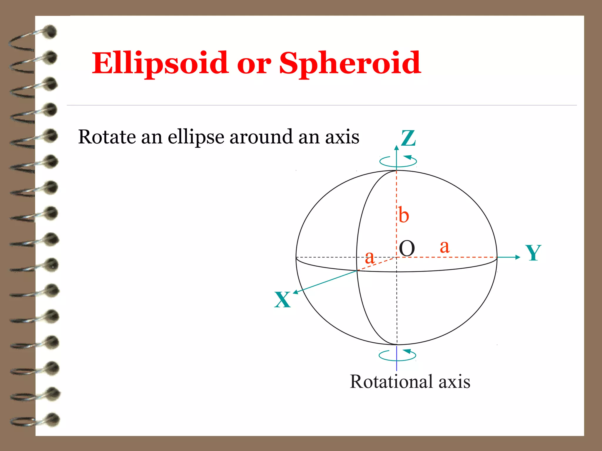
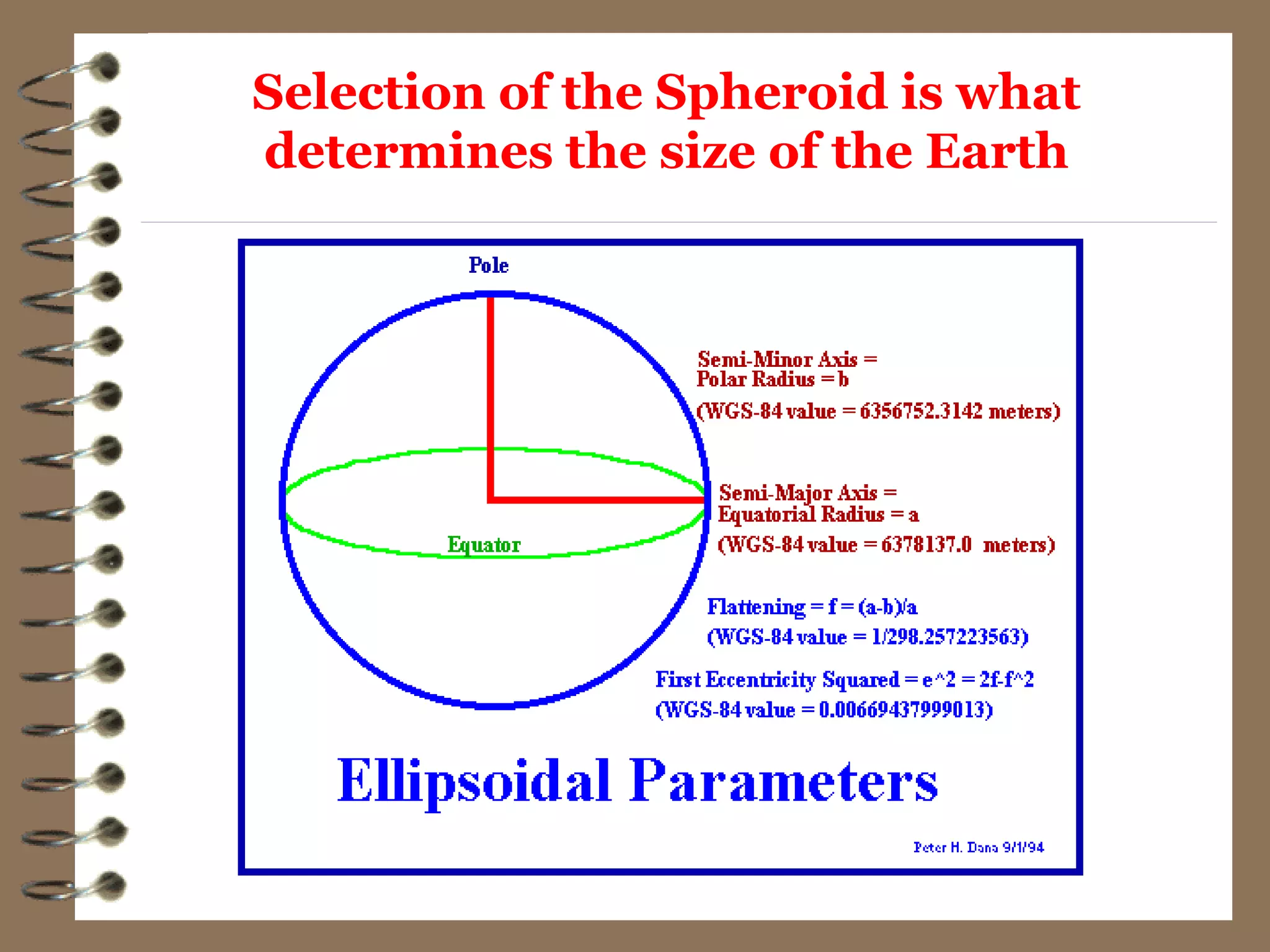
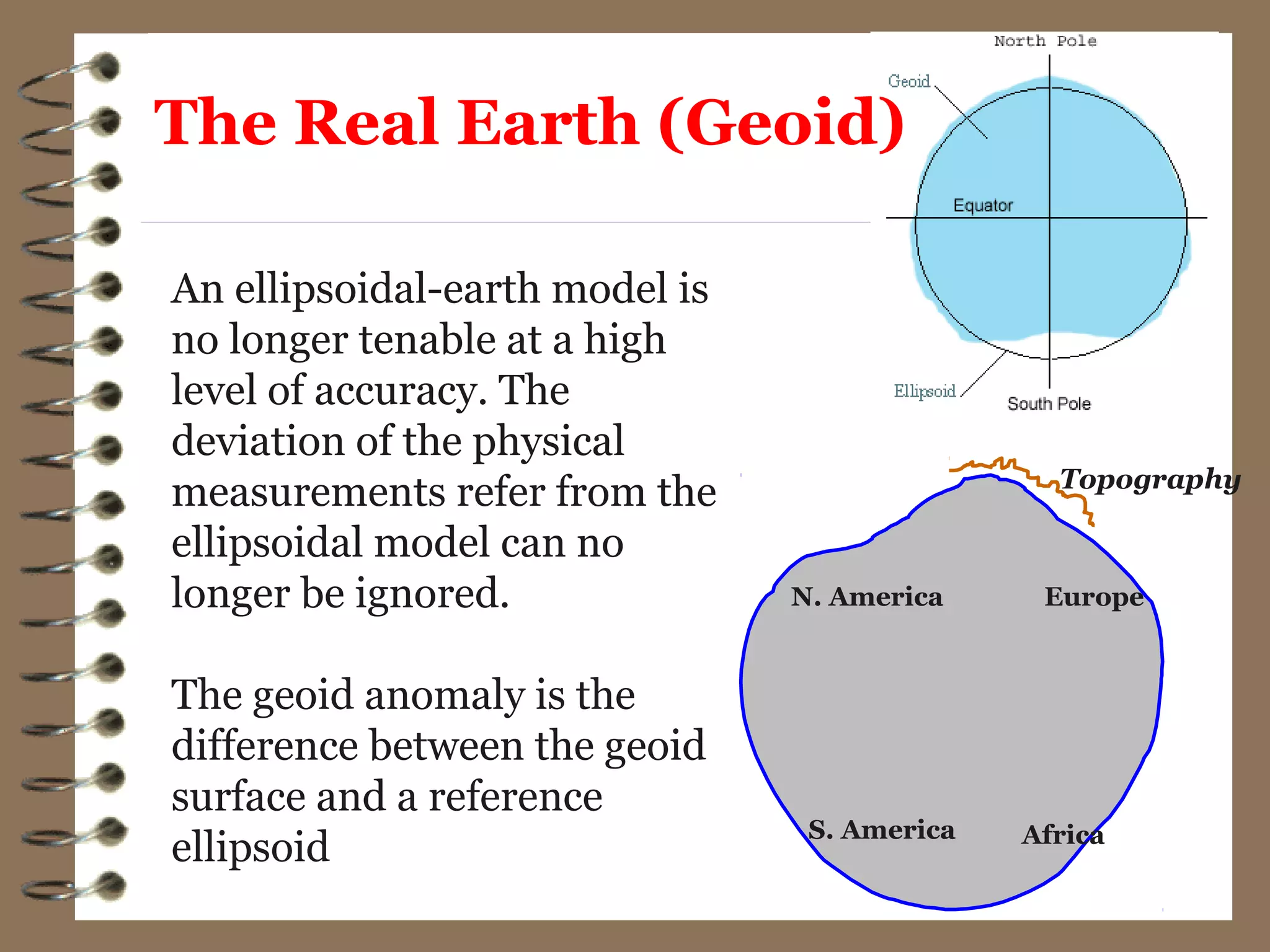
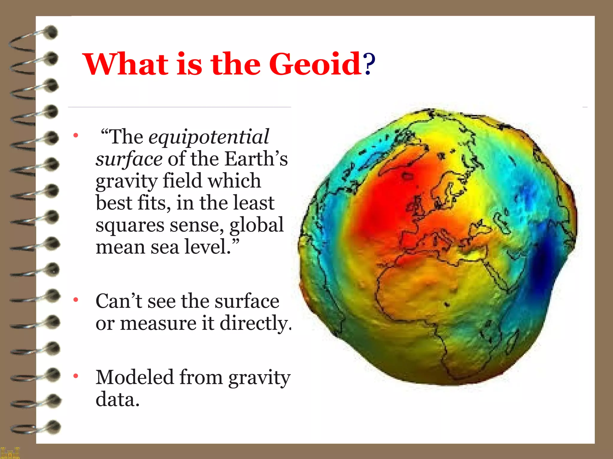

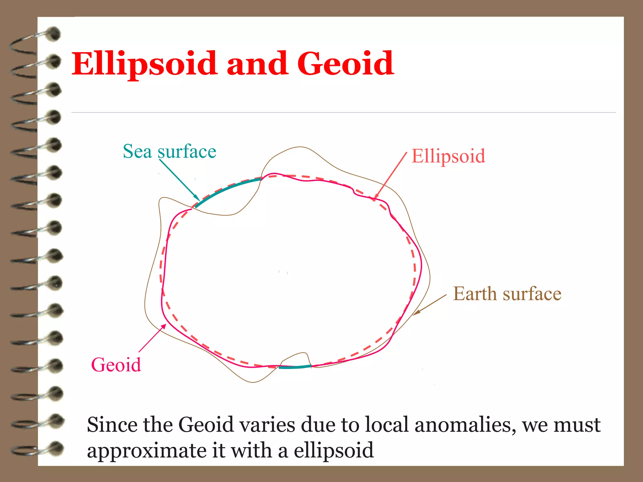
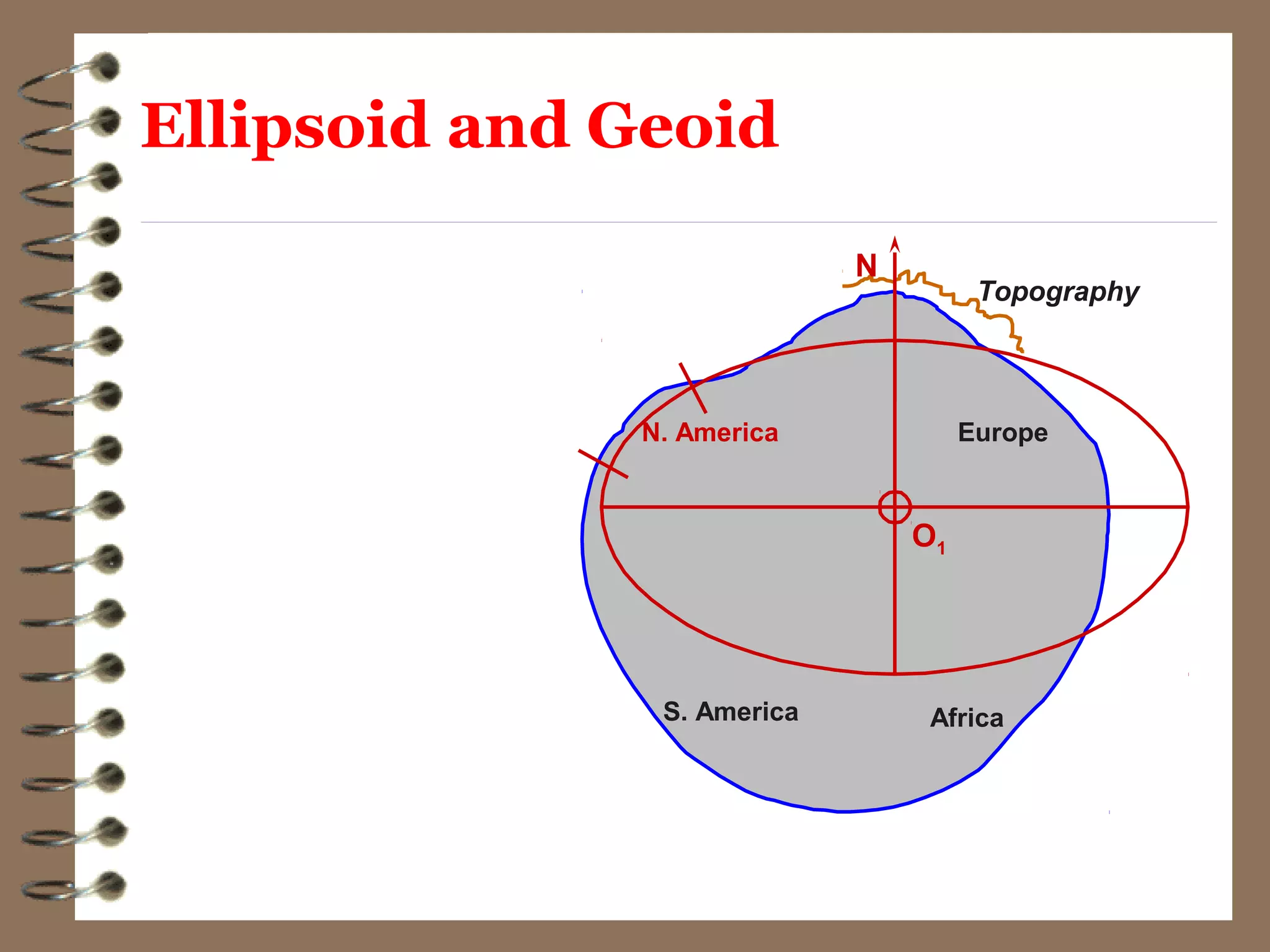
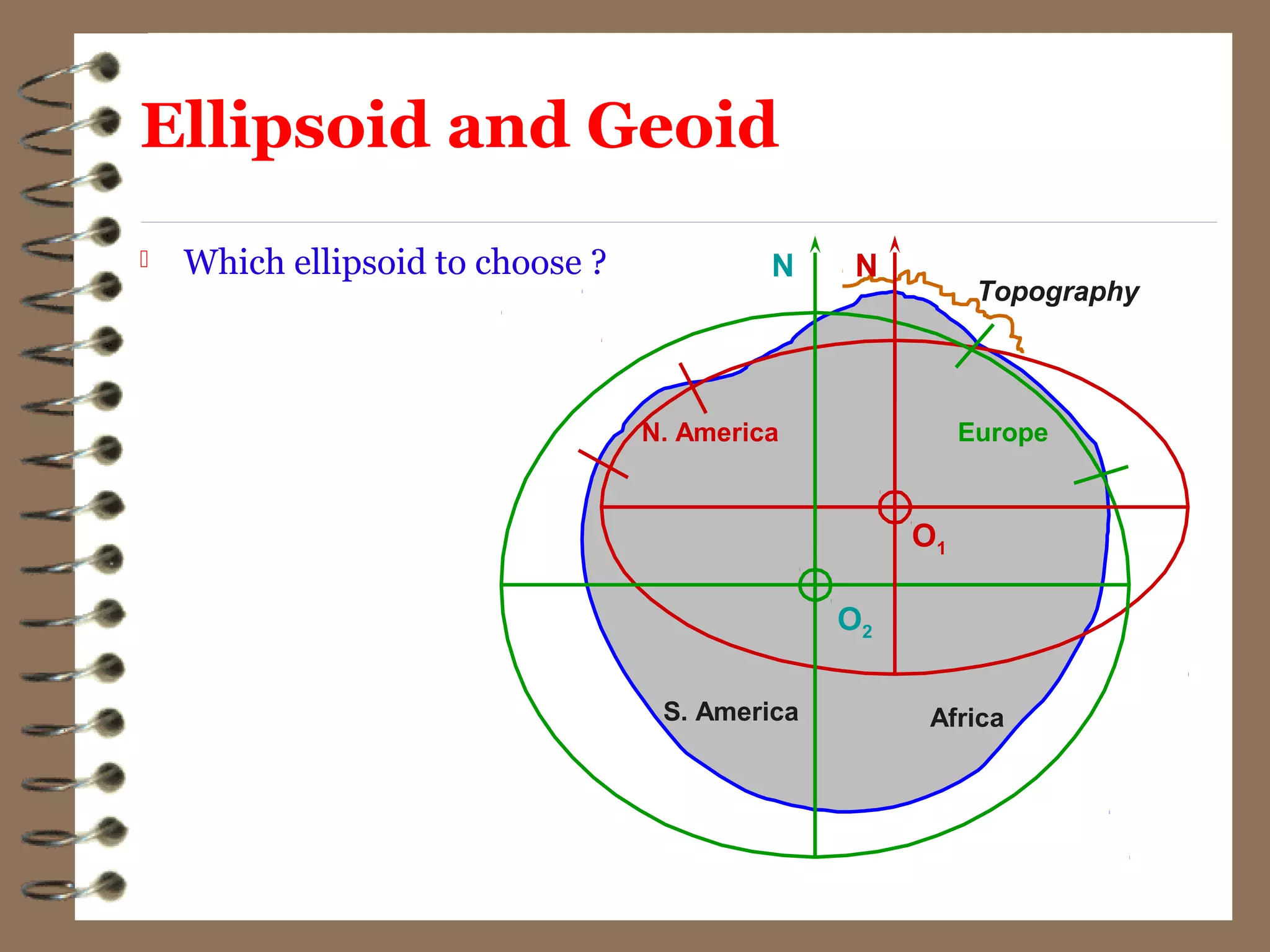
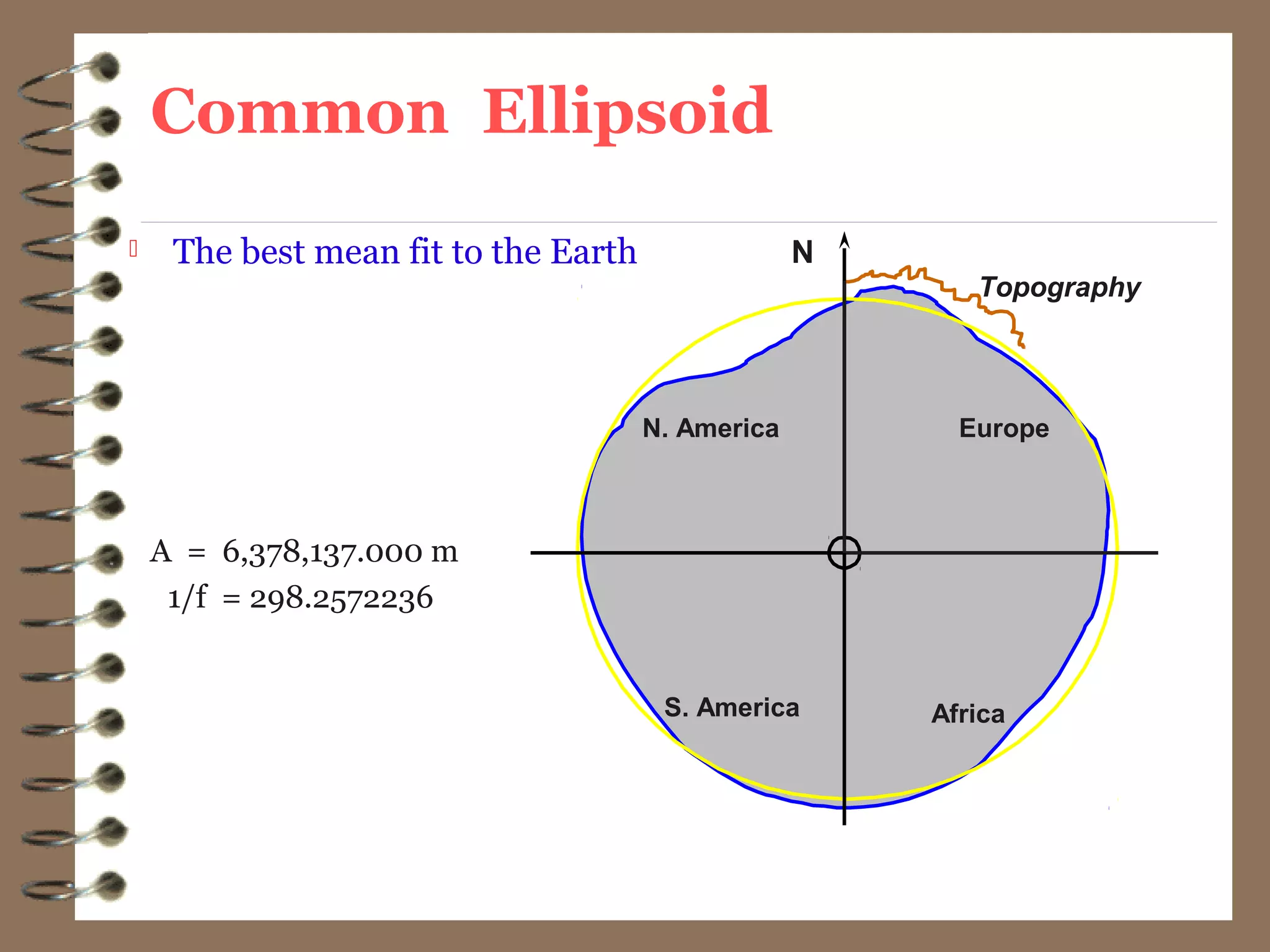

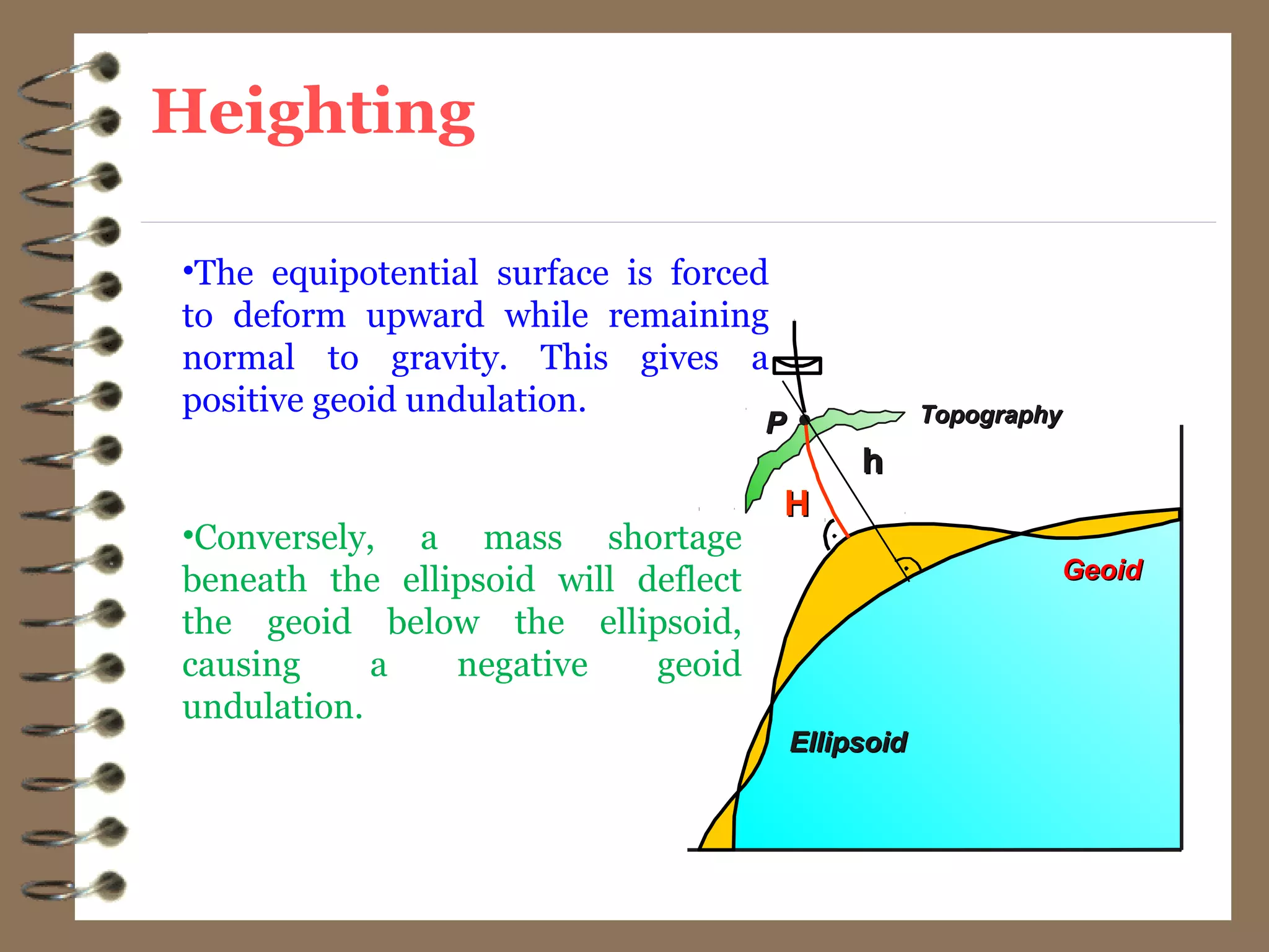
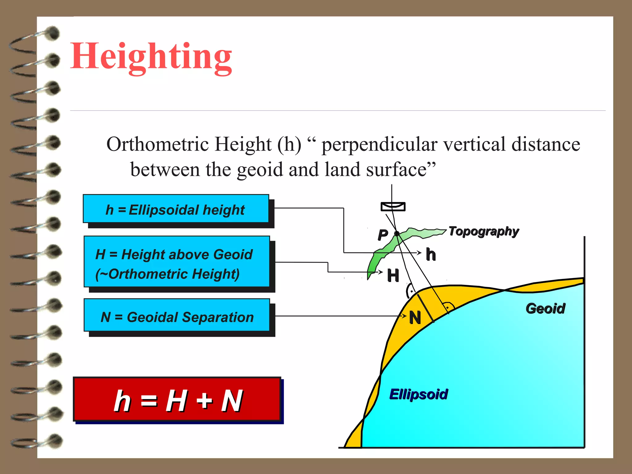
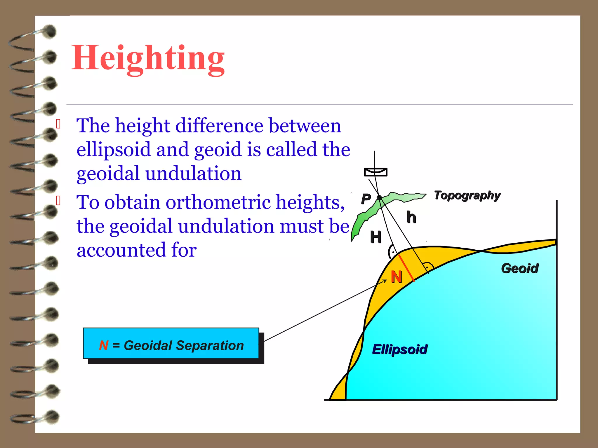
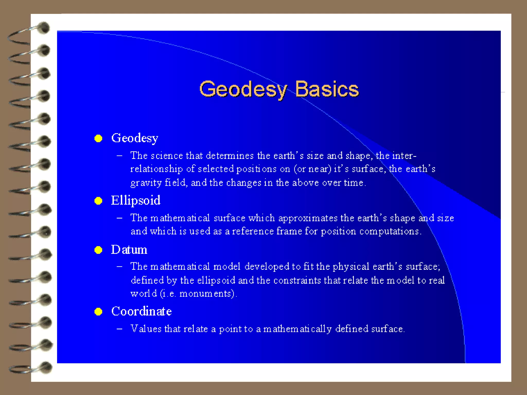

1) Geodesy is the science of measuring and mapping the Earth's surface, including determining its shape, size, and gravity field. 2) Early Greek scholar Eratosthenes used simple observations and geometry to estimate the circumference of Earth to within 1% accuracy over 2000 years ago. 3) While the Earth is approximated as an oblate spheroid, its true shape, called the geoid, is irregular due to density variations underground. Precise positioning and heights require accounting for geoid undulations.