Coal fields Lidar Update (2010)
•Download as PPT, PDF•
0 likes•259 views

1) West Virginia collected LiDAR data in 2010 over coal fields with a horizontal posting of 1 meter and vertical accuracy of 15 centimeters. 2) The initial area of interest was about 5 million acres covering 33% of the state, and as of November 2010 around 2.5 million acres had been collected. 3) An isolated computing island was built with three high performance computers to process the large LiDAR data files without disruptions.
Report
Share
Report
Share
![LiDAR collection specifications ,[object Object],[object Object],[object Object],[object Object],[object Object],[object Object],[object Object],[object Object],Slide](data:image/gif;base64,R0lGODlhAQABAIAAAAAAAP///yH5BAEAAAAALAAAAAABAAEAAAIBRAA7)
Recommended
RAW GNSS in Android Nugat
This document discusses Android's new GNSS API in version 24+, which provides raw GNSS data and enables more accurate positioning than previous APIs. It notes that while Google has released MATLAB code to work with this raw data, a Python library does not yet exist. The goal is to create an open-source Python library that abstracts calculations and can be used across various domains like data science, development, and research to improve positioning in areas like urban environments.
Salt Lake Solar Ignite
Presentation on Salt Lake City Solar Energy Modeling project done in partnership with Utah Clean Energy and the Automated Geographic Reference Center (done in the style of Ignite lightning talks, with a bit of cheating).
2nd Galileo Android Hackathon intro
This document introduces GNSS raw measurements that are available on Android smartphones through the android.location API. It discusses two main GNSS APIs - android.gms.location which simplifies positioning for applications but focuses on battery life, and android.location which gives access to more detailed GNSS observations at the cost of increased battery usage. Applications that could make use of raw GNSS measurements on smartphones include crowdsourcing, low-cost reference networks, and improving positioning in urban areas. Sample code is provided showing how to access raw observations and calculate a position from them.
Android GNSS in Nutshell
Presentation for the online webminar 28th April for the 2017 GSA Hackathon Gdansk, https://attendee.gotowebinar.com/register/1617992215537013763
Wherecamp Berlin Introduction to RAW GNSS Measurements
Wherecamp Berlin Introduction to RAW GNSS Measurements Galileo - By Lukasz Bonenberg , Nottingham University - 3/11/2016 Berlin
MyGalileo
Report Out: Smart Eco-Districts DC
This document summarizes a project to develop smart eco-districts in Washington DC using Internet of Things sensors. The project would scale an existing smart city project on Pennsylvania Avenue to connect four eco-districts with an open data system. In phase one, the plan is to add environmental sensor arrays to the Pennsylvania Avenue project and develop a sensor array prototype. In phase two, the goal is to complete pilot smart eco-district projects in each district, deploy an open data hub, and establish a sensor developer program for students.
Pseudoranges from your Android smartphone
The latest version of Android, Nougat (v7.x), was released in late 2016, and offers access to raw GNSS measurements. Google demonstrated functionality to obtain Pseudoranges, Dopplers and Carrier Phase from a phone or tablet last September at the Institute of Navigation’s conference.
This seminar will explain the current API, hardware limitations and possible future advantages of this exciting new development. We will discuss data collection, raw measurements and demo processing example in Matlab and Python.
GDP presentation
The document discusses options for a constellation of satellites to support a European remote sensing mission with requirements for a 50-year lifetime in geostationary orbit. It analyzes potential applications like agriculture, weather, and disaster monitoring that would benefit European countries. Various constellation designs are considered, including options with two satellites, bistatic designs, and configurations with multiple coverage areas. Tradeoffs between different designs in aspects like complexity, imaging capability, and fuel needs are also discussed. Future work areas identified include studying repositioning operations and function handovers between satellites.
2012 Workshop, Introduction to LiDAR Workshop, Bruce Adey and Mark Stucky (Me...
The document provides an introduction to LiDAR technology and applications presented by GIS in the Rockies. It includes bios of the two presenters, an overview of the company Merrick & Company, and an agenda for the workshop covering LiDAR technology review, applications, data processing workflow, project planning, and Q&A. The workshop aims to educate attendees on airborne LiDAR data acquisition projects through a practical review of technical requirements and benefits of the technology.
A Scalable and Hybrid Cloud Framework for Evaluating Streams of Sensor Data i...
A Scalable and Hybrid Cloud Framework for Evaluating Streams of Sensor Data i...Gabriele Di Bernardo
Combining smartphone sensors and Internet-of-Things (IoT) enables new kinds of application scenarios. Cowbird is a framework that combines the evaluation of both smartphone sensors and IoT in the cloud. However, Cowbird does not scale well in large deployment contexts where thousands of IoT sensors can continuously generate high volumes of data that have to be processed. To this end, we extended Cowbird to support the sensing and evaluation of large streams of sensor data in real-time. We designed a distributed architecture based on the synergy of traditional computing systems and novel stream data processing technologies. The former is required for building a scalable IoT data sensing platform, while the latter are necessary for evaluating and processing large streams of sensor data. We show that in some conditions the data streams evaluation can be performed directly in the sensing platform. This approach avoids the introduction of extra costs and overheads caused by offloading the sensors data evaluation to a stream data processing engine.Geoverse Case Study: Using LiDAR to perform statewide inventory of sign assets
This document discusses a project by Greenman-Pedersen, Inc. (GPI) to use LiDAR technology to inventory all traffic signage along 14,000 lane miles of state-owned routes in Massachusetts. GPI proposed using high-resolution LiDAR and imagery collected from vehicles to extract sign data more efficiently than previous manual methods. GPI developed custom extraction software called HyRoad that integrates with the Geoverse point cloud visualization platform to allow navigating LiDAR data and extracting over 250,000 signs from over 50 terabytes of data. The project is currently over 40% complete.
Rankin LiDAR presentation
LiDAR uses laser light to rapidly create high-resolution 3D models of objects and terrain. It has largely replaced photogrammetry for topographic mapping due to its ability to collect data day or night and its direct measurement of ground surfaces. While public LiDAR datasets are useful for planning, private firms can benefit more from terrestrial and aerial LiDAR for detailed civil engineering and surveying projects. LiDAR allows rapid mapping of complex sites and piping networks to support master planning, grading, utilities, and other design work.
LiDAR Aided Decision Making
The document discusses the use of LiDAR (light detection and ranging) technology for various applications such as flood plain mapping, transportation infrastructure, forestry management, and more. It provides details on LiDAR accuracy standards, processing methods, and deliverable data formats. The presentation aims to help audiences understand how LiDAR data can aid in decision-making processes.
Lidar technology and it’s applications
The document discusses LIDAR technology and its applications. It provides an introduction to LIDAR, describing how it uses lasers to measure distance. Examples of applications discussed include traffic sign detection using LIDAR and camera fusion, forestry inventory using LIDAR to measure tree characteristics, and autonomous vehicles using LIDAR for obstacle detection. The document also covers advantages of LIDAR like high accuracy, fast data collection and lower costs compared to other methods.
LiDAR Data Processing and Classification
This document discusses techniques for interpreting point cloud and image data through automated algorithms that translate human visual interpretations. It describes popular approaches for processing LiDAR point clouds, including height-based segmentation to classify features above the ground and shape-fitting algorithms. It also discusses using spectral information through intensity values or image fusion. Finally, it examines developing "computer vision" tools that can segment data based on visual cues humans use like color, texture, morphology, context and defined shapes. The goal is to replicate human visual interpretation abilities through algorithms.
LiDAR and its application in civil engineering
The document discusses the use of LIDAR (Light Detection and Ranging) technology in civil engineering applications. It describes LIDAR's components, principles of operation, and its advantages over other remote sensing methods. Key applications mentioned include topographic and hydrographic surveying to generate digital terrain models, bridge clearance measurement, and sewer inspection. The document concludes that LIDAR offers highly accurate data collection with minimal human involvement.
LiDAR Expected Accuracy Presentation
This document discusses factors to consider when planning and conducting a LiDAR data acquisition project to ensure accurate results. It covers planning the flight path and sensor settings, conducting pre-flight control surveys, calibration procedures during data collection flights, and performing initial approximate processing checks of the raw GPS, IMU, and laser point data to validate data quality. The goal is to identify and address any issues early to help meet the desired level of positional and elevation accuracy.
LIDAR
LIDAR uses pulsed laser light to measure distance by illuminating targets and analyzing reflections. It can be used to create high-resolution 3D maps of physical features and is useful for applications in fields like agriculture, biology, engineering and law enforcement. LIDAR offers advantages over other mapping methods like higher accuracy, faster data collection and greater data density.
Lidar campaign & products 2014
Lidar technology uses laser pulses to measure distances to the ground and other surfaces. When the pulses return, the time of flight is used to calculate distances and generate precise 3D maps. Lidar data can be processed to classify points and extract terrain models ignoring vegetation and buildings. This allows generating high-resolution digital terrain models and other products for applications like urban planning and flood modeling. The document describes a 2014 lidar and image acquisition project over Cotonou, Benin where calibration points were surveyed and various terrain products were created from processing the lidar data.
Planet: Imaging Earth Every Day
Planet has the ambitious goal of imaging everywhere on earth once per day with a fleet of small satellites. Now with over 100 operational satellites, Planet is collecting over a hundred million square kilometers of remote sensing data every day and for the first time we are able to take actions based on the daily changes that we observe. In addition to this unique data set, Planet has taken an 'API-first' approach to distributing data, allowing our users to build their own applications or integrations directly on our platform services. Safe Software's own Planet transformer is a great example of this kind of integration, giving FME users easy access to Planet's growing archive of satellite imagery.
LiDAR
LiDAR is an active remote sensing technique that uses laser light to image objects. It was invented in the 1960s and became popular after being used on the Apollo 15 mission to map the moon's surface. LiDAR works by measuring the time it takes for a laser pulse to be reflected off an object and return, allowing it to create precise 3D models of surfaces and objects. It has numerous applications like terrain mapping, forestry, archaeology and more due to its speed, accuracy and ability to capture dense point cloud data without human involvement. While powerful lasers pose safety risks, LiDAR provides significant advantages over passive imaging and is an important remote sensing tool.
LIDAR
LIDAR uses laser light to measure distance by illuminating a target and analyzing the reflected light. It can be used to generate highly accurate 3D models of terrain, infrastructure, and other physical features. LIDAR systems consist of a laser, scanner, photodetector, and navigation components. LIDAR has various applications in fields like geography, archaeology, environment, and autonomous vehicles due to its ability to rapidly capture precise spatial data regardless of lighting conditions.
Introduction to lidar and its application
LiDAR acronym as Light Detection and Ranging is remote sensing technology having several technical and socialite advantages. This technology is basically used to make high resolution digital map to provide the real time data. This data can be processed and used to extract the useful information. A typical LIDAR system consists of three main components, a GPS system to provide position information, an INS unit for attitude determination, and a LASER system to provide range (distance) information between the LASER firing point and the ground point. In addition to range data, modern LIDAR systems can capture intensity images over the mapped area. Therefore, LIDAR is being more extensively used in mapping and GIS applications.
android.location - a tool for developers or GNSS researchers?
This document discusses how mobile devices navigate using location services and GNSS technology. It explains that current smartphone hardware is not perfectly accurate for location services, but that upcoming dual-frequency chipsets and external antennas could significantly improve accuracy. Additionally, it notes that location data raises privacy concerns and that sensors on mobile devices provide more context than just position alone. The talk recommends using the android.location library to access raw GNSS data and considers opportunities to think beyond just position to leverage the interconnected sensor capabilities of mobile devices.
BATHYMETRIC LIDAR
BATHYMETRIC LIDAR, Bathymetric Light Detection and Ranging (LiDAR) was designed to penetrate the water column and reach the stream bottom
LIDAR
Lidar is an acronym for light detection and ranging. It is an optical remote sensing technology that can measure the distance to, or other properties of a target by illuminating the target with light, often using pulses from a laser.
Applications of lidar technology
Lidar, or light detection and ranging, is a remote sensing technology that uses laser light to measure distances. It was originally developed in the 1960s and has various applications including agriculture, autonomous vehicles, geology, atmospheric science, mining, space exploration, surveying, and planetary science. For example, lidar allowed NASA to create highly accurate topographic maps of Mars through the Mars Orbiter Laser Altimeter mission.
Introduction to LiDAR presentation.
LIDAR is a remote sensing technology that uses laser pulses to measure distances to surfaces. It can generate highly accurate 3D models of terrain and other physical features. LIDAR data consists of a dense cloud of elevation points that can be used to create digital elevation models, contour maps, and other products. Advances in GPS, laser, and inertial measurement technologies have made airborne LIDAR capable of collecting millions of elevation points per second with sub-meter horizontal and 15-30 cm vertical accuracy. LIDAR data has many applications for mapping forests, urban areas, watersheds and other landscapes.
Monongalia County GIS Implementation (3Nov2011)
Implementation of GIS in Monongalia County. Presented by Michael Paugh, GIS Analyst, Monongalia Planning Commission at WVAGP meeting on 3 Nov 2011.
WVAGP/EPan GIS Event Agenda 2011
This document provides an agenda for a two-day GIS conference taking place on June 14-15, 2011 at the US Fish and Wildlife Service's National Conservation Training Center in Shepherdstown, West Virginia. Day 1 includes hands-on training sessions on coordinate systems, ArcGIS 10, internet mapping, and census data. Day 2 consists of presentations on linking databases, remote sensing, ArcGIS parcel tools, and the West Virginia GeoExplorer project, followed by a business meeting. Breaks and lunches are provided each day. An evening social is scheduled for Day 1. Lodging information and maps of the area are also included.
More Related Content
What's hot
2012 Workshop, Introduction to LiDAR Workshop, Bruce Adey and Mark Stucky (Me...
The document provides an introduction to LiDAR technology and applications presented by GIS in the Rockies. It includes bios of the two presenters, an overview of the company Merrick & Company, and an agenda for the workshop covering LiDAR technology review, applications, data processing workflow, project planning, and Q&A. The workshop aims to educate attendees on airborne LiDAR data acquisition projects through a practical review of technical requirements and benefits of the technology.
A Scalable and Hybrid Cloud Framework for Evaluating Streams of Sensor Data i...
A Scalable and Hybrid Cloud Framework for Evaluating Streams of Sensor Data i...Gabriele Di Bernardo
Combining smartphone sensors and Internet-of-Things (IoT) enables new kinds of application scenarios. Cowbird is a framework that combines the evaluation of both smartphone sensors and IoT in the cloud. However, Cowbird does not scale well in large deployment contexts where thousands of IoT sensors can continuously generate high volumes of data that have to be processed. To this end, we extended Cowbird to support the sensing and evaluation of large streams of sensor data in real-time. We designed a distributed architecture based on the synergy of traditional computing systems and novel stream data processing technologies. The former is required for building a scalable IoT data sensing platform, while the latter are necessary for evaluating and processing large streams of sensor data. We show that in some conditions the data streams evaluation can be performed directly in the sensing platform. This approach avoids the introduction of extra costs and overheads caused by offloading the sensors data evaluation to a stream data processing engine.Geoverse Case Study: Using LiDAR to perform statewide inventory of sign assets
This document discusses a project by Greenman-Pedersen, Inc. (GPI) to use LiDAR technology to inventory all traffic signage along 14,000 lane miles of state-owned routes in Massachusetts. GPI proposed using high-resolution LiDAR and imagery collected from vehicles to extract sign data more efficiently than previous manual methods. GPI developed custom extraction software called HyRoad that integrates with the Geoverse point cloud visualization platform to allow navigating LiDAR data and extracting over 250,000 signs from over 50 terabytes of data. The project is currently over 40% complete.
Rankin LiDAR presentation
LiDAR uses laser light to rapidly create high-resolution 3D models of objects and terrain. It has largely replaced photogrammetry for topographic mapping due to its ability to collect data day or night and its direct measurement of ground surfaces. While public LiDAR datasets are useful for planning, private firms can benefit more from terrestrial and aerial LiDAR for detailed civil engineering and surveying projects. LiDAR allows rapid mapping of complex sites and piping networks to support master planning, grading, utilities, and other design work.
LiDAR Aided Decision Making
The document discusses the use of LiDAR (light detection and ranging) technology for various applications such as flood plain mapping, transportation infrastructure, forestry management, and more. It provides details on LiDAR accuracy standards, processing methods, and deliverable data formats. The presentation aims to help audiences understand how LiDAR data can aid in decision-making processes.
Lidar technology and it’s applications
The document discusses LIDAR technology and its applications. It provides an introduction to LIDAR, describing how it uses lasers to measure distance. Examples of applications discussed include traffic sign detection using LIDAR and camera fusion, forestry inventory using LIDAR to measure tree characteristics, and autonomous vehicles using LIDAR for obstacle detection. The document also covers advantages of LIDAR like high accuracy, fast data collection and lower costs compared to other methods.
LiDAR Data Processing and Classification
This document discusses techniques for interpreting point cloud and image data through automated algorithms that translate human visual interpretations. It describes popular approaches for processing LiDAR point clouds, including height-based segmentation to classify features above the ground and shape-fitting algorithms. It also discusses using spectral information through intensity values or image fusion. Finally, it examines developing "computer vision" tools that can segment data based on visual cues humans use like color, texture, morphology, context and defined shapes. The goal is to replicate human visual interpretation abilities through algorithms.
LiDAR and its application in civil engineering
The document discusses the use of LIDAR (Light Detection and Ranging) technology in civil engineering applications. It describes LIDAR's components, principles of operation, and its advantages over other remote sensing methods. Key applications mentioned include topographic and hydrographic surveying to generate digital terrain models, bridge clearance measurement, and sewer inspection. The document concludes that LIDAR offers highly accurate data collection with minimal human involvement.
LiDAR Expected Accuracy Presentation
This document discusses factors to consider when planning and conducting a LiDAR data acquisition project to ensure accurate results. It covers planning the flight path and sensor settings, conducting pre-flight control surveys, calibration procedures during data collection flights, and performing initial approximate processing checks of the raw GPS, IMU, and laser point data to validate data quality. The goal is to identify and address any issues early to help meet the desired level of positional and elevation accuracy.
LIDAR
LIDAR uses pulsed laser light to measure distance by illuminating targets and analyzing reflections. It can be used to create high-resolution 3D maps of physical features and is useful for applications in fields like agriculture, biology, engineering and law enforcement. LIDAR offers advantages over other mapping methods like higher accuracy, faster data collection and greater data density.
Lidar campaign & products 2014
Lidar technology uses laser pulses to measure distances to the ground and other surfaces. When the pulses return, the time of flight is used to calculate distances and generate precise 3D maps. Lidar data can be processed to classify points and extract terrain models ignoring vegetation and buildings. This allows generating high-resolution digital terrain models and other products for applications like urban planning and flood modeling. The document describes a 2014 lidar and image acquisition project over Cotonou, Benin where calibration points were surveyed and various terrain products were created from processing the lidar data.
Planet: Imaging Earth Every Day
Planet has the ambitious goal of imaging everywhere on earth once per day with a fleet of small satellites. Now with over 100 operational satellites, Planet is collecting over a hundred million square kilometers of remote sensing data every day and for the first time we are able to take actions based on the daily changes that we observe. In addition to this unique data set, Planet has taken an 'API-first' approach to distributing data, allowing our users to build their own applications or integrations directly on our platform services. Safe Software's own Planet transformer is a great example of this kind of integration, giving FME users easy access to Planet's growing archive of satellite imagery.
LiDAR
LiDAR is an active remote sensing technique that uses laser light to image objects. It was invented in the 1960s and became popular after being used on the Apollo 15 mission to map the moon's surface. LiDAR works by measuring the time it takes for a laser pulse to be reflected off an object and return, allowing it to create precise 3D models of surfaces and objects. It has numerous applications like terrain mapping, forestry, archaeology and more due to its speed, accuracy and ability to capture dense point cloud data without human involvement. While powerful lasers pose safety risks, LiDAR provides significant advantages over passive imaging and is an important remote sensing tool.
LIDAR
LIDAR uses laser light to measure distance by illuminating a target and analyzing the reflected light. It can be used to generate highly accurate 3D models of terrain, infrastructure, and other physical features. LIDAR systems consist of a laser, scanner, photodetector, and navigation components. LIDAR has various applications in fields like geography, archaeology, environment, and autonomous vehicles due to its ability to rapidly capture precise spatial data regardless of lighting conditions.
Introduction to lidar and its application
LiDAR acronym as Light Detection and Ranging is remote sensing technology having several technical and socialite advantages. This technology is basically used to make high resolution digital map to provide the real time data. This data can be processed and used to extract the useful information. A typical LIDAR system consists of three main components, a GPS system to provide position information, an INS unit for attitude determination, and a LASER system to provide range (distance) information between the LASER firing point and the ground point. In addition to range data, modern LIDAR systems can capture intensity images over the mapped area. Therefore, LIDAR is being more extensively used in mapping and GIS applications.
android.location - a tool for developers or GNSS researchers?
This document discusses how mobile devices navigate using location services and GNSS technology. It explains that current smartphone hardware is not perfectly accurate for location services, but that upcoming dual-frequency chipsets and external antennas could significantly improve accuracy. Additionally, it notes that location data raises privacy concerns and that sensors on mobile devices provide more context than just position alone. The talk recommends using the android.location library to access raw GNSS data and considers opportunities to think beyond just position to leverage the interconnected sensor capabilities of mobile devices.
BATHYMETRIC LIDAR
BATHYMETRIC LIDAR, Bathymetric Light Detection and Ranging (LiDAR) was designed to penetrate the water column and reach the stream bottom
LIDAR
Lidar is an acronym for light detection and ranging. It is an optical remote sensing technology that can measure the distance to, or other properties of a target by illuminating the target with light, often using pulses from a laser.
Applications of lidar technology
Lidar, or light detection and ranging, is a remote sensing technology that uses laser light to measure distances. It was originally developed in the 1960s and has various applications including agriculture, autonomous vehicles, geology, atmospheric science, mining, space exploration, surveying, and planetary science. For example, lidar allowed NASA to create highly accurate topographic maps of Mars through the Mars Orbiter Laser Altimeter mission.
Introduction to LiDAR presentation.
LIDAR is a remote sensing technology that uses laser pulses to measure distances to surfaces. It can generate highly accurate 3D models of terrain and other physical features. LIDAR data consists of a dense cloud of elevation points that can be used to create digital elevation models, contour maps, and other products. Advances in GPS, laser, and inertial measurement technologies have made airborne LIDAR capable of collecting millions of elevation points per second with sub-meter horizontal and 15-30 cm vertical accuracy. LIDAR data has many applications for mapping forests, urban areas, watersheds and other landscapes.
What's hot (20)
2012 Workshop, Introduction to LiDAR Workshop, Bruce Adey and Mark Stucky (Me...
2012 Workshop, Introduction to LiDAR Workshop, Bruce Adey and Mark Stucky (Me...
A Scalable and Hybrid Cloud Framework for Evaluating Streams of Sensor Data i...
A Scalable and Hybrid Cloud Framework for Evaluating Streams of Sensor Data i...
Geoverse Case Study: Using LiDAR to perform statewide inventory of sign assets
Geoverse Case Study: Using LiDAR to perform statewide inventory of sign assets
android.location - a tool for developers or GNSS researchers?
android.location - a tool for developers or GNSS researchers?
Viewers also liked
Monongalia County GIS Implementation (3Nov2011)
Implementation of GIS in Monongalia County. Presented by Michael Paugh, GIS Analyst, Monongalia Planning Commission at WVAGP meeting on 3 Nov 2011.
WVAGP/EPan GIS Event Agenda 2011
This document provides an agenda for a two-day GIS conference taking place on June 14-15, 2011 at the US Fish and Wildlife Service's National Conservation Training Center in Shepherdstown, West Virginia. Day 1 includes hands-on training sessions on coordinate systems, ArcGIS 10, internet mapping, and census data. Day 2 consists of presentations on linking databases, remote sensing, ArcGIS parcel tools, and the West Virginia GeoExplorer project, followed by a business meeting. Breaks and lunches are provided each day. An evening social is scheduled for Day 1. Lodging information and maps of the area are also included.
Census Data Boot Camp (epan 2011)
This document summarizes a census data boot camp covering topics like the 2010 census overview, geographic products and mapping census data, geographic concepts and programs, and the geographic support system initiative. It describes the 2010 census questionnaire, ensuring confidentiality of responses, and the five phases of the 2010 census redistricting data program which involves collecting state and local district boundary data to tabulate and deliver 2010 census results.
WV Pictometry Project (3Nov2011)
Pictometry International Corp is a world leader in oblique aerial imagery collection. They have captured over 30 million images across 50 states and 42 countries. Their key applications include public safety, assessment and appraisal, public works, and homeland security. The document outlines Pictometry's deliverables to the West Virginia GIS community including various resolutions of ortho and oblique imagery, software, and access points of contact.
WVAGP Welcome Day 2 (epan 2011)
This document provides an agenda and information for the 2011 annual meeting of the West Virginia Association of Geospatial Professionals (WVAGP) and Eastern Panhandle West Virginia GIS Users Group. The one-day meeting was held at the US Fish & Wildlife Service's National Conservation Training Center and included presentations on various GIS projects, a map gallery competition, and business meetings for WVAGP. Over 120 people attended the event, which was organized by WVAGP and sponsored by regional partners.
WV Geo Explorer Project (epan 2011)
The document summarizes the goals and components of the West Virginia GeoExplorer project. The project aims to digitize historic maps of West Virginia, create an online reference library and searchable database, and develop a website to host interactive map layers showing the evolution of historic resources over time. The website uses a content management system to allow collaboration on pages and GIS tools. It provides access to digitized maps, books, and photos in an online map gallery and database for researchers.
Address Compliance and GPS
Presented by Wendy Schutz and Jessica Gormont, Jefferson County GIS/Addressing Office, at EPAN GIS Users Group Meeting in August 2013.
Practical GIS Applications (EPAN 2010)
GIS can help organizations by determining locations on maps and finding places related to their data and information. The key aspects of GIS are spatial data, which combines places with attributes about things. Spatial analysis examines the locations, attributes, and relationships of different features to gain useful insights. Organizations can use GIS tools to analyze their different data sets together, like finding development projects within a specific area and time period. Finally, GIS allows you to produce quality maps to display the results of your analysis.
Viewers also liked (8)
Similar to Coal fields Lidar Update (2010)
Draining and wetland engineering LiDAR - 2-12-2013
This document discusses LiDAR technology and its applications for field drainage. It explains that LiDAR uses lasers to measure ground elevations from airplanes. This topographic data can be used for drainage planning, flood mapping, and precision agriculture. The document provides information on downloading publicly available LiDAR data files and viewing them using free software or GIS programs. Commercial GIS software is needed to develop actual drainage plans from the LiDAR elevation models.
Hawaii LIDAR Datasets
This document provides an overview of LiDAR technology, including what it is, how it collects data, and common applications. It discusses the main types of LiDAR systems, how data is collected and stored, and applications like topographic mapping. It also covers data availability in Hawaii from sources like the USACE and USGS. The document aims to educate about LiDAR and provide resources for accessing LiDAR data.
LiDAR Technology and Geospatial Services
An overview of Merrick's LiDAR Technology and Geospatial Services at the 4th annual SAME Technical Forum.
fyp presentation of group 43011 final.pptx
This document presents a final year project on localization and 3D mapping for an indoor environment. The project is carried out by 4 students under the supervision of two professors. The project aims to develop a rover-based system using two low-cost 2D laser scanners to build a 3D map of the indoor environment in real-time. The methodology involves designing the rover, simulating and implementing the transformation of the laser scanners, developing a 3D mapping package on ROS, and using the rover to generate a real-time 3D map. The results from the simulation and experimental runs will be analyzed and compared to evaluate the performance of the proposed solution.
LiDAR Survey Taking Drone Services in Australia to the Next Level
Drone services in Australia are booming, transforming various sectors with their efficiency and innovative applications. But a powerful new technology is pushing the boundaries even further
What is LiDAR_ A Guide to its Technical Aspects.pdf
LiDAR, which stands for Light Detection and Ranging, is a remote sensing technology that uses laser light to measure distances and generate precise, three-dimensional information about the shape and characteristics of objects in its field of view. LiDAR systems are widely used in various applications, including topographic mapping, forestry, autonomous vehicles, archaeology, and urban planning. Here's a guide to the technical aspects of LiDAR
Hawaii Pacific GIS Conference 2012: LiDAR for Intrastructure and Terrian Mapp...
Hawaii Pacific GIS Conference 2012: LiDAR for Intrastructure and Terrian Mapp...Hawaii Geographic Information Coordinating Council
This document discusses the use of LiDAR data in disaster management. It covers acquiring LiDAR point data through traditional airborne capture or pixel correlation from imagery, with pros and cons of each. It also addresses managing and delivering LiDAR data, and exploiting the data for disaster prevention, search and rescue, insurance assessment, and restoration. Tools for classifying, visualizing, analyzing changes in LiDAR point clouds are also presented.A Comparison of LiDAR and Field Survey Data
This document summarizes Brian McLaughlin's final project comparing LiDAR and field survey data. The project tests the accuracy of airborne LiDAR data in a heavily wooded area of Dallas against survey-grade GPS data. Overall, the LiDAR data was found to be within acceptable tolerances for elevation. While not as accurate as total station or GPS, LiDAR can supplement field survey techniques and reduce costs, especially with the rise of UAV-based LiDAR sensors. The literature review found most applications are for terrestrial LiDAR, but airborne uses like airport mapping produce sub-5cm horizontal and vertical accuracy. Advances in sensor technology allow denser point clouds from higher altitudes.
Low rate information transmission (lrit).pdf
Sutron’s GOES LRIT System captures real-time LRIT data from GOES Satellites, ingests the data & distributes it over the internet.
Web-based LiDAR - More Than A Technology.pdf
As you may be aware, RADAR (Radio Detection and Ranging) uses radio waves to send and time the amount of time it takes for a signal to return to determine how far away an object is.
Similarly to this, LiDAR gathers data about the things the laser bounces off of by measuring the "Time of Flight" (ToF) of a laser beam.
Real-Time 3D Data Visualization and Analysis of Unlimited Detail
2014 SPAR International conference presentation by Josh Beck, Senior Software Consultant for Merrick & Company's Geospatial Solutions team. Presentation occurred on Tuesday, April 15, 2014 at SPAR International, held at The Broadmoor Hotel & Resort in Colorado Springs, Colorado.
Detecting Buildings in AHN2 LiDAR data with ArcGIS - Grontmij
This presentation shows how AHN2 LiDAR data was used to depict buildings and determine object heights
3D Mapping with LiDAR
This University of Washington Bothell capstone project involved the design and implementation of a system where a user can capture 360° scans of an indoor environment in 3D using a MicroVision LiDAR sensor. The user can view the result in our custom-built website or their own point cloud viewer. Our industrial sponsor, MicroVision, had recently begun to market their new indoor LiDAR sensors and they wanted a system that they can use to show potential customers the capabilities of their new LiDAR. Our project included writing software to process, filter, stitch, and view the data. Our prototype processed the data from the sensor and displayed it on the website. A rotating platform was implemented to autonomously rotate the sensor 360° to capture data hands-free. A system to portably power the system was also designed. Our prototype is operated wirelessly through the ‘cloud’.
"Why LiDAR?" Presentation
LiDAR is a remote sensing method that uses light in the form of a pulsed laser to measure variable distances to the Earth. It can be used to create high resolution digital elevation models and terrain models. The document discusses the benefits of high resolution LiDAR data, including more accurate terrain data, multiple applications, and a return on investment of $4-5 for every $1 spent on LiDAR collection. It also provides examples of government agencies that regularly collect and update LiDAR data.
Lidar : light detection and rangeing
Rahul Bhagore presented on LIDAR (Light Detection and Ranging) technology. LIDAR uses laser pulses to measure distance by illuminating a target and analyzing the reflected light. It has applications in fields like agriculture, conservation, and law enforcement. LIDAR systems can be airborne, terrestrial, mobile, or static. Key components include lasers, scanners, detectors, and navigation systems. LIDAR provides highly accurate 3D data at large scales and through foliage, with advantages over other remote sensing methods.
Producing Geographic Data with LIDAR
LIDAR uses laser pulses to measure distance and can be used to create digital elevation models (DEMs) and terrain models. LIDAR systems consist of a laser scanner, direct georeferencing system (GPS and INS), and computer processing. LIDAR data provides highly accurate elevation data that has many applications including flood inundation mapping, as demonstrated after Hurricane Katrina where LIDAR data helped assess flooding in New Orleans. LIDAR has revolutionized data collection and applications in mapping, engineering, and design through 3D modeling of terrain and structures.
Co-Registration of Small-Scale Satellite Data
This content presents a guide to access satellite (Landsat-8) and microsatellite (Diwata), and how to use gdal and AROSIC (Python-based open-source software) for co-registration.
Maps Across Texas
The survey found that aerial imagery at a resolution of 2 to 6 inches is most needed, with natural color preferred over infrared. LiDAR and contour data were also commonly requested elevation datasets. Transportation centerlines, address points, and ranges were the top requested transportation elements, with address points being the most popular.
2010 Usdot Asset Management Presentation
The author is Fred Judson, GIS Coordinator at the Ohio Department of Transportation (ODOT) District 2. The powerpoint will focus on ODOT District 2’s state-of-the-art asset management applications. The following applications will be discussed.
Unlocking the Power of Point Clouds_Tony Kent - Intergraph Geospatial World T...
The Intergraph Portfolio picks up the data processing and management process at all levels. Focus here is on IMAGINE.
Similar to Coal fields Lidar Update (2010) (20)
Draining and wetland engineering LiDAR - 2-12-2013
Draining and wetland engineering LiDAR - 2-12-2013
LiDAR Survey Taking Drone Services in Australia to the Next Level
LiDAR Survey Taking Drone Services in Australia to the Next Level
What is LiDAR_ A Guide to its Technical Aspects.pdf
What is LiDAR_ A Guide to its Technical Aspects.pdf
Hawaii Pacific GIS Conference 2012: LiDAR for Intrastructure and Terrian Mapp...
Hawaii Pacific GIS Conference 2012: LiDAR for Intrastructure and Terrian Mapp...
Real-Time 3D Data Visualization and Analysis of Unlimited Detail
Real-Time 3D Data Visualization and Analysis of Unlimited Detail
Detecting Buildings in AHN2 LiDAR data with ArcGIS - Grontmij
Detecting Buildings in AHN2 LiDAR data with ArcGIS - Grontmij
Unlocking the Power of Point Clouds_Tony Kent - Intergraph Geospatial World T...
Unlocking the Power of Point Clouds_Tony Kent - Intergraph Geospatial World T...
More from WV Assocation of Geospatial Professionals
Flood Risk Review (FRR) Meeting - Upper Monongahela Watershed
Flood Risk Review (FRR) Meeting - Upper Monongahela WatershedWV Assocation of Geospatial Professionals
The Flood Risk Review meeting was held on April 12, 2016 in Morgantown, WV to discuss updates to the Flood Insurance Study and Flood Insurance Rate Maps for parts of the Upper Monongahela Watershed. The meeting agenda included an overview of the Risk MAP program, the project extents and methodology, where to access flood risk products, and a work session to review maps and provide feedback. Attendees included representatives from federal, state, and local partner organizations.Conservation Innovation - Tools and Trends in GIS
Eastern Panhandle GIS Users Group Meeting held on 14 September 2016 in Martinsburg, WV. Presenters Kathryn Wesson & Margaret Markham, Chesapeake Conservancy
High Accuracy Data Collection with Esri's Collector App
Eastern Panhandle GIS Users Group Meeting held on 14 September 2016 in Martinsburg, WV. Presenter Christine Iksic, Precision Laser & Instrument, Inc.
Integrating Survey Data into a GIS
Eastern Panhandle GIS Users Group Meeting held on 14 September 2016 in Martinsburg, WV. Presenter Stacey McDaniel, The Thrasher Group.
Implementation of Parcel Fabric in West Virginia
Eastern Panhandle GIS Users Group Meeting held on 14 September 2016 in Martinsburg, WV. Presenter Tre Penegar, Brewer, Atlas Geographic Data, Inc.
Proceedings for 2016 WV EPAN GIS Users Group Meeting
The annual Eastern WV Panhandle GIS Users Group Forum was held on September 14th, 2016 with 51 people attending. The one-day conference was organized by a committee from Jefferson County GIS and included sponsors from the WV Association of Geospatial Professionals and Eastern Panhandle Regional Planning and Development Council. Speakers presented on topics such as implementing parcel fabric in WV, using GIS for regional economic development, trends in GIS tools, integrating survey data into GIS, local contributions to state/federal datasets, evaluating riparian buffers, GIS for field mobility, and high accuracy data collection. Follow up contact information was provided for Jefferson County WV GIS.
Evaluating Riparian Buffers of WV Landowners in Chesapeake Bay Drainage
Evaluating Riparian Buffers of WV Landowners in Chesapeake Bay Drainage WV Assocation of Geospatial Professionals
Eastern Panhandle GIS Users Group Meeting held on 14 Sep 2016 in Martinsburg, WV. Presenter Steve Harouff, WV DOF GIS Manager2016 Agenda for WV EPAN Users Group Meeting
The agenda outlines a day-long GIS Users Group Meeting taking place on September 14, 2016 in Martinsburg, WV. It includes sessions on implementing parcel fabric in WV, using GIS in regional development, tools and trends in GIS, integrating survey data into GIS, local contributions to state/federal datasets, evaluating riparian buffers, GIS for field mobility, high accuracy data collection, and stream delineation. The meeting runs from 8:30am to 4:00pm at The Purple Iris restaurant. RSVPs were requested by September 13, 2016.
WV Local GIS Data Contributions to State/Federal Datasets
Presented at the 2016 Eastern Panhandle GIS Users Group Meeting held on September 14 in Martinsburg, WV. Contributors Kurt Donaldson, Todd Fagan, & Aaron Cox.
Agenda EPAN 2015
The agenda provides the schedule for a GIS Users Group meeting taking place on September 2, 2015 from 8:00am to 3:15pm at the South Branch Inn in Romney, West Virginia. There will be presentations on topics such as updates from the state GIS coordinator, detecting change using ConnectAssessment software, parcel management, device locational accuracy, transitioning web applications to Web AppBuilder, interactive mapping, and using GIS for stormwater management and reporting. The agenda also lists times for registration, breaks with refreshments, and lunch.
Transitioning Applications to the Web App Builder
Presentation by GeoPrecision Solutions at Eastern Panhandle West Virginia GIS Users Group Meeting on 2 September 2015 at Romney, WV.
Stormwater and GIS
This document discusses stormwater management and GIS applications. It covers MS4 permit requirements, construction stormwater permits, ordinance compliance, flood management, and the Chesapeake Bay TMDL. The document provides information on using GIS to track best management practices (BMPs) to treat stormwater runoff and reduce pollutant loads. It also summarizes observed land use changes and their impacts on nutrient and sediment loads in the Chesapeake Bay watershed. Resources on stormwater design guidance, erosion and sediment control, and watershed protection are also referenced.
Pictometry Imagery for West Virginia
Presentation by Daniel Hendren of Pictometry at Eastern Panhandle West Virginia GIS Users Group Meeting on 2 September 2015 at Romney, WV.
Device Locational Accuracy
Presentation by York Grow at Eastern Panhandle West Virginia GIS Users Group Meeting on 2 September 2015 at Romney, WV.
WV Statewide Addressing and Mapping Update (SAMS-II)
Presentation by Jennings Starcher at Eastern Panhandle West Virginia GIS Users Group Meeting on 2 September 2015 at Romney, WV.
Agenda for WVAGP 2015 Annual Meeting
The West Virginia Association of Geospatial Professionals held their annual meeting on June 3rd, 2015 at the Days Inn in Flatwoods, West Virginia. The agenda included welcome remarks, presentations on statewide GIS coordination, the National 3D Elevation Program, geospatial initiatives from a national perspective, and various geospatial projects in West Virginia. There was also a membership meeting, breaks for networking, and subcommittee meetings.
WV 3D Elevation Program (3DEP) / BAA Overview
This document summarizes a workshop about coordinating West Virginia's participation in the USGS 3D Elevation Program (3DEP). The workshop provided an overview of 3DEP and the Broad Agency Announcement (BAA) process for funding lidar acquisition projects. It encouraged collaboration between federal, state, and local stakeholders to submit coordinated proposals. The document outlines the goals and timeline of 3DEP as well as resources for learning more about the program and tools for identifying areas of interest.
WV National Hydrography Dataset (NHD) Update
Slide presented by Evan Fedorko of WVGISTC about updating NHD in WV. Presented at WVAGP Annual Meeting on 3 June 2015 at Flatwoods, WV.
Three Rivers Quest (WV Water Research Institute)
This document summarizes the Three Rivers QUEST program from 2009-2016 that monitored total dissolved solids (TDS) levels in western Pennsylvania rivers. It provides background on high TDS events in 2008 that led to water intake shutdowns. The program's funding sources and monitoring sites are described. Methods for managing and visualizing the water quality data are also outlined, including manual entry, importing files, and using GIS mapping tools.
Geospatial Initiatives: A National Perspective
This document provides summaries of recent geospatial initiatives from a federal perspective. It discusses updates from the National Geospatial Advisory Committee (NGAC), including their guidance topics for 2015. It also summarizes the Coalition of Geospatial Organizations (COGO) and its member organizations. Additionally, it outlines the Management Association of Private Photogrammetric Surveyors' (MAPPS) initiatives including their support for the USGS 3D Elevation Program and comments submitted to the FAA on drone regulations. It concludes with details on Woolpert's drone program, including the systems and vehicles they use and their strategy for both consulting services and data acquisition/processing.
More from WV Assocation of Geospatial Professionals (20)
Flood Risk Review (FRR) Meeting - Upper Monongahela Watershed
Flood Risk Review (FRR) Meeting - Upper Monongahela Watershed
High Accuracy Data Collection with Esri's Collector App
High Accuracy Data Collection with Esri's Collector App
Proceedings for 2016 WV EPAN GIS Users Group Meeting
Proceedings for 2016 WV EPAN GIS Users Group Meeting
Evaluating Riparian Buffers of WV Landowners in Chesapeake Bay Drainage
Evaluating Riparian Buffers of WV Landowners in Chesapeake Bay Drainage
WV Local GIS Data Contributions to State/Federal Datasets
WV Local GIS Data Contributions to State/Federal Datasets
WV Statewide Addressing and Mapping Update (SAMS-II)
WV Statewide Addressing and Mapping Update (SAMS-II)
Coal fields Lidar Update (2010)
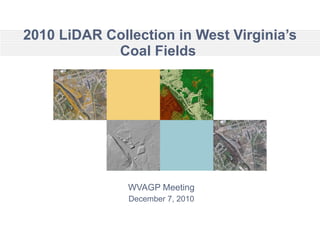
- 1. 2010 LiDAR Collection in West Virginia’s Coal Fields WVAGP Meeting December 7, 2010
- 3. Initially Contracted LiDAR AoI Slide AoI polygons are watershed rather than county-based. Initial AoI encompassed about 5,000,000 acres or about 33% of the State
- 4. Project Status as of Nov. 29, 2010 Slide 1,322,454 acres 1,162,728 acres 1,162,728 acres Highest priority area of the state was about 3,000,00 acres. 2,485,182 acres have been completed collected. A B
- 8. LiDAR Intensity Image Slide Produced from spring 2009 flight contracted by the Cabell County Assessor’s Office two whole LiDAR tiles
- 9. LiDAR Intensity Image Slide Produced from spring 2009 flight contracted by the Cabell County Assessor’s Office two whole LiDAR tiles Zoom in from here
- 11. The end Slide If we don’t take a shot at partnering more effectively … … future opportunities may be lost