Downloaded 686 times
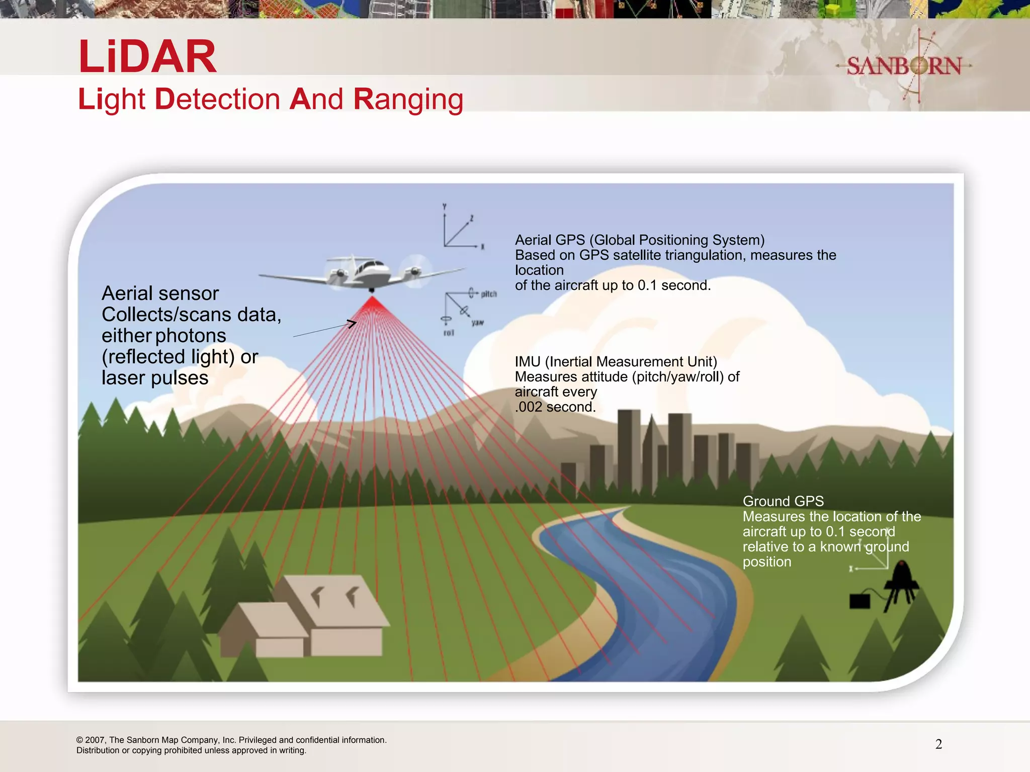


LiDAR is a remote sensing method that uses light in the form of a pulsed laser to measure variable distances to the Earth. It can be used to create high resolution digital elevation models and terrain models. The document discusses the benefits of high resolution LiDAR data, including more accurate terrain data, multiple applications, and a return on investment of $4-5 for every $1 spent on LiDAR collection. It also provides examples of government agencies that regularly collect and update LiDAR data.


