Detecting Buildings in AHN2 LiDAR data with ArcGIS - Grontmij
•
3 likes•1,261 views

This presentation shows how AHN2 LiDAR data was used to depict buildings and determine object heights
![2 Some background information ,[object Object]](data:image/gif;base64,R0lGODlhAQABAIAAAAAAAP///yH5BAEAAAAALAAAAAABAAEAAAIBRAA7)
Recommended
More Related Content
What's hot
What's hot (20)
Similar to Detecting Buildings in AHN2 LiDAR data with ArcGIS - Grontmij
Similar to Detecting Buildings in AHN2 LiDAR data with ArcGIS - Grontmij (20)
More from Xander Bakker
More from Xander Bakker (11)
Recently uploaded
Recently uploaded (20)
Detecting Buildings in AHN2 LiDAR data with ArcGIS - Grontmij
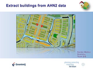
- 1. 1 Extract buildings from AHN2 data Xander Bakker Grontmij Team GIS
- 3. A ‘Clutter’ holds base data on surface including object heights classification
- 4. Grontmij has provided the clutter dataset in 2004
- 6. Using various datasets; NKNL (plans for urban expansion), W&B (population data), aerial photography (Bing) urban expansion areas were identified
- 7. Previous updates were based on AHN1 (5m Min and Max grids)
- 9. Return time defines surface height
- 11. AHN2: 30 points per m²
- 13. 6 AHN2 products Pricing / km² (< 1.250 km²) € 56,- € 56,- € 28,- € 28,- € 28,- € 12,- Pricing / km² (<= 15.000 km²) € 28,- € 28,- € 14,- € 14,- € 14,- € 6,- Pricing / NL (> 15.000 km²) € 455.000,- € 455.000,- € 227.500,- € 227.500,- € 227.500,- € 97.500,- Data contains Bare Earth Bare Earth + Objects Bare Earth Bare Earth Bare Earth + Objects Bare Earth Product Filtered laserpoints Unfiltered laserpoints 0.5m grid filtered 0.5m grid filtered + interpolated 0.5m grid unfiltered 5m grid filtered The purpose of AHN2 is to get a highly detailed representation of the bare earth (maaiveld). Objects (houses, trees, etc.) are filtered.
- 14. 7 LASER points Unfiltered points Filtered points Point cloud TIN
- 15. 8 Filtered grid 0.5 m/pix (Bare Earth) Not Interpolated Interpolated
- 16. 9 Unfiltered grid 0.5m/pix The only raster AHN2 product that holds information on objects…
- 17. 10 Profile unfiltered grid 0.5m/pix ditch river tree road hedge farm
- 18. 11 LIDAR Analyst v4.2
- 20. Attributed data
- 21. Extraction of buildings, trees and forest
- 23. Batch processing
- 25. Parameters vary per area
- 26. Long processing time (estimated 20 minutes CPU per AHN2 subunit)
- 29. 14 ArcGIS 9.3 Spatial Analyst / ArcObjects Simple Case : Buildings exist in TOP10 TOP10 buildings Region group Zonal max Zonal max – Focal min AHN2 raster Focal min
- 31. Buildings contain mainly NoData
- 33. Size
- 34. Gradient
- 36. NDVIOnly works for small areas!
- 41. 22 Calculate object heights
- 43. Buildings mainly covered with NoData are depicted as well1 before 2 3 1 after 2 3
- 45. Processing time for 1 subunit is 3 min.
- 46. Batchprocessing
- 47. Good alternative for lacking data in TOP10
- 48. Highways need to be filtered out
- 49. Some buildings not detected
- 53. Many exceptions difficult to account for at forehand
- 54. AHN2 order process does not indicate percentage of NoData per subunit
- 55. AHN2 data has not been thoroughly checked (subunits entirely filled with NoData, wrong resolution, no crd sys)
- 56. TOP10NL is missing a lot of buildings (is not up-to-date)