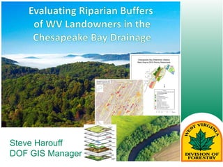
ICLR Friday Forum: Modelling of Future Flood Risk Across Canada (May 31, 2019)glennmcgillivray
On May 31, 2019, ICLR conducted a Friday Forum webinar lead by Dr. Slobodan Simonovic of Western University titled 'Modelling of Future Flood Risk Across Canada Under Climate Change.'
Climate change has induced changes in key climate variables and the hydrological cycle across Canada. With continuous emission of greenhouse gases, this trend is expected to continue over the 21st century and beyond. In this study, a macro-scaled hydrodynamic model is used to simulate 25 km resolution daily streamflow across Canada for historical (1961-2005) and future (2061-2100) timelines.
Future projections from 21 GCMs following four Representative Concentration Pathways (RCPs) were used for the analysis. Changes in the frequency and magnitude of historical 100-year and 250-year return period flood events and month of occurrence of peak flow are analyzed. Results obtained from uncertainty analysis for both return period flood events found that flood frequency will increase in most of the northern Canada, southern Ontario, southern British Columbia, northern Alberta, Manitoba and Saskatchewan. However, northern British Columbia, northern Ontario, Manitoba and northeastern Quebec will be facing decrease in flood frequency. Results indicate that 40%-60% of Canada’s 100 most populated cities including many prominent cities such as Toronto and Montreal are high at risk of increased riverine flooding under climate change.
Slobodan P. Simonovic is Professor of Civil and Environmental Engineering at the University of Western Ontario and Director of Engineering Studies at ICLR. Prof. Simonovic is globally recognized for his unique interdisciplinary research in Systems Analysis and has over 500 professional publications and three major textbooks. Prof. Simonovic was inducted to the Canadian Academy of Engineering in June of 2013.
Sam Mullins - Updates for the H2Ohio programJohn Blue
Updates for the H2Ohio program - Sam Mullins, Ohio Department of Agriculture, from the 2020 Conservation Tillage and Technology Conference, held March 3-4, 2020, Ada, OH, USA.
DSD-INT 2018 Groundwater modelling in Colombia - Galvis FanecaDeltares
Presentation by Marta Faneca Sanchez and Sandra Galvis Rodriquez (Deltares) at the iMOD International User Day 2018, during Delft Software Days - Edition 2018. Tuesday 13 November 2018, Delft.
This presentation was given as part of the EPA-funded Catchment Science and Management Course focusing on Integrated Catchment Management, held in June 2015. This course was delivered by RPS Consultants. If you have any queries or comments, or wish to use the material in this presentation, please contact catchments@epa.ie
It is increasingly being recognised internationally that integrated catchment management (ICM) is a useful organising framework for tackling the ongoing challenge of balancing sustainable use and development of our natural resource, against achieving environmental goals. The basic principles of ICM (Williams, 2012) are to:
• Take a holistic and integrated approach to the management of land, biodiversity, water and community resources at the water catchment scale;
• Involve communities in planning and managing their landscapes; and
• Find a balance between resource use and resource conservation
ICM is now well established in Australia, New Zealand, and the United States. In Europe the ICM approach has been proposed as being required to achieve effective water and catchment management, and is the approach being promoted by DEFRA for the UK, where it is called the “Catchment Based Approach” (CaBA). The principles and methodologies behind ICM sit well within the context of the Water Framework Directive with its aims and objectives for good water quality, sustainable development and public participation in water resource management. In Ireland it is proposed that the ICM approach will underlie the work and philosophy in developing and implementing future River Basin Management Plans.
Large Diameter Sanitary Sewer Condition Assessment Package 5Fairfax County
This project obtained condition assessment information for approximately 47,000 feet of 18 to 42-inch diameter sanitary sewer pipes and 197 manholes located near Herndon, McLean, and Annandale. The inspections were performed using multi-sensor (Closed Circuit Television (CCTV), sonar, and laser) inspection technologies to identify internal defects. Defective sewers were identified for repair, replacement, or rehabilitation under future contracts. This project was substantially complete on January 15, 2021.
This presentation was given as part of the EPA-funded Catchment Science and Management Course focusing on Integrated Catchment Management, held in June 2015. This course was delivered by RPS Consultants. If you have any queries or comments, or wish to use the material in this presentation, please contact catchments@epa.ie
It is increasingly being recognised internationally that integrated catchment management (ICM) is a useful organising framework for tackling the ongoing challenge of balancing sustainable use and development of our natural resource, against achieving environmental goals. The basic principles of ICM (Williams, 2012) are to:
• Take a holistic and integrated approach to the management of land, biodiversity, water and community resources at the water catchment scale;
• Involve communities in planning and managing their landscapes; and
• Find a balance between resource use and resource conservation
ICM is now well established in Australia, New Zealand, and the United States. In Europe the ICM approach has been proposed as being required to achieve effective water and catchment management, and is the approach being promoted by DEFRA for the UK, where it is called the “Catchment Based Approach” (CaBA). The principles and methodologies behind ICM sit well within the context of the Water Framework Directive with its aims and objectives for good water quality, sustainable development and public participation in water resource management. In Ireland it is proposed that the ICM approach will underlie the work and philosophy in developing and implementing future River Basin Management Plans.
Large Diameter Sanitary Sewer Condition Assessment Package 5Fairfax County
This project obtained condition assessment information for approximately 47,000 feet of 18 to 42-inch diameter sanitary sewer pipes and 197 manholes located near Herndon, McLean, and Annandale. The inspections were performed using multi-sensor (Closed Circuit Television (CCTV), sonar, and laser) inspection technologies to identify internal defects. Defective sewers were identified for repair, replacement, or rehabilitation under future contracts. This project was substantially complete on January 15, 2021.
#Walking and #trekking self guided tour from 1 person all, year at Costa da M...Enrique Pérez Sampedro
#Walking and #trekking self guided tour from 1 person all, year at Costa da Morte, #Galicia Lighthouse 200 km way from Malpica to Finisterre all over the coast
Eastern Panhandle GIS Users Group Meeting held on 14 September 2016 in Martinsburg, WV. Presenters Kathryn Wesson & Margaret Markham, Chesapeake Conservancy
Presented at the 2016 Eastern Panhandle GIS Users Group Meeting held on September 14 in Martinsburg, WV. Contributors Kurt Donaldson, Todd Fagan, & Aaron Cox.
Long Branch Central Watershed Management Area Project Overview October 26, 2020Fairfax County
Information about development in Fairfax County, major stormwater management project drivers, a functions-based approach to stream restoration and more information about the project is included in the presentation.
Update on the Conservation Fund's Greater Baltimore Wilderness Coastal Resilience Project, funded by NFWF. Presented at the 9.8.15 Baltimore Urban Waters Partnership meeting.
This presentation describes how the greatest conservation successes occur in collaboration with non-profit partners. This presentation was made at NRPA Conference New Orleans in 2017 and the Minnesota Recreation and Park Association state conference in Rochester in 2018. Both presentation were made with my co-presenter Jim Garges.
This presentation was made at the NRPA 2017 annual conference in New Orleans and the 2018 Minnesota Recreation and Park Association state conference with my co-presenter Jim Garges.
Long Branch Central Watershed Management Area 03-03-2021Fairfax County
Project Goals:
Achieve Long Branch Central TMDL waste load reduction requirements.
Provide long-term stability and have low maintenance.
Improve water quality within the Long Branch Central watershed.
Improve habitat and environmental health (ecological lift).
0x01 - Newton's Third Law: Static vs. Dynamic AbusersOWASP Beja
f you offer a service on the web, odds are that someone will abuse it. Be it an API, a SaaS, a PaaS, or even a static website, someone somewhere will try to figure out a way to use it to their own needs. In this talk we'll compare measures that are effective against static attackers and how to battle a dynamic attacker who adapts to your counter-measures.
About the Speaker
===============
Diogo Sousa, Engineering Manager @ Canonical
An opinionated individual with an interest in cryptography and its intersection with secure software development.
This presentation by Morris Kleiner (University of Minnesota), was made during the discussion “Competition and Regulation in Professions and Occupations” held at the Working Party No. 2 on Competition and Regulation on 10 June 2024. More papers and presentations on the topic can be found out at oe.cd/crps.
This presentation was uploaded with the author’s consent.
Sharpen existing tools or get a new toolbox? Contemporary cluster initiatives...Orkestra
UIIN Conference, Madrid, 27-29 May 2024
James Wilson, Orkestra and Deusto Business School
Emily Wise, Lund University
Madeline Smith, The Glasgow School of Art
Acorn Recovery: Restore IT infra within minutesIP ServerOne
Introducing Acorn Recovery as a Service, a simple, fast, and secure managed disaster recovery (DRaaS) by IP ServerOne. A DR solution that helps restore your IT infra within minutes.
This presentation, created by Syed Faiz ul Hassan, explores the profound influence of media on public perception and behavior. It delves into the evolution of media from oral traditions to modern digital and social media platforms. Key topics include the role of media in information propagation, socialization, crisis awareness, globalization, and education. The presentation also examines media influence through agenda setting, propaganda, and manipulative techniques used by advertisers and marketers. Furthermore, it highlights the impact of surveillance enabled by media technologies on personal behavior and preferences. Through this comprehensive overview, the presentation aims to shed light on how media shapes collective consciousness and public opinion.
Have you ever wondered how search works while visiting an e-commerce site, internal website, or searching through other types of online resources? Look no further than this informative session on the ways that taxonomies help end-users navigate the internet! Hear from taxonomists and other information professionals who have first-hand experience creating and working with taxonomies that aid in navigation, search, and discovery across a range of disciplines.
3. Background, Funding and Partners
2016
• Multi-State Grant Healthy Forests and Trees for
TMDLs in the Potomac
• Competitive grant provided by USDA, Forest Service for
(MD, PA, WV and VA)
• Submitted by Maryland DNR Forest Service
• DOF Lead Herb Peddicord, Chesapeake Bay Forester
• Total Grant Request $375,000
• MD DNR Forest Service – $149,000
• The Potomac Conservancy -$100,000
• PA/Chesapeake Bay Foundation - $50,000
• WVDOF - $44,000
• VA - $32,000
4. Background, Funding and Partners
2016
• 2010 Forest Resource Assessment determined priority
watersheds state-wide which all states developed
• Project goal to reduce nutrient and sediment loads
• Use GIS to determine areas with no riparian buffer for
private land owners
• Enroll landowners in the Conservation Reserve
Enhancement Program (CREP), a voluntary program of
the FSA and NRCS
• Establish forested buffers along streams
5. 2010 Forest Resource Assessment Priority Watersheds
2016
Protection Input Layer Weighting and Prioritization by HUC-12 Sub-Watershed
Data Layer
Sub-watershed Reclassification Values
Unit of Measure
0 1 2 3 4 5 6
High Quality Streams <8 8-20 >20 Stream Miles
Public Land >75* 51-75 26-50 <25 Percent Public Land
Surface and Fill Mining >20 5-20 <5 Percent of HUC-12
FWP Ability to Produce Clean Water
Score
10-13 21-23
19-20
17-18 APCW Composite Score
14-16
Oil and Gas Well Density <0.004 ~ <0.025 Wells per Acre
Public Water Intakes <4 4-9 >9 Intakes per HUC-12
Harvest Pressure <3 3-5 6-7 >7 Percent of HUC-12
Structural Density >0.25* <=0.25 Structures per Acre
* HUC-12s with a calculated structure density >0.25 structures/acre (urban sub-watersheds) and more than 75 percent public land area were scored, but excluded as priority areas.
Restoration Input Layer Weighting and Prioritization by HUC-12 Sub-Watershed
Data Layer
Sub-Watershed Reclassification Values
Unit of Measure
0 1 2 3 4 5 6
Impaired Streams <11 11-34 > 34 Stream Miles
Public Land >75* 51-75 26-50 <25
Percent Public
Land
Surface and Fill
Mining
>20 5-20 <5
Percent of HUC-
12
FWP APCW score 10-13 21-23
19-20
17-18
FWP APCW
Comp. Score
14-16
Oil and Gas well
density
<0.00
4
~
<0.02
5
Wells per Acre
Public Water Intakes <4 4-9 >9
Intakes per
HUC-12
Harvest Pressure <3 3-5 6-7 >7
Percent of HUC-
12
Structural Density
>0.25
*
<=0.2
5
Structures per
Acre
6. CREP Targeting GIS
2016
• Utilize GIS to identify potential CREP enrollees
• Datasets used:
1. NHD Stream layer - buffered 35’
2. Tax parcel data form Berkeley, Hampshire,
Jefferson, Mineral, Morgan and Pendleton
Counties
3. NRAC 4 class land cover – 9m Res.
Forest/Woody, Ag-land, Developed and Water
(2011 NAIP Imagery)
16. Results shared with Bay Forester - Maps and Data
2016
Limitations:
• Accuracy of
the tax parcel
data
• Accuracy of
the Stream
data
• Accuracy of
the image
classifications
20. Where we are today….
2016
• GIS analysis was the first step
• So far about 300 mailings have been
sent to landowners for CREP
program
• About 5% responded with 3 miles
planted so far
• Staffing limitations have not allowed
for good follow-ups, but new staff
have just been hired