The following presentation was delivered by Robert Morrison, Principal Consultant at Esri Ireland, at the 2019 NICS ICT Conference in October 2019.
The presentation focuses on taking a geographic approach to machine learning to help you "see what other's can't".
Imagery and remotely sensed data is a valuable resource for many organisations who have made substantial investment obtaining the data. The field of Machine Learning is both broad and deep and is constantly evolving. Using ArcGIS and Machine Learning allows organisations to derive valuable new content.
ArcGIS is an open, interoperable platform that allows for the integration of complementary methods and techniques that empower ArcGIS users to solve complex, real-world problems in a fundamentally spatial way.
Learn how by combining powerful built-in Image analysis tools with any machine learning package users can benefit from the spatial validation, geo-enrichment and visualisation. See how this Machine Learning is being applied in real world use-cases from marine farming and crime analysis to agriculture and sustainability.
DEFINITION :
GIS is a powerful set of tools for collecting, storing , retrieving at will, transforming and displaying spatial data from the real world for a particular set of purposes
APPLICATION AREAS OF GIS
Agriculture
Business
Electric/Gas utilities
Environment
Forestry
Geology
Hydrology
Land-use planning
Local government
Mapping
11. Military
12. Risk management
13. Site planning
14. Transportation
15. Water / Waste water industry
COMPONENTS OF GIS
DATA INPUT
SPATIAL DATA MODEL
Data Model:
It describes in an abstract way how the data is represented in an information system or in DBMS
Spatial Data Model :
The models or abstractions of reality that are intended to have some similarity with selected aspects of the real world
Creation of analogue and digital spatial data sets involves seven levels of model development and abstraction
SPATIAL DATA MODEL
Conceptual model : A view of reality
Analog model : Human conceptualization leads to analogue abstraction
Spatial data models : Formalization of analogue abstractions without any conventions
Database model : How the data are recorded in the computer
Physical computational model : Particular representation of the data structures in computer memory
Data manipulation model : Accepted axioms and rules for handling the data
SPATIAL DATA MODEL
SPATIAL DATA MODEL
Objects on the earth surface are shown as continuous and discrete objects in spatial data models
Types of data models
Raster data model
vector data models
RASTER DATA MODEL
Basic Elements :
Extent
Rows
Columns
Origin
Orientation
Resolution: pixel = grain = grid cell
Ex: Bit Map Image (BMP),Joint Photographic Expert Group (JPEG), Portable Network Graphics(PNG) etc
RASTER DATA MODEL
VECTOR DATA MODEL
Basic Elements:
Location (x,y) or (x,y,z)
Explicit, i.e. pegged to a coordinate system
Different coordinate system (and precision) require different values
o e.g. UTM as integer (but large)
o Lat, long as two floating point numbers +/-
Points are used to build more complex features
Ex: Auto CAD Drawing File(DWG), Data Interchange(exchange) File(DXF), Vector Product Format (VPF) etc
VECTOR DATA MODEL
RASTER vs VECTOR Raster is faster but Vector is corrector
TESSELLATIONS OF CONTINUOUS FIELDS
Triangular Irregular Network: (TIN)
TIN is a vector data structure for representing geographical information that is continuous
Digital elevation model
TIN is generally used to create Digital Elevation Model (DEM)
DIGITAL ELEVATION MODEL
DATA STRUCTURES
Data structure tells about how the data is stored
Data organization in raster data structures
Each cell is referenced directly
Each overlay Is referenced directly
Each mapping unit is referenced directly
Each overlay is separate file with general header
GIS Training is geographical information system and it is mainly used for the storing, recovering, handle, display and examine the all the types of geographical data.
This is presentation is intended for middle school students. It provides a short introduction to GIS and how to use GIS in the real-world.
ArcGIS Explorer is the software used to demonstrate concepts.
45 minutes + 15 minutes demo
Download ArcGIS Explorer here...
http://www.esri.com/software/arcgis/explorer/
LiDAR acronym as Light Detection and Ranging is remote sensing technology having several technical and socialite advantages. This technology is basically used to make high resolution digital map to provide the real time data. This data can be processed and used to extract the useful information. A typical LIDAR system consists of three main components, a GPS system to provide position information, an INS unit for attitude determination, and a LASER system to provide range (distance) information between the LASER firing point and the ground point. In addition to range data, modern LIDAR systems can capture intensity images over the mapped area. Therefore, LIDAR is being more extensively used in mapping and GIS applications.
LIDAR is an acronym for LIght Detection And Ranging. It is an optical remote sensing technology that can measure the distance to or other properties of a target by illuminating the target with light pulse to form an image.
Light-imaging Detection and Ranging (LiDAR) has become a common tool used in mapping and is being dispatched to complete more and more projects, but do you understand what this technology is, how it works, and what it can be used for? Through this brief but informative presentation, we’ll get you up-to-date on LiDAR
technology and its ability to offer acquisition of digital elevation data for large-scale mapping projects. We’ll also
discuss how LiDAR can work alongside traditional aerial photography and photogrammetric techniques – making it even more powerful.
Unmanned Aerial Systems for Precision MappingUAS Colorado
Presentation by Renee Walmsley, Remote Sensing Program Manager at Tetra Tech, for the August 16, 2017 Rocky Mountain UAS Professionals Meetup at the Esri Broomfield office.
LIDAR is an acronym for light detection and ranging. It is an optical remote sensing technology used to examine the surface of the earth, often using pulses from a laser.
What is LiDAR_ A Guide to its Technical Aspects.pdfAnil
LiDAR, which stands for Light Detection and Ranging, is a remote sensing technology that uses laser light to measure distances and generate precise, three-dimensional information about the shape and characteristics of objects in its field of view. LiDAR systems are widely used in various applications, including topographic mapping, forestry, autonomous vehicles, archaeology, and urban planning. Here's a guide to the technical aspects of LiDAR
The advancement of technologies in the last decade is no surprise to anyone. LiDAR although new to some has been around for some time, haven’t heard of it? What are you missing?
This presentation will briefly explain what LiDAR is and how it is gathered, but the primary focus will be on how the Energy Sector can benefit from its use. We will show several example project datasets, tools developed and available to industry, and how this growing technology can change how you look at your projects.
Additionally, we will show how involving all members of your exploration team in a LiDAR planning process will save time and money while increasing safety and reducing environmental impact. Your well location may begin with Geology calculating back to a surface location, but the finial location can affect many other decisions your company may make…good planning makes for good decisions.
Chris Martin is a Survey Technologist with 17 years of experience in the surveying profession. His field survey career has involved major projects with TransCanada Pipelines and Alliance Pipelines along with many conventional oil and gas programs. For the last 4 years he has primarily focussed on business development and is currently a Marketing Representative for Can-Am Geomatics.
LiDAR, short for light detection and ranging, is a remote sensing technology that uses light in the form of a pulsed laser to measure ranges (distances) to a target. A LiDAR sensor fires off beams of laser light and then measures how long it takes for the light to return to the sensor.
The costs of building and using LIDAR systems are coming down because it’s becoming easier and cheaper to collect more and more data, and LIDAR is being used in more applications.
At Techwave, we strive to be a world-class lighting technology provider. With that role comes the responsibility to be intimately familiar with newer applications and help our partners understand the real value in them.
Laser ScanningLaser scanning is an emerging data acquisition techn.pdfanjaniar7gallery
Laser Scanning
Laser scanning is an emerging data acquisition technology that has remarkably broadened its
application field and has been a serious competitor to other surveying techniques. Due to rapid
technological development, the increased accuracy of global positioning systems and improving
demands to even more accurate digital surface models, airborne laser scanning showed
significant development in the 1990s.
Somewhat later terrestrial laser scanning became a reasonable alternative method in many kinds
of applications that previously by ground based surveying or close-range photogrammetry.
1 Airborne laser scanning
Airborne laser scanning is an active remote sensing technology that is able to rapidly collect data
from huge areas. The resulted dataset can be the base of digital surface and elevation models.
Airborne laser scanning is often coupled with airborne imagery, therefore the point clouds and
images can be fused resulting enhanced quality 3D product.
The basic principle is as follows: the sensor emits a laser pulse through the terrain in a
predefined direction and receives the reflected laser beam. Knowing the speed of light, the
distance of the object can be calculated, see Figure 1.
Figure 1.: Time of flight laser range measurement [2]
Airborne LiDAR systems are composed by the following subsystems:
The components are shown in Figure 2
Figure 2.: Principle of airborne LiDAR [2]
2. Sensors, equipment
Sensors can be distinguished based on the scanning method, i.e. how the laser beam is directed
through the surface. The four most widely used sensor types are shown in Figure 4.2.3.
Figure .3: Scanning mechanisms [1]
As it is clearly seen in Figure 3, different kinds of mechanisms are applied by the different types
of sensors; each has its advantages and shortcomings, e.g. number of moving parts, type of
rotation etc. that lead to different kinds of error sources.
The capabilities (repetition rate, scan frequency, scan angle, point density) of the above scanners
are very similar; the main difference lies in the scanning pattern, as seen in Figure 4. The most
widely used oscillating mirror scanners produce the zigzag pattern. Spacing along the line
depends on the pulse rate and scanning frequency, while spacing along the flight direction
depends on the flying speed. To avoid too wide spacing of points along flight direction, LiDAR
flights are usually slower (e.g. at 60-80 m/sec) compared to that of photogrammetric flights
(even 120-160 m/sec). Careful planning of the measurement results in rather homogenous
density, however, due to technical and microelectronic reasons (regarding the operating
mechanism of the mirror, especially in case of oscillating mirrors), higher point density can be
observed at the edges of the scan swath. Previously, critics were addressed to the fixed optic
scanners, i.e. the parallel scan lines along the flight direction can miss sizeable objects, but
vendors successfully responded and modified the mechanis.
This presentation will provide an update on the Lidar Division's work to produce an ASPRS document providing valuable information on airborne lidar density measuring and reporting. The scope of this document is:
• To clarify various definitions of density and related terms
• To document various methods for quantifying density
• To develop and document various methods for representation of density
• To document various tradeoffs among the methods of representation and quantification of density
• To provide recommendations on the use of density
ASPRS LiDAR Division Update with a focus on quantifying horizontal sampling d...MattBethel1
This presentation will provide an update on the Lidar Division's work to produce an ASPRS document providing valuable information on airborne lidar density measuring and reporting.
An in depth examination of airborne lidar density measurement and reporting. This will review issues with existing methodologies and comparisons to a proposed replacement.
The Forest and the Trees - Enhanced Resolution and Efficiency featuring Galax...MattBethel1
An in-depth look at a unique forestry project featuring lidar-derived forest biomass data products. Led by Merrick and Co and supported by the Galaxy G2 Sensor System, this project features unsurpassed data collection efficiency in restricted airspace limitations. We look forward to sharing details of Merrick's innovative approach resulting in the enablement of flood hazard mitigation and preparedness, conservation planning and various biomass related forest products.
Airborne LiDAR – Traditional Nadir Versus Oblique PerspectivesMattBethel1
Airborne topographic LiDAR started out 25+ years ago with the most commonly known approach of scanning a laser perpendicular to flight direction but with that scan pattern generally pointed straight down. This nadir orientation is still widely used but the airborne LiDAR mapping industry has grown to include a variety of oblique laser perspectives for some applications. Each approach has strengths for some applications and weaknesses for others. LiDAR sidelap should also be grouped into this application-approach discussion. This presentation will review the benefits of each scanning perspective and show data examples highlighting the strengths of each approach.
Slack (or Teams) Automation for Bonterra Impact Management (fka Social Soluti...Jeffrey Haguewood
Sidekick Solutions uses Bonterra Impact Management (fka Social Solutions Apricot) and automation solutions to integrate data for business workflows.
We believe integration and automation are essential to user experience and the promise of efficient work through technology. Automation is the critical ingredient to realizing that full vision. We develop integration products and services for Bonterra Case Management software to support the deployment of automations for a variety of use cases.
This video focuses on the notifications, alerts, and approval requests using Slack for Bonterra Impact Management. The solutions covered in this webinar can also be deployed for Microsoft Teams.
Interested in deploying notification automations for Bonterra Impact Management? Contact us at sales@sidekicksolutionsllc.com to discuss next steps.
Search and Society: Reimagining Information Access for Radical FuturesBhaskar Mitra
The field of Information retrieval (IR) is currently undergoing a transformative shift, at least partly due to the emerging applications of generative AI to information access. In this talk, we will deliberate on the sociotechnical implications of generative AI for information access. We will argue that there is both a critical necessity and an exciting opportunity for the IR community to re-center our research agendas on societal needs while dismantling the artificial separation between the work on fairness, accountability, transparency, and ethics in IR and the rest of IR research. Instead of adopting a reactionary strategy of trying to mitigate potential social harms from emerging technologies, the community should aim to proactively set the research agenda for the kinds of systems we should build inspired by diverse explicitly stated sociotechnical imaginaries. The sociotechnical imaginaries that underpin the design and development of information access technologies needs to be explicitly articulated, and we need to develop theories of change in context of these diverse perspectives. Our guiding future imaginaries must be informed by other academic fields, such as democratic theory and critical theory, and should be co-developed with social science scholars, legal scholars, civil rights and social justice activists, and artists, among others.
The Art of the Pitch: WordPress Relationships and SalesLaura Byrne
Clients don’t know what they don’t know. What web solutions are right for them? How does WordPress come into the picture? How do you make sure you understand scope and timeline? What do you do if sometime changes?
All these questions and more will be explored as we talk about matching clients’ needs with what your agency offers without pulling teeth or pulling your hair out. Practical tips, and strategies for successful relationship building that leads to closing the deal.
Epistemic Interaction - tuning interfaces to provide information for AI supportAlan Dix
Paper presented at SYNERGY workshop at AVI 2024, Genoa, Italy. 3rd June 2024
https://alandix.com/academic/papers/synergy2024-epistemic/
As machine learning integrates deeper into human-computer interactions, the concept of epistemic interaction emerges, aiming to refine these interactions to enhance system adaptability. This approach encourages minor, intentional adjustments in user behaviour to enrich the data available for system learning. This paper introduces epistemic interaction within the context of human-system communication, illustrating how deliberate interaction design can improve system understanding and adaptation. Through concrete examples, we demonstrate the potential of epistemic interaction to significantly advance human-computer interaction by leveraging intuitive human communication strategies to inform system design and functionality, offering a novel pathway for enriching user-system engagements.
JMeter webinar - integration with InfluxDB and GrafanaRTTS
Watch this recorded webinar about real-time monitoring of application performance. See how to integrate Apache JMeter, the open-source leader in performance testing, with InfluxDB, the open-source time-series database, and Grafana, the open-source analytics and visualization application.
In this webinar, we will review the benefits of leveraging InfluxDB and Grafana when executing load tests and demonstrate how these tools are used to visualize performance metrics.
Length: 30 minutes
Session Overview
-------------------------------------------
During this webinar, we will cover the following topics while demonstrating the integrations of JMeter, InfluxDB and Grafana:
- What out-of-the-box solutions are available for real-time monitoring JMeter tests?
- What are the benefits of integrating InfluxDB and Grafana into the load testing stack?
- Which features are provided by Grafana?
- Demonstration of InfluxDB and Grafana using a practice web application
To view the webinar recording, go to:
https://www.rttsweb.com/jmeter-integration-webinar
GraphRAG is All You need? LLM & Knowledge GraphGuy Korland
Guy Korland, CEO and Co-founder of FalkorDB, will review two articles on the integration of language models with knowledge graphs.
1. Unifying Large Language Models and Knowledge Graphs: A Roadmap.
https://arxiv.org/abs/2306.08302
2. Microsoft Research's GraphRAG paper and a review paper on various uses of knowledge graphs:
https://www.microsoft.com/en-us/research/blog/graphrag-unlocking-llm-discovery-on-narrative-private-data/
"Impact of front-end architecture on development cost", Viktor TurskyiFwdays
I have heard many times that architecture is not important for the front-end. Also, many times I have seen how developers implement features on the front-end just following the standard rules for a framework and think that this is enough to successfully launch the project, and then the project fails. How to prevent this and what approach to choose? I have launched dozens of complex projects and during the talk we will analyze which approaches have worked for me and which have not.
Let's dive deeper into the world of ODC! Ricardo Alves (OutSystems) will join us to tell all about the new Data Fabric. After that, Sezen de Bruijn (OutSystems) will get into the details on how to best design a sturdy architecture within ODC.
Key Trends Shaping the Future of Infrastructure.pdfCheryl Hung
Keynote at DIGIT West Expo, Glasgow on 29 May 2024.
Cheryl Hung, ochery.com
Sr Director, Infrastructure Ecosystem, Arm.
The key trends across hardware, cloud and open-source; exploring how these areas are likely to mature and develop over the short and long-term, and then considering how organisations can position themselves to adapt and thrive.
Builder.ai Founder Sachin Dev Duggal's Strategic Approach to Create an Innova...Ramesh Iyer
In today's fast-changing business world, Companies that adapt and embrace new ideas often need help to keep up with the competition. However, fostering a culture of innovation takes much work. It takes vision, leadership and willingness to take risks in the right proportion. Sachin Dev Duggal, co-founder of Builder.ai, has perfected the art of this balance, creating a company culture where creativity and growth are nurtured at each stage.
Neuro-symbolic is not enough, we need neuro-*semantic*Frank van Harmelen
Neuro-symbolic (NeSy) AI is on the rise. However, simply machine learning on just any symbolic structure is not sufficient to really harvest the gains of NeSy. These will only be gained when the symbolic structures have an actual semantics. I give an operational definition of semantics as “predictable inference”.
All of this illustrated with link prediction over knowledge graphs, but the argument is general.
Connector Corner: Automate dynamic content and events by pushing a buttonDianaGray10
Here is something new! In our next Connector Corner webinar, we will demonstrate how you can use a single workflow to:
Create a campaign using Mailchimp with merge tags/fields
Send an interactive Slack channel message (using buttons)
Have the message received by managers and peers along with a test email for review
But there’s more:
In a second workflow supporting the same use case, you’ll see:
Your campaign sent to target colleagues for approval
If the “Approve” button is clicked, a Jira/Zendesk ticket is created for the marketing design team
But—if the “Reject” button is pushed, colleagues will be alerted via Slack message
Join us to learn more about this new, human-in-the-loop capability, brought to you by Integration Service connectors.
And...
Speakers:
Akshay Agnihotri, Product Manager
Charlie Greenberg, Host
Connector Corner: Automate dynamic content and events by pushing a button
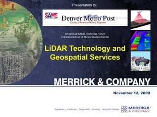
LiDAR Technology and Geospatial Services
1. Presentation to:
November 12, 2009
4th Annual SAME Technical Forum
Colorado School of Mines Student Center
LiDAR Technology and
Geospatial Services
2. Merrick & Company
Corporate Headquarters: Aurora, Colorado
Founded in 1955, incorporated in 1959
Primary Services:
• Architecture
• Civil Engineering
• Facilities Engineering
• GeoSpatial Solutions (GSS)
• Process Engineering
> 450 employees at 9 national & 2 int’l offices
FY09 Revenue = $102M
Ownership: Private (employee-owned)
3. What is LiDAR?
Why use LiDAR?
Examples of LiDAR Data
LiDAR Processing Software
LiDAR Products and
Applications
Types of LiDAR Collections
Multi-Sensor Fusion
The future of LiDAR and
Geospatial Services
Agenda
4. What is LiDAR?
Light Detection And Ranging
An ultra efficient technology used to collect
three dimensional elevation data from
ground or aerial based acquisitions
The technology of using pulses of laser
(light) striking the surfaces of the earth
and measuring the time of pulse return
Used for very rapid collections of highly
accurate XYZ digital map data
LiDAR acquisition system includes:
Laser emitter and detector - both occur at a rapid
rate (hundreds of thousands a time per second)
Scanning system to distribute the laser shots
across the ground or target, typically in a
somewhat evenly dispersed pattern
GPS (Global Positioning System) for XYZ
IMU (Inertial Measurement Unit) for ΩΦΚ
5. LiDAR
LiDAR
Cost effective method for
collecting millions to
billions of elevation points
Technology includes:
Airborne GPS
Inertial Measurement Unit
Limited ground control
Pulsed laser detection
technology
6. LiDAR
LiDAR
Cost effective method for
collecting millions to
billions of elevation points
Technology includes:
Airborne GPS
Inertial Measurement Unit
Limited ground control
Pulsed laser detection
technology
7. LiDAR
Cost effective method for
collecting millions to
billions of elevation points
Technology includes:
Airborne GPS
Inertial Measurement Unit
Limited ground control
Pulsed laser detection
technology
LiDAR
9. 1. Laser pulse leaves plane
2. Pulse reflects off objects
How points are created:
How LiDAR Works
10. 1. Laser pulse leaves plane
2. Pulse reflects off objects
3. Return pulses collected
How points are created:
How LiDAR Works
11. 1. Laser pulse leaves plane
2. Pulse reflects off objects
3. Return pulses collected
5. Returns processed with
GPS and IMU information to
form very accurate XYZ data
How points are created:
4. Time of laser shot “trip”
is calculated and converted
into range (i.e. distance)
How LiDAR Works
13. Laser
swath
Laser
swath
Ground points collected
LiDAR Collection
Advantages
Angle of incidence
Leaf-off not required
Ground points in stand
areas
Above ground feature
returns also collected for
additional applications
Benefits of LiDAR
14. LiDAR System Equipment
LiDAR
Merrick uses three types:
ALS40 (52 KHz per sec)
ALS50 (85 KHz per sec)
ALS50-II+ (150 KHz per sec)
Swath width capable of up to 75 degrees
Capable of scanning up to 70 times per second
Includes an IMU (inertial measurement unit)
Altitudes up to 6,100 meters AGL
Flight navigation system
Aircraft
GPS
16. Uses For LiDAR Data
Floodplain management
Topographic surveys
Hydrological modeling
Viewshed analysis
All facets of 3D planning
Pre or post construction
visibility analysis
Cell tower placement
Forest management
Powerline corridor
obstruction management
Supply surface to orthorectify imagery to and
make as accurate as possible
Ground elevation measurements which will be
used to generate contour deliverables
Building, tree, or any other vertical feature
model with accurate elevation
3D data for modeling purposes to be used by
police, fire, emergency management, defense,
etc.
Slope, erosion, landslide, etc. prediction
modeling and analysis
Building, vegetation, powerline, roadway, etc.
inventory and assessment
17. Better than:
Free DEM data
Photogrametrically compiled DTM data
Faster collection than ground crew survey
data
Cheaper than other competing forms of
DEM collection
No film to loose or damage
Accuracy (+/- 0.25’ or better)
Vegetation Penetration
Can collect in between trees better than
stereo models
Collects ancillary data about trees,
buildings, powerlines, etc.
Acquisition Efficiencies
Collects millions/billions of XYZ data
Not constrained by typical sun angle
window for imagery collection
possibility of multiple shifts throughout
24-hr day
avoids daytime weather issues
avoid air traffic in congested areas
More detail (resolution) than any other
type of collection
Why use LiDAR?
17,677 Square Miles of
LiDAR @ 1.4 m GSD
18. LiDAR compared to a USGS DEM
30m USGS DEM of Story, WY
Data courtesy of USDA-NRCS
19. LiDAR compared to a USGS DEM
LiDAR DEM of Story, WY
Data courtesy of USDA-NRCS
24. • Color by:
- Elevation
- Intensity
- Classification
- Flightline
LiDAR Color Visualization
25. • View by:
- Point cloud
- 2D orthographic
- 3D perspective
- TIN rendered
LiDAR Viewing Capabilities
26. • Orthographic
display and a
cross section
window
simultaneously
• The cross section
can be switched to
a line profile view
LiDAR Cross Section & Profiling
27. • Auto classification
(a.k.a. batch
filtering) is used to
separate the ground
from the above
ground features
• Manual editing is
used to clean up
anything that the
automated
processes did not do
correctly
LiDAR Auto Classification
33. Hydrological Modeling from LiDAR
1. Orthophoto
2. LiDAR TIN
3. LiDAR bare
earth
4. LiDAR
hillshade
5. Hydrological
model
34. • Contour display tool
- Renders with point,
TIN, and/or ortho
display in 2D or 3D
- Selectable settings:
• Intervals
• Indexes
• Minimum contour
lengths
• Contour by
flightlines
• Classifications to
use for contour
generation
• Contours can be exported
to CAD, GIS, etc.
LiDAR Contour Capabilities
36. LiDAR Automated Building Classification
• Automated building
classification will filter
out structures from other
canopy or above ground
features
• The tool works with a
from and to classification
• The result can be viewed
in point or TIN form,
with an ortho
background, and in 2D
orthographic or 3D
perspective views
43. Classified LiDAR and Bathymetry
Classified LiDAR:
•Green – above ground
•Tan – bare earth
•Blue – points in water
•Blue line - Thalweg
Seamless Bare-earth LiDAR
and bathymetric data
48. Multi-Sensor Suite
EO Imager
Merrick & Company DACS II
7216 x 5472 pixel array, Visible
Field-of-View: 34° degrees
Ground Resolution @ 2500 ft AGL: 0.07 m
Source: USA
Hyperspectral Imager
AISA Eagle, Hawk, Dual
Spectral Range: 400-2400 nm (2.9 nm FWHM)
Field-of-view: 40° degrees
Ground Resolution @ 2500 ft AGL: 0.60 m
Includes algorithms to facilitate target
detection and identification
Source: Finland
3D Imaging Laser
Leica ALS50-II+ Airborne LiDAR
Ground Resolution @ 2500 ft
AGL: 1.31 m
Scan Angle Range: 45° degrees
Scan Rate: 5 – 160 scans/second
Eye safe operation above 200 m
Source: Switzerland
Thermal Imager
ITRES TABI 320
Spectral Range: 8-12 µm
Field-of-View: 48°
degrees
Ground Resolution
@ 2500 ft AGL: 2.12 m
Source: Canada
49. Final
Derived
Raster
and/or
Vector
Products
Spatial Data
Fusion
Engine
Attribute Assignment
Vector Processing
Feature Extraction
Variable Weighting
Object Classification
Multi-Sensor Data Fusion
HSI Imagery HSI Image Classification HSI Image Spatial
Query
Thermal Imagery Thermal Image
Classification
Thermal Image Spatial
Query
EO Imagery EO Image Spatial Query
LiDAR LiDAR Auto Filter LiDAR Spatial Query (3D)
EO Image
Classification
50. The Future of LiDAR and Geospatial Services
Courtesy of Riegl USA
51. The Future of LiDAR and Geospatial Services
Courtesy of Riegl USA
52. The Future of LiDAR and Geospatial Services
2D profile
path
3D i-beam
3D modeling of i-beams with
very accurate elevations are
extracted by extruding the 2D
profile along a path.
Courtesy of Riegl USA
53. The Future of LiDAR and Geospatial Services
Courtesy of Riegl USA