Visualising Flux: Storytelling with Time, Space & Torque
•Download as PPTX, PDF•
2 likes•595 views

This document discusses visualizing flux and storytelling with time, space, and torque. It provides examples of maps that incorporate temporal data including maps of rivers over time, shrinking lakes in Argentina from 1986 to present, and urban sprawl from 1984 to 2011. The document also discusses inspirations from NASA, artist Tom Sachs, and researcher Sara Hendren. It outlines capabilities of CartoDB like importing and managing data, customizing maps, and crisis mapping. Finally, it discusses new mapping features from CartoDB including telling stories with torque and integrating with other datasets and APIs.
![the rate of flow of a property per unit area, which has the
dimensions[quantity]·[time]−1·[area]−1.[2]
flux](data:image/gif;base64,R0lGODlhAQABAIAAAAAAAP///yH5BAEAAAAALAAAAAABAAEAAAIBRAA7)
Recommended
More Related Content
What's hot
What's hot (20)
Viewers also liked
Viewers also liked (20)
Similar to Visualising Flux: Storytelling with Time, Space & Torque
Similar to Visualising Flux: Storytelling with Time, Space & Torque (20)
More from Extract Data Conference
More from Extract Data Conference (17)
Recently uploaded
Recently uploaded (20)
Visualising Flux: Storytelling with Time, Space & Torque
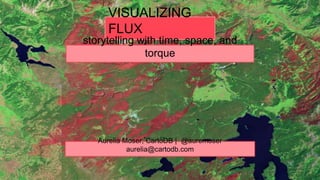
- 1. VISUALIZING FLUX Aurelia Moser, CartoDB | @auremoser aurelia@cartodb.com storytelling with time, space, and torque
- 2. the rate of flow of a property per unit area, which has the dimensions[quantity]·[time]−1·[area]−1.[2] flux
- 3. us river map, cartodb, tinyurl.com/river-cdbmap
- 4. iceland isomap, cartodb, tinyurl.com/cdb-iceland
- 5. indian election map, cartodb, http://tinyurl.com/cdb-indiatweet
- 6. math model that combines space and time into a single interwoven continuum; a manifold consisting of “events” which are described by some type of coordinate system. spacetime
- 11. problem
- 12. utility
- 13. code
- 14. product
- 18. code
- 19. product
- 20. live data, import api and remote sync
- 21. inspiration: space/time how we think about software
- 24. inspiration: nasa science, stellar photos, landsat magic
- 25. mapping urban sprawl 1984 2011
- 27. ~ Todd Schroeder, USDA Forest Service, 2014 “Now that the entire Landsat archive is freely available it has become economically feasible to monitor disturbance over large areas using satellite time series.”
- 29. inspiration: tom sachs artist, architect, urban hacker
- 30. space program: mars, tom sachs, armory 2012
- 31. “our space program is expensive, slow, and crappy and that’s why it’s magic” ~ Tom Sachs
- 33. inspiration: sara hendren researcher, designer, Harvard GSD
- 34. accessible icon project, sara hendron et al, moma, 2011
- 35. “accessible design is universal design”
- 36. maps as digital prosthetics: making the city and its data more accessible
- 37. citizen cartography what can you do with cartodb?
- 38. manage + import data
- 40. Manage + Import Data
- 41. query + customize maps
- 42. crisis + crowd-mapping humanitarian relief and mythic maps
- 43. port au prince, haiti, 2010 before/after on OSM
- 46. unreliable power unreliable infrastructure hostile environments
- 48. Bhutan, 2014, via Google Maps
- 53. apps that change the world projects we support
- 54. ngo aid map, cartodb, http://ngoaidmap.org/
- 55. global forest watch, cartodb, http://www.globalforestwatch.org/
- 56. illustreets econ report, http://illustreets.co.uk/
- 57. fires in the amazon (2012-2014), http://infoamazonia.org/projects/fire/
- 58. super-nova new mapping features + coming soon!
- 60. las vegas tourist traffic, cartodb, tinyurl.com/cdb-tourist
- 61. torque snowplow heatmaps, cartodb, tinyurl.com/snow-cdb
- 62. more open data
- 63. more projections
- 64. more tutorials
- 65. more basemaps
- 66. more apis
- 67. odyssey.js
- 71. historical lakes, odyssey @cartodb, bl.ocks.org/auremoser
- 72. more experiments
- 73. grants: nonprofit + startup
- 77. 1979 2011
- 78. make human maps account for flux respect spacetime
Editor's Notes
- 1989 yellowstone national parkIntense fires are a characteristic of the conifer forests, though they occur infrequently—once every 100 to 300 years.
- Basalt cliffs along the northwest edge of the Meseta de Somuncura plateau near Sierra Colorada, Argentina show an unusual and striking pattern of erosion.
- After a particularly severe storm on November 10, 1985, Lake Epecuén burst through a dyke and flooded the town. Eventually, Epecuén was submerged under 10 meters (33 feet) of salt water.
- http://ablersite.org/2011/09/15/border-town-beyond-ramps-curitiba-brazil/
- http://www.forbes.com/2010/02/01/text-messages-maps-technology-breakthroughs-haiti.html
- development in beijing