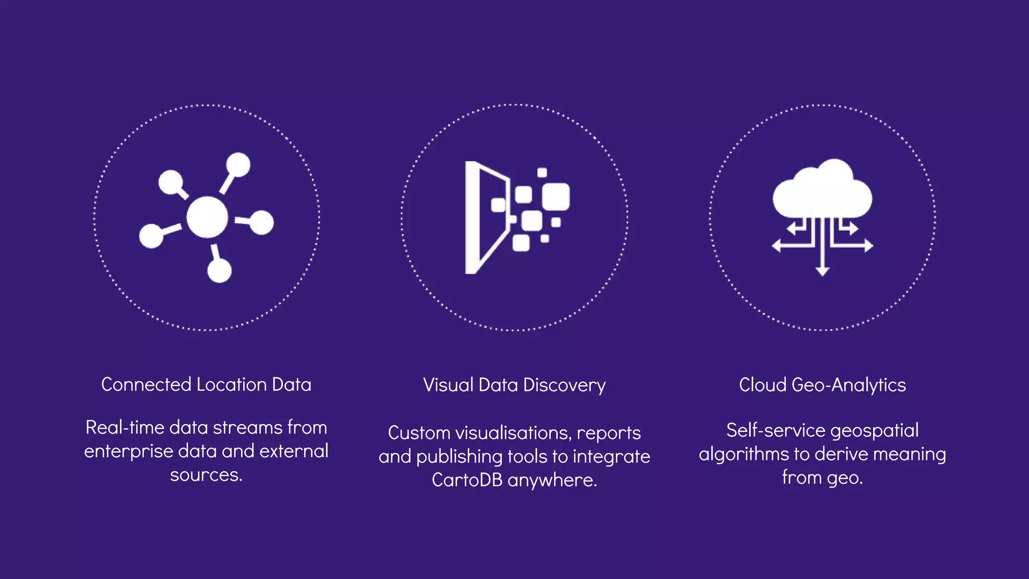
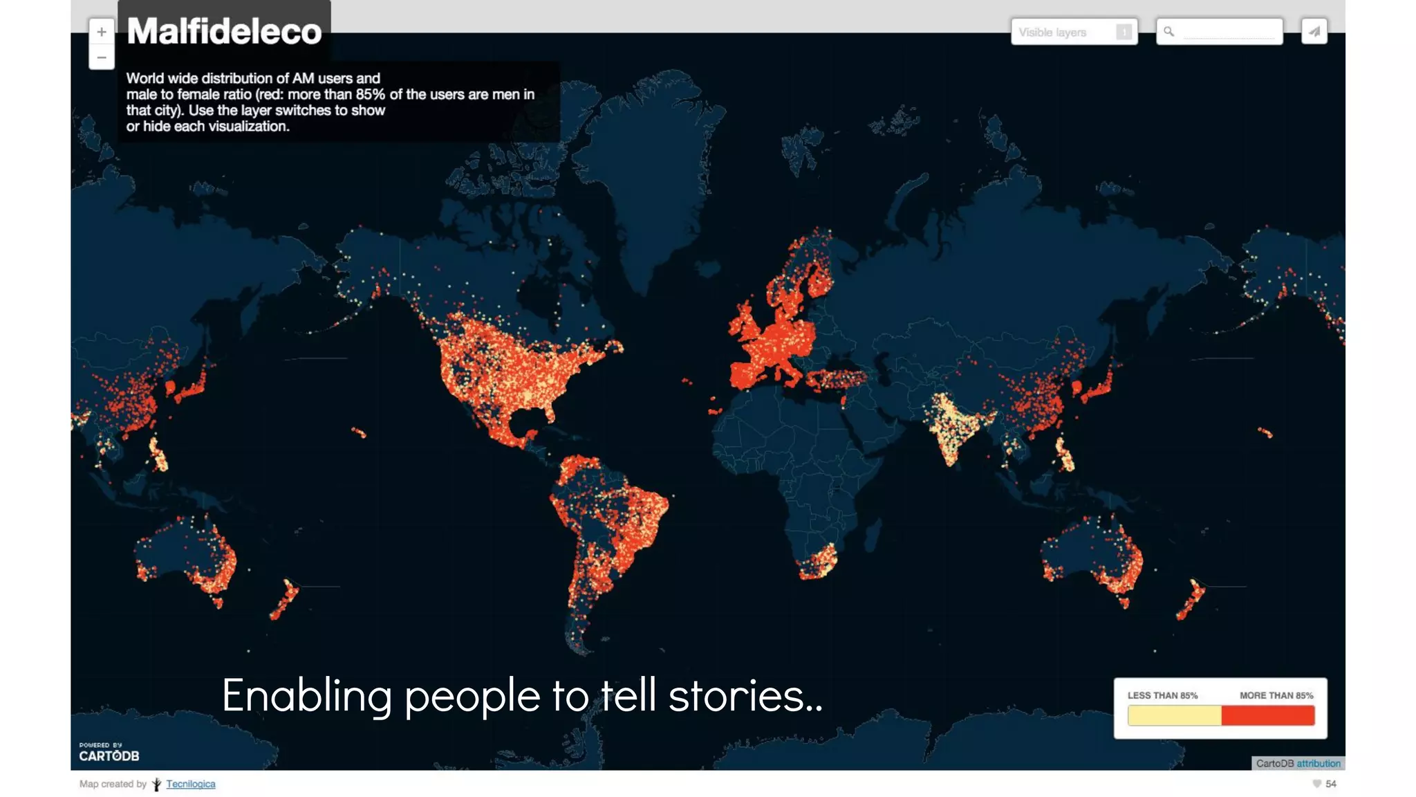
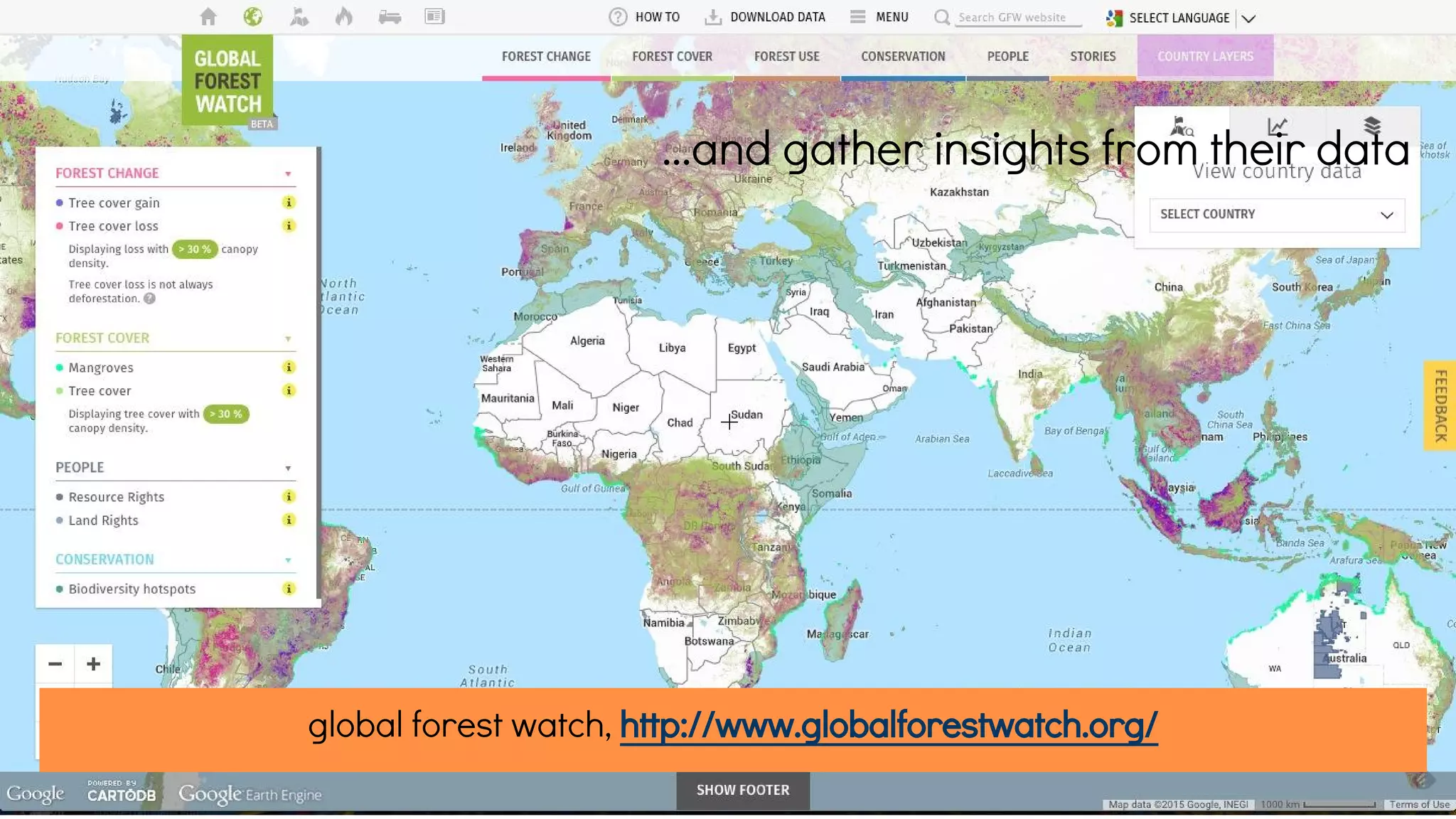
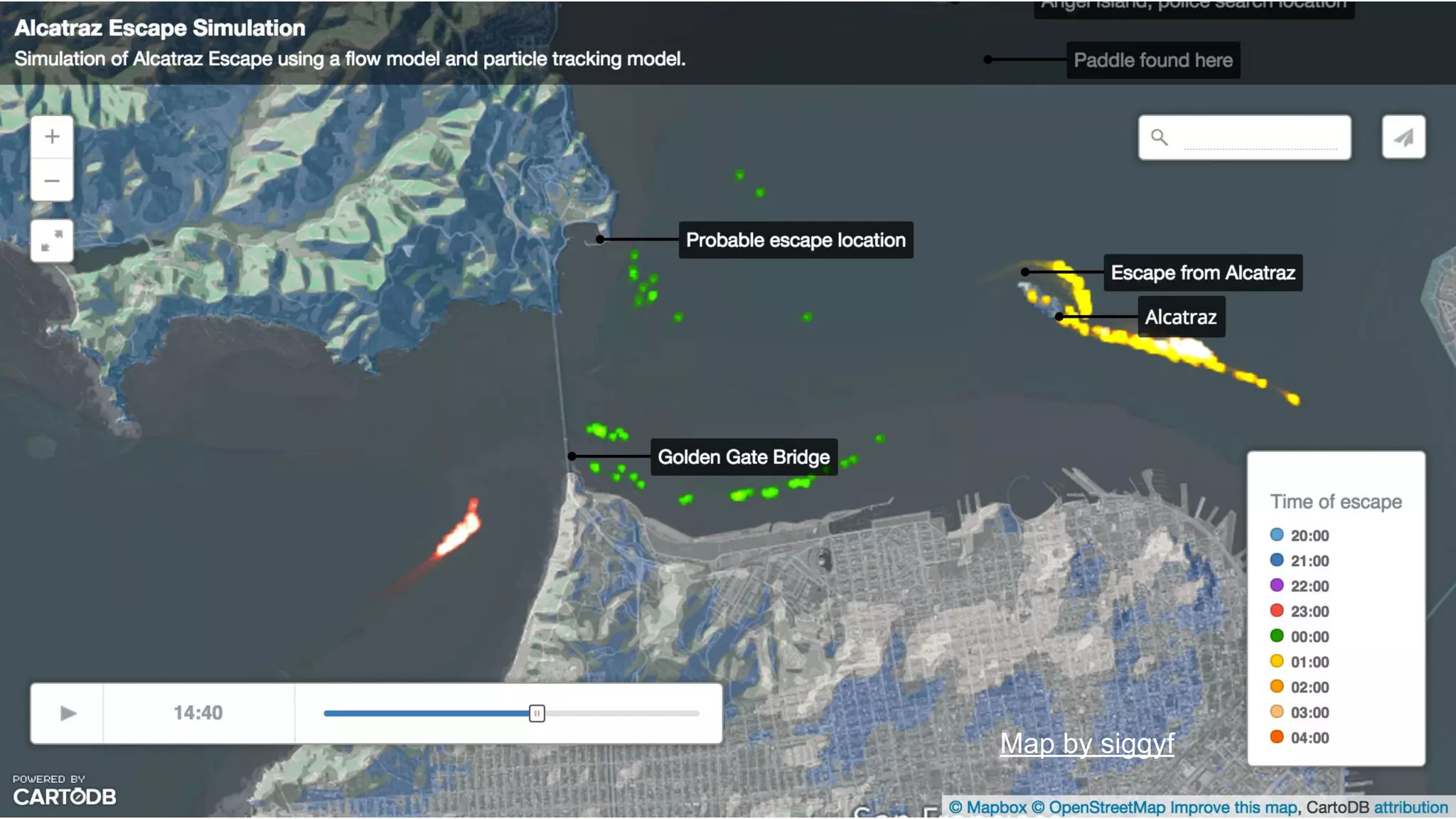
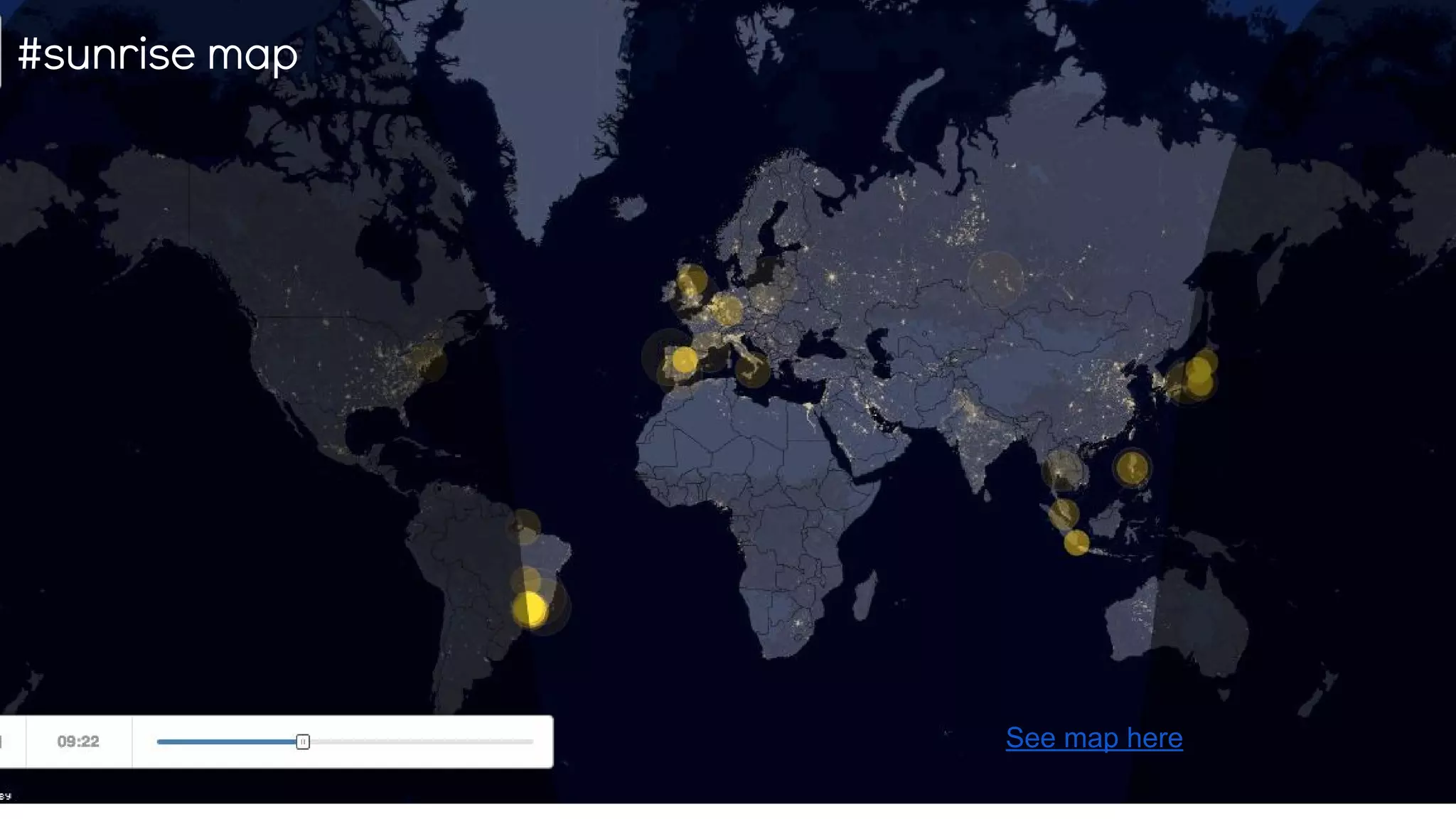
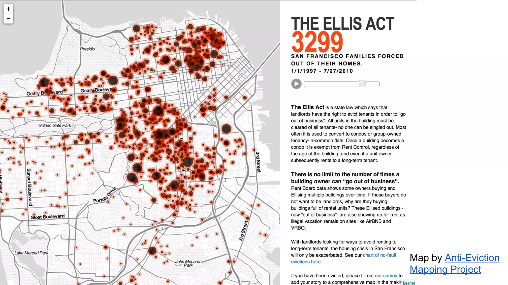
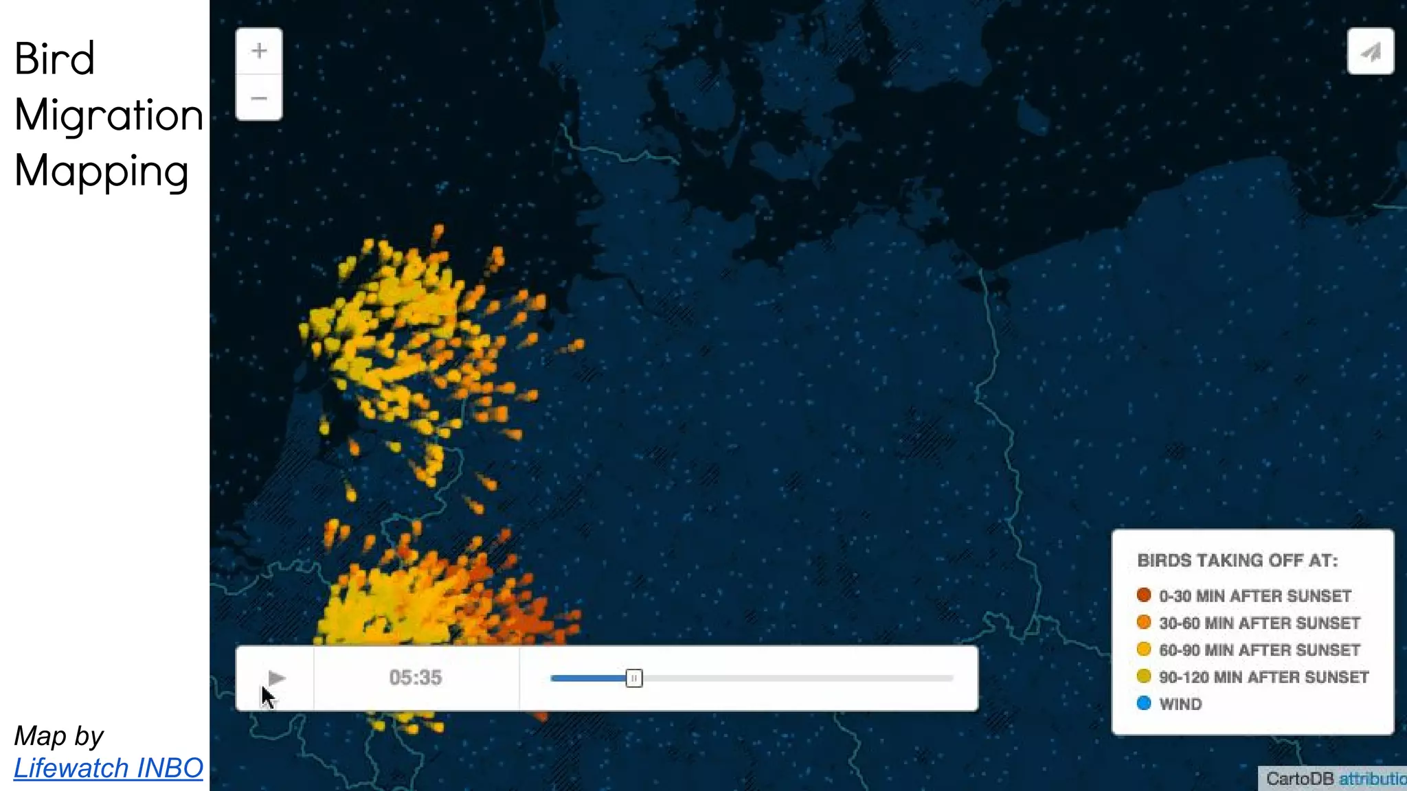
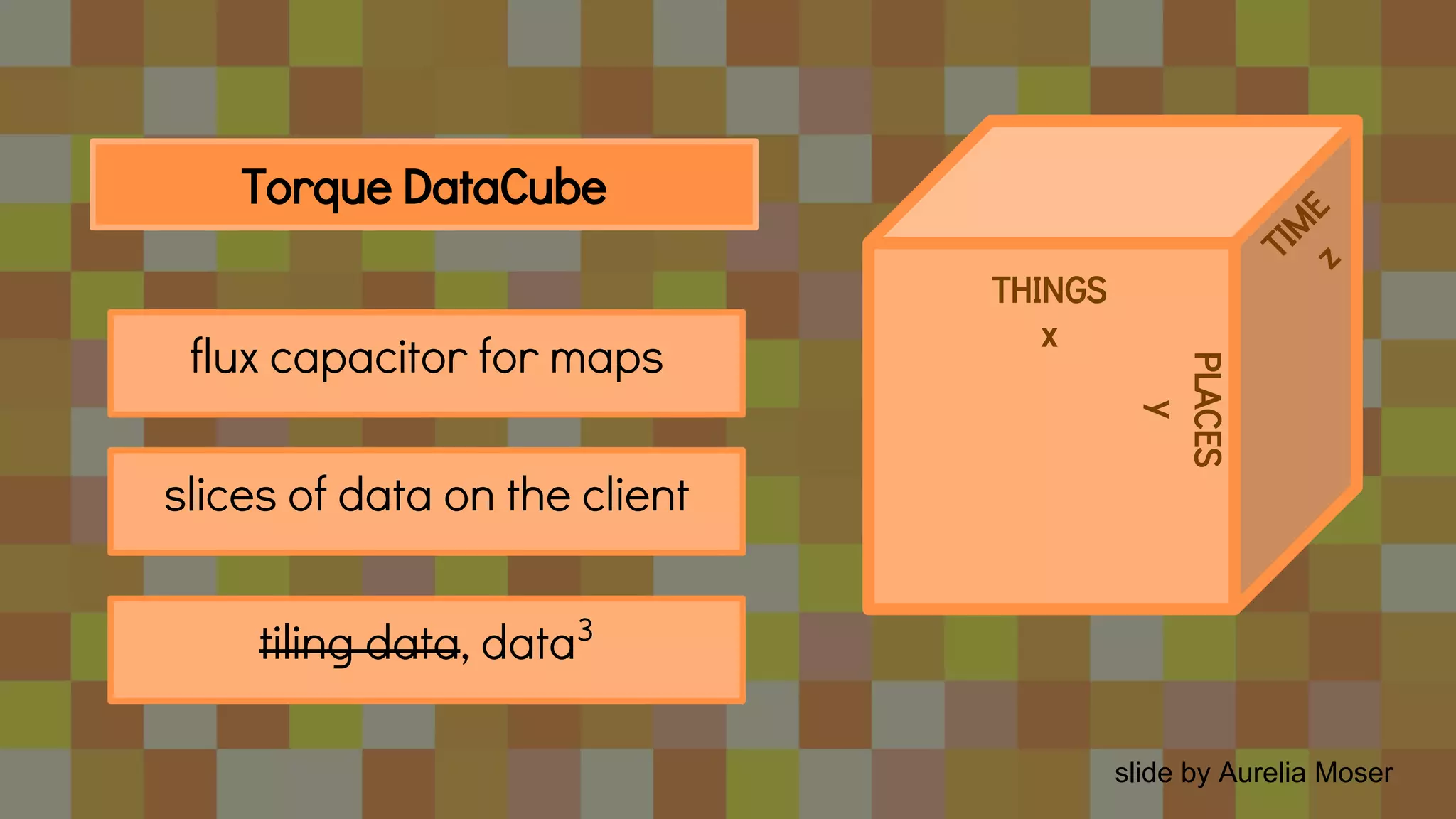
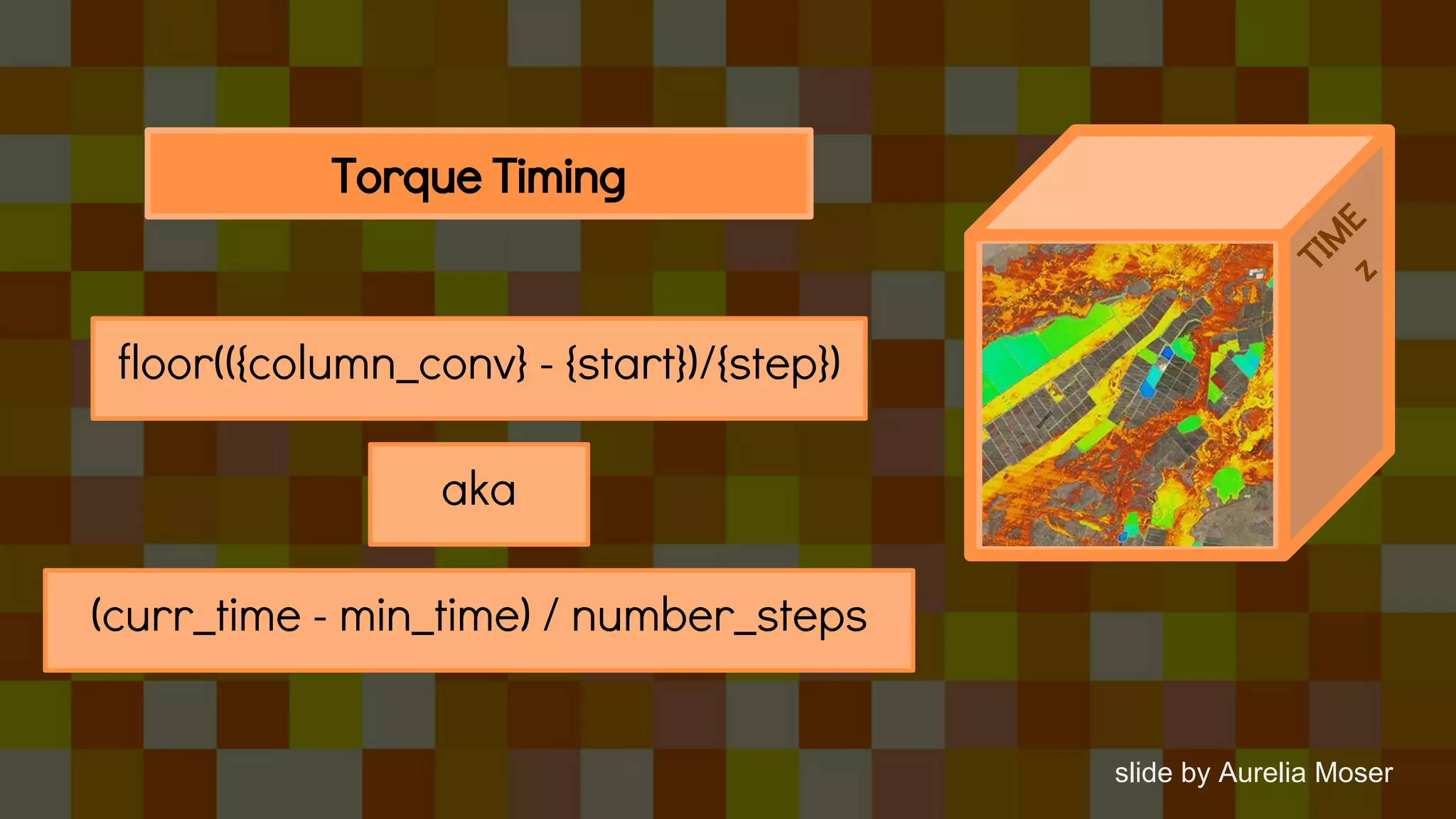
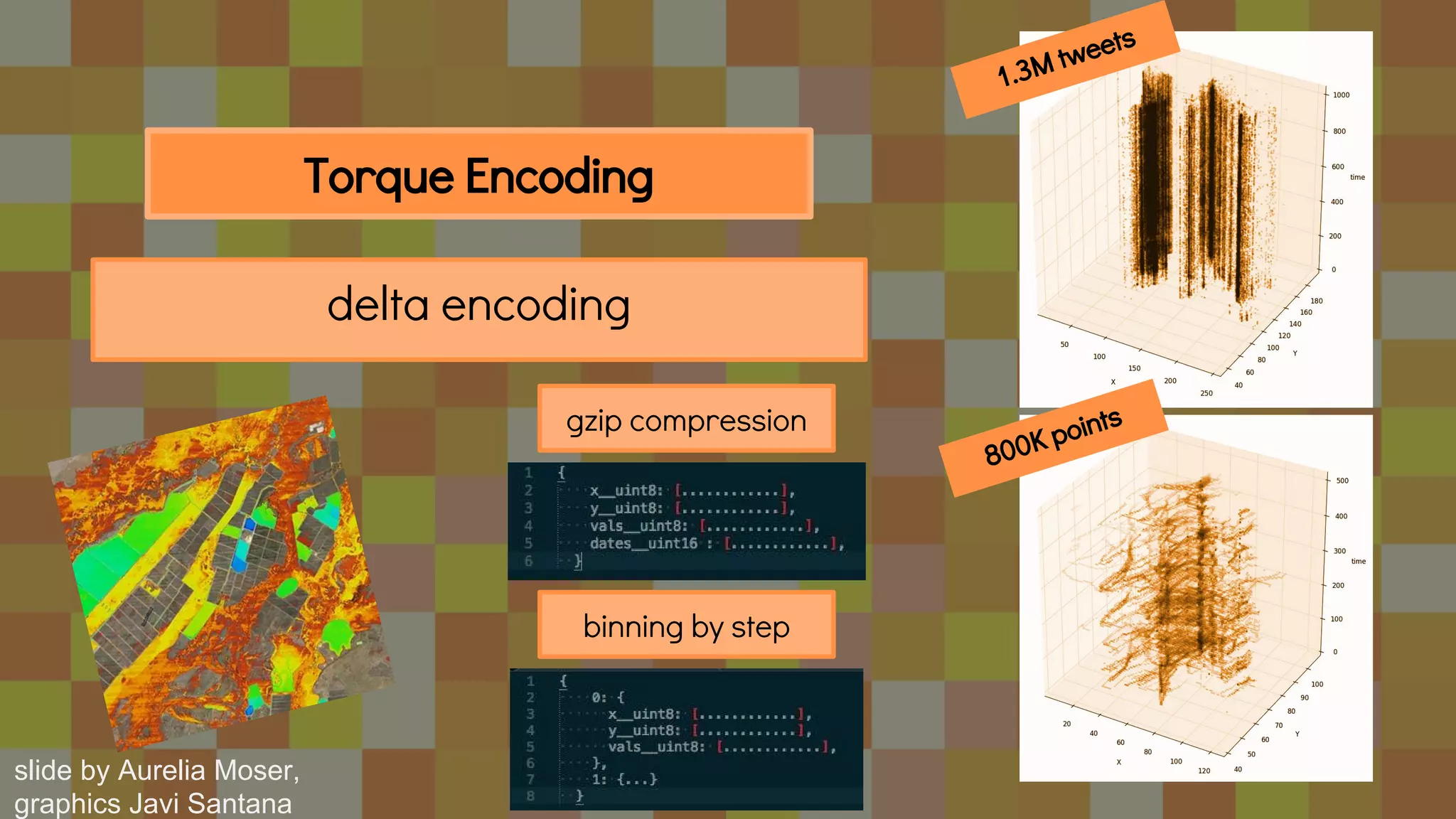
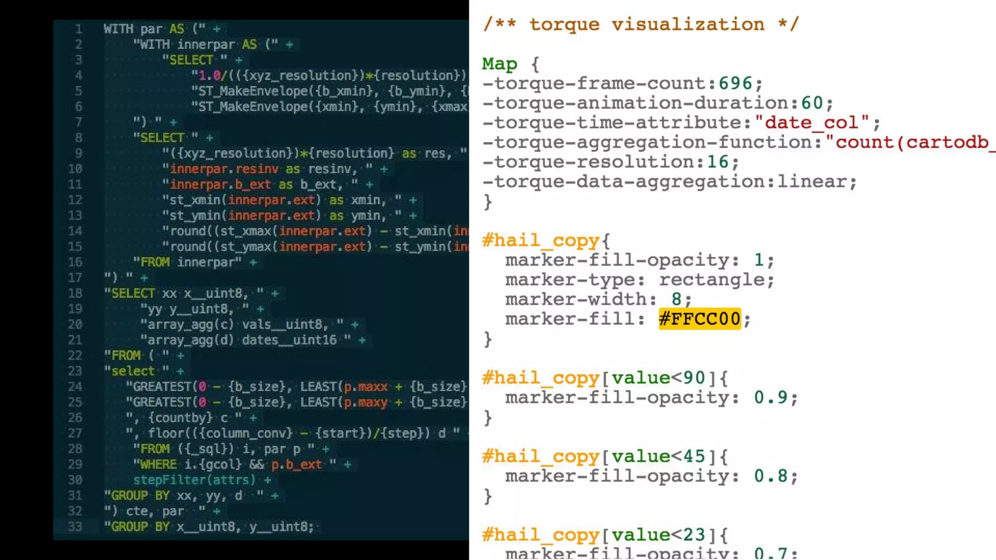
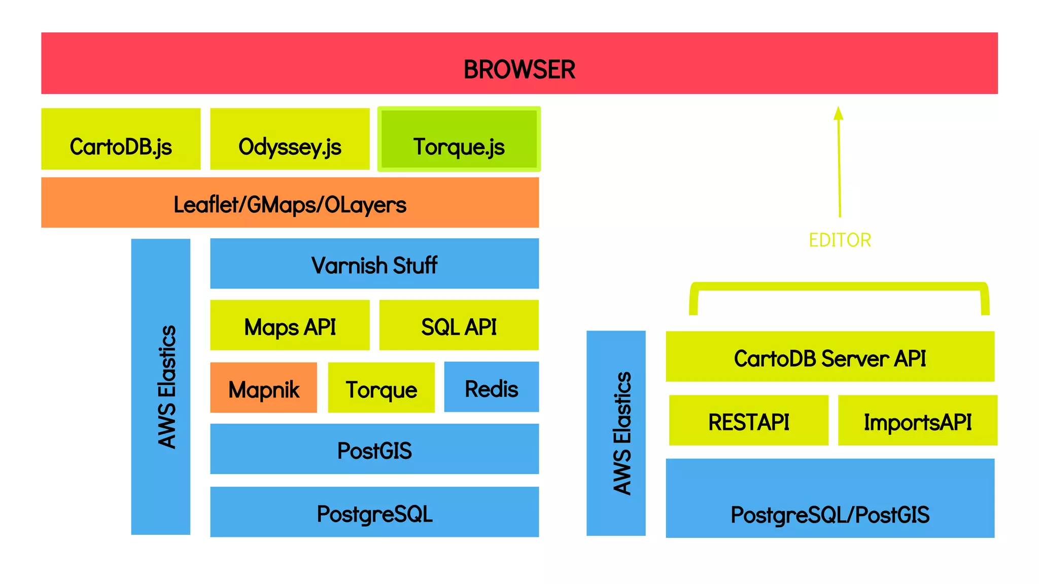
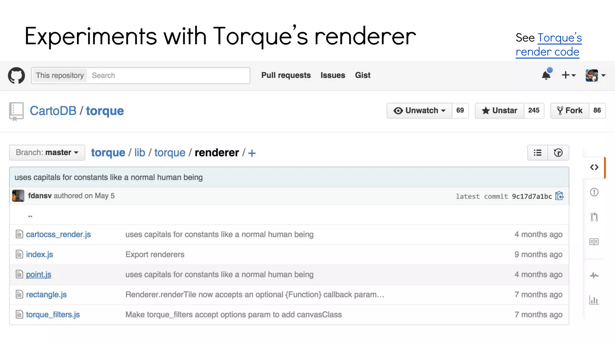
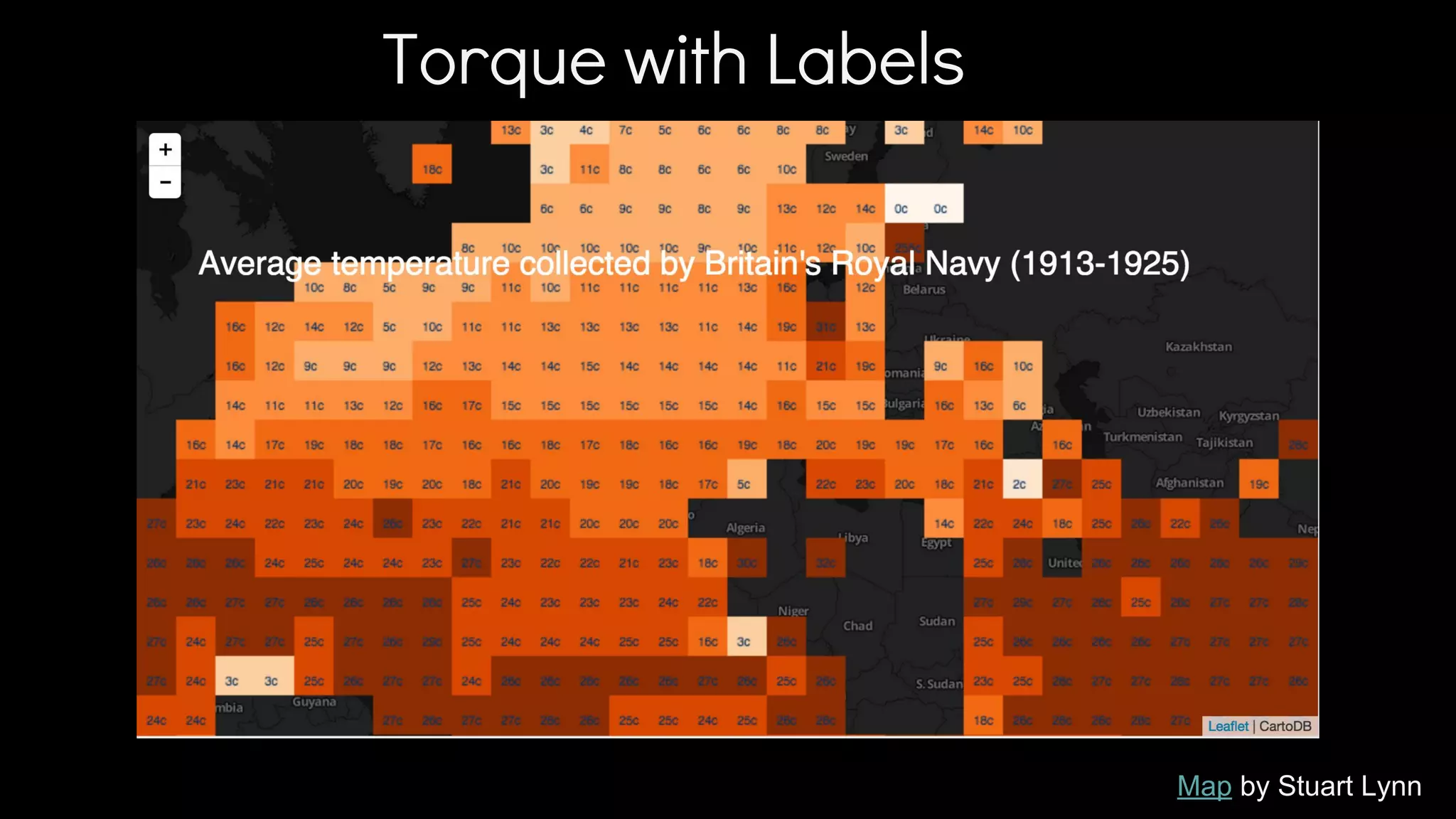
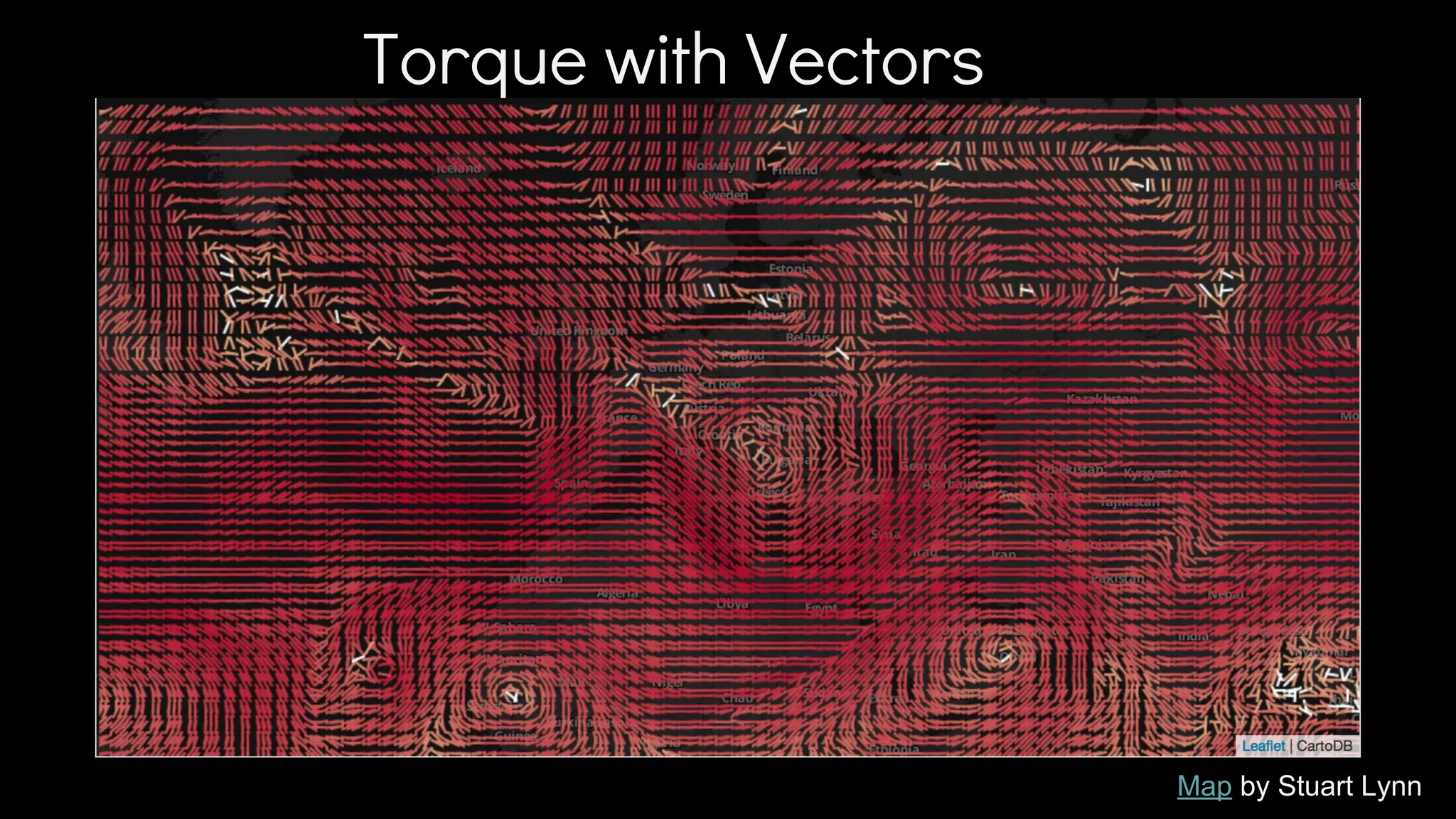
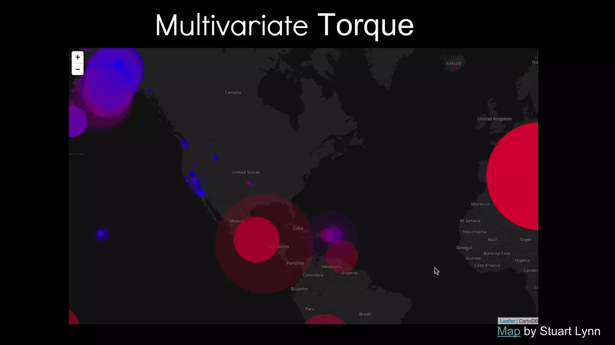
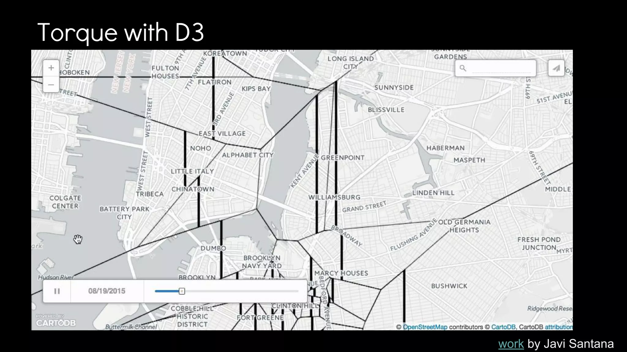
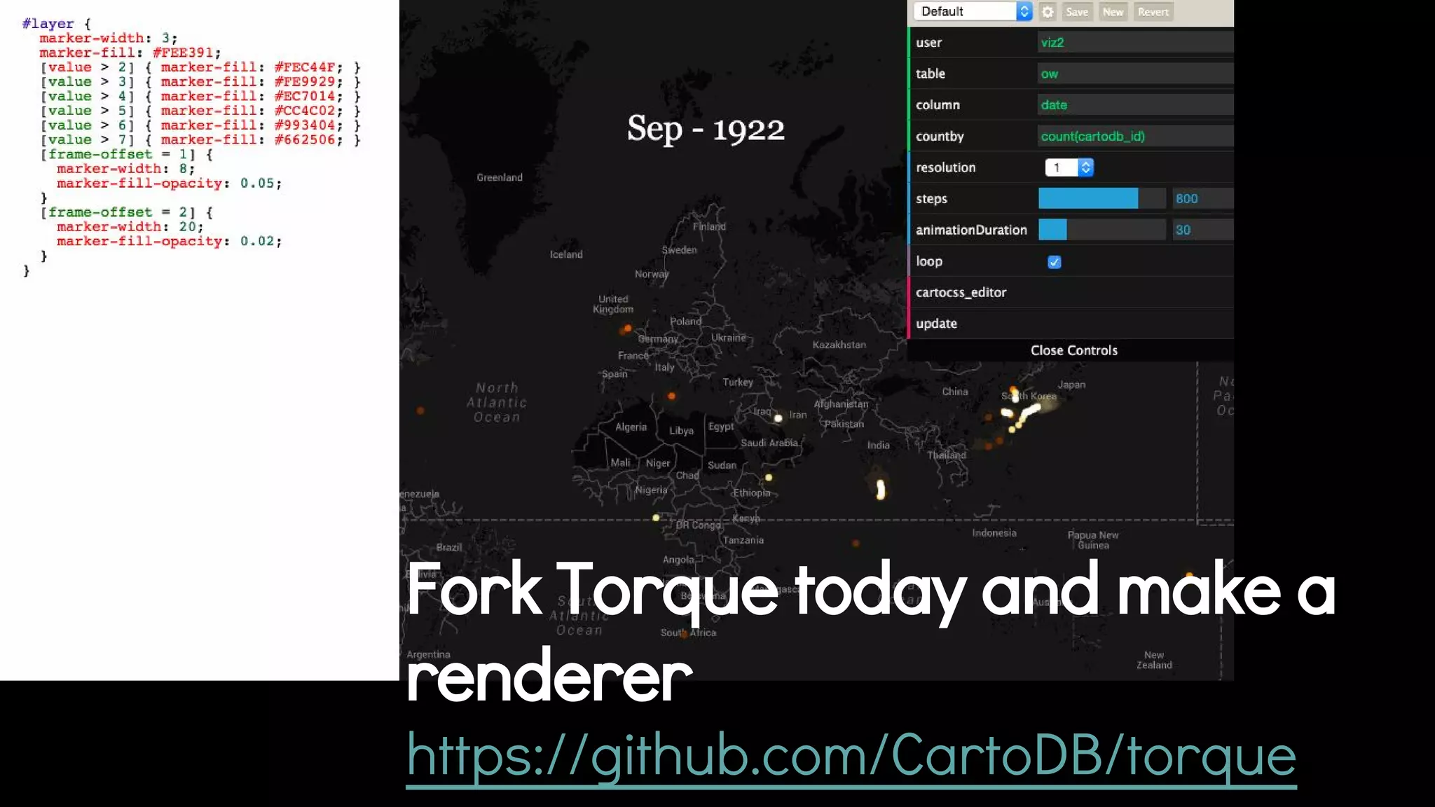
CartoDB and the New Spatial
Technology Paradigm
New ways of exploring
and explaining data
Francisco Dans
@fdans
Rendering developer
CartoDB
Connected Location Data Cloud Geo-AnalyticsVisual Data Discovery
Real-time data streams from
enterprise data and external
sources.
Self-service geospatial
algorithms to derive meaning
from geo.
Custom visualisations, reports
and publishing tools to integrate
CartoDB anywhere.
Enabling people to tell stories..
global forest watch, http://www.globalforestwatch.org/
...and gather insights from their data
CLIENT-SIDE RENDERING!
(without webgl)
cartodb.com/blog
Visualizing
Escape
Scenarios
From the
Washington Post
Map by siggyf
#sunrise map
See map here
See map hereMap by Anti-Eviction
Mapping Project
Map by
Lifewatch INBO
Bird
Migration
Mapping
Animated Web Maps are hard
… traditional data downloads lead to big
bottlenecks
What’s the minimal data dicing we can do?
Torque DataCube
slices of data on the client
flux capacitor for maps
tiling data, data3
THINGS
x
PLACES
y
TIM
Ez
slide by Aurelia Moser
floor(({column_conv} - {start})/{step})
(curr_time - min_time) / number_steps
aka
Torque Timing
TIM
Ez
slide by Aurelia Moser
delta encoding
Torque Encoding
gzip compression
binning by step
1.3M tweets
800K points
slide by Aurelia Moser,
graphics Javi Santana
BROWSER
CartoDB.js Odyssey.js Torque.js
Leaflet/GMaps/OLayers
EDITOR
Varnish Stuff
PostgreSQL
PostGIS
Maps API SQL API
Mapnik Torque Redis
CartoDB Server API
AWSElastics
ImportsAPIRESTAPI
PostgreSQL/PostGIS
AWSElastics
See Torque’s
render code
Experiments with Torque’s renderer
Torque with Labels
Map by Stuart Lynn
Torque with Vectors
Map by Stuart Lynn
Multivariate Torque
Map by Stuart Lynn
Isoline Tests
work by Francisco Dans
Isoline Tests
work by Francisco Dans
Isoband Tests
work by Francisco Dans
Torque with D3
work by Javi Santana
Fork Torque today and make a
renderer
https://github.com/CartoDB/torque
Thank you to Andy Eschbacher
Javi Santana, Stuart Lynn, and
Aurelia Moser for helping with
materials for this talk.

Wherecamp Navigation Conference 2015 - CartoDB and the new spatial technology paradigm