Downloaded 60 times


![Bibliography
Archaeology Data Service. (n.d.) [website]. Retrieved from
http://archaeologydataservice.ac.uk/archsearch/
Blackwell, S. (2004). A Companion to Digital Humanities, ed. Susan
Schreibman, Ray Siemens, John Unsworth. Oxford: Blackwell. Retrieved
from http://www.digitalhumanities.org/companion/
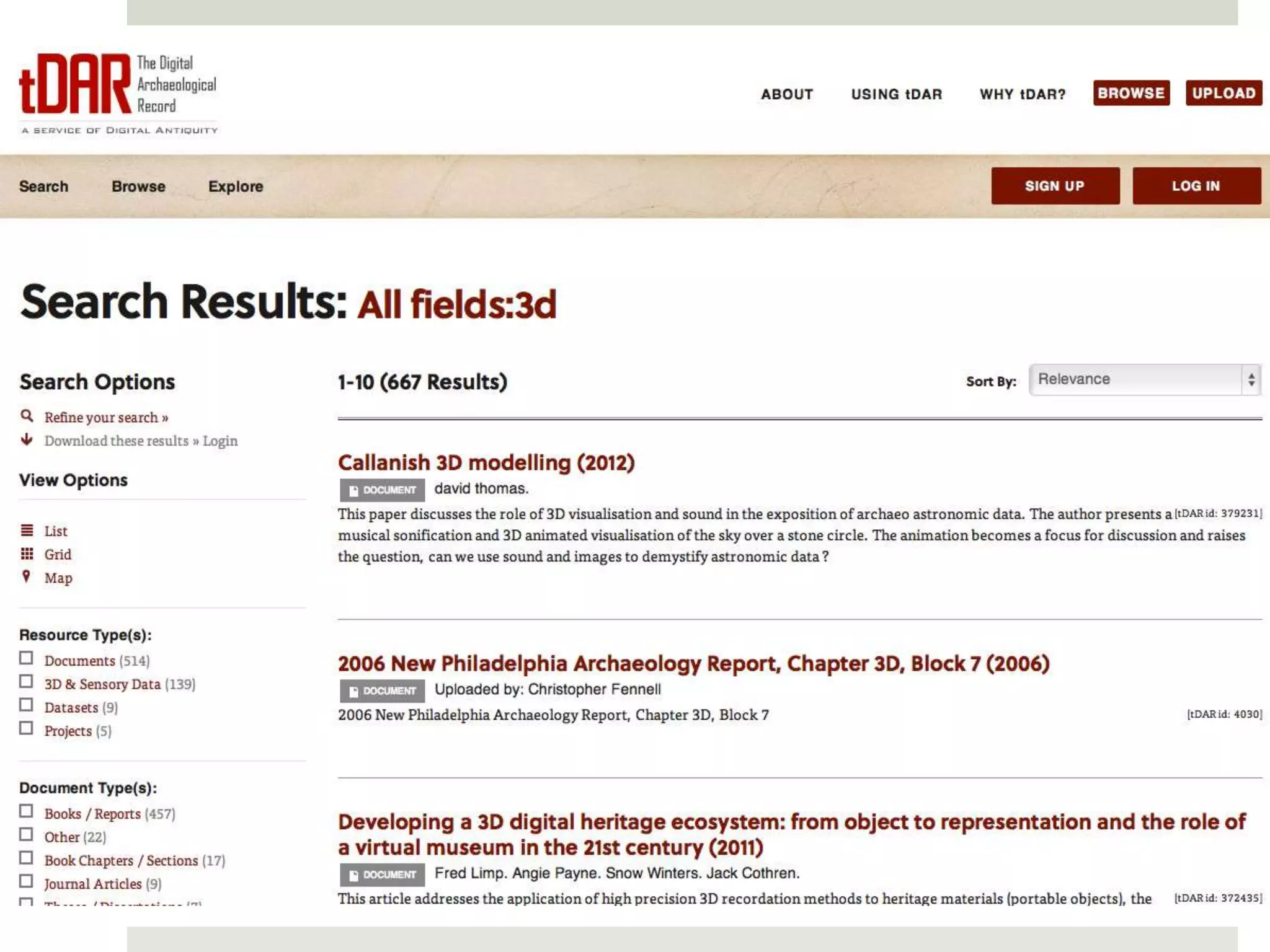
The Digital Archaeological Record tDAR. (n.d.) [website]. Retrieved
from http://www.tdar.org
Grossman J. W. (2008). “Human-landscape interactions.” In:
Encyclopedia of Archaeology, ed. by Deborah M. Pearsall. © 2008,
Academic Press, New York.
Grossman J. W. (2008). “Toxic and hazardous environments.” In:
Encyclopedia of Archaeology, ed. by Deborah M. Pearsall. Academic
Press, New York.](https://image.slidesharecdn.com/digital-humanities-and-archaeology-130213074519-phpapp01/75/Digital-humanities-and-archaeology-43-2048.jpg)
![Bibliography
Hopkins, C. (March 10, 2012). “Indiana Jones goes geek: Laser-mapping
LiDAR revolutionizes archaeology, Arstechnica [website] Retrieved from
http://arstechnica.com/science/2012/03/indiana-jones-goes-geek-
laser-mapping-lidar-revolutionizes-archaeology/
National Oceanic and Atmospheric Administration (NOAA), Coastal
Services Center. (November 2012). LiDAR 101: an introduction to LiDAR
technology, data, and applications. Retrieved from
http://www.csc.noaa.gov/digitalcoast/_/pdf/lidar101.pdf
Texas Advanced Computing Center. (n.d.) Advanced Computing in
the Humanities, Art and Social Sciences. [website] Retrieved from
http://www.tacc.utexas.edu/education/humanities](https://image.slidesharecdn.com/digital-humanities-and-archaeology-130213074519-phpapp01/75/Digital-humanities-and-archaeology-44-2048.jpg)

The document discusses the integration of digital humanities into archaeology, highlighting its role in material studies and historical reconstruction. It outlines various archaeological methods, emphasizes the importance of record-keeping aided by computers, and details the evolution of computing technologies in this field since the 1950s. Furthermore, it addresses challenges related to data preservation and the need for standardization in communication and tools among practitioners.


![Vibe Coding vs. Spec-Driven Development [Free Meetup]](https://cdn.slidesharecdn.com/ss_thumbnails/vibecodingvsspecdrivendevelopment-251209105622-43f455e7-thumbnail.jpg?width=640&height=640&fit=bounds)

