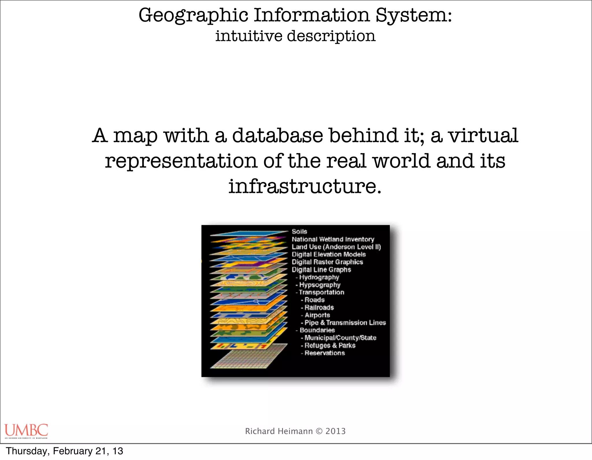

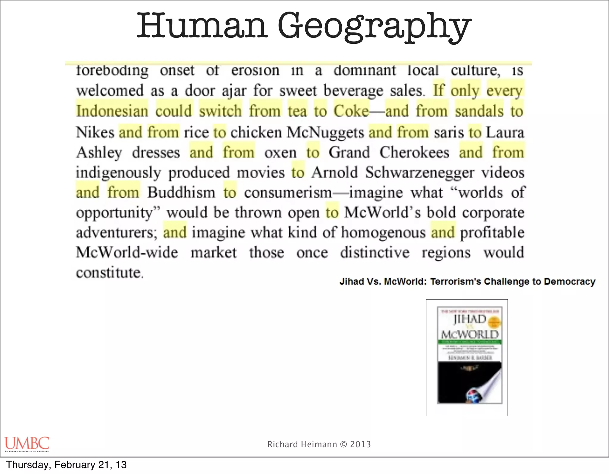


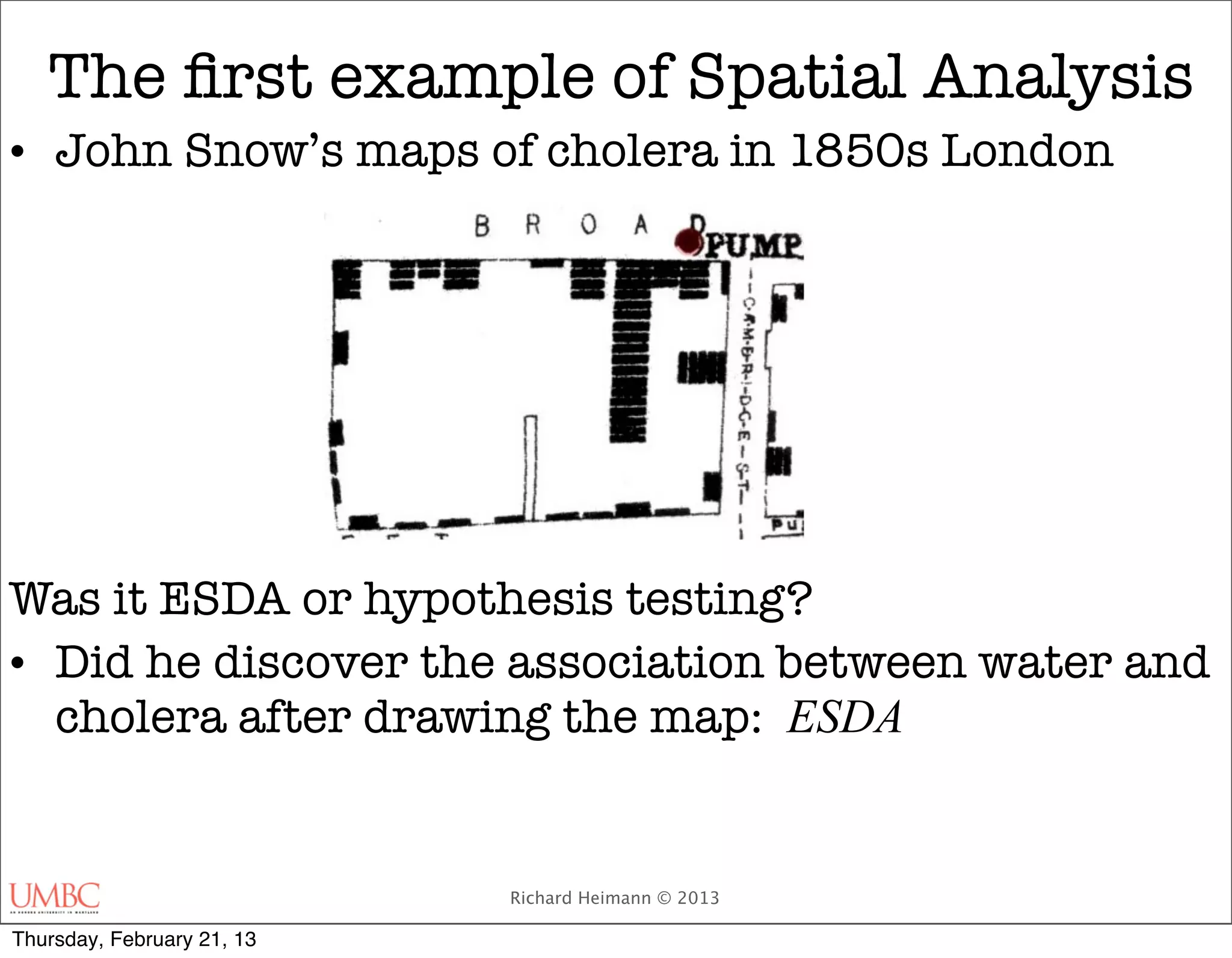
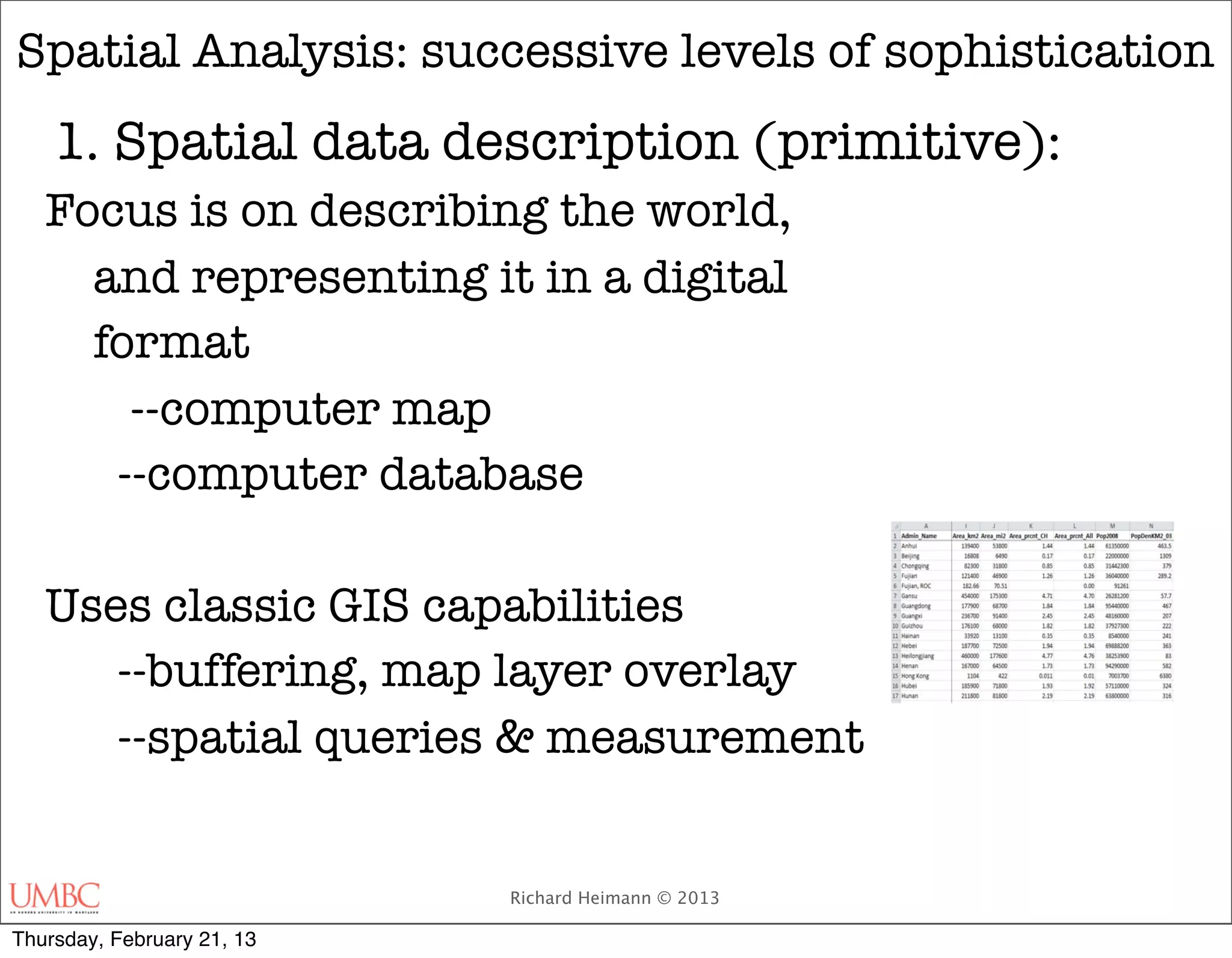
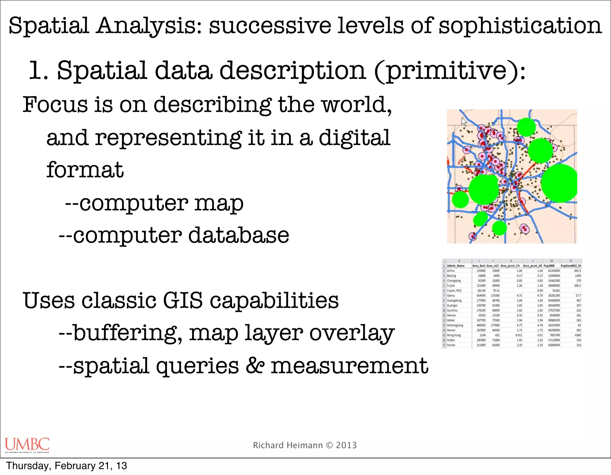
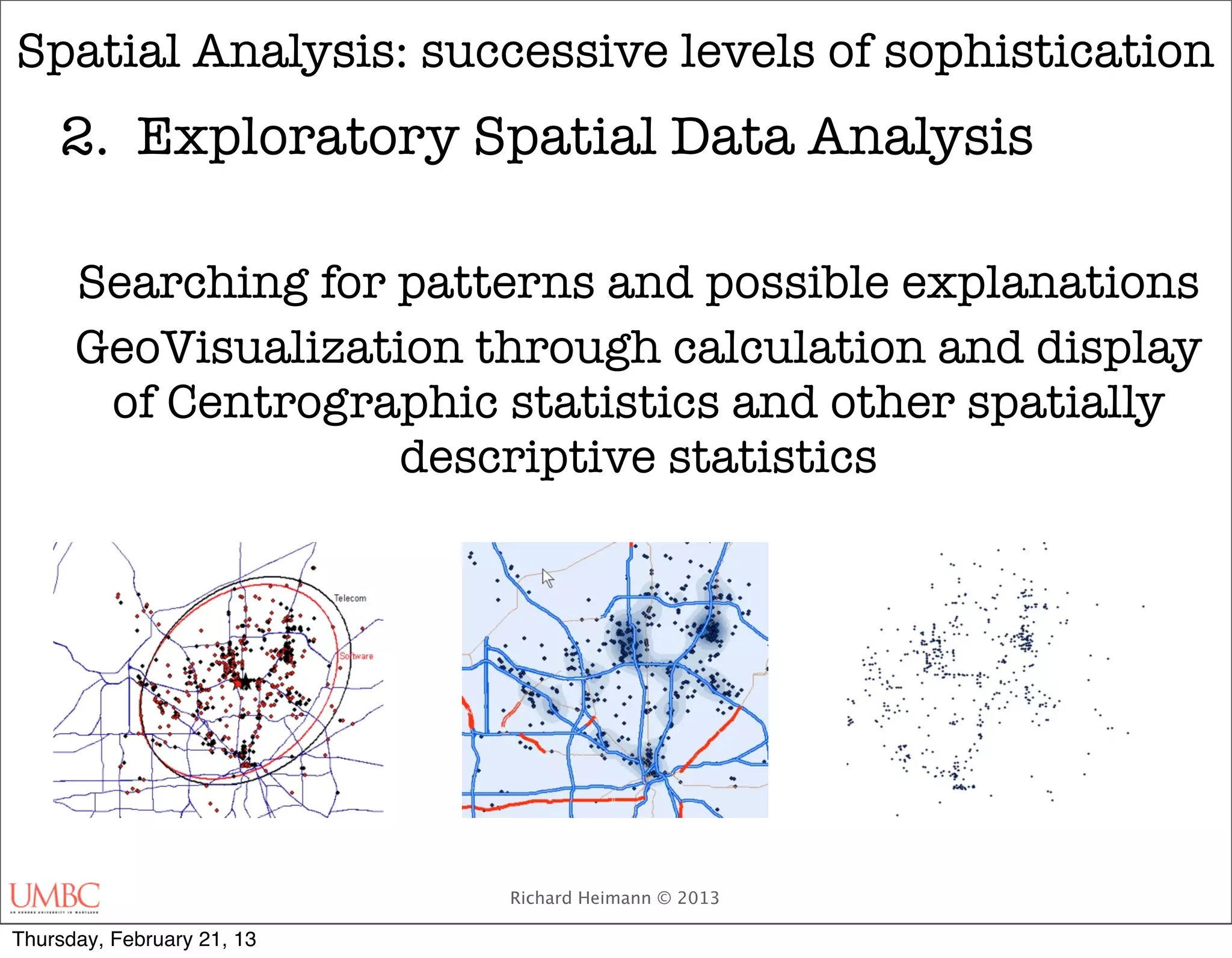
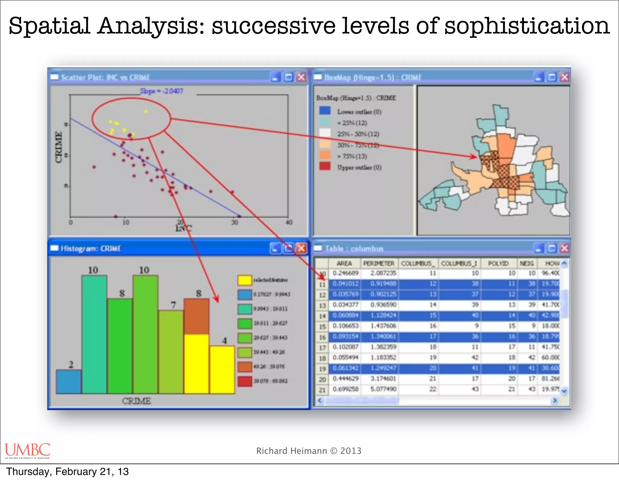
![Spatial Analysis: successive levels of sophistication
2. Exploratory Spatial Data Analysis
Centrographics - Moments of Data
Map showing changes to the mean center of population for the
United States, 1790–2010 (U.S. Census Bureau)[1]
http://en.wikipedia.org/wiki/Moment_(mathematics)
Richard Heimann © 2013
Thursday, February 21, 13](https://image.slidesharecdn.com/ges659spring20131intro-130222092247-phpapp02/75/Spatial-Analysis-and-Geomatics-61-2048.jpg)


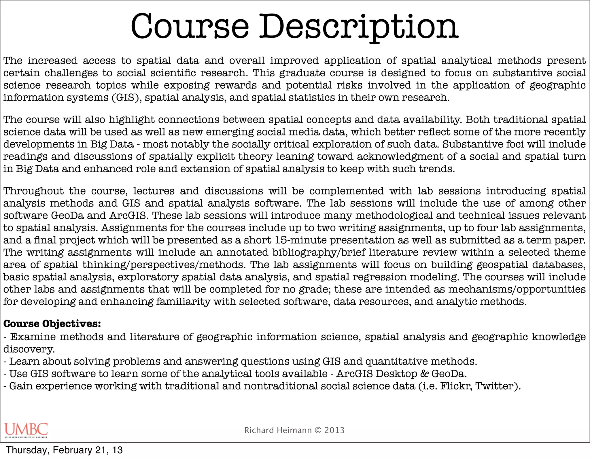
The document outlines the course GES673: Geoprocessing & Spatial Analysis at Shady Grove, focusing on social scientific research using GIS and spatial analytical methods. It details the course structure, including lab sessions, assignments, and objectives, emphasizing both traditional data and emerging social media data in spatial analysis. Key topics include GIS definitions, analytical methodologies, and the importance of geographical literacy in the context of modern data analysis.