Downloaded 142 times


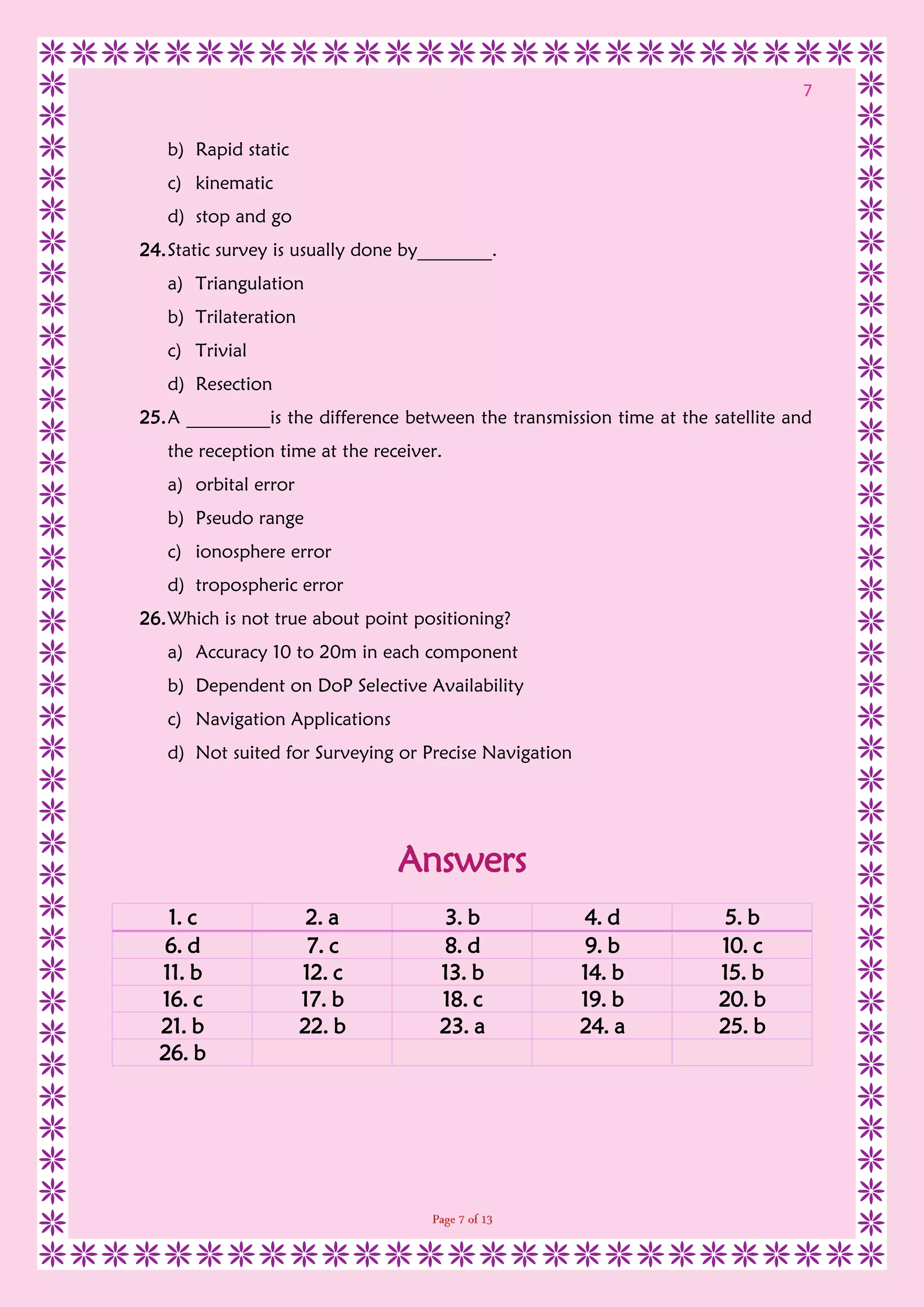
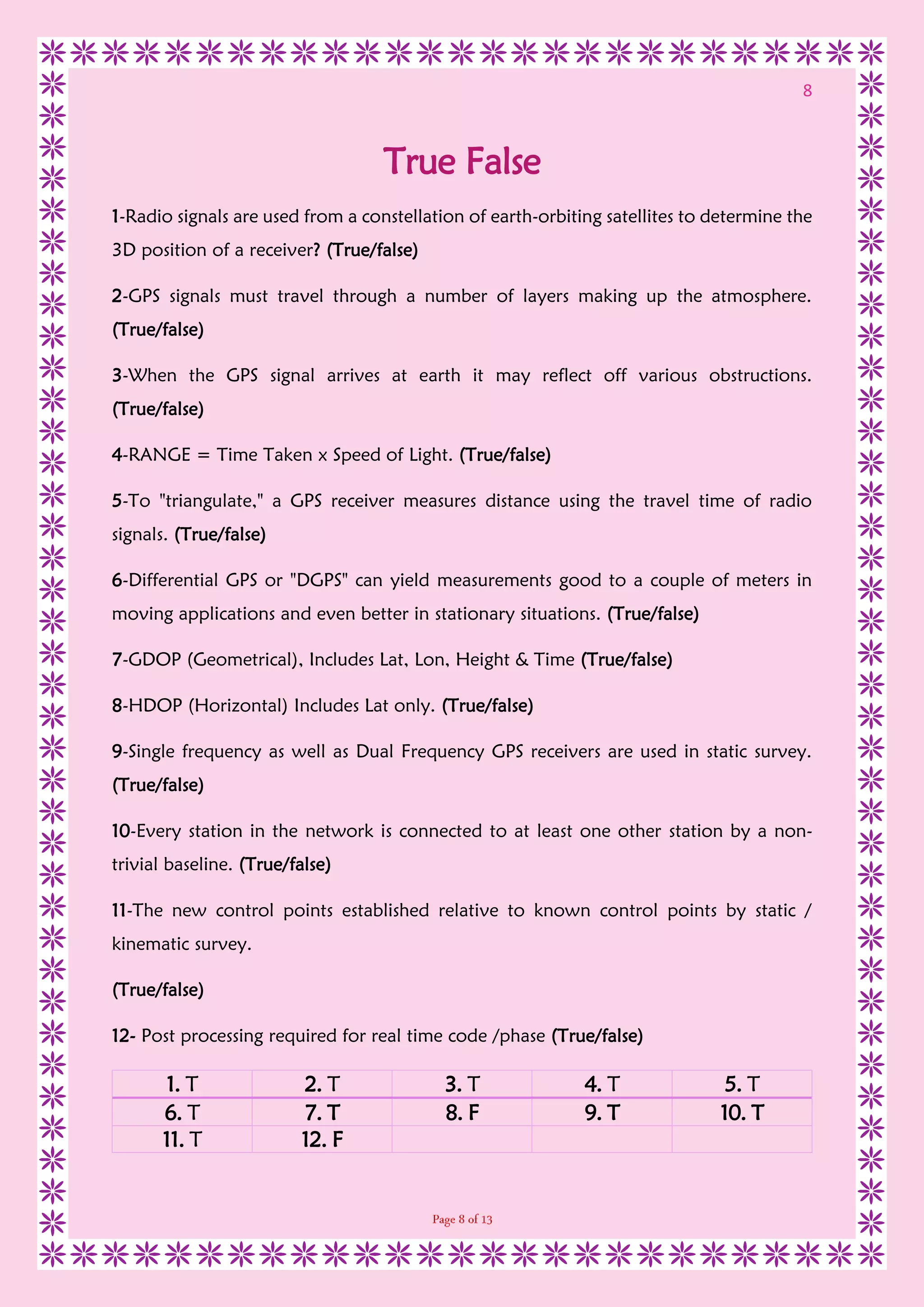
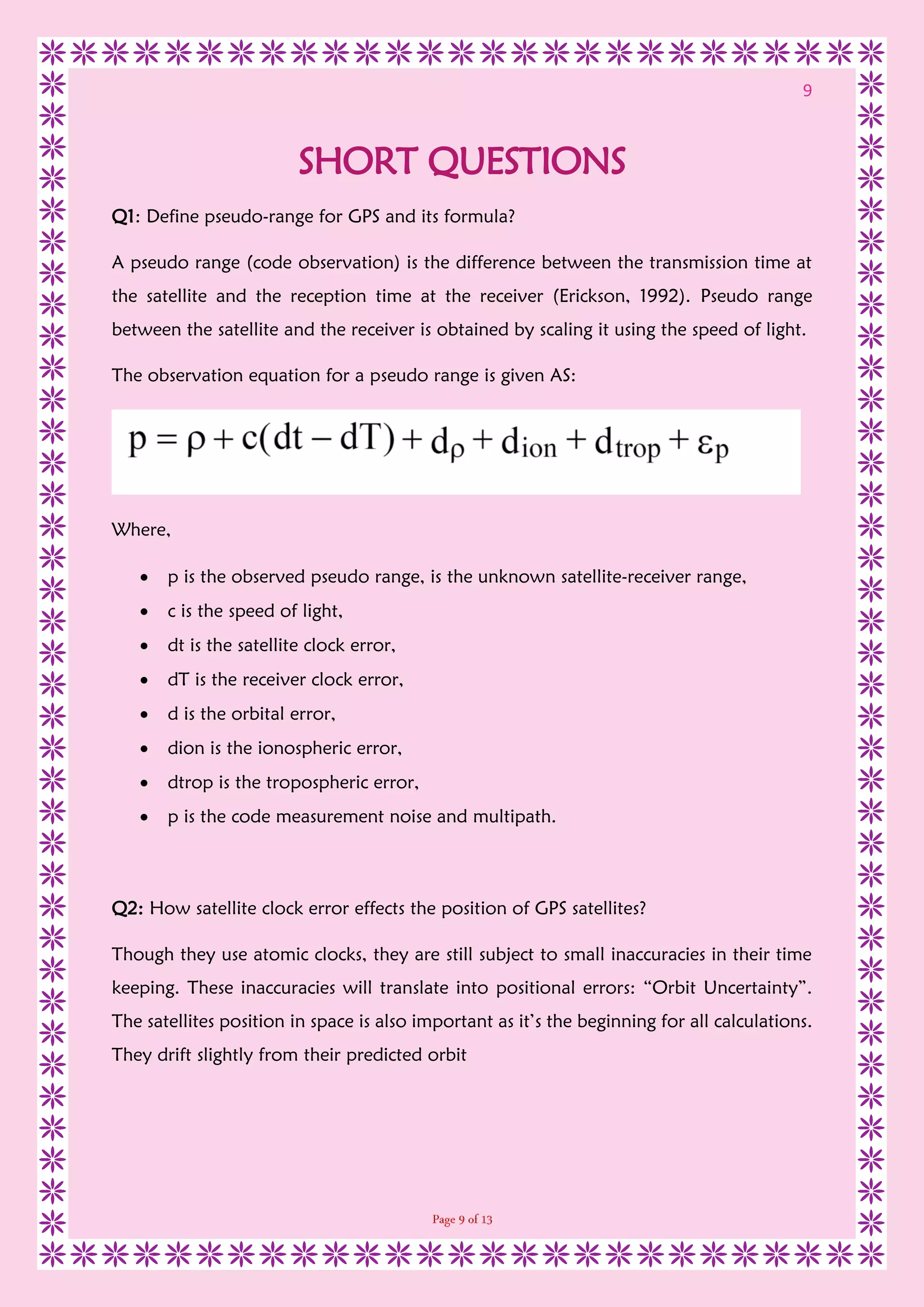
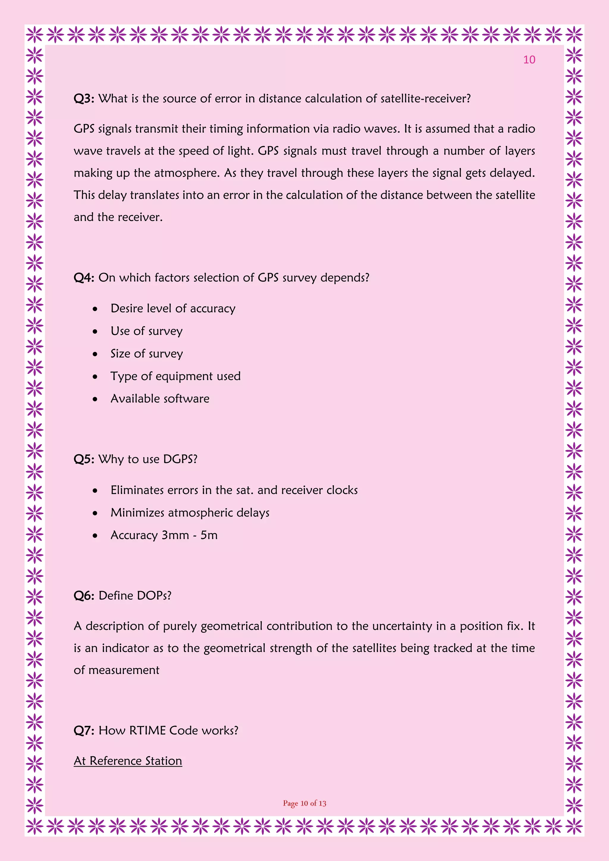
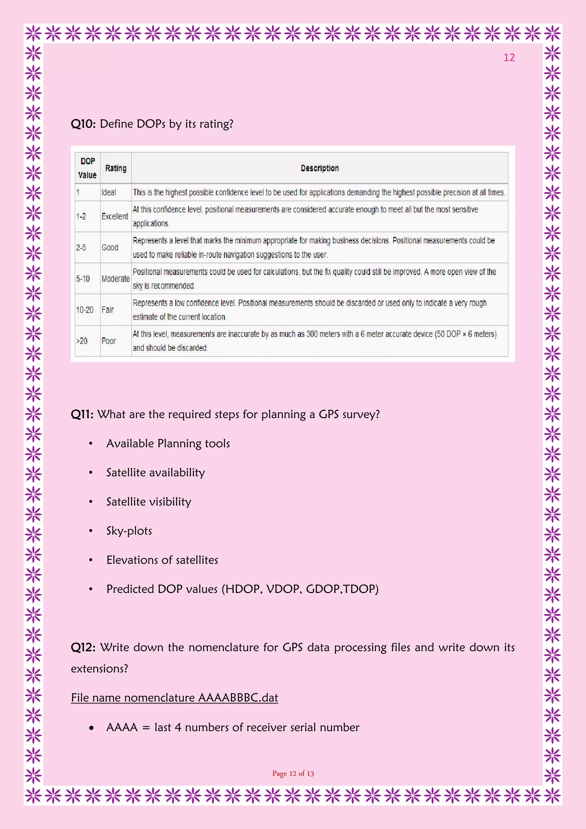

This document contains questions and answers related to GPS surveying techniques. It includes 15 multiple choice questions, 10 true/false statements, and 15 short answer questions about topics such as pseudo-ranges, satellite clock errors, sources of distance calculation errors in GPS, factors to consider when selecting a GPS survey method, real-time kinematic surveying, and types of GPS errors.


![Coded Agents – with UiPath SDK + LangGraph [Virtual Hands-on Workshop]](https://cdn.slidesharecdn.com/ss_thumbnails/codedagentsdeck-251215155422-5497c599-thumbnail.jpg?width=640&height=640&fit=bounds)


