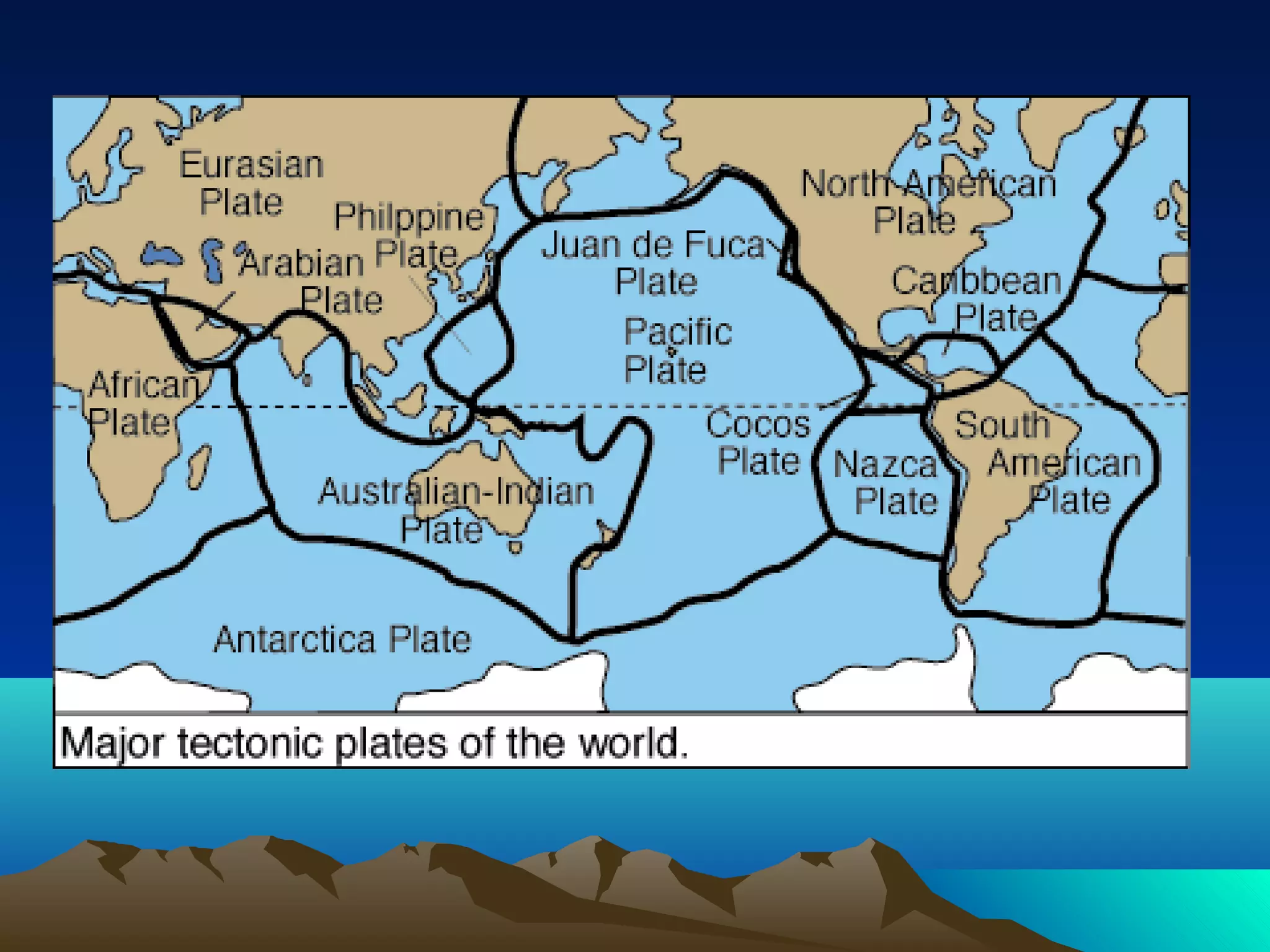
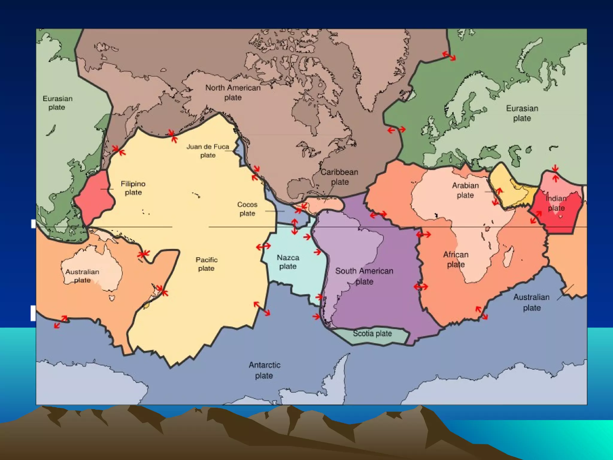
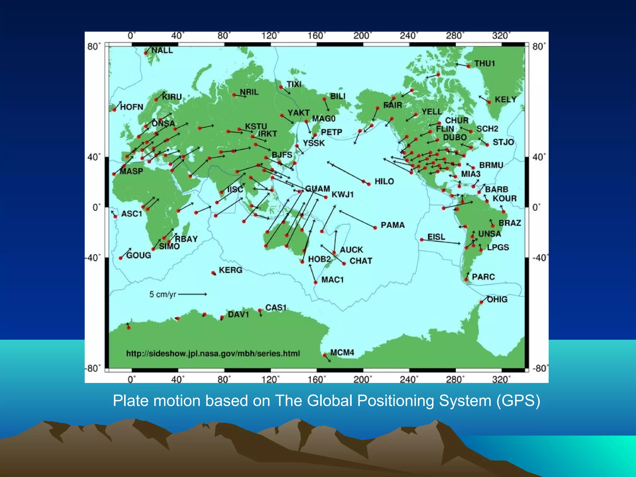
- The Earth's crust is made up of tectonic plates that are constantly moving due to convection currents in the mantle.
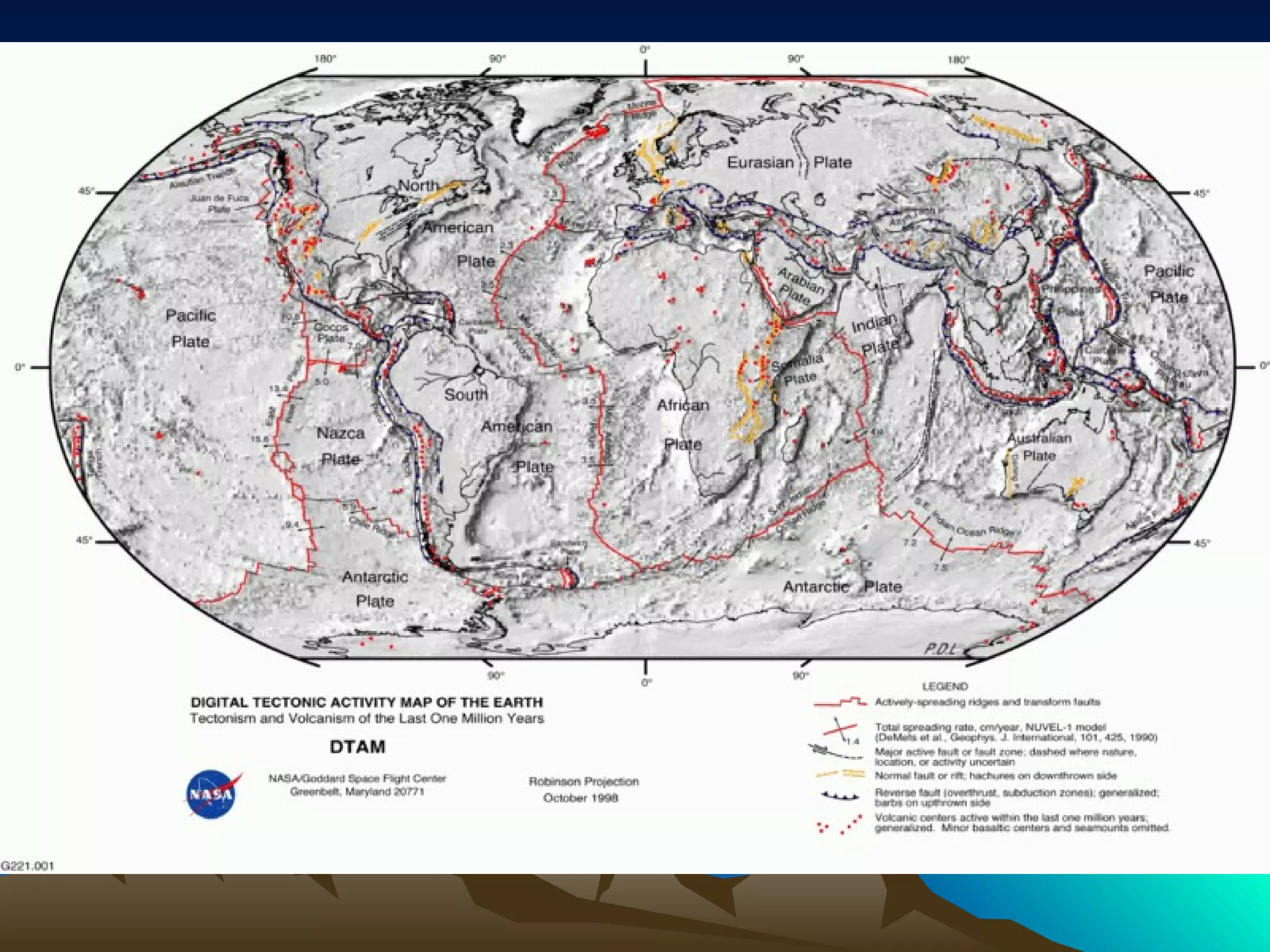
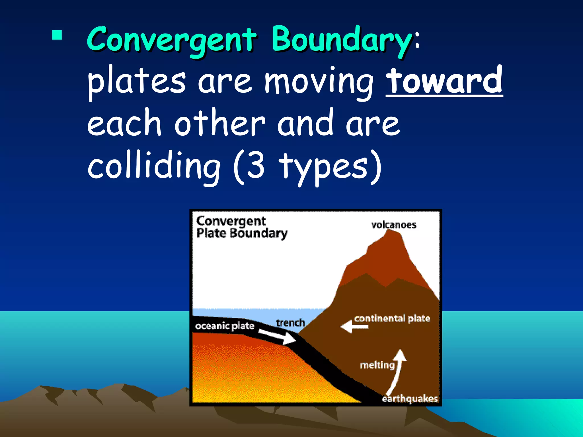
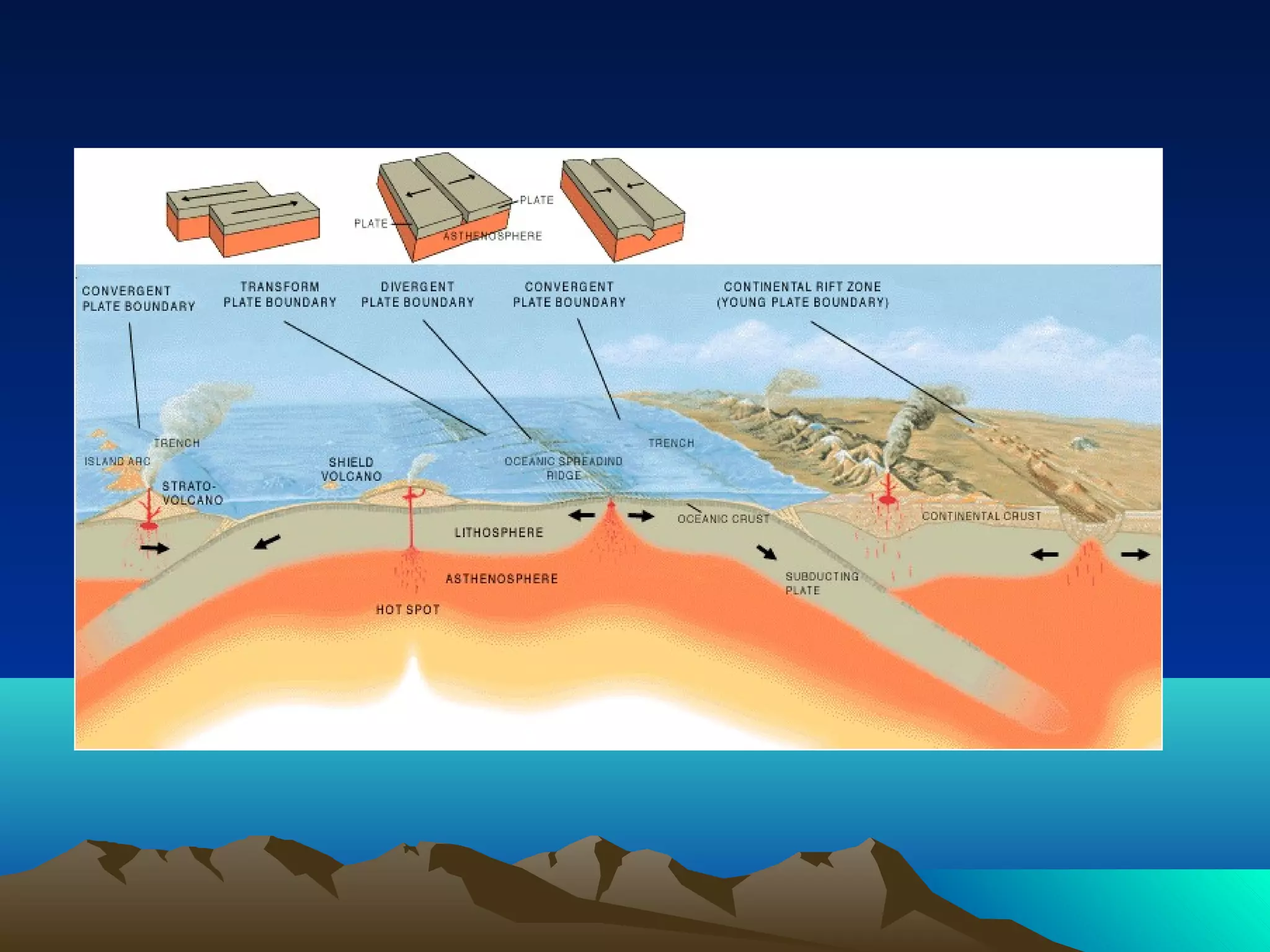
- There are three types of plate boundaries: divergent where plates separate and new crust is formed, convergent where plates collide and oceanic plates are subducted, and transform where plates slide past each other.
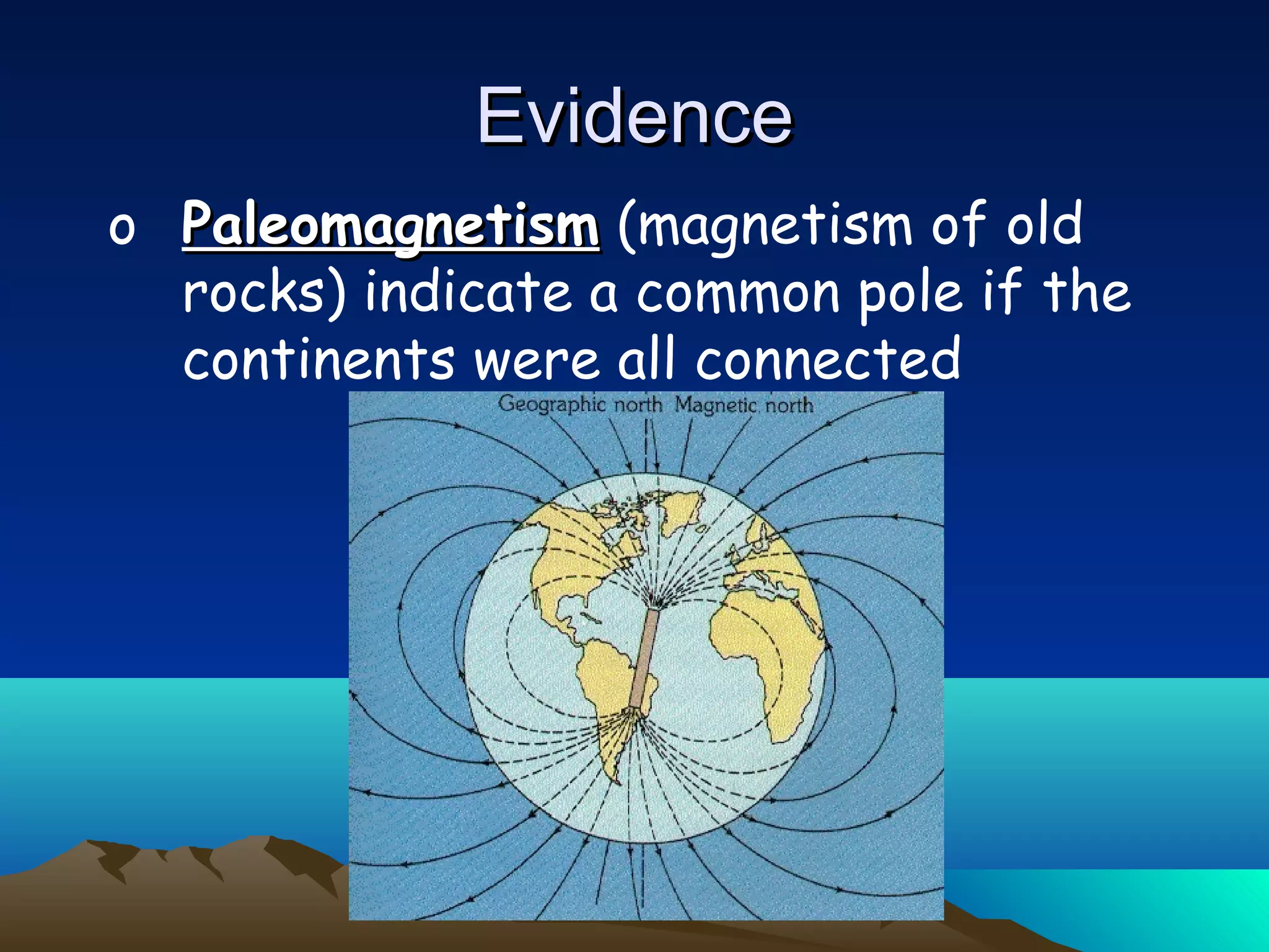
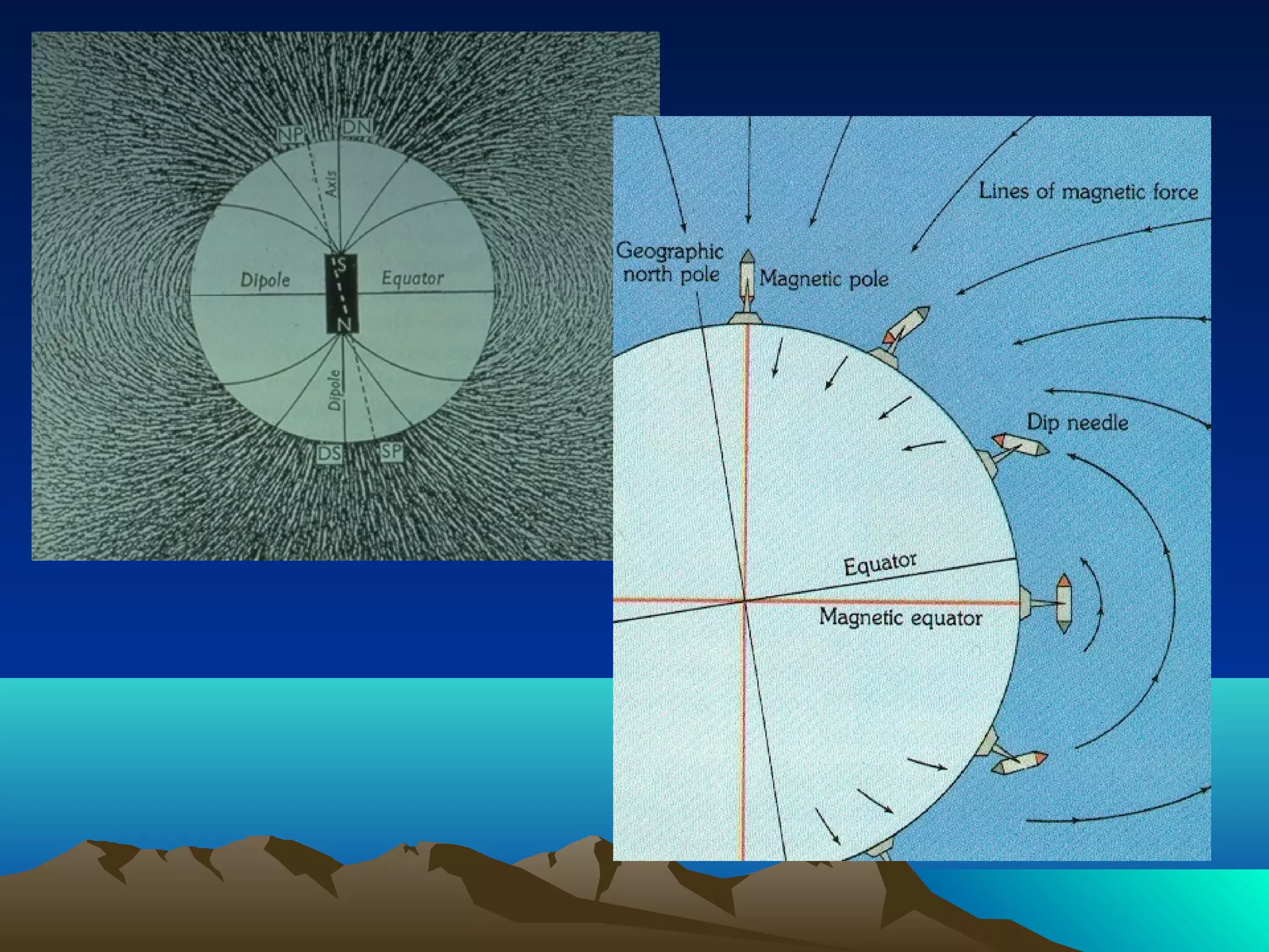
- Evidence for plate tectonics includes magnetic patterns in ocean crust, matching fossils and rock formations on separated continents, and the fit of continental shelves. Plate movements have caused continents like Pangaea to break apart over millions of years.
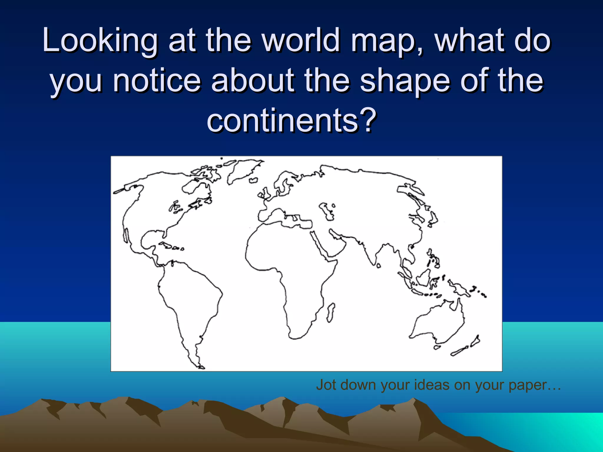
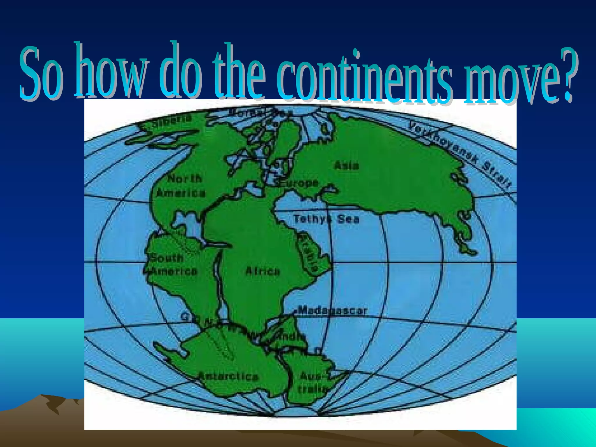
Looking at theworld map, what doLooking at the world map, what do
you notice about the shape of theyou notice about the shape of the
continents?continents?
Jot down your ideas on your paper…
3.
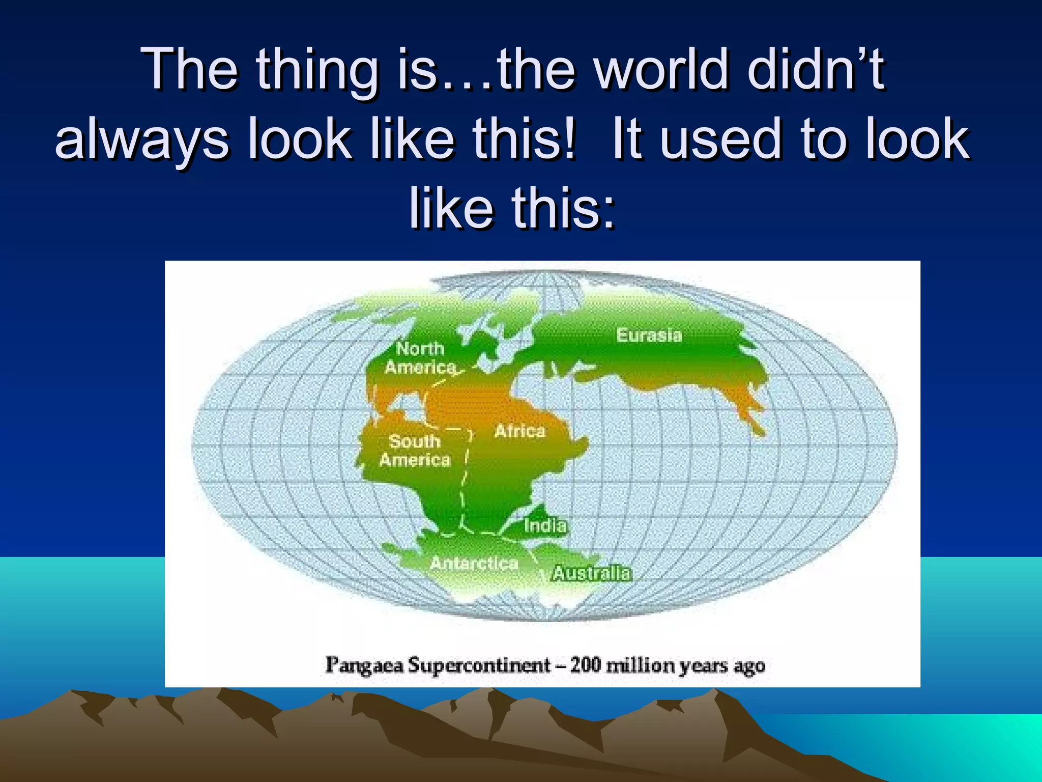
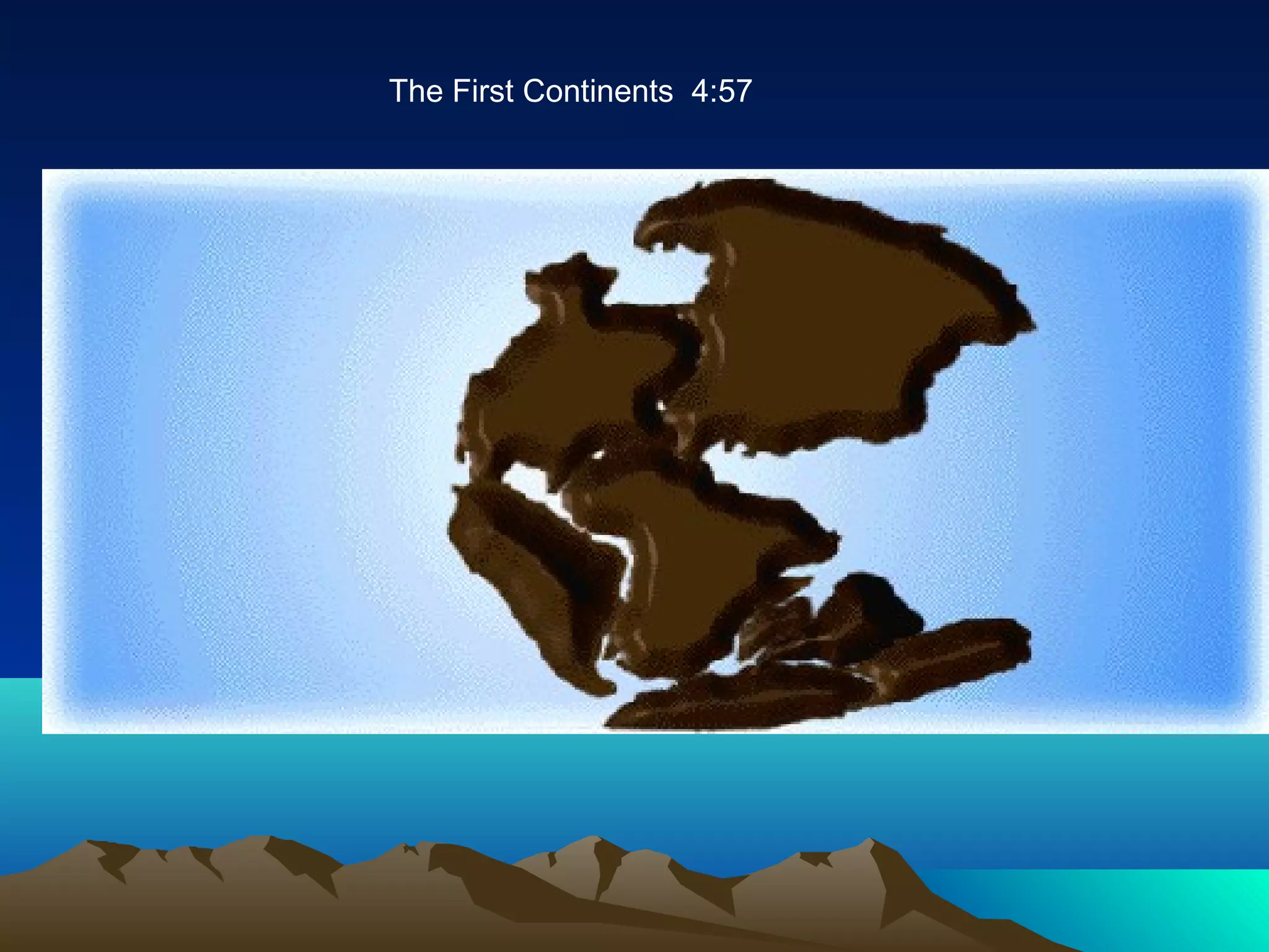
The thing is…theworld didn’tThe thing is…the world didn’t
always look like this! It used to lookalways look like this! It used to look
like this:like this:
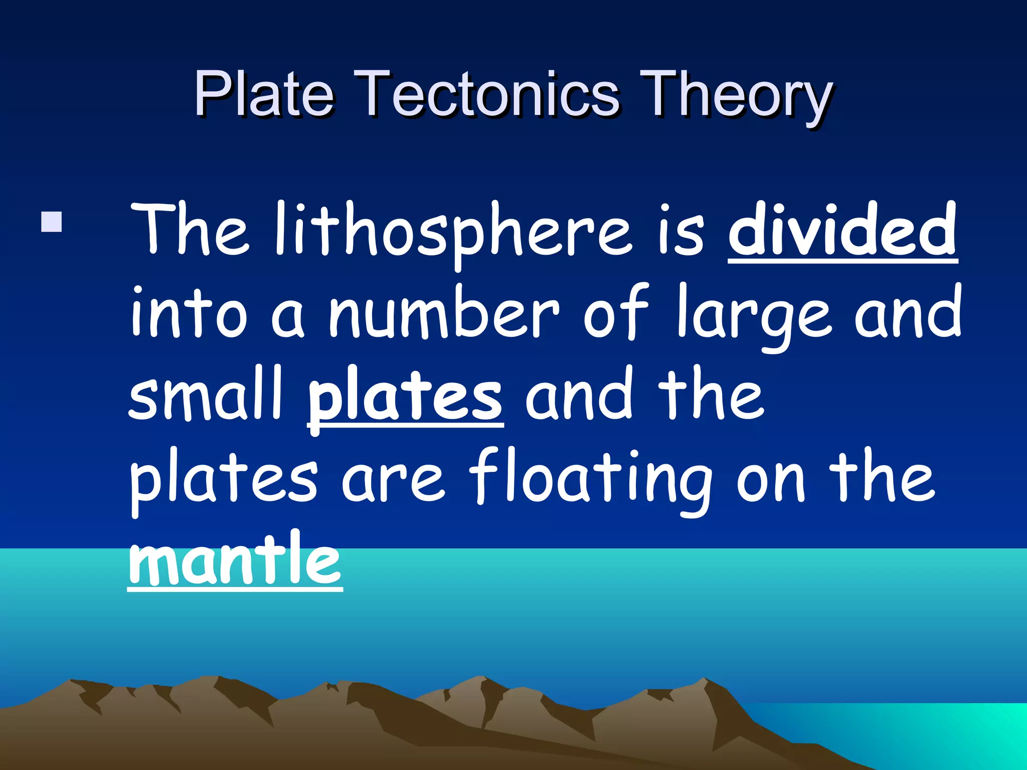
The lithosphereis divided
into a number of large and
small plates and the
plates are floating on the
mantle
Plate Tectonics TheoryPlate Tectonics Theory
6.
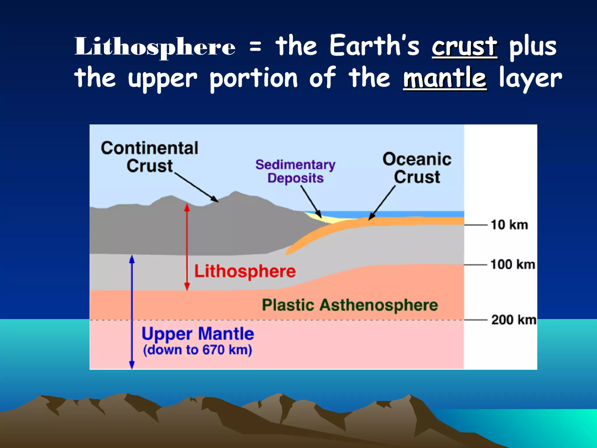
Lithosphere = theEarth’s crustcrust plus
the upper portion of the mantlemantle layer
Plate BoundariesPlate Boundaries
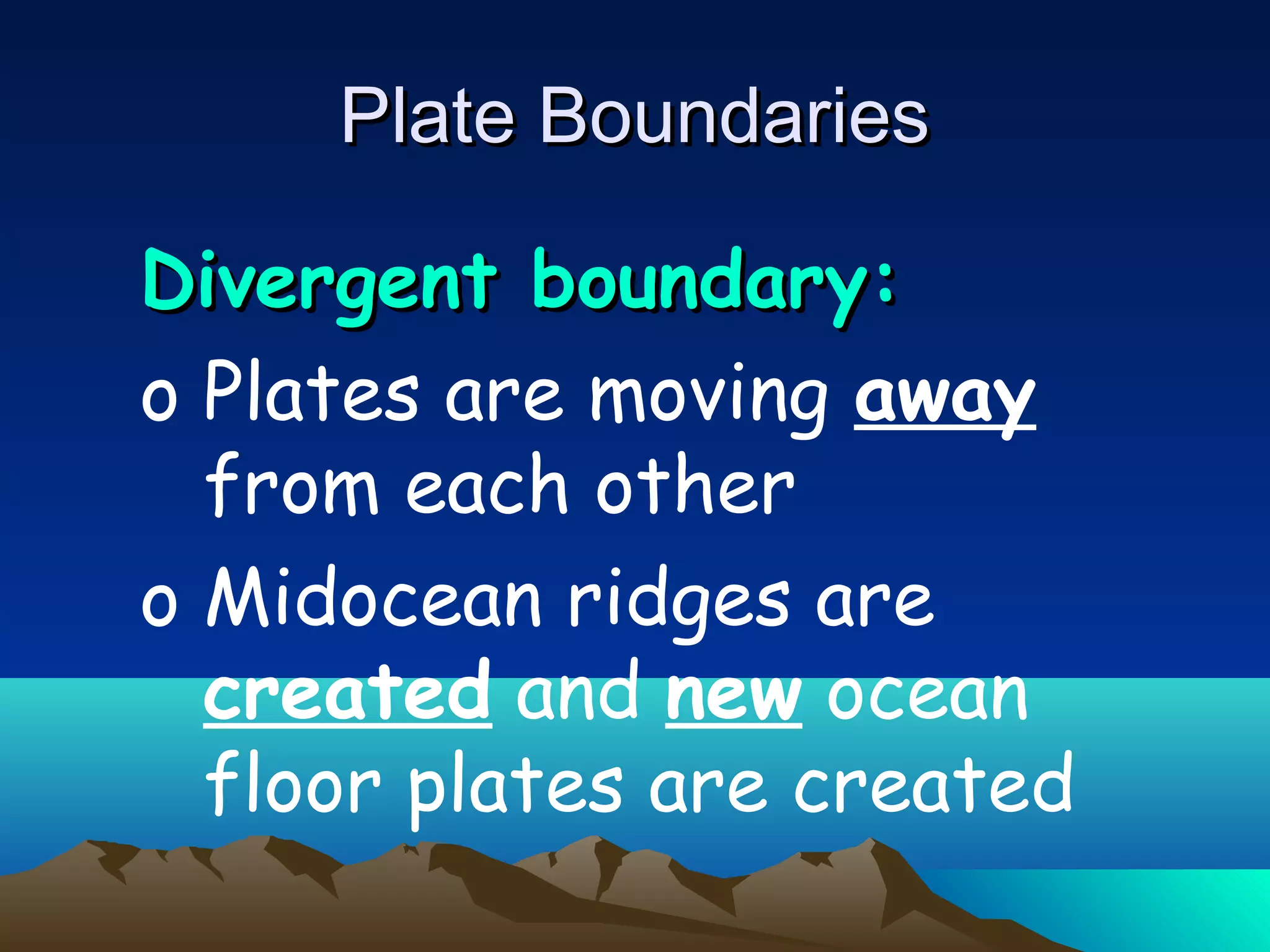
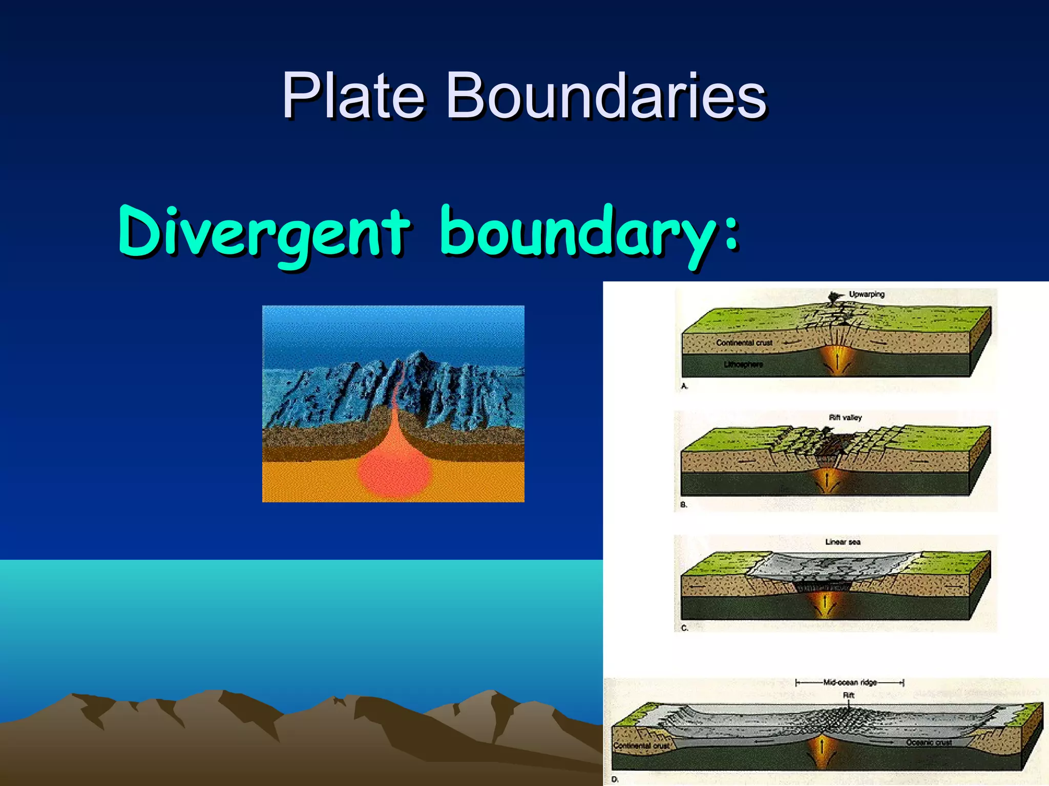
Divergentboundary:Divergent boundary:
o Plates are moving away
from each other
o Midocean ridges are
created and new ocean
floor plates are created
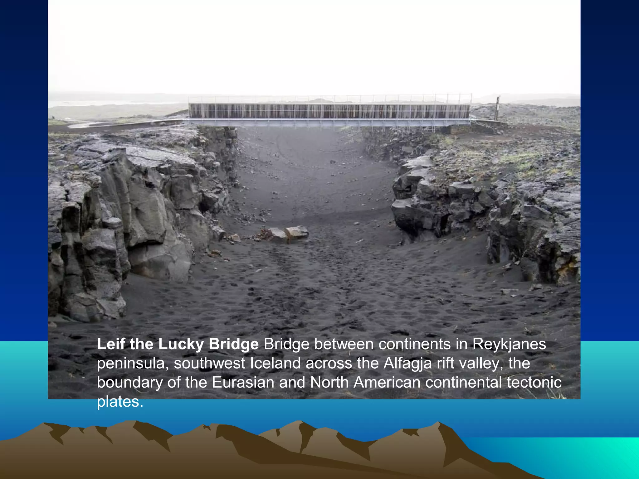
Leif the LuckyBridge Bridge between continents in Reykjanes
peninsula, southwest Iceland across the Alfagja rift valley, the
boundary of the Eurasian and North American continental tectonic
plates.
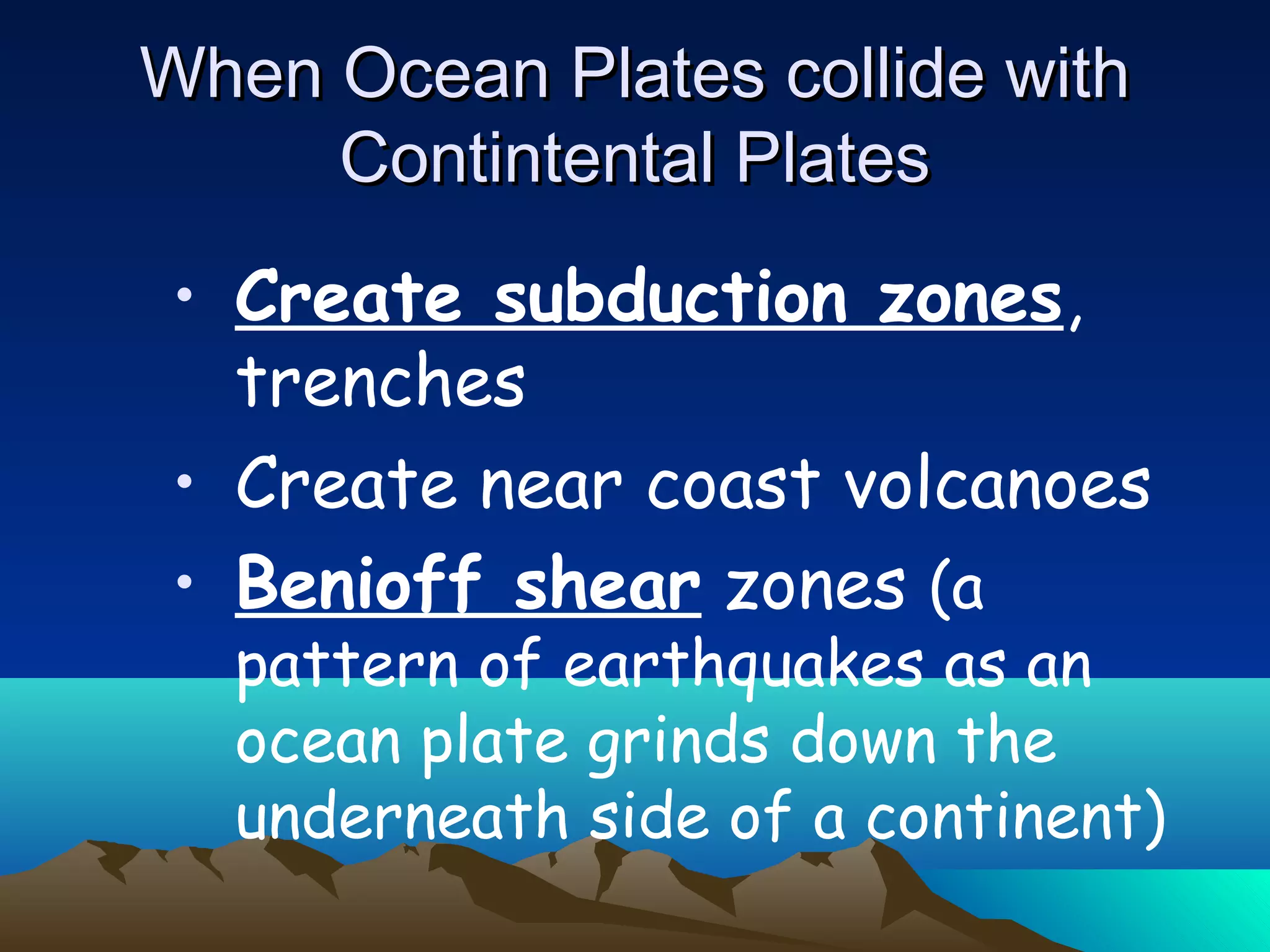
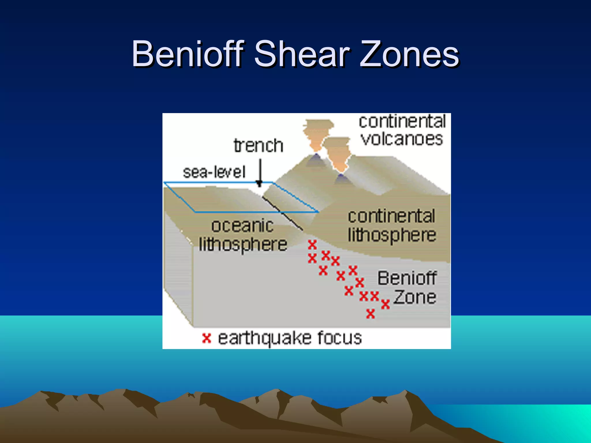
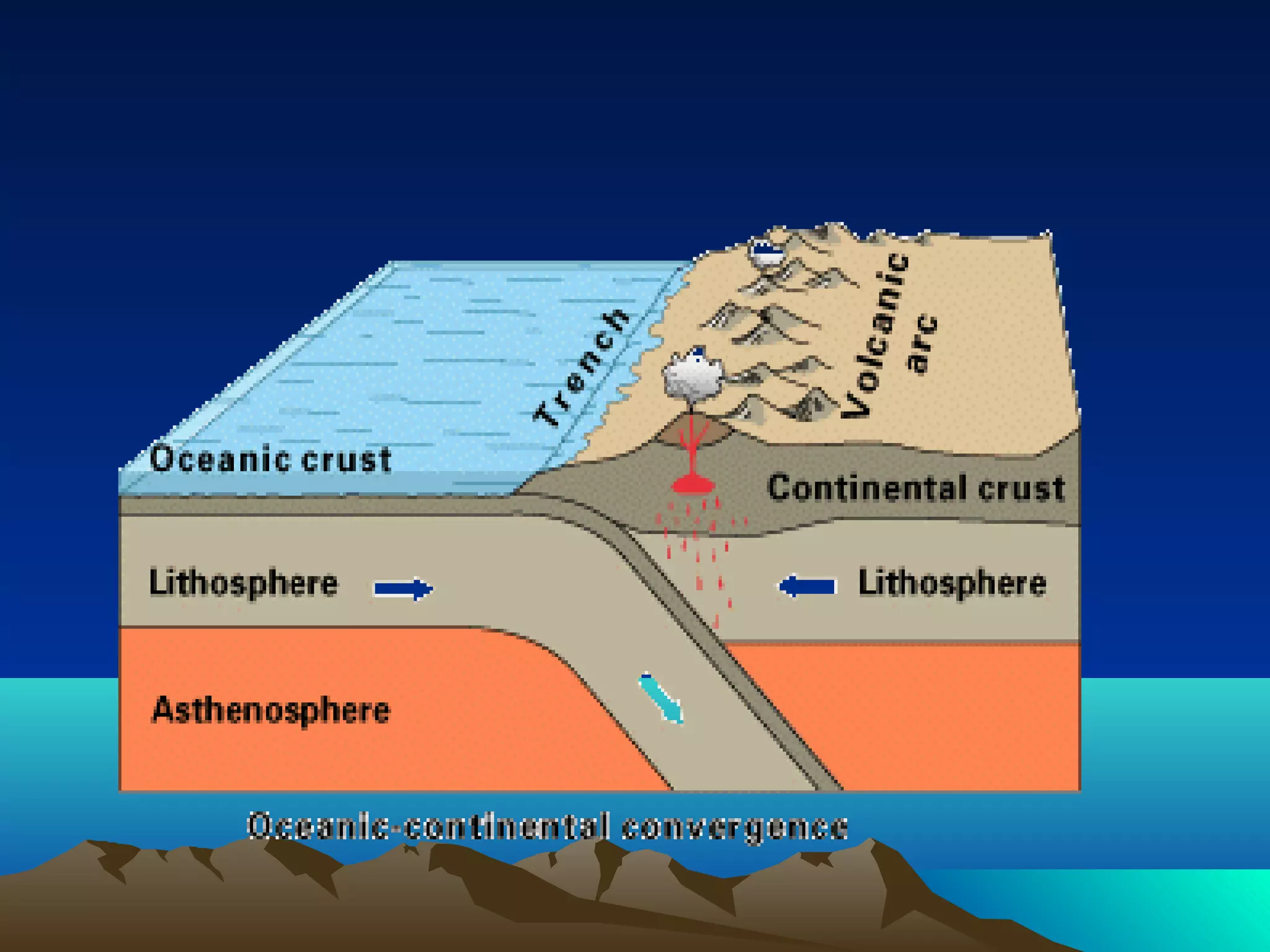
• Create subductionzones,
trenches
• Create near coast volcanoes
• Benioff shear zones (a
pattern of earthquakes as an
ocean plate grinds down the
underneath side of a continent)
When Ocean Plates collide withWhen Ocean Plates collide with
Contintental PlatesContintental Plates
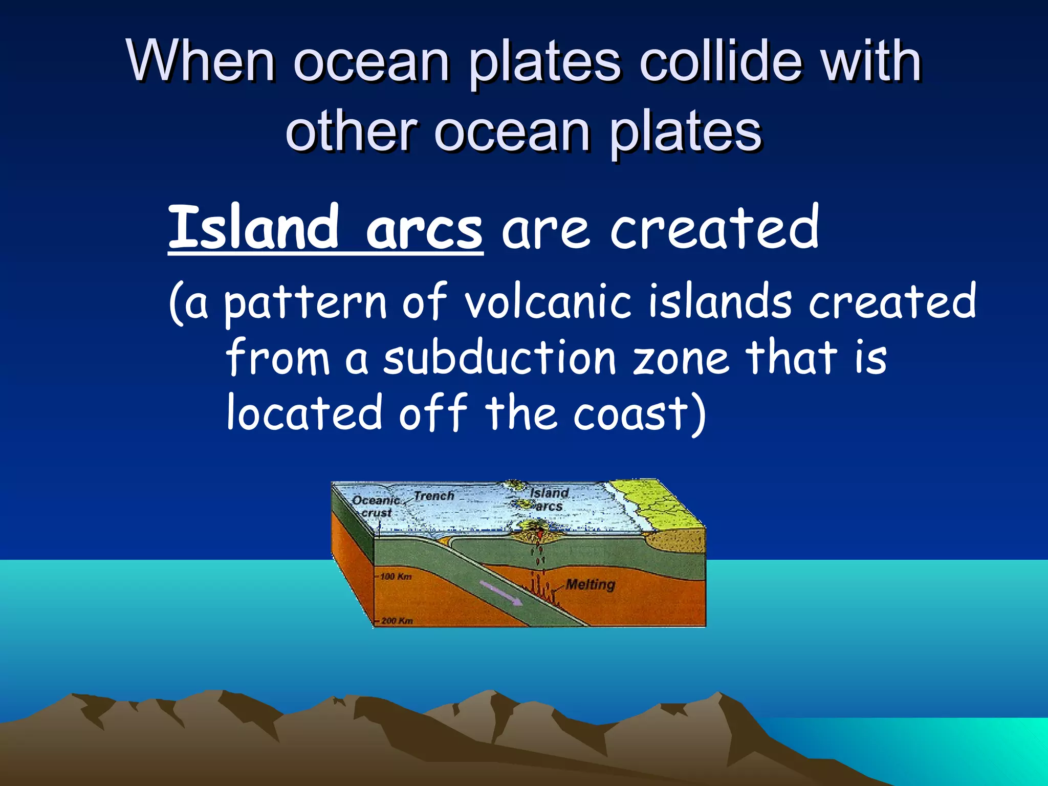
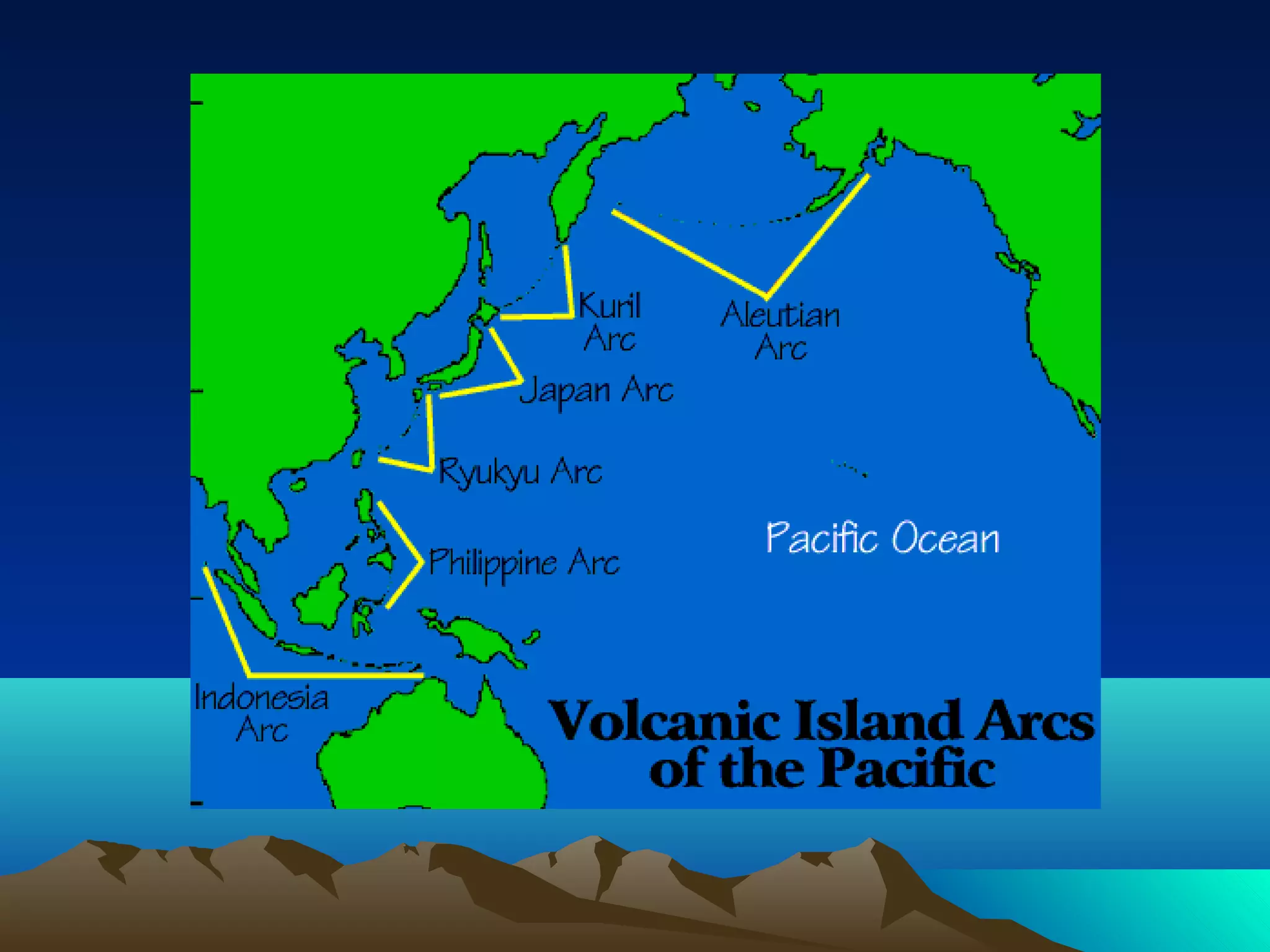
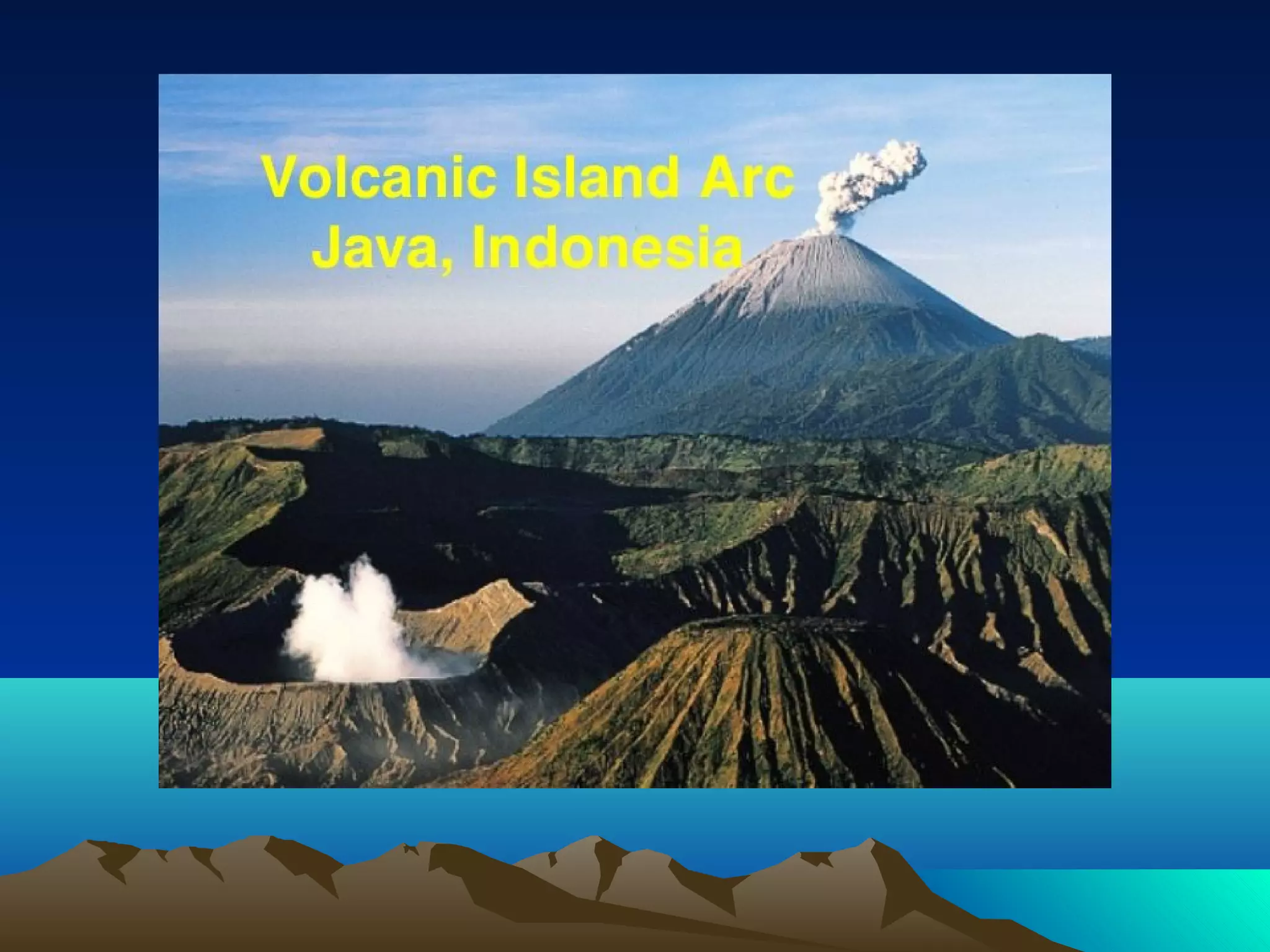
When ocean platescollide withWhen ocean plates collide with
other ocean platesother ocean plates
Island arcs are created
(a pattern of volcanic islands created
from a subduction zone that is
located off the coast)
22.
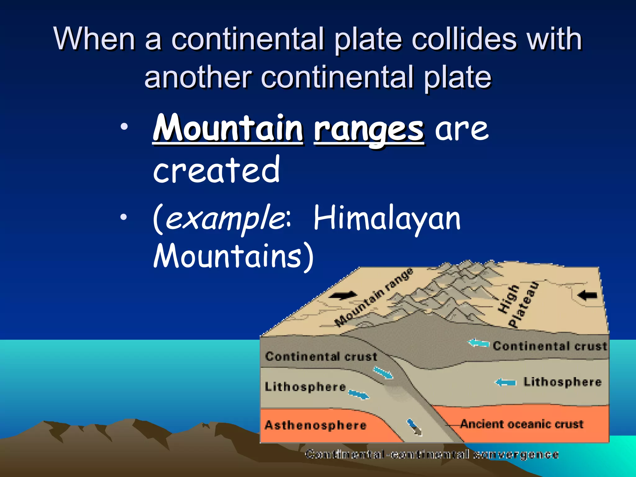
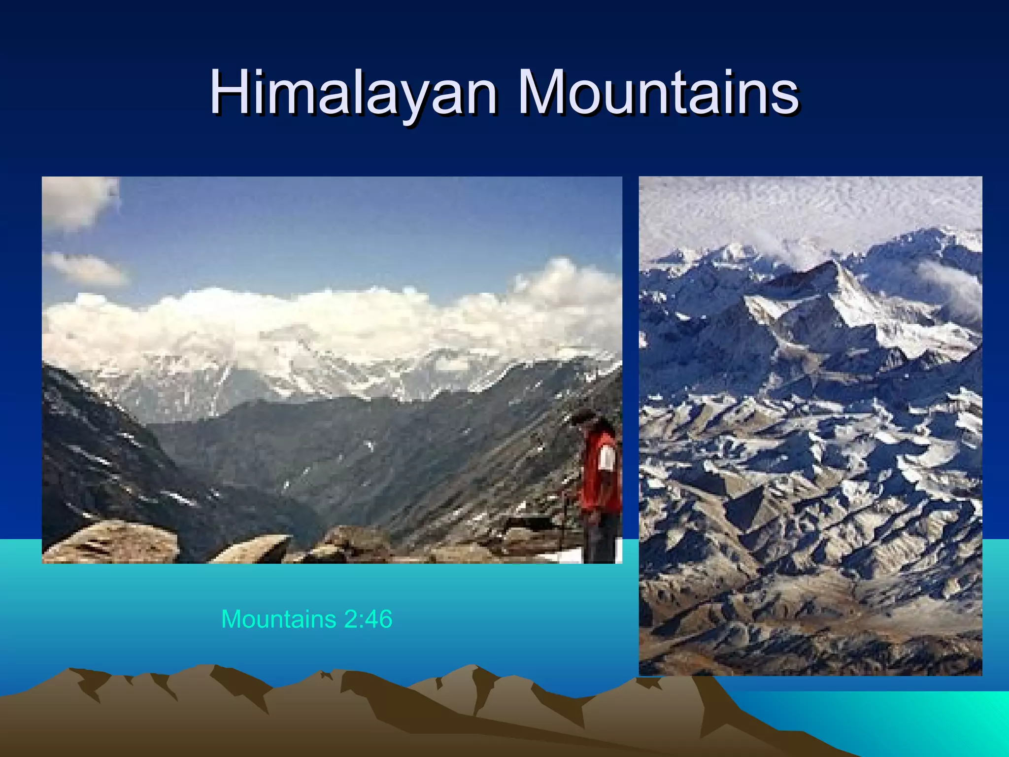
• MountainMountain rangesrangesare
created
• (example: Himalayan
Mountains)
When a continental plate collides withWhen a continental plate collides with
another continental plateanother continental plate
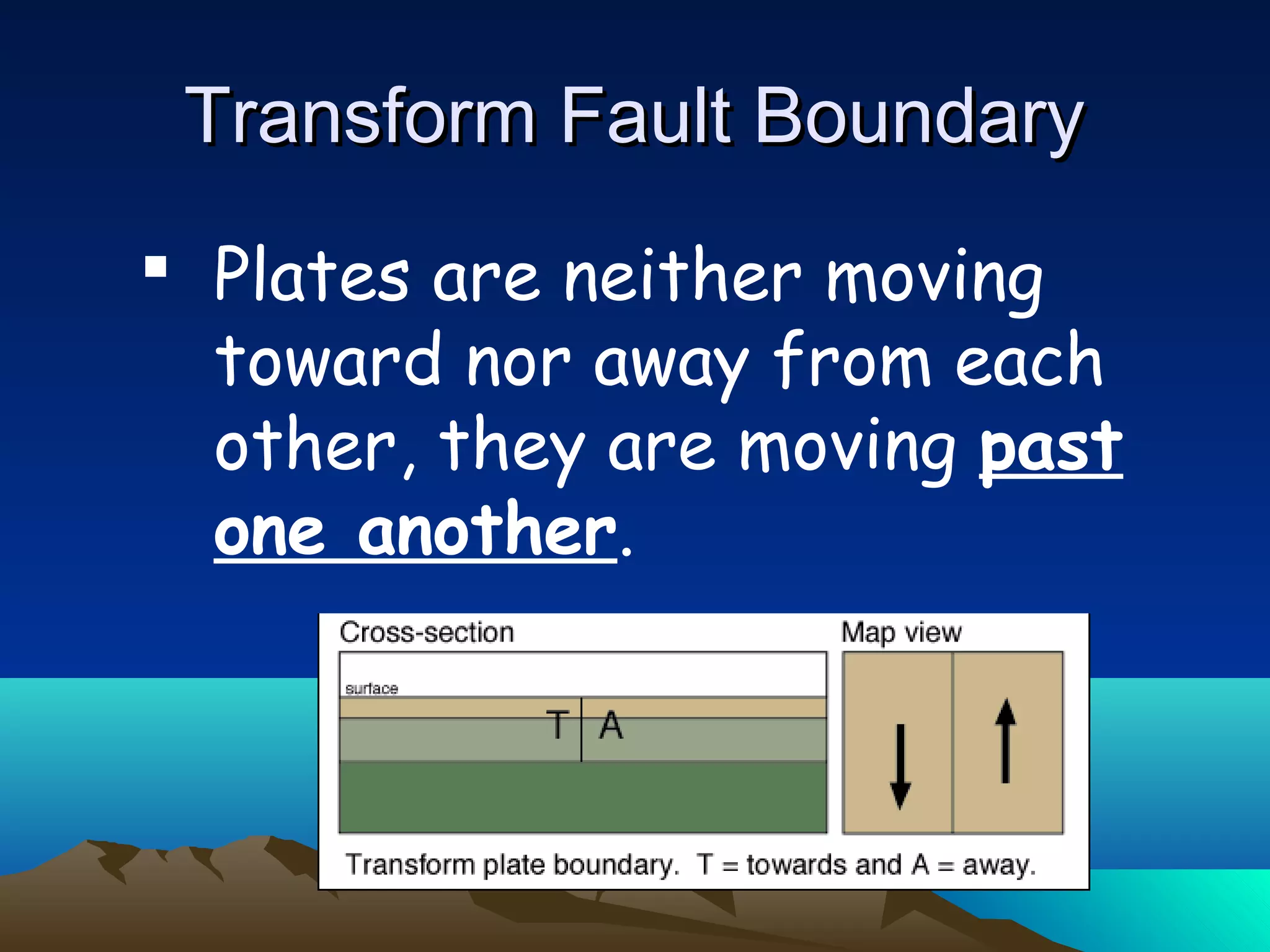
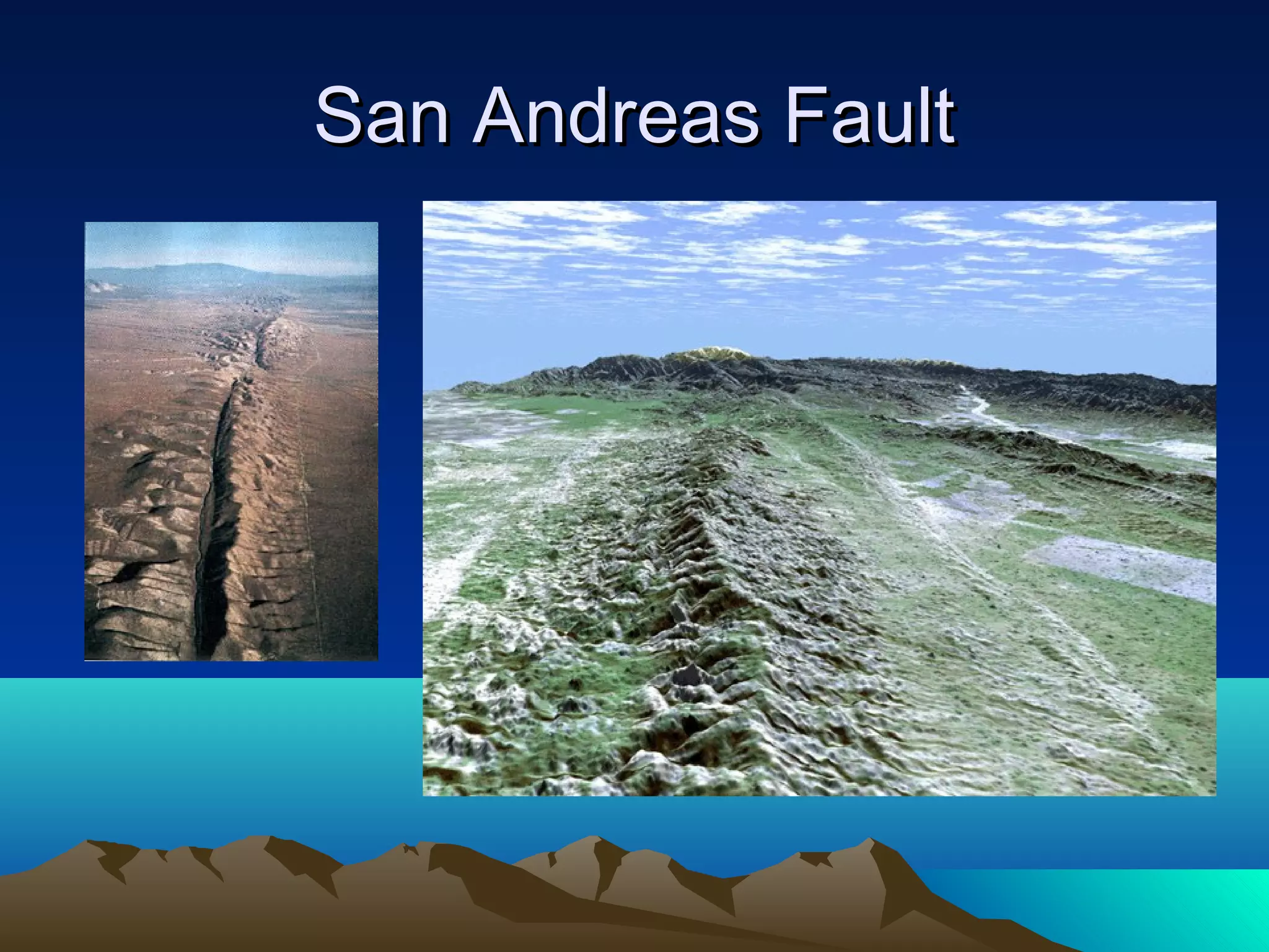
Transform Fault BoundaryTransformFault Boundary
Plates are neither moving
toward nor away from each
other, they are moving past
one another.
25.
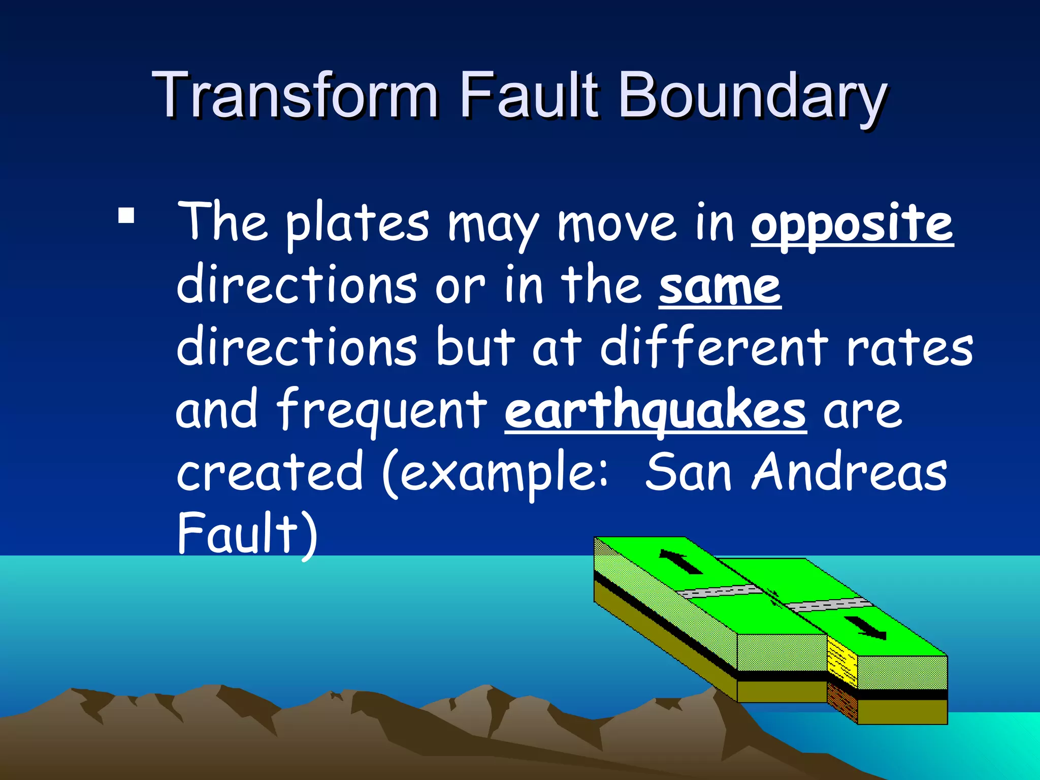
Transform Fault BoundaryTransformFault Boundary
The plates may move in opposite
directions or in the same
directions but at different rates
and frequent earthquakes are
created (example: San Andreas
Fault)
o No
o Platesare destroyed as fast as they
are created (2 ways)
o Plates may be subducted and melted
or may push be pushed upward to
form mountains
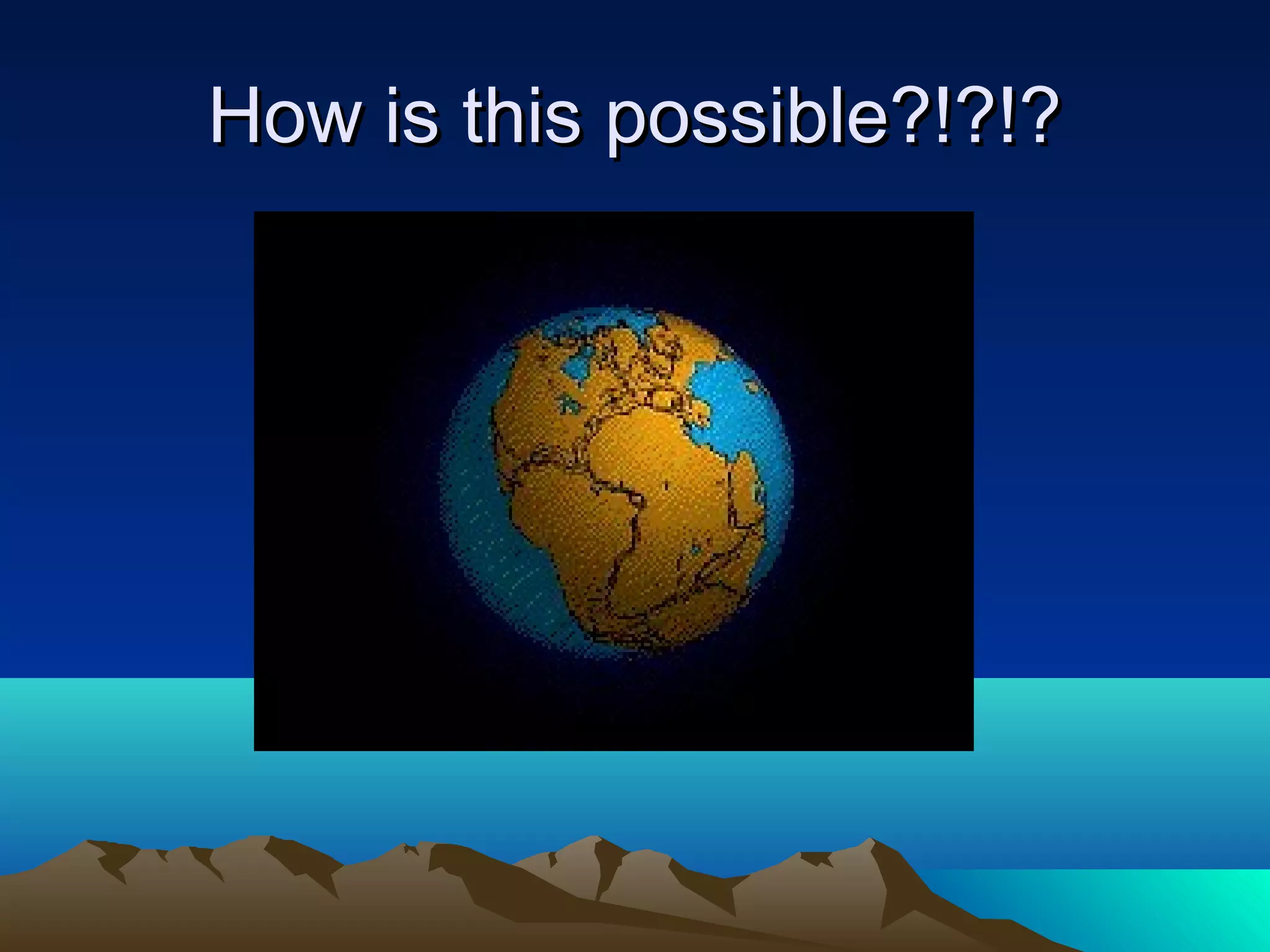
So is the Earth getting bigger?So is the Earth getting bigger?
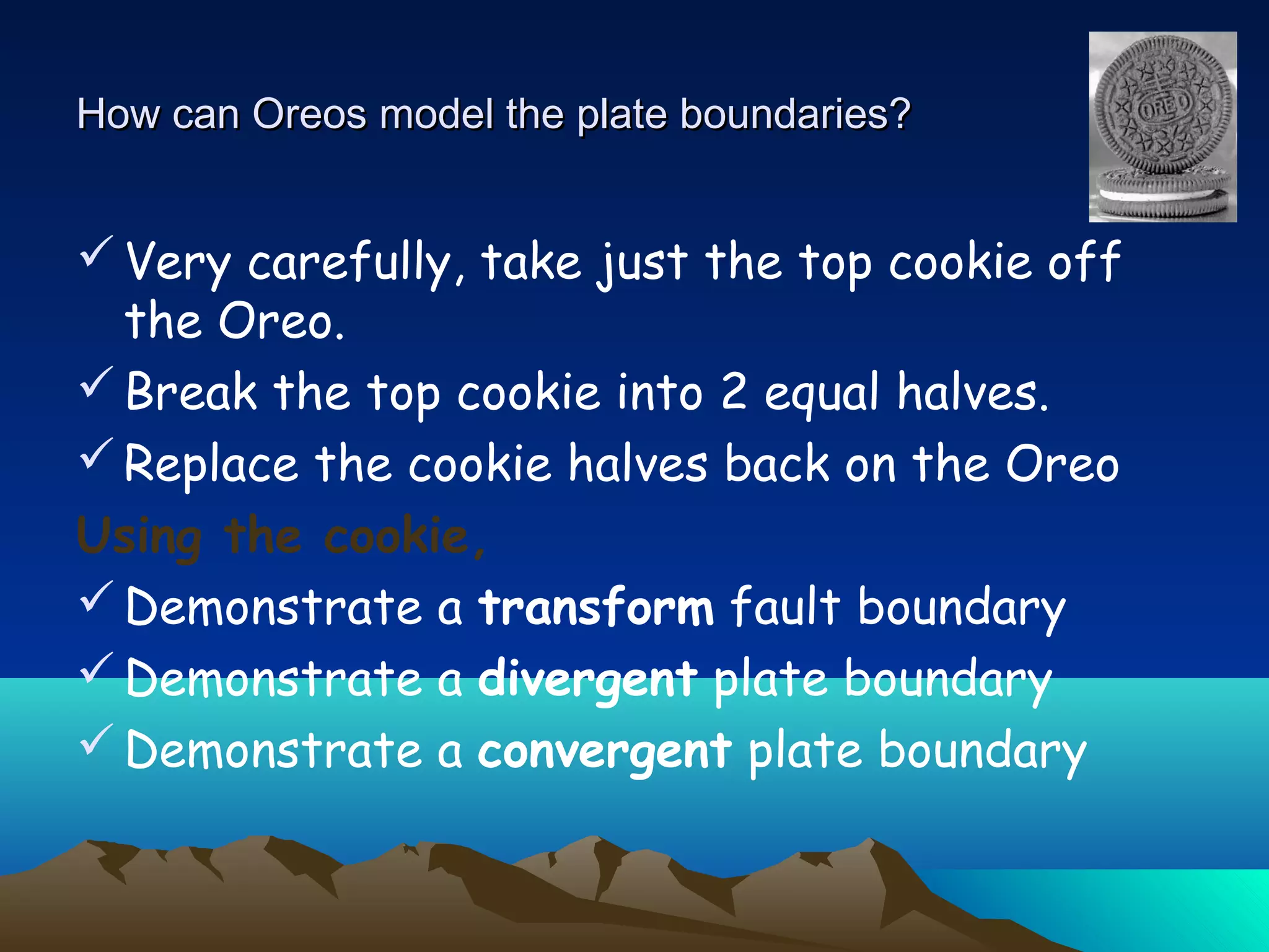
How can Oreosmodel the plate boundaries?How can Oreos model the plate boundaries?
Very carefully, take just the top cookie off
the Oreo.
Break the top cookie into 2 equal halves.
Replace the cookie halves back on the Oreo
Using the cookie,
Demonstrate a transform fault boundary
Demonstrate a divergent plate boundary
Demonstrate a convergent plate boundary
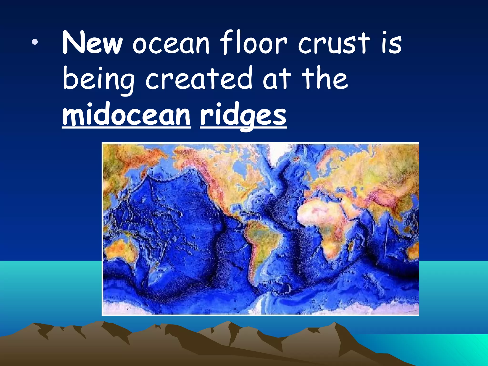
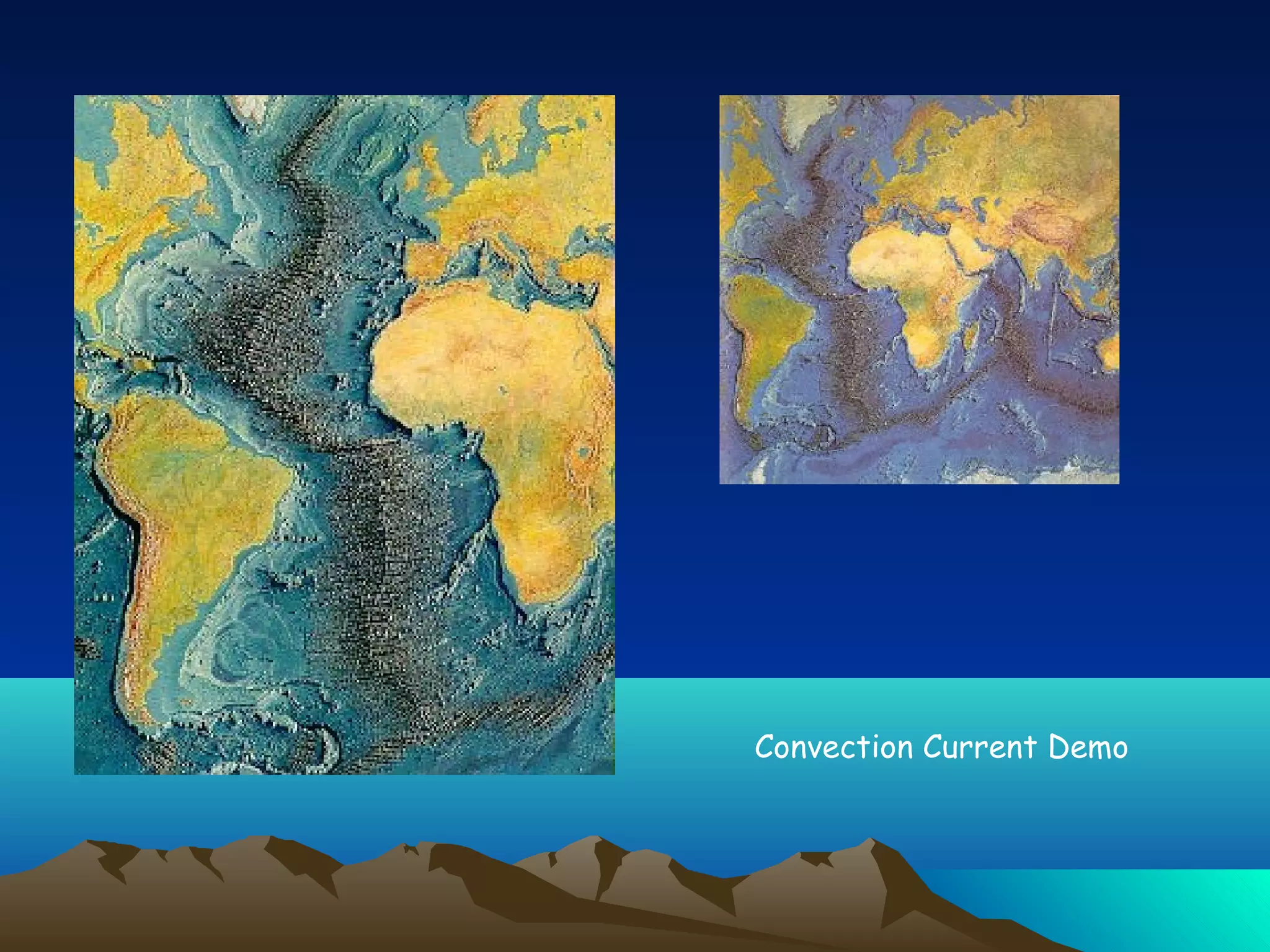
• New oceanfloor crust is
being created at the
midocean ridges
34.
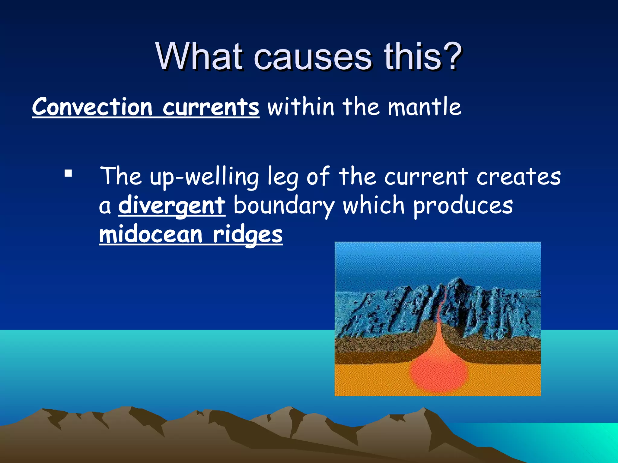
Convection currents withinthe mantle
The up-welling leg of the current creates
a divergent boundary which produces
midocean ridges
What causes this?What causes this?
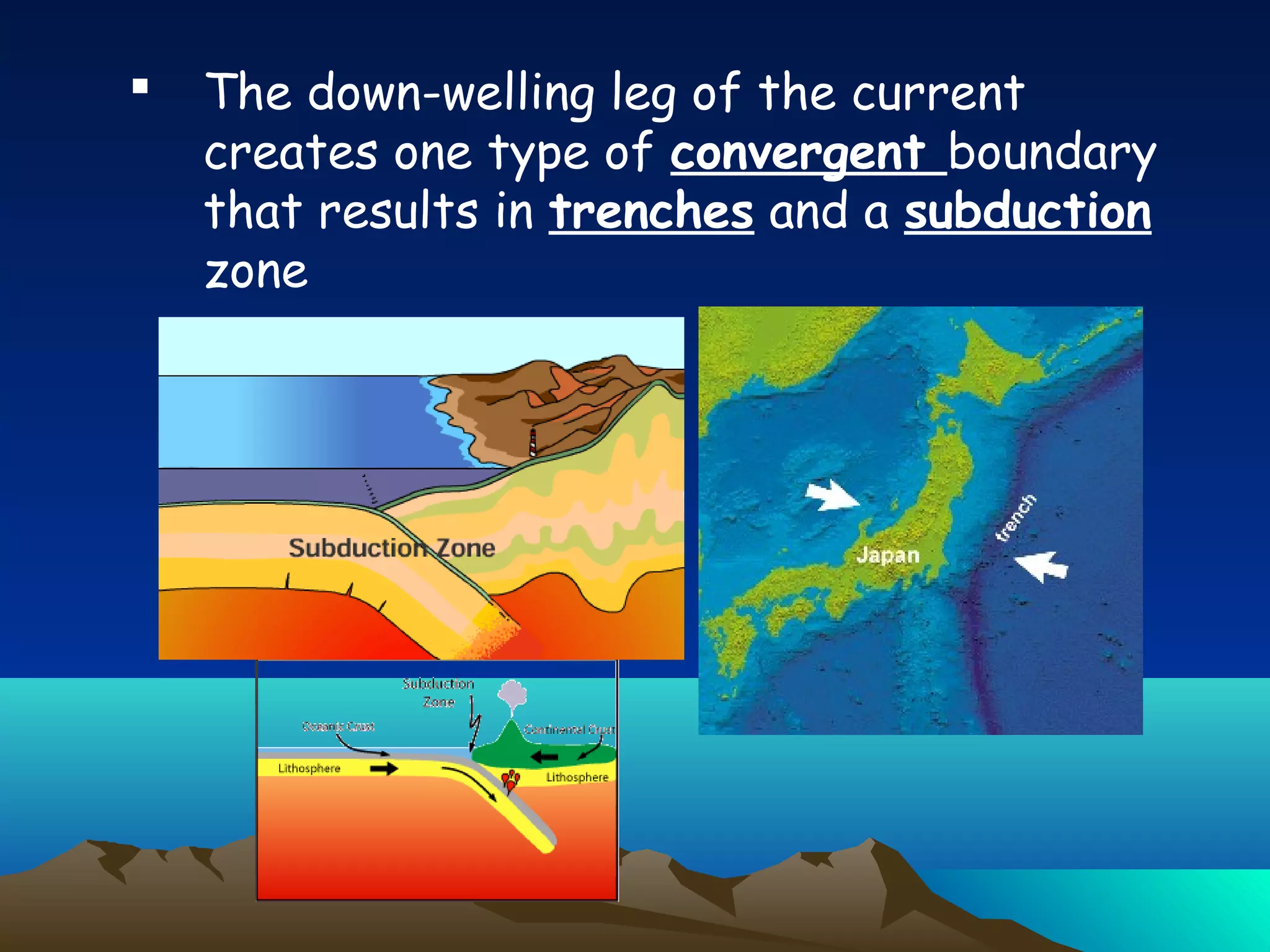
The down-wellingleg of the current
creates one type of convergent boundary
that results in trenches and a subduction
zone
37.
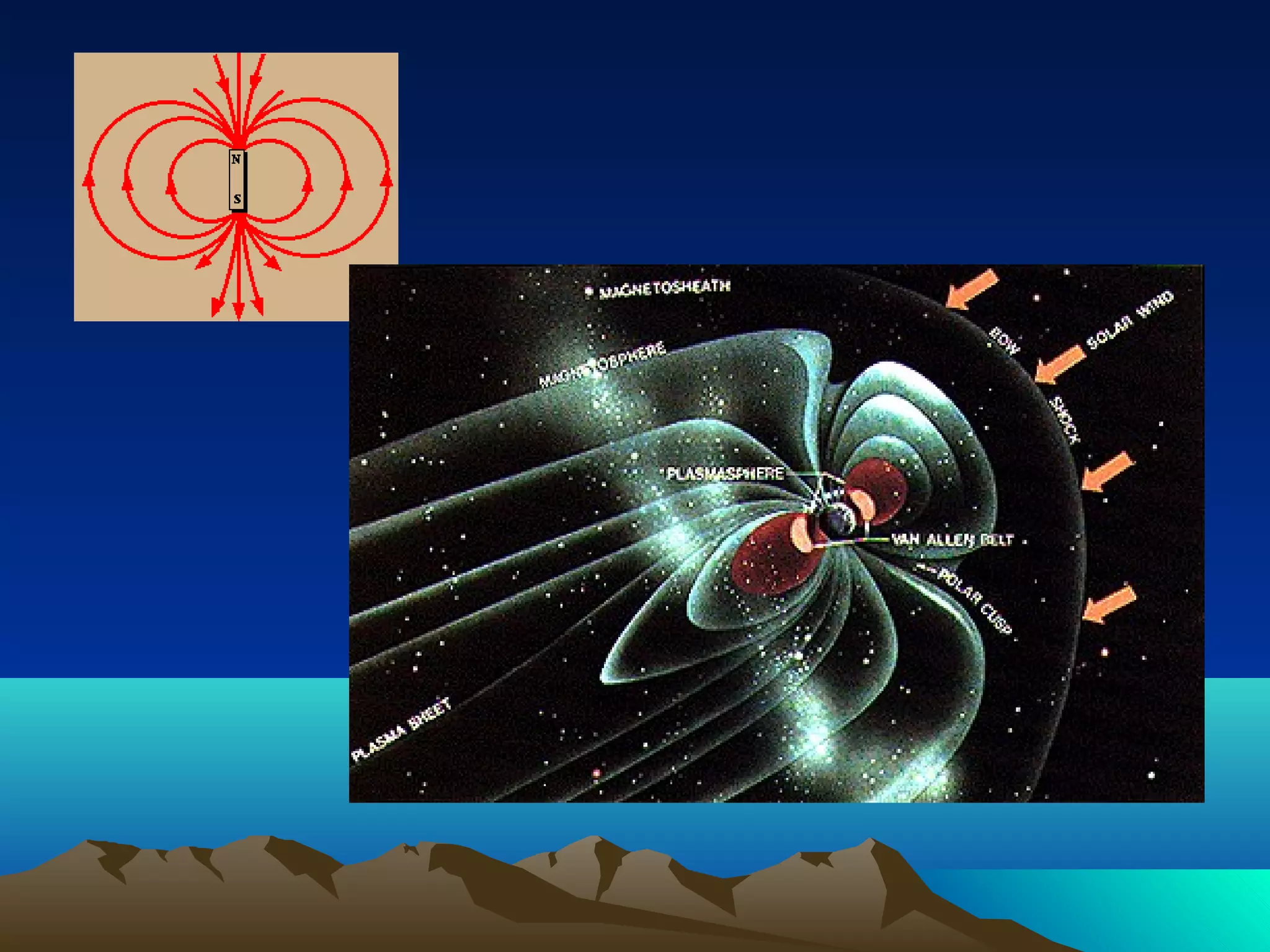
o Midocean ridgesare warmer than
surrounding ocean floors
o Active volcanoes on ridges, earthquakes
on ridges
o Midocean ridge rocks are younger than
surrounding ocean floor rocks
o Midocean ridge volcanoes are younger
than volcanoes further away
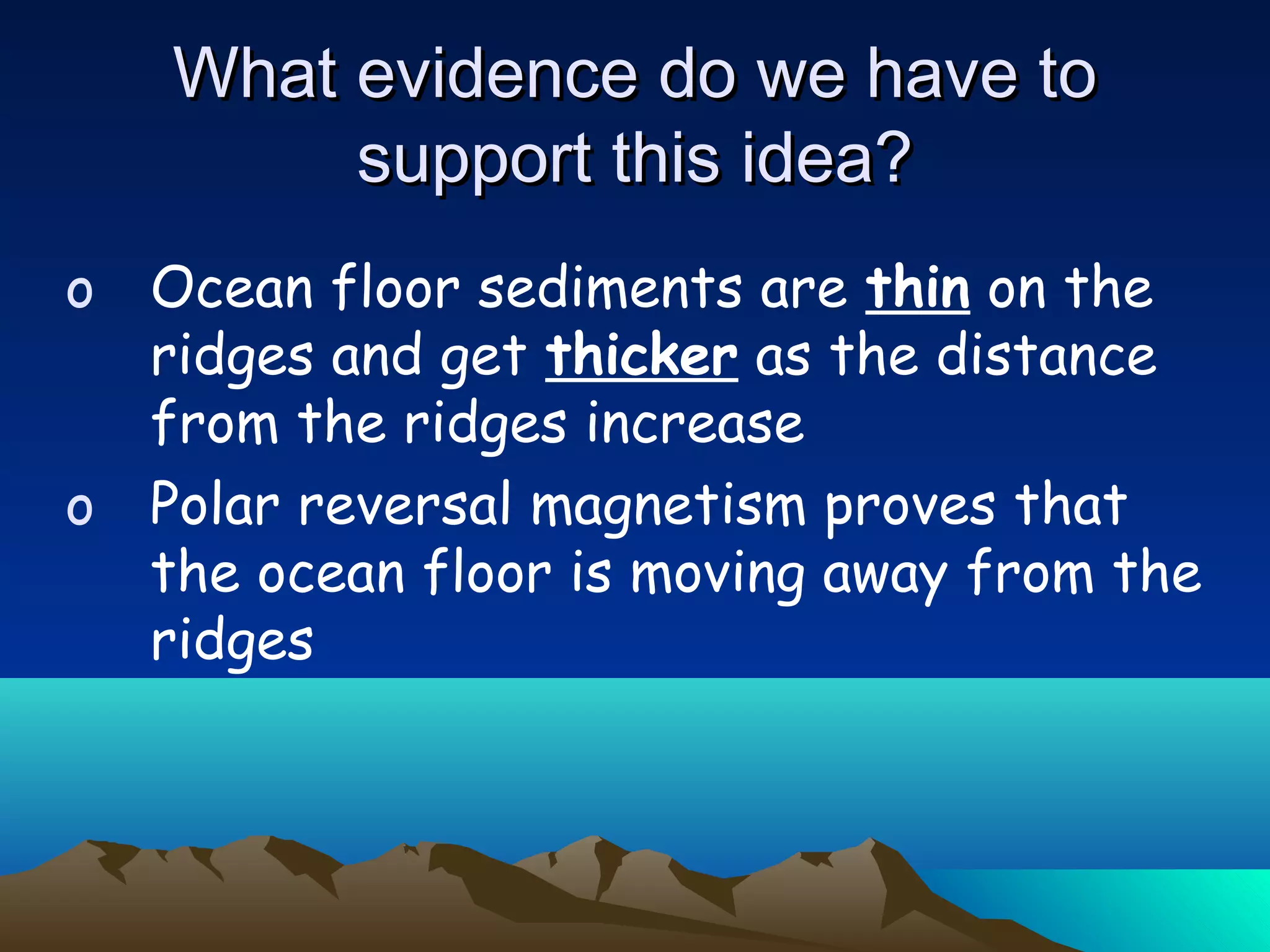
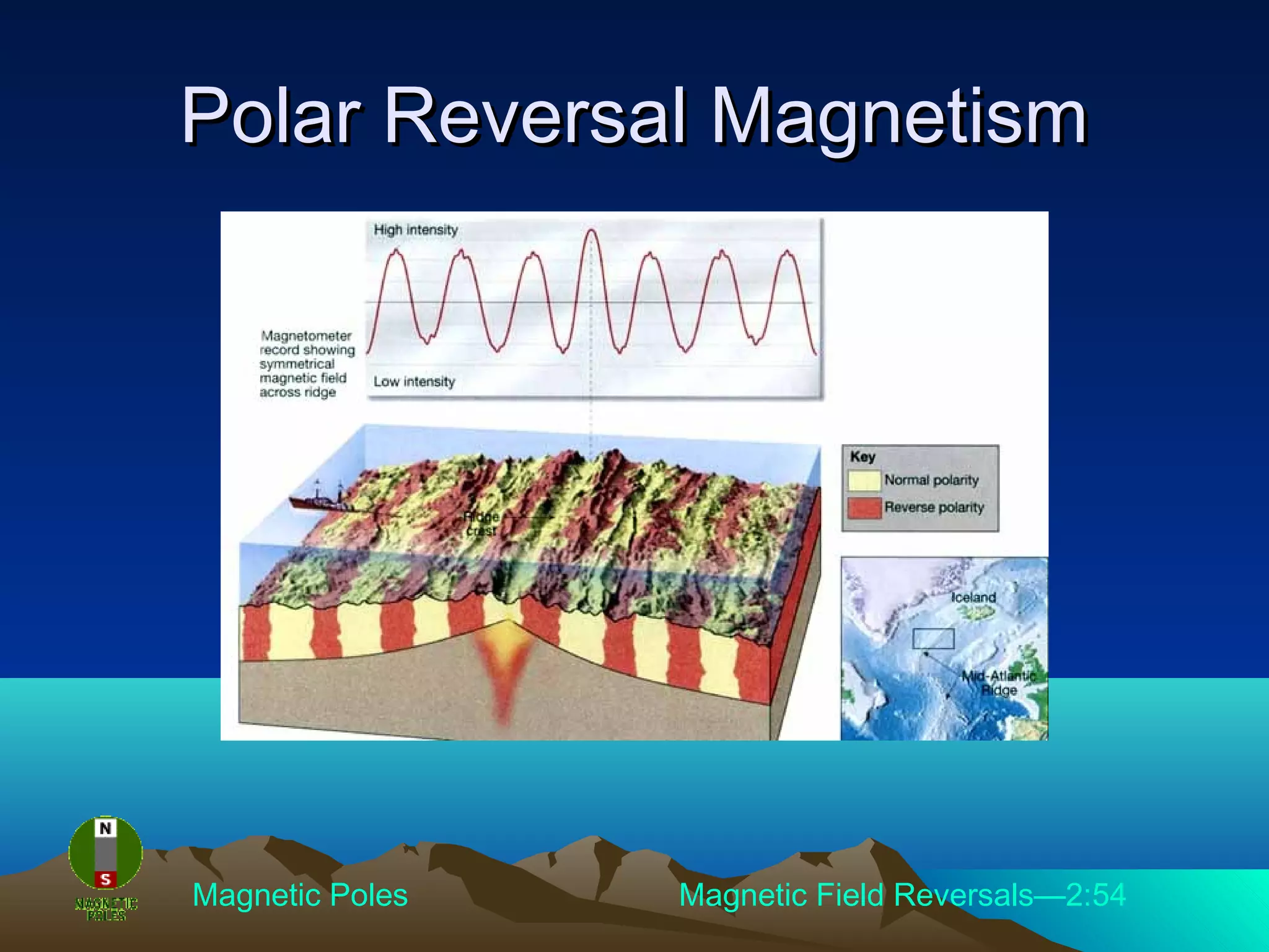
What evidence do we have toWhat evidence do we have to
support this idea?support this idea?
38.
o Ocean floorsediments are thin on the
ridges and get thicker as the distance
from the ridges increase
o Polar reversal magnetism proves that
the ocean floor is moving away from the
ridges
What evidence do we have toWhat evidence do we have to
support this idea?support this idea?
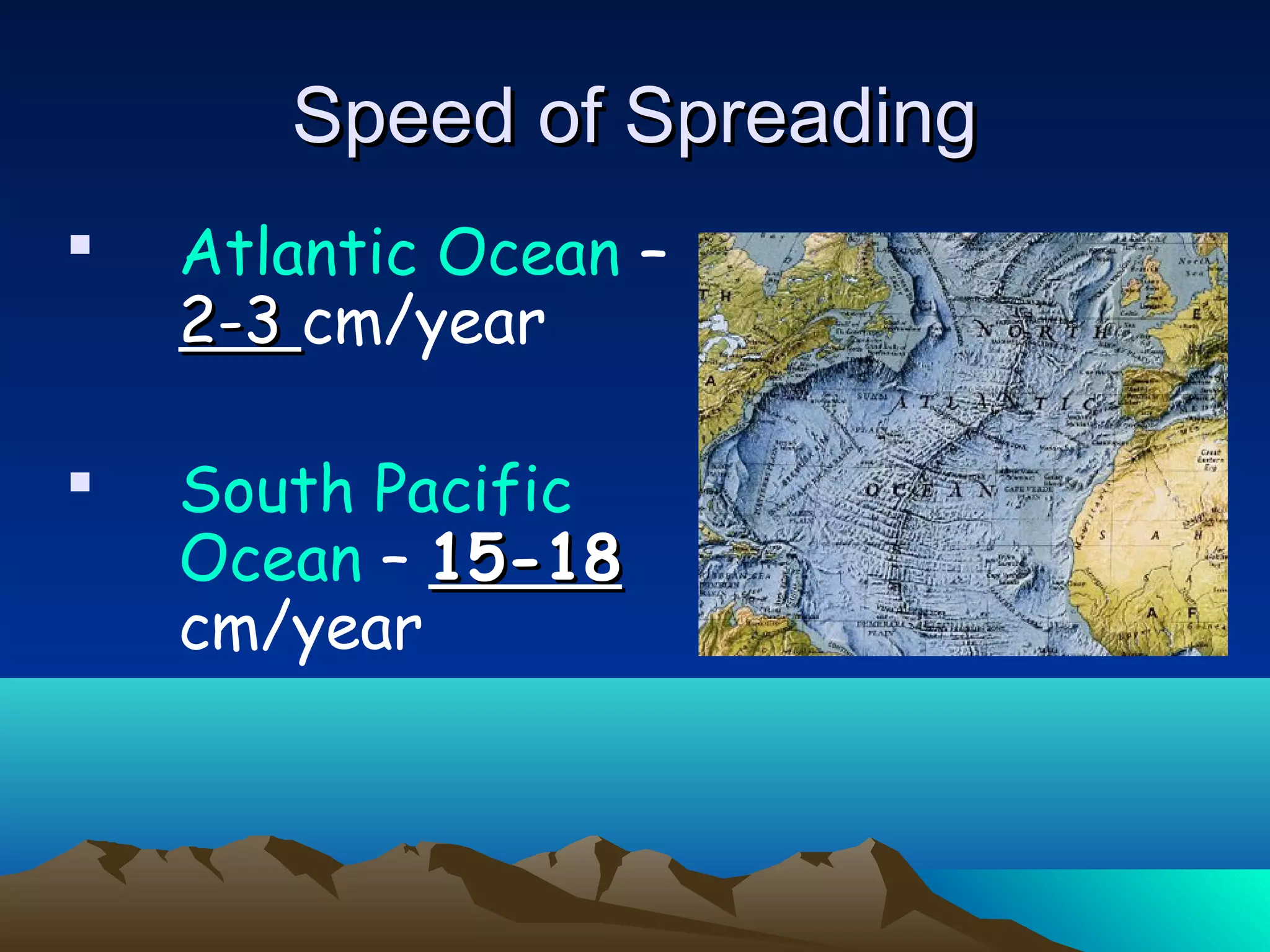
Atlantic Ocean–
2-32-3 cm/year
South Pacific
Ocean – 15-1815-18
cm/year
Speed of SpreadingSpeed of Spreading
42.
The Seafloor isSpreading Clip—4:01
How Earth’s Structure Affects Plate Tectonics—5:43
Seafloor SpreadingSeafloor Spreading
43.
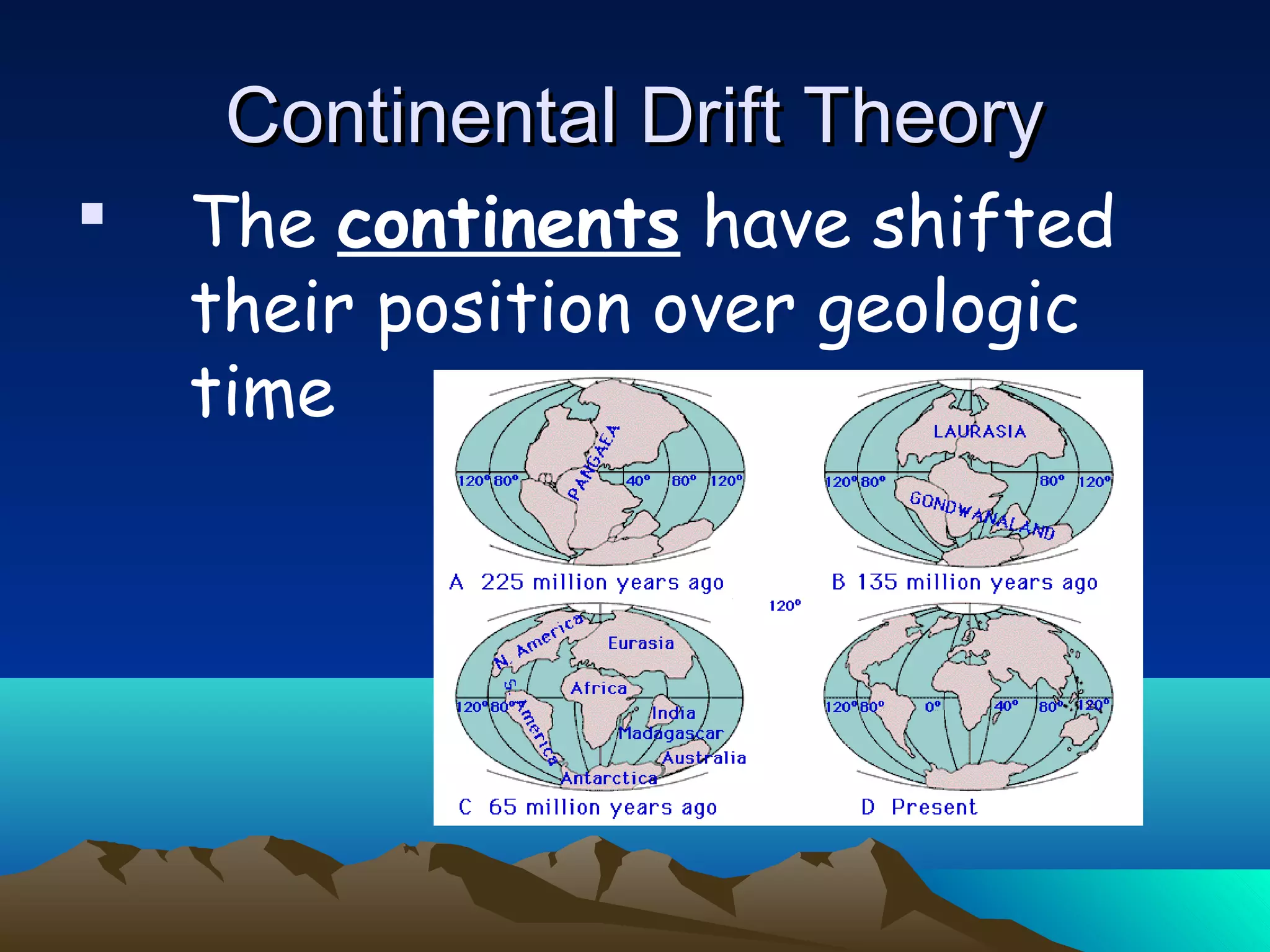
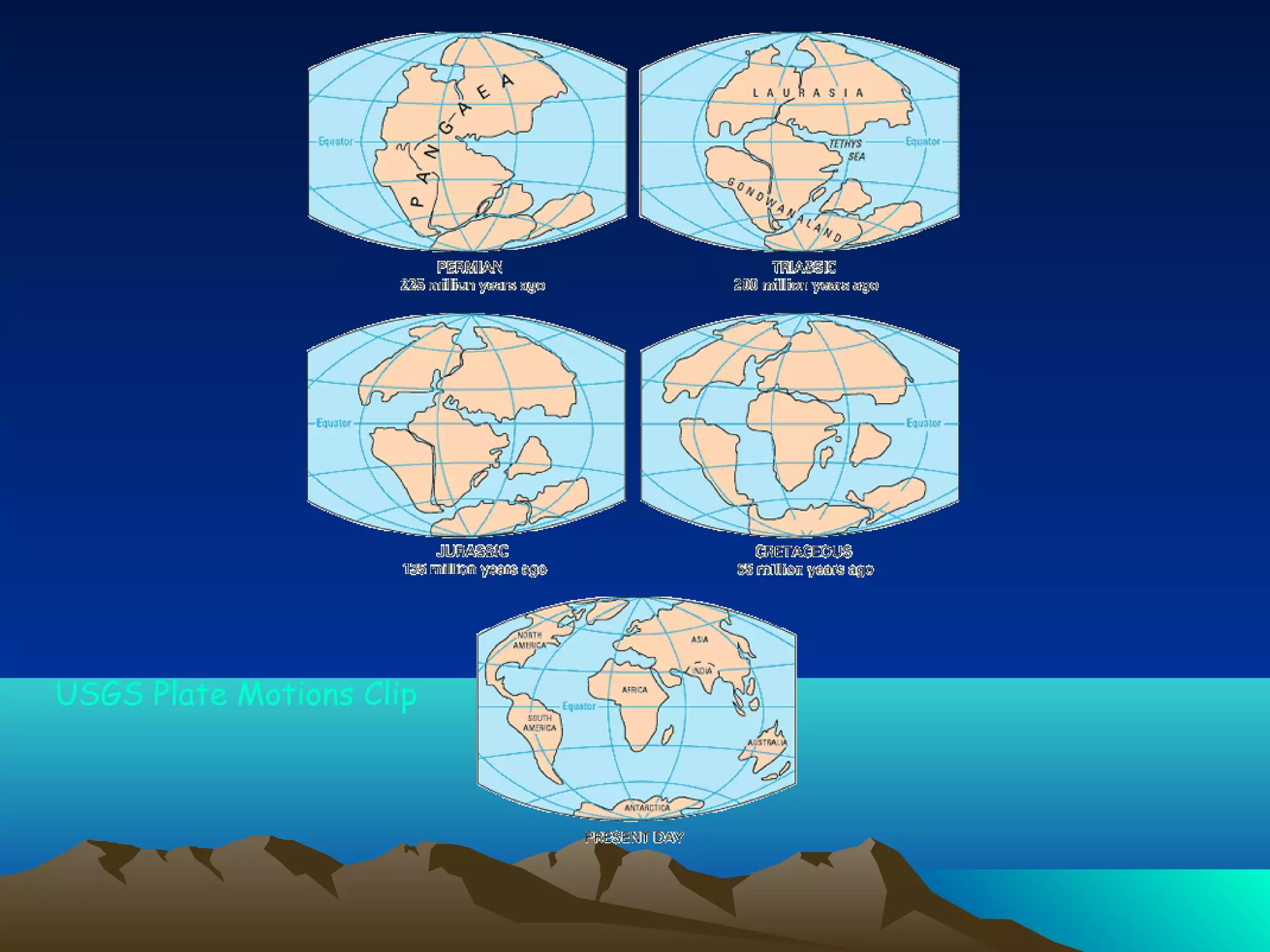
The continentshave shifted
their position over geologic
time
Continental Drift TheoryContinental Drift Theory
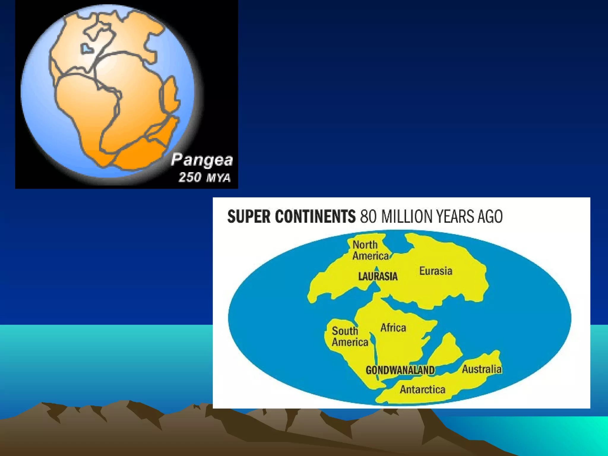
44.
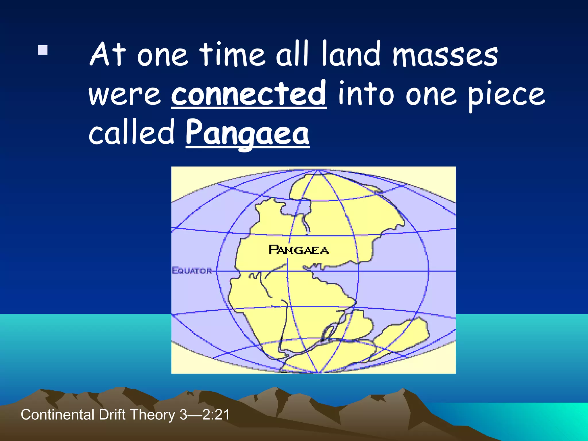
At onetime all land masses
were connected into one piece
called Pangaea
Continental Drift Theory 3—2:21
45.
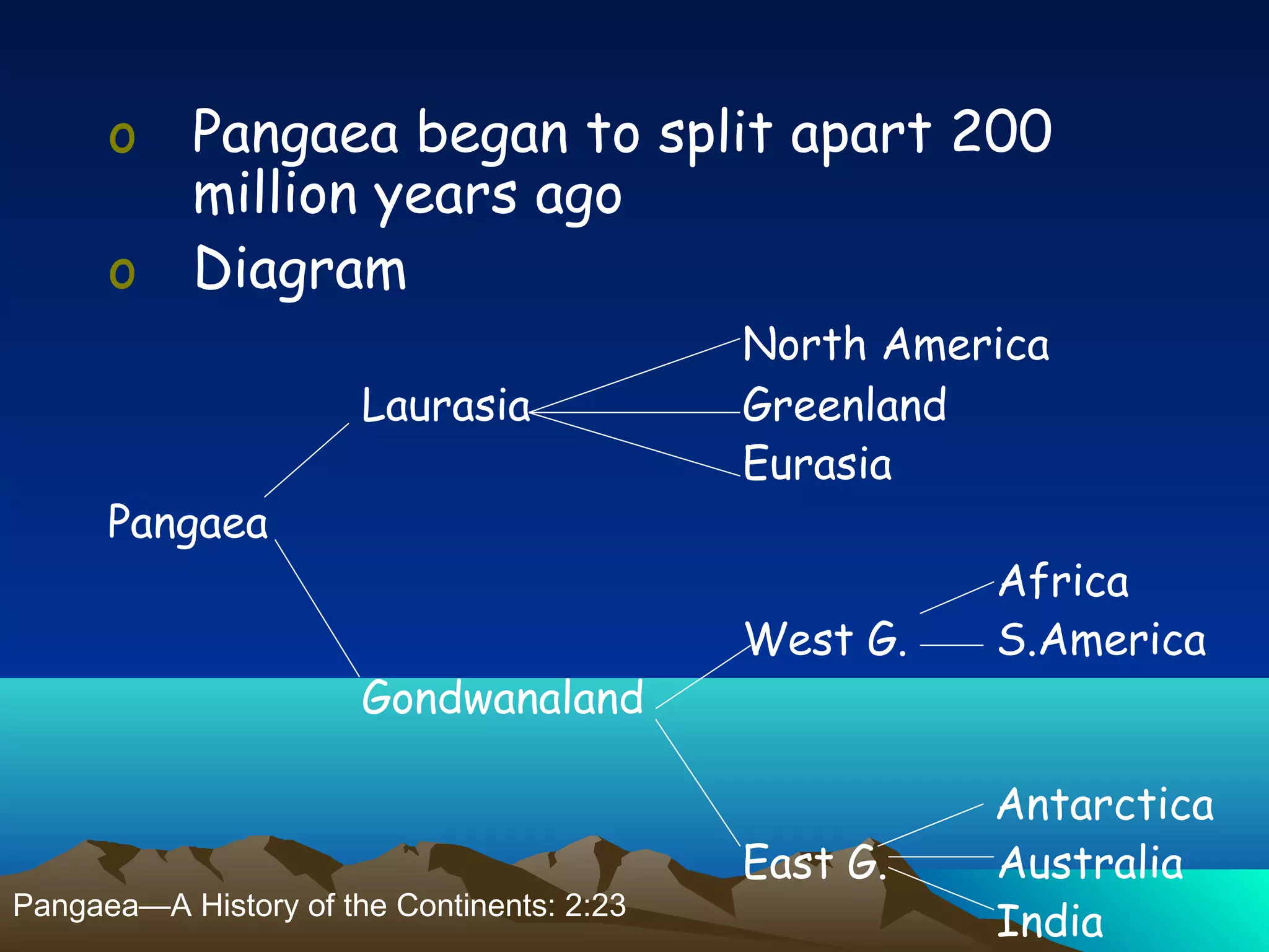
o Pangaea beganto split apart 200
million years ago
o Diagram
North America
Laurasia Greenland
Eurasia
Pangaea
Africa
West G. S.America
Gondwanaland
Antarctica
East G. Australia
IndiaPangaea—A History of the Continents: 2:23
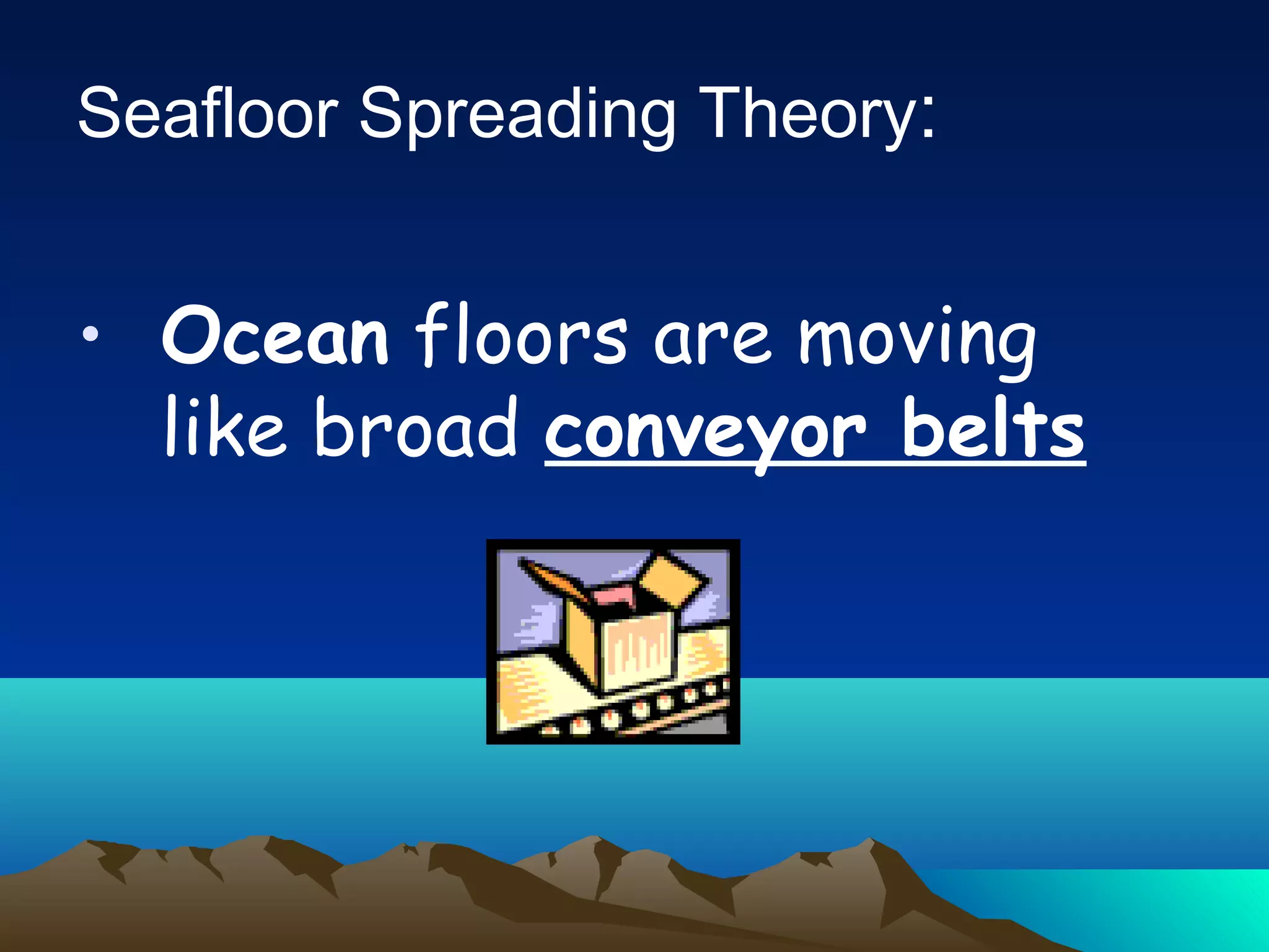
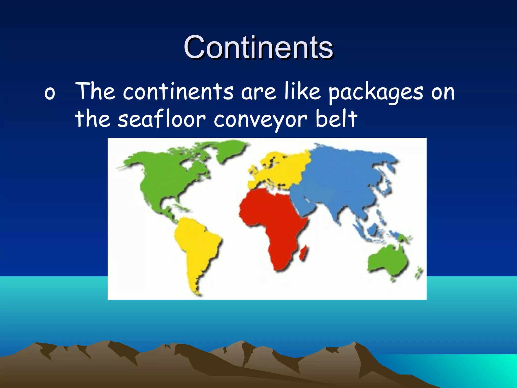
o The continentsare like packages on
the seafloor conveyor belt
ContinentsContinents
50.
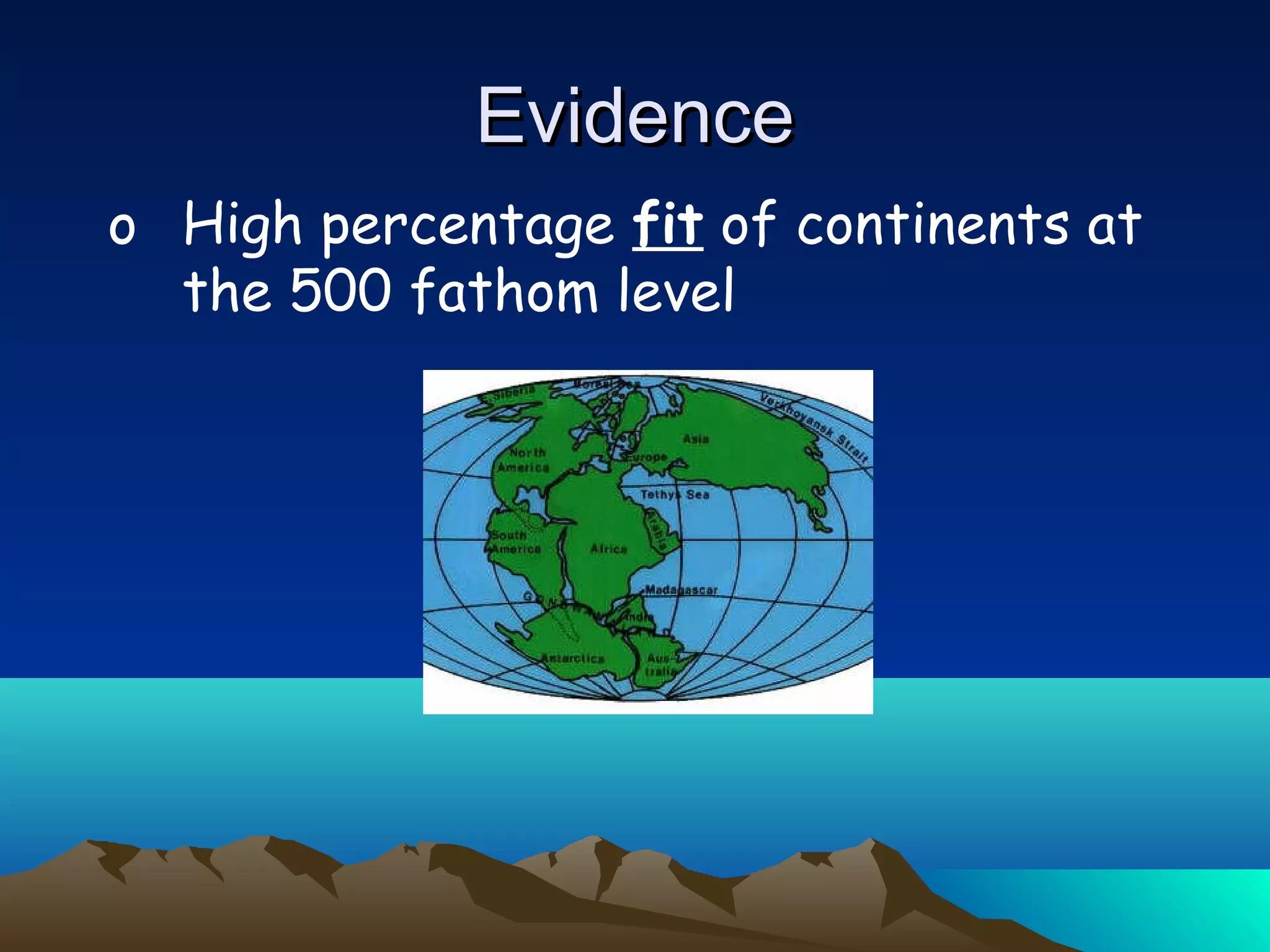
o High percentagefit of continents at
the 500 fathom level
EvidenceEvidence
51.
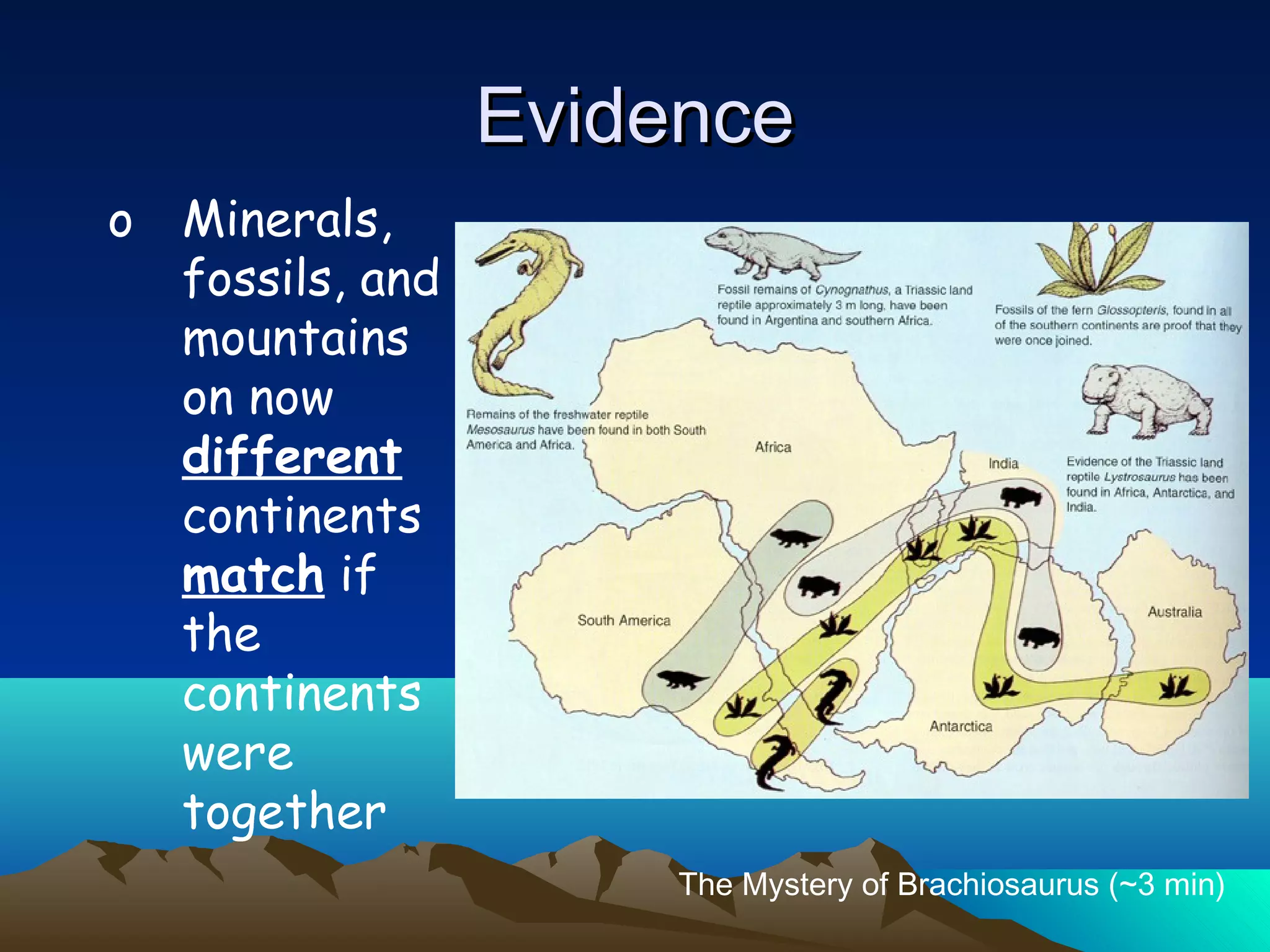
o Minerals,
fossils, and
mountains
onnow
different
continents
match if
the
continents
were
together
EvidenceEvidence
The Mystery of Brachiosaurus (~3 min)


![Vibe Coding vs. Spec-Driven Development [Free Meetup]](https://cdn.slidesharecdn.com/ss_thumbnails/vibecodingvsspecdrivendevelopment-251209105622-43f455e7-thumbnail.jpg?width=640&height=640&fit=bounds)


