
Downloaded 117 times
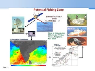
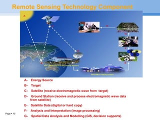

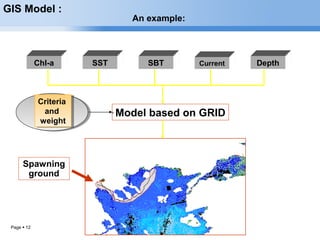
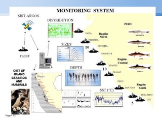
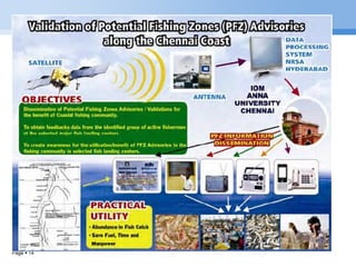

Remotely sensed data of sea surface temperature, chlorophyll, and wind patterns from satellites are used to locate Potential Fish Zones (PFZ) in Indian seas. Satellites and instruments like sonar and radar are currently used to find areas where fish aggregate. In the past, PFZ forecasts were based solely on sea surface temperature maps, but now also incorporate ocean color data from sensors to provide information about conditions below the surface. The Potential Fishing Zone advisories generated from this remote sensing data have benefited fishermen in India by reducing search times, saving on fuel and labor, and increasing incomes.


