SlideShare a Scribd company logo
Coastal Management by 
Remote Sensing and G.I.S 
Sajid Sohail.S 
PPic: fictional image of earth 4.5 billion years ago
Comet(huge water body) struck the earth billion years ago
Before After
Introduction (coast, coastal zone): 
The coast is a unique environment where land, sea and atmosphere interact 
and interplay continuously influencing a strip of spatial zone defined as 
coastal zone 
• coastal zones are the areas having the influence of both marine and 
terrestrial processes. 
• Coastal zones are the most fragile, dynamic and productive ecosystem 
and are quite often under pressure from both anthropogenic activities 
and natural processes 
• Coastal Zone is endowed with a very wide range of habitats such as coral 
reefs, mangroves, sea grasses, sand dunes, vegetated stungle, mudflats, 
salt marshes, estuaries, lagoons etc. 
• Different countries use different distance criteria for defining the coastal 
zone. In India, 500 m distance from the high tide line (landward) is taken 
for demarcating the coastal zone.
High tide line
• Do you know?? 
Total coast line of the world is 35, 6000 km and the coastal area 
covers more than 10% of the earth surface. 
About 40% of the world’s population lives within 100 km of the 
coast 
About 10% of the world’s population resides in low elevation 
coastal zone (<10 m) making their lives highly vulnerable to coastal 
disasters. 
About 35% of Indians live within 100 km of the country’s coast line 
measuring 7517 km.
Vancouver
Coastal zones in India assumes importance because of 
( major issues/problems): 
• high productivity of its ecosystems 
• concentration of population 
• exploitation of renewable and nonrenewable natural resources 
• discharge of waste effluents and municipal sewage 
• industrialization and spurt in recreational activities 
• Coastal zones are continuously changing because of the dynamic interactions 
between the ocean and land 
• Erosion and accretion 
• inundation due to sea level rise and storm surge 
• shifting of shoreline caused by natural or anthropogenic forces, such as 
construction of artificial structure, port and harbors leads to changes in the coastal 
zone and its environment
Remote Sensing (RS) has proved to be extremely useful in providing information 
on various aspects of the coastal environment, viz. coastal wetlands, coastal 
landforms, shoreline changes, tidal boundaries (high/low), brackish water areas, 
suspended sediment dynamics, coastal currents, vital coastal habitats etc. 
Coastal habitats of the entire Indian coast were mapped earlier on 1:250,000 
/1:50,000 scale using multispectral satellite data. 
Implementation of coastal zone management plans require mapping at 
local/cadastral level i.e. 1:4000/8000. Resourcesat and Cartosat 1 and 2 along 
with IKONOS can be used for local level mapping. 
Coastal zone mapping has been done at two scale: i) on 1:25000 scale for 
inventory and monitoring of the entire Indian coast and ii) local level mapping at 
1:5000 scale for selected areas .
Monitoring of coastal Land Use/Land Cover has been done for the following 
Areas(in India) 
Gulf of Kachchh (Selected regions), Gujarat Coast 
Dahej, Gujarat Coast 
Hazira, Gujarat Coast 
Mangalore, Karnataka Coast 
Chennai, Tamilnadu Coast 
Visakhapatnam, Andhra Pradesh Coast 
Details of the satellite data used for this study : 
Landsat TM/MSS (at 10 year interval) 
IRS LISS III (1996-2001) (Linear Imaging Self-Scanning) 
Resourcesat LISS-III (2005-2008) 
Resourcesat LISS-IV (2004-2006) 
Resourcesat-1 AWiFS, Pre and Post monsoon (2005-2008) 
Cartosat/IKNOS (for critical areas) 
In addition, other data utilized for this study are: 
Climatic, physical and biological parameters collected in the CZIS 
component 
Socio-economic data (past and present) 
Past land-use land-cover data from past cadastral/revenue maps
Mangroves: 
Mangroves are salt tolerant plants that occur along inter-tidal zones of rivers 
and seas in the form of narrow strips or as extensive patches in estuarine 
habitats and river deltas of tropical and sub-tropical regions. 
They occur between 32ºN and 38ºS latitudes, mostly on the eastern coasts of Africa, 
Australia, Asia and America. 
Sheltered environment with brackish influx, estuarine and deltaic muddy soils, good 
rainfall (1000 mm - 3000 mm) and temperature between 26ºC - 35ºC are considered 
as ideal growth of mangroves. 
Mangrove forests are usually characterized by uniform type of trees and shrubs and the 
species diversity decreases with increasing latitudes. 
According to a trend analysis conducted on available data by FAO, some 15.2 million 
hectares of mangroves are estimated to exist worldwide as on 2005, down from 18.8 
million hectares in 1980.
Significance of Mangroves 
Mangroves are recognized widely for their ecological and economic functions. 
Mangrove wetlands play an important role in stabilizing shorelines and protect 
the coast by acting as barriers against storm surges and heavy tides. 
They are self-generating and self-perpetuating littoral formations, playing a major 
role 
in the global cycle of carbon, nitrogen and sulphur. 
They act as sink for sediments and detritus draining from coastal catchments and 
help in the tertiary assimilation of wastes. Mangrove swamps are also source of 
nutrients and 
supports highly productive marine food chains. 
Mangroves serve as unique habitats for wild animals like tiger and harbour large 
number of birds, larvae and juveniles of fishes significant to the fishery resources. 
They contribute to 
the livelihood of coastal folks in terms of forest produce and fishery resources. 
Mangrove forests are also valued as potential recreation site for fishing, 
boating, bird watching, sightseeing and photography
The present study envisages mapping of mangroves at community level on 
1:25,000 scale for all maritime states/Union territory harbouring mangroves. 
These are Andhra Pradesh, Goa, Maharashtra, Orissa, Karnataka, Kerala, 
Puducherry, Tamil Nadu (excluding Puducherry), Gujarat, West Bengal, 
Andaman and Nicobar islands 
IRS P6 LISS-III and LISS-IV data of the year 2005 - 2007 during the period 
from October – March have been utilized for discerning mangrove 
communities of the coasts of Andhra Pradesh, Goa, Maharashtra, Orissa, 
Karnataka, Kerala and Puducherry. Table 3.1.1 shows the key parameters of 
IRS P6 LISS-III and LISS-IV sensors
IRS P6 LISS-III data is considered as the primary data source for digital data 
analysis. Digital values are converted to spectral radiance based on the 
equations and calibration coefficients obtained from sensor calibration details 
available in the metadata 
Lrad = {[DN / max grey] × [ Lmax - Lmin ] } + Lmin 
Where, DN = Digital number of each pixel; max grey = 255 for LISS-III
India has launched 74 Indian satellites (as of 4 April 2014) of many types since 
its first attempt in 1975. 
TYPES 
*Physical Oceanography - The study of waves, currents, tides, physical water 
properties, air-sea interaction and the physical forces that cause them. 
• Biological Oceanography - The study of marine life and its productivity, life 
cycles, and ecosystems. 
• Geological Oceanography - The study of plate tectonics, the geology of the 
ocean basins, the geologic history of the oceans and coastal processes erosion, 
sedimentation.
Physical Oceanography: 
Physical oceanography is the study of the physical properties of the oceans. 
This deals with surface and internal waves, air-sea exchanges, turbulence 
and mixing, acoustics, heating and cooling, wave and wind-induced 
currents, tides, tsunamis, storm surges, large-scale waves affected by earth’s 
rotation, large-scale eddies, general circulation and its changes, coupled 
ocean- atmosphere dynamics for weather and climate research/prediction 
FORCES IN OCEAN : 
The external forces that act on the oceans are wind stress, wind-waves, swell-waves, 
turbulence, circulation, short and longwave radiation, evaporation, 
sensible and latent heat fluxes, precipitation and tidal oscillations. 
Solar radiation is the main source of heat energy to the oceans, though only 73% 
reaches 1 cm depth, 45% 1 m depth, 22% 10 m depth and 0.5% 100 m depth 
internal forces acting on the oceans are pressure/density gradients and 
viscosity or friction
Physical Oceanographic Parameters: 
waves (both surface, internal and tsunamis), 
currents/ circulation, 
sea surface temperature (SST), 
sea surface height (SSH), 
and temperature/salinity/current profiles. 
SST can either be measured from instruments or estimated from the satellite 
thermal sensors. 
The profiles of temperature and salinity are generally measured from 
conductivity, temperature and depth (CTD) or expendable CTD observations. 
Expendable bathy thermographs (XBTs) provide only temperature profiles
Ocean waves: 
Waves are periodic deformations of an interface. Surface waves in 
oceanography are deformations of the sea surface, i.e., the atmosphere-ocean 
interface. 
Tsunamis are long waves generated by any disturbance generating vertical 
motion in the water column, generally, the submarine earthquakes. 
The change from deep to shallow water waves is observed when the 
wavelength λ becomes larger than twice the water depth h. 
A change in wave properties occurs also at λ = 20h. 
Ocean currents: 
Ocean currents are due to the movement of water in the oceans. These currents 
could be due to the wind forcing, thermohaline gradients or tidal forcing. These 
currents are influenced by the earth’s rotation through Corriolis deflection. 
Ocean currents play a very prominent role in transporting heat from equatorial to 
the polar regions.
Sea surface temperature: 
SST is the water temperature close to the surface. In practical terms, the exact 
meaning of surface varies according to the measurement method. 
A satellite infrared radiometer indirectly measures the temperature of a very thin 
layer of about 10 micrometres thick (referred to as the skin. 
A microwave instrument measures subskin temperature at about 1 mm. 
A thermometer attached to a moored or drifting buoy in the ocean would measure 
the temperature at a specific depth. The measurements routinely made from ships 
are may be at various depths in the upper few meters of the ocean. In fact, this 
temperature is often called sea surface temperature. 
Sea surface height: 
SSH is the height of the sea surface above the reference ellipsoid. SSH above a 
reference datum can be measured from tide gauges. Since we do not have 
accurate estimations of the geoid, we cannot have absolute height measurements 
from altimeters. SSH variations are causes by the changes in the heat content of 
the oceans, currents and tidal oscillation.
Radiation: 
Radiation coming from the sun is the main source of energy to the oceans. 
Since the atmosphere is transparent to the short wave radiation, energy 
reaches the ocean surface in the visible shortwave radiation 
Biological Oceanography: 
Biological Oceanography concerns the biology and ecology of oceanic, marine, 
coastal and estuarine organisms. These range from viruses and bacteria to 
microbes and phytoplankton, from zooplankton and benthic invertebrates to 
shellfish, fish and marine mammals 
Geological Oceanography: 
Marine Geology is concerned with the earth beneath the sea including the 
near shore zones (beaches, marshes, lagoons, and reefs), the shelf seas 
and -margins. this occupy around 80% of the sub sea- surface. Other 
aspects of marine geology addressed here include ocean circulation, plate 
tectonics, and critical events in present past global oceanography like sea-level 
changes
Ocean colour sensors are having high radiometry to measure water quality with 
reasonable accuracy and precision. 
Thermal infrared sensors provide sea surface temperatures (SST) 
,Large-scale regional pollution (oil) and land discharge. But transient nature makes 
difficult to monitor short-term processes or events during night and cloudy days. 
Microwave sensors have overcome these limitations ,However, microwave sensors 
have large footprint of several kilometers with short-term acquisition capability. 
Some of the important microwave sensors are microwave radiometers (0.3 cm to 
100 cm), scatterometers, altimeter, Profiling Radar and Synthetic Aperture Radar 
(SAR). 
The scatterometer infers sea surface wind by measuring backscatter from ocean 
surface. 
The altimeter helps ranging and sea surface height measurements 
SAR measures the surface ice, wind, sea state, marine pollution including oil slicks. 
Geographic Information System (GIS) is a powerful tool for spatial data base 
management and modeling. The combine power of 1) Remote Sensing, 2) GIS, and 
3) Global Positioning System (GPS) provide precision mapping, timely monitoring, 
and evolution of ecosystems vulnerability.
Coastal Zone Management and Solutions 
Wave-induced alongshore currents provide vital energy for the flow of sand for 
beach development. 
The revetment, bulkhead, seawall, breakwater and groins are the most common 
structures at the approach of harbour entrance to protect it from waves and coastal 
currents. 
Some protective structures trap sand and allow beaches to expand, but interrupt 
the flow of sand to other beaches. 
Structures located too close to the ocean are vulnerable to severe damage during 
cyclonic storm. cost effective maintenance and operations is difficult. 
Beaches are natural shore protection structures; when maintained at proper 
dimensions it can effectively dissipate wave energy. 
. Beach nourishment technique directly increases the beach width by depositing 
sand and cost effective. Some of the advantages are it provides 1) a wider 
recreational beach, 
2) its protection to shoreline structures, 
3) dredged material can be nearby sources and 
4) reclaimed to other beach management methods in the future
Revetment, bulkhead seawall, groins, breakwater( clockwise)
Beach nourishment can also protect threatened or endangered plants in the dune 
area, and restore habitat for sea turtles, shore birds, and other transient or 
permanent beach organisms 
Setting buffer zone to natural processes remain active with in the buffer zone 
and regulate coastal activities beyond the buffer zone is the most effective 
coastal zone management practice is to allow the natural process remains 
unrestricted.

More Related Content

What's hot

Estuaries in Bangladesh
Estuaries in BangladeshEstuaries in Bangladesh
Estuaries in Bangladesh
Md. Abu Zafar
 
Introduction marine geology
Introduction marine geologyIntroduction marine geology
Introduction marine geology
Dedy Aslam
 
Top ideas for Ocean Resource Management
Top ideas for Ocean Resource Management Top ideas for Ocean Resource Management
Top ideas for Ocean Resource Management
Copenhagen_Consensus
 
Bay of bengal project
Bay of bengal project Bay of bengal project
Bay of bengal project Manju Shree
 
Marine sediments
Marine sediments Marine sediments
Marine sediments
Prof. A.Balasubramanian
 
Iirs Role of Remote sensing and GIS in Ground water studies
Iirs Role of Remote sensing and GIS in Ground water studiesIirs Role of Remote sensing and GIS in Ground water studies
Iirs Role of Remote sensing and GIS in Ground water studies
Tushar Dholakia
 
Indian remote sensing satellites
Indian remote sensing satellitesIndian remote sensing satellites
Indian remote sensing satellites
Hiba Shahid
 
Temperature and it’s distribution(ocean)
Temperature and it’s distribution(ocean)Temperature and it’s distribution(ocean)
Temperature and it’s distribution(ocean)
Tanuj Joshi
 
Thermal Remote Sensing
Thermal Remote SensingThermal Remote Sensing
Thermal Remote Sensing
Rohit Kumar
 
History of oceanography: origin and development
History of oceanography: origin and developmentHistory of oceanography: origin and development
History of oceanography: origin and development
Shoaibe H T Shefat
 
THERMOHALINE CIRCULATION
THERMOHALINE CIRCULATIONTHERMOHALINE CIRCULATION
THERMOHALINE CIRCULATION
Himadri Samal
 
Effects of human activities to coastal ecosystem
Effects of human activities to coastal ecosystemEffects of human activities to coastal ecosystem
Effects of human activities to coastal ecosystem
Jenn Leyco
 
Physical Oceanography
Physical  OceanographyPhysical  Oceanography
Physical Oceanography
Prof. A.Balasubramanian
 
Introduction to Remote Sensing
Introduction to Remote SensingIntroduction to Remote Sensing
Introduction to Remote Sensing
Malla Reddy University
 
Sea Surface temperature
Sea Surface temperatureSea Surface temperature
Sea Surface temperature
SERC at Carleton College
 
SURFACE WATER QUALITY ASSESSMENT USING GIS
SURFACE WATER QUALITY ASSESSMENT USING GISSURFACE WATER QUALITY ASSESSMENT USING GIS
SURFACE WATER QUALITY ASSESSMENT USING GIS
AshishVivekSukh
 
Remote sensing - Scanners
Remote sensing - ScannersRemote sensing - Scanners
Remote sensing - Scanners
Pramoda Raj
 
Seawater and its properties
Seawater and its propertiesSeawater and its properties
Seawater and its properties
Prof. A.Balasubramanian
 

What's hot (20)

Bathymetry
BathymetryBathymetry
Bathymetry
 
Estuaries in Bangladesh
Estuaries in BangladeshEstuaries in Bangladesh
Estuaries in Bangladesh
 
Introduction marine geology
Introduction marine geologyIntroduction marine geology
Introduction marine geology
 
Top ideas for Ocean Resource Management
Top ideas for Ocean Resource Management Top ideas for Ocean Resource Management
Top ideas for Ocean Resource Management
 
Bay of bengal project
Bay of bengal project Bay of bengal project
Bay of bengal project
 
Marine sediments
Marine sediments Marine sediments
Marine sediments
 
Sediments in the ocean powerpoint
Sediments in the ocean powerpointSediments in the ocean powerpoint
Sediments in the ocean powerpoint
 
Iirs Role of Remote sensing and GIS in Ground water studies
Iirs Role of Remote sensing and GIS in Ground water studiesIirs Role of Remote sensing and GIS in Ground water studies
Iirs Role of Remote sensing and GIS in Ground water studies
 
Indian remote sensing satellites
Indian remote sensing satellitesIndian remote sensing satellites
Indian remote sensing satellites
 
Temperature and it’s distribution(ocean)
Temperature and it’s distribution(ocean)Temperature and it’s distribution(ocean)
Temperature and it’s distribution(ocean)
 
Thermal Remote Sensing
Thermal Remote SensingThermal Remote Sensing
Thermal Remote Sensing
 
History of oceanography: origin and development
History of oceanography: origin and developmentHistory of oceanography: origin and development
History of oceanography: origin and development
 
THERMOHALINE CIRCULATION
THERMOHALINE CIRCULATIONTHERMOHALINE CIRCULATION
THERMOHALINE CIRCULATION
 
Effects of human activities to coastal ecosystem
Effects of human activities to coastal ecosystemEffects of human activities to coastal ecosystem
Effects of human activities to coastal ecosystem
 
Physical Oceanography
Physical  OceanographyPhysical  Oceanography
Physical Oceanography
 
Introduction to Remote Sensing
Introduction to Remote SensingIntroduction to Remote Sensing
Introduction to Remote Sensing
 
Sea Surface temperature
Sea Surface temperatureSea Surface temperature
Sea Surface temperature
 
SURFACE WATER QUALITY ASSESSMENT USING GIS
SURFACE WATER QUALITY ASSESSMENT USING GISSURFACE WATER QUALITY ASSESSMENT USING GIS
SURFACE WATER QUALITY ASSESSMENT USING GIS
 
Remote sensing - Scanners
Remote sensing - ScannersRemote sensing - Scanners
Remote sensing - Scanners
 
Seawater and its properties
Seawater and its propertiesSeawater and its properties
Seawater and its properties
 

Similar to coastal management by Remote Sensing and GIS

The Intertidal and Kelp Forests - Pacific Coast
The Intertidal and Kelp Forests  - Pacific CoastThe Intertidal and Kelp Forests  - Pacific Coast
The Intertidal and Kelp Forests - Pacific Coast
Tom Moritz
 
Biodiversity and indicators of climate change
Biodiversity and indicators of climate changeBiodiversity and indicators of climate change
Biodiversity and indicators of climate changeWWF-India
 
Coastal Morphology and processes
Coastal Morphology and processes Coastal Morphology and processes
Coastal Morphology and processes
Hafez Ahmad
 
All about coasts
All about coastsAll about coasts
All about coasts
anicholls1234
 
Hernández-Terrones et al. (2010) Groundwater pollution in a karstic region (...
Hernández-Terrones et al. (2010) Groundwater pollution in a karstic region (...Hernández-Terrones et al. (2010) Groundwater pollution in a karstic region (...
Hernández-Terrones et al. (2010) Groundwater pollution in a karstic region (...Emiliano Monroy Ríos
 
final reference.pptx
final reference.pptxfinal reference.pptx
final reference.pptx
MofijulAlamOvi182120
 
Physical oceanography
Physical oceanographyPhysical oceanography
Physical oceanography
Prof. A.Balasubramanian
 
Coastral
Coastral Coastral
Coastral
sumaiya mili
 
A2110107
A2110107A2110107
A2110107
ajmrdjournals
 
92202102
9220210292202102
92202102
IJRAT
 
AN OVERVIEW.pptx
AN OVERVIEW.pptxAN OVERVIEW.pptx
AN OVERVIEW.pptx
KasawaniIbrahim4
 
Crowded Coasts
Crowded CoastsCrowded Coasts
Crowded Coasts
James Foster
 
Biological Oceanography
Biological OceanographyBiological Oceanography
Biological Oceanography
Prof. A.Balasubramanian
 
Biological oceanography
Biological oceanographyBiological oceanography
Biological oceanography
Prof. A.Balasubramanian
 
Jqi1471
Jqi1471Jqi1471
Biodiversity conservation paper
Biodiversity conservation paperBiodiversity conservation paper
Biodiversity conservation paper
Abhijit Mitra
 
CLIMATE CHANGE AND IMPACT ON MANGROVES
CLIMATE CHANGE AND IMPACT ON MANGROVESCLIMATE CHANGE AND IMPACT ON MANGROVES
CLIMATE CHANGE AND IMPACT ON MANGROVES
Abhijit Mitra
 
Sedimentation Rateand Total Suspended Solid (TSS) In Melombo Area, Salurang ...
Sedimentation Rateand Total Suspended Solid (TSS)  In Melombo Area, Salurang ...Sedimentation Rateand Total Suspended Solid (TSS)  In Melombo Area, Salurang ...
Sedimentation Rateand Total Suspended Solid (TSS) In Melombo Area, Salurang ...
International Journal of Engineering Inventions www.ijeijournal.com
 
Formation of coastline
Formation of coastlineFormation of coastline
Formation of coastline
Pathan Farhan
 

Similar to coastal management by Remote Sensing and GIS (20)

The Intertidal and Kelp Forests - Pacific Coast
The Intertidal and Kelp Forests  - Pacific CoastThe Intertidal and Kelp Forests  - Pacific Coast
The Intertidal and Kelp Forests - Pacific Coast
 
Biodiversity and indicators of climate change
Biodiversity and indicators of climate changeBiodiversity and indicators of climate change
Biodiversity and indicators of climate change
 
Coastal Morphology and processes
Coastal Morphology and processes Coastal Morphology and processes
Coastal Morphology and processes
 
All about coasts
All about coastsAll about coasts
All about coasts
 
Hernández-Terrones et al. (2010) Groundwater pollution in a karstic region (...
Hernández-Terrones et al. (2010) Groundwater pollution in a karstic region (...Hernández-Terrones et al. (2010) Groundwater pollution in a karstic region (...
Hernández-Terrones et al. (2010) Groundwater pollution in a karstic region (...
 
final reference.pptx
final reference.pptxfinal reference.pptx
final reference.pptx
 
Physical oceanography
Physical oceanographyPhysical oceanography
Physical oceanography
 
Coastral
Coastral Coastral
Coastral
 
A2110107
A2110107A2110107
A2110107
 
92202102
9220210292202102
92202102
 
AN OVERVIEW.pptx
AN OVERVIEW.pptxAN OVERVIEW.pptx
AN OVERVIEW.pptx
 
Crowded Coasts
Crowded CoastsCrowded Coasts
Crowded Coasts
 
Pcra lecture (camotes pcra orientation)
Pcra lecture (camotes pcra orientation)Pcra lecture (camotes pcra orientation)
Pcra lecture (camotes pcra orientation)
 
Biological Oceanography
Biological OceanographyBiological Oceanography
Biological Oceanography
 
Biological oceanography
Biological oceanographyBiological oceanography
Biological oceanography
 
Jqi1471
Jqi1471Jqi1471
Jqi1471
 
Biodiversity conservation paper
Biodiversity conservation paperBiodiversity conservation paper
Biodiversity conservation paper
 
CLIMATE CHANGE AND IMPACT ON MANGROVES
CLIMATE CHANGE AND IMPACT ON MANGROVESCLIMATE CHANGE AND IMPACT ON MANGROVES
CLIMATE CHANGE AND IMPACT ON MANGROVES
 
Sedimentation Rateand Total Suspended Solid (TSS) In Melombo Area, Salurang ...
Sedimentation Rateand Total Suspended Solid (TSS)  In Melombo Area, Salurang ...Sedimentation Rateand Total Suspended Solid (TSS)  In Melombo Area, Salurang ...
Sedimentation Rateand Total Suspended Solid (TSS) In Melombo Area, Salurang ...
 
Formation of coastline
Formation of coastlineFormation of coastline
Formation of coastline
 

Recently uploaded

Lab report on liquid viscosity of glycerin
Lab report on liquid viscosity of glycerinLab report on liquid viscosity of glycerin
Lab report on liquid viscosity of glycerin
ossaicprecious19
 
Penicillin...........................pptx
Penicillin...........................pptxPenicillin...........................pptx
Penicillin...........................pptx
Cherry
 
Cancer cell metabolism: special Reference to Lactate Pathway
Cancer cell metabolism: special Reference to Lactate PathwayCancer cell metabolism: special Reference to Lactate Pathway
Cancer cell metabolism: special Reference to Lactate Pathway
AADYARAJPANDEY1
 
Astronomy Update- Curiosity’s exploration of Mars _ Local Briefs _ leadertele...
Astronomy Update- Curiosity’s exploration of Mars _ Local Briefs _ leadertele...Astronomy Update- Curiosity’s exploration of Mars _ Local Briefs _ leadertele...
Astronomy Update- Curiosity’s exploration of Mars _ Local Briefs _ leadertele...
NathanBaughman3
 
Hemostasis_importance& clinical significance.pptx
Hemostasis_importance& clinical significance.pptxHemostasis_importance& clinical significance.pptx
Hemostasis_importance& clinical significance.pptx
muralinath2
 
FAIR & AI Ready KGs for Explainable Predictions
FAIR & AI Ready KGs for Explainable PredictionsFAIR & AI Ready KGs for Explainable Predictions
FAIR & AI Ready KGs for Explainable Predictions
Michel Dumontier
 
Structural Classification Of Protein (SCOP)
Structural Classification Of Protein  (SCOP)Structural Classification Of Protein  (SCOP)
Structural Classification Of Protein (SCOP)
aishnasrivastava
 
SCHIZOPHRENIA Disorder/ Brain Disorder.pdf
SCHIZOPHRENIA Disorder/ Brain Disorder.pdfSCHIZOPHRENIA Disorder/ Brain Disorder.pdf
SCHIZOPHRENIA Disorder/ Brain Disorder.pdf
SELF-EXPLANATORY
 
Circulatory system_ Laplace law. Ohms law.reynaults law,baro-chemo-receptors-...
Circulatory system_ Laplace law. Ohms law.reynaults law,baro-chemo-receptors-...Circulatory system_ Laplace law. Ohms law.reynaults law,baro-chemo-receptors-...
Circulatory system_ Laplace law. Ohms law.reynaults law,baro-chemo-receptors-...
muralinath2
 
Predicting property prices with machine learning algorithms.pdf
Predicting property prices with machine learning algorithms.pdfPredicting property prices with machine learning algorithms.pdf
Predicting property prices with machine learning algorithms.pdf
binhminhvu04
 
erythropoiesis-I_mechanism& clinical significance.pptx
erythropoiesis-I_mechanism& clinical significance.pptxerythropoiesis-I_mechanism& clinical significance.pptx
erythropoiesis-I_mechanism& clinical significance.pptx
muralinath2
 
Orion Air Quality Monitoring Systems - CWS
Orion Air Quality Monitoring Systems - CWSOrion Air Quality Monitoring Systems - CWS
Orion Air Quality Monitoring Systems - CWS
Columbia Weather Systems
 
The ASGCT Annual Meeting was packed with exciting progress in the field advan...
The ASGCT Annual Meeting was packed with exciting progress in the field advan...The ASGCT Annual Meeting was packed with exciting progress in the field advan...
The ASGCT Annual Meeting was packed with exciting progress in the field advan...
Health Advances
 
RNA INTERFERENCE: UNRAVELING GENETIC SILENCING
RNA INTERFERENCE: UNRAVELING GENETIC SILENCINGRNA INTERFERENCE: UNRAVELING GENETIC SILENCING
RNA INTERFERENCE: UNRAVELING GENETIC SILENCING
AADYARAJPANDEY1
 
Earliest Galaxies in the JADES Origins Field: Luminosity Function and Cosmic ...
Earliest Galaxies in the JADES Origins Field: Luminosity Function and Cosmic ...Earliest Galaxies in the JADES Origins Field: Luminosity Function and Cosmic ...
Earliest Galaxies in the JADES Origins Field: Luminosity Function and Cosmic ...
Sérgio Sacani
 
platelets_clotting_biogenesis.clot retractionpptx
platelets_clotting_biogenesis.clot retractionpptxplatelets_clotting_biogenesis.clot retractionpptx
platelets_clotting_biogenesis.clot retractionpptx
muralinath2
 
Viksit bharat till 2047 India@2047.pptx
Viksit bharat till 2047  India@2047.pptxViksit bharat till 2047  India@2047.pptx
Viksit bharat till 2047 India@2047.pptx
rakeshsharma20142015
 
Richard's entangled aventures in wonderland
Richard's entangled aventures in wonderlandRichard's entangled aventures in wonderland
Richard's entangled aventures in wonderland
Richard Gill
 
GBSN - Biochemistry (Unit 5) Chemistry of Lipids
GBSN - Biochemistry (Unit 5) Chemistry of LipidsGBSN - Biochemistry (Unit 5) Chemistry of Lipids
GBSN - Biochemistry (Unit 5) Chemistry of Lipids
Areesha Ahmad
 
Body fluids_tonicity_dehydration_hypovolemia_hypervolemia.pptx
Body fluids_tonicity_dehydration_hypovolemia_hypervolemia.pptxBody fluids_tonicity_dehydration_hypovolemia_hypervolemia.pptx
Body fluids_tonicity_dehydration_hypovolemia_hypervolemia.pptx
muralinath2
 

Recently uploaded (20)

Lab report on liquid viscosity of glycerin
Lab report on liquid viscosity of glycerinLab report on liquid viscosity of glycerin
Lab report on liquid viscosity of glycerin
 
Penicillin...........................pptx
Penicillin...........................pptxPenicillin...........................pptx
Penicillin...........................pptx
 
Cancer cell metabolism: special Reference to Lactate Pathway
Cancer cell metabolism: special Reference to Lactate PathwayCancer cell metabolism: special Reference to Lactate Pathway
Cancer cell metabolism: special Reference to Lactate Pathway
 
Astronomy Update- Curiosity’s exploration of Mars _ Local Briefs _ leadertele...
Astronomy Update- Curiosity’s exploration of Mars _ Local Briefs _ leadertele...Astronomy Update- Curiosity’s exploration of Mars _ Local Briefs _ leadertele...
Astronomy Update- Curiosity’s exploration of Mars _ Local Briefs _ leadertele...
 
Hemostasis_importance& clinical significance.pptx
Hemostasis_importance& clinical significance.pptxHemostasis_importance& clinical significance.pptx
Hemostasis_importance& clinical significance.pptx
 
FAIR & AI Ready KGs for Explainable Predictions
FAIR & AI Ready KGs for Explainable PredictionsFAIR & AI Ready KGs for Explainable Predictions
FAIR & AI Ready KGs for Explainable Predictions
 
Structural Classification Of Protein (SCOP)
Structural Classification Of Protein  (SCOP)Structural Classification Of Protein  (SCOP)
Structural Classification Of Protein (SCOP)
 
SCHIZOPHRENIA Disorder/ Brain Disorder.pdf
SCHIZOPHRENIA Disorder/ Brain Disorder.pdfSCHIZOPHRENIA Disorder/ Brain Disorder.pdf
SCHIZOPHRENIA Disorder/ Brain Disorder.pdf
 
Circulatory system_ Laplace law. Ohms law.reynaults law,baro-chemo-receptors-...
Circulatory system_ Laplace law. Ohms law.reynaults law,baro-chemo-receptors-...Circulatory system_ Laplace law. Ohms law.reynaults law,baro-chemo-receptors-...
Circulatory system_ Laplace law. Ohms law.reynaults law,baro-chemo-receptors-...
 
Predicting property prices with machine learning algorithms.pdf
Predicting property prices with machine learning algorithms.pdfPredicting property prices with machine learning algorithms.pdf
Predicting property prices with machine learning algorithms.pdf
 
erythropoiesis-I_mechanism& clinical significance.pptx
erythropoiesis-I_mechanism& clinical significance.pptxerythropoiesis-I_mechanism& clinical significance.pptx
erythropoiesis-I_mechanism& clinical significance.pptx
 
Orion Air Quality Monitoring Systems - CWS
Orion Air Quality Monitoring Systems - CWSOrion Air Quality Monitoring Systems - CWS
Orion Air Quality Monitoring Systems - CWS
 
The ASGCT Annual Meeting was packed with exciting progress in the field advan...
The ASGCT Annual Meeting was packed with exciting progress in the field advan...The ASGCT Annual Meeting was packed with exciting progress in the field advan...
The ASGCT Annual Meeting was packed with exciting progress in the field advan...
 
RNA INTERFERENCE: UNRAVELING GENETIC SILENCING
RNA INTERFERENCE: UNRAVELING GENETIC SILENCINGRNA INTERFERENCE: UNRAVELING GENETIC SILENCING
RNA INTERFERENCE: UNRAVELING GENETIC SILENCING
 
Earliest Galaxies in the JADES Origins Field: Luminosity Function and Cosmic ...
Earliest Galaxies in the JADES Origins Field: Luminosity Function and Cosmic ...Earliest Galaxies in the JADES Origins Field: Luminosity Function and Cosmic ...
Earliest Galaxies in the JADES Origins Field: Luminosity Function and Cosmic ...
 
platelets_clotting_biogenesis.clot retractionpptx
platelets_clotting_biogenesis.clot retractionpptxplatelets_clotting_biogenesis.clot retractionpptx
platelets_clotting_biogenesis.clot retractionpptx
 
Viksit bharat till 2047 India@2047.pptx
Viksit bharat till 2047  India@2047.pptxViksit bharat till 2047  India@2047.pptx
Viksit bharat till 2047 India@2047.pptx
 
Richard's entangled aventures in wonderland
Richard's entangled aventures in wonderlandRichard's entangled aventures in wonderland
Richard's entangled aventures in wonderland
 
GBSN - Biochemistry (Unit 5) Chemistry of Lipids
GBSN - Biochemistry (Unit 5) Chemistry of LipidsGBSN - Biochemistry (Unit 5) Chemistry of Lipids
GBSN - Biochemistry (Unit 5) Chemistry of Lipids
 
Body fluids_tonicity_dehydration_hypovolemia_hypervolemia.pptx
Body fluids_tonicity_dehydration_hypovolemia_hypervolemia.pptxBody fluids_tonicity_dehydration_hypovolemia_hypervolemia.pptx
Body fluids_tonicity_dehydration_hypovolemia_hypervolemia.pptx
 

coastal management by Remote Sensing and GIS

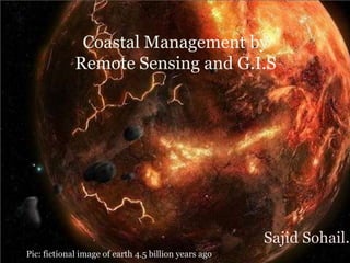
  • 1. Coastal Management by Remote Sensing and G.I.S Sajid Sohail.S PPic: fictional image of earth 4.5 billion years ago
  • 2. Comet(huge water body) struck the earth billion years ago
  • 4. Introduction (coast, coastal zone): The coast is a unique environment where land, sea and atmosphere interact and interplay continuously influencing a strip of spatial zone defined as coastal zone • coastal zones are the areas having the influence of both marine and terrestrial processes. • Coastal zones are the most fragile, dynamic and productive ecosystem and are quite often under pressure from both anthropogenic activities and natural processes • Coastal Zone is endowed with a very wide range of habitats such as coral reefs, mangroves, sea grasses, sand dunes, vegetated stungle, mudflats, salt marshes, estuaries, lagoons etc. • Different countries use different distance criteria for defining the coastal zone. In India, 500 m distance from the high tide line (landward) is taken for demarcating the coastal zone.
  • 6. • Do you know?? Total coast line of the world is 35, 6000 km and the coastal area covers more than 10% of the earth surface. About 40% of the world’s population lives within 100 km of the coast About 10% of the world’s population resides in low elevation coastal zone (<10 m) making their lives highly vulnerable to coastal disasters. About 35% of Indians live within 100 km of the country’s coast line measuring 7517 km.
  • 8. Coastal zones in India assumes importance because of ( major issues/problems): • high productivity of its ecosystems • concentration of population • exploitation of renewable and nonrenewable natural resources • discharge of waste effluents and municipal sewage • industrialization and spurt in recreational activities • Coastal zones are continuously changing because of the dynamic interactions between the ocean and land • Erosion and accretion • inundation due to sea level rise and storm surge • shifting of shoreline caused by natural or anthropogenic forces, such as construction of artificial structure, port and harbors leads to changes in the coastal zone and its environment
  • 9. Remote Sensing (RS) has proved to be extremely useful in providing information on various aspects of the coastal environment, viz. coastal wetlands, coastal landforms, shoreline changes, tidal boundaries (high/low), brackish water areas, suspended sediment dynamics, coastal currents, vital coastal habitats etc. Coastal habitats of the entire Indian coast were mapped earlier on 1:250,000 /1:50,000 scale using multispectral satellite data. Implementation of coastal zone management plans require mapping at local/cadastral level i.e. 1:4000/8000. Resourcesat and Cartosat 1 and 2 along with IKONOS can be used for local level mapping. Coastal zone mapping has been done at two scale: i) on 1:25000 scale for inventory and monitoring of the entire Indian coast and ii) local level mapping at 1:5000 scale for selected areas .
  • 10.
  • 11.
  • 12.
  • 13. Monitoring of coastal Land Use/Land Cover has been done for the following Areas(in India) Gulf of Kachchh (Selected regions), Gujarat Coast Dahej, Gujarat Coast Hazira, Gujarat Coast Mangalore, Karnataka Coast Chennai, Tamilnadu Coast Visakhapatnam, Andhra Pradesh Coast Details of the satellite data used for this study : Landsat TM/MSS (at 10 year interval) IRS LISS III (1996-2001) (Linear Imaging Self-Scanning) Resourcesat LISS-III (2005-2008) Resourcesat LISS-IV (2004-2006) Resourcesat-1 AWiFS, Pre and Post monsoon (2005-2008) Cartosat/IKNOS (for critical areas) In addition, other data utilized for this study are: Climatic, physical and biological parameters collected in the CZIS component Socio-economic data (past and present) Past land-use land-cover data from past cadastral/revenue maps
  • 14.
  • 15. Mangroves: Mangroves are salt tolerant plants that occur along inter-tidal zones of rivers and seas in the form of narrow strips or as extensive patches in estuarine habitats and river deltas of tropical and sub-tropical regions. They occur between 32ºN and 38ºS latitudes, mostly on the eastern coasts of Africa, Australia, Asia and America. Sheltered environment with brackish influx, estuarine and deltaic muddy soils, good rainfall (1000 mm - 3000 mm) and temperature between 26ºC - 35ºC are considered as ideal growth of mangroves. Mangrove forests are usually characterized by uniform type of trees and shrubs and the species diversity decreases with increasing latitudes. According to a trend analysis conducted on available data by FAO, some 15.2 million hectares of mangroves are estimated to exist worldwide as on 2005, down from 18.8 million hectares in 1980.
  • 16. Significance of Mangroves Mangroves are recognized widely for their ecological and economic functions. Mangrove wetlands play an important role in stabilizing shorelines and protect the coast by acting as barriers against storm surges and heavy tides. They are self-generating and self-perpetuating littoral formations, playing a major role in the global cycle of carbon, nitrogen and sulphur. They act as sink for sediments and detritus draining from coastal catchments and help in the tertiary assimilation of wastes. Mangrove swamps are also source of nutrients and supports highly productive marine food chains. Mangroves serve as unique habitats for wild animals like tiger and harbour large number of birds, larvae and juveniles of fishes significant to the fishery resources. They contribute to the livelihood of coastal folks in terms of forest produce and fishery resources. Mangrove forests are also valued as potential recreation site for fishing, boating, bird watching, sightseeing and photography
  • 17.
  • 18. The present study envisages mapping of mangroves at community level on 1:25,000 scale for all maritime states/Union territory harbouring mangroves. These are Andhra Pradesh, Goa, Maharashtra, Orissa, Karnataka, Kerala, Puducherry, Tamil Nadu (excluding Puducherry), Gujarat, West Bengal, Andaman and Nicobar islands IRS P6 LISS-III and LISS-IV data of the year 2005 - 2007 during the period from October – March have been utilized for discerning mangrove communities of the coasts of Andhra Pradesh, Goa, Maharashtra, Orissa, Karnataka, Kerala and Puducherry. Table 3.1.1 shows the key parameters of IRS P6 LISS-III and LISS-IV sensors
  • 19.
  • 20. IRS P6 LISS-III data is considered as the primary data source for digital data analysis. Digital values are converted to spectral radiance based on the equations and calibration coefficients obtained from sensor calibration details available in the metadata Lrad = {[DN / max grey] × [ Lmax - Lmin ] } + Lmin Where, DN = Digital number of each pixel; max grey = 255 for LISS-III
  • 21. India has launched 74 Indian satellites (as of 4 April 2014) of many types since its first attempt in 1975. TYPES *Physical Oceanography - The study of waves, currents, tides, physical water properties, air-sea interaction and the physical forces that cause them. • Biological Oceanography - The study of marine life and its productivity, life cycles, and ecosystems. • Geological Oceanography - The study of plate tectonics, the geology of the ocean basins, the geologic history of the oceans and coastal processes erosion, sedimentation.
  • 22. Physical Oceanography: Physical oceanography is the study of the physical properties of the oceans. This deals with surface and internal waves, air-sea exchanges, turbulence and mixing, acoustics, heating and cooling, wave and wind-induced currents, tides, tsunamis, storm surges, large-scale waves affected by earth’s rotation, large-scale eddies, general circulation and its changes, coupled ocean- atmosphere dynamics for weather and climate research/prediction FORCES IN OCEAN : The external forces that act on the oceans are wind stress, wind-waves, swell-waves, turbulence, circulation, short and longwave radiation, evaporation, sensible and latent heat fluxes, precipitation and tidal oscillations. Solar radiation is the main source of heat energy to the oceans, though only 73% reaches 1 cm depth, 45% 1 m depth, 22% 10 m depth and 0.5% 100 m depth internal forces acting on the oceans are pressure/density gradients and viscosity or friction
  • 23. Physical Oceanographic Parameters: waves (both surface, internal and tsunamis), currents/ circulation, sea surface temperature (SST), sea surface height (SSH), and temperature/salinity/current profiles. SST can either be measured from instruments or estimated from the satellite thermal sensors. The profiles of temperature and salinity are generally measured from conductivity, temperature and depth (CTD) or expendable CTD observations. Expendable bathy thermographs (XBTs) provide only temperature profiles
  • 24. Ocean waves: Waves are periodic deformations of an interface. Surface waves in oceanography are deformations of the sea surface, i.e., the atmosphere-ocean interface. Tsunamis are long waves generated by any disturbance generating vertical motion in the water column, generally, the submarine earthquakes. The change from deep to shallow water waves is observed when the wavelength λ becomes larger than twice the water depth h. A change in wave properties occurs also at λ = 20h. Ocean currents: Ocean currents are due to the movement of water in the oceans. These currents could be due to the wind forcing, thermohaline gradients or tidal forcing. These currents are influenced by the earth’s rotation through Corriolis deflection. Ocean currents play a very prominent role in transporting heat from equatorial to the polar regions.
  • 25.
  • 26. Sea surface temperature: SST is the water temperature close to the surface. In practical terms, the exact meaning of surface varies according to the measurement method. A satellite infrared radiometer indirectly measures the temperature of a very thin layer of about 10 micrometres thick (referred to as the skin. A microwave instrument measures subskin temperature at about 1 mm. A thermometer attached to a moored or drifting buoy in the ocean would measure the temperature at a specific depth. The measurements routinely made from ships are may be at various depths in the upper few meters of the ocean. In fact, this temperature is often called sea surface temperature. Sea surface height: SSH is the height of the sea surface above the reference ellipsoid. SSH above a reference datum can be measured from tide gauges. Since we do not have accurate estimations of the geoid, we cannot have absolute height measurements from altimeters. SSH variations are causes by the changes in the heat content of the oceans, currents and tidal oscillation.
  • 27. Radiation: Radiation coming from the sun is the main source of energy to the oceans. Since the atmosphere is transparent to the short wave radiation, energy reaches the ocean surface in the visible shortwave radiation Biological Oceanography: Biological Oceanography concerns the biology and ecology of oceanic, marine, coastal and estuarine organisms. These range from viruses and bacteria to microbes and phytoplankton, from zooplankton and benthic invertebrates to shellfish, fish and marine mammals Geological Oceanography: Marine Geology is concerned with the earth beneath the sea including the near shore zones (beaches, marshes, lagoons, and reefs), the shelf seas and -margins. this occupy around 80% of the sub sea- surface. Other aspects of marine geology addressed here include ocean circulation, plate tectonics, and critical events in present past global oceanography like sea-level changes
  • 28. Ocean colour sensors are having high radiometry to measure water quality with reasonable accuracy and precision. Thermal infrared sensors provide sea surface temperatures (SST) ,Large-scale regional pollution (oil) and land discharge. But transient nature makes difficult to monitor short-term processes or events during night and cloudy days. Microwave sensors have overcome these limitations ,However, microwave sensors have large footprint of several kilometers with short-term acquisition capability. Some of the important microwave sensors are microwave radiometers (0.3 cm to 100 cm), scatterometers, altimeter, Profiling Radar and Synthetic Aperture Radar (SAR). The scatterometer infers sea surface wind by measuring backscatter from ocean surface. The altimeter helps ranging and sea surface height measurements SAR measures the surface ice, wind, sea state, marine pollution including oil slicks. Geographic Information System (GIS) is a powerful tool for spatial data base management and modeling. The combine power of 1) Remote Sensing, 2) GIS, and 3) Global Positioning System (GPS) provide precision mapping, timely monitoring, and evolution of ecosystems vulnerability.
  • 29. Coastal Zone Management and Solutions Wave-induced alongshore currents provide vital energy for the flow of sand for beach development. The revetment, bulkhead, seawall, breakwater and groins are the most common structures at the approach of harbour entrance to protect it from waves and coastal currents. Some protective structures trap sand and allow beaches to expand, but interrupt the flow of sand to other beaches. Structures located too close to the ocean are vulnerable to severe damage during cyclonic storm. cost effective maintenance and operations is difficult. Beaches are natural shore protection structures; when maintained at proper dimensions it can effectively dissipate wave energy. . Beach nourishment technique directly increases the beach width by depositing sand and cost effective. Some of the advantages are it provides 1) a wider recreational beach, 2) its protection to shoreline structures, 3) dredged material can be nearby sources and 4) reclaimed to other beach management methods in the future
  • 30. Revetment, bulkhead seawall, groins, breakwater( clockwise)
  • 31.
  • 32. Beach nourishment can also protect threatened or endangered plants in the dune area, and restore habitat for sea turtles, shore birds, and other transient or permanent beach organisms Setting buffer zone to natural processes remain active with in the buffer zone and regulate coastal activities beyond the buffer zone is the most effective coastal zone management practice is to allow the natural process remains unrestricted.

Editor's Notes

  1. Earth was formed 4.5 billion years ago
  2. A comet(huge water body) struck the earth which was origin for water on earth
  3. the wind stress is the shear stress exerted by the wind on the surface of large bodies of water – such as oceans, seas, estuaries and lakes…  swell is the one we think is likely to make the largest and most powerfulwaves
  4. In physics, the Coriolis effect is a deflection of moving objects when they are viewed in a rotating reference frame.