Dr. Cynthia Rosenzweig, Senior Research Scientist, NASA Goddard Institute for Space Studies Senior Research Scientist, Earth Institute at Columbia University Co-Chair Mayor Bloomberg’s Climate Change Commission Co-Director Urban Climate Change Research Network (UCCRN); National Institute for Coastal & Harbor Infrastructure, John F. Kennedy Center, Boston, Nov. 12, 2013: "The Triple Threat of Rising Sea Levels, Extreme Storms and Aging Infrastructure: Coastal Community Responses and The Federal Role" See http://www.nichiusa.org or http://www.nichi.us
Simple revision cards for the case studies in the AQA Geography GCSE syllabus A. The categories have been written directly from the syllabus to help pupils revise the correct aspects of each case study and to help them plan their revision. The best thing to do having completed a case study revision card is then to try an exam question on it.
Floods have the greatest damage potential when compared to the other natural disasters, over the environment. Floods are also considered to be both social and economic disasters. This module highlights the details of floods as natural hazards.
This presentation will cover what is meant by disaster , Types of disaster such as Earthquake, Tsunami, Flood. Causes, effects and remedial measures of various earthquakes
Rising Seas in California: an update on sea level rise scienceJennifer Fox
We wrote this to provide a synthesis of the state of the science on sea-level rise. It provides the scientific foundation for the pending update to the California Sea Level Rise Guidance.
Irrigation system of Pakistan proved at top level of countries in the world but still it need deep concern regarding to control flood water. Due to heavy rainfall in September 2011, floods are come in left bank of drain and it has many impacts on the various cities and villages of sindh were observed, at least 360 people were killed, some 5.35 Million people and 1.2 Million homes affected as well 1.7 Million Acres of arable land inundated. Social life was fully disturbed as economy was destroyed due to damage of crop, people were also suffering from drinking water which was not purely provided and due to this dirty water many of the diseases were appeared like direa, malaria and tified. In this research we measure the losses during heavy rain fall 2011 in Nawabshah, Sh Benazeerabad regarding to impact on our social lives and then its precautions in future planning. Data was collected from social survey in premises of city, different departments including NGO’s and Governmental Departments and also solutions on immediate basis are discussed.
2017 MAIREINFRA Conference, Seoul, South Korea, July 19-21.Waheed Uddin
Keynote Lecture, Waheed Uddin:
Disaster Resilience Management and Flood Hazard Assessment of Infrastructure Using Computational Modeling and Geospatial Risk Mapping
Natural Hazard is a common phenomena of Bangladesh which makes visit here every year. It contains a detail study about the natural hazards of Bangladesh with its seasonal distribution, causes, effects and necessary maps. An extended Hazard Calendar has been added here.
Abstract
South Biscay coastally trapped disturbances known as gales (galernas, enbatak, galarrenak, bruilartak) are adverse phenomena that send along the Cantabrian and Basque Coast a narrow jet of sudden and violent gusts of wind that do not follow a hydrostatic balance parameterization, being faster, stronger and of a Western-North-Westerly component, and accelerate as they rush Eastward enduring their speed and intensity. These gales run the coast line from West to East strengthening in Eastern Cantabrian Seashore line from May to October.
On January 25, 2019, ICLR hosted a Friday Forum Webinar titled 'TRCA Flood Risk Assessment Project', led by Rebecca Elliott, water resources engineer with the Toronto and Region Conservation Authority. TRCA’s Flood Risk Assessment project recently assessed flood risk by utilizing flood hazard information from the hydrology and hydraulic modelling for seven different return-period storm events (2-350 year and Regional) at all the historic flood vulnerable areas in the Region. The purpose of this assessment was to combine current riverine flood hazard information and flood exposure information to calculate flood vulnerability and quantify flood risk at both the individual structure level and at a flood-vulnerable cluster level. Flood exposure information includes flood depth and velocity at each building and road subject to flooding for each of the seven return-period storms relative to the first floor elevation of the building. As highlighted by recent major flooding events, including the tropical rainstorm and the Spring 2017 flooding in Ontario/Quebec, as well as Hurricane Harvey’s impact to Texas, many people inhabiting flood-prone communities are not fully aware of the risks to themselves and their property. The Flood Risk Outreach project will build on the results from TRCA’s Flood Risk Assessment project by supporting public awareness of potential flood emergencies. In turn, this can lessen the impact of flooding to these areas, as residents can take preparatory steps to protect themselves and their homes. Recent studies have shown that only a small percentage of residents living in flood prone areas are aware of their flood risk.
Rebecca Elliott is a water resources engineer with 12 years of experience, and more than two years with the Toronto and Region Conservation Authority. She received her undergraduate degree from the University of Guelph with a Bachelor of Science in Water Resources Engineering, and has been a practicing Professional Engineer since 2011. As Flood Risk Management Engineer her role is to manage the flood forecasting and warning program at the TRCA.
Superstorm Sandy's landfall on the northeastern US coast was forecast remarkably well in the days leading up to it. That forecast enabled many life-saving preparations. Another kind of forecast, equally accurate in its own way, had been available much earlier - and yet was not nearly as effective at spurring preparedness. The risks to our built environment of a Sandy-like event had been known for decades. But little was done to make that built environment more resilient, and it suffered great damage as a result. The forecast conforms to a historical pattern in which science-based warnings of the risk of a future disaster are not taken seriously until the disaster has happened at least once. What risks do we face from extreme weather and climate events, on the coasts and inland, now and in the future? Can we learn to make better use of scientific risk assessments with long time horizons? Most of all, how can we prepare for human-induced climate change, when - as Sandy was - it will be outside our experience?
The Marine Environmental Observation Prediction and Response Network (MEOPAR) hosted a speaker tour featuring Dr. Adam Sobel, Director and Chief Scientist of the Columbia Initiative on Extreme Weather and Climate. Dr. Sobel presented information drawn from his recently published book Storm Surge. He received his PhD in meteorology from the Massachusetts Institute of Technology and is a professor at Columbia University’s Lamont-Doherty Earth Observatory and Fu Foundation School of Engineering and Applied Sciences. He is an atmospheric scientist who specializes in the dynamics of climate and weather, particularly in the tropics, on time scales of days to decades. A major focus of his current research is extreme events - such as hurricanes, tornadoes, floods, and droughts, and the risks these pose to human society in the present and future climate. He is leading a new Columbia University Initiative on Extreme Weather and Climate.
Prof Ni-Bin Chang presented the background review of New York City case study.
Flood impact assessment in mega cities under urban sprawl and climate change kick-off workshop
Jayantha Obeysekera
This session will discuss the Southeast Florida Regional Climate Change Compact agreed to by Palm Beach, Broward, Miami-Dade and Monroe counties in SE Florida, and their partnering with the
South Florida Water Management District. The 5.6 million residents of the four counties exceed the population of 30 states and represent 30 percent of Florida’s population, and are situated in
one of the nation’s areas most vulnerable to climate change. The session will detail the Regional Climate Change Compact’s objectives,
its accomplishments to date and the ongoing development of a regional climate action plan.
Coastal cities resilience for climate changeAhmed Haron
This paper aims at studying the impacts of climate change on Egyptian northern coastal zones and exploring the urban resilience to the effects of climate change. In this regard, the current paper discusses the concept of resilience and describes the city resilience framework.
Projected Climate Change Impacts for Rhode Island’s Coast: A Summary of the S...riseagrant
Learn the facts about climate change in Rhode Island, existing impacts, and near-term projections presented by Austin Becker, URI College of Environmental Life Sciences
Sustainability East hosted this event as part of a series of events across the country in partnership with ADEPT, the Department for Transport and Climate UK.
DSD-INT 2019 Understanding impact of extreme sea levels under climate change ...Deltares
Presentation by Kun Yan, Deltares, and Sanne Muis, VU University Amsterdam, at the Data Science Symposium, during Delft Software Days - Edition 2019. Thursday, 14 November 2019, Delft.
The History of Coastal Flood Hazard Assessments in the Great LakesDaryl Shepard
Brian Caufield presented "The History of Coastal Flood Hazard Assessments in the Great Lakes" at the 2016 Association of State Floodplain Managers conference.
ASFPM 2016: The History of Coastal Flood Hazard Assessments in the Great LakesCDM Smith
Brian Caufield presented "The History of Coastal Flood Hazard Assessments in the Great Lakes" at the 2016 Association of State Floodplain Managers conference.
Dr. Jennifer L. Jurado, Southeast Florida Climate Change Compact, Broward County Staff Steering Committee Member, Broward County Director Natural Resources Planning and Management Division; National Institute for Coastal & Harbor Infrastructure, John F. Kennedy Center, Boston, Nov. 12, 2013: "The Triple Threat of Rising Sea Levels, Extreme Storms and Aging Infrastructure: Coastal Community Responses and The Federal Role" See http://www.nichiusa.org or http://www.nichi.us
New Orleans , Garret Graves, Chairman, Louisiana Coastal Protection and Restoration Authority; National Institute for Coastal & Harbor Infrastructure, John F. Kennedy Center, Boston, Nov. 12, 2013: "The Triple Threat of Rising Sea Levels, Extreme Storms and Aging Infrastructure: Coastal Community Responses and The Federal Role" See http://www.nichiusa.org or http://www.nichi.us
Dale Morris, Senior Economist, Royal Dutch Embassy, The Dutch National Plan: The Delta Commission; National Institute for Coastal & Harbor Infrastructure, John F. Kennedy Center, Boston, Nov. 12, 2013: "The Triple Threat of Rising Sea Levels, Extreme Storms and Aging Infrastructure: Coastal Community Responses and The Federal Role." See http://www.nichiusa.org or http://www.nichi.us
Steve Goldbeck, Chief Deputy Director, San Francisco Bay Conservation & Development Commission, at the National Institute for Coastal & Harbor Infrastructure, John F. Kennedy Center, Boston, Nov. 12, 2013: "The Triple Threat of Rising Sea Levels, Extreme Storms and Aging Infrastructure: Coastal Community Responses and The Federal Role" See http://www.nichiusa.org or http://www.nichi.us
Boston Harbor, Julie Wormser, Executive Director, The Boston Harbor Association, Co-Author, Preparing for the Rising Tide; National Institute for Coastal & Harbor Infrastructure, John F. Kennedy Center, Boston, Nov. 12, 2013: "The Triple Threat of Rising Sea Levels, Extreme Storms and Aging Infrastructure: Coastal Community Responses and The Federal Role"
National Institute for Coastal & Harbor Infrastructure, John F. Kennedy Center, Boston, Nov. 12, 2013: "The Triple Threat of Rising Sea Levels, Extreme Storms and Aging Infrastructure: Coastal Community Responses and The Federal Role"
Unit 8 - Information and Communication Technology (Paper I).pdfThiyagu K
This slides describes the basic concepts of ICT, basics of Email, Emerging Technology and Digital Initiatives in Education. This presentations aligns with the UGC Paper I syllabus.
How to Make a Field invisible in Odoo 17Celine George
It is possible to hide or invisible some fields in odoo. Commonly using “invisible” attribute in the field definition to invisible the fields. This slide will show how to make a field invisible in odoo 17.
Palestine last event orientationfvgnh .pptxRaedMohamed3
An EFL lesson about the current events in Palestine. It is intended to be for intermediate students who wish to increase their listening skills through a short lesson in power point.
2024.06.01 Introducing a competency framework for languag learning materials ...Sandy Millin
http://sandymillin.wordpress.com/iateflwebinar2024
Published classroom materials form the basis of syllabuses, drive teacher professional development, and have a potentially huge influence on learners, teachers and education systems. All teachers also create their own materials, whether a few sentences on a blackboard, a highly-structured fully-realised online course, or anything in between. Despite this, the knowledge and skills needed to create effective language learning materials are rarely part of teacher training, and are mostly learnt by trial and error.
Knowledge and skills frameworks, generally called competency frameworks, for ELT teachers, trainers and managers have existed for a few years now. However, until I created one for my MA dissertation, there wasn’t one drawing together what we need to know and do to be able to effectively produce language learning materials.
This webinar will introduce you to my framework, highlighting the key competencies I identified from my research. It will also show how anybody involved in language teaching (any language, not just English!), teacher training, managing schools or developing language learning materials can benefit from using the framework.
How to Split Bills in the Odoo 17 POS ModuleCeline George
Bills have a main role in point of sale procedure. It will help to track sales, handling payments and giving receipts to customers. Bill splitting also has an important role in POS. For example, If some friends come together for dinner and if they want to divide the bill then it is possible by POS bill splitting. This slide will show how to split bills in odoo 17 POS.
Operation “Blue Star” is the only event in the history of Independent India where the state went into war with its own people. Even after about 40 years it is not clear if it was culmination of states anger over people of the region, a political game of power or start of dictatorial chapter in the democratic setup.
The people of Punjab felt alienated from main stream due to denial of their just demands during a long democratic struggle since independence. As it happen all over the word, it led to militant struggle with great loss of lives of military, police and civilian personnel. Killing of Indira Gandhi and massacre of innocent Sikhs in Delhi and other India cities was also associated with this movement.
The Indian economy is classified into different sectors to simplify the analysis and understanding of economic activities. For Class 10, it's essential to grasp the sectors of the Indian economy, understand their characteristics, and recognize their importance. This guide will provide detailed notes on the Sectors of the Indian Economy Class 10, using specific long-tail keywords to enhance comprehension.
For more information, visit-www.vavaclasses.com
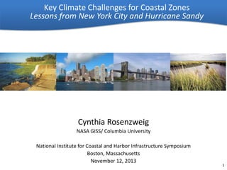
1. Key Climate Challenges for Coastal Zones
Lessons from New York City and Hurricane Sandy
Cynthia Rosenzweig
NASA GISS/ Columbia University
National Institute for Coastal and Harbor Infrastructure Symposium
Boston, Massachusetts
November 12, 2013
1
2. Outline
• Climate Change Challenges in Coastal Zones
• New York City Adaptation Process
• Responding to Hurricane Sandy
• Sandy as Tipping Point
2
3. Coastal Zones
Key Findings from Draft National Climate Assessment
• Coastal zones are increasingly vulnerable to
higher sea levels and storm surges, inland
flooding, and other climate-related changes.
• Climate change increases exposure of
important assets, such as ports, tourism and
fishing sites, in already-vulnerable coastal
locations, threatening to disrupt economic
activity beyond the coast and incurring
significant costs for protecting or moving
them.
• Socioeconomic disparities create uneven
exposures and sensitivities to coastal risks
and limit adaptation options for some coastal
communities, resulting in the displacement
of the most vulnerable from coastal areas.
From 2013 National Climate Assessment, Draft
Chapter 25, USGCRP, 2013v
Challenges of Multiple Jurisdictions
From 2013 National Climate Assessment, Draft
Chapter 25, USGCRP, 2013v
3
4. Coastal Zones
Key Climate Impacts in the Northeast
High water levels, strong winds, and heavy
precipitation from coastal storms already impact
coastal areas.
Warming ocean waters raise sea level through
thermal expansion which will result in more
frequent and extensive coastal flooding and
stronger coastal storms.
• Barrier islands are being significantly altered due to
erosion, overwash and new inlets created by strong
coastal storms
• Sea level rise will increase the risks to populations
in low-lying coastal areas and will lead to
permanent inundation of low-lying areas, more
frequent storm surge flooding and increased beach
erosion
• Loss of coastal wetlands and salt marshes will
reduce species diversity
ClimAID, 2011
4
ClimAID, 2011
5. New York City Adaptation Process
Mayor
Leadership
Implementation
City Agencies
- Regional Authorities
City-wide Sustainability
Office OLTPS
- Private Stakeholders
Coordination
University scholars and
private sector experts
E
Stakeholder
Task Force
CCATF
T
Expert Panel
NPCC
- Social, biological, and
physical scientists
P
Integration across
C
- Legal and insurance
experts
- Risk management
professionals
W
W
Sector-specific Working Groups
- Energy (E)
- Transportation (T)
- Policy (P) - Water & Waste (WW)
Climate Science
- Communications (C)
Source: NPCC, 2010
5
6. First New York City Panel on Climate Change
Mayor Bloomberg convened the First New York City Panel on Climate
Change (NPCC1) in 2008. The NPCC – leading climate and social
scientists and risk management experts – worked to identify future
climate risks facing New York City
•
In 2009, the Panel produced a set of climate
projections specific to New York City region
•
Full report published by New York Academy of
Sciences in 2010
•
New York City Codified NPCC in August 2012
legislation, requiring regular climate science
updates
6
7. Flexible Adaptation Pathways
Climate change adaptation as a risk management issue
Flexible Adaptation Pathways as the response
Source: NPCC, 2010
7
8. Steps – Assess and Implement
1.
Identify current and future climate hazards
2.
Conduct inventory of infrastructure and
assets and begin to identify vulnerabilities
3.
Characterize risk
4.
Develop initial list of strategies
5.
Identify opportunities for coordination
6.
Prioritize strategies
7.
Prepare and implement Resilience Plans
8.
Monitor and reassess
NPCC, 2010
8
9. Framing Adaptation
• Reduce the level of physical, social,
and economic impacts of climate
• Take advantage of new
opportunities
Types
• Management/operations
• Infrastructure – physical
components of each sector
• Policy
Administrative Groups
• Private vs. public
organizations
• Local/municipal, county,
state, national
ClimAID, 2011
Level of Efforts
•
Incremental action
•
Large-scale shifts
Timing
•
Short term <5 yrs; medium term
5-15 yrs; long term >15 years
•
Abrupt Changes - tipping
points/policy triggers
9
10. Pre-Hurricane Sandy Adaptation Actions
• Actions already underway in New
York City to mitigate the impacts
of climate risks
– Planting over 300 Greenstreets,
vegetation that absorbs stormwater
– Securing citywide high-resolution
LiDAR elevation data, which helps to
identify the most vulnerable area
– Incorporating sea level rise into the
City's Comprehensive Waterfront
Plan
– NYC Office of Emergency
Management launched enhanced
emergency response and
preparedness programs
• Post Sandy intensifying efforts
NPCC, 2013
10
11. Hurricane Sandy
• Storm timing coincided almost exactly with
astronomically high, high tide
• Tropical-storm-force winds extended 1,000 miles
from end to end, making it more than three times
the size of Hurricane Katrina
• Storm surge combined with high tide created a
“storm tide” of over 14 feet above Mean Lower Low
Water at the Battery
• Unusual storm track, Sandy turned sharply west
just as it was reaching another peak of intensity
SIRR, 2013
CCSR, 2013
Storm Forecast Well In Advance
11
12. Hurricane Sandy
Links to Climate Change Science
Sea level rise at Battery, NYC 1900-2009, NPCC
• It is not possible to attribute any single
extreme event such as Hurricane Sandy to
climate change
• Sea level rise already occurring in the New York
City area (~1.1 feet since 1900), in part related
to climate change, increased the extent and
magnitude of coastal flooding during the storm
North Atlantic SSTs and Hurricane Power Dissipation Index 1950-2005, Emanuel
• Intensity of severe hurricanes appears to be on
rise and may increase in future***
• Melting sea-ice may be changing pattern of jet
stream, making westward-turning storm tracks
more likely***
***Areas of active research
Sources: CCSR, 2013
Median Minimum Sea Ice Extent 1979-2009
12
13. Hurricane Sandy
Immediate Preparations
LIPA
New York City issued mandatory evacuation
of Zone A on October 28, 2012
Out-of-state utility crews brought in
before the storm
Evacuation – Not complete
43 people died in NYC 80%
from drowning
Utilities – Not prepared
4 million without power in the
tri-state region
MTA/DOT – Major flooding
7 subway lines under East River,
3 tunnels closed
MTA closed down
operations, moved rolling
stock, and boarded and
placed sandbags at
subway entrances to
protect against flooding
SIRR, 2013
MTA
13
14. Climate Change and
a Global City 2001
The Potential
Consequences of
Climate Variability and
Change
Metro East Coast (MEC) July
2001
Hurricane Sandy
Forecasting the Impacts
South Ferry Subway Station
Interdependent Critical
Infrastructure Systems
and
Vulnerable Communities
Beach erosion and boardwalk
damage in the Rockaways
Spencer Platt Getty Images
Extensive power outages
Hard-hit
areas
Sources: CCSR, 2013,
MTA, 2012
Many impacts forecast well in advance
14
15. Hurricane Sandy
Unforeseen Impacts
• Hospital Evacuations
– Flooding and power outages forced the
evacuation of 6,500 people from nursing
homes and hospitals
• Gas Shortages
– Severe breakdowns in the supply chain
serving New York caused by storm
damage to coastal infrastructure led to
fuel shortages that lasted weeks
• Fires
– Over 100 homes and businesses were
destroyed by fire, often electrical in
nature, sparked by the interaction of
electricity and seawater. Narrowly flooded
streets hampered emergency response.
SIRR, 2013
15
16. Second New York City Panel on Climate Change
After Hurricane Sandy, Mayor Bloomberg re-convened the NPCC in
January to provide updated climate risk information for the Special
Initiative for Rebuilding and Resiliency (SIRR)
•
The 2013 NPCC Climate Risk
Information Report (CRI) provides new
climate change projections and future
coastal flood risk maps for New York
City
•
Both “A Stronger, More Resilient New
York” and CRI reports released on June
11, 2013
16
17. Consortium for Climate Risk in the Urban Northeast
• CCRUN conducts stakeholder-driven research that reduces climate-related
vulnerability and advances opportunities for adaptation in the urban
Northeast
• CCRUN scientists lead the technical team that developed the projections for
the NPCC2 report
17
18. Key Findings for Future Projected Changes
Recently released (June 2013) climate change projections…
•
Illustrate a broad-based acceleration of climate change
in coming decades
•
Show significant climate risks for New York City,
especially heat waves, extreme precipitation events, and
coastal flooding
•
Valid for New York City and the metropolitan region
•
By 2050s, projected changes include
–
–
–
–
Annual temperature increase up to 6.5 F
Mean precipitation change between +5 and +10 percent
Sea level rise up to 31 inches
1-in-100 year flood may occur approximately 5 times more often
with the high-estimate for sea level rise
– More likely than not increase in the number of the most intense
hurricanes in the North Atlantic Basin.
– Unknown how the total number of tropical cyclones will change in
the North Atlantic Basin
NPCC, 2013
18
19. NYC SIRR Key Findings for Coastal Protection
•
Increase coastal edge elevations
– The City will increase the height of vulnerable coastal edges with bulkheads,
beach nourishment and other measures over time
•
Minimize upland wave zones
– The City will work to provide significant attenuation of waves—that is, to
knock down waves, or diminish their velocity—both off and onshore, before
they reach neighborhoods
•
Protect against storm surge
– The City will use flood protection structures, such as floodwalls, levees, and
local storm surge barriers built, where possible, to the 100-year flood
elevation with an additional allowance for future sea level rise
•
Improve coastal design
– The City will study how natural areas and open space can be used to protect
adjacent neighborhoods and maintain neighborhood quality of life, and will
work to manage its own waterfront assets more effectively
•
Governance
– Developing partnerships to improve permitting and study innovative coastal
protections.
SIRR, 2013
19
20. NYC SIRR Key Findings for Insurance
•
Strategy: Target affordability solutions to low-income policyholders
–
•
Strategy: Define resiliency standards for existing buildings
–
•
Measures that reduce a property’s risk of damage should be reflected
in a commensurate reduction in the cost of insurance
Strategy: Expand pricing options for policyholders
–
•
Sandy highlighted the limited information currently available on riskreduction techniques short of elevation, which is impractical,
financially infeasible or physically impossible for building types
common in New York City and other dense urban areas.
Strategy: Incorporate resiliency standards in insurance
underwriting
–
•
The combined impact of Biggert-Waters and the remapping of New
York City’s floodplain will result in significant increases in flood
insurance premiums, which many New Yorkers, especially the city’s
most vulnerable populations—including those with low, or on fixed,
incomes—will not be able to afford.
Flexible pricing options can encourage more people, especially those
not required to carry insurance, to purchase coverage that suits their
needs.
Strategy: Improve awareness and education about insurance
–
SIRR, 2013
Consumers must be aware of both their risks and the coverage their
insurance policies include or exclude.
20
21. Hurricane Sandy as Tipping Point
• Leadership in responding to climate change
• Municipal, state, and federal alignment
• Climate science in place and in time
Need for federal coordination that recognizes
local and state initiatives
21
22. References and Links
• Consortium for Climate Risk in the Urban Northeast (www.ccrun.org)
• NYSERDA ClimAID (www.nyserda.ny.gov/climaid)
• New York City Panel on Climate Change report available online at
(www.nyas.org)
• Urban Climate Change Research Network (www.uccrn.org)
• ClimateYou (www.climateyou.org)
– “Learn, Share, Act” about climate change
NPCC
22