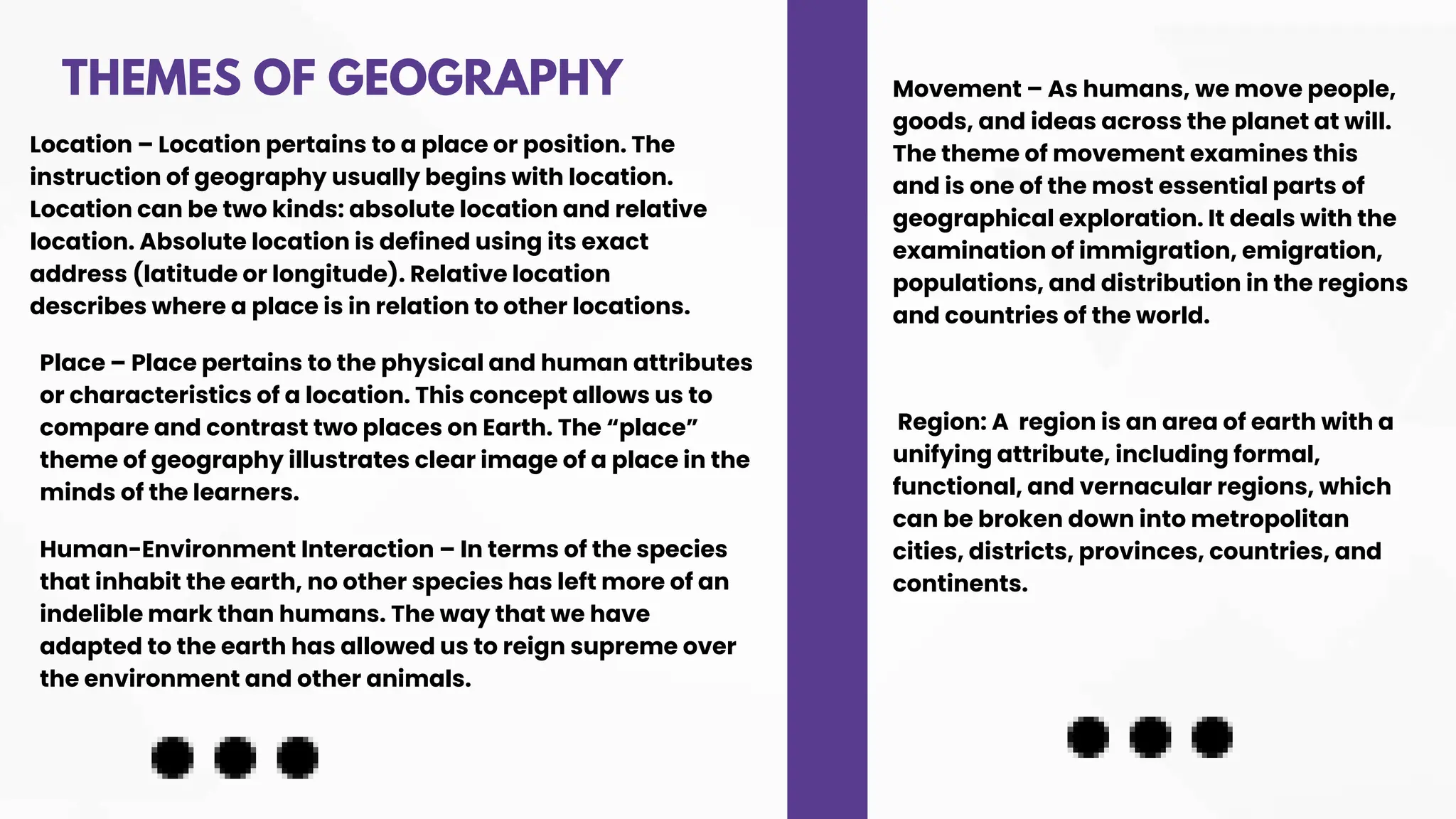
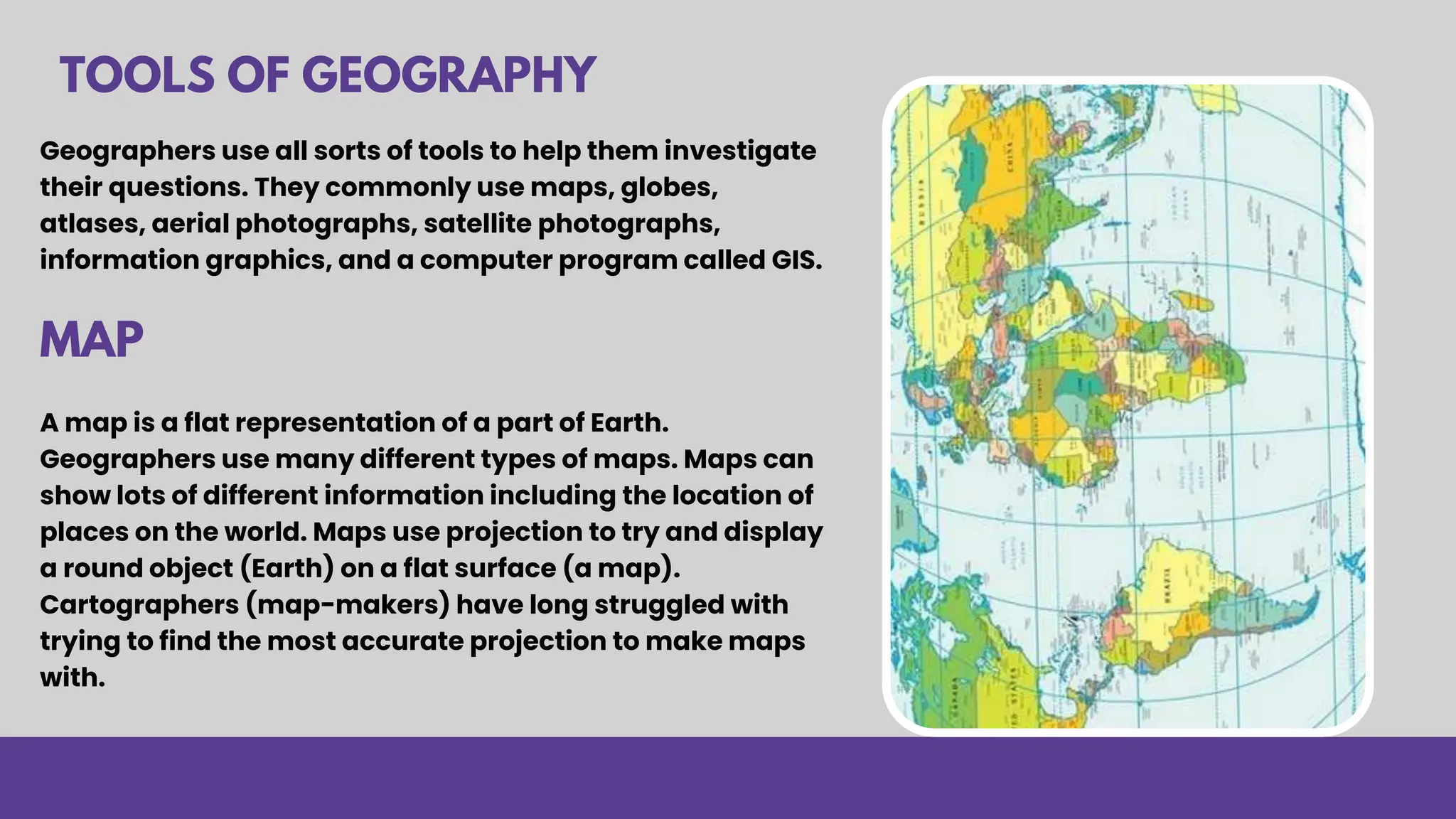
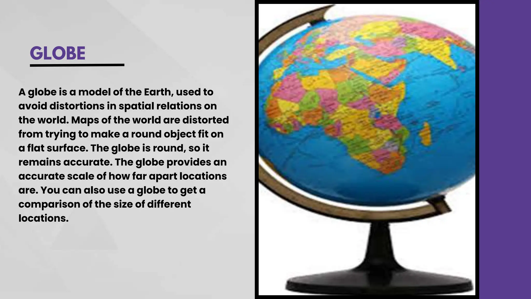
INTRODUCTION
GEOGRAPHY
Dr. Hafiz Kosar
MAIN
TOPICS
What is Geography?
Definition of Geography
Themes of Geography
Traditions of Geography
Tools of Geography
WHAT IS
GEOGRAPHY?
The word geography comes from two
GREEK words.
GEO = EARTH
GRAPHY = TO WRITE ABOUT SOMETHING.
Thus GEO + GRAPHY literally means "to
write about the Earth."
The American Heritage dictionary
defines geography as "the study of the
earth and its features, inhabitants, and
phenomena."
2.DEFINITION OF GEO-
GRAPHY
Geography is the science of spatial
variation of cultural and physical
phenomena over the globe is called
geography.
With aspects of physical as well as social
science, is the study of the features of the
Earth's surface and of their relationships to
each other and to mankind is calle
geography.
THEMES OF GEOGRAPHY
Location – Location pertains to a place or position. The
instruction of geography usually begins with location.
Location can be two kinds: absolute location and relative
location. Absolute location is defined using its exact
address (latitude or longitude). Relative location
describes where a place is in relation to other locations.
Place – Place pertains to the physical and human attributes
or characteristics of a location. This concept allows us to
compare and contrast two places on Earth. The “place”
theme of geography illustrates clear image of a place in the
minds of the learners.
Human-Environment Interaction – In terms of the species
that inhabit the earth, no other species has left more of an
indelible mark than humans. The way that we have
adapted to the earth has allowed us to reign supreme over
the environment and other animals.
Movement – As humans, we move people,
goods, and ideas across the planet at will.
The theme of movement examines this
and is one of the most essential parts of
geographical exploration. It deals with the
examination of immigration, emigration,
populations, and distribution in the regions
and countries of the world.
Region: A region is an area of earth with a
unifying attribute, including formal,
functional, and vernacular regions, which
can be broken down into metropolitan
cities, districts, provinces, countries, and
continents.
TRADITIONS OF
GEOGRAPHY
1.An earth-science tradition, physical
(natural) geography; Physical
geography, descriptions according to
place, atmosphere, biosphere, geology.“
Study of the earth as a home to humans”
12. A man-land tradition; relationship between
human societies and natural environments. Human
impact on nature, impact of nature on humans,
perception of environment, environmentalism
Population, Cultural and Political Geography
A spatial-tradition, spatial unifying theme,
similar patterns between physical & human
geography includes: boundaries, densities,
movement, transportation, spatial patterns of
development, uniqueness of place, central place
theory
1.An area-studies tradition - regional
geography, Nature of places, character, regions,
areas, international relationships, regional
differentiation
Geographers use all sorts of tools to help them investigate
their questions. They commonly use maps, globes,
atlases, aerial photographs, satellite photographs,
information graphics, and a computer program called GIS.
TOOLS OF GEOGRAPHY
A map is a flat representation of a part of Earth.
Geographers use many different types of maps. Maps can
show lots of different information including the location of
places on the world. Maps use projection to try and display
a round object (Earth) on a flat surface (a map).
Cartographers (map-makers) have long struggled with
trying to find the most accurate projection to make maps
with.
MAP
ATLAS
An atlas is a book of maps. An atlas contains maps of the
world or a region of the world. Some atlases also include
more information about the places they include in the
maps. Atlases can be very helpful for traveling. Instead of
brining many maps, you can bring one atlas
GLOBE
A globe is a model of the Earth, used to
avoid distortions in spatial relations on
the world. Maps of the world are distorted
from trying to make a round object fit on
a flat surface. The globe is round, so it
remains accurate. The globe provides an
accurate scale of how far apart locations
are. You can also use a globe to get a
comparison of the size of different
locations.
AERIAL
PHOTOGRAPHS
Aerial photographs are
photographs taken from the sky
and used to take measurements
or create maps. Aerial
photographs can be taken from
airplanes, balloons, or even kites.
SATELLITE
PHOTOGRAPHS
Satellite photographs are like
aerial photographs, but they are
taken from space. Satellite
photographs can capture large
areas of the Earth, but they can
also zoom in pretty close.
INFORMATION GRAPHICS
Information Graphics are
visual symbols of data,
ranging from simple bar
graphs to complex images.
The infographic on the left
shows land cover change in
the Mid-Atlantic between
1996-2006, showing
decreased forests and
wetlands, and increased
developments.
GIS (GEOGRAPHIC
INFORMATION SYSTEM)
GIS is a computer-based
program used for data
storage, management, and
analysis. It aids geographers
in making decisions, such as
ensuring schools are not
near polluting factories. GIS
maps provide a
comprehensive view of
information related to
locations, aiding in decision-
making.
WORLDWIDE
SERVICES
WE PROVIDE
THANK YOU
hafeezkausar.hashmi@gmail.com

Introduction of Geography.pptx

  • 1.
  • 2.
    MAIN TOPICS What is Geography? Definitionof Geography Themes of Geography Traditions of Geography Tools of Geography
  • 3.
    WHAT IS GEOGRAPHY? The wordgeography comes from two GREEK words. GEO = EARTH GRAPHY = TO WRITE ABOUT SOMETHING. Thus GEO + GRAPHY literally means "to write about the Earth." The American Heritage dictionary defines geography as "the study of the earth and its features, inhabitants, and phenomena."
  • 4.
    2.DEFINITION OF GEO- GRAPHY Geographyis the science of spatial variation of cultural and physical phenomena over the globe is called geography. With aspects of physical as well as social science, is the study of the features of the Earth's surface and of their relationships to each other and to mankind is calle geography.
  • 5.
    THEMES OF GEOGRAPHY Location– Location pertains to a place or position. The instruction of geography usually begins with location. Location can be two kinds: absolute location and relative location. Absolute location is defined using its exact address (latitude or longitude). Relative location describes where a place is in relation to other locations. Place – Place pertains to the physical and human attributes or characteristics of a location. This concept allows us to compare and contrast two places on Earth. The “place” theme of geography illustrates clear image of a place in the minds of the learners. Human-Environment Interaction – In terms of the species that inhabit the earth, no other species has left more of an indelible mark than humans. The way that we have adapted to the earth has allowed us to reign supreme over the environment and other animals. Movement – As humans, we move people, goods, and ideas across the planet at will. The theme of movement examines this and is one of the most essential parts of geographical exploration. It deals with the examination of immigration, emigration, populations, and distribution in the regions and countries of the world. Region: A region is an area of earth with a unifying attribute, including formal, functional, and vernacular regions, which can be broken down into metropolitan cities, districts, provinces, countries, and continents.
  • 6.
    TRADITIONS OF GEOGRAPHY 1.An earth-sciencetradition, physical (natural) geography; Physical geography, descriptions according to place, atmosphere, biosphere, geology.“ Study of the earth as a home to humans” 12. A man-land tradition; relationship between human societies and natural environments. Human impact on nature, impact of nature on humans, perception of environment, environmentalism Population, Cultural and Political Geography A spatial-tradition, spatial unifying theme, similar patterns between physical & human geography includes: boundaries, densities, movement, transportation, spatial patterns of development, uniqueness of place, central place theory 1.An area-studies tradition - regional geography, Nature of places, character, regions, areas, international relationships, regional differentiation
  • 7.
    Geographers use allsorts of tools to help them investigate their questions. They commonly use maps, globes, atlases, aerial photographs, satellite photographs, information graphics, and a computer program called GIS. TOOLS OF GEOGRAPHY A map is a flat representation of a part of Earth. Geographers use many different types of maps. Maps can show lots of different information including the location of places on the world. Maps use projection to try and display a round object (Earth) on a flat surface (a map). Cartographers (map-makers) have long struggled with trying to find the most accurate projection to make maps with. MAP
  • 8.
    ATLAS An atlas isa book of maps. An atlas contains maps of the world or a region of the world. Some atlases also include more information about the places they include in the maps. Atlases can be very helpful for traveling. Instead of brining many maps, you can bring one atlas
  • 9.
    GLOBE A globe isa model of the Earth, used to avoid distortions in spatial relations on the world. Maps of the world are distorted from trying to make a round object fit on a flat surface. The globe is round, so it remains accurate. The globe provides an accurate scale of how far apart locations are. You can also use a globe to get a comparison of the size of different locations.
  • 10.
    AERIAL PHOTOGRAPHS Aerial photographs are photographstaken from the sky and used to take measurements or create maps. Aerial photographs can be taken from airplanes, balloons, or even kites.
  • 11.
    SATELLITE PHOTOGRAPHS Satellite photographs arelike aerial photographs, but they are taken from space. Satellite photographs can capture large areas of the Earth, but they can also zoom in pretty close.
  • 12.
    INFORMATION GRAPHICS Information Graphicsare visual symbols of data, ranging from simple bar graphs to complex images. The infographic on the left shows land cover change in the Mid-Atlantic between 1996-2006, showing decreased forests and wetlands, and increased developments.
  • 13.
    GIS (GEOGRAPHIC INFORMATION SYSTEM) GISis a computer-based program used for data storage, management, and analysis. It aids geographers in making decisions, such as ensuring schools are not near polluting factories. GIS maps provide a comprehensive view of information related to locations, aiding in decision- making.
  • 14.
  • 15.